Monument No. 1 Mine, Monument No. 1 channel (Channel No. 36), Mystery Valley, Mineral Mining District, Navajo County, Arizona, USAi
| Regional Level Types | |
|---|---|
| Monument No. 1 Mine | Mine |
| Monument No. 1 channel (Channel No. 36) | Channel |
| Mystery Valley | Basin |
| Mineral Mining District | Mining District |
| Navajo County | County |
| Arizona | State |
| USA | Country |
This page is currently not sponsored. Click here to sponsor this page.


Latitude & Longitude (WGS84):
36° 56' 54'' North , 110° 13' 49'' West
Latitude & Longitude (decimal):
Type:
Köppen climate type:
Nearest Settlements:
| Place | Population | Distance |
|---|---|---|
| Oljato-Monument Valley | 154 (2017) | 5.5km |
| Oljato-Monument Valley | 674 (2016) | 9.3km |
| Kayenta | 5,189 (2011) | 24.6km |
| Dennehotso | 746 (2011) | 36.0km |
| Halchita | 266 (2011) | 36.2km |
Mindat Locality ID:
3364
Long-form identifier:
mindat:1:2:3364:3
GUID (UUID V4):
3943b134-42cf-4fce-b494-78c2cad4595f
A U-V occurrence/mine located in the NE¼ sec. 24, T41N, R19E, G&SRM (Agathla Peak 15 minute topo map), in the Monument No. 1 channel (paleochannel), 1.7 miles S of Gouldings Well, on the ridge W of Kayenta-Mexican Hat Road. Started in 1942 and worked intermittently until 1950. Reopened 1954. Operated by the Vanadium Corporation of America during the period 1942-1950.
Mineralization is a U-V-Cu-Mo deposit hosted in Late Triassic sandstone and conglomerate of the Shinarump Conglomerate Member of the Chinle Formation, in the channel that trends N10W and is some 250 feet wide and 50 feet deep. The ore body is lenticular, 5.49 meters thick, 22.86 meters wide and 205.74 meters long. The channel is filled with medium-grained, massive sandstone. Controls for ore emplacement included "trashy" conglomerate channels near silicified wood, carbonaceous matter, & clay. Alteration (local) includes an unoxidized core surrounded by oxidized mineralization. Local rocks include rocks of the Chinle Formation.
The possible significance of the altered zone has been investigated (Alice D. Weeks, written communication, 1952). Specimens of both the red unaltered and the gray altered Moenkopi formation were chemically analyzed. Mrs. Weeks reports:
At Monument No. 1 mine, both red and gray clay contain quartz, hydromica, chlorite, and kaolinite. Chemical determinations of total iron, ferric and ferrous iron, titanium dioxide, and vanadium pentoxide, made by R. G. Milkey, showed that in all suites of samples total iron and ferric iron are higher in the red than in the adjacent gray sample. Although the ferrous-ferric ratio is higher in all the gray samples than in the adjacent red clay, the ferrous iron does not vary significantly between the red and gray of each set. To alter the red clay to gray, only l percent more or less of ferric iron pigment would have to be leached from the red. Hematite is too small in quantity or too fine grained to show in X-ray patterns of natural red clays.
Mrs. Weeks sought but found no evidence for or against a relationship of the altered zone to ore-mineralizing solutions.
Workings include unspecified underground openings.
Production was a few hundred tons of V ore during the period 1942-1944. Several thousand tons of of ore were produced during the period 1952-1956.
Analytical data results: V:U = 2.5:1. 10 MR/hour maximum or 0.25% to 0.5% U.
Reserve resource information: Some mineralization remains, but too small to justify further exploration.
Select Mineral List Type
Standard Detailed Gallery Strunz Chemical ElementsCommodity List
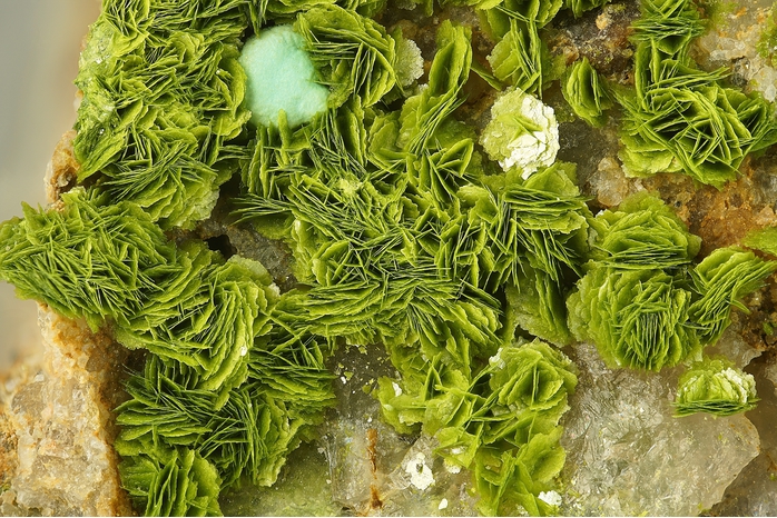
This is a list of exploitable or exploited mineral commodities recorded at this locality.Mineral List
26 valid minerals.
Rock Types Recorded
Note: data is currently VERY limited. Please bear with us while we work towards adding this information!
Select Rock List Type
Alphabetical List Tree DiagramDetailed Mineral List:
| ⓘ 'Apatite' Formula: Ca5(PO4)3(Cl/F/OH) |
| ⓘ Autunite Formula: Ca(UO2)2(PO4)2 · 10-12H2O |
| ⓘ Azurite Formula: Cu3(CO3)2(OH)2 |
| ⓘ Calcite Formula: CaCO3 |
| ⓘ Carnotite Formula: K2(UO2)2(VO4)2 · 3H2O References: |
| ⓘ 'Chlorite Group' |
| ⓘ Chrysocolla Formula: Cu2-xAlx(H2-xSi2O5)(OH)4 · nH2O, x < 1 |
| ⓘ Coffinite Formula: U(SiO4) · nH2O |
| ⓘ Corvusite Formula: (Na,K,Ca,Mg)2(V5+,V4+,Fe2+)8O20 · 6-10H2O |
| ⓘ Hewettite Formula: CaV6O16 · 9H2O References: |
| ⓘ Jarosite Formula: KFe3+3(SO4)2(OH)6 Description: Occurs in largely oxidized U-V ores. References: |
| ⓘ Kaolinite Formula: Al2(Si2O5)(OH)4 |
| ⓘ 'Limonite' |
| ⓘ Malachite Formula: Cu2(CO3)(OH)2 |
| ⓘ Metatorbernite Formula: Cu(UO2)2(PO4)2 · 8H2O References: |
| ⓘ Metatyuyamunite Formula: Ca(UO2)2(VO4)2 · 3H2O |
| ⓘ Montmorillonite ? Formula: (Na,Ca)0.33(Al,Mg)2(Si4O10)(OH)2 · nH2O |
| ⓘ Montroseite Formula: (V3+,Fe3+)O(OH) References: |
| ⓘ Pyrite Formula: FeS2 |
| ⓘ Rauvite Formula: Ca(UO2)2(V10O28) · 16H2O |
| ⓘ Roscoelite Formula: K(V3+,Al)2(AlSi3O10)(OH)2 References: |
| ⓘ Santafeite Formula: (Na,Ca,Sr)12(Mn2+,Fe3+,Al,Mg)8Mn4+8(VO4)16(OH,O)20 · 8H2O Description: Occurs as massive veinlets that cut sandstone in one large chunk of ore. |
| ⓘ Tangeite Formula: CaCu(VO4)(OH) |
| ⓘ Torbernite Formula: Cu(UO2)2(PO4)2 · 12H2O |
| ⓘ Tyuyamunite Formula: Ca(UO2)2(VO4)2 · 5-8H2O References: |
| ⓘ Uraninite Formula: UO2 References: |
| ⓘ Vésigniéite Formula: BaCu3(VO4)2(OH)2 References: |
| ⓘ Volborthite Formula: Cu3(V2O7)(OH)2 · 2H2O References: |
| ⓘ Zippeite Formula: K3(UO2)4(SO4)2O3(OH) · 3H2O References: |

List of minerals arranged by Strunz 10th Edition classification
| Group 2 - Sulphides and Sulfosalts | |||
|---|---|---|---|
| ⓘ | Pyrite | 2.EB.05a | FeS2 |
| Group 4 - Oxides and Hydroxides | |||
| ⓘ | Uraninite | 4.DL.05 | UO2 |
| ⓘ | Montroseite | 4.FD.10 | (V3+,Fe3+)O(OH) |
| ⓘ | Carnotite | 4.HB.05 | K2(UO2)2(VO4)2 · 3H2O |
| ⓘ | Tyuyamunite | 4.HB.25 | Ca(UO2)2(VO4)2 · 5-8H2O |
| ⓘ | Metatyuyamunite | 4.HB.25 | Ca(UO2)2(VO4)2 · 3H2O |
| ⓘ | Rauvite | 4.HB.40 | Ca(UO2)2(V10O28) · 16H2O |
| ⓘ | Hewettite | 4.HE.15 | CaV6O16 · 9H2O |
| ⓘ | Corvusite | 4.HE.20 | (Na,K,Ca,Mg)2(V5+,V4+,Fe2+)8O20 · 6-10H2O |
| Group 5 - Nitrates and Carbonates | |||
| ⓘ | Calcite | 5.AB.05 | CaCO3 |
| ⓘ | Azurite | 5.BA.05 | Cu3(CO3)2(OH)2 |
| ⓘ | Malachite | 5.BA.10 | Cu2(CO3)(OH)2 |
| Group 7 - Sulphates, Chromates, Molybdates and Tungstates | |||
| ⓘ | Jarosite | 7.BC.10 | KFe3+3(SO4)2(OH)6 |
| ⓘ | Zippeite | 7.EC.05 | K3(UO2)4(SO4)2O3(OH) · 3H2O |
| Group 8 - Phosphates, Arsenates and Vanadates | |||
| ⓘ | Tangeite | 8.BH.35 | CaCu(VO4)(OH) |
| ⓘ | Vésigniéite | 8.BH.45 | BaCu3(VO4)2(OH)2 |
| ⓘ | Santafeite | 8.DM.40 | (Na,Ca,Sr)12(Mn2+,Fe3+,Al,Mg)8Mn4+8(VO4)16(OH,O)20 · 8H2O |
| ⓘ | Torbernite | 8.EB.05 | Cu(UO2)2(PO4)2 · 12H2O |
| ⓘ | Autunite | 8.EB.05 | Ca(UO2)2(PO4)2 · 10-12H2O |
| ⓘ | Metatorbernite | 8.EB.10 | Cu(UO2)2(PO4)2 · 8H2O |
| ⓘ | Volborthite | 8.FD.05 | Cu3(V2O7)(OH)2 · 2H2O |
| Group 9 - Silicates | |||
| ⓘ | Coffinite | 9.AD.30 | U(SiO4) · nH2O |
| ⓘ | Roscoelite | 9.EC.15 | K(V3+,Al)2(AlSi3O10)(OH)2 |
| ⓘ | Montmorillonite ? | 9.EC.40 | (Na,Ca)0.33(Al,Mg)2(Si4O10)(OH)2 · nH2O |
| ⓘ | Kaolinite | 9.ED.05 | Al2(Si2O5)(OH)4 |
| ⓘ | Chrysocolla | 9.ED.20 | Cu2-xAlx(H2-xSi2O5)(OH)4 · nH2O, x < 1 |
| Unclassified | |||
| ⓘ | 'Limonite' | - | |
| ⓘ | 'Chlorite Group' | - | |
| ⓘ | 'Apatite' | - | Ca5(PO4)3(Cl/F/OH) |
List of minerals for each chemical element
| H | Hydrogen | |
|---|---|---|
| H | ⓘ Autunite | Ca(UO2)2(PO4)2 · 10-12H2O |
| H | ⓘ Azurite | Cu3(CO3)2(OH)2 |
| H | ⓘ Carnotite | K2(UO2)2(VO4)2 · 3H2O |
| H | ⓘ Chrysocolla | Cu2-xAlx(H2-xSi2O5)(OH)4 · nH2O, x < 1 |
| H | ⓘ Coffinite | U(SiO4) · nH2O |
| H | ⓘ Corvusite | (Na,K,Ca,Mg)2(V5+,V4+,Fe2+)8O20 · 6-10H2O |
| H | ⓘ Hewettite | CaV6O16 · 9H2O |
| H | ⓘ Jarosite | KFe33+(SO4)2(OH)6 |
| H | ⓘ Kaolinite | Al2(Si2O5)(OH)4 |
| H | ⓘ Malachite | Cu2(CO3)(OH)2 |
| H | ⓘ Metatorbernite | Cu(UO2)2(PO4)2 · 8H2O |
| H | ⓘ Metatyuyamunite | Ca(UO2)2(VO4)2 · 3H2O |
| H | ⓘ Montroseite | (V3+,Fe3+)O(OH) |
| H | ⓘ Montmorillonite | (Na,Ca)0.33(Al,Mg)2(Si4O10)(OH)2 · nH2O |
| H | ⓘ Rauvite | Ca(UO2)2(V10O28) · 16H2O |
| H | ⓘ Roscoelite | K(V3+,Al)2(AlSi3O10)(OH)2 |
| H | ⓘ Santafeite | (Na,Ca,Sr)12(Mn2+,Fe3+,Al,Mg)8Mn84+(VO4)16(OH,O)20 · 8H2O |
| H | ⓘ Torbernite | Cu(UO2)2(PO4)2 · 12H2O |
| H | ⓘ Tyuyamunite | Ca(UO2)2(VO4)2 · 5-8H2O |
| H | ⓘ Tangeite | CaCu(VO4)(OH) |
| H | ⓘ Vésigniéite | BaCu3(VO4)2(OH)2 |
| H | ⓘ Volborthite | Cu3(V2O7)(OH)2 · 2H2O |
| H | ⓘ Zippeite | K3(UO2)4(SO4)2O3(OH) · 3H2O |
| H | ⓘ Apatite | Ca5(PO4)3(Cl/F/OH) |
| C | Carbon | |
| C | ⓘ Azurite | Cu3(CO3)2(OH)2 |
| C | ⓘ Calcite | CaCO3 |
| C | ⓘ Malachite | Cu2(CO3)(OH)2 |
| O | Oxygen | |
| O | ⓘ Autunite | Ca(UO2)2(PO4)2 · 10-12H2O |
| O | ⓘ Azurite | Cu3(CO3)2(OH)2 |
| O | ⓘ Calcite | CaCO3 |
| O | ⓘ Carnotite | K2(UO2)2(VO4)2 · 3H2O |
| O | ⓘ Chrysocolla | Cu2-xAlx(H2-xSi2O5)(OH)4 · nH2O, x < 1 |
| O | ⓘ Coffinite | U(SiO4) · nH2O |
| O | ⓘ Corvusite | (Na,K,Ca,Mg)2(V5+,V4+,Fe2+)8O20 · 6-10H2O |
| O | ⓘ Hewettite | CaV6O16 · 9H2O |
| O | ⓘ Jarosite | KFe33+(SO4)2(OH)6 |
| O | ⓘ Kaolinite | Al2(Si2O5)(OH)4 |
| O | ⓘ Malachite | Cu2(CO3)(OH)2 |
| O | ⓘ Metatorbernite | Cu(UO2)2(PO4)2 · 8H2O |
| O | ⓘ Metatyuyamunite | Ca(UO2)2(VO4)2 · 3H2O |
| O | ⓘ Montroseite | (V3+,Fe3+)O(OH) |
| O | ⓘ Montmorillonite | (Na,Ca)0.33(Al,Mg)2(Si4O10)(OH)2 · nH2O |
| O | ⓘ Rauvite | Ca(UO2)2(V10O28) · 16H2O |
| O | ⓘ Roscoelite | K(V3+,Al)2(AlSi3O10)(OH)2 |
| O | ⓘ Santafeite | (Na,Ca,Sr)12(Mn2+,Fe3+,Al,Mg)8Mn84+(VO4)16(OH,O)20 · 8H2O |
| O | ⓘ Torbernite | Cu(UO2)2(PO4)2 · 12H2O |
| O | ⓘ Tyuyamunite | Ca(UO2)2(VO4)2 · 5-8H2O |
| O | ⓘ Tangeite | CaCu(VO4)(OH) |
| O | ⓘ Uraninite | UO2 |
| O | ⓘ Vésigniéite | BaCu3(VO4)2(OH)2 |
| O | ⓘ Volborthite | Cu3(V2O7)(OH)2 · 2H2O |
| O | ⓘ Zippeite | K3(UO2)4(SO4)2O3(OH) · 3H2O |
| O | ⓘ Apatite | Ca5(PO4)3(Cl/F/OH) |
| F | Fluorine | |
| F | ⓘ Apatite | Ca5(PO4)3(Cl/F/OH) |
| Na | Sodium | |
| Na | ⓘ Corvusite | (Na,K,Ca,Mg)2(V5+,V4+,Fe2+)8O20 · 6-10H2O |
| Na | ⓘ Montmorillonite | (Na,Ca)0.33(Al,Mg)2(Si4O10)(OH)2 · nH2O |
| Na | ⓘ Santafeite | (Na,Ca,Sr)12(Mn2+,Fe3+,Al,Mg)8Mn84+(VO4)16(OH,O)20 · 8H2O |
| Mg | Magnesium | |
| Mg | ⓘ Corvusite | (Na,K,Ca,Mg)2(V5+,V4+,Fe2+)8O20 · 6-10H2O |
| Mg | ⓘ Montmorillonite | (Na,Ca)0.33(Al,Mg)2(Si4O10)(OH)2 · nH2O |
| Mg | ⓘ Santafeite | (Na,Ca,Sr)12(Mn2+,Fe3+,Al,Mg)8Mn84+(VO4)16(OH,O)20 · 8H2O |
| Al | Aluminium | |
| Al | ⓘ Chrysocolla | Cu2-xAlx(H2-xSi2O5)(OH)4 · nH2O, x < 1 |
| Al | ⓘ Kaolinite | Al2(Si2O5)(OH)4 |
| Al | ⓘ Montmorillonite | (Na,Ca)0.33(Al,Mg)2(Si4O10)(OH)2 · nH2O |
| Al | ⓘ Roscoelite | K(V3+,Al)2(AlSi3O10)(OH)2 |
| Al | ⓘ Santafeite | (Na,Ca,Sr)12(Mn2+,Fe3+,Al,Mg)8Mn84+(VO4)16(OH,O)20 · 8H2O |
| Si | Silicon | |
| Si | ⓘ Chrysocolla | Cu2-xAlx(H2-xSi2O5)(OH)4 · nH2O, x < 1 |
| Si | ⓘ Coffinite | U(SiO4) · nH2O |
| Si | ⓘ Kaolinite | Al2(Si2O5)(OH)4 |
| Si | ⓘ Montmorillonite | (Na,Ca)0.33(Al,Mg)2(Si4O10)(OH)2 · nH2O |
| Si | ⓘ Roscoelite | K(V3+,Al)2(AlSi3O10)(OH)2 |
| P | Phosphorus | |
| P | ⓘ Autunite | Ca(UO2)2(PO4)2 · 10-12H2O |
| P | ⓘ Metatorbernite | Cu(UO2)2(PO4)2 · 8H2O |
| P | ⓘ Torbernite | Cu(UO2)2(PO4)2 · 12H2O |
| P | ⓘ Apatite | Ca5(PO4)3(Cl/F/OH) |
| S | Sulfur | |
| S | ⓘ Jarosite | KFe33+(SO4)2(OH)6 |
| S | ⓘ Pyrite | FeS2 |
| S | ⓘ Zippeite | K3(UO2)4(SO4)2O3(OH) · 3H2O |
| Cl | Chlorine | |
| Cl | ⓘ Apatite | Ca5(PO4)3(Cl/F/OH) |
| K | Potassium | |
| K | ⓘ Carnotite | K2(UO2)2(VO4)2 · 3H2O |
| K | ⓘ Corvusite | (Na,K,Ca,Mg)2(V5+,V4+,Fe2+)8O20 · 6-10H2O |
| K | ⓘ Jarosite | KFe33+(SO4)2(OH)6 |
| K | ⓘ Roscoelite | K(V3+,Al)2(AlSi3O10)(OH)2 |
| K | ⓘ Zippeite | K3(UO2)4(SO4)2O3(OH) · 3H2O |
| Ca | Calcium | |
| Ca | ⓘ Autunite | Ca(UO2)2(PO4)2 · 10-12H2O |
| Ca | ⓘ Calcite | CaCO3 |
| Ca | ⓘ Corvusite | (Na,K,Ca,Mg)2(V5+,V4+,Fe2+)8O20 · 6-10H2O |
| Ca | ⓘ Hewettite | CaV6O16 · 9H2O |
| Ca | ⓘ Metatyuyamunite | Ca(UO2)2(VO4)2 · 3H2O |
| Ca | ⓘ Montmorillonite | (Na,Ca)0.33(Al,Mg)2(Si4O10)(OH)2 · nH2O |
| Ca | ⓘ Rauvite | Ca(UO2)2(V10O28) · 16H2O |
| Ca | ⓘ Santafeite | (Na,Ca,Sr)12(Mn2+,Fe3+,Al,Mg)8Mn84+(VO4)16(OH,O)20 · 8H2O |
| Ca | ⓘ Tyuyamunite | Ca(UO2)2(VO4)2 · 5-8H2O |
| Ca | ⓘ Tangeite | CaCu(VO4)(OH) |
| Ca | ⓘ Apatite | Ca5(PO4)3(Cl/F/OH) |
| V | Vanadium | |
| V | ⓘ Carnotite | K2(UO2)2(VO4)2 · 3H2O |
| V | ⓘ Corvusite | (Na,K,Ca,Mg)2(V5+,V4+,Fe2+)8O20 · 6-10H2O |
| V | ⓘ Hewettite | CaV6O16 · 9H2O |
| V | ⓘ Metatyuyamunite | Ca(UO2)2(VO4)2 · 3H2O |
| V | ⓘ Montroseite | (V3+,Fe3+)O(OH) |
| V | ⓘ Rauvite | Ca(UO2)2(V10O28) · 16H2O |
| V | ⓘ Roscoelite | K(V3+,Al)2(AlSi3O10)(OH)2 |
| V | ⓘ Santafeite | (Na,Ca,Sr)12(Mn2+,Fe3+,Al,Mg)8Mn84+(VO4)16(OH,O)20 · 8H2O |
| V | ⓘ Tyuyamunite | Ca(UO2)2(VO4)2 · 5-8H2O |
| V | ⓘ Tangeite | CaCu(VO4)(OH) |
| V | ⓘ Vésigniéite | BaCu3(VO4)2(OH)2 |
| V | ⓘ Volborthite | Cu3(V2O7)(OH)2 · 2H2O |
| Mn | Manganese | |
| Mn | ⓘ Santafeite | (Na,Ca,Sr)12(Mn2+,Fe3+,Al,Mg)8Mn84+(VO4)16(OH,O)20 · 8H2O |
| Fe | Iron | |
| Fe | ⓘ Corvusite | (Na,K,Ca,Mg)2(V5+,V4+,Fe2+)8O20 · 6-10H2O |
| Fe | ⓘ Jarosite | KFe33+(SO4)2(OH)6 |
| Fe | ⓘ Montroseite | (V3+,Fe3+)O(OH) |
| Fe | ⓘ Pyrite | FeS2 |
| Fe | ⓘ Santafeite | (Na,Ca,Sr)12(Mn2+,Fe3+,Al,Mg)8Mn84+(VO4)16(OH,O)20 · 8H2O |
| Cu | Copper | |
| Cu | ⓘ Azurite | Cu3(CO3)2(OH)2 |
| Cu | ⓘ Chrysocolla | Cu2-xAlx(H2-xSi2O5)(OH)4 · nH2O, x < 1 |
| Cu | ⓘ Malachite | Cu2(CO3)(OH)2 |
| Cu | ⓘ Metatorbernite | Cu(UO2)2(PO4)2 · 8H2O |
| Cu | ⓘ Torbernite | Cu(UO2)2(PO4)2 · 12H2O |
| Cu | ⓘ Tangeite | CaCu(VO4)(OH) |
| Cu | ⓘ Vésigniéite | BaCu3(VO4)2(OH)2 |
| Cu | ⓘ Volborthite | Cu3(V2O7)(OH)2 · 2H2O |
| Sr | Strontium | |
| Sr | ⓘ Santafeite | (Na,Ca,Sr)12(Mn2+,Fe3+,Al,Mg)8Mn84+(VO4)16(OH,O)20 · 8H2O |
| Ba | Barium | |
| Ba | ⓘ Vésigniéite | BaCu3(VO4)2(OH)2 |
| U | Uranium | |
| U | ⓘ Autunite | Ca(UO2)2(PO4)2 · 10-12H2O |
| U | ⓘ Carnotite | K2(UO2)2(VO4)2 · 3H2O |
| U | ⓘ Coffinite | U(SiO4) · nH2O |
| U | ⓘ Metatorbernite | Cu(UO2)2(PO4)2 · 8H2O |
| U | ⓘ Metatyuyamunite | Ca(UO2)2(VO4)2 · 3H2O |
| U | ⓘ Rauvite | Ca(UO2)2(V10O28) · 16H2O |
| U | ⓘ Torbernite | Cu(UO2)2(PO4)2 · 12H2O |
| U | ⓘ Tyuyamunite | Ca(UO2)2(VO4)2 · 5-8H2O |
| U | ⓘ Uraninite | UO2 |
| U | ⓘ Zippeite | K3(UO2)4(SO4)2O3(OH) · 3H2O |
Other Databases
| Link to USGS MRDS: | 10102487 |
|---|
Other Regions, Features and Areas containing this locality
North America PlateTectonic Plate
- Great Plains DomainDomain
USA
- Arizona & Utah
- Apache; Navajo and San Juan Cos.
- Colorado Plateau
- Apache; Navajo and San Juan Cos.
- Colorado PlateauPlateau
- ⭔Navajo Nation Indian ReservationReservation
This page contains all mineral locality references listed on mindat.org. This does not claim to be a complete list. If you know of more minerals from this site, please register so you can add to our database. This locality information is for reference purposes only. You should never attempt to
visit any sites listed in mindat.org without first ensuring that you have the permission of the land and/or mineral rights holders
for access and that you are aware of all safety precautions necessary.
References


Monument No. 1 Mine, Monument No. 1 channel, Mystery Valley, Mineral Mining District, Navajo County, Arizona, USA