| Locality | Latitude | Longitude | Distance | Bearing |
|---|
| Pettycur, Fife, Scotland, UK | 56° 3' 45" N | 3° 10' 39" W | 4.1km (2.6 miles) | |
| Kingshorn Colliery, Fife, Scotland, UK | 56° 4' 9" N | 3° 12' 23" W | 5.9km (3.7 miles) | |
| Binnend Colliery, Fife, Scotland, UK | 56° 4' 12" N | 3° 13' 17" W | 6.7km (4.1 miles) | |
| Burnt-Island, Fife, Scotland, UK | 56° 3' 31" N | 3° 14' 2" W | 6.7km (4.2 miles) | |
| Seafield - Frances Colliery, Fife, Scotland, UK | 56° 5' 32" N | 3° 9' 48" W | 6.8km (4.2 miles) | |
| Seafield c Colliery, Fife, Scotland, UK | 56° 5' 32" N | 3° 9' 48" W | 6.8km (4.2 miles) | |
| Calton Hill, City of Edinburgh, Scotland, UK | 55° 57' 18" N | 3° 10' 57" W | 9.2km (5.7 miles) | |
| Calton Hill tunnel, City of Edinburgh, Scotland, UK | 55° 57' 13" N | 3° 10' 43" W | 9.2km (5.7 miles) | |
| Kirkcaldy, Fife, Scotland, UK | 56° 7' 0" N | 3° 9' 29" W | 9.4km (5.8 miles) | |
| Orrock Quarry, Kirkcaldy, Fife, Scotland, UK | 56° 5' 5" N | 3° 15' 35" W | 9.6km (5.9 miles) | |
| Raith, Fife, Scotland, UK | 56° 6' 46" N | 3° 11' 51" W | 9.6km (6.0 miles) | |
| Cats Nick, City of Edinburgh, Scotland, UK | 55° 56' 55" N | 3° 10' 19" W | 9.7km (6.0 miles) | |
| Camstone Quarry, Arthur's Seat, City of Edinburgh, Scotland, UK | 55° 56' 53" N | 3° 10' 9" W | 9.7km (6.0 miles) | |
| King's Park, City of Edinburgh, Scotland, UK | 55° 56' 45" N | 3° 9' 36" W | 9.8km (6.1 miles) | |
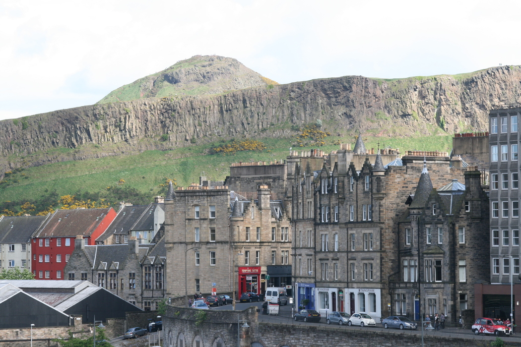
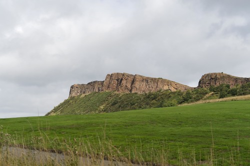
| Salisbury Crags, City of Edinburgh, Scotland, UK | 55° 56' 47" N | 3° 10' 27" W | 9.9km (6.2 miles) | |
| Arthur's Seat, City of Edinburgh, Scotland, UK | 55° 56' 38" N | 3° 9' 42" W | 10.0km (6.2 miles) | |
| Castle Rock, City of Edinburgh, Scotland, UK | 55° 56' 54" N | 3° 12' 2" W | 10.2km (6.4 miles) | |
| Lady Blanche Pit, Fife, Scotland, UK | 56° 7' 29" N | 3° 7' 12" W | 10.2km (6.4 miles) | |
| Lion's Haunch, Arthur's Seat, City of Edinburgh, Scotland, UK | 55° 56' 30" N | 3° 9' 44" W | 10.3km (6.4 miles) | |
| Niddrie Pit No.09 Colliery, City of Edinburgh, Scotland, UK | 55° 56' 26" N | 3° 6' 8" W | 10.5km (6.5 miles) | |
| Aberdour, Fife, Scotland, UK | 56° 3' 16" N | 3° 18' 9" W | 10.6km (6.6 miles) | |
| Frances Pit, Fife, Scotland, UK | 56° 7' 57" N | 3° 6' 43" W | 11.2km (6.9 miles) | |
| Dysart Colliery, Fife, Scotland, UK | 56° 7' 57" N | 3° 6' 43" W | 11.2km (6.9 miles) | |
| Niddrie Pit No.10 Colliery, City of Edinburgh, Scotland, UK | 55° 56' 2" N | 3° 6' 23" W | 11.2km (7.0 miles) | |
| Niddry Colliery, City of Edinburgh, Scotland, UK | 55° 56' 1" N | 3° 6' 26" W | 11.2km (7.0 miles) | |
| Newcraighall Colliery, City of Edinburgh, Scotland, UK | 55° 56' 5" N | 3° 5' 40" W | 11.3km (7.0 miles) | |
| Belgregay Pit, Fife, Scotland, UK | 56° 8' 2" N | 3° 7' 16" W | 11.3km (7.0 miles) | |
| Balgreiggy Pit, Fife, Scotland, UK | 56° 8' 3" N | 3° 7' 18" W | 11.3km (7.0 miles) | |
| Old Colliery, East Lothian, Scotland, UK | 55° 56' 12" N | 3° 4' 35" W | 11.3km (7.1 miles) | |
| William Pit, Fife, Scotland, UK | 56° 8' 9" N | 3° 7' 12" W | 11.5km (7.1 miles) | |
Minerals recorded nearby (within 11.5 km)
Rock types recorded nearby (within 11.5 km)
Entries shown in red are rocks recorded for this region.


Salisbury Crags, City of Edinburgh, Scotland, UK