| Locality | Latitude | Longitude | Distance | Bearing |
|---|
| Thetford Lead Mine, Thetford, Orange County, Vermont, USA | 43° 49' 27" N | 72° 13' 8" W | 5.3km (3.3 miles) | |
| Holts Ledge, Lyme, Grafton County, New Hampshire, USA | 43° 46' 40" N | 72° 6' 15" W | 5.5km (3.4 miles) | |
| Thetford, Orange County, Vermont, USA | 43° 49' 36" N | 72° 14' 44" W | 7.4km (4.6 miles) | |
| Northey Hill Line Occurrences, Orford, Grafton County, New Hampshire, USA | 43° 52' 59" N | 72° 5' 9" W | 9.9km (6.1 miles) | |
| Archertown Brook Occurrences, Orford, Grafton County, New Hampshire, USA | 43° 54' 10" N | 72° 6' 29" W | 11.0km (6.8 miles) | |
| Eastman Ledges, Orford, Grafton County, New Hampshire, USA | 43° 51' 51" N | 72° 2' 4" W | 11.4km (7.1 miles) | |
| Cottonstone Mountain, Orford, Grafton County, New Hampshire, USA | 43° 55' 47" N | 72° 6' 29" W | 13.9km (8.6 miles) | |
| West Fairlee, Orange County, Vermont, USA | 43° 55' 19" N | 72° 14' 3" W | 13.9km (8.7 miles) | |
| Elizabeth Mine, South Strafford, Strafford, Orange County, Vermont, USA | 43° 49' 24" N | 72° 19' 56" W | 14.2km (8.8 miles) | |
| Gile Mountain Park, Sharon, Windsor County, Vermont, USA | 43° 47' 21" N | 72° 20' 35" W | 15.2km (9.4 miles) | |
| King prospect, Wentworth, Grafton County, New Hampshire, USA | 43° 51' 34" N | 71° 58' 9" W | 15.9km (9.9 miles) | |
| Signal Hill, Lebanon, Grafton County, New Hampshire, USA | 43° 40' 4" N | 72° 13' 35" W | 16.8km (10.5 miles) | |
| Ely Mine, South Vershire, Town of Vershire, Orange County, Vermont, USA | 43° 55' 45" N | 72° 17' 8" W | 16.8km (10.5 miles) | |
| Stone Hill, Norwich, Windsor County, Vermont, USA | 43° 46' 9" N | 72° 21' 33" W | 16.9km (10.5 miles) | |
| South Strafford, Strafford, Orange County, Vermont, USA | 43° 50' 7" N | 72° 21' 57" W | 17.1km (10.6 miles) | |
| South Vershire, Town of Vershire, Orange County, Vermont, USA | 43° 55' 19" N | 72° 19' 0" W | 17.9km (11.1 miles) | |
| Lower Baker Pond Brook Occurrences, Wentworth, Grafton County, New Hampshire, USA | 43° 53' 9" N | 71° 57' 29" W | 18.0km (11.2 miles) | |
| McGinnis Mine (McGinnis Mica Mine; Wilcher and Pilsbury Mine), Wentworth, Grafton County, New Hampshire, USA | 43° 49' 53" N | 71° 55' 36" W | 18.5km (11.5 miles) | |
| Strafford, Orange County, Vermont, USA | 43° 51' 56" N | 72° 22' 37" W | 18.8km (11.7 miles) | |
| New Gove prospect, Wentworth, Grafton County, New Hampshire, USA | 43° 50' 48" N | 71° 54' 46" W | 19.9km (12.4 miles) | |
| Brown Mine, Wentworth, Grafton County, New Hampshire, USA | 43° 51' 31" N | 71° 54' 15" W | 20.9km (13.0 miles) | |
| Town of Vershire, Orange County, Vermont, USA | 43° 57' 33" N | 72° 19' 28" W | 21.4km (13.3 miles) | |
| No. 3 pit, Keyes Mica Quarries, Orange, Grafton County, New Hampshire, USA | 43° 41' 42" N | 71° 56' 30" W | 21.5km (13.3 miles) | |
| Keyes Mica Quarries, Orange, Grafton County, New Hampshire, USA | 43° 41' 32" N | 71° 56' 32" W | 21.6km (13.4 miles) | |
| No. 1 pit, Keyes Mica Quarries, Orange, Grafton County, New Hampshire, USA | 43° 41' 32" N | 71° 56' 32" W | 21.6km (13.4 miles) | |
| No. 5 pit, Keyes Mica Quarries, Orange, Grafton County, New Hampshire, USA | 43° 41' 22" N | 71° 56' 42" W | 21.6km (13.4 miles) | |
| Leggett mica prospect, Rumney, Grafton County, New Hampshire, USA | 43° 49' 21" N | 71° 53' 9" W | 21.7km (13.5 miles) | |
| Fellows Mine, Wentworth, Grafton County, New Hampshire, USA | 43° 53' 49" N | 71° 54' 43" W | 21.8km (13.5 miles) | |
| Rice Quarry, Groton, Grafton County, New Hampshire, USA | 43° 44' 42" N | 71° 53' 47" W | 22.1km (13.7 miles) | |
| Palermo No. 2 Mine, Groton, Grafton County, New Hampshire, USA | 43° 45' 6" N | 71° 53' 33" W | 22.1km (13.7 miles) | |

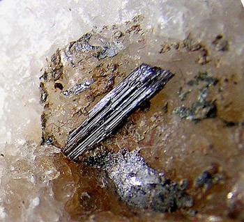


Holts Ledge, Lyme, Grafton County, New Hampshire, USA