| Locality | Latitude | Longitude | Distance | Bearing |
|---|
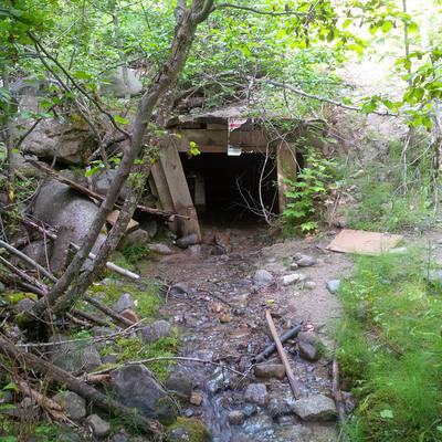
| Tungsten Hill Mine (Howard Wickersham; Bull Moose; M & F; Blanche), Boundary County, Idaho, USA | 48° 53' 58" N | 116° 16' 28" W | 0.0km (0.0 miles) | |
| Chief Joseph Prospect (M & F; Tungsten Hill), Moyie - Yaak Mining District, Boundary County, Idaho, USA | 48° 53' 56" N | 116° 16' 32" W | 0.1km (0.1 miles) | |
| Queen Mountain Deposits, Moyie - Yaak Mining District, Boundary County, Idaho, USA | 48° 54' 0" N | 116° 16' 59" W | 0.6km (0.4 miles) | |
| Tommy Moran prospect (Howard Wickersham; Moran property), Brush Lake District, Moyie - Yaak Mining District, Boundary County, Idaho, USA | 48° 53' 26" N | 116° 15' 0" W | 2.1km (1.3 miles) | |
| Bethlehem Mine (Brush Lake Minco; Mable Tunnel; Brush Lake Mine; Dora), Copeland, Moyie - Yaak Mining District, Boundary County, Idaho, USA | 48° 53' 34" N | 116° 18' 20" W | 2.4km (1.5 miles) | |
| Queen Mine (Moyie Gold Mining and Milling Company), Moyie - Yaak Mining District, Boundary County, Idaho, USA | 48° 54' 10" N | 116° 13' 24" W | 3.8km (2.3 miles) | |
| Regal Mine (Silver Crescent; Commercial), Moyie - Yaak Mining District, Boundary County, Idaho, USA | 48° 51' 59" N | 116° 15' 29" W | 3.9km (2.4 miles) | |
| Blue Grouse prospect, Brush Lake District, Moyie - Yaak Mining District, Boundary County, Idaho, USA | 48° 54' 50" N | 116° 19' 24" W | 3.9km (2.4 miles) | |
| American Girl Prospect, Brush Lake District, Moyie - Yaak Mining District, Boundary County, Idaho, USA | 48° 55' 9" N | 116° 19' 54" W | 4.7km (2.9 miles) | |
| Tilley Mine, Brush Lake District, Moyie - Yaak Mining District, Boundary County, Idaho, USA | 48° 54' 35" N | 116° 12' 35" W | 4.9km (3.0 miles) | |
| Kent property prospect, Brush Lake District, Moyie - Yaak Mining District, Boundary County, Idaho, USA | 48° 54' 28" N | 116° 20' 25" W | 4.9km (3.0 miles) | |
| Klondike Prospect, Moyie - Yaak Mining District, Boundary County, Idaho, USA | 48° 51' 59" N | 116° 13' 44" W | 5.0km (3.1 miles) | |
| Miller Brothers Mine (Lucky Charlie Mine), Boundary County, Idaho, USA | 48° 57' 0" N | 116° 17' 48" W | 5.8km (3.6 miles) | |
| Copeland, Moyie - Yaak Mining District, Boundary County, Idaho, USA | 48° 54' 7" N | 116° 23' 20" W | 8.3km (5.2 miles) | |
| Hall Mountain Nickel Deposit - Idaho, Brush Lake District, Moyie - Yaak Mining District, Boundary County, Idaho, USA | 48° 55' 0" N | 116° 24' 0" W | 9.3km (5.8 miles) | |
| Downey Prospect, Moyie - Yaak Mining District, Boundary County, Idaho, USA | 48° 51' 15" N | 116° 9' 37" W | 9.8km (6.1 miles) | |
| Hall Mountain, Boundary County, Idaho, USA | 48° 58' 0" N | 116° 22' 0" W | 10.0km (6.2 miles) | |
| Hall Mountain, Moyie - Yaak Mining District, Boundary County, Idaho, USA | 48° 58' 26" N | 116° 22' 18" W | 10.9km (6.8 miles) | |
| Montgomery Prospect, Moyie - Yaak Mining District, Boundary County, Idaho, USA | 48° 57' 43" N | 116° 23' 30" W | 11.0km (6.8 miles) | |
| Lead Mill Prospect, Moyie - Yaak Mining District, Boundary County, Idaho, USA | 48° 49' 32" N | 116° 9' 54" W | 11.5km (7.1 miles) | |
| Silver Spoon Prospect, Moyie - Yaak Mining District, Boundary County, Idaho, USA | 48° 49' 30" N | 116° 9' 54" W | 11.6km (7.2 miles) | |
| Copper Creek Prospect, Moyie - Yaak Mining District, Boundary County, Idaho, USA | 48° 58' 49" N | 116° 10' 21" W | 11.6km (7.2 miles) | |
| Trust Mining Company Prospect, Moyie - Yaak Mining District, Boundary County, Idaho, USA | 48° 58' 12" N | 116° 23' 35" W | 11.7km (7.2 miles) | |
| Geneva Claims, Moyie - Yaak Mining District, Boundary County, Idaho, USA | 48° 58' 11" N | 116° 8' 35" W | 12.4km (7.7 miles) | |
| Bruce Berringer Prospect, Moyie - Yaak Mining District, Boundary County, Idaho, USA | 48° 58' 55" N | 116° 23' 30" W | 12.5km (7.8 miles) | |
| Big T Prospect, Moyie - Yaak Mining District, Boundary County, Idaho, USA | 48° 58' 14" N | 116° 8' 28" W | 12.5km (7.8 miles) | |
| Copper Falls Prospect, Moyie - Yaak Mining District, Boundary County, Idaho, USA | 48° 58' 18" N | 116° 8' 30" W | 12.6km (7.8 miles) | |
| Lucky Seven Prospect (Scheller Prospect; Schiller and Dougherty), Moyie - Yaak Mining District, Boundary County, Idaho, USA | 48° 59' 0" N | 116° 24' 15" W | 13.3km (8.2 miles) | |
| Railroad Prospect, Moyie - Yaak Mining District, Boundary County, Idaho, USA | 48° 48' 33" N | 116° 9' 2" W | 13.5km (8.4 miles) | |
| N. W. Prospecting & Development Prospect (Atomic Fuels Corporation), Moyie - Yaak Mining District, Boundary County, Idaho, USA | 48° 59' 9" N | 116° 24' 29" W | 13.7km (8.5 miles) | |
Minerals recorded nearby (within 13.7 km)
Rock types recorded nearby (within 13.7 km)
Entries shown in red are rocks recorded for this region.


Tilley Mine, Brush Lake District, Moyie - Yaak Mining District, Boundary County, Idaho, USA