| Locality | Latitude | Longitude | Distance | Bearing |
|---|
| Rainbow Ridge Mine (Monarch Opal Mine; Roop Mine), Virgin Valley, Humboldt County, Nevada, USA | 41° 47' 44" N | 119° 0' 50" W | 0.0km (0.0 miles) | |
| Rincon Belle Extension, Rainbow Ridge Mine (Monarch Opal Mine; Roop Mine), Virgin Valley, Humboldt County, Nevada, USA | 41° 47' 53" N | 119° 1' 4" W | 0.4km (0.3 miles) | |
| Lowlands, Virgin Valley, Humboldt County, Nevada, USA | 41° 48' 3" N | 119° 0' 52" W | 0.6km (0.4 miles) | |
| May Day Mine (May Day No. 1 & No. 2 lodes), Virgin Valley, Humboldt County, Nevada, USA | 41° 47' 53" N | 119° 1' 18" W | 0.7km (0.4 miles) | |
| Vaillant Mine (Hopeless claim; Sergine claim; Pine Cone claim; Sunshine claim; Jeanne Marie claim; Charlotte's Folly claim; Goldbrick claim), Virgin Valley, Humboldt County, Nevada, USA | 41° 47' 22" N | 119° 1' 20" W | 1.0km (0.6 miles) | |
| Swordfish Mine, Virgin Valley, Humboldt County, Nevada, USA | 41° 48' 17" N | 118° 59' 35" W | 2.0km (1.3 miles) | |
| Green Fire Mine, Virgin Valley, Humboldt County, Nevada, USA | 41° 48' 52" N | 119° 0' 36" W | 2.2km (1.3 miles) | |
| Ladd and Sherdson's Group, Virgin Valley Mining District, Humboldt County, Nevada, USA | 41° 47' 30" N | 118° 58' 50" W | 2.8km (1.7 miles) | |
| Jo Lu 55 Opal Mine, Virgin Valley, Humboldt County, Nevada, USA | 41° 48' 12" N | 119° 2' 54" W | 3.0km (1.9 miles) | |
| Joy Lo, Virgin Valley Mining District, Humboldt County, Nevada, USA | 41° 48' 19" N | 119° 3' 4" W | 3.3km (2.0 miles) | |
| Prisms Millsite, Virgin Valley, Humboldt County, Nevada, USA | 41° 49' 34" N | 119° 1' 31" W | 3.5km (2.2 miles) | |
| Black Hope group, Virgin Valley, Humboldt County, Nevada, USA | 41° 48' 51" N | 119° 3' 41" W | 4.4km (2.8 miles) | |
| Meyer Group Mine, Virgin Valley Mining District, Humboldt County, Nevada, USA | 41° 48' 51" N | 119° 3' 40" W | 4.4km (2.8 miles) | |
| Cecilie Anne Mine, Virgin Valley Mining District, Humboldt County, Nevada, USA | 41° 49' 33" N | 119° 3' 3" W | 4.6km (2.8 miles) | |
| Goodwill claims, Virgin Valley Mining District, Humboldt County, Nevada, USA | 41° 50' 18" N | 119° 0' 20" W | 4.8km (3.0 miles) | |
| Becky-Mucket claims, Virgin Valley, Humboldt County, Nevada, USA | 41° 48' 51" N | 119° 4' 14" W | 5.2km (3.2 miles) | |
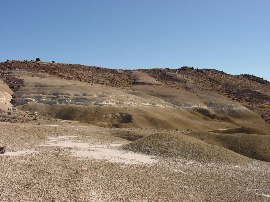
| Virgin Valley, Humboldt County, Nevada, USA | 41° 50' 39" N | 119° 0' 38" W | 5.4km (3.4 miles) | |
| PJ Opal Mine, Virgin Valley, Humboldt County, Nevada, USA | 41° 49' 7" N | 119° 4' 27" W | 5.6km (3.5 miles) | |
| Kelley Mine, Virgin Valley Mining District, Humboldt County, Nevada, USA | 41° 46' 52" N | 119° 4' 57" W | 5.9km (3.7 miles) | |
| Northern Lights Mine, Royal Peacock Group Mines, Virgin Valley, Humboldt County, Nevada, USA | 41° 47' 13" N | 119° 5' 9" W | 6.1km (3.8 miles) | |
| Reed Mine (Dorothy Rae claim; Nicki No. 1 claim; MS4982), Virgin Valley, Humboldt County, Nevada, USA | 41° 49' 28" N | 119° 4' 35" W | 6.1km (3.8 miles) | |
| Opal Queen group, Virgin Valley, Humboldt County, Nevada, USA | 41° 49' 50" N | 119° 4' 18" W | 6.2km (3.8 miles) | |
| Mesa Claim, Humboldt County, Nevada, USA | 41° 45' 59" N | 119° 4' 40" W | 6.2km (3.9 miles) | |
| Eddy group, Virgin Valley, Humboldt County, Nevada, USA | 41° 50' 8" N | 119° 3' 57" W | 6.2km (3.9 miles) | |
| Titanium Two claim, Virgin Valley, Humboldt County, Nevada, USA | 41° 51' 3" N | 119° 0' 6" W | 6.3km (3.9 miles) | |
| Little Pebble Mine (Pebbles), Royal Peacock Group Mines, Virgin Valley, Humboldt County, Nevada, USA | 41° 48' 9" N | 119° 5' 22" W | 6.3km (3.9 miles) | |
| Royal Peacock Group Mines, Virgin Valley, Humboldt County, Nevada, USA | 41° 47' 23" N | 119° 5' 26" W | 6.4km (4.0 miles) | |
| Kokopelli Opal Mine, Virgin Valley, Humboldt County, Nevada, USA | 41° 49' 18" N | 119° 5' 0" W | 6.5km (4.0 miles) | |
| Pandoras Woodpile Mine, Virgin Valley, Humboldt County, Nevada, USA | 41° 51' 14" N | 119° 1' 14" W | 6.5km (4.0 miles) | |
| Opal Negra Mine, Virgin Valley, Humboldt County, Nevada, USA | 41° 50' 22" N | 119° 3' 59" W | 6.6km (4.1 miles) | |


WRT Virgin Desert Flame claim, WRT Stonetree group, Virgin Valley, Humboldt County, Nevada, USA