| Locality | Latitude | Longitude | Distance | Bearing |
|---|
| Whitefield, Coos County, New Hampshire, USA | 44° 22' 23" N | 71° 36' 43" W | 0.0km (0.0 miles) | |
| Dalton, Coos County, New Hampshire, USA | 44° 24' 56" N | 71° 41' 40" W | 8.1km (5.0 miles) | |
| Twin Mountain Quarry, Carroll, Coos County, New Hampshire, USA | 44° 17' 41" N | 71° 33' 13" W | 9.9km (6.2 miles) | |
| Carroll, Coos County, New Hampshire, USA | 44° 17' 53" N | 71° 32' 26" W | 10.1km (6.3 miles) | |
| Cherry Mountain, Carroll, Coos County, New Hampshire, USA | 44° 18' 51" N | 71° 29' 31" W | 11.6km (7.2 miles) | |
| Lunenburg, Essex County, Vermont, USA | 44° 28' 4" N | 71° 41' 13" W | 12.1km (7.5 miles) | |
| Lancaster, Coos County, New Hampshire, USA | 44° 29' 20" N | 71° 34' 9" W | 13.3km (8.3 miles) | |
| Littleton Hospital construction site, Littleton, Grafton County, New Hampshire, USA | 44° 19' 7" N | 71° 49' 34" W | 18.1km (11.2 miles) | |
| Garnet Hill locality, Sugar Hill, Grafton County, New Hampshire, USA | 44° 13' 42" N | 71° 47' 40" W | 21.7km (13.5 miles) | |
| Kilkenny, Coos County, New Hampshire, USA | 44° 29' 43" N | 71° 23' 32" W | 22.1km (13.7 miles) | |
| Northey Hill locality(s), Sugar Hill, Grafton County, New Hampshire, USA | 44° 14' 9" N | 71° 49' 4" W | 22.4km (13.9 miles) | |
| Hutchins Mountain, Stark, Coos County, New Hampshire, USA | 44° 32' 53" N | 71° 27' 17" W | 23.1km (14.4 miles) | |
| Bean's Grant, Coos County, New Hampshire, USA | 44° 15' 12" N | 71° 22' 23" W | 23.2km (14.4 miles) | |
| Mount Guyot locality, Lincoln, Grafton County, New Hampshire, USA | 44° 10' 5" N | 71° 32' 2" W | 23.7km (14.7 miles) | |
| Ore Hill, Sugar Hill, Grafton County, New Hampshire, USA | 44° 11' 57" N | 71° 47' 29" W | 24.0km (14.9 miles) | |
| Mount Lafayette, Franconia, Grafton County, New Hampshire, USA | 44° 9' 24" N | 71° 38' 26" W | 24.2km (15.0 miles) | |
| Coppermine Brook Mine, Franconia, Grafton County, New Hampshire, USA | 44° 10' 37" N | 71° 44' 53" W | 24.4km (15.1 miles) | |
| Burke Quarry, Kirby, Caledonia County, Vermont, USA | 44° 29' 29" N | 71° 52' 19" W | 24.5km (15.2 miles) | |
| Grout Quarry, Kirby, Caledonia County, Vermont, USA | 44° 29' 52" N | 71° 52' 32" W | 25.1km (15.6 miles) | |
| Cannon Mountain, Franconia, Grafton County, New Hampshire, USA | 44° 9' 23" N | 71° 41' 53" W | 25.1km (15.6 miles) | |
| Mount Bond locality, Lincoln, Grafton County, New Hampshire, USA | 44° 9' 10" N | 71° 31' 51" W | 25.4km (15.8 miles) | |
| Mount Webster pegmatite locality, Bean's Grant, Coos County, New Hampshire, USA | 44° 11' 40" N | 71° 23' 17" W | 26.7km (16.6 miles) | |
| Pond Hill locality, Lisbon, Grafton County, New Hampshire, USA | 44° 11' 55" N | 71° 52' 10" W | 28.2km (17.5 miles) | |
| Cooley Hill Iron prospects, Easton, Grafton County, New Hampshire, USA | 44° 9' 15" N | 71° 49' 21" W | 29.6km (18.4 miles) | |
| Paddock mine, Lyman, Grafton County, New Hampshire, USA | 44° 16' 45" N | 71° 58' 2" W | 30.1km (18.7 miles) | |
| Sargents Purchase, Coos County, New Hampshire, USA | 44° 13' 9" N | 71° 18' 1" W | 30.2km (18.7 miles) | |
| Mill Mountain, Stark, Coos County, New Hampshire, USA | 44° 35' 53" N | 71° 23' 11" W | 30.7km (19.1 miles) | |
| Stark, Coos County, New Hampshire, USA | 44° 36' 34" N | 71° 24' 33" W | 30.8km (19.2 miles) | |
| Stratford, Coos County, New Hampshire, USA | 44° 39' 15" N | 71° 33' 30" W | 31.5km (19.6 miles) | |
| Glen Ellis Falls, Jackson, Carroll County, New Hampshire, USA | 44° 14' 38" N | 71° 15' 5" W | 32.1km (20.0 miles) | |


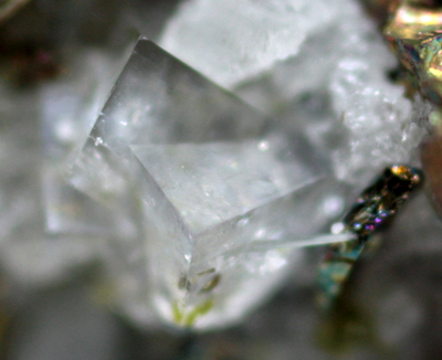


Twin Mountain Quarry, Carroll, Coos County, New Hampshire, USA