| Locality | Latitude | Longitude | Distance | Bearing |
|---|
| Ardtully Quarry, Kenmare, Kerry County, Munster, Ireland | 51° 54' 5" N | 9° 29' 16" W | 2.6km (1.6 miles) | |
| Ardtully Mine (Cloontoo Mine), Kenmare Mines, Kenmare, Kerry County, Munster, Ireland | 51° 54' 6" N | 9° 29' 24" W | 2.8km (1.7 miles) | |
| Caher West Mine (Shanagarry Mine), Kenmare Mines, Kenmare, Kerry County, Munster, Ireland | 51° 53' 52" N | 9° 31' 27" W | 5.1km (3.2 miles) | |
| Muckross Mine, Killarney, Kerry County, Munster, Ireland | 52° 0' 56" N | 9° 31' 55" W | 14.1km (8.7 miles) | |
| Ross Island, Lough Leane, Killarney, Kerry County, Munster, Ireland | 52° 2' 5" N | 9° 32' 13" W | 16.2km (10.0 miles) | |
| Leaghillaun (Leaghuillean), Tuosist, Beara, Kerry County, Munster, Ireland | 51° 48' 41" N | 9° 45' 50" W | 23.7km (14.7 miles) | |
| Rooska Mine, Sheeps Head Peninsula, Cork County, Munster, Ireland | 51° 39' 5" N | 9° 33' 2" W | 28.5km (17.7 miles) | |
| Dereenalomane Mine, Mizen Peninsula, Cork County, Munster, Ireland | 51° 35' 18" N | 9° 31' 49" W | 35.1km (21.8 miles) | |
| Cooragurteen Mine, Ballydehob, Mizen Peninsula, Cork County, Munster, Ireland | 51° 33' 56" N | 9° 28' 5" W | 37.2km (23.1 miles) | |
| Ballydehob Mine, Audley Mines, Ballydehob, Mizen Peninsula, Cork County, Munster, Ireland | 51° 33' 51" N | 9° 27' 57" W | 37.3km (23.2 miles) | |
| Letter Mine, Letter, Mizen Peninsula, Cork County, Munster, Ireland | 51° 33' 42" N | 9° 31' 6" W | 37.9km (23.6 miles) | |
| Mt. Gabriel Mine, Schull, Mizen Peninsula, Cork County, Munster, Ireland | 51° 33' 29" N | 9° 32' 48" W | 38.6km (24.0 miles) | |
| Ballyegan Quarry, Castleisland, Kerry County, Munster, Ireland | 52° 14' 39" N | 9° 31' 35" W | 38.7km (24.0 miles) | |
| Roaringwater Mine, Aughadown/Leighcloon, Mizen Peninsula, Cork County, Munster, Ireland | 51° 33' 9" N | 9° 23' 38" W | 38.8km (24.1 miles) | |
| McCarthy's Quarry, Skibbereen, Cork County, Munster, Ireland | 51° 33' 46" N | 9° 16' 26" W | 39.4km (24.5 miles) | |
| Drominagh Colliery, The Municipal District of Kanturk – Mallow, Cork County, Munster, Ireland | 52° 7' 53" N | 9° 0' 39" W | 39.6km (24.6 miles) | |
| Cappagh Mine (Cappaghglass; Audley; Great Cappagh), Audley Mines, Ballydehob, Mizen Peninsula, Cork County, Munster, Ireland | 51° 32' 9" N | 9° 27' 46" W | 40.5km (25.1 miles) | |
| Drumskehey Colliery, The Municipal District of Kanturk – Mallow, Cork County, Munster, Ireland | 52° 7' 37" N | 8° 59' 8" W | 40.6km (25.2 miles) | |
| Ballycummisk Mine, Audley Mines, Ballydehob, Mizen Peninsula, Cork County, Munster, Ireland | 51° 32' 4" N | 9° 28' 33" W | 40.7km (25.3 miles) | |
| Dromagh Colliery, The Municipal District of Kanturk – Mallow, Cork County, Munster, Ireland | 52° 7' 38" N | 8° 58' 55" W | 40.8km (25.3 miles) | |
| Lisnacon Colliery, The Municipal District of Kanturk – Mallow, Cork County, Munster, Ireland | 52° 8' 2" N | 8° 58' 45" W | 41.4km (25.7 miles) | |
| Hurley's Quarry, Glaun, Schull, Mizen Peninsula, Cork County, Munster, Ireland | 51° 32' 12" N | 9° 35' 12" W | 41.5km (25.8 miles) | |
| Coosheen Mine (Cosheen Mine; Skull Bay Mine), Coosheen, Schull, Mizen Peninsula, Cork County, Munster, Ireland | 51° 31' 27" N | 9° 31' 40" W | 42.1km (26.2 miles) | |
| Leap Mine, Glandore, Cork County, Munster, Ireland | 51° 34' 17" N | 9° 8' 12" W | 42.4km (26.4 miles) | |
| Glandore Mine (Aghatubrid Mine; Glendore Mine), Glandore, Cork County, Munster, Ireland | 51° 34' 26" N | 9° 7' 20" W | 42.7km (26.5 miles) | |
| Horse Island Mine, Roaringwater Bay, Mizen Peninsula, Cork County, Munster, Ireland | 51° 30' 56" N | 9° 28' 0" W | 42.7km (26.6 miles) | |
| Gortavallig Mine, Sheeps Head Peninsula, Cork County, Munster, Ireland | 51° 34' 32" N | 9° 47' 4" W | 42.8km (26.6 miles) | |
| Coalbrook & Drominagh Colliery, The Municipal District of Kanturk – Mallow, Cork County, Munster, Ireland | 52° 8' 36" N | 8° 56' 33" W | 44.0km (27.4 miles) | |
| Roury Glen Mine, Glandore, Cork County, Munster, Ireland | 51° 34' 31" N | 9° 4' 35" W | 44.3km (27.5 miles) | |
| Celtic Ross Hotel, Rosscarbery, Cork County, Munster, Ireland | 51° 34' 32" N | 9° 1' 42" W | 46.3km (28.8 miles) | |


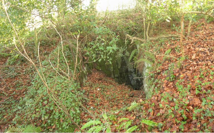
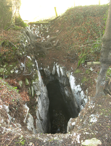


Ardtully Mine, Kenmare Mines, Kenmare, Kerry County, Munster, Ireland