| Locality | Latitude | Longitude | Distance | Bearing |
|---|
| Powers Mine, Willis Gulch, Quartz Hill, Central City Mining District (Central Mining District), Gilpin County, Colorado, USA | 39° 46' 59" N | 105° 30' 0" W | 0.0km (0.0 miles) | |
| Wood Mine (E. Calhoun), Willis Gulch, Quartz Hill, Central City Mining District (Central Mining District), Gilpin County, Colorado, USA | 39° 46' 59" N | 105° 30' 0" W | 0.0km (0.0 miles) | |
| Anchor Occurrence, Central City Mining District (Central Mining District), Gilpin County, Colorado, USA | 39° 46' 59" N | 105° 30' 0" W | 0.0km (0.0 miles) | |
| War Dance, Central City Mining District (Central Mining District), Gilpin County, Colorado, USA | 39° 46' 57" N | 105° 30' 2" W | 0.1km (0.1 miles) | |
| Widow Woman vein, Southern, Gilpin County, Colorado, USA | 39° 46' 56" N | 105° 29' 47" W | 0.3km (0.2 miles) | |
| Francis, Central City Mining District (Central Mining District), Gilpin County, Colorado, USA | 39° 46' 47" N | 105° 30' 0" W | 0.4km (0.2 miles) | |
| Pittsburgh (Notaway East; Notaway Shaft; Notaway West), Central City Mining District (Central Mining District), Gilpin County, Colorado, USA | 39° 47' 10" N | 105° 30' 9" W | 0.4km (0.3 miles) | |
| Hidee Mine, Central City Mining District (Central Mining District), Gilpin County, Colorado, USA | 39° 47' 13" N | 105° 30' 2" W | 0.4km (0.3 miles) | |
| Chase, Central City Mining District (Central Mining District), Gilpin County, Colorado, USA | 39° 46' 57" N | 105° 30' 19" W | 0.5km (0.3 miles) | |
| Meeker, Central City Mining District (Central Mining District), Gilpin County, Colorado, USA | 39° 47' 14" N | 105° 30' 2" W | 0.5km (0.3 miles) | |
| Baltimore No. 7391, Lower Russel Gulch, Gilpin County, Colorado, USA | 39° 47' 15" N | 105° 30' 7" W | 0.5km (0.3 miles) | |
| Mattie May, Central City Mining District (Central Mining District), Gilpin County, Colorado, USA | 39° 47' 16" N | 105° 30' 9" W | 0.6km (0.4 miles) | |
| Curtis Lode, Central City Mining District (Central Mining District), Gilpin County, Colorado, USA | 39° 47' 19" N | 105° 30' 4" W | 0.6km (0.4 miles) | |
| Justice, Central City Mining District (Central Mining District), Gilpin County, Colorado, USA | 39° 46' 57" N | 105° 29' 23" W | 0.9km (0.5 miles) | |
| American Girl, Central City Mining District (Central Mining District), Gilpin County, Colorado, USA | 39° 46' 32" N | 105° 29' 45" W | 0.9km (0.6 miles) | |
| Gasten Mine, Central City Mining District (Central Mining District), Gilpin County, Colorado, USA | 39° 46' 41" N | 105° 30' 29" W | 0.9km (0.6 miles) | |
| Cherokee Mine, Eureka Mining District, Gilpin County, Colorado, USA | 39° 46' 30" N | 105° 29' 52" W | 0.9km (0.6 miles) | |
| Wolverine, Central City Mining District (Central Mining District), Gilpin County, Colorado, USA | 39° 46' 30" N | 105° 29' 55" W | 0.9km (0.6 miles) | |
| Diamond Joe, Central City Mining District (Central Mining District), Gilpin County, Colorado, USA | 39° 46' 30" N | 105° 29' 55" W | 0.9km (0.6 miles) | |
| Two Brothers Tunnel, Idaho Springs Mining District (Virginia Mining District), Clear Creek County, Colorado, USA | 39° 46' 30" N | 105° 29' 55" W | 0.9km (0.6 miles) | |
| Little Annie, Central City Mining District (Central Mining District), Gilpin County, Colorado, USA | 39° 46' 30" N | 105° 29' 55" W | 0.9km (0.6 miles) | |
| Beecher, Central City Mining District (Central Mining District), Gilpin County, Colorado, USA | 39° 46' 30" N | 105° 29' 55" W | 0.9km (0.6 miles) | |
| Chemung - Belmont, Central City Mining District (Central Mining District), Gilpin County, Colorado, USA | 39° 47' 4" N | 105° 29' 20" W | 1.0km (0.6 miles) | |
| Hill; Bunkhouse Occurrence, Central City Mining District (Central Mining District), Gilpin County, Colorado, USA | 39° 46' 36" N | 105° 29' 30" W | 1.0km (0.6 miles) | |
| Vigilant; Banta Hill; Gold; Bunkhouse Occurrence, Idaho Springs Mining District (Virginia Mining District), Clear Creek County, Colorado, USA | 39° 46' 36" N | 105° 29' 30" W | 1.0km (0.6 miles) | |
| Kokomo Mine, Central City Mining District (Central Mining District), Gilpin County, Colorado, USA | 39° 46' 41" N | 105° 30' 36" W | 1.0km (0.6 miles) | |
| Saratoga Mine, Central City Mining District (Central Mining District), Gilpin County, Colorado, USA | 39° 46' 54" N | 105° 30' 42" W | 1.0km (0.6 miles) | |
| Hazeline, Central City Mining District (Central Mining District), Gilpin County, Colorado, USA | 39° 46' 41" N | 105° 30' 36" W | 1.1km (0.7 miles) | |
| Ute Gold Properties, Central City Mining District (Central Mining District), Gilpin County, Colorado, USA | 39° 47' 27" N | 105° 30' 29" W | 1.1km (0.7 miles) | |
| Unknown Silver - Gold (MRDS - 10018605), Central City Mining District (Central Mining District), Gilpin County, Colorado, USA | 39° 47' 27" N | 105° 29' 30" W | 1.1km (0.7 miles) | |

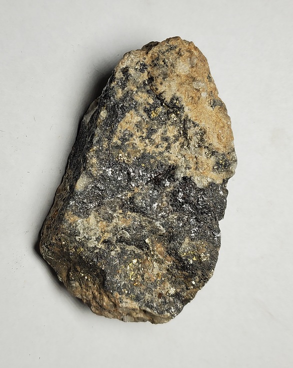


War Dance, Central City Mining District, Gilpin County, Colorado, USA