| Locality | Latitude | Longitude | Distance | Bearing |
|---|
| Wenatchee Placers, Wenatchee Mining District, Chelan County, Washington, USA | 47° 25' 45" N | 120° 18' 29" W | 0.7km (0.4 miles) | |
| Squaw Saddle Mercury Prospect, Wenatchee Mining District, Chelan County, Washington, USA | 47° 23' 53" N | 120° 19' 52" W | 3.2km (2.0 miles) | |
| Squaw Saddle Mountain, Wenatchee Mining District, Chelan County, Washington, USA | 47° 24' 4" N | 120° 20' 19" W | 3.3km (2.0 miles) | |
| Cannon Mine, Wenatchee Mining District, Chelan County, Washington, USA | 47° 23' 44" N | 120° 19' 30" W | 3.3km (2.0 miles) | |
| Cain, Wenatchee Mining District, Chelan County, Washington, USA | 47° 23' 15" N | 120° 18' 20" W | 4.0km (2.5 miles) | |
| Dry Gulch Preserve, Wenatchee Mining District, Chelan County, Washington, USA | 47° 23' 13" N | 120° 20' 5" W | 4.5km (2.8 miles) | |
| Brown Quarry, Wenatchee Mining District, Chelan County, Washington, USA | 47° 22' 56" N | 120° 19' 7" W | 4.6km (2.9 miles) | |
| Lovitt Mine, Wenatchee Mining District, Chelan County, Washington, USA | 47° 22' 54" N | 120° 18' 53" W | 4.6km (2.9 miles) | |
| Charlotte Prospect, Wenatchee Mining District, Chelan County, Washington, USA | 47° 22' 43" N | 120° 19' 21" W | 5.1km (3.1 miles) | |
| Althouse Placers,Inc. Project, Wenatchee Mining District, Chelan County, Washington, USA | 47° 22' 9" N | 120° 17' 34" W | 6.2km (3.8 miles) | |
| Boyles, Wenatchee Mining District, Chelan County, Washington, USA | 47° 30' 26" N | 120° 19' 48" W | 9.4km (5.9 miles) | |
| Number Two Canyon, Wenatchee Mining District, Chelan County, Washington, USA | 47° 23' 31" N | 120° 25' 45" W | 9.6km (6.0 miles) | |
| Fairview Canyon, Wenatchee Mining District, Chelan County, Washington, USA | 47° 27' 29" N | 120° 25' 49" W | 9.8km (6.1 miles) | |
| Horselake Mountain Hornblende occurrence, Wenatchee Mining District, Chelan County, Washington, USA | 47° 24' 57" N | 120° 26' 31" W | 9.9km (6.2 miles) | |
| Monitor Tin Occurrence, Wenatchee Mining District, Chelan County, Washington, USA | 47° 28' 22" N | 120° 25' 15" W | 10.0km (6.2 miles) | |
| Burch Mountain, Wenatchee Mining District, Chelan County, Washington, USA | 47° 30' 42" N | 120° 20' 7" W | 10.0km (6.2 miles) | |
| Burch Mountain No. 1, Wenatchee Mining District, Chelan County, Washington, USA | 47° 31' 27" N | 120° 21' 3" W | 11.6km (7.2 miles) | |
| Burch Mountain No. 2, Wenatchee Mining District, Chelan County, Washington, USA | 47° 31' 27" N | 120° 21' 6" W | 11.6km (7.2 miles) | |
| Burch Mountain[1], Wenatchee Mining District, Chelan County, Washington, USA | 47° 34' 14" N | 120° 23' 46" W | 17.6km (10.9 miles) | |
| Rock Island Dam, Douglas County, Washington, USA | 47° 20' 36" N | 120° 5' 22" W | 18.8km (11.7 miles) | |
| Amalgamated Gold Mines Company, Culver Gulch, Blewett Mining District (Peshastin Mining District), Wenatchee Mining District, Chelan County, Washington, USA | 47° 28' 52" N | 120° 35' 9" W | 21.7km (13.5 miles) | |
| Wednesday Placer, Leavenworth Mining District, Chelan County, Washington, USA | 47° 32' 30" N | 120° 34' 0" W | 23.3km (14.5 miles) | |
| Wenatchee River Placer, Leavenworth Mining District, Chelan County, Washington, USA | 47° 33' 33" N | 120° 34' 24" W | 24.9km (15.5 miles) | |
| Caledonia Prospect, Peshastin Creek, Blewett Mining District (Peshastin Mining District), Chelan County, Washington, USA | 47° 25' 47" N | 120° 38' 48" W | 25.3km (15.7 miles) | |
| Apple Queen Claim, Peshastin Creek, Blewett Mining District (Peshastin Mining District), Chelan County, Washington, USA | 47° 25' 44" N | 120° 39' 0" W | 25.6km (15.9 miles) | |
| Chumstick Mountain, Leavenworth Mining District, Chelan County, Washington, USA | 47° 38' 4" N | 120° 26' 44" W | 25.6km (15.9 miles) | |
| April Fool, Blewett Mining District (Peshastin Mining District), Chelan County, Washington, USA | 47° 25' 39" N | 120° 39' 4" W | 25.6km (15.9 miles) | |
| Lovejoy Claim, Entiat Mining District, Chelan County, Washington, USA | 47° 38' 57" N | 120° 13' 57" W | 25.8km (16.0 miles) | |
| Tip Top Mine, Peshastin Creek, Blewett Mining District (Peshastin Mining District), Chelan County, Washington, USA | 47° 25' 26" N | 120° 39' 13" W | 25.8km (16.1 miles) | |
| Scotty Creek Placers, Blewett Mining District (Peshastin Mining District), Chelan County, Washington, USA | 47° 22' 42" N | 120° 38' 50" W | 25.9km (16.1 miles) | |

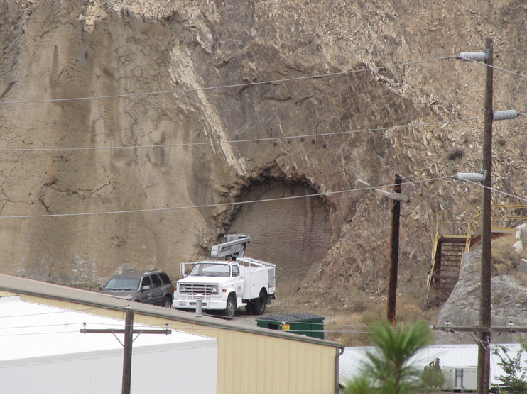


Cannon Mine, Wenatchee Mining District, Chelan County, Washington, USA