| Locality | Latitude | Longitude | Distance | Bearing |
|---|
| Donkey Pastures, Winster, Derbyshire Dales District, Derbyshire, England, UK | 53° 8' 17" N | 1° 38' 12" W | 0.6km (0.3 miles) | |
| Pike Lane Opencut, Winster, Derbyshire Dales District, Derbyshire, England, UK | 53° 8' 1" N | 1° 39' 0" W | 0.6km (0.4 miles) | |
| Brown Edge, Winster, Derbyshire Dales District, Derbyshire, England, UK | 53° 8' 43" N | 1° 38' 28" W | 0.8km (0.5 miles) | |
| Plackett mines, Winster, Derbyshire Dales District, Derbyshire, England, UK | 53° 8' 43" N | 1° 38' 28" W | 0.8km (0.5 miles) | |
| Blakelow Hill Mine, Bonsall Moor, Bonsall, Derbyshire Dales District, Derbyshire, England, UK | 53° 8' 3" N | 1° 37' 45" W | 1.1km (0.7 miles) | |
| Sacheveral Farm, Winster, Derbyshire Dales District, Derbyshire, England, UK | 53° 7' 47" N | 1° 39' 22" W | 1.2km (0.7 miles) | |
| Portaway Mine (Portaway Pipe), Elton, Derbyshire Dales District, Derbyshire, England, UK | 53° 8' 51" N | 1° 39' 22" W | 1.3km (0.8 miles) | |
| Bonsall Moor Quarry (Moor Farm Quarry; "Slayley Quarry"), Bonsall Moor, Bonsall, Derbyshire Dales District, Derbyshire, England, UK | 53° 7' 51" N | 1° 37' 40" W | 1.4km (0.9 miles) | |
| Heyspot Mine, Elton, Derbyshire Dales District, Derbyshire, England, UK | 53° 8' 29" N | 1° 39' 55" W | 1.4km (0.9 miles) | |
| Ivonbrook Quarry, Ivonbrook Grange, Derbyshire Dales District, Derbyshire, England, UK | 53° 7' 19" N | 1° 39' 5" W | 1.8km (1.1 miles) | |
| Raithe Mine (Rath Rake), Elton, Derbyshire Dales District, Derbyshire, England, UK | 53° 8' 41" N | 1° 40' 13" W | 1.9km (1.2 miles) | |
| Slack Mines, Bonsall Moor, Bonsall, Derbyshire Dales District, Derbyshire, England, UK | 53° 7' 53" N | 1° 36' 53" W | 2.1km (1.3 miles) | |
| Tearsall Farm, Winster, Derbyshire Dales District, Derbyshire, England, UK | 53° 8' 17" N | 1° 36' 33" W | 2.4km (1.5 miles) | |
| Tearsall Mine, South Darley, Derbyshire Dales District, Derbyshire, England, UK | 53° 8' 10" N | 1° 36' 29" W | 2.5km (1.5 miles) | |
| Old Millclose Mine, South Darley, Derbyshire Dales District, Derbyshire, England, UK | 53° 9' 10" N | 1° 36' 57" W | 2.5km (1.6 miles) | |
| Whitelow Mines, Bonsall Moor, Bonsall, Derbyshire Dales District, Derbyshire, England, UK | 53° 7' 6" N | 1° 37' 24" W | 2.6km (1.6 miles) | |
| Wensley, South Darley, Derbyshire Dales District, Derbyshire, England, UK | 53° 8' 47" N | 1° 36' 28" W | 2.6km (1.6 miles) | |
| Brightgate, South Darley, Derbyshire Dales District, Derbyshire, England, UK | 53° 7' 59" N | 1° 36' 12" W | 2.8km (1.7 miles) | |
| Blakemere Pit, Bonsall Moor, Bonsall, Derbyshire Dales District, Derbyshire, England, UK | 53° 7' 34" N | 1° 36' 26" W | 2.8km (1.8 miles) | |
| Brassington Moor Quarry, Aldwark, Derbyshire Dales District, Derbyshire, England, UK | 53° 6' 42" N | 1° 38' 54" W | 2.9km (1.8 miles) | |
| Grange Mill Quarry, Brassington, Derbyshire Dales District, Derbyshire, England, UK | 53° 6' 40" N | 1° 38' 29" W | 3.0km (1.9 miles) | |
| Gratton Dale, Gratton, Derbyshire Dales District, Derbyshire, England, UK | 53° 8' 27" N | 1° 41' 39" W | 3.3km (2.0 miles) | |
| Millclose Mine, South Darley, Derbyshire Dales District, Derbyshire, England, UK | 53° 9' 30" N | 1° 36' 29" W | 3.3km (2.1 miles) | |
| Darley Bridge, Matlock, Derbyshire Dales District, Derbyshire, England, UK | 53° 9' 9" N | 1° 36' 0" W | 3.4km (2.1 miles) | |
| Ible Quarry, Ible, Derbyshire Dales District, Derbyshire, England, UK | 53° 6' 25" N | 1° 37' 18" W | 3.8km (2.3 miles) | |
| Oxclose mine, Snitterton, South Darley, Derbyshire Dales District, Derbyshire, England, UK | 53° 7' 59" N | 1° 35' 20" W | 3.8km (2.3 miles) | |
| Mawstone mine, Youlgreave, Derbyshire Dales District, Derbyshire, England, UK | 53° 10' 1" N | 1° 40' 58" W | 4.1km (2.5 miles) | |
| Bonsall Leys Mines, Bonsall, Derbyshire Dales District, Derbyshire, England, UK | 53° 6' 38" N | 1° 36' 6" W | 4.2km (2.6 miles) | |
| Jug Holes, Matlock, Derbyshire Dales District, Derbyshire, England, UK | 53° 7' 57" N | 1° 34' 53" W | 4.3km (2.7 miles) | |
| Long Dale, Gratton, Derbyshire Dales District, Derbyshire, England, UK | 53° 8' 9" N | 1° 42' 36" W | 4.4km (2.7 miles) | |
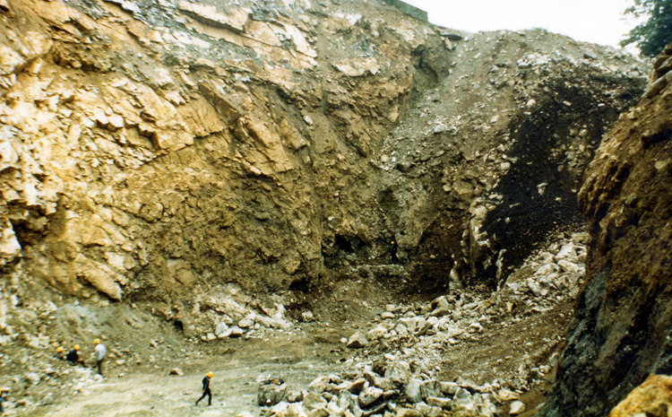


Bonsall Moor Quarry, Bonsall Moor, Bonsall, Derbyshire Dales District, Derbyshire, England, UK