| Locality | Latitude | Longitude | Distance | Bearing |
|---|
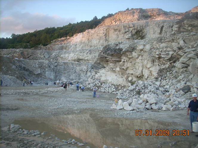
| Penland Mine, Mitchell County, North Carolina, USA | 35° 56' 12" N | 82° 6' 9" W | 0.0km (0.0 miles) | |
| Davis Mine, Mitchell County, North Carolina, USA | 35° 56' 12" N | 82° 6' 2" W | 0.2km (0.1 miles) | |
| Gudger Mine, Spruce Pine, Mitchell County, North Carolina, USA | 35° 56' 7" N | 82° 6' 6" W | 0.2km (0.1 miles) | |
| Feldspar/Mica Mine (MRDS - 10151671), Mitchell County, North Carolina, USA | 35° 56' 6" N | 82° 5' 59" W | 0.3km (0.2 miles) | |
| Unnamed Kaolin mine [3], Mitchell County, North Carolina, USA | 35° 56' 12" N | 82° 5' 56" W | 0.3km (0.2 miles) | |
| Bunker Hill Mine, Mitchell County, North Carolina, USA | 35° 56' 23" N | 82° 6' 19" W | 0.4km (0.2 miles) | |
| Southers Branch Mine (Sullins Branch Mine), Spruce Pine, Mitchell County, North Carolina, USA | 35° 55' 59" N | 82° 5' 59" W | 0.5km (0.3 miles) | |
| Pegram Mine, Mitchell County, North Carolina, USA | 35° 56' 23" N | 82° 6' 23" W | 0.5km (0.3 miles) | |
| Feldspar Mine (MRDS - 10224346), Mitchell County, North Carolina, USA | 35° 56' 17" N | 82° 5' 51" W | 0.5km (0.3 miles) | |
| Deer Park Mine, Penland, Mitchell County, North Carolina, USA | 35° 55' 56" N | 82° 6' 15" W | 0.5km (0.3 miles) | |
| Deer Park No. 2 Mine, Penland, Mitchell County, North Carolina, USA | 35° 55' 56" N | 82° 6' 14" W | 0.5km (0.3 miles) | |
| Unnamed Kaolin mine [5], Mitchell County, North Carolina, USA | 35° 56' 13" N | 82° 6' 30" W | 0.6km (0.3 miles) | |
| Buchanan Mine (Buchanan pegmatite), Mitchell County, North Carolina, USA | 35° 56' 33" N | 82° 6' 7" W | 0.6km (0.4 miles) | |
| Number Twelve Mine, Mitchell County, North Carolina, USA | 35° 55' 59" N | 82° 6' 29" W | 0.7km (0.4 miles) | |
| No.12 Mine, Mitchell County, North Carolina, USA | 35° 55' 59" N | 82° 6' 29" W | 0.7km (0.4 miles) | |
| Feldspar Mine (MRDS - 10248787), Mitchell County, North Carolina, USA | 35° 56' 7" N | 82° 6' 36" W | 0.7km (0.4 miles) | |
| Flat Rock Mine (Flat Rock pegmatite), Mitchell County, North Carolina, USA | 35° 56' 38" N | 82° 6' 15" W | 0.8km (0.5 miles) | |
| Feldspar Mine (MRDS - 10126750), Mitchell County, North Carolina, USA | 35° 56' 2" N | 82° 5' 35" W | 0.9km (0.6 miles) | |
| Feldspar Mine (MRDS - 10200225), Mitchell County, North Carolina, USA | 35° 56' 2" N | 82° 6' 43" W | 0.9km (0.6 miles) | |
| Jase Mine, Mitchell County, North Carolina, USA | 35° 56' 44" N | 82° 6' 16" W | 1.0km (0.6 miles) | |
| Unnamed Kaolin mine [9], Mitchell County, North Carolina, USA | 35° 56' 4" N | 82° 5' 26" W | 1.1km (0.7 miles) | |
| Penland, Mitchell County, North Carolina, USA | 35° 55' 47" N | 82° 6' 42" W | 1.1km (0.7 miles) | |
| Feldspar Mine (MRDS - 10248779), Mitchell County, North Carolina, USA | 35° 56' 52" N | 82° 6' 7" W | 1.2km (0.8 miles) | |
| Pine Mountain (Pine Mountain Mine), Mitchell County, North Carolina, USA | 35° 56' 34" N | 82° 5' 23" W | 1.3km (0.8 miles) | |
| Feldspar Mine (MRDS - 10232404), Mitchell County, North Carolina, USA | 35° 56' 35" N | 82° 5' 20" W | 1.4km (0.9 miles) | |
| Feldspar/Mica Mine (MRDS - 10297236), Mitchell County, North Carolina, USA | 35° 55' 26" N | 82° 6' 18" W | 1.5km (0.9 miles) | |
| Unnamed Kaolin mine [1], Mitchell County, North Carolina, USA | 35° 55' 41" N | 82° 5' 25" W | 1.5km (0.9 miles) | |
| Unnamed Kaolin mine [6], Mitchell County, North Carolina, USA | 35° 55' 53" N | 82° 5' 15" W | 1.5km (0.9 miles) | |
| Feldspar/Mica Mine (MRDS - 10176374), Mitchell County, North Carolina, USA | 35° 55' 26" N | 82° 6' 33" W | 1.6km (1.0 miles) | |
| Feldspar Mine (MRDS - 10296852), Mitchell County, North Carolina, USA | 35° 56' 40" N | 82° 5' 15" W | 1.6km (1.0 miles) | |


Pine Mountain, Mitchell County, North Carolina, USA