| Locality | Latitude | Longitude | Distance | Bearing |
|---|
| Furuhovden Olivine Deposit, Stad, Vestland, Norway | 61° 56' 57" N | 5° 39' 50" E | 0.0km (0.0 miles) | |
| Kassen Farm eclogite, Almklovdalen, Vanylven, Møre og Romsdal, Norway | 61° 59' 43" N | 5° 37' 30" E | 5.5km (3.4 miles) | |
| Lien, Almklovdalen, Vanylven, Møre og Romsdal, Norway | 61° 59' 59" N | 5° 37' 10" E | 6.1km (3.8 miles) | |
| Helgehornsvatnet, Almklovdalen, Vanylven, Møre og Romsdal, Norway | 62° 0' 10" N | 5° 36' 35" E | 6.6km (4.1 miles) | |
| Rødhaugen, Almklovdalen, Vanylven, Møre og Romsdal, Norway | 62° 0' 28" N | 5° 38' 24" E | 6.6km (4.1 miles) | |
| Eikremsæterfoss eclogite, Almklovdalen, Vanylven, Møre og Romsdal, Norway | 62° 0' 36" N | 5° 38' 25" E | 6.9km (4.3 miles) | |
| Sundalen, Vanylven, Møre og Romsdal, Norway | 62° 0' 4" N | 5° 34' 46" E | 7.3km (4.5 miles) | |
| Grofsa Olivine Quarry, Sundalen, Vanylven, Møre og Romsdal, Norway | 62° 0' 13" N | 5° 34' 46" E | 7.5km (4.7 miles) | |
| Ekremseter Olivine Pit, Almklovdalen, Vanylven, Møre og Romsdal, Norway | 62° 0' 52" N | 5° 37' 36" E | 7.5km (4.7 miles) | |
| Halse Olivine Quarry, Sundalen, Vanylven, Møre og Romsdal, Norway | 62° 0' 1" N | 5° 33' 57" E | 7.7km (4.8 miles) | |
| Peridotplassen, Sundalen, Vanylven, Møre og Romsdal, Norway | 62° 0' 14" N | 5° 34' 25" E | 7.7km (4.8 miles) | |
| Sætrevatnet, Almklovdalen, Vanylven, Møre og Romsdal, Norway | 62° 1' 11" N | 5° 39' 16" E | 7.9km (4.9 miles) | |
| Almklovdalen, Vanylven, Møre og Romsdal, Norway | 62° 1' 1" N | 5° 35' 56" E | 8.3km (5.1 miles) | |
| Lefdal Olivine Mine, Eid, Stad, Vestland, Norway | 61° 55' 56" N | 5° 30' 22" E | 8.5km (5.3 miles) | |
| Gusdal Olivine Pit (Åheim Olivine Pit), Almklovdalen, Vanylven, Møre og Romsdal, Norway | 62° 1' 13" N | 5° 35' 41" E | 8.7km (5.4 miles) | |
| Berge, Almklovdalen, Vanylven, Møre og Romsdal, Norway | 62° 1' 22" N | 5° 36' 9" E | 8.8km (5.5 miles) | |
| Furenakken Quartz Prospect, Stad, Vestland, Norway | 61° 58' 9" N | 5° 29' 49" E | 9.0km (5.6 miles) | |
| Åheim, Vanylven, Møre og Romsdal, Norway | 62° 2' 9" N | 5° 31' 50" E | 11.9km (7.4 miles) | |
| Kjødepollen, Selje, Stad, Vestland, Norway | 62° 0' 13" N | 5° 27' 26" E | 12.4km (7.7 miles) | |
| Gammelsætra Olivine Deposit, Bremanger, Vestland, Norway | 61° 53' 35" N | 5° 27' 17" E | 12.6km (7.8 miles) | |
| Bryggja, Vågsøy, Kinn, Vestland, Norway | 61° 56' 12" N | 5° 25' 24" E | 12.7km (7.9 miles) | |
| Kjøde, Selje, Stad, Vestland, Norway | 62° 0' 19" N | 5° 27' 11" E | 12.7km (7.9 miles) | |
| Åheim Port, Åheim, Vanylven, Møre og Romsdal, Norway | 62° 2' 31" N | 5° 31' 19" E | 12.7km (7.9 miles) | |
| 40.000 tons Silo, Åheim, Vanylven, Møre og Romsdal, Norway | 62° 2' 34" N | 5° 31' 7" E | 12.9km (8.0 miles) | |
| Kleberga Serpentine Deposits, Bremanger, Vestland, Norway | 61° 51' 56" N | 5° 28' 13" E | 13.7km (8.5 miles) | |
| Årsheim, Selje, Stad, Vestland, Norway | 62° 3' 42" N | 5° 26' 31" E | 17.1km (10.6 miles) | |
| Krokaberg Tunnel, Vågsøy, Kinn, Vestland, Norway | 61° 54' 59" N | 5° 20' 31" E | 17.2km (10.7 miles) | |
| Nordfjordeid, Eid, Stad, Vestland, Norway | 61° 54' 22" N | 5° 58' 58" E | 17.3km (10.8 miles) | |
| Årsheimneset eclogite pod, Årsheim, Selje, Stad, Vestland, Norway | 62° 4' 16" N | 5° 26' 17" E | 18.0km (11.2 miles) | |
| Saltaneset, Selje, Stad, Vestland, Norway | 62° 1' 33" N | 5° 20' 49" E | 18.6km (11.6 miles) | |

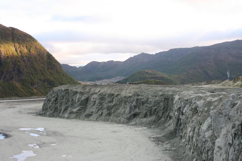

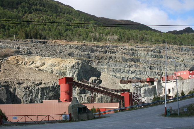


Gusdal Olivine Pit, Almklovdalen, Vanylven, Møre og Romsdal, Norway