| Locality | Latitude | Longitude | Distance | Bearing |
|---|
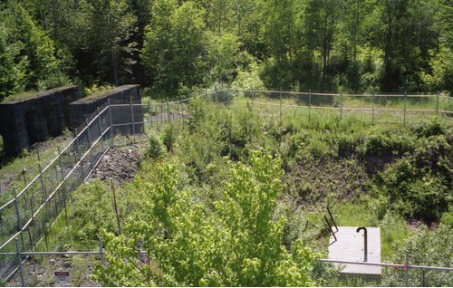
| Indiana Mine, Winona, Greenland Township, Ontonagon County, Michigan, USA | 46° 48' 5" N | 88° 59' 49" W | 0.3km (0.2 miles) | |
| Firesteel Mine, Winona, Greenland Township, Ontonagon County, Michigan, USA | 46° 48' 19" N | 88° 59' 33" W | 0.8km (0.5 miles) | |
| What Cheer Mine, Winona, Greenland Township, Ontonagon County, Michigan, USA | 46° 48' 36" N | 88° 59' 49" W | 1.2km (0.8 miles) | |
| Henwood Mine (Douglass Houghton Mine), Winona, Greenland Township, Ontonagon County, Michigan, USA | 46° 49' 14" N | 88° 59' 30" W | 2.5km (1.5 miles) | |
| North Lake Mine, Ontonagon County, Michigan, USA | 46° 47' 2" N | 89° 1' 23" W | 2.5km (1.6 miles) | |
| Butler Mine, Mass City, Ontonagon County, Michigan, USA | 46° 46' 36" N | 89° 2' 30" W | 4.1km (2.5 miles) | |
| Belt Mine (Piscatauqua), Mass City, Ontonagon County, Michigan, USA | 46° 46' 45" N | 89° 2' 42" W | 4.1km (2.6 miles) | |
| Old Algomah Mine, Mass City, Ontonagon County, Michigan, USA | 46° 46' 57" N | 89° 3' 7" W | 4.4km (2.7 miles) | |
| Lake Mine (Great Western Mine; Bohemian), Mass City, Ontonagon County, Michigan, USA | 46° 46' 0" N | 89° 2' 14" W | 4.6km (2.9 miles) | |
| South Lake Mine (Aztec Mine), Mass City, Ontonagon County, Michigan, USA | 46° 46' 32" N | 89° 3' 13" W | 4.9km (3.1 miles) | |
| Algomah Mine, Mass City, Ontonagon County, Michigan, USA | 46° 45' 41" N | 89° 2' 24" W | 5.2km (3.2 miles) | |
| Toltec Mine, Mass City, Ontonagon County, Michigan, USA | 46° 47' 0" N | 89° 3' 55" W | 5.3km (3.3 miles) | |
| Cherokee Mine (Cherokee Penn Mine; Dunn Mine), Winona, Greenland Township, Ontonagon County, Michigan, USA | 46° 50' 36" N | 88° 58' 0" W | 5.5km (3.4 miles) | |
| Hilton Mine (Ohio Mine), Greenland, Greenland Township, Ontonagon County, Michigan, USA | 46° 46' 24" N | 89° 3' 56" W | 5.8km (3.6 miles) | |
| Algonquin Mine (Pennsylvania Mine), Ontonagon County, Michigan, USA | 46° 51' 14" N | 88° 57' 25" W | 6.9km (4.3 miles) | |
| Adventure mine, Greenland, Greenland Township, Ontonagon County, Michigan, USA | 46° 46' 27" N | 89° 4' 54" W | 6.9km (4.3 miles) | |
| Mass City, Ontonagon County, Michigan, USA | 46° 45' 49" N | 89° 5' 10" W | 7.7km (4.8 miles) | |
| Greenland, Greenland Township, Ontonagon County, Michigan, USA | 46° 46' 45" N | 89° 6' 6" W | 8.1km (5.0 miles) | |
| Ridge Mine, Mass Consolidated Mine, Mass City, Ontonagon County, Michigan, USA | 46° 46' 0" N | 89° 5' 50" W | 8.3km (5.2 miles) | |
| Mass Consolidated Mine, Mass City, Ontonagon County, Michigan, USA | 46° 45' 55" N | 89° 5' 54" W | 8.4km (5.2 miles) | |
| Mass Mine, Mass Consolidated Mine, Mass City, Ontonagon County, Michigan, USA | 46° 45' 56" N | 89° 5' 56" W | 8.5km (5.3 miles) | |
| Evergreen Bluff Mine, Mass City, Ontonagon County, Michigan, USA | 46° 45' 48" N | 89° 6' 3" W | 8.7km (5.4 miles) | |
| Evergreen Series (Evergreen Lodes), Ontonagon County, Michigan, USA | 46° 45' 48" N | 89° 6' 3" W | 8.7km (5.4 miles) | |
| Merrimac Mine, Mass Consolidated Mine, Mass City, Ontonagon County, Michigan, USA | 46° 45' 50" N | 89° 6' 6" W | 8.8km (5.4 miles) | |
| Ogima Mine, Mass Consolidated Mine, Mass City, Ontonagon County, Michigan, USA | 46° 45' 30" N | 89° 6' 18" W | 9.2km (5.7 miles) | |
| King Philip Mine, Winona, Elm River Township, Houghton County, Michigan, USA | 46° 52' 11" N | 88° 55' 18" W | 9.8km (6.1 miles) | |
| Old Mass Mine, Mass City, Ontonagon County, Michigan, USA | 46° 45' 25" N | 89° 6' 47" W | 9.8km (6.1 miles) | |
| Hazard Mine, Mass Consolidated Mine, Mass City, Ontonagon County, Michigan, USA | 46° 45' 59" N | 89° 7' 18" W | 10.0km (6.2 miles) | |
| Winona No. 1 shaft, Winona Mine, Winona, Elm River Township, Houghton County, Michigan, USA | 46° 52' 15" N | 88° 55' 10" W | 10.0km (6.2 miles) | |
| Knowlton Mine, Mass City, Ontonagon County, Michigan, USA | 46° 45' 15" N | 89° 6' 55" W | 10.1km (6.3 miles) | |


King Philip Mine, Winona, Elm River Township, Houghton County, Michigan, USA