| Locality | Latitude | Longitude | Distance | Bearing |
|---|
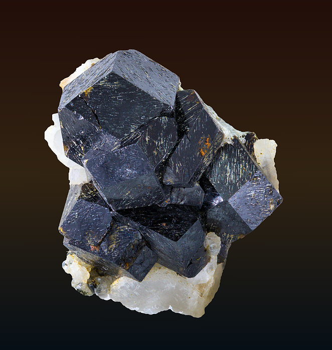
| Koga Nepheline Syenite Intrusion, Mardan District, Khyber Pakhtunkhwa Province, Pakistan | 34° 22' 0" N | 72° 31' 0" E | 0.0km (0.0 miles) | |
| Mullah Yusef, Buner District, Khyber Pakhtunkhwa Province, Pakistan | 34° 27' 14" N | 72° 26' 34" E | 11.8km (7.4 miles) | |
| Shewa-Shahbazgarhi-Machai Outcrop, Khyber Pakhtunkhwa Province, Pakistan | 34° 19' 59" N | 72° 16' 59" E | 21.7km (13.5 miles) | |
| Ambela Granite Complex, Mardan District, Khyber Pakhtunkhwa Province, Pakistan | 34° 22' 31" N | 72° 9' 29" E | 32.9km (20.4 miles) | |
| Tarbela dam, Swabi District, Khyber Pakhtunkhwa Province, Pakistan | 34° 5' 32" N | 72° 41' 7" E | 34.2km (21.3 miles) | |
| Ghundao hill, Katlang, Mardan District, Khyber Pakhtunkhwa Province, Pakistan | 34° 23' 57" N | 72° 6' 7" E | 38.2km (23.7 miles) | |
| Katlang, Mardan District, Khyber Pakhtunkhwa Province, Pakistan | 34° 22' 0" N | 72° 4' 59" E | 39.8km (24.7 miles) | |
| Jambil carbonatite complex, Swat District, Khyber Pakhtunkhwa Province, Pakistan | 34° 43' 59" N | 72° 27' 0" E | 41.2km (25.6 miles) | |
| Saidu Sharif, Swat District, Khyber Pakhtunkhwa Province, Pakistan | 34° 44' 58" N | 72° 21' 20" E | 45.1km (28.0 miles) | |
| Islamia trench, Mingora emerald deposit, Swat District, Khyber Pakhtunkhwa Province, Pakistan | 34° 46' 53" N | 72° 22' 1" E | 48.1km (29.9 miles) | |
| Mine #3, Mingora emerald deposit, Swat District, Khyber Pakhtunkhwa Province, Pakistan | 34° 47' 2" N | 72° 22' 5" E | 48.3km (30.0 miles) | |
| Caral trench, Mingora emerald deposit, Swat District, Khyber Pakhtunkhwa Province, Pakistan | 34° 47' 5" N | 72° 22' 14" E | 48.4km (30.1 miles) | |
| Mingora emerald deposit, Swat District, Khyber Pakhtunkhwa Province, Pakistan | 34° 47' 4" N | 72° 22' 9" E | 48.4km (30.1 miles) | |
| Mine #2, Mingora emerald deposit, Swat District, Khyber Pakhtunkhwa Province, Pakistan | 34° 47' 12" N | 72° 22' 13" E | 48.6km (30.2 miles) | |
| Farooq mine, Mingora emerald deposit, Swat District, Khyber Pakhtunkhwa Province, Pakistan | 34° 47' 13" N | 72° 22' 19" E | 48.6km (30.2 miles) | |
| Khur Khel, Mardan District, Khyber Pakhtunkhwa Province, Pakistan | 33° 56' 15" N | 72° 18' 45" E | 51.3km (31.9 miles) | |
| Khazana, Lower Dir District, Khyber Pakhtunkhwa Province, Pakistan | 34° 43' 47" N | 72° 10' 9" E | 51.4km (32.0 miles) | |
| Allah Dher, Mardan District, Khyber Pakhtunkhwa Province, Pakistan | 33° 57' 0" N | 72° 16' 14" E | 51.6km (32.0 miles) | |
| Gujar Killi Emerald Deposit, Shangla District, Khyber Pakhtunkhwa Province, Pakistan | 34° 50' 3" N | 72° 35' 4" E | 52.4km (32.6 miles) | |
| Jehangira, Nowshera District, Khyber Pakhtunkhwa Province, Pakistan | 33° 57' 33" N | 72° 12' 32" E | 53.4km (33.2 miles) | |
| Mula Mansoor, Punjab Province, Pakistan | 33° 55' 0" N | 72° 17' 59" E | 53.9km (33.5 miles) | |
| Kund, Peshawar District, Khyber Pakhtunkhwa Province, Pakistan | 33° 55' 29" N | 72° 14' 14" E | 55.4km (34.4 miles) | |
| Atttock-Khurd, Peshawar District, Khyber Pakhtunkhwa Province, Pakistan | 33° 54' 15" N | 72° 15' 0" E | 57.0km (35.4 miles) | |
| Khawrai (Khawari), Jehangira, Nowshera District, Khyber Pakhtunkhwa Province, Pakistan | 33° 54' 45" N | 72° 8' 53" E | 60.8km (37.8 miles) | |
| Mansehra, Mansehra District, Khyber Pakhtunkhwa Province, Pakistan | 34° 20' 2" N | 73° 12' 5" E | 63.0km (39.1 miles) | |
| Tipra deposit, Abbottabad District, Khyber Pakhtunkhwa Province, Pakistan | 33° 55' 59" N | 73° 6' 29" E | 72.7km (45.2 miles) | |
| Sakhakot-Quila complex, Charsadda District, Khyber Pakhtunkhwa Province, Pakistan | 34° 16' 56" N | 71° 42' 50" E | 74.3km (46.2 miles) | |
| Faquir Mohammad deposit, Abbottabad District, Khyber Pakhtunkhwa Province, Pakistan | 33° 56' 30" N | 73° 9' 29" E | 75.6km (47.0 miles) | |
| Sillai Patti Carbonatite, Malakand District, Khyber Pakhtunkhwa Province, Pakistan | 34° 32' 59" N | 71° 40' 59" E | 79.1km (49.1 miles) | |
| Jawar, Khyber Pakhtunkhwa Province, Pakistan | 34° 34' 0" N | 71° 40' 0" E | 81.0km (50.4 miles) | |


Koga Nepheline Syenite Intrusion, Mardan District, Khyber Pakhtunkhwa Province, Pakistan