| Locality | Latitude | Longitude | Distance | Bearing |
|---|
| Boston Mine, Tring-Jonction, Robert-Cliche RCM, Chaudière-Appalaches, Québec, Canada | 46° 14' 53" N | 71° 3' 34" W | 0.0km (0.0 miles) | |
| Carey mine (Carey Canada Inc. mine), Tring-Jonction, Robert-Cliche RCM, Chaudière-Appalaches, Québec, Canada | 46° 15' 15" N | 71° 2' 11" W | 1.9km (1.2 miles) | |
| Bernstein deposit, Broughton, Chaudière-Appalaches, Québec, Canada | 46° 14' 54" N | 71° 5' 17" W | 2.2km (1.4 miles) | |
| Frontenac mine, East Broughton, Les Appalaches RCM, Chaudière-Appalaches, Québec, Canada | 46° 13' 44" N | 71° 5' 20" W | 3.1km (1.9 miles) | |
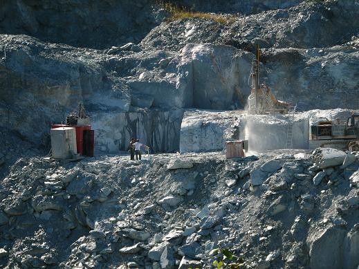
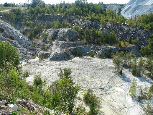
| Fraser Mine, East Broughton, Les Appalaches RCM, Chaudière-Appalaches, Québec, Canada | 46° 13' 27" N | 71° 5' 17" W | 3.4km (2.1 miles) | |
| Tring-Jonction, Robert-Cliche RCM, Chaudière-Appalaches, Québec, Canada | 46° 16' 15" N | 70° 59' 42" W | 5.6km (3.5 miles) | |
| Montréal-Broughton mine, Sacré-Cœur-de-Jésus, Les Appalaches RCM, Chaudière-Appalaches, Québec, Canada | 46° 12' 24" N | 71° 7' 18" W | 6.6km (4.1 miles) | |
| 11e Rang, Saint-Pierre-de-Broughton (West Broughton), Les Appalaches RCM, Chaudière-Appalaches, Québec, Canada | 46° 13' 23" N | 71° 11' 2" W | 9.9km (6.2 miles) | |
| Harvey Hill mine, Saint-Pierre-de-Broughton (West Broughton), Les Appalaches RCM, Chaudière-Appalaches, Québec, Canada | 46° 16' 0" N | 71° 12' 28" W | 11.6km (7.2 miles) | |
| Broughton talc mine (Luzcan mine; Carrière rang XV), Saint-Pierre-de-Broughton (West Broughton), Les Appalaches RCM, Chaudière-Appalaches, Québec, Canada | 46° 15' 35" N | 71° 13' 8" W | 12.3km (7.6 miles) | |
| Federal Mine, Robertsonville, Thetford Mines, Les Appalaches RCM, Chaudière-Appalaches, Québec, Canada | 46° 9' 16" N | 71° 13' 0" W | 16.0km (9.9 miles) | |
| Federal Mine, Chaudière-Appalaches, Québec, Canada | 46° 9' 16" N | 71° 13' 0" W | 16.0km (9.9 miles) | |
| Robertsonville, Thetford Mines, Les Appalaches RCM, Chaudière-Appalaches, Québec, Canada | 46° 8' 29" N | 71° 12' 53" W | 16.8km (10.5 miles) | |
| Pontbriand, Thetford Mines, Les Appalaches RCM, Chaudière-Appalaches, Québec, Canada | 46° 9' 12" N | 71° 15' 15" W | 18.3km (11.4 miles) | |
| Rt 269 roadcut, Adstock, Les Appalaches RCM, Chaudière-Appalaches, Québec, Canada | 46° 5' 45" N | 71° 10' 5" W | 18.9km (11.7 miles) | |
| Rivière Linière, Robert-Cliche RCM, Chaudière-Appalaches, Québec, Canada | 46° 24' 59" N | 70° 59' 57" W | 19.3km (12.0 miles) | |
| Rivière-du-Loup, Robert-Cliche RCM, Chaudière-Appalaches, Québec, Canada | 46° 24' 59" N | 70° 59' 57" W | 19.3km (12.0 miles) | |
| Pennington mine, Pontbriand, Thetford Mines, Les Appalaches RCM, Chaudière-Appalaches, Québec, Canada | 46° 8' 13" N | 71° 15' 10" W | 19.3km (12.0 miles) | |
| National mine, Pontbriand, Thetford Mines, Les Appalaches RCM, Chaudière-Appalaches, Québec, Canada | 46° 8' 7" N | 71° 15' 10" W | 19.5km (12.1 miles) | |
| Rivière des Plantes placer, Beauceville, Robert-Cliche RCM, Chaudière-Appalaches, Québec, Canada | 46° 15' 27" N | 70° 48' 12" W | 19.7km (12.3 miles) | |
| Route 73 road cut, Saint-Joseph-de-Beauce, Robert-Cliche RCM, Chaudière-Appalaches, Québec, Canada | 46° 17' 25" N | 70° 48' 28" W | 19.9km (12.4 miles) | |
| Flintkote mine, Pontbriand, Thetford Mines, Les Appalaches RCM, Chaudière-Appalaches, Québec, Canada | 46° 7' 45" N | 71° 16' 19" W | 21.1km (13.1 miles) | |
| Road cut on Chemin du Lac, Adstock, Les Appalaches RCM, Chaudière-Appalaches, Québec, Canada | 46° 5' 43" N | 71° 13' 15" W | 21.1km (13.1 miles) | |
| Beauceville Industrial park Quarry, Beauceville, Robert-Cliche RCM, Chaudière-Appalaches, Québec, Canada | 46° 13' 36" N | 70° 46' 55" W | 21.5km (13.3 miles) | |
| Saint-Joseph-de-Beauce quarry (Calway Quarry), Saint-Joseph-de-Beauce, Robert-Cliche RCM, Chaudière-Appalaches, Québec, Canada | 46° 18' 46" N | 70° 46' 0" W | 23.6km (14.7 miles) | |
| Rapides-du-Diable, Beauceville, Robert-Cliche RCM, Chaudière-Appalaches, Québec, Canada | 46° 11' 53" N | 70° 45' 2" W | 24.4km (15.2 miles) | |
| King mine, Thetford Mines, Les Appalaches RCM, Chaudière-Appalaches, Québec, Canada | 46° 5' 8" N | 71° 18' 3" W | 25.9km (16.1 miles) | |
| Bell mine, Thetford Mines, Les Appalaches RCM, Chaudière-Appalaches, Québec, Canada | 46° 5' 12" N | 71° 18' 37" W | 26.4km (16.4 miles) | |
| Johnson mine, Thetford Mines, Les Appalaches RCM, Chaudière-Appalaches, Québec, Canada | 46° 4' 42" N | 71° 18' 2" W | 26.5km (16.4 miles) | |
| King Beaver mine (Jacob mine; Beaver-1 mine; Beaver-2 mine), Thetford Mines, Les Appalaches RCM, Chaudière-Appalaches, Québec, Canada | 46° 4' 37" N | 71° 18' 45" W | 27.2km (16.9 miles) | |


Fraser Mine, East Broughton, Les Appalaches RCM, Chaudière-Appalaches, Québec, Canada