| Locality | Latitude | Longitude | Distance | Bearing |
|---|
| Brakpan, City of Ekurhuleni Metropolitan Municipality, Gauteng, South Africa | 26° 14' 7" S | 28° 22' 12" E | 2.1km (1.3 miles) | |
| Van Ryn Deep Mine, Benoni, City of Ekurhuleni Metropolitan Municipality, Gauteng, South Africa | 26° 12' 15" S | 28° 19' 48" E | 3.9km (2.4 miles) | |
| New Modder Gold Mine, Benoni, City of Ekurhuleni Metropolitan Municipality, Gauteng, South Africa | 26° 10' 38" S | 28° 22' 6" E | 4.4km (2.7 miles) | |
| New Chimes Gold Mine, Benoni, City of Ekurhuleni Metropolitan Municipality, Gauteng, South Africa | 26° 10' 40" S | 28° 21' 22" E | 4.4km (2.7 miles) | |
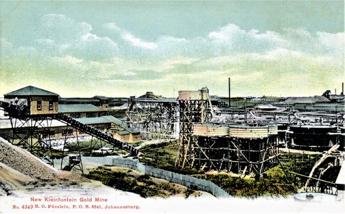
| New Kleinfontein Gold Mine, Benoni, City of Ekurhuleni Metropolitan Municipality, Gauteng, South Africa | 26° 10' 50" S | 28° 20' 1" E | 5.2km (3.2 miles) | |
| Modderfontein 'B' gold mine, Springs, City of Ekurhuleni Metropolitan Municipality, Gauteng, South Africa | 26° 11' 17" S | 28° 24' 34" E | 5.3km (3.3 miles) | |
| State Mine, Springs, City of Ekurhuleni Metropolitan Municipality, Gauteng, South Africa | 26° 13' 57" S | 28° 25' 3" E | 5.4km (3.3 miles) | |
| Benoni Gold Mine, Benoni, City of Ekurhuleni Metropolitan Municipality, Gauteng, South Africa | 26° 12' 14" S | 28° 18' 51" E | 5.4km (3.4 miles) | |
| Van Ryn Gold Mine, Benoni, City of Ekurhuleni Metropolitan Municipality, Gauteng, South Africa | 26° 10' 1" S | 28° 21' 3" E | 5.7km (3.6 miles) | |
| Clydesdale Collieries, Springs, City of Ekurhuleni Metropolitan Municipality, Gauteng, South Africa | 26° 14' 42" S | 28° 24' 59" E | 5.9km (3.7 miles) | |
| Hercules Gold Mine, Benoni, City of Ekurhuleni Metropolitan Municipality, Gauteng, South Africa | 26° 9' 43" S | 28° 21' 46" E | 6.1km (3.8 miles) | |
| New State Areas Mine, Springs, City of Ekurhuleni Metropolitan Municipality, Gauteng, South Africa | 26° 15' 5" S | 28° 24' 55" E | 6.2km (3.9 miles) | |
| Benoni, City of Ekurhuleni Metropolitan Municipality, Gauteng, South Africa | 26° 11' 34" S | 28° 18' 34" E | 6.3km (3.9 miles) | |
| East Geduld Mine, Springs, City of Ekurhuleni Metropolitan Municipality, Gauteng, South Africa | 26° 13' 35" S | 28° 26' 13" E | 7.1km (4.4 miles) | |
| Springs, City of Ekurhuleni Metropolitan Municipality, Gauteng, South Africa | 26° 14' 36" S | 28° 25' 54" E | 7.2km (4.5 miles) | |
| S.A. Lands Mine, Brakpan, City of Ekurhuleni Metropolitan Municipality, Gauteng, South Africa | 26° 16' 59" S | 28° 22' 0" E | 7.4km (4.6 miles) | |
| Benoni meteorite, Benoni, City of Ekurhuleni Metropolitan Municipality, Gauteng, South Africa | 26° 10' 0" S | 28° 25' 0" E | 7.5km (4.6 miles) | |
| Geduld Proprietary Mine, Springs, City of Ekurhuleni Metropolitan Municipality, Gauteng, South Africa | 26° 12' 41" S | 28° 26' 30" E | 7.5km (4.7 miles) | |
| Van Dyk Mine, Boksburg, City of Ekurhuleni Metropolitan Municipality, Gauteng, South Africa | 26° 15' 37" S | 28° 18' 5" E | 8.1km (5.0 miles) | |
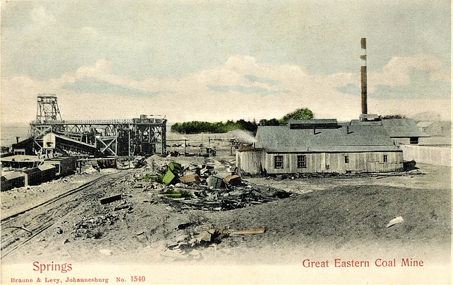
| Great Eastern Coal Mine, Springs, City of Ekurhuleni Metropolitan Municipality, Gauteng, South Africa | 26° 15' 0" S | 28° 27' 19" E | 9.6km (6.0 miles) | |
| New Blue Sky Gold Mine, City of Ekurhuleni Metropolitan Municipality, Gauteng, South Africa | 26° 12' 43" S | 28° 15' 51" E | 10.2km (6.4 miles) | |
| Cinderella Deep Gold Mine, Boksburg, City of Ekurhuleni Metropolitan Municipality, Gauteng, South Africa | 26° 12' 36" S | 28° 15' 7" E | 11.5km (7.1 miles) | |
| Grootvlei Proprietary Mines, Springs, City of Ekurhuleni Metropolitan Municipality, Gauteng, South Africa | 26° 14' 28" S | 28° 29' 3" E | 12.1km (7.5 miles) | |
| Cason Gold Mine, Boksburg, City of Ekurhuleni Metropolitan Municipality, Gauteng, South Africa | 26° 12' 30" S | 28° 14' 33" E | 12.4km (7.7 miles) | |
| Boksburg, City of Ekurhuleni Metropolitan Municipality, Gauteng, South Africa | 26° 13' 57" S | 28° 14' 17" E | 12.9km (8.0 miles) | |
| East Rand Gold Mine, Boksburg, City of Ekurhuleni Metropolitan Municipality, Gauteng, South Africa | 26° 12' 52" S | 28° 13' 54" E | 13.5km (8.4 miles) | |
| New Comet Gold Mine, Boksburg, City of Ekurhuleni Metropolitan Municipality, Gauteng, South Africa | 26° 12' 15" S | 28° 13' 52" E | 13.6km (8.4 miles) | |
| East Rand Proprietary Mine, Boksburg, City of Ekurhuleni Metropolitan Municipality, Gauteng, South Africa | 26° 14' 49" S | 28° 13' 37" E | 14.3km (8.9 miles) | |
| Angelo Gold Mine, Boksburg, City of Ekurhuleni Metropolitan Municipality, Gauteng, South Africa | 26° 12' 6" S | 28° 13' 21" E | 14.5km (9.0 miles) | |
| Driefontein Consolidated Mine, Boksburg, City of Ekurhuleni Metropolitan Municipality, Gauteng, South Africa | 26° 12' 25" S | 28° 13' 7" E | 14.8km (9.2 miles) | |
Minerals recorded nearby (within 14.8 km)
Warning: mysqli::query(): (HY000/3024): Query execution was interrupted, maximum statement execution time exceeded in /home/mindat/www/locsearch_class.php on line 264
ⓘ Modderite (TL)
Rock types recorded nearby (within 14.8 km)
Entries shown in red are rocks recorded for this region.


Clydesdale Collieries, Springs, City of Ekurhuleni Metropolitan Municipality, Gauteng, South Africa