| Locality | Latitude | Longitude | Distance | Bearing |
|---|
| Sullivan Quarries, New Bedford, Bristol County, Massachusetts, USA | 41° 39' 18" N | 70° 57' 23" W | 3.4km (2.1 miles) | |
| Acushnet Quarry, Acushnet, Bristol County, Massachusetts, USA | 41° 40' 21" N | 70° 54' 25" W | 7.9km (4.9 miles) | |
| Fort Point, Fairhaven, Bristol County, Massachusetts, USA | 41° 37' 26" N | 70° 53' 52" W | 7.9km (4.9 miles) | |
| Beattie & Wilcox Quarry, Fall River, Bristol County, Massachusetts, USA | 41° 40' 59" N | 71° 7' 53" W | 12.7km (7.9 miles) | |
| Mattapoisett Quarry, Mattapoisett, Plymouth County, Massachusetts, USA | 41° 39' 16" N | 70° 50' 14" W | 12.9km (8.0 miles) | |
| Savoie Quarry, Fall River, Bristol County, Massachusetts, USA | 41° 42' 2" N | 71° 7' 51" W | 13.5km (8.4 miles) | |
| Construction Materials Corp. quarry (Fish Road quarry), Tiverton, Newport County, Rhode Island, USA | 41° 38' 56" N | 71° 10' 59" W | 16.0km (9.9 miles) | |
| Tiverton, Newport County, Rhode Island, USA | 41° 37' 0" N | 71° 10' 59" W | 16.2km (10.0 miles) | |
| Viking Stone Corp. Quarry, Tiverton, Newport County, Rhode Island, USA | 41° 37' 27" N | 71° 11' 11" W | 16.3km (10.1 miles) | |
| Assonet Village, Freetown, Bristol County, Massachusetts, USA | 41° 47' 44" N | 71° 4' 4" W | 18.6km (11.5 miles) | |
| Cape Cod Aggregates quarry (Freetown Sand and Gravel quarry), Freetown, Bristol County, Massachusetts, USA | 41° 48' 55" N | 71° 2' 54" W | 20.2km (12.5 miles) | |
| Mount Hope, Bristol, Bristol County, Rhode Island, USA | 41° 40' 26" N | 71° 14' 23" W | 21.0km (13.1 miles) | |
| Little Compton, Newport County, Rhode Island, USA | 41° 30' 0" N | 71° 10' 0" W | 21.3km (13.2 miles) | |
| Bristol Ferry, Portsmouth, Newport County, Rhode Island, USA | 41° 37' 57" N | 71° 15' 13" W | 21.8km (13.6 miles) | |
| Cory's Lane, Portsmouth, Newport County, Rhode Island, USA | 41° 36' 4" N | 71° 16' 36" W | 24.1km (15.0 miles) | |
| Bristol Coal prospect, Bristol, Bristol County, Rhode Island, USA | 41° 40' 24" N | 71° 16' 42" W | 24.2km (15.0 miles) | |
| Dyer Island, Portsmouth, Newport County, Rhode Island, USA | 41° 34' 58" N | 71° 17' 56" W | 26.3km (16.4 miles) | |
| Paradise quarry, Middletown, Newport County, Rhode Island, USA | 41° 29' 47" N | 71° 15' 11" W | 27.0km (16.8 miles) | |
| Peckham quarry, Middletown, Newport County, Rhode Island, USA | 41° 30' 3" N | 71° 15' 44" W | 27.3km (17.0 miles) | |
| Middletown, Newport County, Rhode Island, USA | 41° 30' 42" N | 71° 17' 12" W | 28.4km (17.6 miles) | |
| Barrington Brick Yard (Nyatt Brick Pit), Barrington, Bristol County, Rhode Island, USA | 41° 44' 4" N | 71° 19' 11" W | 29.3km (18.2 miles) | |
| Newport, Newport County, Rhode Island, USA | 41° 29' 17" N | 71° 18' 45" W | 31.6km (19.6 miles) | |
| Sheep Point Cove, Newport, Newport County, Rhode Island, USA | 41° 27' 53" N | 71° 18' 9" W | 32.4km (20.1 miles) | |
| Aggregate Industries Quarry, Taunton, Bristol County, Massachusetts, USA | 41° 55' 29" N | 71° 7' 5" W | 33.5km (20.8 miles) | |
| Brenton Cove, Newport, Newport County, Rhode Island, USA | 41° 28' 18" N | 71° 20' 1" W | 34.0km (21.1 miles) | |
| Riverside, East Providence, Providence County, Rhode Island, USA | 41° 46' 1" N | 71° 21' 52" W | 34.1km (21.2 miles) | |
| Jamestown, Newport County, Rhode Island, USA | 41° 31' 13" N | 71° 22' 18" W | 34.3km (21.3 miles) | |
| Ide's Ledge quarry, East Providence, Providence County, Rhode Island, USA | 41° 47' 57" N | 71° 20' 48" W | 34.5km (21.4 miles) | |
| Gay Head Cliffs, Aquinnah, Martha's Vineyard, Dukes County, Massachusetts, USA | 41° 21' 0" N | 70° 50' 9" W | 34.6km (21.5 miles) | |
| McCormick Quarry (Leonard Corner), East Providence, Providence County, Rhode Island, USA | 41° 48' 28" N | 71° 21' 5" W | 35.3km (21.9 miles) | |
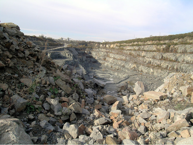

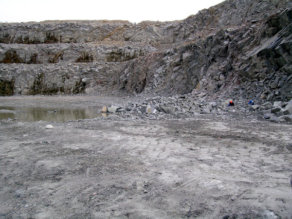


Acushnet Quarry, Acushnet, Bristol County, Massachusetts, USA