| Locality | Latitude | Longitude | Distance | Bearing |
|---|
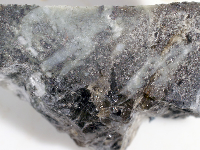
| Glebe Hill, Kilchoan, Ardnamurchan, Fort William and Ardnamurchan, Highland, Scotland, UK | 56° 42' 10" N | 6° 6' 59" W | 0.0km (0.0 miles) | |
| Kilchoan, Ardnamurchan, Fort William and Ardnamurchan, Highland, Scotland, UK | 56° 41' 53" N | 6° 6' 15" W | 0.9km (0.6 miles) | |
| Camphouse, Ardnamurchan, Fort William and Ardnamurchan, Highland, Scotland, UK | 56° 42' 20" N | 6° 4' 13" W | 2.8km (1.8 miles) | |
| Ardnamurchan, Fort William and Ardnamurchan, Highland, Scotland, UK | 56° 43' 0" N | 6° 0' 0" W | 7.3km (4.5 miles) | |
| Tobermory, Isle of Mull, Argyll and Bute, Scotland, UK | 56° 37' 22" N | 6° 4' 20" W | 9.3km (5.8 miles) | |
| Loch Sunart, Highland, Scotland, UK | 56° 39' 37" N | 5° 57' 55" W | 10.4km (6.4 miles) | |
| 'S Airde Beinn, Isle of Mull, Argyll and Bute, Scotland, UK | 56° 36' 34" N | 6° 7' 12" W | 10.4km (6.5 miles) | |
| A848 road cutting, Isle of Mull, Argyll and Bute, Scotland, UK | 56° 35' 33" N | 6° 1' 11" W | 13.6km (8.5 miles) | |
| Camas Mor Intrusion, Isle of Muck, Caol and Mallaig, Highland, Scotland, UK | 56° 49' 44" N | 6° 15' 27" W | 16.4km (10.2 miles) | |
| Isle of Muck, Caol and Mallaig, Highland, Scotland, UK | 56° 50' 8" N | 6° 14' 18" W | 16.5km (10.3 miles) | |
| Rubh'an Tangaird, Isle of Eigg, Caol and Mallaig, Highland, Scotland, UK | 56° 52' 20" N | 6° 8' 45" W | 18.9km (11.7 miles) | |
| An Sgurr, Isle of Eigg, Caol and Mallaig, Highland, Scotland, UK | 56° 52' 59" N | 6° 10' 0" W | 20.3km (12.6 miles) | |
| Treshnish, Isle of Mull, Argyll and Bute, Scotland, UK | 56° 33' 14" N | 6° 18' 36" W | 20.4km (12.7 miles) | |
| Isle of Eigg, Caol and Mallaig, Highland, Scotland, UK | 56° 53' 58" N | 6° 8' 29" W | 21.9km (13.6 miles) | |
| Sgurr na Greine, Morvern, East Sutherland and Edderton, Highland, Scotland, UK | 56° 35' 25" N | 5° 49' 17" W | 22.0km (13.6 miles) | |
| Lòn Reudle, Treshnish, Isle of Mull, Argyll and Bute, Scotland, UK | 56° 31' 44" N | 6° 17' 49" W | 22.3km (13.8 miles) | |
| Aros, Isle of Mull, Argyll and Bute, Scotland, UK | 56° 31' 10" N | 5° 56' 33" W | 23.0km (14.3 miles) | |
| Salen, Isle of Mull, Argyll and Bute, Scotland, UK | 56° 30' 59" N | 5° 56' 46" W | 23.2km (14.4 miles) | |
| Killimore, Isle of Mull, Argyll and Bute, Scotland, UK | 56° 28' 57" N | 6° 4' 52" W | 24.6km (15.3 miles) | |
| Camas Sgiotaig (The Singing Sands), Isle of Eigg, Caol and Mallaig, Highland, Scotland, UK | 56° 55' 52" N | 6° 9' 26" W | 25.5km (15.8 miles) | |
| Gleann Dubh, Morvern, East Sutherland and Edderton, Highland, Scotland, UK | 56° 35' 49" N | 5° 44' 3" W | 26.2km (16.3 miles) | |
| Luinga Bheag Island, Caol and Mallaig, Highland, Scotland, UK | 56° 54' 54" N | 5° 54' 50" W | 26.6km (16.5 miles) | |
| Scarisdale wood (Scarisdale beach), Loch na Keal, Isle of Mull, Argyll and Bute, Scotland, UK | 56° 28' 9" N | 6° 0' 21" W | 26.8km (16.7 miles) | |
| Lurga Mine, Morvern, East Sutherland and Edderton, Highland, Scotland, UK | 56° 38' 8" N | 5° 41' 32" W | 27.0km (16.8 miles) | |
| Silica mine, Lochaline, Morvern, East Sutherland and Edderton, Highland, Scotland, UK | 56° 32' 26" N | 5° 46' 30" W | 27.6km (17.2 miles) | |
| Beinn a' Ghraig, Ben More, Isle of Mull, Argyll and Bute, Scotland, UK | 56° 27' 46" N | 5° 59' 32" W | 27.7km (17.2 miles) | |
| Lochaline, Morvern, East Sutherland and Edderton, Highland, Scotland, UK | 56° 32' 5" N | 5° 46' 38" W | 27.9km (17.4 miles) | |
| Arisaig, Caol and Mallaig, Highland, Scotland, UK | 56° 54' 36" N | 5° 50' 33" W | 28.4km (17.7 miles) | |
| Traigh Doire Dhubhaig (beach), Loch na Keal, Isle of Mull, Argyll and Bute, Scotland, UK | 56° 26' 54" N | 6° 4' 16" W | 28.4km (17.7 miles) | |
| Creag Mhor (Creag Thor), Isle of Mull, Argyll and Bute, Scotland, UK | 56° 26' 47" N | 6° 6' 53" W | 28.5km (17.7 miles) | |


Tobermory, Isle of Mull, Argyll and Bute, Scotland, UK