| Locality | Latitude | Longitude | Distance | Bearing |
|---|
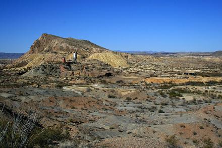
| Brewster County Consolidated Mine (Study Butte Mine; Rainbow Mine; Big Bend; Texas-Almaden), Study Butte, Brewster County, Texas, USA | 29° 19' 25" N | 103° 31' 40" W | 1.1km (0.7 miles) | |
| Bee Mountain, Study Butte, Brewster County, Texas, USA | 29° 20' 29" N | 103° 32' 21" W | 1.2km (0.7 miles) | |
| Study Butte, Brewster County, Texas, USA | 29° 19' 17" N | 103° 31' 45" W | 1.3km (0.8 miles) | |
| Unnamed prospect (EM-BR-V26-8), Brewster County, Texas, USA | 29° 19' 25" N | 103° 30' 39" W | 2.4km (1.5 miles) | |
| Two Forty-eight prospect, Brewster County, Texas, USA | 29° 19' 35" N | 103° 34' 2" W | 3.3km (2.0 miles) | |
| Study Butte meteorite, Study Butte, Brewster County, Texas, USA | 29° 18' 6" N | 103° 30' 0" W | 4.7km (2.9 miles) | |
| Location 159, Big Bend National Park, Brewster County, Texas, USA | 29° 19' 1" N | 103° 28' 49" W | 5.5km (3.4 miles) | |
| Unnamed prospect (EM-BR-V26-5), Brewster County, Texas, USA | 29° 19' 29" N | 103° 35' 27" W | 5.6km (3.5 miles) | |
| Brown prospect, Brewster County, Texas, USA | 29° 19' 11" N | 103° 36' 1" W | 6.6km (4.1 miles) | |
| Terlingua, Brewster County, Texas, USA | 29° 19' 17" N | 103° 36' 57" W | 8.0km (5.0 miles) | |
| Chisos Mine (McKinney-Parker Mine), Brewster County, Texas, USA | 29° 19' 5" N | 103° 37' 12" W | 8.4km (5.2 miles) | |
| Rainbow mine, Brewster County, Texas, USA | 29° 19' 13" N | 103° 37' 27" W | 8.8km (5.5 miles) | |
| Le Roi mine, Brewster County, Texas, USA | 29° 18' 35" N | 103° 37' 22" W | 8.9km (5.6 miles) | |
| Rattlesnake Mountains, Big Bend National Park, Brewster County, Texas, USA | 29° 15' 4" N | 103° 33' 10" W | 9.1km (5.7 miles) | |
| Unnamed localities on Reed Plateau (EM-BR-V25-23), Brewster County, Texas, USA | 29° 18' 30" N | 103° 38' 9" W | 10.2km (6.3 miles) | |
| Coltrins camp, Brewster County, Texas, USA | 29° 18' 54" N | 103° 38' 28" W | 10.5km (6.5 miles) | |
| Star Mine, Brewster County, Texas, USA | 29° 19' 2" N | 103° 38' 58" W | 11.3km (7.0 miles) | |
| Little 38 Mine, Brewster County, Texas, USA | 29° 19' 18" N | 103° 39' 17" W | 11.8km (7.3 miles) | |
| Ferandes Mine (Destolin Mine; Scott claims; Gatlin claims), Christmas Mountains, Brewster County, Texas, USA | 29° 24' 34" N | 103° 26' 17" W | 12.7km (7.9 miles) | |
| Colquitt-Tigner Mine (Waldron Mine), Brewster County, Texas, USA | 29° 19' 52" N | 103° 39' 58" W | 12.8km (7.9 miles) | |
| Unnamed locality (EM-BR-U27-5), Christmas Mountains, Brewster County, Texas, USA | 29° 25' 16" N | 103° 26' 19" W | 13.6km (8.4 miles) | |
| Unnamed mine (EM-BR-V25-14), Brewster County, Texas, USA | 29° 19' 41" N | 103° 40' 40" W | 13.9km (8.7 miles) | |
| Tarrant mine, Brewster County, Texas, USA | 29° 19' 11" N | 103° 40' 45" W | 14.1km (8.8 miles) | |
| Unnamed localities (EM-BR-V25-22), Brewster County, Texas, USA | 29° 20' 36" N | 103° 40' 55" W | 14.4km (8.9 miles) | |
| Waldron workings, Brewster County, Texas, USA | 29° 19' 33" N | 103° 41' 22" W | 15.1km (9.4 miles) | |
| Lafarell mine, Brewster County, Texas, USA | 29° 21' 6" N | 103° 41' 24" W | 15.3km (9.5 miles) | |
| Tarrant Property in Sec. 39, Brewster County, Texas, USA | 29° 19' 29" N | 103° 41' 31" W | 15.3km (9.5 miles) | |
| Christmas Mountain deposit (Piedra Azul), Christmas Mountains, Brewster County, Texas, USA | 29° 26' 49" N | 103° 26' 49" W | 15.3km (9.5 miles) | |
| Needle Peak (Sierra Aguja), Brewster County, Texas, USA | 29° 13' 36" N | 103° 38' 24" W | 15.6km (9.7 miles) | |
| Mariposa Mine, Brewster County, Texas, USA | 29° 19' 5" N | 103° 41' 39" W | 15.6km (9.7 miles) | |


Brewster County Consolidated Mine, Study Butte, Brewster County, Texas, USA