| Locality | Latitude | Longitude | Distance | Bearing |
|---|
| Old Fall Level (Snail Beds Level), Ireshopeburn, Stanhope, County Durham, England, UK | 54° 44' 34" N | 2° 11' 33" W | 0.0km (0.0 miles) | |
| Levelgate Level, Ireshopeburn, Stanhope, County Durham, England, UK | 54° 44' 41" N | 2° 10' 59" W | 0.6km (0.4 miles) | |
| Blackdene Mine, Ireshopeburn, Stanhope, County Durham, England, UK | 54° 44' 44" N | 2° 12' 18" W | 0.9km (0.5 miles) | |
| Ireshopeburn, Stanhope, County Durham, England, UK | 54° 44' 33" N | 2° 12' 23" W | 0.9km (0.5 miles) | |
| St. John's Chapel, Stanhope, County Durham, England, UK | 54° 44' 11" N | 2° 10' 51" W | 1.0km (0.6 miles) | |
| Barbary Mine, Ireshopeburn, Stanhope, County Durham, England, UK | 54° 44' 28" N | 2° 12' 34" W | 1.1km (0.7 miles) | |
| Carricks Mine, Ireshopeburn, Stanhope, County Durham, England, UK | 54° 44' 12" N | 2° 12' 57" W | 1.7km (1.0 miles) | |
| Daddry Shield, Stanhope, County Durham, England, UK | 54° 44' 9" N | 2° 9' 54" W | 1.9km (1.2 miles) | |
| Daddry Shield Pit, Daddry Shield, Stanhope, County Durham, England, UK | 54° 44' 0" N | 2° 9' 59" W | 2.0km (1.2 miles) | |
| Old Middlehope Mine, Ireshopeburn, Stanhope, County Durham, England, UK | 54° 45' 29" N | 2° 10' 32" W | 2.0km (1.3 miles) | |
| Greenlaws Mine, Daddry Shield, Stanhope, County Durham, England, UK | 54° 43' 19" N | 2° 10' 41" W | 2.5km (1.5 miles) | |
| Middlehope Burn, Westgate, Stanhope, County Durham, England, UK | 54° 44' 31" N | 2° 8' 51" W | 2.9km (1.8 miles) | |
| Cowshill, Stanhope, County Durham, England, UK | 54° 45' 37" N | 2° 13' 38" W | 2.9km (1.8 miles) | |
| Sedling Mine, Cowshill, Stanhope, County Durham, England, UK | 54° 45' 58" N | 2° 12' 57" W | 3.0km (1.9 miles) | |
| Slitt Mine, Westgate, Stanhope, County Durham, England, UK | 54° 44' 51" N | 2° 8' 45" W | 3.0km (1.9 miles) | |
| Burtree Pasture Mine (Breckonsyke Mine; Broadmea Mine), Cowshill, Stanhope, County Durham, England, UK | 54° 45' 58" N | 2° 13' 3" W | 3.0km (1.9 miles) | |
| Burtree Slits, Cowshill, Stanhope, County Durham, England, UK | 54° 45' 52" N | 2° 13' 20" W | 3.1km (1.9 miles) | |
| Westgate, Stanhope, County Durham, England, UK | 54° 44' 16" N | 2° 8' 43" W | 3.1km (1.9 miles) | |
| Middlehope Shield Mine, Westgate, Stanhope, County Durham, England, UK | 54° 45' 10" N | 2° 8' 44" W | 3.2km (2.0 miles) | |
| Lower Slitt Hushes, Westgate, Stanhope, County Durham, England, UK | 54° 44' 54" N | 2° 8' 34" W | 3.3km (2.0 miles) | |
| Copthill Quarry, Stanhope, County Durham, England, UK | 54° 45' 42" N | 2° 13' 53" W | 3.3km (2.0 miles) | |
| Lodge Sike Mine, Ireshopeburn, Stanhope, County Durham, England, UK | 54° 43' 45" N | 2° 14' 26" W | 3.4km (2.1 miles) | |
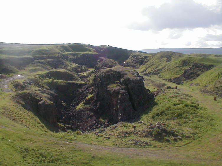
| West Rigg Quarry, Westgate, Stanhope, County Durham, England, UK | 54° 44' 51" N | 2° 8' 12" W | 3.6km (2.3 miles) | |
| Harthope Head Quarries, St. John's Chapel, Stanhope, County Durham, England, UK | 54° 42' 41" N | 2° 12' 47" W | 3.8km (2.3 miles) | |
| Rigg Mine, Westgate, Stanhope, County Durham, England, UK | 54° 44' 44" N | 2° 7' 55" W | 3.9km (2.4 miles) | |
| Ireshope Moor, Stanhope, County Durham, England, UK | 54° 43' 17" N | 2° 14' 48" W | 4.2km (2.6 miles) | |
| Park Burn Opencut, Westgate, Stanhope, County Durham, England, UK | 54° 44' 38" N | 2° 7' 21" W | 4.5km (2.8 miles) | |
| Heights Mine, Westgate, Stanhope, County Durham, England, UK | 54° 44' 51" N | 2° 7' 21" W | 4.5km (2.8 miles) | |
| Swinhopehead Mine, Daddry Shield, Stanhope, County Durham, England, UK | 54° 42' 9" N | 2° 10' 31" W | 4.6km (2.9 miles) | |
| Heights Quarry, Westgate, Stanhope, County Durham, England, UK | 54° 44' 48" N | 2° 6' 53" W | 5.0km (3.1 miles) | |
Minerals recorded nearby (within 5.0 km)
Rock types recorded nearby (within 5.0 km)
Entries shown in red are rocks recorded for this region.


West Rigg Quarry, Westgate, Stanhope, County Durham, England, UK