| Locality | Latitude | Longitude | Distance | Bearing |
|---|
| Denny Gulch, Denny Mountain, Snoqualmie Mining District, King County, Washington, USA | 47° 25' 54" N | 121° 27' 9" W | 1.9km (1.2 miles) | |
| Snoqualmie Pass, Snoqualmie Mining District, King County, Washington, USA | 47° 25' 17" N | 121° 24' 43" W | 2.2km (1.4 miles) | |
| Carmack Mine, Snoqualmie Mining District, King County, Washington, USA | 47° 23' 58" N | 121° 27' 21" W | 2.3km (1.4 miles) | |
| Denny Mountain, Snoqualmie Mining District, King County, Washington, USA | 47° 26' 20" N | 121° 26' 37" W | 2.4km (1.5 miles) | |
| Guye Mine, Snoqualmie Mining District, King County, Washington, USA | 47° 26' 45" N | 121° 25' 11" W | 3.5km (2.2 miles) | |
| Commonwealth Prospect, Snoqualmie Mining District, King County, Washington, USA | 47° 26' 44" N | 121° 23' 30" W | 4.8km (3.0 miles) | |
| Chair Peak Skarn, Snoqualmie Mining District, King County, Washington, USA | 47° 27' 34" N | 121° 27' 55" W | 5.1km (3.2 miles) | |
| Humpback Mountain Slump Zone, Hansen Creek, Snoqualmie Mining District, King County, Washington, USA | 47° 23' 0" N | 121° 30' 19" W | 6.2km (3.8 miles) | |
| Garden Slug Claim, Hansen Creek, Snoqualmie Mining District, King County, Washington, USA | 47° 22' 55" N | 121° 30' 21" W | 6.3km (3.9 miles) | |
| Silver Peak, Snoqualmie Mining District, King County, Washington, USA | 47° 21' 40" N | 121° 27' 42" W | 6.4km (4.0 miles) | |
| Silver King and Queen Mine, Gold Creek, Kittitas County, Washington, USA | 47° 26' 10" N | 121° 20' 54" W | 7.2km (4.5 miles) | |
| Hansen Creek Crystal Area, Hansen Creek, Snoqualmie Mining District, King County, Washington, USA | 47° 22' 8" N | 121° 31' 5" W | 7.9km (4.9 miles) | |
| Hansen Creek, Snoqualmie Mining District, King County, Washington, USA | 47° 22' 7" N | 121° 31' 7" W | 8.0km (5.0 miles) | |
| Granite King Prospect, Gold Creek, Kittitas County, Washington, USA | 47° 27' 11" N | 121° 20' 50" W | 8.1km (5.0 miles) | |
| Goldmyer Hot Springs, Middle Fork of the Snoqualmie River, Snoqualmie Mining District, King County, Washington, USA | 47° 28' 59" N | 121° 23' 30" W | 8.2km (5.1 miles) | |
| Mount Roosevelt, Middle Fork of the Snoqualmie River, Snoqualmie Mining District, King County, Washington, USA | 47° 28' 50" N | 121° 30' 8" W | 8.5km (5.3 miles) | |
| Tinhorn Mine, Gold Creek, Kittitas County, Washington, USA | 47° 27' 16" N | 121° 20' 32" W | 8.5km (5.3 miles) | |
| Gold Creek, Kittitas County, Washington, USA | 47° 27' 12" N | 121° 20' 13" W | 8.8km (5.4 miles) | |
| Christina Claim, Cedar River Mining District, King County, Washington, USA | 47° 20' 39" N | 121° 30' 29" W | 9.6km (5.9 miles) | |
| Porter Claim, Middle Fork of the Snoqualmie River, Snoqualmie Mining District, King County, Washington, USA | 47° 29' 28" N | 121° 22' 25" W | 9.6km (6.0 miles) | |
| Giant Mine, Gold Creek, Kittitas County, Washington, USA | 47° 27' 34" N | 121° 19' 34" W | 9.8km (6.1 miles) | |
| Esther and Louisa Mine, Gold Creek, Kittitas County, Washington, USA | 47° 27' 38" N | 121° 19' 16" W | 10.2km (6.3 miles) | |
| Puffball claim, Middle Fork of the Snoqualmie River, Snoqualmie Mining District, King County, Washington, USA | 47° 29' 53" N | 121° 22' 27" W | 10.3km (6.4 miles) | |
| Copper Queen Prospect, Middle Fork of the Snoqualmie River, Snoqualmie Mining District, King County, Washington, USA | 47° 29' 54" N | 121° 22' 23" W | 10.4km (6.4 miles) | |
| Brown Bear Mine, Cedar River Mining District, King County, Washington, USA | 47° 21' 8" N | 121° 32' 35" W | 10.6km (6.6 miles) | |
| Condor-Hemlock Mine, Middle Fork of the Snoqualmie River, Snoqualmie Mining District, King County, Washington, USA | 47° 29' 48" N | 121° 21' 35" W | 10.7km (6.7 miles) | |
| Transit Prospect, Gold Creek, Kittitas County, Washington, USA | 47° 27' 31" N | 121° 18' 38" W | 10.8km (6.7 miles) | |
| Spruce Ridge, Middle Fork of the Snoqualmie River, Snoqualmie Mining District, King County, Washington, USA | 47° 30' 29" N | 121° 22' 12" W | 11.4km (7.1 miles) | |
| Bear Creek Mine, Cedar River Mining District, King County, Washington, USA | 47° 20' 4" N | 121° 32' 32" W | 12.0km (7.4 miles) | |
| Hardscrabble Creek, Middle Fork of the Snoqualmie River, Snoqualmie Mining District, King County, Washington, USA | 47° 30' 38" N | 121° 20' 39" W | 12.7km (7.9 miles) | |


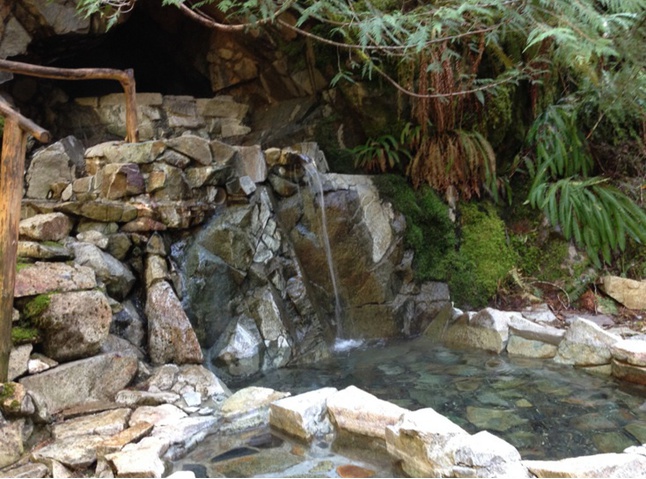


Goldmyer Hot Springs, Middle Fork of the Snoqualmie River, Snoqualmie Mining District, King County, Washington, USA