| Locality | Latitude | Longitude | Distance | Bearing |
|---|
| Coastal cliffs, Glenarm, Co. Antrim, Northern Ireland, UK | 54° 57' 53" N | 5° 55' 42" W | 0.0km (0.0 miles) | |
| Little Deerpark Quarry, Glenarm, Co. Antrim, Northern Ireland, UK | 54° 57' 55" N | 5° 55' 37" W | 0.1km (0.1 miles) | |
| Glenarm, Co. Antrim, Northern Ireland, UK | 54° 58' 6" N | 5° 57' 8" W | 1.6km (1.0 miles) | |
| Minnis North, Glenarm, Co. Antrim, Northern Ireland, UK | 54° 57' 4" N | 5° 54' 37" W | 1.9km (1.2 miles) | |
| Scawt Hill, Larne, Co. Antrim, Northern Ireland, UK | 54° 54' 37" N | 5° 54' 55" W | 6.1km (3.8 miles) | |
| Black Burn, Waterfoot, Co. Antrim, Northern Ireland, UK | 55° 2' 16" N | 5° 58' 55" W | 8.8km (5.5 miles) | |
| Ticloy, Co. Antrim, Northern Ireland, UK | 54° 56' 30" N | 6° 4' 52" W | 10.1km (6.3 miles) | |
| Fallowvee, Waterfoot, Co. Antrim, Northern Ireland, UK | 55° 3' 4" N | 5° 59' 57" W | 10.6km (6.6 miles) | |
| Glenariff Valley, Garron Plateau, Co. Antrim, Northern Ireland, UK | 55° 1' 55" N | 6° 4' 45" W | 12.2km (7.6 miles) | |
| Garron Plateau, Co. Antrim, Northern Ireland, UK | 54° 59' 22" N | 6° 7' 23" W | 12.7km (7.9 miles) | |
| Waterfoot, Co. Antrim, Northern Ireland, UK | 55° 3' 37" N | 6° 3' 30" W | 13.5km (8.4 miles) | |
| Dungonnell Dam, Ballymena, Co. Antrim, Northern Ireland, UK | 54° 59' 13" N | 6° 8' 17" W | 13.6km (8.4 miles) | |
| Kilwaughter Castle, Larne, Co. Antrim, Northern Ireland, UK | 54° 50' 35" N | 5° 53' 20" W | 13.8km (8.6 miles) | |
| Disused Quarry, Dungonnell Dam, Ballymena, Co. Antrim, Northern Ireland, UK | 54° 59' 26" N | 6° 8' 27" W | 13.8km (8.6 miles) | |
| Unnamed quarry, Kilwaughter Castle, Larne, Co. Antrim, Northern Ireland, UK | 54° 50' 18" N | 5° 53' 5" W | 14.3km (8.9 miles) | |
| Larne, Co. Antrim, Northern Ireland, UK | 54° 51' 1" N | 5° 49' 9" W | 14.5km (9.0 miles) | |
| Dungonnell Mines, Cargan, Co. Antrim, Northern Ireland, UK | 54° 59' 13" N | 6° 9' 38" W | 15.0km (9.3 miles) | |
| Tieveragh, Cushendall, Co. Antrim, Northern Ireland, UK | 55° 4' 39" N | 6° 4' 3" W | 15.4km (9.5 miles) | |
| Cushendall, Co. Antrim, Northern Ireland, UK | 55° 4' 50" N | 6° 3' 50" W | 15.5km (9.6 miles) | |
| Ballylig Quarry, Broughshane, Ballymena, Co. Antrim, Northern Ireland, UK | 54° 54' 51" N | 6° 9' 32" W | 15.8km (9.8 miles) | |
| Evishacrow Mine, Glenravel Mines, Cargan, Co. Antrim, Northern Ireland, UK | 55° 0' 36" N | 6° 10' 8" W | 16.1km (10.0 miles) | |
| Ballynahavla Mine, Glenravel Mines, Cargan, Co. Antrim, Northern Ireland, UK | 55° 0' 38" N | 6° 10' 21" W | 16.4km (10.2 miles) | |
| Cargan, Co. Antrim, Northern Ireland, UK | 54° 59' 35" N | 6° 10' 55" W | 16.5km (10.2 miles) | |
| Mcllroy's Port, Port Muck, Islandmagee, Co. Antrim, Northern Ireland, UK | 54° 51' 21" N | 5° 45' 0" W | 16.6km (10.3 miles) | |
| Robinson Quarry, Ballymena, Co. Antrim, Northern Ireland, UK | 54° 49' 48" N | 6° 3' 1" W | 16.9km (10.5 miles) | |
| Glenravel Mines, Cargan, Co. Antrim, Northern Ireland, UK | 55° 0' 31" N | 6° 11' 13" W | 17.2km (10.7 miles) | |
| Tievebulliagh, Cushendall, Co. Antrim, Northern Ireland, UK | 55° 4' 27" N | 6° 7' 58" W | 17.8km (11.1 miles) | |
| Port Muck, Islandmagee, Co. Antrim, Northern Ireland, UK | 54° 50' 51" N | 5° 43' 48" W | 18.2km (11.3 miles) | |
| Skarn, Port Muck, Islandmagee, Co. Antrim, Northern Ireland, UK | 54° 50' 46" N | 5° 43' 28" W | 18.6km (11.5 miles) | |
| Ballynulto Quarry, Broughshane, Ballymena, Co. Antrim, Northern Ireland, UK | 54° 51' 14" N | 6° 8' 44" W | 18.6km (11.5 miles) | |

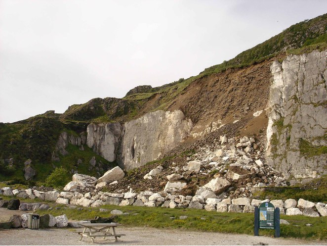
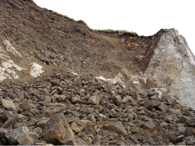


Little Deerpark Quarry, Glenarm, Co. Antrim, Northern Ireland, UK