Log InRegister
Quick Links : The Mindat ManualThe Rock H. Currier Digital LibraryMindat Newsletter [Free Download]
Home PageAbout MindatThe Mindat ManualHistory of MindatCopyright StatusWho We AreContact UsAdvertise on Mindat
Donate to MindatCorporate SponsorshipSponsor a PageSponsored PagesMindat AdvertisersAdvertise on Mindat
Learning CenterWhat is a mineral?The most common minerals on earthInformation for EducatorsMindat ArticlesThe ElementsThe Rock H. Currier Digital LibraryGeologic Time
Minerals by PropertiesMinerals by ChemistryAdvanced Locality SearchRandom MineralRandom LocalitySearch by minIDLocalities Near MeSearch ArticlesSearch GlossaryMore Search Options
Search For:
Mineral Name:
Locality Name:
Keyword(s):
 
The Mindat ManualAdd a New PhotoRate PhotosLocality Edit ReportCoordinate Completion ReportAdd Glossary Item
Mining CompaniesStatisticsUsersMineral MuseumsClubs & OrganizationsMineral Shows & EventsThe Mindat DirectoryDevice SettingsThe Mineral Quiz
Photo SearchPhoto GalleriesSearch by ColorNew Photos TodayNew Photos YesterdayMembers' Photo GalleriesPast Photo of the Day GalleryPhotography

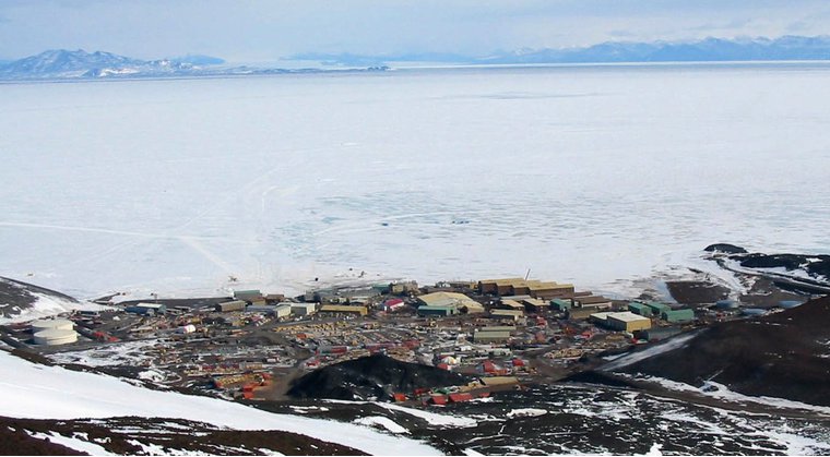
McMurdo Station, Antarctica


Alternative Names:Base McMurdo, Base antarctique McMurdo, Estacao McMurdo, Estacio McMurdo, Estació McMurdo, Estação McMurdo, Mak-Merdo, Makmerdo, McMurdo, McMurdo Statschoon, McMurdo basea, McMurdo-Station, McMurdo-stasjonen, Polarni stanice McMurdo, Polusa stacio McMurdo, Polární stanice McMurdo, Station McMurdo, Stazione McMurdo, maegmeodo giji, mai ke mo duo zhan, makumado ji de, thnt mq-mrdw, Мак-Мердо, Макмөрдо, תחנת מק-מרדו, قاعدة ماك موردو, マクマード基地, 麥克默多站, 맥머도 기지
Type:Populated place - a city, town, village, or other agglomeration of buildings where people live and work
Mindat.org Region:Ross Island, Ross Archipelago, Victoria Land, Eastern Antarctica, Antarctica
Region:Antarctica
Latitude:77° 50' 45" S
Longitude:166° 40' 33" E
Lat/Long (dec):-77.846,166.676
Köppen climate type:EF : Ice cap climate
Population:1,258 (2012)
Mindat Feature ID:6696480
Long-form Identifier:mindat:2:6:6696480:1
GUID:c7ee5e0e-8616-4fdf-817c-98d98873afbf
  Search for other features

Mindat.org localities near to this feature


LocalityLatitudeLongitudeDistanceBearing
Hut Point Peninsula, Ross Island, Ross Archipelago, Victoria Land, Eastern Antarctica, Antarctica77° 46' 59" S166° 50' 59" E8.1km (5.0 miles)
White Island, Ross Archipelago, Victoria Land, Eastern Antarctica, Antarctica78° 7' 59" S167° 24' 0" E36.1km (22.4 miles)
Mount Erebus, Ross Island, Ross Archipelago, Victoria Land, Eastern Antarctica, Antarctica77° 31' 45" S167° 8' 57" E36.9km (23.0 miles)
Brown Peninsula, Ross Archipelago, Victoria Land, Eastern Antarctica, Antarctica78° 5' 59" S165° 25' 0" E40.6km (25.2 miles)
Black Island, Ross Archipelago, Victoria Land, Eastern Antarctica, Antarctica78° 13' 59" S166° 19' 59" E43.8km (27.2 miles)
Mount Terror, Ross Island, Ross Archipelago, Victoria Land, Eastern Antarctica, Antarctica77° 31' 59" S168° 33' 0" E56.4km (35.1 miles)
Mount Discovery, Victoria Land, Eastern Antarctica, Antarctica78° 17' 59" S165° 10' 0" E61.2km (38.1 miles)
Mount Bird, Ross Island, Ross Archipelago, Victoria Land, Eastern Antarctica, Antarctica77° 16' 0" S166° 43' 0" E64.4km (40.0 miles)
Minna Bluff, Victoria Land, Eastern Antarctica, Antarctica78° 32' 59" S166° 22' 0" E78.6km (48.8 miles)
Beaufort Island, Ross Archipelago, Victoria Land, Eastern Antarctica, Antarctica76° 58' 59" S167° 0' 0" E96.2km (59.8 miles)

Minerals recorded nearby (within 20 km)

Rock types recorded nearby (within 20 km)

Regions in mindat.org that contain this locality

RegionType
Antarctic MeteoritesMeteorite Fall Location
Antarctic PlateTectonic Plate
AntarcticaContinent
Ross Island, Ross Archipelago, Victoria Land, Eastern Antarctica, AntarcticaIsland
 
Mineral and/or Locality  
Mindat Discussions Facebook Logo Instagram Logo Discord Logo
Mindat.org is an outreach project of the Hudson Institute of Mineralogy, a 501(c)(3) not-for-profit organization.
Copyright © mindat.org and the Hudson Institute of Mineralogy 1993-2024, except where stated. Most political location boundaries are © OpenStreetMap contributors. Mindat.org relies on the contributions of thousands of members and supporters. Founded in 2000 by Jolyon Ralph.
Privacy Policy - Terms & Conditions - Contact Us / DMCA issues - Report a bug/vulnerability Current server date and time: April 26, 2024 17:37:31
Go to top of page