Parker Range Goldfield, Yilgarn Shire, Western Australia, Australia
This page is currently not sponsored. Click here to sponsor this page.

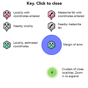
Key
Lock Map
| Latitude & Longitude (WGS84): | 31° 37' 58'' South , 119° 35' 6'' East |
|---|---|
| Latitude & Longitude (decimal): | -31.63285,119.58503 |
| GeoHash: | G#: qdmh11rjm |
| Locality type: | Ore Field |
| Köppen climate type: | BSk : Cold semi-arid (steppe) climate |
(Maps- please note when looking at the individual locations, Google Maps, has mis-placed the 'Parker Range' location).
Historically the name is Parker's, however modern sources including maps name it Parker. Gold was discovered in the area by W.M. Parker in 1888. Considering gold in the Yilgarn region was only discovered in 1887 (north of Bullfinch), the Parker Range discovery was one of the earliest in the area.
This was despite its remoteness. There is still little human activity in the area now. The goldfield is reached by the Marvel Loch-Forrestania Road, starting 20 kilometres south of Marvel Loch. The goldfield extends on strike north-south for about a further 20 kilometres. Gold deposits are found either side (east and west) of the road, and usually close to it (sometimes bordering the edge of the road).
The countryside is semi arid heathland, with Salmon Gum woodland in low lying areas. The Parker Range itself is a low range of hills in one section of the goldfield, and west of the road. It is the only substantial geographic feature in the area. There are no towns, or in fact any human habitation in the region, the nearest being Marvel Loch.
While there was initially some mining activity after 1888, the Coolgardie discovery elsewhere in the State in 1892, saw many miners leave. Many of the deposits were small and of low value. A few companies tried their luck, and quickly abandoned their mines. Various named prospecting leases, occupied by a miner or two would last a year or more then be abandoned. All had fallen quiet by the beginning of World War One.
There has been some modern exploration in the area, although mining has been very limited. The field in general could be classed as a prospecting area. Modern companies would need a high gold price, accessing several small pits, through a central plant for it to be profitable.
Commodity List
This is a list of exploitable or exploited mineral commodities recorded from this region.Mineral List
Mineral list contains entries from the region specified including sub-localities20 valid minerals.
Rock Types Recorded
Note: this is a very new system on mindat.org and data is currently VERY limited. Please bear with us while we work towards adding this information!
Rock list contains entries from the region specified including sub-localities
Select Rock List Type
Alphabetical List Tree DiagramLocalities in this RegionShow map
Australia
- Western Australia
- Yilgarn Shire
- Western Australia
This page contains all mineral locality references listed on mindat.org. This does not claim to be a complete list. If you know of more minerals from this site, please register so you can add to our database. This locality information is for reference purposes only. You should never attempt to
visit any sites listed in mindat.org without first ensuring that you have the permission of the land and/or mineral rights holders
for access and that you are aware of all safety precautions necessary.


Centenary Gold Mine, Parker Range Goldfield, Yilgarn Shire, Western Australia, Australia