| Locality | Latitude | Longitude | Distance | Bearing |
|---|
| Plohn, Lengenfeld, Vogtlandkreis, Saxony, Germany | 50° 34' 14" N | 12° 24' 10" E | 2.3km (1.4 miles) | |
| Pechtelsgrün, Lengenfeld, Vogtlandkreis, Saxony, Germany | 50° 35' 25" N | 12° 24' 42" E | 2.6km (1.6 miles) | |
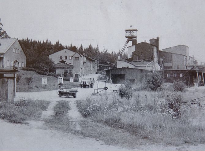
| Wolframite mine, Pechtelsgrün, Lengenfeld, Vogtlandkreis, Saxony, Germany | 50° 35' 12" N | 12° 25' 28" E | 3.4km (2.1 miles) | |
| Eich, Treuen, Vogtlandkreis, Saxony, Germany | 50° 32' 49" N | 12° 21' 7" E | 4.4km (2.7 miles) | |
| Granite quarry (Röthenbach quarry), Wildenau, Steinberg, Vogtlandkreis, Saxony, Germany | 50° 33' 49" N | 12° 26' 1" E | 4.5km (2.8 miles) | |
| Irfersgrün, Lengenfeld, Vogtlandkreis, Saxony, Germany | 50° 36' 42" N | 12° 25' 35" E | 4.7km (2.9 miles) | |
| Hauptmannsgrün, Heinsdorfergrund, Vogtlandkreis, Saxony, Germany | 50° 37' 36" N | 12° 23' 31" E | 4.9km (3.1 miles) | |
| Wildenau, Steinberg, Vogtlandkreis, Saxony, Germany | 50° 33' 22" N | 12° 27' 21" E | 6.3km (3.9 miles) | |
| Diatreme outcrop, Reichenbach im Vogtland, Vogtlandkreis, Saxony, Germany | 50° 38' 30" N | 12° 24' 6" E | 6.7km (4.2 miles) | |
| Thekla Mine, Hauptmannsgrün, Heinsdorfergrund, Vogtlandkreis, Saxony, Germany | 50° 38' 40" N | 12° 23' 33" E | 6.9km (4.3 miles) | |
| Diabase quarries, Neumark, Vogtlandkreis, Saxony, Germany | 50° 39' 35" N | 12° 20' 58" E | 8.7km (5.4 miles) | |
| Göltzsch river alluvials, Mylau, Reichenbach im Vogtland, Vogtlandkreis, Saxony, Germany | 50° 37' 19" N | 12° 14' 40" E | 10.3km (6.4 miles) | |
| Reimersgrün Quarry, Limbach, Vogtlandkreis, Saxony, Germany | 50° 32' 29" N | 12° 10' 23" E | 10.8km (6.7 miles) | |
| Zobes, Neuensalz, Vogtlandkreis, Saxony, Germany | 50° 30' 37" N | 12° 15' 14" E | 11.9km (7.4 miles) | |
| Heilmann Quarry, Kirchberg, Zwickau District, Saxony, Germany | 50° 37' 8" N | 12° 32' 34" E | 12.3km (7.7 miles) | |
| Steinbach meteorite (Potůčky; Breitenbach; Eibenstock; Gotha; Grimma; Johanngeorgenstadt; Rittersgrün), Schönheide, Erzgebirgskreis, Saxony, Germany | 50° 30' 0" N | 12° 30' 0" E | 12.7km (7.9 miles) | |
| Steinbach meteorite, Schönheide, Erzgebirgskreis, Saxony, Germany | 50° 30' 0" N | 12° 30' 0" E | 12.7km (7.9 miles) | |
| Schelmberg Quarry, Kirchberg, Zwickau District, Saxony, Germany | 50° 38' 21" N | 12° 32' 4" E | 12.7km (7.9 miles) | |
| Augustas Glück Mine, Pöhl, Vogtlandkreis, Saxony, Germany | 50° 32' 12" N | 12° 12' 38" E | 12.9km (8.0 miles) | |
| Shaft 277, Zobes, Neuensalz, Vogtlandkreis, Saxony, Germany | 50° 29' 58" N | 12° 14' 41" E | 13.2km (8.2 miles) | |
| Trieb quarry, Falkenstein, Falkenstein, Vogtlandkreis, Saxony, Germany | 50° 28' 12" N | 12° 18' 23" E | 13.6km (8.4 miles) | |
| Heinrichschacht Mine, Niederplanitz, Zwickau, Zwickau District, Saxony, Germany | 50° 41' 5" N | 12° 29' 5" E | 13.6km (8.4 miles) | |
| Shaft 320, Zobes, Neuensalz, Vogtlandkreis, Saxony, Germany | 50° 29' 36" N | 12° 14' 46" E | 13.6km (8.5 miles) | |
| Maxhütte, Zwickau, Zwickau District, Saxony, Germany | 50° 42' 6" N | 12° 26' 36" E | 13.9km (8.7 miles) | |
| Königin-Marienhütte smelter, Cainsdorf, Zwickau, Zwickau District, Saxony, Germany | 50° 41' 2" N | 12° 29' 50" E | 14.0km (8.7 miles) | |
| Planitz, Zwickau, Zwickau District, Saxony, Germany | 50° 41' 14" N | 12° 29' 25" E | 14.0km (8.7 miles) | |
| Shaft 362, Mechelgrün, Neuensalz, Vogtlandkreis, Saxony, Germany | 50° 29' 14" N | 12° 14' 39" E | 14.2km (8.8 miles) | |
| Alexanderschacht Mine, Niederplanitz, Zwickau, Zwickau District, Saxony, Germany | 50° 41' 30" N | 12° 29' 7" E | 14.3km (8.9 miles) | |
| Mechelgrün, Neuensalz, Vogtlandkreis, Saxony, Germany | 50° 29' 6" N | 12° 14' 25" E | 14.6km (9.1 miles) | |
| Zwickau brickworks, Niederplanitz, Zwickau, Zwickau District, Saxony, Germany | 50° 42' 1" N | 12° 28' 22" E | 14.6km (9.1 miles) | |


Wolframite mine, Pechtelsgrün, Lengenfeld, Vogtlandkreis, Saxony, Germany