| Locality | Latitude | Longitude | Distance | Bearing |
|---|
| Bollihope lead smelter slag locality, Stanhope, County Durham, England, UK | 54° 42' 44" N | 2° 2' 13" W | 0.0km (0.0 miles) | |
| Harnisha Burn Mine, Stanhope, County Durham, England, UK | 54° 42' 38" N | 2° 0' 55" W | 1.4km (0.9 miles) | |
| Yew Tree Mine, Stanhope, County Durham, England, UK | 54° 42' 45" N | 2° 0' 39" W | 1.7km (1.1 miles) | |
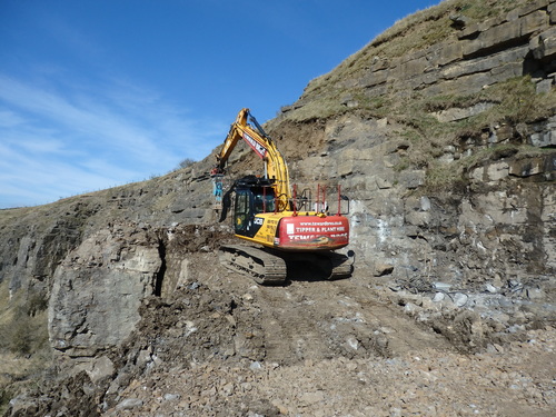
| Newlandside Quarry, Stanhope, County Durham, England, UK | 54° 44' 6" N | 2° 1' 35" W | 2.6km (1.6 miles) | |
| Cornish Hush Mine, Stanhope, County Durham, England, UK | 54° 41' 56" N | 1° 59' 48" W | 3.0km (1.9 miles) | |
| Eastgate Quarry, Eastgate, Stanhope, County Durham, England, UK | 54° 43' 40" N | 2° 4' 39" W | 3.1km (1.9 miles) | |
| Whitfield Brow Mines, Stanhope, County Durham, England, UK | 54° 42' 13" N | 1° 59' 26" W | 3.1km (2.0 miles) | |
| West Newlandside Vein, Newlandside Quarry, Stanhope, County Durham, England, UK | 54° 44' 23" N | 2° 1' 27" W | 3.2km (2.0 miles) | |
| Bollihope quarry, Bollihope Mining District, County Durham, England, UK | 54° 42' 32" N | 1° 59' 13" W | 3.2km (2.0 miles) | |
| Parson Byers Quarry, Stanhope, County Durham, England, UK | 54° 43' 41" N | 1° 59' 37" W | 3.3km (2.1 miles) | |
| Quarry Hill Veins, Newlandside Quarry, Stanhope, County Durham, England, UK | 54° 44' 21" N | 2° 0' 53" W | 3.3km (2.1 miles) | |
| Rainbow's End Pocket, Fairy Hole Vein, Lady Annabella Mine, Eastgate Quarry, Eastgate, Stanhope, County Durham, England, UK | 54° 43' 35" N | 2° 5' 3" W | 3.4km (2.1 miles) | |
| Lady Annabella Mine, Eastgate Quarry, Eastgate, Stanhope, County Durham, England, UK | 54° 43' 37" N | 2° 5' 12" W | 3.6km (2.2 miles) | |
| Greenfoot Quarry, Stanhope, County Durham, England, UK | 54° 44' 48" N | 2° 1' 46" W | 3.8km (2.4 miles) | |
| Billing Hills Mine, Eastgate, Stanhope, County Durham, England, UK | 54° 44' 2" N | 2° 5' 1" W | 3.8km (2.4 miles) | |
| Bollihope Smelt Mill slag locality, Stanhope, County Durham, England, UK | 54° 42' 44" N | 1° 58' 34" W | 3.9km (2.4 miles) | |
| Billing Shield Mine, Stanhope, County Durham, England, UK | 54° 44' 13" N | 2° 4' 56" W | 4.0km (2.5 miles) | |
| Eastgate, Stanhope, County Durham, England, UK | 54° 44' 38" N | 2° 4' 31" W | 4.3km (2.7 miles) | |
| Rat Tail Pocket, Rogerley Mine, Rogerley Quarry, Stanhope, County Durham, England, UK | 54° 44' 17" N | 1° 59' 4" W | 4.4km (2.7 miles) | |
| Rat Hole Pocket, Rogerley Mine, Rogerley Quarry, Stanhope, County Durham, England, UK | 54° 44' 17" N | 1° 59' 4" W | 4.4km (2.7 miles) | |
| Dodgy Bugger Pocket, Rogerley Mine, Rogerley Quarry, Stanhope, County Durham, England, UK | 54° 44' 17" N | 1° 59' 4" W | 4.4km (2.7 miles) | |
| Rogerley Mine, Rogerley Quarry, Stanhope, County Durham, England, UK | 54° 44' 16" N | 1° 59' 3" W | 4.4km (2.7 miles) | |
| West Cross Cut, Rogerley Mine, Rogerley Quarry, Stanhope, County Durham, England, UK | 54° 44' 17" N | 1° 59' 4" W | 4.4km (2.8 miles) | |
| West Cross Cut Pocket Zone, Rogerley Mine, Rogerley Quarry, Stanhope, County Durham, England, UK | 54° 44' 17" N | 1° 59' 3" W | 4.4km (2.8 miles) | |
| Corner Pocket, Rogerley Mine, Rogerley Quarry, Stanhope, County Durham, England, UK | 54° 44' 17" N | 1° 59' 4" W | 4.4km (2.8 miles) | |
| Weasel Pocket, Rogerley Mine, Rogerley Quarry, Stanhope, County Durham, England, UK | 54° 44' 17" N | 1° 59' 3" W | 4.4km (2.8 miles) | |
| Rogerley Quarry, Stanhope, County Durham, England, UK | 54° 44' 14" N | 1° 58' 59" W | 4.4km (2.8 miles) | |
| Black Sheep Pocket, Rogerley Mine, Rogerley Quarry, Stanhope, County Durham, England, UK | 54° 44' 17" N | 1° 59' 2" W | 4.4km (2.8 miles) | |
| The Tube, Rogerley Mine, Rogerley Quarry, Stanhope, County Durham, England, UK | 54° 44' 17" N | 1° 59' 3" W | 4.4km (2.8 miles) | |
| Solstice Pocket, Rogerley Mine, Rogerley Quarry, Stanhope, County Durham, England, UK | 54° 44' 17" N | 1° 59' 3" W | 4.4km (2.8 miles) | |


Diana Maria Mine, Rogerley Quarry, Stanhope, County Durham, England, UK