Forest Hill Mining District, Placer Co., California, USAi
| Regional Level Types | |
|---|---|
| Forest Hill Mining District | Mining District |
| Placer Co. | County |
| California | State |
| USA | Country |
This page is currently not sponsored. Click here to sponsor this page.


Latitude & Longitude (WGS84):
39° North , 120° West (est.)
Estimate based on other nearby localities or region boundaries.
Margin of Error:
~76km
Locality type:
Köppen climate type:
A former Au-Ag-Pt-Cu-Zn-Fe-Pb-In mining district located in secs. 3-8 & 18, T13N, R10E, and in secs. 13, 14, 23-28, & 32-35, T14N, R10E and in secs. 18, 19 & 30, T14N, R11E, MDM, 15 miles northeast of Auburn. Discovered in 1850.
Location: The Forest Hill district is in south-central Placer County in the general vicinity of the town of that name. This district is fairly large in area and includes not only the "diggings" at Forest Hill but those at Bath to the E, Todd Valley and Dardanelles to the SW, and Yankee Jims to the NW.
The Forest Hill Mining District is centered around the town of Foresthill (note different spelling) in south central Placer County, California. The district includes all hydraulic, drift, and lode gold mines between Baker Ranch on the northeast and Drivers Flat to the southwest along the crest and flanks of the Forest Hill Divide (to the northeast is the adjacent Michigan Bluff Mining District). The Forest Hill Divide is a northeast-southwest trending drainage divide separating the modern North and Middle Forks of the American River. The district is primarily a placer gold district, the majority of production having come from drift and hydraulic mining of Tertiary channel gravel deposits. Significant hydraulic mines include those at Yankee Jims, Peckham Hill, and Todd's Valley, while important drift mines are the Dardanelles, Mayflower, and Paragon Mines. Only a limited amount of production came from quartz lode mines on the flanks of the divide including the Eureka, Consolidated International, and Three Queens Mines.
The Forest Hill District is one of the most important Tertiary placer-gold mining districts in the northern Sierra Nevada. The district is famous for hydraulic and drift mines within auriferous Eocene channel gravels of the ancient American River. Discovery of these gravel deposits high above the North Fork of the American River on the flanks of the Forest Hill Divide led to some of the first hydraulic mining in the state at Yankee Jims on the north flank of the divide. Hydraulic mining prevailed until the Sawyer Decision of 1884, which severely curtailed hydraulic mining, after which drift mining of the buried channels became the primary means of exploration and development.
While a few small quartz lode deposits were developed in the basement rocks on the flanks of the divide, the predominant ores were Eocene channel lag and bench gravels deposited on the eroded bedrock surface and later elevated and exposed by uplift and downcutting of modern drainages. They were preserved under a thick overlying sequence of volcanic deposits of the Mehrten Formation, which makes up the backbone of the Forest Hill Divide. The gravels were heavily laden with placer gold from the erosion of the auriferous bedrock and gold-quartz veins through which the rivers flowed. Secondary placer deposits were encountered overlying the basal sand and gravel in a section of younger interbedded channel gravels and volcanic flows of the Valley Springs Formation. These "intervolcanic" gravels, while often barren, were sometimes charged with placer gold by erosion of the older auriferous channel gravels.
The primary Eocene bedrock channel, the "Forest Hill Channel," is expressed as a flat trough-shaped depression that meanders in wide bends from northeast to southwest through the district. Generally between 300 and 1,500 feet wide, it widened to 2,500 feet in the Dardanelles Mine. The depth of the bedrock channel was commonly over 100 feet from thalwag to rim. Auriferous bench gravels up to several miles wide often spilled over the channel rims covering floodplains up to several miles wide.
The best bedrock gravels were recognized by the abundance of quartz and metamorphic bedrock fragments, the latter imparting a bluish cast to the gravels. Deposits included gravels, cobbles, and quartz boulders of up to many tons, which were well-cemented and required blasting and crushing. Pay zones were commonly erratic, but often meandered from one side of the channel to the other reflecting relict current velocities. Gold particles tended to be flat or rounded and ranged from fine flour gold to large nuggets. A little fine or flour gold was found in the sands and clays that covered the gravels. Gravel beds within the intervolcanic series contained economic quantities of gold when, during their deposition, the channels eroded adjacent beds or older channels that were gold laden. The gold particles are in some places associated with platinum and almost invariably associated with black sands composed of magnetite, ilmenite, chromite, and pyrite derived from basic bedrock such as diabase, gabbro, and serpentinite.
Environment The Forest Hill District is the area encompassing a portion of the Forest Hill Divide in south central Placer County approximately 35-40 miles northeast of Sacramento, California. The divide separates the North and Middle Forks of the American River and can be traced for almost 50 miles from an elevation of more than 6,500 feet west of Lake Tahoe to about 1,000 feet near Auburn, California. It is one of many northeast-southwest trending ridges present along the western flank of the northern Sierra Nevada.
The area is generally rural, with the town of Foresthill (pop. 2,000) located near the center of the district. The larger city of Auburn (pop.13,300) is located approximately 16 miles southwest. Most of the historic mine workings are on private property.
Topography is dominated by heavily forested and mountainous terrain punctuated by riverine canyons, which support a cover of mixed oak, conifers, and manzanita. The Forest Hill Divide generally trends northeast, and its flanks are strongly dissected by small gullies and ravines, which support mostly ephemeral streams. Relief from the Middle Fork of the American River to the top of the divide near the town of Foresthill exceeds 2,100 feet. The former hydraulic and drift mine adits are located on the upper flanks surrounding the divide where the Tertiary gravels were exposed by regional uplift and downcutting by the modern American River. A few gold-bearing quartz veins in the bedrock flanks were mined, but none were important producers.
The climate is intermediate between the Mediterranean climate of California's Central Valley and the alpine climate of the higher mountains to the east. Temperatures range from freezing in the winter to 100 degrees F in the summer, with average winter low temperatures of between 38 - 40oF and average summer highs in the mid-90s. Mean annual precipitation is approximately 14 inches, most of which falls during the rainy winter months between November and May.
The Forest Hill District includes many individual mines widely distributed throughout an area encompassing nearly 25 square miles of a portion of the Forest Hill Divide. Since the town of Foresthill geographically lies near the center of the district and is itself underlain by several important mines, it was chosen to represent the location of the district. The location latitude and longitude identify the approximate center of the town of Foresthill on the USGS Foresthill 7.5 minute quadrangle (coincident with the center N½NE¼, Sec. 35, T14N, R10E, MDM). The town of Foresthill is reached by taking the paved Foresthill Road from Auburn, California. The road traverses the crest of the divide to the northeast for approximately 20 miles before reaching the town.
History: Gold was discovered here in 1850. By 1852 the area was highly productive. In that year the Jenny Lind Mine was discovered, and hydraulic mining was introduced at Yankee Jims by Colonel McClure. The town was an important trading center in those days. By 1868 the mines in the vicinity of the town had yielded more than $10 million (period values). Large-scale hydraulic mining continued until the early 1880's and drift mining until the early 1900's. There was appreciable activity in the district again in the 1930's and early 1940's, and a few mines, such as the Paragon and Three Queens, have been worked since. Forest Hill is now an important lumbering center. The total output of the district is estimated to be at least $25 million (period values), and it may be considerably more.
Shortly after the discovery of gold in the American River at Sutter?s Mill in 1848, placer deposits were discovered in the North and Middle Forks of the American River flanking the Forest Hill Divide. Miners soon realized that much of the gold was eroded from rich Tertiary channel gravels perched high on the flanks of the divide. In 1850, the first ancient channels and gravel benches were identified hundreds of feet above the current rivers. Hydraulic mining of the Yankee Jims and Georgia Hill deposits commenced in 1852 using a primitive canvas hose and a small quantity of water under a head of only 50 feet. The Yankee Jims discovery was soon followed by others at Todd Valley and Peckham Hill and to the east in the neighboring Michigan Bluff District. Ultimately, most of the major and many of the smaller surface placer deposits in the district were hydraulically mined.
Hydraulic mining in the Sierra Nevada contributed enormous quantities of sediment to the Sacramento River causing flooding and silting of downstream farmlands. The Sawyer Decision of 1884 severely curtailed the dumping of sediment in the rivers resulting in a precipitous decline in hydraulic mining. Declining gold content and difficulties in dealing with the overlying volcanic cap also contributed to its demise. Hydraulic mining so declined that by 1908, the total production of hydraulically mined gold in California had declined to $170,000 (period values) (Lindgren, 1911).
Miners persevered by following the auriferous basal Eocene gravels (especially those of the Forest Hill Channel) into the hillsides via drift mining. Unable to remove the thick cover, they resorted to tunneling, the gravels being brought to the surface and washed for their gold. It was found that some of the overlying intervolcanic gravels could be rich enough to drift mine. Eventually, skilled miners to began to infer the location of channels from existing drainage patterns, and tunnels and crosscuts were driven to locate and mine them.
The Forest Hill Channel was first identified in outcrop at the Paragon Mine and worked primarily through tunnels from the south side of the divide. Drift mining involved driving adits along or below the bedrock trough of the channel. Drift mining reached its zenith in the mines of the Forest Hill Divide and adjacent districts. Although hydraulic mining continued into the 1880's, drift mining became the dominant method up into the early 1900's. The Forest Hill District was the most productive drift mining camp in the state. The district was most active during the late 1850s and 1860s. By 1859, it was shipping $100,000 of gold a month, and by 1868 was credited with production of over $10,000,000 (period values).
Pay gravels were originally accessed and worked in tunnels along the bedrock surface or by shafts connected to tunnels on the bedrock surface. Eventually, shafts were abandoned and access adits were driven in the more competent bedrock below the channel with raises and inclines to access the working tunnels within the channels. This method didn't require much timbering and correct placement of the bedrock adits had the added advantage of naturally draining the workings. By 1890, all major drift mines were worked through bedrock tunnels with raises into the overlying gravels.
By 1917, little gold was being produced from the district although active mines included the Dry Hill Quartz, Eureka Consolidated Quartz, International Quartz, Mitchell Quartz, Dardanelles Drift, Excelsior Drift, Florida Drift, Grey Eagle Drift, Maus Drift, Mayflower Drift, and Paragon Drift. By 1920 little gold was being produced throughout Placer County and most of that produced came from dredges on the American River and quartz mines in the Ophir District. The district saw renewed activity during the Depression, and many mines were active during the 1930s and 1940s. Operation of all mines ceased in 1942 with the War Production Order. Only a few mines, including the Paragon Mine and Three Queens Mine have been worked since. No significant mines are in production today.
Today, the remains of many of the hydraulic mines in the district are clearly visible. The extensive pit walls and debris fields are still evident having not fully re-vegetated themselves. What were once forested areas, they appear as cliffs, slopes, and hummocky flats of white to light tan sands and rhyolite beds devoid of mature vegetation. Large boulders are common on the flats. Sparse and immature stands of pine and manzanita as well as native grasses help identify these areas. The remains of the drift mines are far from evident. While virtually all drift mines are on posted private property and were not visited, only a few were even remotely visible from any nearby accessible viewpoint.
Geology: The main early Tertiary channel of the Middle Fork of the American River enters the district from Michigan Bluff on the E. At Bath it turns N and then West and SW and continues SW through Forest Hill. At the Dardanelles mine, W of Forest Hill, the channel swings NW to Yankee Jims and then N to the Iowa Hill District. An inter-volcanic channel extends WSW from Baker Ranch to N of Forest Hill. Another inter-volcanic channel extends SSW between the above and Yankee Jims. The older quartzitic gravels near bedrock arc coarse and well-cemented and have yielded the most gold. Much of the gravel is overlain by rhyolite and andesite. Bedrock is slate with some phyllite, schist, and serpentine. Some of the gold-quartz veins were rich, especially
those that occur near serpentine. The veins are usually 3 to 4 feet thick and strike in a northwesterly direction. A number of small but rich pockets were found in the Three Queens Mine, the principal lode mine in the district.
Rocks of the Forest Hill District can be divided into four units: 1) basement rocks of the Calaveras Complex-Mariposa Formation and Feather River Peridotite Belt, 2) Eocene auriferous gravels, 3) interbedded volcanic rocks and gravels of the Valley Springs Formation, and 4) an uppermost Mehrten Formation volcanic cap. These units are prominently exposed on the flanks of the Forest Hill Divide where the North and Middle Forks of the American River have cut deep canyons hundreds of feet lower than the pre-Tertiary basement surface.
Basement:
Forming the main body of the divide are NNW-trending foliated rocks of the Calaveras Complex and Mariposa Formation. The Foresthill Fault, a steep easterly dipping thrust fault, bisects the district and juxtaposes a terrane of slate, argillite, phyllite, metavolcanic rock and chert on the west against a terrane of metavolcanic rocks on the east. Chandra (1961) mapped these terranes as the Capehorn Formation and Tightner Formation, respectively, before they were recognized later as lithotectonic assemblages of the Calaveras Complex. Metasedimentary rocks of the western terrane strike north-northwest and dip 75?- 85? east and are interspersed with local belts of serpentinite and diorite dikes. On the west end of the district, the steeply east-dipping Gillis Hill Thrust Fault separates the Calaveras Complex from sandstone and slate of the Jurassic Mariposa Formation. The easternmost end of the district coincides with the Melones Fault Zone, which cuts the divide in the vicinity of Baker Ranch and Michigan Bluff. The fault zone is represented by a one- mile wide belt of partially to completely serpentinized peridotite of the Feather River Peridotite Belt. The bounding fault on the east side of the belt is the Volcano Canyon thrust (Chandra, 1961). Farther east, basement is composed of sandstone, siltstone, and slate of the Lower Paleozoic Shoo Fly Complex.
Basal Eocene Auriferous Gravels and the Forest Hill Channel:
The primary Eocene channel system within the district is the "Forest Hill Channel", a part of an ancient American River system that meandered from east to west through the district, incising a distinct channel in the exposed bedrock. The channel gravels and associated bench gravels yielded the bulk of the district's gold production. The gravel-filled bedrock channel is preserved in a sinuous trend almost six miles long in which three of the district?s most prolific drift mines are located (Paragon, Mayflower, and Dardanelles Mines). The river entered the district from the Michigan Bluff area to the northeast. Its channel was exposed in cross-section on the south side of the divide at the Paragon Mine where it was hydraulically mined before drifts were driven to follow the channel underground. From the Paragon Mine, the buried channel curved north under the divide to the Mayflower Mine; then southwest through the Independence, Baltimore, and Dardanelles Mines before being abruptly truncated in the Dardanelles Mine by the younger Orono Channel. Based on extrapolation, Lindgren (1911) suggested that the Forest Hill Channel continued under the center of the divide and reappeared in the hydraulic workings at Yankee Jims on the north side of the divide. Chandra (1961) contended that the Forest Hill Channel ran southwest from the Dardanelles Mine and included gravels worked at the San Francisco and Pond's Channel Mines. This issue remains unresolved, and much of the Forest Hill Channel is probably still unexplored. Chandra also mapped a second, smaller bedrock Eocene channel, which skirted the north side of the district and entered the district at the Keystone Mine. It then trended southwest through the Keystone and Small Hope Mines and the Yankee Jims placer deposits before exiting the district to the southwest near the Grey Eagle Mine.
The bedrock expression of the Forest Hill Channel is a flat trough shaped depression with gently inclined flanking benches. Near Bath, the bedrock trough is 500 feet wide and 100 feet deep. The bedrock surface is irregular with ridges, swales, and potholes conducive to trapping placer gold. The gravels are composed of well-rounded boulders, cobbles, pebbles, and sand composed of the more resistant bedrock materials such as quartz and siliceous metamorphic rock, metavolcanic rock, and slate. They are well-cemented with precipitated opal or chalcedony and require blasting and crushing. A blue-gray hue imparted by the slate and other metamorphic rock resulted in the terms ?blue gravels? or ?blue leads.? Blue gravels are commonly overlain with white or red gravel composed almost entirely of quartz. These quartz gravels are less cemented and generally don't require crushing. The bedrock channel gravels are often capped by a widespread layer of weathered rhyolite or "pipe clay."
Gravels within 3 feet of bedrock are usually the richest, with rounded gold nuggets, flakes, and dust. Pay gravels may run the full width of the channel, but more often occur as a narrow ribbon-like belts meandering from side to side due to the currents or meandering in the former channels. Barren stretches are common and yields vary considerably. Important placer deposits are also found on bench gravels flanking the channels. Bench gravels consist of sand, pebbles, cobbles, and some boulders and are commonly interbedded with sandy shales and sands. Bench gravels are leaner than bedrock gravels, but truly barren gravels are rare.
Valley Springs Intervolcanic Channels:
Overlying the Forest Hill Channel are varying thicknesses of intercalated rhyolite tuffs and intervolcanic channel gravels of the Valley Springs Formation. Towards the top of the formation the tuffs become progressively more andesitic before being blanketed by the overlying Mehrten Formation andesites. Including the Forest Hill Channel gravels, thicknesses of up to several hundred feet of gravel, sand, and pipe clay, can extend well beyond the limits of the lowest channel depression. At Bath and Mayflower, over 100 feet of rhyolitic tuff and intervolcanic gravels occur. Along the flank of the divide south of Foresthill, the exposed thickness of rhyolite tuff and intervolcanic gravels ranges from 40-130 feet.
On the Forest Hill Divide, the network of intervolcanic paleochannels is complex, each channel representing a periodic displacement of the stream, a distinct cut with a deposit of gravel, and a volcanic event bringing each channel event to an end. The frequent diversion and reestablishment of the intervolcanic channels (often called cement channels), and subsequent erosion of earlier channels makes it very difficult to establish correlative channels with any certainty. Channels of this period are notably narrower and deeper, the flanks steeper, and the accumulations of bedrock gravel significantly less than those of the older basement channels. Gravel thickness in these channels is generally several inches to fifteen feet and is usually dominated by volcanic gravel unless that stream cut deeply enough to erode older deposits or basement.
Clay beds are common in the upper portions of intervolcanic gravels. Petrified and/or lignitized cedar and oak tree trunks are not uncommon. Some gravel layers have become highly cemented by percolation of siliceous and calcareous waters and colors include gray, blue, green, reddish brown, and white depending on the source material and oxidation of the gravel and/or cementing material.
Between the first rhyolite flow and the later andesitic flows, the Sierra was elevated, which increased the gradient. In response, many intervolcanic channels eroded deeply into older auriferous gravels either partially or wholly removing them. The Forest Hill Channel is frequently cut by intervolcanic channels. Where this has occurred, they are generally rich in gold. Locally, the uppermost channels in the andesite tuffs may contain small amounts of gold, but not enough to warrant mining.
The most important intervolcanic channel in the district, the Orono, has cut small canyons as deep as 150 feet into bedrock. This channel enters the district near Michigan Bluff where it is exposed in the Hazard Shaft near the northeast corner of the district. The sinuous channel has been identified under much of the district and can be traced in surface and subsurface for almost 14 miles from the northeast end of the district to its outlet at the southwest end of the district at Peckham Hill. It has been encountered in the Hazard Shaft, Paragon Mine, Mayflower Mine, Live Oak Tunnel, Dardanelles Mine, Georgia Hill Tunnel, Gray Eagle Mine, and Peckham Hill. The Orono Channel has been encountered cutting the Forest Hill Channel deposits in the Paragon, Mayflower, and Dardanelles Mines, in some cases cutting deeply into the underlying basement. The Orono Channel is particularly rich in these areas and was often worked in lateral drifts from the main Forest Hill Channel drifts. In the Mayflower Mine, it eroded to bedrock level where it was worked for almost 3,500 feet along its length. The Orono Channel was also worked in the Live Oak Tunnel (just below the Mayflower Tunnel portal) along the north flank of the divide for 2,000 feet. In the Paragon Mine, the Orono Channel was also mined for 1,800 feet where it cut into, but not completely through, the Forest Hill Channel desposits. In the Dardanelles Mine, the Orono Channel cut 100 feet into bedrock, completely truncating the Forest Hill Channel a half-mile into the mine. At Peckham Hill, the Orono gravel did not pay, while in the Grey Eagle Mine (2 miles north), Orono pay was spotty, the gravel thin, but very rich in places.
Several smaller volcanic channels, often with local names, also occur but are too small or erratic for accurate correlations. On the flank of the divide below the town of Foresthill, a series of such channels and bench gravels were worked in several drift mines including the Jenny Lind and New Jersey Mines. Some of these channels were extremely rich. In the New Jersey Mine alone, a single claim of only 800' x 300' is reported to have yielded $1,500,000. Collectively, this localized area is reported to have produced about $5,000,000 (Lindgren, 1911).
Mehrten Formation:
Throughout the Forest Hill District, the Valley Springs Formation is overlain by the Mehrten Formation. Once covering the whole region, it is now confined to the flat-topped divides between drainages such as the Forest Hill Divide. Throughout the Colfax and Foresthill quadrangles, it ranges from a few feet to 700 feet thick. It consists of hard and dense massive layers of light gray, reddish brown, and dark colored andesitic mud flows, tuffs, breccias, and volcanic conglomerates. Intervolcanic channels are locally present in the Mehrten Formation, but they are almost universally barren.
Lode Gold Deposits:
The Forest Hill District also contains lode gold mines, including the Dry Hill Quartz, Eureka Consolidated Quartz, International Quartz, and Three Queens Quartz Mines. While some of the gold-quartz veins were rich (especially those occurring near serpentinite), they were of limited extent and thickness. Veins are usually 3-4 feet thick and strike northwesterly. Consequently, these mines were not significant producers, having collectively produced something more than $100,000.
In the Three Queens Mine (Sec. 31, T14N, R11E, MDM), located in Volcano Canyon and the district's principal lode mine, the gold occurs in a white, mesothermal quartz vein 3-4 feet wide along the contact of a serpentinite body and black schist within the Feather River Peridotite Belt. The vein strikes northwest and dips 30-40NE. Gold occurs as free-milling gold within the quartz and as "pocket" ore bodies. In the Eureka Consolidated Quartz Mine (Sec. 1, T13N, R9E), quartz stringers strike N 11? W and dip 45? E within amphibolite of the Calaveras Complex. Ore assayed $5/ton (period values). In the Dry Hill Quartz Mine (Sec. 31, T14N, R11E), quartz stringers bearing free crystallized gold occur in slate of the Calaveras Complex. In the Consolidated International Quartz Mine (Sec. 12, T13N, R9E), free gold occurs in a vein along the footwall of a 50-foot-wide porphyry dike. Assays ran $3.75 - $15.00/ton (period values). A quartz vein 4 feet thick was encountered in the main tunnel of the Paragon Mine at the contact of serpentinite and amphibolite. The vein strikes N65E and dips 66SE. The Forest Hill channel gravel was greatly enriched downstream of the vein.
Most of the quartz mines were short lived. The last of them was closed down during World War II and never reopened.
Structural Disturbance:
With the exception of the westward regional tilting of the Sierra Nevada, there is very little evidence of significant post-Cretaceous structural disturbance in the Forest Hill District. A small, almost vertical, fault was encountered across the bed of the Yankee Jim Channel. The strike was N35W with a throw to the NE of 15 feet.
Regional geologic structures include the Melones Fault Zone and the Gillis Hill Fault Zone. Local structures include the Foresthill Fault, Volcano Canyon Fault and the Melones Fault Zone.
Mineral occurrence models information: Model code: 119; USGS model code: 39a; BC deposit profile: C01. C02; Deposit model name: Placer Au-PGE; Mark3 model number: 54. Model code: 273; USGS model code: 36a; Deposit model name: Low-sulfide Au-quartz vein; Mark3 model number: 27. Host rocks include Tertiary unconsolidated sand and gravel; Miocene-Oligocene rhyolite tuff of the Valley Springs Formation; Triassic-Permian Calaveras Complex slate and Paleozoic serpentinite. The ore bodies are airregular, tabular, lenticular. Controls for ore emplacement included mechanical accumulation on irregular natural bedrock riffles and within river and stream channel lag gravels, bars, and point bar deposits. Deposits are often enriched downstream of eroded gold quartz veins in the bedrock channels. Ore shoots occur within mesothermal gold-bearing quartz veins. Local alteration is negligible (none described). Local rocks include Tertiary pyroclastic and volcanic mudflow deposits, unit 9 (Cascade Range).
Commodity Info: Placer deposits: Placer gold dust to large nuggets; Lode deposits: Free-milling gold-bearing quartz veins; Ore materials: Native gold; Gangue materials: gravels of mixed metamorphic and igneous composition; quartz.
Since production figures were not compiled during the most prolific production years (1852-1884), no accurate figures are available for the mines of the Forest Hill Divide, or collectively for the Tertiary channels of the Sierra Nevada. Lindgren (1911) conservatively estimated that approximately $507 million (period values) had been produced from Tertiary channels statewide by 1911. Root (1927) reported at least $19,550,000 (period values) had been produced from the larger drift mines in the Forest Hill District (includes lode production from veins encountered in drifts). Clark (1970) estimated that an additional $100,000+ (period values) was produced from the Dry Hill, Eureka, Consolidated International, Mitchell, and Three Queens quartz lode mines. A summation of other accounts suggests that the district produced over $25,000,000 (period values) by the time all operations ceased.
Merwin (1968) concluded that the 1884 Sawyer Decision's adverse impact of hydraulic mining resulted in more than half of the then known gravels being left unworked. He characterized these gravels as one of the largest known reserves of gold in the United States. Based on Gilbert's (1917) volumetric calculations of produced Tertiary gravels, Lindgren's (1911) production information, and average yield information, Merwin estimated that a total of 3-4 billion cubic yards of gravel with an average yield of $0.25/cubic yard and worth $750 million - $1 billion dollars (at $35.00/ounce) remained; the majority of this volume of gravel was contained in the deposits of the ancient Yuba and American Rivers. His estimate did not include allowance for unknown channel segments of possible value, which still remained concealed under the volcanic cover.
In an effort to spur development of these reserves by encouraging hydraulic mining, federal funds were appropriated in 1930 to build the Englebright and North Fork Dams to serve as debris dams for hydraulic tailings. Unfortunately, water rights and distribution canals had long ago been sold to water and power companies, which precluded any significant mining.
Mines: Placer: Baker Divide; Baltimore; Big Spring ($150,000); Dardanelles ($2 million+); Excelsior; Florida; Georgia Hill, Yankee Jim and Smiths Point (the 3 mines together $5 million); Gray Eagle; Homestake; Independent, New Jersey and Jenny Lind (3 mines together $2,-
653,000); Mayflower ($1 million); Maus; Paragon ($2.65 million+); Peckham Hill and Todd Valley, (2 mines together $5 million); Pond; San Francisco; Small Hope; Yankee Jims. Lode: Dry Hill, Eureka, Consolidated International, Mitchell, and the Three Queens ($100,000+).
Select Mineral List Type
Standard Detailed Gallery Strunz Chemical ElementsCommodity List
This is a list of exploitable or exploited mineral commodities recorded from this region.Mineral List
Mineral list contains entries from the region specified including sub-localities14 valid minerals.
Detailed Mineral List:
| ⓘ 'Amphibole Supergroup' Formula: AB2C5((Si,Al,Ti)8O22)(OH,F,Cl,O)2 Reference: USGS (2005), Mineral Resources Data System (MRDS): U.S. Geological Survey, Reston, Virginia, loc. file ID #10032082. |
| ⓘ Ankerite Formula: Ca(Fe2+,Mg)(CO3)2 Localities: Reference: U.S. Geological Survey, 2005, Mineral Resources Data System: U.S. Geological Survey, Reston, Virginia. |
| ⓘ 'Asbestos' Reference: USGS (2005), Mineral Resources Data System (MRDS): U.S. Geological Survey, Reston, Virginia, loc. file ID #10140262. |
| ⓘ Chromite Formula: Fe2+Cr3+2O4 Localities: Reported from at least 16 localities in this region. Reference: U.S. Geological Survey, 2005, Mineral Resources Data System: U.S. Geological Survey, Reston, Virginia. |
| ⓘ Diamond Formula: C Description: Occur in gravels of an early Tertiary channel of the Middle Fork of the American River (40-50 stones). NOTE: Some of these finds occurred N of the El Doroado county line and are also documented there. Reference: Silliman, Benjamin, Jr. (1867c), On new localities of diamonds in California: American Journal of Science, 2nd. series: 44: 119; Clark, Wm. B. (1970a) Gold districts of California: California Division Mines & Geology Bulletin 193; Pemberton, H. Earl (1983), Minerals of California; Van Nostrand Reinholt Press: 54. |
| ⓘ 'Fayalite-Forsterite Series' Reference: USGS (2005), Mineral Resources Data System (MRDS): U.S. Geological Survey, Reston, Virginia, loc. file ID #10261204. |
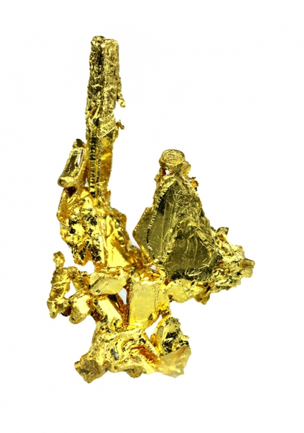
| ⓘ Gold Formula: Au Localities: Reported from at least 35 localities in this region. Reference: U.S. Geological Survey, 2005, Mineral Resources Data System: U.S. Geological Survey, Reston, Virginia. |
| ⓘ Graphite Formula: C Reference: U.S. Geological Survey, 2005, Mineral Resources Data System: U.S. Geological Survey, Reston, Virginia. |
| ⓘ Magnetite Formula: Fe2+Fe3+2O4 Reference: U.S. Geological Survey, 2005, Mineral Resources Data System: U.S. Geological Survey, Reston, Virginia. |
| ⓘ 'Manganese Oxides' Reference: USGS (2005), Mineral Resources Data System (MRDS): U.S. Geological Survey, Reston, Virginia, loc. file ID #10034882. |
| ⓘ Manganite Formula: Mn3+O(OH) Reference: U.S. Geological Survey, 2005, Mineral Resources Data System: U.S. Geological Survey, Reston, Virginia. |
| ⓘ Muscovite Formula: KAl2(AlSi3O10)(OH)2 Description: Occurs as sericite schist or phyllite. Reference: USGS (2005), Mineral Resources Data System (MRDS): U.S. Geological Survey, Reston, Virginia, loc. file ID #10110842. |
| ⓘ Muscovite var. Sericite Formula: KAl2(AlSi3O10)(OH)2 Description: Occurs as sericite schist or phyllite. Reference: USGS (2005), Mineral Resources Data System (MRDS): U.S. Geological Survey, Reston, Virginia, loc. file ID #10110842. |
| ⓘ Nontronite Formula: Na0.3Fe2((Si,Al)4O10)(OH)2 · nH2O Locality: Unnamed Nontronite occurrence [1], Bath, Forest Hill Mining District, Placer Co., California, USA Reference: Hanks, Henry Garber (1886), Sixth report of the State Mineralogist: California Mining Bureau. Report 6 part 1, 145 pp.: 100; Murdoch, Joseph & Robert W. Webb (1966), Minerals of California, Centennial Volume (1866-1966): California Division Mines & Geology Bulletin 189: 280. |
| ⓘ 'Psilomelane' Localities: Gold Hill Mine (Crown Point Mine), Yankee Jims, Forest Hill Mining District, Placer Co., California, USA Pettigrew-Stafford Mine (Pettigrew - Stafford lease; Gray lease), Yankee Jims, Forest Hill Mining District, Placer Co., California, USA Randel claim No. 1 (American; Tilsley and Coplen claim; Tilsey & Coplen group [of WWI]), Yankee Jims, Forest Hill Mining District, Placer Co., California, USA Reference: U.S. Geological Survey, 2005, Mineral Resources Data System: U.S. Geological Survey, Reston, Virginia. |
| ⓘ Pyrolusite Formula: Mn4+O2 Localities: Gold Hill Mine (Crown Point Mine), Yankee Jims, Forest Hill Mining District, Placer Co., California, USA Pettigrew-Stafford Mine (Pettigrew - Stafford lease; Gray lease), Yankee Jims, Forest Hill Mining District, Placer Co., California, USA Randel claim No. 1 (American; Tilsley and Coplen claim; Tilsey & Coplen group [of WWI]), Yankee Jims, Forest Hill Mining District, Placer Co., California, USA Reference: Trask, Parker Davies (1950) Geologic description of the manganese deposits of California. California Division of Mines Bulletin 152, 378 pp.: 169-171; Pemberton, H. Earl (1983), Minerals of California; Van Nostrand Reinholt Press: 165. |
| ⓘ 'Pyroxene Group' Formula: ADSi2O6 Reference: USGS (2005), Mineral Resources Data System (MRDS): U.S. Geological Survey, Reston, Virginia, loc. file ID #10261204. |
| ⓘ Quartz Formula: SiO2 Localities: Reported from at least 18 localities in this region. Reference: U.S. Geological Survey, 2005, Mineral Resources Data System: U.S. Geological Survey, Reston, Virginia. |
| ⓘ Rhodonite Formula: CaMn3Mn[Si5O15] Localities: Randel claim No. 1 (American; Tilsley and Coplen claim; Tilsey & Coplen group [of WWI]), Yankee Jims, Forest Hill Mining District, Placer Co., California, USA Foresthill, Forest Hill Mining District, Placer Co., California, USA Gold Hill Mine (Crown Point Mine), Yankee Jims, Forest Hill Mining District, Placer Co., California, USA Reference: Trask, Parker Davies (1950) Geologic description of the manganese deposits of California. California Division of Mines Bulletin 152, 378 pp.: 169-172; Pemberton, H. Earl (1983), Minerals of California; Van Nostrand Reinholt Press: 413. |
| ⓘ 'Serpentine Subgroup' Formula: D3[Si2O5](OH)4 Localities: Reference: USGS (2005), Mineral Resources Data System (MRDS): U.S. Geological Survey, Reston, Virginia, loc. file ID #10261204. |
| ⓘ Talc Formula: Mg3Si4O10(OH)2 Localities: Reference: U.S. Geological Survey, 2005, Mineral Resources Data System: U.S. Geological Survey, Reston, Virginia. |
| ⓘ Uvarovite Formula: Ca3Cr2(SiO4)3 Reference: Rynearson, Garn Arthur (1953), Chromite deposits in the northern Sierra Nevada, California. California Division of Mines and Geology Bulletin 134, part 3 chapter 5: 230; Pemberton, H. Earl (1983), Minerals of California; Van Nostrand Reinholt Press: 497. |

List of minerals arranged by Strunz 10th Edition classification
| Group 1 - Elements | |||
|---|---|---|---|
| ⓘ | Diamond | 1.CB.10a | C |
| ⓘ | Gold | 1.AA.05 | Au |
| ⓘ | Graphite | 1.CB.05a | C |
| Group 4 - Oxides and Hydroxides | |||
| ⓘ | Chromite | 4.BB.05 | Fe2+Cr3+2O4 |
| ⓘ | Magnetite | 4.BB.05 | Fe2+Fe3+2O4 |
| ⓘ | Manganite | 4.FD.15 | Mn3+O(OH) |
| ⓘ | Pyrolusite | 4.DB.05 | Mn4+O2 |
| ⓘ | Quartz | 4.DA.05 | SiO2 |
| Group 5 - Nitrates and Carbonates | |||
| ⓘ | Ankerite | 5.AB.10 | Ca(Fe2+,Mg)(CO3)2 |
| Group 9 - Silicates | |||
| ⓘ | Muscovite | 9.EC.15 | KAl2(AlSi3O10)(OH)2 |
| ⓘ | var. Sericite | 9.EC.15 | KAl2(AlSi3O10)(OH)2 |
| ⓘ | Nontronite | 9.EC.40 | Na0.3Fe2((Si,Al)4O10)(OH)2 · nH2O |
| ⓘ | Rhodonite | 9.DK.05 | CaMn3Mn[Si5O15] |
| ⓘ | Talc | 9.EC.05 | Mg3Si4O10(OH)2 |
| ⓘ | Uvarovite | 9.AD.25 | Ca3Cr2(SiO4)3 |
| Unclassified Minerals, Rocks, etc. | |||
| ⓘ | 'Amphibole Supergroup' | - | AB2C5((Si,Al,Ti)8O22)(OH,F,Cl,O)2 |
| ⓘ | 'Asbestos' | - | |
| ⓘ | 'Fayalite-Forsterite Series' | - | |
| ⓘ | 'Manganese Oxides' | - | |
| ⓘ | 'Psilomelane' | - | |
| ⓘ | 'Pyroxene Group' | - | ADSi2O6 |
| ⓘ | 'Serpentine Subgroup' | - | D3[Si2O5](OH)4 |
List of minerals for each chemical element
| H | Hydrogen | |
|---|---|---|
| H | ⓘ Manganite | Mn3+O(OH) |
| H | ⓘ Talc | Mg3Si4O10(OH)2 |
| H | ⓘ Nontronite | Na0.3Fe2((Si,Al)4O10)(OH)2 · nH2O |
| H | ⓘ Muscovite var. Sericite | KAl2(AlSi3O10)(OH)2 |
| H | ⓘ Serpentine Subgroup | D3[Si2O5](OH)4 |
| H | ⓘ Amphibole Supergroup | AB2C5((Si,Al,Ti)8O22)(OH,F,Cl,O)2 |
| H | ⓘ Muscovite | KAl2(AlSi3O10)(OH)2 |
| C | Carbon | |
| C | ⓘ Diamond | C |
| C | ⓘ Ankerite | Ca(Fe2+,Mg)(CO3)2 |
| C | ⓘ Graphite | C |
| O | Oxygen | |
| O | ⓘ Quartz | SiO2 |
| O | ⓘ Chromite | Fe2+Cr23+O4 |
| O | ⓘ Ankerite | Ca(Fe2+,Mg)(CO3)2 |
| O | ⓘ Magnetite | Fe2+Fe23+O4 |
| O | ⓘ Uvarovite | Ca3Cr2(SiO4)3 |
| O | ⓘ Pyrolusite | Mn4+O2 |
| O | ⓘ Manganite | Mn3+O(OH) |
| O | ⓘ Talc | Mg3Si4O10(OH)2 |
| O | ⓘ Rhodonite | CaMn3Mn[Si5O15] |
| O | ⓘ Nontronite | Na0.3Fe2((Si,Al)4O10)(OH)2 · nH2O |
| O | ⓘ Muscovite var. Sericite | KAl2(AlSi3O10)(OH)2 |
| O | ⓘ Pyroxene Group | ADSi2O6 |
| O | ⓘ Serpentine Subgroup | D3[Si2O5](OH)4 |
| O | ⓘ Amphibole Supergroup | AB2C5((Si,Al,Ti)8O22)(OH,F,Cl,O)2 |
| O | ⓘ Muscovite | KAl2(AlSi3O10)(OH)2 |
| F | Fluorine | |
| F | ⓘ Amphibole Supergroup | AB2C5((Si,Al,Ti)8O22)(OH,F,Cl,O)2 |
| Na | Sodium | |
| Na | ⓘ Nontronite | Na0.3Fe2((Si,Al)4O10)(OH)2 · nH2O |
| Mg | Magnesium | |
| Mg | ⓘ Ankerite | Ca(Fe2+,Mg)(CO3)2 |
| Mg | ⓘ Talc | Mg3Si4O10(OH)2 |
| Al | Aluminium | |
| Al | ⓘ Nontronite | Na0.3Fe2((Si,Al)4O10)(OH)2 · nH2O |
| Al | ⓘ Muscovite var. Sericite | KAl2(AlSi3O10)(OH)2 |
| Al | ⓘ Amphibole Supergroup | AB2C5((Si,Al,Ti)8O22)(OH,F,Cl,O)2 |
| Al | ⓘ Muscovite | KAl2(AlSi3O10)(OH)2 |
| Si | Silicon | |
| Si | ⓘ Quartz | SiO2 |
| Si | ⓘ Uvarovite | Ca3Cr2(SiO4)3 |
| Si | ⓘ Talc | Mg3Si4O10(OH)2 |
| Si | ⓘ Rhodonite | CaMn3Mn[Si5O15] |
| Si | ⓘ Nontronite | Na0.3Fe2((Si,Al)4O10)(OH)2 · nH2O |
| Si | ⓘ Muscovite var. Sericite | KAl2(AlSi3O10)(OH)2 |
| Si | ⓘ Pyroxene Group | ADSi2O6 |
| Si | ⓘ Serpentine Subgroup | D3[Si2O5](OH)4 |
| Si | ⓘ Amphibole Supergroup | AB2C5((Si,Al,Ti)8O22)(OH,F,Cl,O)2 |
| Si | ⓘ Muscovite | KAl2(AlSi3O10)(OH)2 |
| Cl | Chlorine | |
| Cl | ⓘ Amphibole Supergroup | AB2C5((Si,Al,Ti)8O22)(OH,F,Cl,O)2 |
| K | Potassium | |
| K | ⓘ Muscovite var. Sericite | KAl2(AlSi3O10)(OH)2 |
| K | ⓘ Muscovite | KAl2(AlSi3O10)(OH)2 |
| Ca | Calcium | |
| Ca | ⓘ Ankerite | Ca(Fe2+,Mg)(CO3)2 |
| Ca | ⓘ Uvarovite | Ca3Cr2(SiO4)3 |
| Ca | ⓘ Rhodonite | CaMn3Mn[Si5O15] |
| Ti | Titanium | |
| Ti | ⓘ Amphibole Supergroup | AB2C5((Si,Al,Ti)8O22)(OH,F,Cl,O)2 |
| Cr | Chromium | |
| Cr | ⓘ Chromite | Fe2+Cr23+O4 |
| Cr | ⓘ Uvarovite | Ca3Cr2(SiO4)3 |
| Mn | Manganese | |
| Mn | ⓘ Pyrolusite | Mn4+O2 |
| Mn | ⓘ Manganite | Mn3+O(OH) |
| Mn | ⓘ Rhodonite | CaMn3Mn[Si5O15] |
| Fe | Iron | |
| Fe | ⓘ Chromite | Fe2+Cr23+O4 |
| Fe | ⓘ Ankerite | Ca(Fe2+,Mg)(CO3)2 |
| Fe | ⓘ Magnetite | Fe2+Fe23+O4 |
| Fe | ⓘ Nontronite | Na0.3Fe2((Si,Al)4O10)(OH)2 · nH2O |
| Au | Gold | |
| Au | ⓘ Gold | Au |
References
Sort by
Year (asc) Year (desc) Author (A-Z) Author (Z-A)Irelan, William, Jr. (1888), Dardanelles, Boker Divide, and Breece and Wheeler Mines: California Mining Bureau. (Report. 8): 8: 464-468.
Browne, Ross E. (1890), Ancient river beds of the Forest Hill Divide: California Mining Bureau. (Report 10): 10: 435-465.
Lindgren, Waldemar (1900), Description of the Colfax sheet, California: USGS Geological Atlas, Colfax folio (Folio No. 66), 10 pp.
Lindgren, Waldemar (1911), The Tertiary gravels of the Sierra Nevada of California: USGS Professional Paper 73, 226 pp.: 149-151.
Waring, Clarence A. (1919), Placer County, Forest Hill district: California Mining Bureau (Report 15): 16: 317.
Jarmin, Arthur (1927), Forest Hill and south side Forest Hill, Report of the Hydraulic Mining Commission upon the feasibility of the resumption of hydraulic mining in California: California Division of Mines 23rd Report of the State Mineralogist: 88, 91-92.
Ellsworth, E. W. (1933), Tracing buried-river channel deposits by geomagnetic methods: California Division of Mines Report 29 (Report 29): 29: 244—250.
Logan, Clarence August (1936), Mayflower and Paragon Mines, Gold Mines of Placer County: California Journal of Mines and Geology, California Division Mines (Report 32): 32(1): 55, 69, 73-75.
Chandra, Deb K. (1961) Geology and mineral deposits of the Colfax and Foresthill quadrangles, California. Special Report 67, California Division of Mines, 50 pp.
USGS (2005), Mineral Resources Data System (MRDS): U.S. Geological Survey, Reston, Virginia, loc. file ID #10310614.
USGS quadrangle Foresthill, California, 7.5 minute topo map.
Localities in this Region
- California
- Placer Co.
- Forest Hill Mining District
- Bath
- Baker Divide Mine
- Black & Brown occurrence
- Black Hawk placer
- Breece & Wheeler Placer Mine (Paragon Mine; Paragon prospect)
- Canothos placer
- Duffey Lease Mine
- Lehigh Canyon Patent property (Poco Tiempo Quartz Mine; Buttercup Chrome occurrence)
- Lehigh placer
- Marigold Mine
- Pioneer Slope placer
- Spanish Mines Consolidated Mine (Spanish Mines Cons.; Garrison claim; Spanish claim; Esmeralda claim)
- Unnamed Nontronite occurrence [1]
- Volcano Mine
- Washout claim
- Foresthill
- Baltimore Mine
- Big Spring Placer Mine
- Black Rock Chrome deposit
- California and Virginia Mine (California & Virginia Placer Mines)
- Chrome Divide Mine (Mystery Mine)
- Dardanelles Placer Mine (Oro & Dardanelles)
- Dewey and Stocker Mine (Dewey & Stocker; Burt Mine)
- Doherty Mine
- Donna's Stake occurrence
- Dry Hill and Blue Jay Mine (Dry Hill Mine)
- E. A. Garrison prospects
- El Dorado Mine
- Eva Lode Mine
- Ferrier Diggings Mine (Johnny Rafael Mine)
- Florida & Tilton placer (Florida)
- Homestake Mine [1]
- Independent Placer Mine (Jenny Lind Mine; New Jersey Mine)
- Iowa Hill placer
- Ladies Canyon placer
- Little Greek claims
- Lucky Strike Mine (Lucky Strike occurrence [1])
- Marigold Placer Mine
- Mascot placer (Excelsior; Baltimore)
- Maus tunnel
- Mosquito Ridge Mine (AKA: Unknown)
- Moss Ledge Mine
- Pegasus Mine
- Rio Del Oro Mine
- Rough & Ready placer
- Sellier Mine
- Three Queens Mine (Four Acres Mine)
- Thundering Bar Placer Mine
- Two unnamed Au prospects [1]
- Unnamed Au location [2]
- Unnamed Au Mine [3]
- Unnamed Au mine [34]
- Unnamed Au prospect [4]
- Unnamed Au prospect [5]
- Unnamed Au prospects [89]
- Unspecified Diamond occurrences [1]
- Washington Mine
- West Quartz Mine
- Bath
- Forest Hill Mining District
- Placer Co.
- California
- Placer Co.
- Forest Hill Mining District
- Gas Canyon
- Todd Valley
- Big Bend Placer Mine
- Bisbee Mine
- Bowman Mine
- Buckhorn occurrence
- Burner prospect
- California Chief Development Company property (Calif. Chief Development Co.)
- Derby and Wild Cat occurrence (Derby & Wild Cat)
- Diana occurrence
- Dodds Ranch prospect (Dodds Ranch deposit)
- Dorr placer
- Duffy property
- Effie Placer Mine
- Eureka Consolidated Mine (Eureka Cons.; Eureka No. 1 claim; Eureka No. 2 claim; Eureka Extension No. 1 claim; Buttes Extension claim; Hathaway claim; Kirkland claim)
- Farmer property
- Farnier occurrence
- Fiddler's Green deposit (Farmer property)
- Garbe and De Maria Mine (Dry Hill; Blue Jay)
- Garden Springs Consolidated
- Gas Canyon claim
- Green deposit (Americus deposit; Farmer property)
- Hosmer occurrence
- Maria No. 2 Mine
- Mountain Tunnel placer
- New Black Jack Mine
- Owl Creek Mine
- Peckham Hill Gold Mines Inc. (Peckham Hill Mine)
- Pond pit (Pond & Company Mine)
- Rainy Day Placer Mine
- Shenanigan Mine
- Unnamed Au mine [37]
- Unnamed Au mine [39]
- Unnamed Au occurrence [47]
- Unnamed Au occurrence [65]
- Unnamed Au pit [32]
- Walsh occurrence
- Yankee Jims
- Anthony Clark tunnels
- Armbruster Mine
- Ben Franklin Mine
- Buchanan placer
- Dow placer
- Emma deposit
- Georgia Hill Mines
- Gillespie occurrence
- Gold Hill Mine (Crown Point Mine)
- Grey Eagle Mine
- Homestake Placer Mine [2]
- Jordan occurrence
- Mayflower Gravel Mining Company Mine (Mayflower Mine)
- Missouri placer
- Pettigrew-Stafford Mine (Pettigrew - Stafford lease; Gray lease)
- Randel claim No. 1 (American; Tilsley and Coplen claim; Tilsey & Coplen group [of WWI])
- San Francisco placer
- Smiths Point
- St. George placer
- Yankee Jims placer
- Yankee Jims prospect (Yankee Jims deposit; Lee deposit)
- Forest Hill Mining District
- Placer Co.
Other Regions, Features and Areas containing this locality
This page contains all mineral locality references listed on mindat.org. This does not claim to be a complete list. If you know of more minerals from this site, please register so you can add to our database. This locality information is for reference purposes only. You should never attempt to
visit any sites listed in mindat.org without first ensuring that you have the permission of the land and/or mineral rights holders
for access and that you are aware of all safety precautions necessary.


Garbe and De Maria Mine, Todd Valley, Forest Hill Mining District, Placer Co., California, USA