| Locality | Latitude | Longitude | Distance | Bearing |
|---|
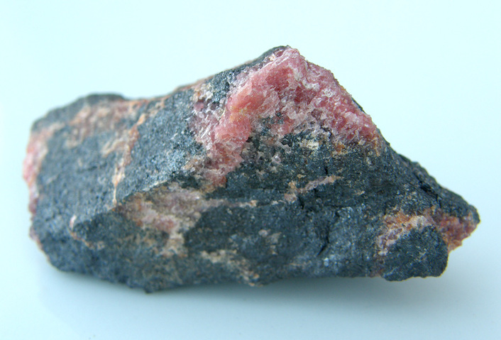
| Brandsnuten manganese deposit, Botnedal, Tokke, Telemark, Norway | 59° 30' 10" N | 7° 39' 51" E | 0.0km (0.0 miles) | |
| Botnedal, Tokke, Telemark, Norway | 59° 29' 33" N | 7° 44' 15" E | 4.3km (2.7 miles) | |
| Bessevatn, Tokke, Telemark, Norway | 59° 29' 35" N | 7° 52' 20" E | 11.8km (7.3 miles) | |
| Folurdi, Tokke, Telemark, Norway | 59° 23' 29" N | 7° 38' 15" E | 12.5km (7.7 miles) | |
| Haukås, Tokke, Telemark, Norway | 59° 35' 32" N | 7° 49' 10" E | 13.2km (8.2 miles) | |
| Kaldevassdalen, Tokke, Telemark, Norway | 59° 22' 10" N | 7° 37' 34" E | 15.0km (9.3 miles) | |
| Berdal Copper Prospect, Vinje, Telemark, Norway | 59° 32' 11" N | 7° 56' 40" E | 16.2km (10.1 miles) | |
| Vein No. 1, Riplusdalsnuten deposit, Skafså, Tokke, Telemark, Norway | 59° 25' 1" N | 7° 55' 18" E | 17.4km (10.8 miles) | |
| Vein No. 4 - upper adit, Riplusdalsnuten deposit, Skafså, Tokke, Telemark, Norway | 59° 25' 0" N | 7° 55' 19" E | 17.4km (10.8 miles) | |
| Working No. 5 - lower adit, Riplusdalsnuten deposit, Skafså, Tokke, Telemark, Norway | 59° 24' 58" N | 7° 55' 21" E | 17.5km (10.9 miles) | |
| Vistadmoen prospect, Tokke, Telemark, Norway | 59° 27' 0" N | 7° 57' 21" E | 17.5km (10.9 miles) | |
| Hovden, Bykle, Agder, Norway | 59° 33' 37" N | 7° 21' 24" E | 18.5km (11.5 miles) | |
| Hartevatn Ouarry, Hovden, Bykle, Agder, Norway | 59° 33' 25" N | 7° 19' 51" E | 19.7km (12.3 miles) | |
| Askom lower adit, Dalen Molybdenum and Copper Mines, Dalen, Tokke, Telemark, Norway | 59° 27' 10" N | 8° 0' 18" E | 20.0km (12.4 miles) | |
| Åmot, Vinje, Telemark, Norway | 59° 34' 8" N | 7° 59' 42" E | 20.0km (12.5 miles) | |
| Dalen Main mine, Dalen Molybdenum and Copper Mines, Dalen, Tokke, Telemark, Norway | 59° 27' 5" N | 8° 0' 23" E | 20.2km (12.5 miles) | |
| Dalen, Tokke, Telemark, Norway | 59° 26' 26" N | 8° 0' 6" E | 20.3km (12.6 miles) | |
| Hovdenuten manganese deposit, Hovden, Bykle, Agder, Norway | 59° 33' 45" N | 7° 19' 18" E | 20.4km (12.7 miles) | |
| Eidsborg, Tokke, Telemark, Norway | 59° 27' 54" N | 8° 1' 14" E | 20.6km (12.8 miles) | |
| Road 450 roadcut, Eidsborg, Tokke, Telemark, Norway | 59° 27' 57" N | 8° 1' 26" E | 20.7km (12.9 miles) | |
| Eidsborg whetstone quarries, Eidsborg, Tokke, Telemark, Norway | 59° 28' 17" N | 8° 2' 2" E | 21.2km (13.1 miles) | |
| Tveiten Mine, Tokke, Telemark, Norway | 59° 24' 0" N | 7° 59' 47" E | 22.0km (13.7 miles) | |
| Skafså, Tokke, Telemark, Norway | 59° 24' 17" N | 8° 0' 21" E | 22.2km (13.8 miles) | |
| Oberstløynantskjerpet, Fjellgardane, Fyresdal, Telemark, Norway | 59° 20' 2" N | 7° 52' 26" E | 22.2km (13.8 miles) | |
| Åmli Prospect, Tokke, Telemark, Norway | 59° 23' 11" N | 7° 59' 14" E | 22.4km (13.9 miles) | |
| Aslestad Copper Prospect, Moisesberg Mines, Fyresdal, Telemark, Norway | 59° 19' 49" N | 7° 53' 13" E | 22.9km (14.3 miles) | |
| Slystøyl Copper Prospect, Moisesberg Mines, Fyresdal, Telemark, Norway | 59° 19' 24" N | 7° 52' 43" E | 23.3km (14.5 miles) | |
| Tveitsto fluorite Mine, Dalen, Tokke, Telemark, Norway | 59° 25' 42" N | 8° 3' 8" E | 23.4km (14.6 miles) | |
| Grusen Mine, Moisesberg Mines, Fyresdal, Telemark, Norway | 59° 18' 51" N | 7° 52' 6" E | 23.9km (14.9 miles) | |
| Revstøyl asbestos locality, Tokke, Telemark, Norway | 59° 29' 57" N | 8° 5' 20" E | 24.0km (14.9 miles) | |


Brandsnuten manganese deposit, Botnedal, Tokke, Telemark, Norway