| Locality | Latitude | Longitude | Distance | Bearing |
|---|
| Wejh, Tabuk Region, Saudi Arabia | 26° 14' 11" N | 36° 28' 8" E | 1.9km (1.2 miles) | |
| Jaydah Intrusion, Tabuk Region, Saudi Arabia | 26° 10' 0" N | 37° 1' 0" E | 57.0km (35.4 miles) | |
| Numran Intrusion, Tabuk Region, Saudi Arabia | 27° 1' 0" N | 36° 38' 59" E | 88.0km (54.7 miles) | |
| Jabal Ash Shizm, Medina Region, Saudi Arabia | 26° 26' 59" N | 37° 31' 59" E | 110.1km (68.4 miles) | |
| Raydan Pluton, Tabuk Region, Saudi Arabia | 27° 15' 0" N | 36° 15' 0" E | 113.5km (70.5 miles) | |
| Harrat Ar Rahah and Harrat Al Uwayrid Lava Fields, Medina Region, Saudi Arabia | 27° 19' 59" N | 36° 58' 59" E | 131.9km (82.0 miles) | |
| Massah Intrusion, Tabuk Region, Saudi Arabia | 27° 23' 59" N | 36° 0' 0" E | 136.0km (84.5 miles) | |
| Qaraqir Peralkaline Granite, Tabuk Region, Saudi Arabia | 27° 34' 59" N | 36° 22' 59" E | 148.9km (92.5 miles) | |
| Hedjaz meteorite (Et-tlahi), Tabuk Region, Saudi Arabia | 27° 36' 0" N | 35° 40' 0" E | 169.6km (105.4 miles) | |
| Kebrit Deep, Red Sea | 24° 43' 23" N | 36° 16' 36" E | 170.2km (105.7 miles) | |
| Jabal Shar Intrusion, Tabuk Region, Saudi Arabia | 27° 40' 0" N | 35° 42' 0" E | 174.7km (108.6 miles) | |
| Al ‘Ays ophiolite complex, Medina Region, Saudi Arabia | 25° 19' 59" N | 38° 4' 59" E | 192.2km (119.4 miles) | |
| Marsa Alam, Red Sea Governorate, Egypt | 25° 3' 58" N | 34° 53' 21" E | 204.3km (126.9 miles) | |
| Jabal Dabbagh Granite Pluton, Tabuk Region, Saudi Arabia | 27° 55' 59" N | 35° 37' 59" E | 204.4km (127.0 miles) | |
| Um Rus Mine, Red Sea Governorate, Egypt | 25° 28' 0" N | 34° 34' 59" E | 206.1km (128.1 miles) | |
| Um Gheig Lead-Zinc Mine, Red Sea Governorate, Egypt | 25° 43' 0" N | 34° 28' 0" E | 207.0km (128.6 miles) | |
| Abu Dabbab Ta-Sn deposit, Abu Dabbab Massif, Red Sea Governorate, Egypt | 25° 20' 45" N | 34° 32' 39" E | 215.6km (134.0 miles) | |
| Quaria Tin deposit, Abu Dabbab Massif, Red Sea Governorate, Egypt | 25° 20' 7" N | 34° 32' 36" E | 216.3km (134.4 miles) | |
| Mubarak Tin deposit, Abu Dabbab Massif, Red Sea Governorate, Egypt | 25° 21' 0" N | 34° 31' 45" E | 216.7km (134.7 miles) | |
| Sukari North Extension, Sukari gold mine, Marsa Alam, Red Sea Governorate, Egypt | 24° 59' 54" N | 34° 45' 0" E | 219.9km (136.6 miles) | |
| Wadi Alam 1, Sukari gold mine, Marsa Alam, Red Sea Governorate, Egypt | 24° 57' 54" N | 34° 46' 32" E | 220.3km (136.9 miles) | |
| Sukari North, Sukari gold mine, Marsa Alam, Red Sea Governorate, Egypt | 24° 59' 29" N | 34° 45' 3" E | 220.3km (136.9 miles) | |
| Wadi Alam 2, Sukari gold mine, Marsa Alam, Red Sea Governorate, Egypt | 24° 57' 30" N | 34° 46' 27" E | 220.9km (137.3 miles) | |
| Sukari North 2, Sukari gold mine, Marsa Alam, Red Sea Governorate, Egypt | 24° 59' 49" N | 34° 44' 15" E | 221.0km (137.3 miles) | |
| V-Shear East 1, Sukari gold mine, Marsa Alam, Red Sea Governorate, Egypt | 24° 58' 4" N | 34° 45' 44" E | 221.1km (137.4 miles) | |
| V-Shear East 2, Sukari gold mine, Marsa Alam, Red Sea Governorate, Egypt | 24° 57' 44" N | 34° 45' 2" E | 222.4km (138.2 miles) | |
| Sukari North 1, Sukari gold mine, Marsa Alam, Red Sea Governorate, Egypt | 24° 58' 31" N | 34° 44' 15" E | 222.5km (138.3 miles) | |
| V-Shear East 3, Sukari gold mine, Marsa Alam, Red Sea Governorate, Egypt | 24° 57' 21" N | 34° 45' 19" E | 222.5km (138.3 miles) | |
| Abu Dabbab Massif, Red Sea Governorate, Egypt | 25° 19' 1" N | 34° 28' 8" E | 223.8km (139.1 miles) | |
| Wadi Um Tunduba, Sukari gold mine, Marsa Alam, Red Sea Governorate, Egypt | 24° 55' 25" N | 34° 46' 3" E | 223.9km (139.2 miles) | |

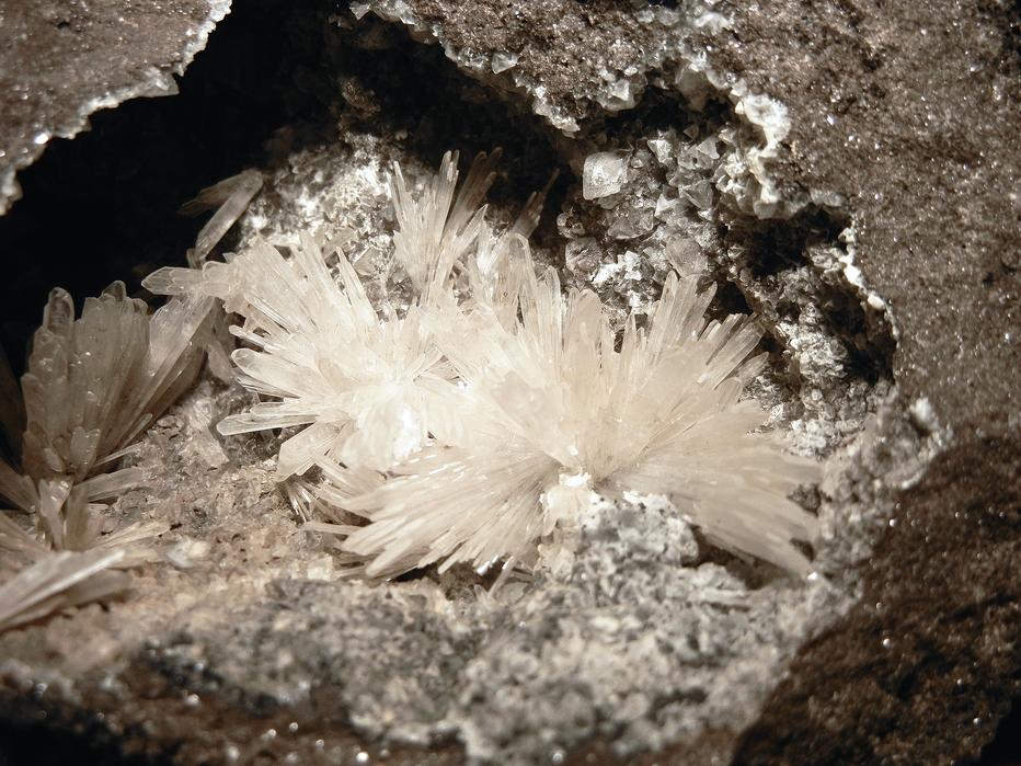


Mahd Adh Dhahab Mine, Wejh, Tabuk Region, Saudi Arabia