| Locality | Latitude | Longitude | Distance | Bearing |
|---|
| Chimney Rock Gorge, Bridgewater Township, Somerset County, New Jersey, USA | 40° 34' 50" N | 74° 33' 27" W | 2.1km (1.3 miles) | |
| Chimney Rock (Geographical feature), Bridgewater Township, Somerset County, New Jersey, USA | 40° 34' 59" N | 74° 33' 24" W | 2.3km (1.4 miles) | |
| Chimney Rock Copper Mine, Bridgewater Township, Somerset County, New Jersey, USA | 40° 34' 57" N | 74° 33' 29" W | 2.3km (1.4 miles) | |
| Washington Mine, Bridgewater Township, Somerset County, New Jersey, USA | 40° 34' 57" N | 74° 33' 38" W | 2.5km (1.5 miles) | |
| Chimney Rock Quarry, Bridgewater Township, Somerset County, New Jersey, USA | 40° 35' 4" N | 74° 33' 55" W | 2.9km (1.8 miles) | |
| Martinsville, Bridgewater Township, Somerset County, New Jersey, USA | 40° 36' 0" N | 74° 32' 59" W | 3.6km (2.3 miles) | |
| Green Valley, Middlesex County, New Jersey, USA | 40° 34' 59" N | 74° 30' 0" W | 3.6km (2.3 miles) | |
| Dock Watch Quarry, Warren Township, Somerset County, New Jersey, USA | 40° 36' 16" N | 74° 32' 11" W | 4.0km (2.5 miles) | |
| Bolmer Copper prospect, Martinsville, Bridgewater Township, Somerset County, New Jersey, USA | 40° 35' 58" N | 74° 34' 36" W | 4.7km (2.9 miles) | |
| Raritan River, Piscataway Township, Middlesex County, New Jersey, USA | 40° 31' 59" N | 74° 30' 0" W | 5.1km (3.2 miles) | |
| E.E. Cooper Quarry, Green Brook Township, Somerset County, New Jersey, USA | 40° 35' 59" N | 74° 28' 59" W | 5.8km (3.6 miles) | |
| Warrenville, Warren Township, Somerset County, New Jersey, USA | 40° 36' 54" N | 74° 29' 45" W | 6.3km (3.9 miles) | |
| Piscataway, Piscataway Township, Middlesex County, New Jersey, USA | 40° 32' 46" N | 74° 27' 57" W | 6.6km (4.1 miles) | |
| Fields' Copper Mine (Field Mine), Warrenville, Warren Township, Somerset County, New Jersey, USA | 40° 36' 54" N | 74° 29' 21" W | 6.6km (4.1 miles) | |
| George Drake farm, Newtown, Piscataway Township, Middlesex County, New Jersey, USA | 40° 33' 6" N | 74° 27' 38" W | 6.8km (4.2 miles) | |
| Newtown, Piscataway Township, Middlesex County, New Jersey, USA | 40° 33' 6" N | 74° 27' 38" W | 6.8km (4.2 miles) | |
| American Mine (Alpha Copper Mine; Bridgewater Mine; Somerville Mine; Somerville deposit), Bridgewater Township, Somerset County, New Jersey, USA | 40° 36' 54" N | 74° 37' 0" W | 8.4km (5.2 miles) | |
| Stirling Brook ("Carnelian Creek"), Warren Township, Somerset County, New Jersey, USA | 40° 38' 37" N | 74° 28' 27" W | 10.0km (6.2 miles) | |
| Voorhees, Franklin Township, Somerset County, New Jersey, USA | 40° 28' 59" N | 74° 28' 59" W | 10.5km (6.6 miles) | |
| Wilson's Quarry (Wilson Stone Co. Quarry), Watchung, Somerset County, New Jersey, USA | 40° 38' 2" N | 74° 26' 41" W | 10.7km (6.7 miles) | |
| Compton's Quarry, Bridgewater Township, Somerset County, New Jersey, USA | 40° 38' 0" N | 74° 37' 59" W | 10.8km (6.7 miles) | |
| Liberty Corner, Bernards Township, Somerset County, New Jersey, USA | 40° 39' 53" N | 74° 34' 38" W | 11.2km (7.0 miles) | |
| Hoffman Mine, Sunset Lake, Bridgewater Township, Somerset County, New Jersey, USA | 40° 38' 32" N | 74° 37' 46" W | 11.3km (7.0 miles) | |
| Smalley Stone Co. Quarry, North Plainfield, Somerset County, New Jersey, USA | 40° 37' 48" N | 74° 25' 40" W | 11.6km (7.2 miles) | |
| Somerset Street basement excavation, New Brunswick, Middlesex County, New Jersey, USA | 40° 29' 9" N | 74° 27' 7" W | 11.7km (7.3 miles) | |
| Burnt Woods, New Brunswick, Middlesex County, New Jersey, USA | 40° 28' 59" N | 74° 27' 0" W | 12.1km (7.5 miles) | |
| New Brunswick Mine (French Mine), New Brunswick, Middlesex County, New Jersey, USA | 40° 28' 59" N | 74° 27' 0" W | 12.1km (7.5 miles) | |
| Pluckemin Copper Mine, Pluckemin, Bedminster Township, Somerset County, New Jersey, USA | 40° 38' 44" N | 74° 38' 21" W | 12.1km (7.5 miles) | |
| Pluckemin, Bedminster Township, Somerset County, New Jersey, USA | 40° 38' 44" N | 74° 38' 21" W | 12.1km (7.5 miles) | |
| North Branch, Branchburg Township, Somerset County, New Jersey, USA | 40° 35' 59" N | 74° 40' 40" W | 12.3km (7.6 miles) | |
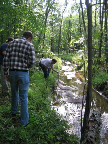


Stirling Brook, Warren Township, Somerset County, New Jersey, USA