Ubehebe Mine [1](Copper Bell Mine; Ubehebe Lead Mine), Teakettle Junction, Ubehebe Mining District, Cottonwood Mountains, Panamint Mts (Panamint Range), Inyo County, California, USAi
| Regional Level Types | |
|---|---|
| Ubehebe Mine [1](Copper Bell Mine; Ubehebe Lead Mine) | - not defined - |
| Teakettle Junction | - not defined - |
| Ubehebe Mining District | Mining District |
| Cottonwood Mountains | Mountain Range |
| Panamint Mts (Panamint Range) | Mountain Range |
| Inyo County | County |
| California | State |
| USA | Country |
This page is currently not sponsored. Click here to sponsor this page.


Latitude & Longitude (WGS84):
36° 44' 51'' North , 117° 34' 42'' West
Latitude & Longitude (decimal):
Köppen climate type:
Nearest Clubs:
Local clubs are the best way to get access to collecting localities
Local clubs are the best way to get access to collecting localities
| Club | Location | Distance |
|---|---|---|
| Lone Pine Gem & Mineral Society | Lone Pine, California | 46km |
Mindat Locality ID:
25095
Long-form identifier:
mindat:1:2:25095:4
GUID (UUID V4):
f2477b3c-a3ee-4b07-adc0-7c0956e680c7
A former Pb-Zn-Ag-Cu-Zn mine located in SE¼ sec. 1 and sec. 2, T14S, R40E, MDM, 3.0 km (1.9 miles) WSW of Teakettle Junction, and 6.3 km (3.9 miles) N of Ubehebe Peak at the NW corner of Racetrack Valley, on National Park Service wilderness land (Death Valley National Park/Death Valley Wilderness). Discovered in 1906. MRDS database stated accuracy for this location is 10 meters.
The Ubehebe copper/lead Mine is reached via a one-lane gravel access road leading west off the Racetrack Valley Road about twenty-five miles south of Ubehebe Crater, the mine area lying off the northwest corner of Racetrack Valley. Dozer activity can be seen at the Copper Bell Mine site just north of the junction of the Ubehebe Mine and Racetrack Valley roads. The mine access ends after about one mile in the vicinity of the abandoned mine camp and main adit portal.
The camp consists of two frame and composition-paper shacks extensively damaged by weathering, washing, and obvious vandalism. West of the Main Workings is a one-chute ore bin reached by tram rails, and near the timber-lined main adit are the ruins of some small corrugated-metal, tarpaper, and wooden mine buildings once housing such functions as the blacksmith shop and hoisting apparatus. Some concrete foundations are also visible in this area. Other adits and stone retaining walls are scattered up the hillside toward the ridgetop in the vicinity of the South Workings, the first stope developed. The tramway cable is still attached to one support at the top of this ridge. The Tram stope, or North Workings, to which the cable led are on the opposite side of the ridge and accessible only by foot trail or possibly by a steep four-wheel-drive climb.
The entire area has undergone extensive washing: bits of rail and pipe sections lie about near the mine, as do crockery fragments, pieces of glass, and tin cans that have worked down from the camp site. The several dumps nearby contain nothing of historical significance.
The first actual recorded production from the area was from the Ubehebe Mine, which shipped 491 ozs. of silver in 1908. From that year up to 1951 the metallic content of 4,788 tons of ore mined from the Ubehebe Peak area could be broken down as follows: 332 ozs. gold; 44,729 ozs. silver; 120,180 lbs. copper; 2,657,559 lbs. lead; 164,959 lbs. zinc. Annual lead production from the region has been less than 145,000 lbs. The annual copper production since 1930 has been under 1,000 lbs., while silver production usually did not exceed 3,700 ozs. a year. Gold has been recovered almost entirely from the Lost Burro Mine. The record for longest productivity in the area is held by the Ubehebe Mine, although it experienced a quiet period between 1931 and 1946, while the Lippincott Lead. Mine. has undergone the most continuous mining in recent years, from 1938 to 1952.
The Ubehebe Lead Mine actually began operations as a copper property, but its activities were somewhat overshadowed in the early newspaper accounts of mining in the area by those on the immensely wealthy and highly publicized copper properties of Jack Salsberry that lay nearby. The Butte Nos. 6-10 and West Extension Butte No. 3 were actually located in late 1906 through 1908, while the nearby Copper Bell Claim Group was not officially recorded until the late 1920s and early 1940s. Initial accounts of the property did not begin to appear until around the fall of 1907 when it was mentioned that "Messrs. Smith and Watterson of the Inyo County bank [Bishop] have sent in supplies and are about to begin operations on an extensive scale.
In the course of pursuing annual assessment work on their claims, located one mile northwest of the new town of "Ubehebe," one of the owners picked up quite by chance a large rock sample that proved to be galena; further investigation- uncovered a four-foot solid ledge of this ore. Immediately the efforts of the eight men employed on the property were divided, four being put to work on the copper veins and four on development of the new galena ledge. During the assessment work, forty tons of lead ore were removed, running about $60 in silver per ton, a strike momentarily topping Salsberry's mineral showings.
The Watterson stope was the first of five ore bodies opened up on the property, sometime after 1906, ultimately producing 700 to 800 tons of high-grade ore that was shipped to smelters. By February 1908 the eight-foot solid vein of lead was perceived to run entirely through the mountain, and was accordingly being opened up with drifts on both the Saline and Racetrack valley sides, making this one of the biggest and most-promising lead prospects in the district. Already over 250 tons of ore were on the dumps awaiting shipment.
In March 1908 Archibald Farrington bought a one-third interest in the property for $6,000, while the other two partners, Smith and Watterson, were considering plans for construction of a road across the mountain range from the west to enable hauling of ore from the mine and salt from the Saline Valley deposits to Bonnie Claire. The new partnership incorporated as the Ubehebe Lead Mines Company, whose development work at the mine so far consisted primarily of one twenty-five-foot tunnel, all in ore, with a face showing of 70% lead and a high silver content. Two shifts were removing ten tons a day that were then teamed to the railhead at Bonnie Claire.
A summer-long campaign on the property was planned, and in preparation for the isolated stay, two teams hauled 26,000 pounds of grain, groceries, and mining supplies to the site to sustain the crew during the long months ahead. A contract was also let at this time for hauling the ore recovered during the winter to the railroad at Bonnie Claire. In July it was reported that Watterson and his associates had organized the Ubehebe Mining Company to operate a group of 5-1/2 claims on which a tunnel had been excavated extending fifty feet and from which 1,000 tons of shipping ore were now available. A month later the property was described as "easily the biggest undeveloped property of the kind in California." A trial shipment of ore from the Watterson property sent to a Salt Lake City smelter at this time returned only $40 a ton on the average. This was not considered pay ore because of the long, time-consuming trip involved in getting the ore to Cuprite, north of Bonnie Claire and over sixty miles away. According to McAllister the first recorded production from property in the Ubehebe District was of silver from the Ubehebe Mine in 1908.
For the next few years mostly assessment work was performed on the claims, and no startling discoveries were recorded. Development was primarily impeded by lack of water and other hardships associated with desert prospecting. In an attempt to solve the transportation problem, Watterson and Farrington made an agreement with a Frank A. Campbell to transport ores from the district by means of a Vuba ball-tread tractor, beginning with an initial trial run of 500 tons of ore. The outcome of this novel experiment was eagerly awaited by other mine owners in the area who were tired of the inadequacies of an animal-powered transportation system. Because it had heretofore not been worthwhile to perform extended development work, the depth of ore bodies in the Ubehebe Mine was not known, but the surface showings were immensely promising.
The auto-tractor project turned out well, and in March 1916 Campbell was not only still hauling lead ore in the Ubehebe region, but manganese as well from Owl Holes to Riggs across the southern part of Death Valley. Production from the Ubehebe Mine now was sporadic, but reached a peak in 1916 when 254 tons of ore running 15% lead were shipped. By 1917 development at the mine consisted of two tunnels, an upper one 60 feet long and a lower one 100 feet long, connected by a fifty-foot winze. Two ten-ton-capacity Yuba tractors still transported the ore to Bonnie Claire in a fifty-two-hour round trip at a cost of $8 per ton. By April the mine's three employees had produced 200 tons of 60% lead ore.
The next step in the Ubehebe Mine's development was leasing of the property to Fred Dahlstrom and the Finkel brothers of Tonopah, Nevada, in 1928. The Snyder stope was opened about this time and turned out to be a very profitable venture. After paying $15 a ton transportation costs, the lessees netted $55,453 from twenty-five carloads of lead carbonate shipped to the U.S. Smelting, Refining and Mining Company at Salt Lake City. The ore averaged about 64% lead, 17 ozs. silver, 704 gold, and 1.7% zinc, and because of its adaptability for flux, gained for its shippers an additional $1 to $3 per ton bonus. The maximum annual recorded production of lead and silver for mines in the Ubehebe area in 1928 was attained by the Ubehebe Mine, which produced 1,120,343 lbs. of lead, 1,523 lbs. of copper, 15,222 ozs. of silver, and 17 ozs. of gold.
Lead and silver mining was much less active in 1929 when lead prices dropped. The California lead output was down about 600,000 pounds from the previous year, and the number of miscellaneous shippers in Inyo County had vastly decreased. Principal lead producers listed in the Ubehebe District were the Estelle (?) and Butte. In these later years the Ubehebe Mine's production varied from 22 tons in 1929 to 379 tons in 1951. Most development work was done prior to 1930. The Tramway stope was not mined until the tramway was installed, and then is said to have produced nine carloads for the lessees, one of which netted over $5,000. The No. 4 stope, discovered in 1930 and completely gutted by lessees after that, contained small quantities of molybdenum. Successive lessees after 1930 mostly enlarged the old stopes and cleaned them out in the search for shipping ore. In 1937 Sol Camp returned to the Ubehebe Mine in an attempt to revamp mining operations because of a rise in lead prices. A contract was let to haul the ore to Death Valley Junction for shipment over the Tonopah & Tidewater to the smelter at Murray, Utah.
The Archie Farrington Estate owned the property in 1938, but the nine or twelve claims (figures differ) were under lease to Grant Snyder of Salt Lake City and C.A. Rankin of Los Angeles who were working a crew of ten. Trucks hauled the ore, reportedly carrying 50% to 60% lead with some silver, to Death Valley Junction, and from there it was shipped to Salt Lake City smelters. Principal development consisted of a long tunnel with drifts and crosscuts, with production so far totalling approximately $100,000 in lead-silver ore.
In the late 1940s Snyder was still working the property, which in 1946 consisted of eleven unpatented lode claims: the Butte Nos. 6-10, West Extension Butte No. 3, Copper Bell, Copper Bell Nos. 1-3, and the Quartz Spring Claim seven miles east of the mine. Five principal ore bodies were being worked: the Watterson, Snyder, Flat, No. 4, and Tram stopes. Facilities and equipment at the mine included a cook- and bunkhouse with three rooms, furnished with beds, a stove, and table; a small compressor house with a 100-cubic-foot compressor driven by an auto engine; a small air receiver; a dilapidated blacksmith shop with an anvil, vise, grindstone, and workbench; four mine cars; one jackhammer; and a tramway cable.
The maximum recorded annual production of zinc in the Ubehebe District in 1948 was 53,854 pounds from the Ubehebe Mine. Camp facilities in 1949 remained about the same. In the gulley near the portal of the main tunnel was one house with two large bedrooms and a kitchen, provided with beds and a coal cookstove, while a partially constructed house nearby could be completed for a second bunkhouse if needed. This complex adequately served about five to seven men. The mine workings consisted of two major tunnels, three short ones, and several cuts and shallow shafts penetrating the steep ridge. The Tram tunnel was located on the opposite side of the ridge from the camp, about 200 feet above the main tunnel. Ore from here was transported to the ore bin at the lower tunnel portal by a single-bucket tramway operated by a ten-horsepower gas engine on top of the ridge. Wheelbarrows brought the ore out of the tunnel to the tramway terminal. The Ubehebe Group now consisted of thirteen unpatented lode claims--the Butte Nos. 3-10 and West Extension Butte #3 in the lead zone, and the Copper Bell and Copper Bell Nos. 1-3 in the copper area to the east--plus the Quartz Spring Claim. No water supply existed on site, so that during shipping periods this precious commodity was hauled back from Beatty on the ore trucks and at other times one of the nearby springs was tapped and water stored in large drums on site. Total production of the mine at this time was estimated at 5,000 tons, containing 20% to 60% lead, an amount of ore that at the current 1949 market price exceeded $250,000 in value. Ore was hauled to Beatty, Nevada, and then either on to Las Vegas for rail shipment to Salt Lake City or trucked directly to Salt Lake City through Tonopah and Ely.
In 1966 a lease/purchase agreement between the Ubehebe Lead Mines, Inc., and Basic Resources Corporation was initiated, but development was disappointing and BRC's interests were later quitclaimed back in 1968. Ubehebe Lead Mines Company has owned the property ever since. Revised estimates of the total tonnage produced by the Ubehebe Mine are placed at about 3,500 tons, averaging 38% lead, 7% zinc, 12 ozs. silver, and .02 oz. gold per ton. The Copper Bell claims have averaged about 16% copper.Greene, 1981
Mineralization is hosted in a tactite (limestone). The ore body is irregular in form at a thickness of 4.57 meters. The limestone is cut by diorite dikes. Associated rocks include diorite. Local rocks include Silurian and/or Ordovician marine rocks, unit 1 (Death Valley).
Workings include underground openings with a length of 502.92 meters, and comprised of a 900 foot tunnel (1949), and 750 feet of drifts (1951).
Production data are found in: Goodwin, J. G. (1957): 519.
Assay data results: Year: 1949; period: 1948-1949; ore: ^20% Pb, 13% Zn, 5 ounces (141 grams) Ag/ton
Ore shipped in 1951 averaged 13.8% Pb, 4.93% Zn, 3.47 ounces Ag/ton, and some Cu. Shipment in 1952 contained 12.4% Pb, 12.4% Zn, 3.93 ounces Ag/ton, plus some Cu & Au.
Select Mineral List Type
Standard Detailed Gallery Strunz Chemical ElementsCommodity List
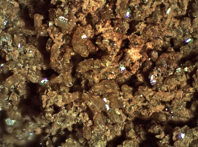
This is a list of exploitable or exploited mineral commodities recorded at this locality.Mineral List
19 valid minerals.
Detailed Mineral List:
| ⓘ Anglesite Formula: PbSO4 |
| ⓘ 'Axinite Group' Colour: White Description: Occurs as small, perfectly-formed crystals. |
| ⓘ Bournonite Formula: PbCuSbS3 References: |
| ⓘ Calcite Formula: CaCO3 |
| ⓘ Caledonite Formula: Pb5Cu2(SO4)3(CO3)(OH)6 References: |
| ⓘ Cerussite Formula: PbCO3 References: |
| ⓘ Chalcocite Formula: Cu2S |
| ⓘ Chalcopyrite Formula: CuFeS2 |
| ⓘ Dolomite Formula: CaMg(CO3)2 Description: Occurs as drusy, clear rhombohedra of supergene material in gangue. |
| ⓘ Epidote Formula: (CaCa)(AlAlFe3+)O[Si2O7][SiO4](OH) |
| ⓘ Fluorite Formula: CaF2 Colour: Red-purple Description: Occurs as anhedral and subhedral crystal. |
| ⓘ Galena Formula: PbS Description: Occurs as massive aggregates. References: |
| ⓘ Hemimorphite Formula: Zn4Si2O7(OH)2 · H2O Description: Occurs widely and in good crystals to 5 mm and in coarse-grained aggregates in cavities. References: |
| ⓘ Hydrozincite Formula: Zn5(CO3)2(OH)6 Description: Occurs as colloform linings of fine-grained material coating and filling cavities. References: |
| ⓘ 'Limonite' |
| ⓘ Linarite Formula: PbCu(SO4)(OH)2 References: |
| ⓘ Quartz Formula: SiO2 References: Rolf LuetckeIdentification: Visual Identification |
| ⓘ Smithsonite Formula: ZnCO3 |
| ⓘ Sphalerite Formula: ZnS References: |
| ⓘ Vanadinite Formula: Pb5(VO4)3Cl Description: Occurs as drusy encrustations in ores. References: |
| ⓘ Vanadinite var. Arsenic-bearing Vanadinite Formula: Pb5[(V,As)O4]3Cl Description: Occurs as drusy encrustations in ores. References: |
| ⓘ Wulfenite Formula: Pb(MoO4) Habit: Thin tabular; minute elongate crystals; open crystal meshes. Description: Widely distributed with other Pb minerals. |

List of minerals arranged by Strunz 10th Edition classification
| Group 2 - Sulphides and Sulfosalts | |||
|---|---|---|---|
| ⓘ | Chalcocite | 2.BA.05 | Cu2S |
| ⓘ | Sphalerite | 2.CB.05a | ZnS |
| ⓘ | Chalcopyrite | 2.CB.10a | CuFeS2 |
| ⓘ | Galena | 2.CD.10 | PbS |
| ⓘ | Bournonite | 2.GA.50 | PbCuSbS3 |
| Group 3 - Halides | |||
| ⓘ | Fluorite | 3.AB.25 | CaF2 |
| Group 4 - Oxides and Hydroxides | |||
| ⓘ | Quartz | 4.DA.05 | SiO2 |
| Group 5 - Nitrates and Carbonates | |||
| ⓘ | Calcite | 5.AB.05 | CaCO3 |
| ⓘ | Smithsonite | 5.AB.05 | ZnCO3 |
| ⓘ | Dolomite | 5.AB.10 | CaMg(CO3)2 |
| ⓘ | Cerussite | 5.AB.15 | PbCO3 |
| ⓘ | Hydrozincite | 5.BA.15 | Zn5(CO3)2(OH)6 |
| Group 7 - Sulphates, Chromates, Molybdates and Tungstates | |||
| ⓘ | Anglesite | 7.AD.35 | PbSO4 |
| ⓘ | Caledonite | 7.BC.50 | Pb5Cu2(SO4)3(CO3)(OH)6 |
| ⓘ | Linarite | 7.BC.65 | PbCu(SO4)(OH)2 |
| ⓘ | Wulfenite | 7.GA.05 | Pb(MoO4) |
| Group 8 - Phosphates, Arsenates and Vanadates | |||
| ⓘ | Vanadinite var. Arsenic-bearing Vanadinite | 8.BN.05 | Pb5[(V,As)O4]3Cl |
| ⓘ | 8.BN.05 | Pb5(VO4)3Cl | |
| Group 9 - Silicates | |||
| ⓘ | Hemimorphite | 9.BD.10 | Zn4Si2O7(OH)2 · H2O |
| ⓘ | Epidote | 9.BG.05a | (CaCa)(AlAlFe3+)O[Si2O7][SiO4](OH) |
| Unclassified | |||
| ⓘ | 'Limonite' | - | |
| ⓘ | 'Axinite Group' | - | |
List of minerals for each chemical element
| H | Hydrogen | |
|---|---|---|
| H | ⓘ Caledonite | Pb5Cu2(SO4)3(CO3)(OH)6 |
| H | ⓘ Epidote | (CaCa)(AlAlFe3+)O[Si2O7][SiO4](OH) |
| H | ⓘ Hemimorphite | Zn4Si2O7(OH)2 · H2O |
| H | ⓘ Hydrozincite | Zn5(CO3)2(OH)6 |
| H | ⓘ Linarite | PbCu(SO4)(OH)2 |
| C | Carbon | |
| C | ⓘ Calcite | CaCO3 |
| C | ⓘ Caledonite | Pb5Cu2(SO4)3(CO3)(OH)6 |
| C | ⓘ Cerussite | PbCO3 |
| C | ⓘ Dolomite | CaMg(CO3)2 |
| C | ⓘ Hydrozincite | Zn5(CO3)2(OH)6 |
| C | ⓘ Smithsonite | ZnCO3 |
| O | Oxygen | |
| O | ⓘ Anglesite | PbSO4 |
| O | ⓘ Calcite | CaCO3 |
| O | ⓘ Caledonite | Pb5Cu2(SO4)3(CO3)(OH)6 |
| O | ⓘ Cerussite | PbCO3 |
| O | ⓘ Dolomite | CaMg(CO3)2 |
| O | ⓘ Vanadinite var. Arsenic-bearing Vanadinite | Pb5[(V,As)O4]3Cl |
| O | ⓘ Epidote | (CaCa)(AlAlFe3+)O[Si2O7][SiO4](OH) |
| O | ⓘ Hemimorphite | Zn4Si2O7(OH)2 · H2O |
| O | ⓘ Hydrozincite | Zn5(CO3)2(OH)6 |
| O | ⓘ Linarite | PbCu(SO4)(OH)2 |
| O | ⓘ Quartz | SiO2 |
| O | ⓘ Smithsonite | ZnCO3 |
| O | ⓘ Vanadinite | Pb5(VO4)3Cl |
| O | ⓘ Wulfenite | Pb(MoO4) |
| F | Fluorine | |
| F | ⓘ Fluorite | CaF2 |
| Mg | Magnesium | |
| Mg | ⓘ Dolomite | CaMg(CO3)2 |
| Al | Aluminium | |
| Al | ⓘ Epidote | (CaCa)(AlAlFe3+)O[Si2O7][SiO4](OH) |
| Si | Silicon | |
| Si | ⓘ Epidote | (CaCa)(AlAlFe3+)O[Si2O7][SiO4](OH) |
| Si | ⓘ Hemimorphite | Zn4Si2O7(OH)2 · H2O |
| Si | ⓘ Quartz | SiO2 |
| S | Sulfur | |
| S | ⓘ Anglesite | PbSO4 |
| S | ⓘ Bournonite | PbCuSbS3 |
| S | ⓘ Caledonite | Pb5Cu2(SO4)3(CO3)(OH)6 |
| S | ⓘ Chalcopyrite | CuFeS2 |
| S | ⓘ Chalcocite | Cu2S |
| S | ⓘ Galena | PbS |
| S | ⓘ Linarite | PbCu(SO4)(OH)2 |
| S | ⓘ Sphalerite | ZnS |
| Cl | Chlorine | |
| Cl | ⓘ Vanadinite var. Arsenic-bearing Vanadinite | Pb5[(V,As)O4]3Cl |
| Cl | ⓘ Vanadinite | Pb5(VO4)3Cl |
| Ca | Calcium | |
| Ca | ⓘ Calcite | CaCO3 |
| Ca | ⓘ Dolomite | CaMg(CO3)2 |
| Ca | ⓘ Epidote | (CaCa)(AlAlFe3+)O[Si2O7][SiO4](OH) |
| Ca | ⓘ Fluorite | CaF2 |
| V | Vanadium | |
| V | ⓘ Vanadinite var. Arsenic-bearing Vanadinite | Pb5[(V,As)O4]3Cl |
| V | ⓘ Vanadinite | Pb5(VO4)3Cl |
| Fe | Iron | |
| Fe | ⓘ Chalcopyrite | CuFeS2 |
| Fe | ⓘ Epidote | (CaCa)(AlAlFe3+)O[Si2O7][SiO4](OH) |
| Cu | Copper | |
| Cu | ⓘ Bournonite | PbCuSbS3 |
| Cu | ⓘ Caledonite | Pb5Cu2(SO4)3(CO3)(OH)6 |
| Cu | ⓘ Chalcopyrite | CuFeS2 |
| Cu | ⓘ Chalcocite | Cu2S |
| Cu | ⓘ Linarite | PbCu(SO4)(OH)2 |
| Zn | Zinc | |
| Zn | ⓘ Hemimorphite | Zn4Si2O7(OH)2 · H2O |
| Zn | ⓘ Hydrozincite | Zn5(CO3)2(OH)6 |
| Zn | ⓘ Smithsonite | ZnCO3 |
| Zn | ⓘ Sphalerite | ZnS |
| As | Arsenic | |
| As | ⓘ Vanadinite var. Arsenic-bearing Vanadinite | Pb5[(V,As)O4]3Cl |
| Mo | Molybdenum | |
| Mo | ⓘ Wulfenite | Pb(MoO4) |
| Sb | Antimony | |
| Sb | ⓘ Bournonite | PbCuSbS3 |
| Pb | Lead | |
| Pb | ⓘ Anglesite | PbSO4 |
| Pb | ⓘ Bournonite | PbCuSbS3 |
| Pb | ⓘ Caledonite | Pb5Cu2(SO4)3(CO3)(OH)6 |
| Pb | ⓘ Cerussite | PbCO3 |
| Pb | ⓘ Vanadinite var. Arsenic-bearing Vanadinite | Pb5[(V,As)O4]3Cl |
| Pb | ⓘ Galena | PbS |
| Pb | ⓘ Linarite | PbCu(SO4)(OH)2 |
| Pb | ⓘ Vanadinite | Pb5(VO4)3Cl |
| Pb | ⓘ Wulfenite | Pb(MoO4) |
Other Databases
| Link to USGS MRDS: | 10076604 |
|---|
Other Regions, Features and Areas containing this locality
North America PlateTectonic Plate
- Antler Foreland BasinBasin
- Basin and Range BasinsBasin
- Mojave DomainDomain
USA
- Death Valley National ParkNational Park
- Sierra NevadaMountain Range
This page contains all mineral locality references listed on mindat.org. This does not claim to be a complete list. If you know of more minerals from this site, please register so you can add to our database. This locality information is for reference purposes only. You should never attempt to
visit any sites listed in mindat.org without first ensuring that you have the permission of the land and/or mineral rights holders
for access and that you are aware of all safety precautions necessary.
References
(n.d.) Minerals Availability System (MAS), U.S. Bureau of Mines.file ID #0060270091
(1908, September) The Copper Resources of California. Bulletin 50. California State Mining Bureaup.302


Ubehebe Mine [1](Copper Bell Mine; Ubehebe Lead Mine), Teakettle Junction, Ubehebe Mining District, Cottonwood Mountains, Panamint Mts, Inyo County, California, USA