| Locality | Latitude | Longitude | Distance | Bearing |
|---|
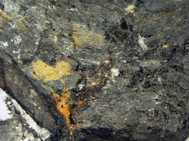
| Abdong Zr-Nb deposit (Aptong; Apdong), Pyonggang County, Kangwon Province, North Korea | 38° 29' 32" N | 127° 21' 11" E | 0.0km (0.0 miles) | |
| Sinsongsan Intrusion, Pyonggang County, Kangwon Province, North Korea | 38° 27' 0" N | 127° 16' 0" E | 8.9km (5.5 miles) | |
| Songsan-Konchon Intrusion, Kimhwa County, Kangwon Province, North Korea | 38° 25' 0" N | 127° 25' 0" E | 10.1km (6.3 miles) | |
| Hasong Intrusion, Kimhwa County, Kangwon Province, North Korea | 38° 25' 0" N | 127° 25' 59" E | 10.9km (6.8 miles) | |
| Hoamsan Intrusion, Pyonggang County, Kangwon Province, North Korea | 38° 23' 59" N | 127° 16' 59" E | 11.9km (7.4 miles) | |
| Fukushinzan, Pyonggang County, Kangwon Province, North Korea | 38° 31' 0" N | 127° 10' 0" E | 16.5km (10.2 miles) | |
| Pokjinsan Intrusion, Pyonggang County, Kangwon Province, North Korea | 38° 31' 0" N | 127° 10' 0" E | 16.5km (10.2 miles) | |
| Ponghwasan Intrusion, Kimhwa County, Kangwon Province, North Korea | 38° 19' 59" N | 127° 25' 59" E | 19.0km (11.8 miles) | |
| Jodoksan Intrusion, Ichon County, Kangwon Province, North Korea | 38° 31' 0" N | 127° 0' 0" E | 30.9km (19.2 miles) | |
| Chollyong Intrusion, Hoeyang County, Kangwon Province, North Korea | 38° 46' 0" N | 127° 28' 0" E | 32.0km (19.9 miles) | |
| Sokthandong Intrusion, Ichon County, Kangwon Province, North Korea | 38° 31' 59" N | 126° 52' 0" E | 42.6km (26.5 miles) | |
| Gwanin magnetite mine, Pocheon City, Gyeonggi Province, South Korea | 38° 7' 3" N | 127° 13' 28" E | 43.1km (26.8 miles) | |
| Solhwasan intrusion, Ichon County, Kangwon Province, North Korea | 38° 28' 59" N | 126° 46' 0" E | 51.1km (31.7 miles) | |
| Unidentified quarries No. 1, Pocheon City, Gyeonggi Province, South Korea | 37° 59' 3" N | 127° 13' 23" E | 57.6km (35.8 miles) | |
| Kymgang Mine, Kumgang County, Kangwon Province, North Korea | 38° 42' 0" N | 127° 58' 0" E | 58.1km (36.1 miles) | |
| Tanchon complex, Gogsan-Mannjon-gun, North Hwanghae Province, North Korea | 38° 55' 59" N | 126° 57' 0" E | 60.2km (37.4 miles) | |
| Kamuri mining district, Singye County, North Hwanghae Province, North Korea | 38° 24' 45" N | 126° 33' 29" E | 69.8km (43.4 miles) | |
| Oksanga jade mine, Chuncheon City, Gangwon Province, South Korea | 38° 0' 0" N | 128° 0' 0" E | 78.7km (48.9 miles) | |
| Unidentified quarry No. 1, Yangju City, Gyeonggi Province, South Korea | 37° 50' 8" N | 127° 0' 45" E | 78.9km (49.0 miles) | |
| Pyongsan Fluorspar Mine, Pyongsan County, North Hwanghae Province, North Korea | 38° 19' 40" N | 126° 25' 20" E | 83.1km (51.7 miles) | |
| Hongcheon Carbonatite, Hongcheon County, Gangwon Province, South Korea | 37° 51' 0" N | 128° 0' 0" E | 91.1km (56.6 miles) | |
| Tapch’ol-li workings, Munchon City, Kangwon Province, North Korea | 39° 19' 52" N | 127° 25' 5" E | 93.5km (58.1 miles) | |
| Kangbuk Intrusion, Kaesong City, North Hwanghae Province, North Korea | 38° 0' 0" N | 126° 25' 0" E | 98.4km (61.2 miles) | |
| Songhung-Kumgwang Mine (Songhung Mine), Songhung-dong, South Hamgyong Province, North Korea | 39° 6' 6" N | 126° 28' 22" E | 102.1km (63.4 miles) | |
| Unidentified mine, Kowon County, South Hamgyong Province, North Korea | 39° 25' 46" N | 127° 11' 24" E | 105.2km (65.3 miles) | |
| Solban-ni/Sinhŭng-ni/P’ungnam-ni mines, Munchon City, Kangwon Province, North Korea | 39° 29' 25" N | 127° 18' 51" E | 111.0km (69.0 miles) | |
| Yangyang Mine, Yangyang County, Gangwon Province, South Korea | 38° 4' 58" N | 128° 33' 0" E | 114.0km (70.8 miles) | |
| Ryeui Intrusion, Paechon County, South Hwanghae Province, North Korea | 38° 0' 0" N | 126° 12' 0" E | 114.6km (71.2 miles) | |
| Yulpo Mine, Paechon County, South Hwanghae Province, North Korea | 37° 52' 59" N | 126° 16' 59" E | 115.5km (71.7 miles) | |
| Unidentified mine, Sangwon County, North Hwanghae Province, North Korea | 38° 51' 59" N | 126° 5' 31" E | 117.1km (72.8 miles) | |


Abdong Zr-Nb deposit, Pyonggang County, Kangwon Province, North Korea