| Locality | Latitude | Longitude | Distance | Bearing |
|---|
| Unterwassern, Oberwald, Obergoms, Goms, Valais, Switzerland | 46° 31' 58" N | 8° 21' 7" E | 0.2km (0.2 miles) | |
| Hungerberg (Faulhorn), Oberwald, Obergoms, Goms, Valais, Switzerland | 46° 32' 6" N | 8° 22' 24" E | 1.5km (0.9 miles) | |
| Unnerbrunnji, Oberwald, Obergoms, Goms, Valais, Switzerland | 46° 32' 19" N | 8° 19' 37" E | 2.3km (1.4 miles) | |
| Obergesteln, Obergoms, Goms, Valais, Switzerland | 46° 30' 55" N | 8° 19' 33" E | 2.9km (1.8 miles) | |
| Gletsch, Furka pass area, Oberwald, Obergoms, Goms, Valais, Switzerland | 46° 33' 43" N | 8° 21' 41" E | 3.4km (2.1 miles) | |
| Gere Valley (Geren Valley), Gere (Geren), Oberwald, Obergoms, Goms, Valais, Switzerland | 46° 31' 59" N | 8° 23' 59" E | 3.4km (2.1 miles) | |
| Grimsel pass, Guttannen, Interlaken-Oberhasli, Bern, Switzerland | 46° 33' 40" N | 8° 20' 12" E | 3.6km (2.2 miles) | |
| Raifte, Gletsch, Furka pass area, Oberwald, Obergoms, Goms, Valais, Switzerland | 46° 33' 39" N | 8° 22' 32" E | 3.6km (2.2 miles) | |
| Sidelhorn, Aargrat, Oberaar lake area, Guttannen, Interlaken-Oberhasli, Bern, Switzerland | 46° 33' 9" N | 8° 18' 45" E | 4.0km (2.5 miles) | |
| Gälmer, Ägene Valley (Äginen Valley; Aeginen Valley), Ulrichen, Obergoms, Goms, Valais, Switzerland | 46° 29' 44" N | 8° 20' 41" E | 4.1km (2.5 miles) | |
| Breccia outcrop, Triebten lake (Trübten lake), Oberaar lake area, Guttannen, Interlaken-Oberhasli, Bern, Switzerland | 46° 33' 14" N | 8° 18' 15" E | 4.6km (2.9 miles) | |
| Mittaghorn, Gere (Geren), Oberwald, Obergoms, Goms, Valais, Switzerland | 46° 29' 47" N | 8° 23' 11" E | 4.6km (2.9 miles) | |
| Vorder Bockstelli, Ägene Valley (Äginen Valley; Aeginen Valley), Ulrichen, Obergoms, Goms, Valais, Switzerland | 46° 29' 21" N | 8° 20' 52" E | 4.8km (3.0 miles) | |
| Ägene Valley (Äginen Valley; Aeginen Valley), Ulrichen, Obergoms, Goms, Valais, Switzerland | 46° 29' 17" N | 8° 21' 33" E | 4.9km (3.0 miles) | |
| Triebten lake (Trübten lake), Oberaar lake area, Guttannen, Interlaken-Oberhasli, Bern, Switzerland | 46° 33' 9" N | 8° 17' 53" E | 4.9km (3.1 miles) | |
| Chessituren (Vorderer Kessiturm), Guttannen, Interlaken-Oberhasli, Bern, Switzerland | 46° 34' 5" N | 8° 19' 1" E | 5.0km (3.1 miles) | |
| Pizzo Gallina, Nufenen pass area (Novena Pass area), Ägene Valley (Äginen Valley; Aeginen Valley), Ulrichen, Obergoms, Goms, Valais, Switzerland | 46° 29' 41" N | 8° 23' 32" E | 5.0km (3.1 miles) | |
| Hammer (Hammerhorn), Nufenen pass area (Novena Pass area), Ägene Valley (Äginen Valley; Aeginen Valley), Ulrichen, Obergoms, Goms, Valais, Switzerland | 46° 29' 21" N | 8° 22' 45" E | 5.1km (3.1 miles) | |
| Sommerloch, Gerstenegg, Guttannen, Interlaken-Oberhasli, Bern, Switzerland | 46° 34' 32" N | 8° 20' 10" E | 5.1km (3.2 miles) | |
| Mutt Glacier, Gletsch, Furka pass area, Oberwald, Obergoms, Goms, Valais, Switzerland | 46° 33' 6" N | 8° 25' 4" E | 5.3km (3.3 miles) | |
| Muttbach, Gletsch, Furka pass area, Oberwald, Obergoms, Goms, Valais, Switzerland | 46° 34' 14" N | 8° 23' 48" E | 5.4km (3.3 miles) | |
| Gross Sidelhorn, Aargrat, Oberaar lake area, Guttannen, Interlaken-Oberhasli, Bern, Switzerland | 46° 32' 27" N | 8° 17' 7" E | 5.4km (3.4 miles) | |
| Nägelisgrätli, Grimsel pass, Guttannen, Interlaken-Oberhasli, Bern, Switzerland | 46° 34' 48" N | 8° 21' 45" E | 5.4km (3.4 miles) | |
| Belvédère hotel, Furka, Furka pass area, Oberwald, Obergoms, Goms, Valais, Switzerland | 46° 34' 36" N | 8° 23' 17" E | 5.6km (3.5 miles) | |
| Triebtenegg, Guttannen, Interlaken-Oberhasli, Bern, Switzerland | 46° 33' 9" N | 8° 17' 12" E | 5.7km (3.5 miles) | |
| Gerstenegg cleft, Gerstenegg-Grimsel cable tunnel, Gerstenegg, Guttannen, Interlaken-Oberhasli, Bern, Switzerland | 46° 34' 42" N | 8° 19' 24" E | 5.7km (3.5 miles) | |
| Muttenhörner, Gletsch, Furka pass area, Oberwald, Obergoms, Goms, Valais, Switzerland | 46° 32' 47" N | 8° 25' 37" E | 5.8km (3.6 miles) | |
| Bäregg, Guttannen, Interlaken-Oberhasli, Bern, Switzerland | 46° 33' 5" N | 8° 16' 51" E | 6.1km (3.8 miles) | |
| Furka pass area, Realp, Urseren, Uri, Switzerland | 46° 34' 20" N | 8° 24' 53" E | 6.4km (4.0 miles) | |
| Furka pass area, Oberwald, Obergoms, Goms, Valais, Switzerland | 46° 34' 20" N | 8° 24' 53" E | 6.4km (4.0 miles) | |


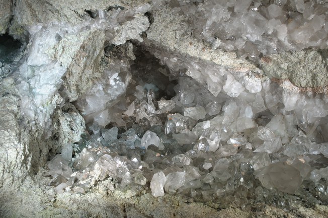


Grimsel pass, Guttannen, Interlaken-Oberhasli, Bern, Switzerland