| Locality | Latitude | Longitude | Distance | Bearing |
|---|
| Emma mine, Brunssum, Limburg, Netherlands | 50° 55' 54" N | 5° 56' 52" E | 0.9km (0.5 miles) | |
| Oranje-Nassau-III mine, Heerlen, Limburg, Netherlands | 50° 55' 16" N | 5° 57' 49" E | 1.2km (0.8 miles) | |
| Beaujean sand pit, Heerlen, Limburg, Netherlands | 50° 55' 2" N | 5° 58' 2" E | 1.6km (1.0 miles) | |
| Oranje-Nassau-IV mine, Heerlen, Limburg, Netherlands | 50° 54' 46" N | 5° 58' 34" E | 2.4km (1.5 miles) | |
| Heerenweg sand pit west, Beaujean sand pit, Heerlen, Limburg, Netherlands | 50° 54' 30" N | 5° 58' 16" E | 2.4km (1.5 miles) | |
| Heerenweg sand pit east, Beaujean sand pit, Heerlen, Limburg, Netherlands | 50° 54' 25" N | 5° 58' 22" E | 2.6km (1.6 miles) | |
| Hendrik mine, Brunssum, Limburg, Netherlands | 50° 56' 18" N | 5° 58' 41" E | 2.8km (1.7 miles) | |
| Heksenberg sand pit, Heerlen, Limburg, Netherlands | 50° 54' 43" N | 5° 59' 11" E | 3.1km (1.9 miles) | |
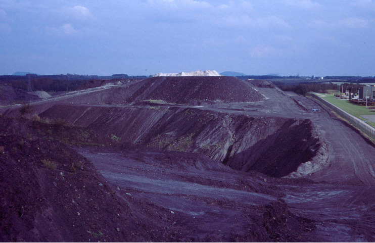
| Oranje-Nassau-I mine, Heerlen, Limburg, Netherlands | 50° 53' 42" N | 5° 58' 2" E | 3.5km (2.2 miles) | |
| Hendrik-Emma dumps, Brunssum, Limburg, Netherlands | 50° 56' 47" N | 6° 0' 30" E | 5.0km (3.1 miles) | |
| De Groot quarry, Landgraaf, Limburg, Netherlands | 50° 55' 34" N | 6° 1' 38" E | 5.6km (3.5 miles) | |
| Kunrader quarry, Voerendaal, Limburg, Netherlands | 50° 52' 17" N | 5° 56' 5" E | 5.9km (3.7 miles) | |
| Schaesberg, Landgraaf, Limburg, Netherlands | 50° 53' 29" N | 6° 0' 57" E | 6.0km (3.8 miles) | |
| Nagelbeek quarry, Schinnen, Beekdaelen, Limburg, Netherlands | 50° 55' 42" N | 5° 51' 31" E | 6.2km (3.8 miles) | |
| Oranje-Nassau-II mine, Schaesberg, Landgraaf, Limburg, Netherlands | 50° 52' 59" N | 6° 1' 0" E | 6.7km (4.1 miles) | |
| Spaubeek quarry, Spaubeek, Beek, Limburg, Netherlands | 50° 55' 52" N | 5° 50' 52" E | 7.0km (4.3 miles) | |
| Ubachsberg, Voerendaal, Limburg, Netherlands | 50° 51' 10" N | 5° 56' 49" E | 7.9km (4.9 miles) | |
| Laura mine, Eygelshoven, Kerkrade, Limburg, Netherlands | 50° 53' 34" N | 6° 2' 58" E | 8.0km (5.0 miles) | |
| Lignite mine, Eygelshoven, Kerkrade, Limburg, Netherlands | 50° 53' 5" N | 6° 3' 8" E | 8.6km (5.3 miles) | |
| Eygelshoven, Kerkrade, Limburg, Netherlands | 50° 53' 38" N | 6° 3' 36" E | 8.6km (5.4 miles) | |
| Wilhelmina mine, Kerkrade, Limburg, Netherlands | 50° 52' 0" N | 6° 1' 59" E | 8.8km (5.5 miles) | |
| Julia mine, Eygelshoven, Kerkrade, Limburg, Netherlands | 50° 53' 34" N | 6° 4' 17" E | 9.4km (5.8 miles) | |
| Däölkesberg, Oud-Valkenburg, Valkenburg aan de Geul, Limburg, Netherlands | 50° 51' 37" N | 5° 51' 29" E | 9.4km (5.8 miles) | |
| Schaelsberg quarry, Valkenburg aan de Geul, Limburg, Netherlands | 50° 51' 47" N | 5° 50' 40" E | 9.8km (6.1 miles) | |
| Willem-Sophia mine, Kerkrade, Limburg, Netherlands | 50° 51' 9" N | 6° 1' 56" E | 9.9km (6.2 miles) | |
| Oud-Valkenburg, Valkenburg aan de Geul, Limburg, Netherlands | 50° 51' 16" N | 5° 51' 15" E | 10.1km (6.3 miles) | |
| Boschhoef, Ravensbos forest, Valkenburg aan de Geul, Limburg, Netherlands | 50° 52' 38" N | 5° 48' 52" E | 10.6km (6.6 miles) | |
| Kasteel quarry, Valkenburg aan de Geul, Limburg, Netherlands | 50° 51' 44" N | 5° 49' 49" E | 10.6km (6.6 miles) | |
| Villa Alpha quarries, Valkenburg aan de Geul, Limburg, Netherlands | 50° 51' 48" N | 5° 49' 42" E | 10.7km (6.6 miles) | |
| Wilhelmina quarry, Valkenburg aan de Geul, Limburg, Netherlands | 50° 51' 34" N | 5° 50' 0" E | 10.7km (6.6 miles) | |


Oranje-Nassau-I mine, Heerlen, Limburg, Netherlands