| Locality | Latitude | Longitude | Distance | Bearing |
|---|
| Vár Hill, Somoskő, Nógrád County, Hungary | 48° 8' 0" N | 19° 51' 39" E | 1.4km (0.9 miles) | |
| Salgóbánya, Salgótarján, Nógrád County, Hungary | 48° 8' 46" N | 19° 51' 41" E | 1.6km (1.0 miles) | |
| Eresztvény quarries, Salgótarján, Nógrád County, Hungary | 48° 9' 18" N | 19° 51' 37" E | 2.2km (1.4 miles) | |
| Bagó-kő, Somoskő, Nógrád County, Hungary | 48° 9' 39" N | 19° 50' 34" E | 2.5km (1.6 miles) | |
| Somoskő, Nógrád County, Hungary | 48° 10' 6" N | 19° 51' 18" E | 3.4km (2.1 miles) | |
| Karancs Hill quarry, Somoskőújfalu, Nógrád County, Hungary | 48° 9' 3" N | 19° 47' 49" E | 3.7km (2.3 miles) | |
| Medves Hill quarry, Salgótarján, Nógrád County, Hungary | 48° 10' 11" N | 19° 52' 6" E | 4.0km (2.5 miles) | |
| Pécs-kő, Salgótarján, Nógrád County, Hungary | 48° 6' 10" N | 19° 50' 12" E | 4.0km (2.5 miles) | |
| Šiatorská Bukovinka quarry, Šiatorská Bukovinka, Lučenec District, Banská Bystrica Region, Slovakia | 48° 10' 26" N | 19° 49' 27" E | 4.2km (2.6 miles) | |
| Szilvás-kő, Salgótarján, Nógrád County, Hungary | 48° 7' 5" N | 19° 54' 8" E | 4.9km (3.1 miles) | |
| Sandstone quarry, Šiatorská Bukovinka, Lučenec District, Banská Bystrica Region, Slovakia | 48° 11' 25" N | 19° 49' 46" E | 5.8km (3.6 miles) | |
| Homorú Hill quarry, Karancsberény, Nógrád County, Hungary | 48° 10' 25" N | 19° 46' 41" E | 6.2km (3.9 miles) | |
| Quarry, Kazár, Nógrád County, Hungary | 48° 4' 34" N | 19° 51' 18" E | 7.0km (4.3 miles) | |
| Alsópálfalva, Salgótarján, Nógrád County, Hungary | 48° 3' 49" N | 19° 47' 55" E | 8.9km (5.6 miles) | |
| Nagy-kő, Bárna, Nógrád County, Hungary | 48° 5' 37" N | 19° 57' 4" E | 9.4km (5.9 miles) | |
| Etes, Nógrád County, Hungary | 48° 6' 46" N | 19° 42' 56" E | 9.9km (6.1 miles) | |
| Unnamed stone quarry, Čamovce, Lučenec District, Banská Bystrica Region, Slovakia | 48° 14' 9" N | 19° 51' 42" E | 10.9km (6.8 miles) | |
| Kis-kő, Szilaspogony, Nógrád County, Hungary | 48° 6' 47" N | 19° 59' 32" E | 11.4km (7.1 miles) | |
| Hajnáčka sapphire occurrence, Hajnáčka, Rimavská Sobota District, Banská Bystrica Region, Slovakia | 48° 12' 38" N | 19° 57' 50" E | 12.0km (7.5 miles) | |
| Gemerský Jablonec quarry, Gemerský Jablonec, Rimavská Sobota District, Banská Bystrica Region, Slovakia | 48° 12' 23" N | 19° 58' 50" E | 12.7km (7.9 miles) | |
| Nemti, Nógrád County, Hungary | 48° 0' 34" N | 19° 53' 58" E | 14.9km (9.3 miles) | |
| Gortva, Hajnáčka sapphire occurrence, Hajnáčka, Rimavská Sobota District, Banská Bystrica Region, Slovakia | 48° 14' 59" N | 19° 57' 32" E | 15.1km (9.4 miles) | |
| Kányáspuszta, Bátonyterenye, Nógrád County, Hungary | 47° 58' 59" N | 19° 48' 0" E | 17.6km (10.9 miles) | |
| Konrádovce quarry, Konrádovce, Rimavská Sobota District, Banská Bystrica Region, Slovakia | 48° 17' 38" N | 19° 53' 22" E | 17.6km (10.9 miles) | |
| Nagybátony, Bátonyterenye, Nógrád County, Hungary | 47° 58' 35" N | 19° 49' 13" E | 18.1km (11.2 miles) | |
| Szorospatak, Bátonyterenye, Nógrád County, Hungary | 47° 56' 57" N | 19° 50' 22" E | 21.0km (13.1 miles) | |
| Nagy-Zsunyi Hill quarry (Zunypuszta quarry), Nagylóc, Nógrád County, Hungary | 48° 0' 18" N | 19° 37' 40" E | 21.8km (13.6 miles) | |
| Basalt quarry, Veľké Dravce, Lučenec District, Banská Bystrica Region, Slovakia | 48° 20' 4" N | 19° 51' 50" E | 21.9km (13.6 miles) | |
| Husiná basalt quarries, Husiná, Rimavská Sobota District, Banská Bystrica Region, Slovakia | 48° 20' 27" N | 19° 51' 18" E | 22.5km (14.0 miles) | |
| Mátraszentlászló, Heves County, Hungary | 47° 55' 29" N | 19° 52' 45" E | 23.9km (14.9 miles) | |
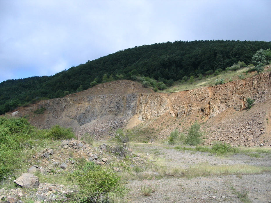


Karancs Hill quarry, Somoskőújfalu, Nógrád County, Hungary