Sylling, Lier, Buskerud fylke, Norway
| Alternative Names: | Sylling |
|---|---|
| Type: | Populated place - a city, town, village, or other agglomeration of buildings where people live and work |
| Mindat Locality: | Sylling, Lier, Buskerud, Norway |
| Mindat.org Region: | Sylling, Lier, Buskerud, Norway |
| Region: | Lier, Buskerud fylke, Norway |
| Latitude: | 59° 53' 34" N |
| Longitude: | 10° 17' 27" E |
| Lat/Long (dec): | 59.89303,10.29105 |
| Köppen climate type: | Dfb : Warm-summer humid continental climate |
| Population: | 525 (2013) |
| Mindat Feature ID: | 3134975 |
| Long-form Identifier: | mindat:2:6:3134975:4 |
| GUID: | 1055e099-24a7-4b32-b51b-4b7094ac0507 |
Mindat.org localities near to this feature
| Locality | Latitude | Longitude | Distance | Bearing |
|---|---|---|---|---|
| Sylling, Lier, Buskerud, Norway | 59° 53' 34" N | 10° 17' 28" E | 0.0km (0.0 miles) | |
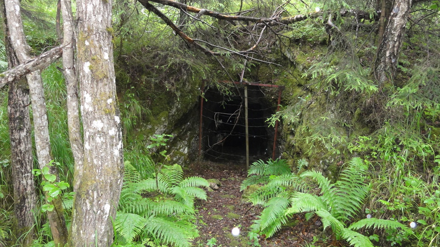
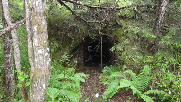
| Hørtekollen Fluorite Mine, Sylling, Lier, Buskerud, Norway | 59° 54' 33" N | 10° 16' 27" E | 2.0km (1.3 miles) | |
| Asdøljuvet (Astøljuvet), Lier, Buskerud, Norway | 59° 52' 24" N | 10° 18' 29" E | 2.4km (1.5 miles) | |
| Asdøl, Lier, Buskerud, Norway | 59° 52' 16" N | 10° 19' 25" E | 3.0km (1.9 miles) | |
| Bø Mine, Lierskogen, Lier, Buskerud, Norway | 59° 50' 41" N | 10° 20' 13" E | 5.9km (3.7 miles) | |
| Mobråtan, Asker, Viken, Norway | 59° 51' 58" N | 10° 24' 24" E | 7.1km (4.4 miles) | |
| Olledalen Shooting Range (Bergsmarka), Asker, Viken, Norway | 59° 50' 42" N | 10° 22' 45" E | 7.3km (4.5 miles) | |
| Kattås, Sandvika, Bærum (Baerum), Viken, Norway | 59° 53' 39" N | 10° 25' 39" E | 7.6km (4.7 miles) | |
| Hajum waterfall, Asker, Viken, Norway | 59° 51' 41" N | 10° 25' 4" E | 7.9km (4.9 miles) | |
| Øksne Quarry, Lier, Buskerud, Norway | 59° 49' 59" N | 10° 12' 30" E | 8.1km (5.0 miles) | |
| Slettfjella, Lier, Buskerud, Norway | 59° 53' 0" N | 10° 8' 43" E | 8.2km (5.1 miles) | |
| Lierskogen Quarry, Lierskogen, Lier, Buskerud, Norway | 59° 49' 6" N | 10° 17' 49" E | 8.3km (5.1 miles) | |
| Buttedal Mine, Tranby, Lier, Buskerud, Norway | 59° 49' 7" N | 10° 15' 42" E | 8.4km (5.2 miles) | |
| Sollihøgda, Hole, Buskerud, Norway | 59° 57' 49" N | 10° 20' 43" E | 8.4km (5.2 miles) | |
| Lierskogen, Lier, Buskerud, Norway | 59° 49' 10" N | 10° 19' 50" E | 8.5km (5.3 miles) | |
| Gjellebekk marble quarry, Gjellebekk, Lier, Buskerud, Norway | 59° 48' 43" N | 10° 17' 0" E | 9.0km (5.6 miles) | |
| Ringeriksveien Prospect, Bærum (Baerum), Viken, Norway | 59° 56' 4" N | 10° 25' 53" E | 9.1km (5.6 miles) | |
| Gjellebekk Mine (Auvi Mine), Gjellebekk, Lier, Buskerud, Norway | 59° 48' 39" N | 10° 17' 44" E | 9.1km (5.7 miles) | |
| Sølvhølen Prospect, Bærum (Baerum), Viken, Norway | 59° 55' 53" N | 10° 26' 7" E | 9.1km (5.7 miles) | |
| Kjenner Bismuth Mine, Lierskogen, Lier, Buskerud, Norway | 59° 48' 41" N | 10° 19' 1" E | 9.2km (5.7 miles) | |
| Tranby, Lier, Buskerud, Norway | 59° 48' 37" N | 10° 15' 38" E | 9.3km (5.8 miles) | |
| Gjellebekk, Lier, Buskerud, Norway | 59° 48' 32" N | 10° 17' 54" E | 9.4km (5.8 miles) | |
| Liertoppen, Lier, Buskerud, Norway | 59° 48' 28" N | 10° 17' 37" E | 9.5km (5.9 miles) | |
| Skaret, Sollihøgda, Hole, Buskerud, Norway | 59° 58' 36" N | 10° 19' 35" E | 9.5km (5.9 miles) | |
| Markebekk Prospect 1, Bærum (Baerum), Viken, Norway | 59° 56' 27" N | 10° 26' 6" E | 9.6km (6.0 miles) | |
| Skaret Tunnel E 16, Sollihøgda, Hole, Buskerud, Norway | 59° 58' 48" N | 10° 19' 1" E | 9.8km (6.1 miles) | |
| Humledal, Hole, Buskerud, Norway | 59° 58' 51" N | 10° 18' 42" E | 9.9km (6.1 miles) | |
| Eggekollen, Lier, Buskerud, Norway | 59° 49' 33" N | 10° 10' 23" E | 9.9km (6.2 miles) | |
| Isi Prospect, Bærum (Baerum), Viken, Norway | 59° 56' 28" N | 10° 26' 36" E | 10.0km (6.2 miles) | |
| Oppsjøen Mine, Oppsjø, Dikemark, Asker, Viken, Norway | 59° 48' 51" N | 10° 22' 52" E | 10.1km (6.3 miles) |


Minerals recorded nearby (within 10.1 km)
Warning: mysqli::query(): (HY000/3024): Query execution was interrupted, maximum statement execution time exceeded in /home/mindat/www/locsearch_class.php on line 264
ⓘ Bismuthinite
Rock types recorded nearby (within 10.1 km)
Regions in mindat.org that contain this locality
Contains data courtesy of geonames.org - Creative Commons Attribution 4.0 License


Gjellebekk Mine, Gjellebekk, Lier, Buskerud, Norway