| Locality | Latitude | Longitude | Distance | Bearing |
|---|
| Vue de l'eau, Riverside, East Providence, Providence County, Rhode Island, USA | 41° 47' 17" N | 71° 22' 8" W | 0.0km (0.0 miles) | |
| Silver Spring, Riverside, East Providence, Providence County, Rhode Island, USA | 41° 47' 20" N | 71° 22' 5" W | 0.1km (0.1 miles) | |
| Ide's Ledge quarry, East Providence, Providence County, Rhode Island, USA | 41° 47' 57" N | 71° 20' 48" W | 2.2km (1.4 miles) | |
| Riverside, East Providence, Providence County, Rhode Island, USA | 41° 46' 1" N | 71° 21' 52" W | 2.3km (1.5 miles) | |
| McCormick Quarry (Leonard Corner), East Providence, Providence County, Rhode Island, USA | 41° 48' 28" N | 71° 21' 5" W | 2.6km (1.6 miles) | |
| McCormick quarry (Pierce Field), East Providence, Providence County, Rhode Island, USA | 41° 48' 36" N | 71° 22' 59" W | 2.7km (1.7 miles) | |
| East Providence, Providence County, Rhode Island, USA | 41° 48' 48" N | 71° 22' 12" W | 2.8km (1.8 miles) | |
| Roger Williams Park, Providence, Providence County, Rhode Island, USA | 41° 47' 2" N | 71° 24' 38" W | 3.5km (2.2 miles) | |
| Cranston, Providence County, Rhode Island, USA | 41° 46' 45" N | 71° 26' 15" W | 5.8km (3.6 miles) | |
| Hopkins Iron Mine, Cranston, Providence County, Rhode Island, USA | 41° 46' 0" N | 71° 25' 59" W | 5.8km (3.6 miles) | |
| Arlington, Cranston, Providence County, Rhode Island, USA | 41° 47' 59" N | 71° 26' 17" W | 5.9km (3.7 miles) | |
| Rumford, East Providence, Providence County, Rhode Island, USA | 41° 50' 43" N | 71° 21' 6" W | 6.5km (4.0 miles) | |
| Phillipsdale, East Providence, Providence County, Rhode Island, USA | 41° 50' 48" N | 71° 21' 56" W | 6.6km (4.1 miles) | |
| Barrington Brick Yard (Nyatt Brick Pit), Barrington, Bristol County, Rhode Island, USA | 41° 44' 4" N | 71° 19' 11" W | 7.2km (4.5 miles) | |
| Cranston Graphite mine, Cranston, Providence County, Rhode Island, USA | 41° 45' 54" N | 71° 27' 34" W | 8.0km (4.9 miles) | |
| Neutaconkanut Hill, Providence, Providence County, Rhode Island, USA | 41° 48' 29" N | 71° 28' 0" W | 8.4km (5.2 miles) | |
| Dyerville, Providence, Providence County, Rhode Island, USA | 41° 49' 32" N | 71° 27' 29" W | 8.5km (5.3 miles) | |
| Warwick, Kent County, Rhode Island, USA | 41° 43' 0" N | 71° 25' 0" W | 8.9km (5.5 miles) | |
| Manton Avenue Quarry (Manton Quarry; Violet Hill Quarry), Manton, Providence, Providence County, Rhode Island, USA | 41° 49' 47" N | 71° 27' 40" W | 8.9km (5.6 miles) | |
| Hipses Rock (Indian Rock), Johnston, Providence County, Rhode Island, USA | 41° 48' 7" N | 71° 28' 47" W | 9.3km (5.8 miles) | |
| Wanskuck, Providence, Providence County, Rhode Island, USA | 41° 51' 34" N | 71° 25' 55" W | 9.5km (5.9 miles) | |
| Pawtucket, Providence County, Rhode Island, USA | 41° 52' 32" N | 71° 22' 36" W | 9.8km (6.1 miles) | |
| Oaklawn, Cranston, Providence County, Rhode Island, USA | 41° 45' 6" N | 71° 28' 37" W | 9.8km (6.1 miles) | |
| Manton, Providence, Providence County, Rhode Island, USA | 41° 50' 11" N | 71° 28' 6" W | 9.8km (6.1 miles) | |
| Interstate highway 295 road cut, Cranston, Providence County, Rhode Island, USA | 41° 46' 19" N | 71° 29' 17" W | 10.0km (6.2 miles) | |
| Olney Avenue, North Providence, Providence County, Rhode Island, USA | 41° 50' 56" N | 71° 27' 48" W | 10.4km (6.4 miles) | |
| North Providence, Providence County, Rhode Island, USA | 41° 51' 35" N | 71° 27' 23" W | 10.8km (6.7 miles) | |
| Central Falls, Providence County, Rhode Island, USA | 41° 53' 30" N | 71° 23' 27" W | 11.7km (7.2 miles) | |
| Centredale, North Providence, Providence County, Rhode Island, USA | 41° 51' 21" N | 71° 28' 44" W | 11.8km (7.4 miles) | |
| Interstate 295 / US Route 6 road cuts, Johnston, Providence County, Rhode Island, USA | 41° 49' 13" N | 71° 30' 52" W | 12.6km (7.8 miles) | |
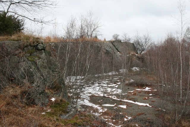


Kettle Point quarry, East Providence, Providence County, Rhode Island, USA