| Locality | Latitude | Longitude | Distance | Bearing |
|---|
| Ballinglen, Aughrim, Wicklow County, Leinster, Ireland | 52° 49' 25" N | 6° 25' 10" W | 1.5km (1.0 miles) | |
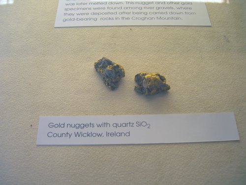
| Croghan Kinshela Mountain, Wicklow County, Leinster, Ireland | 52° 47' 42" N | 6° 19' 27" W | 5.6km (3.5 miles) | |
| Ballycoog, Gold Mines River, Croghan Kinshela Mountain, Wicklow County, Leinster, Ireland | 52° 50' 3" N | 6° 16' 58" W | 8.1km (5.0 miles) | |
| Gold Mines River, Croghan Kinshela Mountain, Wicklow County, Leinster, Ireland | 52° 49' 27" N | 6° 15' 20" W | 9.7km (6.0 miles) | |
| Stranakelly, Shillelagh, Wicklow County, Leinster, Ireland | 52° 47' 5" N | 6° 32' 13" W | 9.9km (6.1 miles) | |
| Ballygahan Mine, Avoca, Wicklow County, Leinster, Ireland | 52° 51' 48" N | 6° 13' 40" W | 12.7km (7.9 miles) | |
| Kilmacoo Mine (East Cronebane Mine), Avoca, Wicklow County, Leinster, Ireland | 52° 52' 0" N | 6° 13' 36" W | 12.9km (8.0 miles) | |
| Ballymurtagh Mine, Avoca, Wicklow County, Leinster, Ireland | 52° 52' 14" N | 6° 13' 28" W | 13.2km (8.2 miles) | |
| Tigroney Mine (East Avoca Open Pit; St. Patrick's Mine), Avoca, Wicklow County, Leinster, Ireland | 52° 52' 57" N | 6° 12' 48" W | 14.5km (9.0 miles) | |
| Cronebane Mine, Avoca, Wicklow County, Leinster, Ireland | 52° 53' 16" N | 6° 12' 18" W | 15.3km (9.5 miles) | |
| Connary mine (Connorree mine), Avoca, Wicklow County, Leinster, Ireland | 52° 53' 30" N | 6° 12' 5" W | 15.7km (9.8 miles) | |
| Moylisha, Shillelagh, Wicklow County, Leinster, Ireland | 52° 44' 42" N | 6° 37' 37" W | 17.2km (10.7 miles) | |
| Ballinafunshoge Mine, Glenmalure, Wicklow County, Leinster, Ireland | 52° 58' 23" N | 6° 23' 21" W | 17.4km (10.8 miles) | |
| Parnell Quarry, Arklow, Wicklow County, Leinster, Ireland | 52° 46' 19" N | 6° 9' 1" W | 17.5km (10.9 miles) | |
| Clonkeen mine, Glenmalure, Wicklow County, Leinster, Ireland | 52° 58' 33" N | 6° 23' 36" W | 17.7km (11.0 miles) | |
| Baravore mine, Glenmalure, Wicklow County, Leinster, Ireland | 52° 59' 22" N | 6° 25' 18" W | 19.3km (12.0 miles) | |
| Ballynagoneen mine, Glenmalure, Wicklow County, Leinster, Ireland | 52° 59' 39" N | 6° 25' 17" W | 19.8km (12.3 miles) | |
| Van Diemen's Land mines, Glendalough, Wicklow County, Leinster, Ireland | 53° 0' 20" N | 6° 23' 44" W | 21.0km (13.1 miles) | |
| Glendalough mine, Glendalough, Wicklow County, Leinster, Ireland | 53° 0' 21" N | 6° 22' 39" W | 21.1km (13.1 miles) | |
| Kilranelagh, Wicklow County, Leinster, Ireland | 52° 56' 56" N | 6° 38' 43" W | 22.1km (13.7 miles) | |
| Old Luganure mine, Glendasan, Wicklow County, Leinster, Ireland | 53° 1' 18" N | 6° 22' 31" W | 22.9km (14.2 miles) | |
| Moll Doyle mine, Glendasan, Wicklow County, Leinster, Ireland | 53° 1' 18" N | 6° 21' 34" W | 23.0km (14.3 miles) | |
| North Hero lode, Glendasan, Wicklow County, Leinster, Ireland | 53° 1' 23" N | 6° 21' 47" W | 23.1km (14.3 miles) | |
| Hollyrock lode, Glendasan, Wicklow County, Leinster, Ireland | 53° 1' 23" N | 6° 21' 32" W | 23.1km (14.4 miles) | |
| Camaderry Mountain, Glendalough, Wicklow County, Leinster, Ireland | 53° 1' 28" N | 6° 22' 37" W | 23.2km (14.4 miles) | |
| Foxrock mine, Glendasan, Wicklow County, Leinster, Ireland | 53° 1' 24" N | 6° 21' 18" W | 23.2km (14.4 miles) | |
| Ruplagh mine (Rupla mine), Glendasan, Wicklow County, Leinster, Ireland | 53° 2' 7" N | 6° 22' 13" W | 24.4km (15.2 miles) | |
| West Ruplagh lode, Glendasan, Wicklow County, Leinster, Ireland | 53° 2' 12" N | 6° 22' 24" W | 24.5km (15.2 miles) | |
| Aclare, Carlow County, Leinster, Ireland | 52° 41' 7" N | 6° 44' 57" W | 27.7km (17.2 miles) | |
| Vesuvianite locality, Brown Mountain, Lough Dan, Wicklow County, Leinster, Ireland | 53° 4' 13" N | 6° 18' 33" W | 28.8km (17.9 miles) | |


Gold Mines River, Croghan Kinshela Mountain, Wicklow County, Leinster, Ireland