| Locality | Latitude | Longitude | Distance | Bearing |
|---|
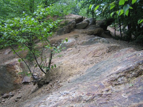
| Petrified wood locality, South Britain, Southbury, New Haven County, Connecticut, USA | 41° 27' 44" N | 73° 14' 54" W | 0.0km (0.0 miles) | |
| South Britain, Southbury, New Haven County, Connecticut, USA | 41° 28' 15" N | 73° 15' 5" W | 1.0km (0.6 miles) | |
| Heritage Village, Southbury, New Haven County, Connecticut, USA | 41° 29' 18" N | 73° 13' 36" W | 3.4km (2.1 miles) | |
| Southbury, New Haven County, Connecticut, USA | 41° 28' 59" N | 73° 13' 0" W | 3.5km (2.2 miles) | |
| Interstate 84 and state Route 172 interchange, Southbury, New Haven County, Connecticut, USA | 41° 28' 38" N | 73° 12' 29" W | 3.7km (2.3 miles) | |
| Unnamed quartz prospect, Southbury, New Haven County, Connecticut, USA | 41° 27' 23" N | 73° 12' 7" W | 3.9km (2.4 miles) | |
| Bates' Rock Road, Southbury, New Haven County, Connecticut, USA | 41° 30' 0" N | 73° 14' 3" W | 4.3km (2.7 miles) | |
| Sandy Hook gold mine (Blackwell's mine), Sandy Hook, Newtown, Fairfield County, Connecticut, USA | 41° 25' 51" N | 73° 16' 47" W | 4.4km (2.7 miles) | |
| Sandy Hook, Newtown, Fairfield County, Connecticut, USA | 41° 25' 12" N | 73° 16' 55" W | 5.5km (3.4 miles) | |
| Unnamed quartz quarry, Southbury, New Haven County, Connecticut, USA | 41° 29' 26" N | 73° 18' 37" W | 6.0km (3.7 miles) | |
| Interstate 84 road cuts (Route 6A bypass), Newtown, Fairfield County, Connecticut, USA | 41° 25' 4" N | 73° 17' 26" W | 6.1km (3.8 miles) | |
| Curtis Quarry (Southford Quarry; Southford pegmatite; Southbury rose quartz quarry; Bridgeport Woodfinishing Co. Quarry; Hulls Hill), Southford, Southbury, New Haven County, Connecticut, USA | 41° 26' 58" N | 73° 10' 32" W | 6.3km (3.9 miles) | |
| O & G Southbury Quarry (Silliman Quarry; O & G No. 2 Quarry), Orenaug Hills, Woodbury, Litchfield County, Connecticut, USA | 41° 30' 50" N | 73° 12' 57" W | 6.3km (3.9 miles) | |
| Sachem Road area, Southbury, New Haven County, Connecticut, USA | 41° 29' 10" N | 73° 19' 14" W | 6.6km (4.1 miles) | |
| Green's Farm locality (Roxbury garnet mine; Roxbury Falls garnet mine; Garnet Hill), Roxbury, Litchfield County, Connecticut, USA | 41° 30' 24" N | 73° 18' 11" W | 6.7km (4.2 miles) | |
| Southford, Southbury, New Haven County, Connecticut, USA | 41° 27' 53" N | 73° 9' 44" W | 7.2km (4.5 miles) | |
| Newtown, Fairfield County, Connecticut, USA | 41° 24' 47" N | 73° 18' 32" W | 7.4km (4.6 miles) | |
| Copper mine, Woodbury, Litchfield County, Connecticut, USA | 41° 31' 17" N | 73° 11' 51" W | 7.8km (4.9 miles) | |
| Berry Road kyanite locality, Roxbury, Litchfield County, Connecticut, USA | 41° 30' 24" N | 73° 19' 47" W | 8.4km (5.2 miles) | |
| Great Ring farm, Newtown, Fairfield County, Connecticut, USA | 41° 23' 22" N | 73° 13' 18" W | 8.4km (5.2 miles) | |
| Ilmenite locality, Bridgewater, Litchfield County, Connecticut, USA | 41° 29' 3" N | 73° 21' 28" W | 9.4km (5.9 miles) | |
| Hawleyville, Newtown, Fairfield County, Connecticut, USA | 41° 25' 39" N | 73° 21' 18" W | 9.7km (6.0 miles) | |
| Woodbury, Litchfield County, Connecticut, USA | 41° 32' 39" N | 73° 12' 32" W | 9.7km (6.0 miles) | |
| O & G Woodbury Traprock Quarry (Orenaug Quarry; O & G No. 1 Quarry), Orenaug Hills, Woodbury, Litchfield County, Connecticut, USA | 41° 32' 32" N | 73° 11' 47" W | 9.9km (6.2 miles) | |
| Orenaug Hills, Woodbury, Litchfield County, Connecticut, USA | 41° 32' 40" N | 73° 12' 7" W | 9.9km (6.2 miles) | |
| Grace Feldspar Mine, Newtown, Fairfield County, Connecticut, USA | 41° 24' 1" N | 73° 20' 12" W | 10.1km (6.3 miles) | |
| Sky Ridge railroad cut, Hawleyville, Newtown, Fairfield County, Connecticut, USA | 41° 25' 35" N | 73° 21' 35" W | 10.1km (6.3 miles) | |
| Stevenson Mine (Burke's Copper Mine), Oxford, New Haven County, Connecticut, USA | 41° 23' 43" N | 73° 9' 59" W | 10.1km (6.3 miles) | |
| Rocky Mountain Road garnet prospect, Roxbury, Litchfield County, Connecticut, USA | 41° 32' 27" N | 73° 18' 46" W | 10.2km (6.4 miles) | |
| Danbury beryl prospect, Brookfield, Fairfield County, Connecticut, USA | 41° 25' 55" N | 73° 22' 59" W | 11.7km (7.3 miles) | |


Green's Farm locality, Roxbury, Litchfield County, Connecticut, USA