| Locality | Latitude | Longitude | Distance | Bearing |
|---|
| Malachite Mine (Morrison), Evergreen Mining District (Malachite Mining District), Jefferson County, Colorado, USA | 39° 40' 39" N | 105° 15' 49" W | 1.2km (0.7 miles) | |
| F.M.D. Mine, Evergreen Mining District (Malachite Mining District), Jefferson County, Colorado, USA | 39° 40' 50" N | 105° 17' 17" W | 1.4km (0.9 miles) | |
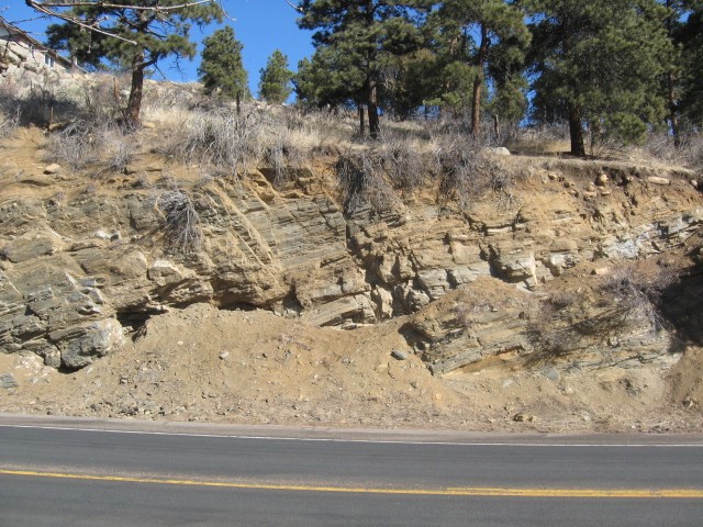
| Highway 74 roadcut, Bear Creek, Evergreen Mining District (Malachite Mining District), Jefferson County, Colorado, USA | 39° 39' 56" N | 105° 16' 23" W | 2.2km (1.4 miles) | |
| Genesee Park calc-silicate locality, Jefferson County, Colorado, USA | 39° 42' 29" N | 105° 16' 39" W | 2.5km (1.6 miles) | |
| Unknown Copper (MRDS - 10191295), Idledale Mining District, Jefferson County, Colorado, USA | 39° 39' 43" N | 105° 15' 53" W | 2.7km (1.7 miles) | |
| Quatman Lease, Idledale Mining District, Jefferson County, Colorado, USA | 39° 40' 46" N | 105° 14' 30" W | 2.7km (1.7 miles) | |
| Grapevine Mine, Idledale Mining District, Jefferson County, Colorado, USA | 39° 40' 27" N | 105° 14' 23" W | 3.1km (1.9 miles) | |
| Idledale Mining District, Jefferson County, Colorado, USA | 39° 39' 55" N | 105° 14' 52" W | 3.1km (1.9 miles) | |
| Wright lease (Foothills Mine), Idledale Mining District, Jefferson County, Colorado, USA | 39° 39' 55" N | 105° 14' 52" W | 3.1km (1.9 miles) | |
| Appel Lease, Lower Clear Creek Area, Jefferson County, Colorado, USA | 39° 43' 7" N | 105° 16' 0" W | 3.7km (2.3 miles) | |
| Unknown Feldspar (MRDS - 10215533), Clear Creek Pegmatite Province, Jefferson County, Colorado, USA | 39° 40' 43" N | 105° 19' 12" W | 4.1km (2.6 miles) | |
| Burroughs Mine (Traut-Rudin-Anderson Pegmatite; Sunrise Peak Mine), Clear Creek pegmatite Province, Jefferson County, Colorado, USA | 39° 40' 53" N | 105° 19' 22" W | 4.3km (2.7 miles) | |
| Swede - Kerr Gulches Pegmatites, Clear Creek Pegmatite Province, Jefferson County, Colorado, USA | 39° 40' 32" N | 105° 19' 23" W | 4.5km (2.8 miles) | |
| Seven Hills - Yetter Ranch Pegmatite Occurrence, Clear Creek Pegmatite Province, Jefferson County, Colorado, USA | 39° 39' 39" N | 105° 19' 23" W | 5.1km (3.2 miles) | |
| Bear Creek, Evergreen Mining District (Malachite Mining District), Jefferson County, Colorado, USA | 39° 38' 44" N | 105° 18' 10" W | 5.2km (3.2 miles) | |
| Unknown Clay Occurrence (MRDS - 10091166), Jefferson County, Colorado, USA | 39° 42' 16" N | 105° 12' 38" W | 5.7km (3.5 miles) | |
| Dakota hogback, Jefferson County, Colorado, USA | 39° 42' 14" N | 105° 12' 9" W | 6.3km (3.9 miles) | |
| Hosa Lodge Mine, Evergreen Mining District (Malachite Mining District), Jefferson County, Colorado, USA | 39° 43' 19" N | 105° 19' 50" W | 6.4km (4.0 miles) | |
| Unknown Clay Occurrence (MRDS - 10016980), Lower Clear Creek Area, Jefferson County, Colorado, USA | 39° 43' 7" N | 105° 12' 38" W | 6.5km (4.0 miles) | |
| Unnamed Placer (MRDS - 10013742), Lower Clear Creek Area, Jefferson County, Colorado, USA | 39° 44' 35" N | 105° 17' 21" W | 6.5km (4.0 miles) | |
| Stranger Mine (George W. Parfet Estate; Inc.; Prospect), Jefferson County, Colorado, USA | 39° 41' 23" N | 105° 11' 29" W | 7.0km (4.3 miles) | |
| Dinosaur Ridge, Morrison Area, Jefferson County, Colorado, USA | 39° 40' 52" N | 105° 11' 29" W | 7.0km (4.3 miles) | |
| Unknown Clay - Fire (Refractory) Occurrence (MRDS - 10016803), Jefferson County, Colorado, USA | 39° 40' 32" N | 105° 11' 29" W | 7.0km (4.4 miles) | |
| Bertrand Quarry, Lower Clear Creek Area, Jefferson County, Colorado, USA | 39° 44' 51" N | 105° 14' 52" W | 7.2km (4.5 miles) | |
| Strainland Mine (Golden Mine), Jefferson County, Colorado, USA | 39° 42' 16" N | 105° 11' 29" W | 7.2km (4.5 miles) | |
| Section 35 T3S R71W Prospect, Front Range, Jefferson County, Colorado, USA | 39° 44' 51" N | 105° 18' 12" W | 7.4km (4.6 miles) | |
| State Highway 74 roadcut, Foothill Mining District, Jefferson County, Colorado, USA | 39° 39' 39" N | 105° 11' 32" W | 7.4km (4.6 miles) | |
| Unknown Clay - Fire (Refractory) Occurrence (MRDS - 10016805), Jefferson County, Colorado, USA | 39° 39' 39" N | 105° 11' 29" W | 7.5km (4.6 miles) | |
| Unknown Clay Occurrence (MRDS - 10016136), Lower Clear Creek Area, Jefferson County, Colorado, USA | 39° 44' 0" N | 105° 12' 38" W | 7.5km (4.7 miles) | |
| Jefferson County Iron Mines, Morrison Area, Jefferson County, Colorado, USA | 39° 38' 9" N | 105° 12' 43" W | 7.6km (4.7 miles) | |


Burroughs Mine, Clear Creek pegmatite Province, Jefferson County, Colorado, USA