| Locality | Latitude | Longitude | Distance | Bearing |
|---|
| Cisowiec hill, Wojcieszów, Złotoryja County, Lower Silesian Voivodeship, Poland | 50° 56' 49" N | 15° 53' 14" E | 1.5km (0.9 miles) | |
| Połom quarry, Wojcieszów, Złotoryja County, Lower Silesian Voivodeship, Poland | 50° 56' 19" N | 15° 54' 36" E | 1.6km (1.0 miles) | |
| Limestone quarry, Komarno, Gmina Janowice Wielkie, Karkonosze County, Lower Silesian Voivodeship, Poland | 50° 55' 44" N | 15° 51' 45" E | 1.9km (1.2 miles) | |
| Beckenstein quarry, Wojcieszów, Złotoryja County, Lower Silesian Voivodeship, Poland | 50° 56' 59" N | 15° 53' 55" E | 2.0km (1.2 miles) | |
| Połom - Zerówka quarry, Wojcieszów, Złotoryja County, Lower Silesian Voivodeship, Poland | 50° 56' 34" N | 15° 54' 44" E | 2.0km (1.2 miles) | |
| Silesia quarry, Wojcieszów, Złotoryja County, Lower Silesian Voivodeship, Poland | 50° 57' 6" N | 15° 53' 16" E | 2.0km (1.2 miles) | |
| Podgórki quarry, Podgórki, Gmina Świerzawa, Złotoryja County, Lower Silesian Voivodeship, Poland | 50° 57' 0" N | 15° 51' 30" E | 2.8km (1.7 miles) | |
| Miłek quarry, Wojcieszów, Złotoryja County, Lower Silesian Voivodeship, Poland | 50° 56' 10" N | 15° 55' 53" E | 3.0km (1.9 miles) | |
| Gruszka quarry, Wojcieszów, Złotoryja County, Lower Silesian Voivodeship, Poland | 50° 57' 16" N | 15° 55' 38" E | 3.6km (2.2 miles) | |
| Graphite occurrence, Radzyń, Podgórki, Gmina Świerzawa, Złotoryja County, Lower Silesian Voivodeship, Poland | 50° 58' 6" N | 15° 51' 50" E | 4.2km (2.6 miles) | |
| Radomierz sand pit, Radomierz, Gmina Janowice Wielkie, Karkonosze County, Lower Silesian Voivodeship, Poland | 50° 53' 45" N | 15° 53' 58" E | 4.3km (2.7 miles) | |
| Rodeland quarry, Wojcieszów, Złotoryja County, Lower Silesian Voivodeship, Poland | 50° 55' 48" N | 15° 57' 6" E | 4.5km (2.8 miles) | |
| Chmielarz Mountain, Wojcieszów, Złotoryja County, Lower Silesian Voivodeship, Poland | 50° 57' 13" N | 15° 56' 44" E | 4.6km (2.9 miles) | |
| Uranium adit, Chmielarz Mountain, Wojcieszów, Złotoryja County, Lower Silesian Voivodeship, Poland | 50° 57' 22" N | 15° 56' 39" E | 4.7km (2.9 miles) | |
| Okrajnik gravel pit, Kaczorów, Gmina Bolków, Jawor County, Lower Silesian Voivodeship, Poland | 50° 55' 39" N | 15° 57' 15" E | 4.7km (2.9 miles) | |
| Radomierz granite quarry, Radomierz, Gmina Janowice Wielkie, Karkonosze County, Lower Silesian Voivodeship, Poland | 50° 53' 30" N | 15° 53' 42" E | 4.7km (2.9 miles) | |
| Rybień Mt., Maciejowa, Jelenia Góra, Lower Silesian Voivodeship, Poland | 50° 54' 55" N | 15° 49' 36" E | 4.8km (3.0 miles) | |
| Bełkotka stream alluvials, Dziwiszów, Gmina Jeżów Sudecki, Karkonosze County, Lower Silesian Voivodeship, Poland | 50° 56' 23" N | 15° 49' 4" E | 5.0km (3.1 miles) | |
| Railway cutting, Kaczorów, Gmina Bolków, Jawor County, Lower Silesian Voivodeship, Poland | 50° 54' 49" N | 15° 57' 7" E | 5.0km (3.1 miles) | |
| Mount Dłużec, Wojcieszów, Złotoryja County, Lower Silesian Voivodeship, Poland | 50° 57' 24" N | 15° 57' 21" E | 5.4km (3.4 miles) | |
| Trzcińsko granite quarry, Trzcińsko, Gmina Janowice Wielkie, Karkonosze County, Lower Silesian Voivodeship, Poland | 50° 53' 3" N | 15° 53' 46" E | 5.5km (3.4 miles) | |
| Pocieszenie Górnika field, Wilhelm Mine, Stara Góra deposit, Radzimowice, Gmina Bolków, Jawor County, Lower Silesian Voivodeship, Poland | 50° 56' 29" N | 15° 58' 4" E | 5.7km (3.5 miles) | |
| Wilhelm Mine, Stara Góra deposit, Radzimowice, Gmina Bolków, Jawor County, Lower Silesian Voivodeship, Poland | 50° 56' 31" N | 15° 58' 7" E | 5.7km (3.6 miles) | |
| Unnamed quarry, Stara Kraśnica, Gmina Świerzawa, Złotoryja County, Lower Silesian Voivodeship, Poland | 50° 59' 0" N | 15° 54' 47" E | 5.8km (3.6 miles) | |
| Janowice sand pit, Janowice Wielkie, Gmina Janowice Wielkie, Karkonosze County, Lower Silesian Voivodeship, Poland | 50° 53' 13" N | 15° 55' 30" E | 5.8km (3.6 miles) | |
| Arnold shaft no. 1, Pocieszenie Górnika field, Wilhelm Mine, Stara Góra deposit, Radzimowice, Gmina Bolków, Jawor County, Lower Silesian Voivodeship, Poland | 50° 56' 30" N | 15° 58' 12" E | 5.8km (3.6 miles) | |
| Skowron basalt quarry, Maciejowa, Jelenia Góra, Lower Silesian Voivodeship, Poland | 50° 55' 0" N | 15° 48' 32" E | 5.9km (3.6 miles) | |
| Mount Świerki, Lubiechowa, Gmina Świerzawa, Złotoryja County, Lower Silesian Voivodeship, Poland | 50° 58' 35" N | 15° 50' 20" E | 5.9km (3.6 miles) | |
| Leśna Ambona spur, Mount Świerki, Lubiechowa, Gmina Świerzawa, Złotoryja County, Lower Silesian Voivodeship, Poland | 50° 58' 35" N | 15° 50' 20" E | 5.9km (3.6 miles) | |
| Księży Kamień Hill, Mysłów, Gmina Bolków, Jawor County, Lower Silesian Voivodeship, Poland | 50° 56' 8" N | 15° 58' 20" E | 5.9km (3.7 miles) | |
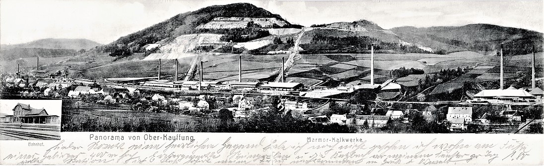


Połom - Zerówka quarry, Wojcieszów, Złotoryja County, Lower Silesian Voivodeship, Poland