| Locality | Latitude | Longitude | Distance | Bearing |
|---|
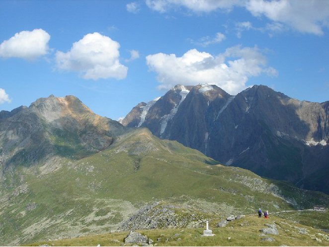
| Hohe Wand east slope, Finkenberg, Schwaz District, Tyrol, Austria | 47° 0' 47" N | 11° 37' 46" E | 0.0km (0.0 miles) | |
| Hohe Wand, Vals, Innsbruck-Land District, Tyrol, Austria | 47° 0' 47" N | 11° 37' 37" E | 0.2km (0.1 miles) | |
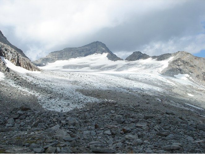
| Stampfl glacier, Finkenberg, Schwaz District, Tyrol, Austria | 47° 0' 36" N | 11° 38' 34" E | 1.1km (0.7 miles) | |
| Grawandkofel (Croda Alta), Vizze Pass (Pfitsch Pass; Pfitscher Joch), Sankt Jakob (San Giacomo), Pfitsch (Val di Vizze), Wipptal (Alta Vall'Isarco), South Tyrol, Trentino-Alto Adige (Trentino-South Tyrol), Italy | 47° 0' 11" N | 11° 38' 5" E | 1.2km (0.7 miles) | |
| Schrammach ridge, Schrammacher, Finkenberg, Schwaz District, Tyrol, Austria | 47° 1' 2" N | 11° 38' 44" E | 1.3km (0.8 miles) | |
| Sagwandspitze north face, Vals, Innsbruck-Land District, Tyrol, Austria | 47° 1' 31" N | 11° 37' 40" E | 1.4km (0.8 miles) | |
| Wasserfallköpfe, Vizze Pass (Pfitsch Pass; Pfitscher Joch), Sankt Jakob (San Giacomo), Pfitsch (Val di Vizze), Wipptal (Alta Vall'Isarco), South Tyrol, Trentino-Alto Adige (Trentino-South Tyrol), Italy | 47° 0' 1" N | 11° 37' 48" E | 1.4km (0.9 miles) | |
| Oberschrammach glacier, Schrammacher, Finkenberg, Schwaz District, Tyrol, Austria | 47° 1' 19" N | 11° 38' 47" E | 1.6km (1.0 miles) | |
| Schrammacher, Finkenberg, Schwaz District, Tyrol, Austria | 47° 1' 36" N | 11° 38' 33" E | 1.8km (1.1 miles) | |
| Schrammacher north-west face, Vals, Innsbruck-Land District, Tyrol, Austria | 47° 1' 38" N | 11° 38' 31" E | 1.8km (1.1 miles) | |
| Wasserfallkar, Vals, Innsbruck-Land District, Tyrol, Austria | 47° 0' 25" N | 11° 36' 13" E | 2.1km (1.3 miles) | |
| Windtal, Vizze Pass (Pfitsch Pass; Pfitscher Joch), Sankt Jakob (San Giacomo), Pfitsch (Val di Vizze), Wipptal (Alta Vall'Isarco), South Tyrol, Trentino-Alto Adige (Trentino-South Tyrol), Italy | 46° 59' 33" N | 11° 39' 8" E | 2.9km (1.8 miles) | |
| Ameiskopf, Finkenberg, Schwaz District, Tyrol, Austria | 47° 1' 23" N | 11° 39' 53" E | 2.9km (1.8 miles) | |
| Alpeiner Scharte deposit, Vals, Innsbruck-Land District, Tyrol, Austria | 47° 2' 15" N | 11° 38' 44" E | 3.0km (1.8 miles) | |
| Joch lakes, Pfitsch pass, Finkenberg, Schwaz District, Tyrol, Austria | 46° 59' 44" N | 11° 39' 35" E | 3.0km (1.9 miles) | |
| Pfitsch pass, Finkenberg, Schwaz District, Tyrol, Austria | 46° 59' 43" N | 11° 39' 36" E | 3.1km (1.9 miles) | |
| Rinnerlahner, Vizze Pass (Pfitsch Pass; Pfitscher Joch), Sankt Jakob (San Giacomo), Pfitsch (Val di Vizze), Wipptal (Alta Vall'Isarco), South Tyrol, Trentino-Alto Adige (Trentino-South Tyrol), Italy | 46° 59' 23" N | 11° 39' 4" E | 3.1km (1.9 miles) | |
| Vizze Pass (Pfitsch Pass; Pfitscher Joch), Sankt Jakob (San Giacomo), Pfitsch (Val di Vizze), Wipptal (Alta Vall'Isarco), South Tyrol, Trentino-Alto Adige (Trentino-South Tyrol), Italy | 46° 59' 42" N | 11° 39' 36" E | 3.1km (1.9 miles) | |
| Pfitscher-Joch-Haus, Vizze Pass (Pfitsch Pass; Pfitscher Joch), Sankt Jakob (San Giacomo), Pfitsch (Val di Vizze), Wipptal (Alta Vall'Isarco), South Tyrol, Trentino-Alto Adige (Trentino-South Tyrol), Italy | 46° 59' 33" N | 11° 39' 27" E | 3.1km (1.9 miles) | |
| Lavitz Alp, Pfitsch pass, Finkenberg, Schwaz District, Tyrol, Austria | 47° 0' 4" N | 11° 40' 8" E | 3.3km (2.0 miles) | |
| Rotbachl, Rotbachlspitze (Rote Wand), Pfitsch pass, Finkenberg, Schwaz District, Tyrol, Austria | 47° 0' 6" N | 11° 40' 10" E | 3.3km (2.1 miles) | |
| Grünig quartzite quarry, Sankt Jakob (San Giacomo), Pfitsch (Val di Vizze), Wipptal (Alta Vall'Isarco), South Tyrol, Trentino-Alto Adige (Trentino-South Tyrol), Italy | 46° 58' 42" N | 11° 38' 21" E | 3.9km (2.4 miles) | |
| Fußstein west slope, Finkenberg, Schwaz District, Tyrol, Austria | 47° 2' 47" N | 11° 39' 1" E | 4.0km (2.5 miles) | |
| Haupen valley, Finkenberg, Schwaz District, Tyrol, Austria | 47° 0' 20" N | 11° 41' 23" E | 4.6km (2.9 miles) | |
| Croda Rossa southwest slope (Rotbachl peak southwest slope), Vizze Pass (Pfitsch Pass; Pfitscher Joch), Sankt Jakob (San Giacomo), Pfitsch (Val di Vizze), Wipptal (Alta Vall'Isarco), South Tyrol, Trentino-Alto Adige (Trentino-South Tyrol), Italy | 46° 59' 36" N | 11° 41' 4" E | 4.7km (2.9 miles) | |
| Rotbachlspitze (Rote Wand), Pfitsch pass, Finkenberg, Schwaz District, Tyrol, Austria | 46° 59' 44" N | 11° 41' 21" E | 4.9km (3.1 miles) | |
| Olperer, Finkenberg, Schwaz District, Tyrol, Austria | 47° 3' 11" N | 11° 39' 32" E | 5.0km (3.1 miles) | |
| Haupenscharte (Haupentalscharte), Haupen valley, Finkenberg, Schwaz District, Tyrol, Austria | 46° 59' 41" N | 11° 41' 31" E | 5.2km (3.2 miles) | |
| Sankt Jakob (San Giacomo), Pfitsch (Val di Vizze), Wipptal (Alta Vall'Isarco), South Tyrol, Trentino-Alto Adige (Trentino-South Tyrol), Italy | 46° 58' 5" N | 11° 36' 10" E | 5.4km (3.4 miles) | |
| Haupentalscharte (Forcella Lavizza; Haupenscharte), Oberbergtal, Sankt Jakob (San Giacomo), Pfitsch (Val di Vizze), Wipptal (Alta Vall'Isarco), South Tyrol, Trentino-Alto Adige (Trentino-South Tyrol), Italy | 46° 59' 33" N | 11° 41' 57" E | 5.8km (3.6 miles) | |


Croda Rossa southwest slope, Vizze Pass, Sankt Jakob, Pfitsch, Wipptal, South Tyrol, Trentino-Alto Adige, Italy