| Locality | Latitude | Longitude | Distance | Bearing |
|---|
| Wheal Muttrall, Wheal Gorland, St Day, Cornwall, England, UK | 50° 14' 24" N | 5° 11' 5" W | 0.1km (0.0 miles) | |
| Wheal Gorland, St Day, Cornwall, England, UK | 50° 14' 30" N | 5° 11' 2" W | 0.1km (0.1 miles) | |
| Wheal Clinton, Clinton and Pink United Mine, St Day, Cornwall, England, UK | 50° 14' 36" N | 5° 11' 23" W | 0.4km (0.3 miles) | |
| Wheal Pink, Clinton and Pink United Mine, St Day, Cornwall, England, UK | 50° 14' 26" N | 5° 11' 42" W | 0.7km (0.4 miles) | |
| Wheal Unity, St Day, Gwennap, Cornwall, England, UK | 50° 14' 34" N | 5° 10' 32" W | 0.7km (0.5 miles) | |
| West Wheal Jewel (Tolcarne Mine; North Wheal Damsel), St Day, Cornwall, England, UK | 50° 14' 3" N | 5° 11' 15" W | 0.7km (0.5 miles) | |
| Clinton and Pink United Mine, St Day, Cornwall, England, UK | 50° 14' 42" N | 5° 11' 38" W | 0.8km (0.5 miles) | |
| West Wheal Gorland (Roselobby Mine; Roselabby Mine), West Wheal Jewel (Tolcarne Mine; North Wheal Damsel), St Day, Cornwall, England, UK | 50° 14' 10" N | 5° 11' 36" W | 0.8km (0.5 miles) | |
| Crofthandy, St Day, Gwennap, Cornwall, England, UK | 50° 14' 19" N | 5° 10' 27" W | 0.8km (0.5 miles) | |
| St Day United Mines (Poldice Mines), St Day, Gwennap, Cornwall, England, UK | 50° 14' 16" N | 5° 10' 28" W | 0.8km (0.5 miles) | |
| Wheal Unity Wood (Tolgullow United Mine; West Poldice Mine), Chacewater, Cornwall, England, UK | 50° 14' 53" N | 5° 10' 48" W | 0.9km (0.6 miles) | |
| Wheal Jewel, St Day, Gwennap, Cornwall, England, UK | 50° 14' 5" N | 5° 10' 35" W | 0.9km (0.6 miles) | |
| Park-an-Chy Mine, Treskerby, St Day, Cornwall, England, UK | 50° 14' 42" N | 5° 11' 48" W | 0.9km (0.6 miles) | |
| East Wheal Damsel, Carharrack, Cornwall, England, UK | 50° 13' 58" N | 5° 10' 45" W | 1.0km (0.6 miles) | |
| Wheal Damsel, Wheal Damsel United Mines, Carharrack, Cornwall, England, UK | 50° 13' 54" N | 5° 11' 10" W | 1.0km (0.6 miles) | |
| Carharrack Mine, Gwennap, Cornwall, England, UK | 50° 14' 4" N | 5° 10' 26" W | 1.1km (0.7 miles) | |
| Wheal Damsel United Mines, Carharrack, Cornwall, England, UK | 50° 13' 50" N | 5° 11' 8" W | 1.1km (0.7 miles) | |
| Wheal Maid, St Day, Gwennap, Cornwall, England, UK | 50° 14' 14" N | 5° 10' 7" W | 1.2km (0.8 miles) | |
| North Wheal Grambler, St Aubyn United Mines (Grambler and St Aubyn Mines), St Day, Cornwall, England, UK | 50° 14' 12" N | 5° 12' 6" W | 1.3km (0.8 miles) | |
| Wheal Hope, Wheal Damsel, Wheal Damsel United Mines, Carharrack, Cornwall, England, UK | 50° 13' 50" N | 5° 11' 40" W | 1.3km (0.8 miles) | |
| West Wheal Virgin, Great Consolidated Mines, Clifford Amalgamated Mines, St Day, Gwennap, Cornwall, England, UK | 50° 14' 3" N | 5° 10' 12" W | 1.3km (0.8 miles) | |
| Wheal Maid Decline, St Day, Gwennap, Cornwall, England, UK | 50° 14' 10" N | 5° 10' 2" W | 1.4km (0.9 miles) | |
| West Wheal Damsel (Wheal Spinster), Wheal Damsel United Mines, Carharrack, Cornwall, England, UK | 50° 13' 44" N | 5° 11' 29" W | 1.4km (0.9 miles) | |
| Wheal Trefula (incl. Wheal Lily), Redruth, Cornwall, England, UK | 50° 14' 28" N | 5° 12' 18" W | 1.4km (0.9 miles) | |
| Poldice Mine, St Day United Mines (Poldice Mines), St Day, Gwennap, Cornwall, England, UK | 50° 14' 32" N | 5° 9' 56" W | 1.4km (0.9 miles) | |
| Treskerby, St Day, Cornwall, England, UK | 50° 14' 48" N | 5° 12' 11" W | 1.4km (0.9 miles) | |
| Busveal, St Day, Cornwall, England, UK | 50° 13' 57" N | 5° 12' 3" W | 1.4km (0.9 miles) | |
| East Wheal Virgin, Great Consolidated Mines, Clifford Amalgamated Mines, St Day, Gwennap, Cornwall, England, UK | 50° 14' 10" N | 5° 9' 54" W | 1.5km (0.9 miles) | |
| St Aubyn United Mines (Grambler and St Aubyn Mines), St Day, Cornwall, England, UK | 50° 14' 9" N | 5° 12' 19" W | 1.5km (1.0 miles) | |
| Great Consolidated Mines, Clifford Amalgamated Mines, St Day, Gwennap, Cornwall, England, UK | 50° 14' 8" N | 5° 9' 51" W | 1.6km (1.0 miles) | |


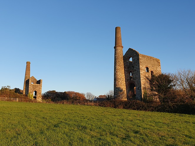


Wheal Unity Wood, Chacewater, Cornwall, England, UK