| Locality | Latitude | Longitude | Distance | Bearing |
|---|
| East Wheal Russell, Gulworthy, West Devon, Devon, England, UK | 50° 31' 2" N | 4° 11' 18" W | 0.0km (0.0 miles) | |
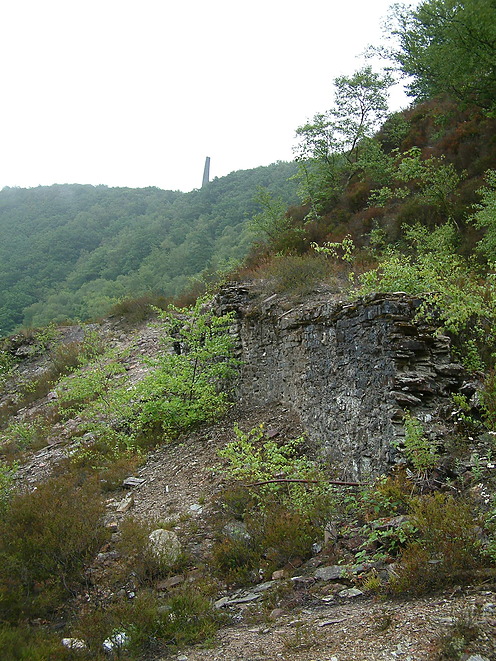
| Russell United Mine (incl. Wheal Russell), Gulworthy, West Devon, Devon, England, UK | 50° 31' 9" N | 4° 12' 8" W | 1.0km (0.6 miles) | |
| George and Charlotte Mine, Devon and Cornwall United Mines, Gulworthy, West Devon, Devon, England, UK | 50° 30' 31" N | 4° 10' 54" W | 1.1km (0.7 miles) | |
| West Wheal Crebor, Gulworthy, West Devon, Devon, England, UK | 50° 31' 36" N | 4° 10' 58" W | 1.1km (0.7 miles) | |
| Wheal Crebor, Gulworthy, West Devon, Devon, England, UK | 50° 31' 36" N | 4° 10' 47" W | 1.2km (0.7 miles) | |
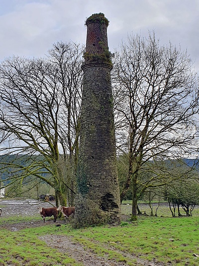
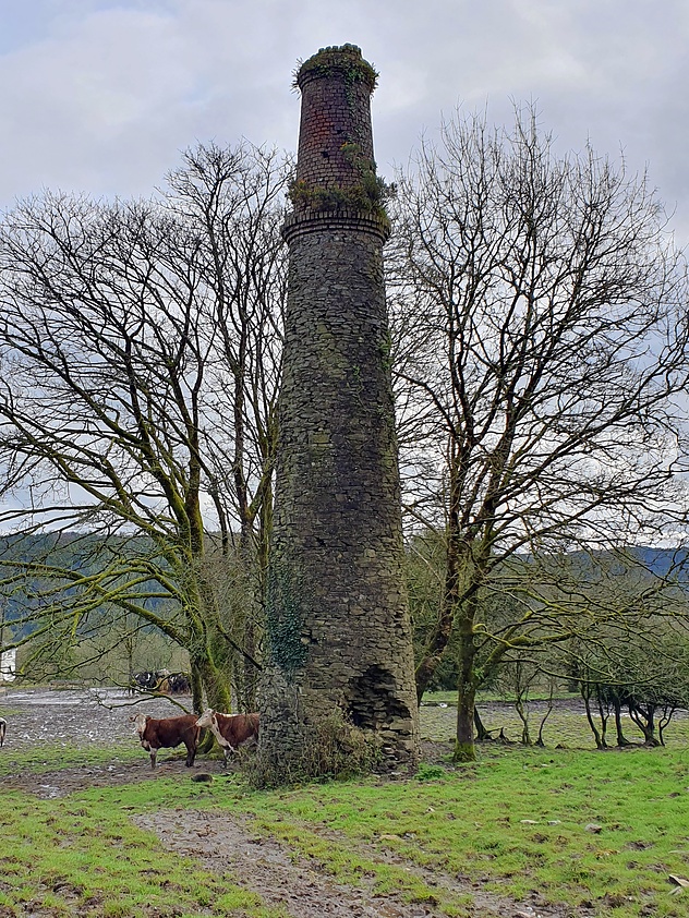
| Luscombe Mine (South Luscombe Mine; East Luscombe Mine), South Bedford Mine (South Gunnislake Mine; in part: South Bedford and East Gunnislake Mine), Gulworthy, West Devon, Devon, England, UK | 50° 31' 35" N | 4° 11' 54" W | 1.2km (0.8 miles) | |
| Harewood Consols, Harewood, Calstock, Cornwall, England, UK | 50° 30' 14" N | 4° 11' 12" W | 1.5km (0.9 miles) | |
| William and Mary Mine, Devon and Cornwall United Mines, Gulworthy, West Devon, Devon, England, UK | 50° 30' 37" N | 4° 10' 10" W | 1.6km (1.0 miles) | |
| South Bedford Mine (South Gunnislake Mine; in part: South Bedford and East Gunnislake Mine), Gulworthy, West Devon, Devon, England, UK | 50° 31' 29" N | 4° 12' 32" W | 1.7km (1.0 miles) | |
| New East Wheal Russell (South Wheal Crebor), Gulworthy, West Devon, Devon, England, UK | 50° 31' 20" N | 4° 9' 59" W | 1.7km (1.0 miles) | |
| Bedford Consols, Gulworthy, West Devon, Devon, England, UK | 50° 30' 15" N | 4° 10' 34" W | 1.7km (1.1 miles) | |
| East Gunnislake Mine (in part: South Bedford and East Gunnislake Mine), Gunnislake, Calstock, Cornwall, England, UK | 50° 31' 33" N | 4° 12' 33" W | 1.7km (1.1 miles) | |
| Ding Dong Mine, Bedford United Mine, Gulworthy, West Devon, Devon, England, UK | 50° 31' 40" N | 4° 12' 29" W | 1.8km (1.1 miles) | |
| Harewood, Calstock, Cornwall, England, UK | 50° 30' 3" N | 4° 11' 28" W | 1.8km (1.1 miles) | |
| Tavistock Canal Tunnel, Gulworthy, West Devon, Devon, England, UK | 50° 31' 50" N | 4° 10' 18" W | 1.9km (1.2 miles) | |
| Gunnislake, Calstock, Cornwall, England, UK | 50° 31' 27" N | 4° 12' 47" W | 1.9km (1.2 miles) | |
| Wheal Arthur (Wheal Phoenix; Slime Veor Mine), Drakewalls, Calstock, Cornwall, England, UK | 50° 30' 33" N | 4° 12' 46" W | 1.9km (1.2 miles) | |
| Marquis Lode, Bedford United Mine, Gulworthy, West Devon, Devon, England, UK | 50° 31' 50" N | 4° 12' 24" W | 1.9km (1.2 miles) | |
| Bedford United Mine, Gulworthy, West Devon, Devon, England, UK | 50° 31' 50" N | 4° 12' 25" W | 2.0km (1.2 miles) | |
| Watson's Mine, Devon Great Consols, Gulworthy, West Devon, Devon, England, UK | 50° 31' 50" N | 4° 12' 25" W | 2.0km (1.2 miles) | |
| Broadwell Wood Railway Cutting (2), Gulworthy, West Devon, Devon, England, UK | 50° 30' 32" N | 4° 9' 49" W | 2.0km (1.2 miles) | |
| Okel Tor Mine, Harewood, Calstock, Cornwall, England, UK | 50° 29' 57" N | 4° 11' 34" W | 2.0km (1.3 miles) | |
| Old Gunnislake Mine, Clitters United Mines, Gunnislake, Calstock, Cornwall, England, UK | 50° 31' 29" N | 4° 12' 53" W | 2.0km (1.3 miles) | |
| Colcharton Mine (Devon and Bedford Mine), Gulworthy, West Devon, Devon, England, UK | 50° 32' 9" N | 4° 11' 17" W | 2.1km (1.3 miles) | |
| Gawton Mine, Gulworthy, West Devon, Devon, England, UK | 50° 29' 54" N | 4° 10' 58" W | 2.1km (1.3 miles) | |
| Wheal Zion, Calstock, Cornwall, England, UK | 50° 30' 19" N | 4° 12' 46" W | 2.2km (1.4 miles) | |
| Hawkmoor Mine, Clitters United Mines, Gunnislake, Calstock, Cornwall, England, UK | 50° 31' 55" N | 4° 12' 34" W | 2.2km (1.4 miles) | |
| Trelawney Consols (incl. Wheal Morshead), Wheal Zion, Calstock, Cornwall, England, UK | 50° 30' 7" N | 4° 12' 31" W | 2.2km (1.4 miles) | |
| Broadwell Wood Railway Cutting (1), Gulworthy, West Devon, Devon, England, UK | 50° 30' 29" N | 4° 9' 33" W | 2.3km (1.4 miles) | |
| Wheal Edward, Drakewalls, Calstock, Cornwall, England, UK | 50° 30' 32" N | 4° 13' 8" W | 2.3km (1.5 miles) | |


Wheal Zion, Calstock, Cornwall, England, UK