| Locality | Latitude | Longitude | Distance | Bearing |
|---|
| Golconda Barite Mine, Humboldt County, Nevada, USA | 40° 57' 58" N | 117° 20' 38" W | 4.5km (2.8 miles) | |
| Kramer-Silver King mine, Golconda Mining District, Humboldt County, Nevada, USA | 40° 56' 20" N | 117° 19' 9" W | 6.2km (3.8 miles) | |
| Marble Occurrence (MRDS10270730), Humboldt County, Nevada, USA | 40° 59' 45" N | 117° 22' 52" W | 6.4km (4.0 miles) | |
| Silver Occurrence (MRDS10043960), Iron Point Mining District, Humboldt County, Nevada, USA | 40° 55' 56" N | 117° 19' 3" W | 6.9km (4.3 miles) | |
| Preble Mine, Potosi Mining District, Osgood Mountains, Humboldt County, Nevada, USA | 40° 59' 52" N | 117° 23' 31" W | 7.3km (4.5 miles) | |
| Silver Coin Mine, Valmy, Iron Point Mining District, Humboldt County, Nevada, USA | 40° 55' 44" N | 117° 19' 26" W | 7.4km (4.6 miles) | |
| Silver Coin Mine (Silver Coin group; Kramer property; Nevada Bureau of Mines & Geology sample site 2307), Golconda Mining District, Humboldt County, Nevada, USA | 40° 55' 41" N | 117° 19' 27" W | 7.4km (4.6 miles) | |
| Little Red's Excavation, Humboldt County, Nevada, USA | 40° 58' 2" N | 117° 23' 13" W | 7.5km (4.6 miles) | |
| Marble Occurrence (MRDS10222425), Potosi Mining District, Osgood Mountains, Humboldt County, Nevada, USA | 41° 0' 17" N | 117° 23' 48" W | 7.8km (4.8 miles) | |
| Maggie No. 1 Claim, Potosi Mining District, Osgood Mountains, Humboldt County, Nevada, USA | 40° 59' 32" N | 117° 23' 59" W | 8.0km (4.9 miles) | |
| Vanadium Occurrence MRDS(10197825), Iron Point Mining District, Humboldt County, Nevada, USA | 40° 55' 19" N | 117° 19' 11" W | 8.0km (5.0 miles) | |
| Unnamed Silver prospect (MRDS10173580), Iron Point Mining District, Humboldt County, Nevada, USA | 40° 55' 20" N | 117° 19' 31" W | 8.1km (5.0 miles) | |
| Horton Barite Mine, Humboldt County, Nevada, USA | 40° 58' 2" N | 117° 23' 56" W | 8.4km (5.2 miles) | |
| Iron Point Vanadium Occurrence, Humboldt County, Nevada, USA | 40° 55' 4" N | 117° 18' 55" W | 8.4km (5.2 miles) | |
| Quick Gold Claims, Iron Point Mining District, Humboldt County, Nevada, USA | 40° 55' 1" N | 117° 18' 56" W | 8.5km (5.3 miles) | |
| Unnamed Barite mine (MRDS10125693), Golconda Mining District, Humboldt County, Nevada, USA | 40° 57' 25" N | 117° 24' 0" W | 8.9km (5.6 miles) | |
| Jerry's Demise, Golconda Mining District, Humboldt County, Nevada, USA | 40° 57' 19" N | 117° 23' 56" W | 8.9km (5.6 miles) | |
| Cougar Enterprises Incorporated, Golconda Mine, Golconda Mining District, Humboldt County, Nevada, USA | 40° 57' 13" N | 117° 23' 56" W | 9.0km (5.6 miles) | |
| Little Britches Mine, Golconda Mining District, Humboldt County, Nevada, USA | 40° 57' 16" N | 117° 23' 59" W | 9.1km (5.6 miles) | |
| Kuhel Barite Deposit, Potosi Mining District, Osgood Mountains, Humboldt County, Nevada, USA | 41° 2' 21" N | 117° 23' 58" W | 9.4km (5.9 miles) | |
| Unnamed Silver prospect (MRDS10173597), Iron Point Mining District, Humboldt County, Nevada, USA | 40° 55' 16" N | 117° 22' 4" W | 9.6km (6.0 miles) | |
| Silver Occurrence (MRDS10125615), Humboldt County, Nevada, USA | 40° 54' 23" N | 117° 18' 46" W | 9.7km (6.0 miles) | |
| Manganese Occurrence (MRDS10043963), Iron Point Mining District, Humboldt County, Nevada, USA | 40° 54' 15" N | 117° 20' 43" W | 10.5km (6.5 miles) | |
| Manganese Occurrence (MRDS10222085), Humboldt County, Nevada, USA | 40° 54' 10" N | 117° 20' 23" W | 10.5km (6.5 miles) | |
| Manganese Occurrence (MRDS10271068), Iron Point Mining District, Humboldt County, Nevada, USA | 40° 54' 16" N | 117° 20' 49" W | 10.5km (6.5 miles) | |
| Barite Mine (MRDS10222520), Golconda Mining District, Humboldt County, Nevada, USA | 40° 57' 8" N | 117° 25' 13" W | 10.7km (6.6 miles) | |
| BR Claims, Golconda Mining District, Humboldt County, Nevada, USA | 40° 56' 13" N | 117° 24' 35" W | 10.8km (6.7 miles) | |
| July 4 Claim, Humboldt County, Nevada, USA | 40° 58' 3" N | 117° 26' 8" W | 11.3km (7.0 miles) | |
| Loadie Mine, Potosi Mining District, Osgood Mountains, Humboldt County, Nevada, USA | 40° 59' 38" N | 117° 26' 27" W | 11.4km (7.1 miles) | |
| National Lead Claims, Potosi Mining District, Osgood Mountains, Humboldt County, Nevada, USA | 41° 5' 48" N | 117° 18' 24" W | 11.5km (7.1 miles) | |


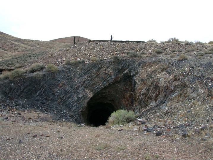


Silver Coin Mine, Golconda Mining District, Humboldt County, Nevada, USA