| Locality | Latitude | Longitude | Distance | Bearing |
|---|
| Antelope mine, Antelope Mining District, Pershing County, Nevada, USA | 40° 41' 14" N | 118° 32' 25" W | 0.0km (0.0 miles) | |
| Iron Mask Mine, Antelope Mining District, Pershing County, Nevada, USA | 40° 41' 41" N | 118° 32' 43" W | 1.0km (0.6 miles) | |
| Antelope Spring, Antelope Mining District, Pershing County, Nevada, USA | 40° 40' 59" N | 118° 33' 3" W | 1.0km (0.6 miles) | |
| Nevada Superior mine, Antelope Mining District, Pershing County, Nevada, USA | 40° 41' 34" N | 118° 33' 2" W | 1.1km (0.7 miles) | |
| Silver King Mine, Antelope Mining District, Pershing County, Nevada, USA | 40° 41' 49" N | 118° 33' 13" W | 1.6km (1.0 miles) | |
| Unnamed prospect (MRDS10271853), Antelope Mining District, Pershing County, Nevada, USA | 40° 40' 54" N | 118° 31' 20" W | 1.6km (1.0 miles) | |
| Nevada Hills, Scossa Mining District, Pershing County, Nevada, USA | 40° 42' 15" N | 118° 33' 13" W | 2.2km (1.4 miles) | |
| Old Noble, Scossa Mining District, Pershing County, Nevada, USA | 40° 42' 6" N | 118° 33' 51" W | 2.6km (1.6 miles) | |
| Noble mine, Antelope Mining District, Pershing County, Nevada, USA | 40° 42' 4" N | 118° 33' 56" W | 2.7km (1.6 miles) | |
| Ma Group, Antelope Mining District, Pershing County, Nevada, USA | 40° 40' 17" N | 118° 29' 56" W | 3.9km (2.4 miles) | |
| DeSoto mine (Antelope Spring mine), Antelope Mining District, Pershing County, Nevada, USA | 40° 41' 2" N | 118° 29' 38" W | 3.9km (2.4 miles) | |
| Gold Ribbon Rock Mine, Antelope Mining District, Pershing County, Nevada, USA | 40° 43' 23" N | 118° 31' 40" W | 4.1km (2.6 miles) | |
| Golden Molly, Pershing County, Nevada, USA | 40° 43' 33" N | 118° 31' 32" W | 4.5km (2.8 miles) | |
| Arsenic King mine, Antelope Mining District, Pershing County, Nevada, USA | 40° 40' 37" N | 118° 29' 8" W | 4.7km (2.9 miles) | |
| Pershing titanium placers, Scossa Mining District, Pershing County, Nevada, USA | 40° 42' 59" N | 118° 35' 3" W | 4.9km (3.1 miles) | |
| Unnamed prospect (MRDS10295793), Scossa Mining District, Pershing County, Nevada, USA | 40° 43' 19" N | 118° 34' 42" W | 5.0km (3.1 miles) | |
| Western Mines Group, Antelope Mining District, Pershing County, Nevada, USA | 40° 40' 0" N | 118° 28' 42" W | 5.7km (3.5 miles) | |
| Unnamed prospect (MRDS10198614), Antelope Springs Mining District, Pershing County, Nevada, USA | 40° 39' 22" N | 118° 28' 50" W | 6.1km (3.8 miles) | |
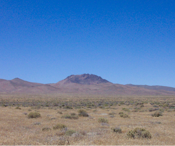
| Majuba Mountain, Antelope Mining District, Pershing County, Nevada, USA | 40° 40' 27" N | 118° 28' 11" W | 6.1km (3.8 miles) | |
| Majuba Hill Mine, Antelope Mining District, Pershing County, Nevada, USA | 40° 40' 9" N | 118° 28' 11" W | 6.3km (3.9 miles) | |
| Hawkeye mine, North Star group, Scossa Mining District, Pershing County, Nevada, USA | 40° 44' 2" N | 118° 35' 12" W | 6.5km (4.0 miles) | |
| Keough Prospect, Scossa Mining District, Pershing County, Nevada, USA | 40° 43' 54" N | 118° 35' 25" W | 6.5km (4.0 miles) | |
| Unnamed prospect (MRDS10247557), Antelope Mining District, Pershing County, Nevada, USA | 40° 42' 52" N | 118° 27' 53" W | 7.0km (4.4 miles) | |
| North Star group, Scossa Mining District, Pershing County, Nevada, USA | 40° 44' 22" N | 118° 35' 18" W | 7.1km (4.4 miles) | |
| Last Chance Mine, Antelope Mining District, Pershing County, Nevada, USA | 40° 39' 27" N | 118° 27' 55" W | 7.1km (4.4 miles) | |
| Crossroads, Scossa Mining District, Pershing County, Nevada, USA | 40° 45' 3" N | 118° 33' 35" W | 7.3km (4.5 miles) | |
| Unnamed prospect (MRDS10247090), Antelope Mining District, Pershing County, Nevada, USA | 40° 38' 52" N | 118° 28' 11" W | 7.4km (4.6 miles) | |
| Mohawk group, Scossa Mining District, Pershing County, Nevada, USA | 40° 43' 34" N | 118° 36' 43" W | 7.4km (4.6 miles) | |
| Unnamed prospect (MRDS10296267), Scossa Mining District, Pershing County, Nevada, USA | 40° 45' 35" N | 118° 33' 2" W | 8.1km (5.0 miles) | |
| Unnamed prospect (MRDS10296413), Scossa Mining District, Pershing County, Nevada, USA | 40° 45' 35" N | 118° 33' 2" W | 8.1km (5.0 miles) | |

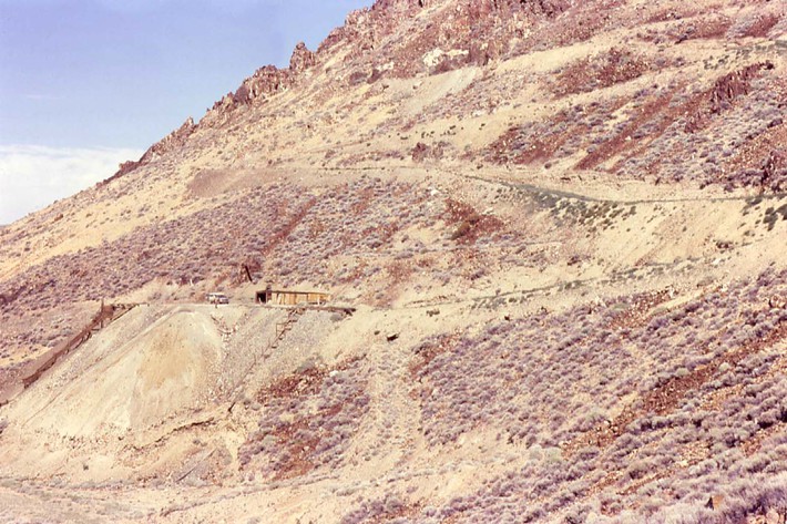


Majuba Hill Mine, Antelope Mining District, Pershing County, Nevada, USA