| Locality | Latitude | Longitude | Distance | Bearing |
|---|
| Murtörl (Mürtörl), Mur source, Muhr, Tamsweg District, Salzburg, Austria | 47° 8' 6" N | 13° 20' 9" E | 0.0km (0.0 miles) | |
| Mur source, Muhr, Tamsweg District, Salzburg, Austria | 47° 7' 47" N | 13° 20' 48" E | 1.0km (0.6 miles) | |
| Reinkar, Muhr, Tamsweg District, Salzburg, Austria | 47° 8' 43" N | 13° 20' 23" E | 1.2km (0.7 miles) | |
| Jägerspitze (Jagerspitzel), Muhr, Tamsweg District, Salzburg, Austria | 47° 8' 47" N | 13° 20' 22" E | 1.3km (0.8 miles) | |
| Schmalzscharte, Mur source, Muhr, Tamsweg District, Salzburg, Austria | 47° 7' 23" N | 13° 20' 41" E | 1.5km (0.9 miles) | |
| Rosskar marble outcrops, Frauennock, Mur source, Muhr, Tamsweg District, Salzburg, Austria | 47° 7' 57" N | 13° 21' 44" E | 2.0km (1.3 miles) | |
| Frauennock, Mur source, Muhr, Tamsweg District, Salzburg, Austria | 47° 7' 7" N | 13° 21' 29" E | 2.5km (1.6 miles) | |
| Kree Alp, Hüttschlag, St. Johann im Pongau District, Salzburg, Austria | 47° 8' 50" N | 13° 18' 27" E | 2.5km (1.6 miles) | |
| Sticklerhütte, Muhr, Tamsweg District, Salzburg, Austria | 47° 8' 53" N | 13° 22' 41" E | 3.5km (2.2 miles) | |
| Lower Schwarz lake, Muritzen valley, Rotgülden, Muhr, Tamsweg District, Salzburg, Austria | 47° 6' 23" N | 13° 21' 38" E | 3.7km (2.3 miles) | |
| Muritzen valley, Rotgülden, Muhr, Tamsweg District, Salzburg, Austria | 47° 7' 8" N | 13° 22' 44" E | 3.7km (2.3 miles) | |
| Spatgraben, Hüttschlag, St. Johann im Pongau District, Salzburg, Austria | 47° 8' 8" N | 13° 16' 52" E | 4.1km (2.6 miles) | |
| Muritzenkar, Haderlingspitze, Muritzen valley, Rotgülden, Muhr, Tamsweg District, Salzburg, Austria | 47° 6' 6" N | 13° 22' 45" E | 5.0km (3.1 miles) | |
| Rucksackkluft, Weißeck area (incl. Rauchkopf; Riedingscharte), Muhr, Tamsweg District, Salzburg, Austria | 47° 9' 44" N | 13° 23' 25" E | 5.1km (3.2 miles) | |
| Sprinzgasse Mine, Rotschopf Alp, Muhr, Tamsweg District, Salzburg, Austria | 47° 8' 3" N | 13° 24' 17" E | 5.2km (3.2 miles) | |
| Knappenloch, Weißeck area (incl. Rauchkopf; Riedingscharte), Muhr, Tamsweg District, Salzburg, Austria | 47° 9' 42" N | 13° 23' 35" E | 5.2km (3.2 miles) | |
| Summit Cleft, Weißeck area (incl. Rauchkopf; Riedingscharte), Muhr, Tamsweg District, Salzburg, Austria | 47° 9' 44" N | 13° 23' 37" E | 5.3km (3.3 miles) | |
| Weißeck area (incl. Rauchkopf; Riedingscharte), Muhr, Tamsweg District, Salzburg, Austria | 47° 9' 45" N | 13° 23' 38" E | 5.3km (3.3 miles) | |
| Schrovinkar, Rotgülden, Muhr, Tamsweg District, Salzburg, Austria | 47° 6' 48" N | 13° 24' 13" E | 5.7km (3.5 miles) | |
| Haderlingspitze, Muritzen valley, Rotgülden, Muhr, Tamsweg District, Salzburg, Austria | 47° 5' 47" N | 13° 23' 20" E | 5.9km (3.7 miles) | |
| Keeskogel, Bad Gastein, St. Johann im Pongau District, Salzburg, Austria | 47° 5' 42" N | 13° 16' 39" E | 6.3km (3.9 miles) | |
| Kölnbrein dam, Malta, Spittal an der Drau District, Carinthia, Austria | 47° 4' 41" N | 13° 20' 40" E | 6.4km (4.0 miles) | |
| Kölnbreinkar, Kölnbreinspitze - Lausnock area, Malta, Spittal an der Drau District, Carinthia, Austria | 47° 4' 50" N | 13° 21' 55" E | 6.5km (4.0 miles) | |
| Hühnerkar, Hüttschlag, St. Johann im Pongau District, Salzburg, Austria | 47° 6' 47" N | 13° 15' 19" E | 6.6km (4.1 miles) | |
| Rieding valley, Wald, Zederhaus, Tamsweg District, Salzburg, Austria | 47° 11' 19" N | 13° 22' 26" E | 6.6km (4.1 miles) | |
| Karteis, Hüttschlag, St. Johann im Pongau District, Salzburg, Austria | 47° 10' 7" N | 13° 15' 49" E | 6.6km (4.1 miles) | |
| Auweilwand, Hüttschlag, St. Johann im Pongau District, Salzburg, Austria | 47° 9' 34" N | 13° 15' 2" E | 7.0km (4.3 miles) | |
| Petereck, Malta, Spittal an der Drau District, Carinthia, Austria | 47° 4' 47" N | 13° 22' 55" E | 7.1km (4.4 miles) | |
| Petereck arsenic mine, Kölnbreinspitze - Lausnock area, Malta, Spittal an der Drau District, Carinthia, Austria | 47° 4' 41" N | 13° 22' 41" E | 7.1km (4.4 miles) | |
| Lower Rotgülden lake, Rotgülden, Muhr, Tamsweg District, Salzburg, Austria | 47° 5' 54" N | 13° 24' 46" E | 7.1km (4.4 miles) | |

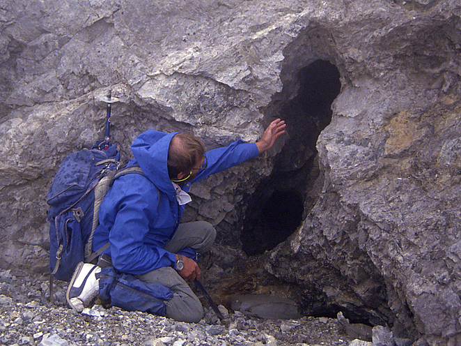


Summit Cleft, Weißeck area, Muhr, Tamsweg District, Salzburg, Austria