|
Canada | |
|
| www.venuewest.com/8IKC/s1post.htm. |
|
| Peatfield, Giles (n.d.) Personal communication. |
|
| minfile.gov.bc.ca (2022) https://minfile.gov.bc.ca/report.aspx?f=PDF&r=Minfile_Detail.rpt&minfilno=104K%20%20009
Peatfield, Giles (n.d.) Personal communication. |
|
| Peatfield, Giles (n.d.) Personal communication. |
|
| minfile.gov.bc.ca (n.d.) https://minfile.gov.bc.ca/report.aspx?f=PDF&r=Minfile_Detail.rpt&minfilno=104N%20%20005
Peatfield, Giles (n.d.) Personal communication. |
|
| Peatfield, Giles (n.d.) Personal communication. |
|
| Personal correspondance with Giles Peatfield (see comments in description) |
|
| Soregaroli, A. E. (1968). Geology of the Boss Mountain Mine, British Columbia (Doctoral dissertation, University of British Columbia). |
|
| Imperial Metals Corp |
|
| Singer, D.A., Berger, V.I., Moring, B.C. (2008) Porphyry copper deposits of the world: Database and grade and tonnage models, 2008. Open-File Report 2008-1155
personal correspondence with Giles Peatfield (see notes in description) |
- Fort Steele Mining Division
| MINFILE Number: 082JSE019 |
|
| Thomson, Ellis (1918) Some Canadian cerussite crystals. American Mineralogist, 3 (5) 41-43
Peatfield, Giles (n.d.) Personal communication. |
|
| personal correspondence with Giles Peatfield (see comments) |
|
| Dana 7:I:203. |
|
| Peatfield, Giles (n.d.) Personal communication. |
|
| Thomson, Ellis (1918) Some Canadian cerussite crystals. American Mineralogist, 3 (5) 41-43
Peatfield, Giles (n.d.) Personal communication. |
|
| Econ Geol (1997) 92:343-350
Peatfield, Giles (n.d.) Personal communication. |
|
| Thomson, Ellis (1918) Some Canadian cerussite crystals. American Mineralogist, 3 (5) 41-43 |
|
| Canadian Museum of Nature collection |
- Ice River Alkaline Complex
| Aris Reports 03433 |
- Greenwood Mining Division
| BC Minfile |
|
| Peatfield, Giles (n.d.) Personal communication. |
|
| Peatfield, Giles (n.d.) Personal communication.
Peatfield, Giles (n.d.) Personal communication.
Peatfield, Giles (n.d.) Personal communication.
Peatfield, Giles (n.d.) Personal communication.
Peatfield, Giles (n.d.) Personal communication. |
|
| MINFILE No 082ESE020 |
|
| Peatfield, Giles (n.d.) Personal communication. |
|
| R. M. Thompson (1954) Mineral occurrences in Western Canada. American Mineralogist 39:525-528 |
|
| G.E. Ray and I.C.L. Webster (2007): Geology and Chemistry of the Low Ti Magnetite-bearing Heff Cu-Au Skarn and its Associated Plutonic Rocks, Heffley Lake, South-Central British Columbia. Exploration and Mining Geology 16, 159-186. |
|
| I.C.L. Webster, G.E. Ray and A.R. Pettipas (1992) An Investigation of Selected Mineralized Skarns in British Columbia. British Columbia Geological Survey Paper 1992I |
|
| Peatfield, Giles (n.d.) Personal communication. |
|
| Imperial Metals Corp |
|
| Caudle, D. (2016) Mineralogy, geochemistry, and geochronology of the KIN property pegmatites in eastern British Columbia. Masters dissertation, University of British Columbia. |
|
| minfile.gov.bc.ca (2022) https://minfile.gov.bc.ca/report.aspx?f=PDF&r=Minfile_Detail.rpt&minfilno=104P%20%20004
Peatfield, Giles (n.d.) Personal communication. |
|
| Canadian Mineralogist: 43: 1687-1710. |
|
| Singer, Donald A., Berger, Vladimir Iosifovich, Moring, Barry C. (2005) Porphyry copper deposits of the world: database, map, and grade and tonnage models. Open-File Report 2005-1060. US Geological Survey doi:10.3133/ofr20051060 |
|
| Novagold Resources Inc. |
|
| minfile.gov.bc.ca (2022) https://minfile.gov.bc.ca/report.aspx?f=PDF&r=Minfile_Detail.rpt&minfilno=104P%20%20024
Peatfield, Giles (n.d.) Personal communication. |
|
| Coulson, I. M., Westphal, M., Anderson, R. G., Kyser, T. K. (2007) Concomitant skarn and syenitic magma evolution at the margins of the Zippa Mountain pluton. Mineralogy and Petrology, 90 (3) 199-221 doi:10.1007/s00710-006-0178-9 |
|
| Econ Geol (1991) 86:318-353 |
|
| Peatfield, Giles (n.d.) Personal communication. |
|
| personal correspondence with Giles Peatfield (see comments in description) |
|
| Personal correspondance with Giles Peatfield (see comments in description) |
|
| Peatfield, Giles (n.d.) Personal communication. |
|
| (2005) Mineral Resources Data System (MRDS), US Geological Survey. |
|
| Peatfield, Giles (n.d.) Personal communication. |
|
| Greenwood, H. J. (1967): Am. Mineral. 52, 1669-1680. |
- New Westminster Mining Division
| Peatfield, Giles (n.d.) Personal communication. |
|
| Peatfield, Giles (n.d.) Personal communication. |
|
| Peatfield, Giles (n.d.) Personal communication. |
|
| Peatfield, Giles (n.d.) Personal communication. |
|
| BC Minfile |
|
| Singer, D.A., Berger, V.I., Moring, B.C. (2008) Porphyry copper deposits of the world: Database and grade and tonnage models, 2008. Open-File Report 2008-1155 |
|
| personal correspondence with Giles Peatfield (see notes in description) |
|
| MINFILE No 093L 109 |
|
| Ray, G., Webster, I., Megaw, P., McGlasson, J., & Glover, K. (2002). The Lustdust Property in central British Columbia: a polymetallic zoned porphyry-skarn-manto-vein system. Geological Fieldwork, British Columbia Ministry of Energy and Mines, Paper, 1, 257-280.
BC Minfile data |
|
| personal correspondence with Giles Peatfield (see notes in description) |
|
| Duuring, P., Rowins, S.M., McKinley, B.S.M., Dickinson, J.M., Diakow, L.J., Kim, Y.-S., and Creaser, R.A. (2009): Mineralium Deposita 44, 463-496. |
|
| Peatfield, Giles (n.d.) Personal communication. |
|
| G.E. Ray and G.L. Dawson, (1994) The Geology and Mineral Deposits of the Hedley Gold Skarn District, Southern B.C. BC Geological Survey Bulletin 87:
G E Ray, G. L. Dawson, R Simpson (1983) The Geology And Controls Of Skakn Mineralization In The Hedley Gold Camp Southern British Columbia* (92W8, 82315) British Columbia Ministry of Energy, Mines and Petroleum Resources. Geological Fieldwork, 1986, Paper 1987-1 |
|
| G E Ray, G. L. Dawson, R Simpson (1983) The Geology And Controls Of Skakn Mineralization In The Hedley Gold Camp Southern British Columbia* (92W8, 82315) British Columbia Ministry of Energy, Mines and Petroleum Resources. Geological Fieldwork, 1986, Paper 1987-1
Fleischer M (1945) New mineral names, American Mineralogist 30, 644 |
|
| Ray, G.E., Dawson, G.L. & Simpson, G.. (1983) The Geology and controls of skarn mineralization In the Hedley gold camp Southern British Columbia* (92W8, 82315) British Columbia Ministry of Energy, Mines and Petroleum Resources. Geological Fieldwork, 1986, Paper 1987-1 |
|
| G.E. Ray and G.L. Dawson, (1994) The Geology and Mineral Deposits of the Hedley Gold Skarn District, Southern B.C. BC Geological Survey Bulletin 87:
G E Ray, G. L. Dawson, R Simpson (1983) The Geology And Controls Of Skakn Mineralization In The Hedley Gold Camp Southern British Columbia* (92W8, 82315) British Columbia Ministry of Energy, Mines and Petroleum Resources. Geological Fieldwork, 1986, Paper 1987-1
MINFILE No 092HSE038 |
|
| G E Ray, G. L. Dawson, R Simpson (1983) The Geology And Controls Of Skakn Mineralization In The Hedley Gold Camp Southern British Columbia* (92W8, 82315) British Columbia Ministry of Energy, Mines and Petroleum Resources. Geological Fieldwork, 1986, Paper 1987-1
www.em.gov.bc.ca (n.d.) http://www.em.gov.bc.ca/cf/minfile/search/search.cfm?mode=capbib&minfilno=092HSE059 |
|
| G E Ray, G. L. Dawson, R Simpson (1983) The Geology And Controls Of Skakn Mineralization In The Hedley Gold Camp Southern British Columbia* (92W8, 82315) British Columbia Ministry of Energy, Mines and Petroleum Resources. Geological Fieldwork, 1986, Paper 1987-1 |
- Revelstoke Mining Division
| Peatfield, Giles (n.d.) Personal communication. |
|
| Peatfield, Giles (n.d.) Personal communication. |
|
| Dixon, A. (2014, October). Mount Begbie Pegmatite Group, British Columbia, Canada–evolution from Barren to Complex Rare-element Pegmatites. In 2014 GSA Annual Meeting in Vancouver, British Columbia. |
- Similkameen Mining Division
| Copper Mountain Mining Corporation |
|
| Canadian Mineralogist: 43: 1687-1710. |
|
| Canadian Mineralogist , 1973, 12, pp.21-25. |
|
| Cabri, L. J., Owens, D. R., Laflamme, J. H. G. (1973) Tulameenite, a new platinum - iron - copper mineral from placers in the Tulameen River area, British Columbia. The Canadian Mineralogist, 12 (1) 21-25 |
|
| Schoeman, P. (1996). Overview and comparison of Besshi-type deposits: ancient and recent (Doctoral dissertation, Rhodes University). |
|
| P & E Mining Consultants Inc. Report No. 161 (2009): Technical Report and Resource Estimate on the Snowfield Property, Skeena Mining Division, British Columbia, Canada, for Silver Standard Resources Inc. |
|
| British Columbia Geological Survey, Minfile database. |
|
| British Columbia Geological Survey, Minfile database. |
|
| personal correspondence with Giles Peatfield (see notes in description) |
|
| Minfile 082FNW259 |
|
| Peatfield, Giles (n.d.) Personal communication. |
- Trail Creek Mining Division
| Peatfield, Giles (n.d.) Personal communication. |
|
| Econ Geol. (1995) 90:255-270 |
|
| MINFILE No 082FSW010 |
|
| I.C.L. Webster, G.E. Ray and A.R. Pettipas (1992) An Investigation of Selected Mineralized Skarns in British Columbia. British Columbia Geological Survey Paper 1992I |
|
| minfile.gov.bc.ca (2013) https://minfile.gov.bc.ca/Summary.aspx?minfilno=082FSW140
Montgomery, John R. (n.d.) Personal Communication. |
|
| Peatfield, Giles (n.d.) Personal communication. |
|
| minfile.gov.bc.ca (n.d.) https://minfile.gov.bc.ca/report.aspx?f=PDF&r=Minfile_Detail.rpt&minfilno=092F++001 |
|
| Singer, D.A., Berger, V.I., Moring, B.C. (2008) Porphyry copper deposits of the world: Database and grade and tonnage models, 2008. Open-File Report 2008-1155 |
|
| BC Minfile |
|
| I.C.L. Webster, G.E. Ray and A.R. Pettipas (1992) An Investigation of Selected Mineralized Skarns in British Columbia. British Columbia Geological Survey Paper 1992I |
|
| Singer, D.A., Berger, V.I., Moring, B.C. (2008) Porphyry copper deposits of the world: Database and grade and tonnage models, 2008. Open-File Report 2008-1155 |
|
| www.em.gov.bc.ca (n.d.) http://www.em.gov.bc.ca/cf/minfile/search/search.cfm?mode=capbib&minfilno=092L%20%20044
correspondance with Giles Peatfied |
|
| MinFile report |
|
| McConnell, (1914) |
|
| Ray and Webster (1997)
McConnell, (1914) |
|
| MINFILE No 104P 026 |
|
| BC Minfile data |
|
| Peatfield, Giles (n.d.) Personal communication. |
|
| Phillips, K.A. (1979) Minerals of Manitoba Volume II: Metallic minerals. MRD Educational Series ES78-2. Manitoba Mineral Resources Division |
|
| Bannatyne, B.B. (1985) Industrial Minerals in Rare-element Pegmatites of Manitoba. Economic Geology Report ER84-1, Manitoba Energy and Mines Geological Services. |
|
| Schetselaar, Ernst, Doreen Ames, and Eric Grunsky. (2018) "Integrated 3D Geological Modeling to Gain Insight in the Effects of Hydrothermal Alteration on Post-Ore Deformation Style and Strain Localization in the Flin Flon Volcanogenic Massive Sulfide Ore System" Minerals 8, no. 1: 3. https://doi.org/10.3390/min8010003 |
|
| Bannatyne, B.B. (1985) Industrial Minerals in Rare-element Pegmatites of Manitoba. Economic Geology Report ER84-1, Manitoba Energy and Mines Geological Services. |
|
| Econ Geol (1995) 90:658-675 |
|
| Bannatyne, B.B. (1985) Industrial Minerals in Rare-element Pegmatites of Manitoba. Economic Geology Report ER84-1, Manitoba Energy and Mines Geological Services. |
|
| Canadian Mineralogist Vol. 11,pp.591-608 (1972) |
|
| Ritchie, Paul M. H. (1973) A study of the copper-nickel-zinc deposit of Bird River Mines Co. Ltd., Southeastern Manitoba. MS Thesis University of Manitoba. |
- Cat Lake - Winnipeg River pegmatite field
| Bannatyne, B.B. (1985) Industrial Minerals in Rare-element Pegmatites of Manitoba. Economic Geology Report ER84-1, Manitoba Energy and Mines Geological Services. |
|
| Bannatyne, B.B. (1985) Industrial Minerals in Rare-element Pegmatites of Manitoba. Economic Geology Report ER84-1, Manitoba Energy and Mines Geological Services. |
|
| Bannatyne, B.B. (1985) Industrial Minerals in Rare-element Pegmatites of Manitoba. Economic Geology Report ER84-1, Manitoba Energy and Mines Geological Services. |
|
| Bannatyne, B.B. (1985) Industrial Minerals in Rare-element Pegmatites of Manitoba. Economic Geology Report ER84-1, Manitoba Energy and Mines Geological Services. |
|
| Bannatyne, B.B. (1985) Industrial Minerals in Rare-element Pegmatites of Manitoba. Economic Geology Report ER84-1, Manitoba Energy and Mines Geological Services. |
|
| Bannatyne, B.B. (1985) Industrial Minerals in Rare-element Pegmatites of Manitoba. Economic Geology Report ER84-1, Manitoba Energy and Mines Geological Services. |
|
| Bannatyne, B.B. (1985) Industrial Minerals in Rare-element Pegmatites of Manitoba. Economic Geology Report ER84-1, Manitoba Energy and Mines Geological Services. |
|
| Bannatyne, B.B. (1985) Industrial Minerals in Rare-element Pegmatites of Manitoba. Economic Geology Report ER84-1, Manitoba Energy and Mines Geological Services. |
|
| Bannatyne, B.B. (1985) Industrial Minerals in Rare-element Pegmatites of Manitoba. Economic Geology Report ER84-1, Manitoba Energy and Mines Geological Services. |
|
| Bannatyne, B.B. (1985) Industrial Minerals in Rare-element Pegmatites of Manitoba. Economic Geology Report ER84-1, Manitoba Energy and Mines Geological Services. |
|
| Bannatyne, B.B. (1985) Industrial Minerals in Rare-element Pegmatites of Manitoba. Economic Geology Report ER84-1, Manitoba Energy and Mines Geological Services.
Phillips, K.A. (1978) Minerals of Manitoba - Volume I: Non-metallic and pegmatitic. MRD Educational Series ES78-1. Manitoba Mineral Resources Division |
|
| Bannatyne, B.B. (1985) Industrial Minerals in Rare-element Pegmatites of Manitoba. Economic Geology Report ER84-1, Manitoba Energy and Mines Geological Services. |
|
| Bannatyne, B.B. (1985) Industrial Minerals in Rare-element Pegmatites of Manitoba. Economic Geology Report ER84-1, Manitoba Energy and Mines Geological Services. |
|
| Bannatyne, B.B. (1985) Industrial Minerals in Rare-element Pegmatites of Manitoba. Economic Geology Report ER84-1, Manitoba Energy and Mines Geological Services. |
- Shatford Creek-Bird River Area
| Bannatyne, B.B. (1985) Industrial Minerals in Rare-element Pegmatites of Manitoba. Economic Geology Report ER84-1, Manitoba Energy and Mines Geological Services. |
|
| Bannatyne, B.B. (1985) Industrial Minerals in Rare-element Pegmatites of Manitoba. Economic Geology Report ER84-1, Manitoba Energy and Mines Geological Services. |
|
| Bannatyne, B.B. (1985) Industrial Minerals in Rare-element Pegmatites of Manitoba. Economic Geology Report ER84-1, Manitoba Energy and Mines Geological Services. |
|
| Bannatyne, B.B. (1985) Industrial Minerals in Rare-element Pegmatites of Manitoba. Economic Geology Report ER84-1, Manitoba Energy and Mines Geological Services. |
|
| Bannatyne, B.B. (1985) Industrial Minerals in Rare-element Pegmatites of Manitoba. Economic Geology Report ER84-1, Manitoba Energy and Mines Geological Services. |
|
| Phillips, K.A. (1979) Minerals of Manitoba Volume II: Metallic minerals. MRD Educational Series ES78-2. Manitoba Mineral Resources Division |
|
| Phillips, K.A. (1979) Minerals of Manitoba Volume II: Metallic minerals. MRD Educational Series ES78-2. Manitoba Mineral Resources Division |
|
| Bannatyne, B.B. (1985) Industrial Minerals in Rare-element Pegmatites of Manitoba. Economic Geology Report ER84-1, Manitoba Energy and Mines Geological Services. |
|
| Bannatyne, B.B. (1985) Industrial Minerals in Rare-element Pegmatites of Manitoba. Economic Geology Report ER84-1, Manitoba Energy and Mines Geological Services. |
|
| Bannatyne, B.B. (1985) Industrial Minerals in Rare-element Pegmatites of Manitoba. Economic Geology Report ER84-1, Manitoba Energy and Mines Geological Services. |
|
| Bannatyne, B.B. (1985) Industrial Minerals in Rare-element Pegmatites of Manitoba. Economic Geology Report ER84-1, Manitoba Energy and Mines Geological Services. |
|
| Černý, P., Teertstra, D. K., Chapman, R., Selway, J. B., Hawthorne, F. C., Ferreira, K., Chackowsky, L. E., Wang, X.-J., Meintzer, R. E. (2012) Extreme fractionation and deformation of the leucogranite-pegmatite suite at Red Cross Lake, Manitoba, Canada. IV. Mineralogy. The Canadian Mineralogist, 50 (6) 1839-1875 doi:10.3749/canmin.50.6.1839 |
|
| Barrie, C.T. and Taylor, C.F. (2001) Geology, alteration mineralogy, geochemistry and volcanogenic massive-sulphide potential of the Ruttan mine area and the southern Rusty Lake volcanic belt (NTS 64B). Manitoba Geological Survey Open File Report 2001-9 |
|
| Phillips, K.A. (1979) Minerals of Manitoba Volume II: Metallic minerals. MRD Educational Series ES78-2. Manitoba Mineral Resources Division |
|
| Phillips, K.A. (1979) Minerals of Manitoba Volume II: Metallic minerals. MRD Educational Series ES78-2. Manitoba Mineral Resources Division |
|
| Leroux, M. V. & Ercit, T. S. (1992): Wagnerite, an accessory phase in cordierite-anthophyllite gneiss from Star Lake, Manitoba. Can. Mineral. 30, 1161-1165. |
|
| Rocks & Minerals 83:6 pp520-526 |
|
| Phillips, K.A. (1979) Minerals of Manitoba Volume II: Metallic minerals. MRD Educational Series ES78-2. Manitoba Mineral Resources Division |
|
| Gagné, S., Beaumont-Smith, C.J., Williams-Jones, A.E. and Hynes, A. 2006: Metallogenic and metamorphic study of selected deposits from the Snow Lake area and the southern flank of the Kisseynew Domain, Manitoba (NTS 63K16 and 63N2)
in Report of Activities 2006, Manitoba Science, Technology, Energy and Mines, Manitoba Geological Survey, p. 42–48. |
|
| Richardson, D.J., Ostry, G., Weber, W., Fogwill, D. (1996) Gold Deposits of Manitoba. Economic Geology Report ER86-1 (2nd ed.) Manitoba Energy and Mines Geological Services |
|
| Duff, S. (2016). Ore Types of the Auriferous Lalor VMS Deposit, Snow Lake, Manitoba: Implications for Genesis and Post Depositional Processes (MS Thesis, Université d'Ottawa/University of Ottawa). |
|
| Phillips, K.A. (1979) Minerals of Manitoba Volume II: Metallic minerals. MRD Educational Series ES78-2. Manitoba Mineral Resources Division |
|
| Richardson, D.J., Ostry, G., Weber, W., Fogwill, D. (1996) Gold Deposits of Manitoba. Economic Geology Report ER86-1 (2nd ed.) Manitoba Energy and Mines Geological Services |
|
| Rubingh, Kate E.L., Lafrance, Bruno, Gibson, Harold L. (2024) The Snow Lake Deposits in Manitoba, Canada: Formation of Metamorphosed Amphibolite Facies Orogenic Gold Deposits During a Progressive and Prograde Orogenic Event. Economic Geology, 119 (2) 421-444 doi:10.5382/econgeo.5048 |
|
| Rubingh, Kate E.L., Lafrance, Bruno, Gibson, Harold L. (2024) The Snow Lake Deposits in Manitoba, Canada: Formation of Metamorphosed Amphibolite Facies Orogenic Gold Deposits During a Progressive and Prograde Orogenic Event. Economic Geology, 119 (2) 421-444 doi:10.5382/econgeo.5048 |
|
| Rubingh, Kate E.L., Lafrance, Bruno, Gibson, Harold L. (2024) The Snow Lake Deposits in Manitoba, Canada: Formation of Metamorphosed Amphibolite Facies Orogenic Gold Deposits During a Progressive and Prograde Orogenic Event. Economic Geology, 119 (2) 421-444 doi:10.5382/econgeo.5048 |
|
| Phillips, K.A. (1979) Minerals of Manitoba Volume II: Metallic minerals. MRD Educational Series ES78-2. Manitoba Mineral Resources Division
Phillips, K.A. (1978) Minerals of Manitoba - Volume I: Non-metallic and pegmatitic. MRD Educational Series ES78-1. Manitoba Mineral Resources Division |
|
| Bailes, A. H., & Galley, A. G. (2000). Evolution of the Paleoproterozoic Snow Lake arc assemblage and geodynamic setting for associated volcanic-hosted massive sulphide deposits, Flin Flon Belt, Manitoba, Canada. Canadian Journal of Earth Sciences, 36(11), 1789-1805 |
|
| Richardson, D.J., Ostry, G., Weber, W., Fogwill, D. (1996) Gold Deposits of Manitoba. Economic Geology Report ER86-1 (2nd ed.) Manitoba Energy and Mines Geological Services
Gagné, S., Beaumont-Smith, C.J., Williams-Jones, A.E. and Hynes, A. 2006: Metallogenic and metamorphic study of selected deposits from the Snow Lake area and the southern flank of the Kisseynew Domain, Manitoba (NTS 63K16 and 63N2)
in Report of Activities 2006, Manitoba Science, Technology, Energy and Mines, Manitoba Geological Survey, p. 42–48. |
|
| Phillips, K.A. (1979) Minerals of Manitoba Volume II: Metallic minerals. MRD Educational Series ES78-2. Manitoba Mineral Resources Division |
|
| Pan, Y., Fleet, M. E., Barnett, R. L., & Chen, Y. (1993) Pyrosmalite in Canadian Precambrian sulfide deposits
A. Dogan Paktunc (1984) Metamorphism of the ultramafic rocks of the Thompson Mine, Thompson nickel belt, northern Manitoba Can Mineral, 22:77-91
Phillips, K.A. (1979) Minerals of Manitoba Volume II: Metallic minerals. MRD Educational Series ES78-2. Manitoba Mineral Resources Division
mineral chemistry, petrogenesis and significance. The Canadian Mineralogist: 31(3): 695-710. |
|
| Phillips, K.A. (1979) Minerals of Manitoba Volume II: Metallic minerals. MRD Educational Series ES78-2. Manitoba Mineral Resources Division |
|
| Phillips, K.A. (1979) Minerals of Manitoba Volume II: Metallic minerals. MRD Educational Series ES78-2. Manitoba Mineral Resources Division |
|
| Bannatyne, B.B. (1985) Industrial Minerals in Rare-element Pegmatites of Manitoba. Economic Geology Report ER84-1, Manitoba Energy and Mines Geological Services. |
|
| Peter, J. M., & Goodfellow, W. D. (1996). Mineralogy, bulk and rare earth element geochemistry of massive sulphide-associated hydrothermal sediments of the Brunswick Horizon, Bathurst Mining Camp, New Brunswick. Canadian Journal of Earth Sciences, 33(2), 252-283. |
|
| Nast, H.J., Williams-Jones, A.E. (1991) The role of water-rock interaction and fluid evolution in forming the porphyry-related Sisson Brook W-Cu-Mo deposit, New Brunswick. Economic Geology: 86(2): 302-317. |
|
| Archibald, D.A. (2020) U-Pb, Ar-Ar, and Re-Os Geochronological Constraints on Multiple Magmatic–Hydrothermal Episodes at the Lake George Mine, Central New Brunswick. Minerals 10, 566.
Lentz, C.
Thorne, K.
McFarlane, C.R.M. |
- Newfoundland and Labrador
| Personal correspondance with Giles Peatfield (see comments in description) |
|
| www.geosurv.gov.nf.ca/gacmap/LAB2.html. |
|
| Chafe, A. N. (2015). Direct dating and characterization of the Pope's Hill REE occurrence (Masters thesis, Memorial University of Newfoundland). |
- Red Wine Alkaline Complex
| Curtis, L.W. & Currie, K.L. (1977) Geology and petrology of the Red Wine complex, Central Labrador. GSC Bulletin 287, 61p. + maps |
|
| Tectonophysics 347:167–177 (2002) |
|
| correspondance with Giles Peatfied (see description) |
|
| Pe-Piper, Georgia, Piper, David J. W., Dessureau, Gilles (2024) Mineralogy of the Steel Mountain Anorthosite Complex, Western Newfoundland Appalachians, Canada: Petrogenesis and Tectonic Affinity. Minerals, 14 (1) doi:10.3390/min14010081 |
|
| P.B. Tomascak, M.A. Wise, P. Cerni, and D.L. Trueman (1994) Reconnaissance studies of four pegmatite populations in the Northwest Territories. pp 33-62. in W.D. Sinclair and D.G. Richardson eds. Studies Of Rare-Metal Deposits In The Northwest Territories. Geological Survey Of Canada Bulletin 475 |
|
| Am Min 35:173-184 |
|
| Donnelly, C. L. et al. (2007): Lithos 98, 160-176. |
|
| Porritt, Lucy Anne, Russell, James Kelly, McLean, Hayley, Fomradas, Gus, Eichenberg, David (2013) A Phreatomagmatic Kimberlite: The A418 Kimberlite Pipe, Northwest Territories, Canada. In Proceedings of 10th International Kimberlite Conference. Springer India. p.97-107. doi:10.1007/978-81-322-1173-0_7 |
|
| Dominion Diamond Mines |
|
| Mustafa, J., Nowicki, T. E., Oshust, P., Dyck, D., Crawford, B., & Harrison, S. (2003, June). The geology of the Misery kimberlite, Ekati diamond mine, Canada. In International Kimberlite Conference: Extended Abstracts (Vol. 8). |
|
| Tappert, R., Stachel, T., Harris, J. W., & Shimizu, N. (2005). Mineral inclusions in diamonds from the Panda kimberlite, Slave Province, Canada. European Journal of Mineralogy, 17(3), 423-440. |
|
| Abersteiner, A., Kamenetsky, V. S., Kamenetsky, M., Goemann, K., Ehrig, K., & Rodemann, T. (2018). Significance of halogens (F, Cl) in kimberlite melts: Insights from mineralogy and melt inclusions in the Roger pipe (Ekati, Canada). Chemical Geology, 478, 148-163. |
|
| Mesh Environmental (2008) Geochemical Characterization of the Cantung Mine Tailings, NWT. Project No. M018-001
Mining Weekly 29 July 2008 |
|
| Groat, L.A., Giuliani, G., Marshall, D.D., Turner, D. (2008) Emerald deposits and occurrences: A review. Ore Geology Reviews, 34 (1) 87-112 doi:10.1016/j.oregeorev.2007.09.003 |
|
| Groat, L.A., Mulja, T., Mauthner, M.H.F., Ercit, T.S., Raudsepp, M., Gault, R.A., Rollo, H.A. (2003) Geology and mineralogy of the Little Nahanni rare-element granitic pegmatites, Northwest Territories. The Canadian Mineralogist: 41: 139-160. |
|
| (1998) International strategic mineral issues summary report: tungsten. Circular 930-O. US Geological Survey doi:10.3133/cir930o |
|
| Northern Mineral Showings Database, NWT Geoscience Office. |
|
| Reardon, N C (1992) Geological Survey of Canada, Open File 2507 |
|
| Kevin Shelton collection |
|
| Peatfield, Giles (n.d.) Personal communication. |
|
| Malcolm, W. (1929) Gold fields of Nova Scotia. Memoir 156. Geological Survey of Canada doi:10.4095/119968 |
|
| Terry Collett |
|
| The Nova Scotia Department of Natural Resources Mineral Occurrence Database |
|
| Sabina, A. P. (1964) Rocks and minerals for the collector, Bay of Fundy area. Paper 64-10. Geological Survey of Canada doi:10.4095/101010 |
|
| Sabina, A. P. (1964) Rocks and minerals for the collector, Bay of Fundy area. Paper 64-10. Geological Survey of Canada doi:10.4095/101010 |
|
| Sabina, A. P. (1964) Rocks and minerals for the collector, Bay of Fundy area. Paper 64-10. Geological Survey of Canada doi:10.4095/101010 |
|
| Chatterjee, A.K. (1977) Copper-Zinc Deposit at McMillan Brook, Victoria County, Cape Breton Island. Nova Scotia Department of Mines, Report 77-1. |
|
| Sabina, A. P. (1964) Rocks and minerals for the collector, Bay of Fundy area. Paper 64-10. Geological Survey of Canada doi:10.4095/101010 |
|
| P.B. Tomascak, M.A. Wise, P. Cerni, and D.L. Trueman (1994) Reconnaissance studies of four pegmatite populations in the Northwest Territories. pp 33-62. in W.D. Sinclair and D.G. Richardson eds. Studies Of Rare-Metal Deposits In The Northwest Territories. Geological Survey Of Canada Bulletin 475 |
|
| Journal of Petrology 40:79-104 |
|
| Grant, H. L. J. (2009). The distribution and controls on silver mineralization in the Main Zone of the 2.68 Ga Archean Hackett River Zn-Pb-Cu-Ag volcanogenic massive sulfide (VMS) deposit, Nunavut, Canada (Masters thesis) Lakehead University.
portergeo.com.au (2007) http://portergeo.com.au/database/mineinfo.asp?mineid=mn1224 |
|
| Ozyer, C. (2011) Ice-movement history and kimberlite indicator mineral dispersal study, Pelly Bay, lower Boothia Peninsula, and Wager Plateau areas, Nunavut, Canada. PhD thesis University of Western Ontario, London, Ontario, 226 pages. |
|
| Ozyer, C. (2011) Ice-movement history and kimberlite indicator mineral dispersal study, Pelly Bay, lower Boothia Peninsula, and Wager Plateau areas, Nunavut, Canada. PhD thesis University of Western Ontario, London, Ontario, 226 pages. |
|
| Ozyer, C. (2011) Ice-movement history and kimberlite indicator mineral dispersal study, Pelly Bay, lower Boothia Peninsula, and Wager Plateau areas, Nunavut, Canada. PhD thesis University of Western Ontario, London, Ontario, 226 pages. |
|
| Campos-Alvarez, N. O., Samson, I. M., & Fryer, B. J. (2012). The roles of magmatic and hydrothermal processes in PGE mineralization, Ferguson Lake deposit, Nunavut, Canada. Mineralium Deposita, 47(4), 441-465. |
|
| www.davidkjoyceminerals.com |
|
| The Canadian Mineralogist Vol. 38, pp. 443-454 (2000) |
|
| Geochimica et Cosmochimica Acta, Vol. 65, No. 22, pp. 4243–4255, 2001 |
|
| Robertson, J.A. (1976) The Blind River Uranium Deposits: the ores and their setting. (Ontario Division of Mines, Miscellaneous paper 65) |
|
| Laird (1931) GERMAN-CURRIE AREA, COCH. DIST., ONT., ODM, V.40, PT. 3, P.1-22 |
|
| MDI Number: MDI32D05NW00159 |
|
| MDI Number: MDI42A09SE00012 |
|
| Econ Geol (1984) 79:1796-1817 |
|
| Sabina, Ann P. (1987) Rocks and minerals for the collector, Hull-Maniwaki, Quebec, Ottawa-Peterborough, Ontario. Miscellaneous report 41. Geological Survey of Canada |
|
| Econ Geol (1989) 84:676-693 |
|
| Ann P.Sabina (1983), Rocks and Minerals for the Collector
Kingston,Ontario to Lac St.Jean, Quebec. GSC Misc. Report 32 |
|
| Ann P.Sabina (1983), Rocks and Minerals for the Collector
Kingston,Ontario to Lac St.Jean, Quebec. GSC Misc. Report 32, p.12 |
|
| Sabina, Ann P. (1983) Rocks and minerals for the collector : Kingston, Ontario to Lac St-Jean, Quebec. Miscellaneous report 32. Geological Survey of Canada |
|
| Sangster, P.J., McGuinty, W.J., Papertzian, V.C., Steele, K.G., Lee, C.R., Barua, M., Laidlaw, D.A. and Carter, T.R. 2003. Report of Activities 2002, Resident Geologist Program, Southern Ontario Regional Resident Geologist Southeastern and Southwestern Districts, Mines and Minerals Information Centre, and Petroleum Resources Centre
Ontario Geological Survey, Open File Report 6115, 118p. |
|
| Szentpeteri, K., Molnar, Watkinson & Jones (2003) Geology and high grade hydrothermal PGE mineralization of the Vermilion quartz diorite offset dike, Sudbury, Canada, |
|
| Sabina, Ann P. (1991) Rocks and minerals for the collector, Sudbury to Winnipeg. Miscellaneous report 49. Geological Survey of Canada |
|
| A. R. Graham, R. Buchan, C. R. Lee (1964) Millerite at Strathcona Mine, Sudbury District: AAPG Bulletin Abstract 48:527 |
|
| Sabina, Ann P., Geological Survey of Canada Miscellaneous Report 49, page12 - 13. |
- Algonquin Highlands Township
| MDI Number: MDI31E07NW00029 |
|
| Collection of Michal Adamowicz. |
|
| Ontario Ministry of Northern Development and Mines MDI Number: MDI31E01NE00002 |
|
| G. Pouliot, J. A. Maxwell, and S. C. Robinson (1964): Cenosite from Bancroft, Ontario. Canadian Mineralogist 8, 1-10. |
|
| Ref.: Geological Survey of Canada Miscellaneous Report 39. |
|
| www.geologyontario.mndm.gov.on.ca (n.d.) http://www.geologyontario.mndm.gov.on.ca/mndmfiles/mdi/data/records/MDI31E01SE00021.html |
|
| Christopher Fouts (1999) Report of Assessment Work Physical Assessment Geotechnical Assessment Mining claim: S.O. 1195060 SI/3, lot 31, con. XVII, Monmouth Township, Haliburton County
Ref.: Goelogical Survey of Canada Miscellaneous Report 39 |
|
| Ref.: Geological Survey of Canada Miscellaneous Report 39. |
|
| Geological Survey of Canada Miscellaneous Report 39 |
|
| Hewitt, D.F. (1965) Graphite in Ontario. Industrial Mineral Report 20. Ontario Department of Mines |
|
| Ref.: Geological Survey of Canada Miscellaneous Report 39. |
|
| Ontario Ministry of Northern Development and Mines MDI Number: MDI31D15NE00020 |
|
| Ref.: Geological Survey of Canada Miscellaneous Report 39. |
|
| |
- Centre Hastings Municipality
| MDI Number: MDI31C11SW00018 |
- Hastings Highlands Municipality
| Hewitt, D. F. (1967) Pegmatite Mineral Resources of Ontario. Industrial Mineral Report 21. Ontario Department of Mines |
|
| King, Van (n.d.) Personal communcation. |
|
| Ref.: Geological Survey of Canada Miscellaneous Report 39. |
|
| Ref.: Geological Survey of Canada Miscellaneous Report 39. |
|
| D.F Hewitt (1954) |
|
| ref.: D.F. Hewitt (1954) |
|
| Storey C.C. and Vos M.A. (1981) Industrial minerals of the Pembroke-Renfrew area, Ontario Geological Survey, Mineral Deposit Circular 22, pt.2, p.147. |
|
| T. S. Ercit (1994) The geochemistry and crystal chemistry of columbite-group minerals from granitic pegmatites, southwestern Grenville Province, Canadian Shield. The Canadian Mineralogist 32:421-438 |
|
| [Bancroft & District Mineral Collecting Guidebook] |
|
| Ref.: Geological Survey of Canada Miscellaneous Report 39. |
|
| Personal Collection of Matthew Neuzil |
|
| Ref.: Geological Survey of Canada Miscellaneous Report 39. |
|
| MDI Number: MDI31C13SE00014 |
|
| Identified by Mineral Associates Inc. |
|
| Jacob Stanaszek Collection |
|
| Dubé, B., Balmer, W., Sanborn-Barrie, M., Skulski, T. and Parker, J. 2000. A preliminary report on amphibolite-facies, disseminated-replacement-style mineralization at the Madsen gold mine, Red Lake, Ontario
in Current Research 2000-C17, Geological Survey of Canada, 12p. |
|
| Sabina, Ann P. (1991) Rocks and minerals for the collector, Sudbury to Winnipeg. Miscellaneous report 49. Geological Survey of Canada |
|
| Rocks & Minerals 79:2 pp94-99 |
|
| Sabina, Ann P. (1991) Rocks and minerals for the collector, Sudbury to Winnipeg. Miscellaneous report 49. Geological Survey of Canada |
|
| Černý, P., Selway, J.B., Ercit, T.S., Breaks, F.W., Anderson, A.J., Anderson, S.D. (1998) Graftonite-beusite in granitic pegmatites of the Superior Province
a study in contrasts. The Canadian Mineralogist: 36(2): 367–376. |
|
| SAGE, R.P. (1983) Geology of the Carb Lake carbonatite complex. Ontario Geological Survey Open File Report 5399, 68p. |
|
| Breaks, F.W., Tindle, A.G., and Selway, J.B. (2008) Electron microprobe and bulk rock and mineral compositions from rare-element pegmatites and peraluminous, S-type granitic rocks from the Fort Hope pegmatite field, north-central Superior Province of Ontario. Ontario Geological Survey, Miscellaneous Release Data, 235. |
|
| J.C. Pedersen (2000) Report on 2000 Winter Diamond Drill Program Lilypad Lakes Tantalum - Cesium Property. Assessment File |
|
| Romios Gold Resources Inc. |
|
| Blackburn C. et al (2002) Separation Rapids Rare-Element Pegmatite Field, Ontario. in 48th Annual Meeting Institute on Lake Superior Geology. Vol 48 Part 2 - Field Trip Guidebook |
|
| Blackburn C. et al (2002) Separation Rapids Rare-Element Pegmatite Field, Ontario. in 48th Annual Meeting Institute on Lake Superior Geology. Vol 48 Part 2 - Field Trip Guidebook |
|
| Albina Adamova (2020) Technical Report on the Dixie Property Red Lake, Ontario. National Instrument 43-101 |
- Root Lake pegmatite group
| Tindle, A. G., Selway, J. B. & Breaks, F. W. (2005): Liddicoatite and associated species from the McCombe spodumene-subtype rare-element granitic pegmatite, northwestern Ontario, Canada. Canadian Mineralogist 43, 769-793. |
|
| Gossan Resources Limited |
|
| Ontario Ministry of Northern Development and Mines Number: MDI52L08SW00025 |
|
| Sabina, Ann P. (1991) Rocks and minerals for the collector, Sudbury to Winnipeg. Miscellaneous report 49. Geological Survey of Canada |
|
| Ann P.Sabina (1987), Rocks and Minerals for the Collector, Hull-Maniwaki, Quebec
Ottawa-Peterborough, Ontario. GSC Misc. Report 41, p.63 |
|
| Ann P.Sabina (1987), Rocks and Minerals for the Collector, Hull-Maniwaki, Quebec
Ottawa-Peterborough, Ontario. GSC Misc. Report 41, p.63 |
|
| MDI Number: MDI31F02NE00012 |
|
| MDI Number: MDI31F02NE00012 |
- Leeds and Grenville Counties
- Lyndhurst area (Black Rapids area)
| Wynne-Edwards, H. R. (1967) Geological Survey of Canada, Memoir 346, pp 128-129. |
|
| www.canadianwollastonite.com/Files/Articles/CIM2002-V2b.htm. |
|
| Grew, Edward S. (1983) A grandidierite-sapphirine association from India. Mineralogical Magazine, 47 (344) 401-403 doi:10.1180/minmag.1983.047.344.20
Lonker, S. (1980) Canadian Journal of Earth Science: 17: 1666-1684. |
- Lennox and Addington County
- Addington Highlands Township
| MDI Number: MDI31C14NW00004 |
|
| Econ Geol (1989) 84:676-693 |
|
| Lloyd Van Duzen |
|
| Sabina, A. P. (1971) Rocks and minerals for the collector Ottawa to North Bay, Ontario; Hull to Waltham, Quebec. Paper 70-50. Geological Survey of Canada doi:10.4095/102463 |
|
| Stevenson, J.S. (1954) Determination of columbium in ores by x-ray fluorescence. American Mineralogist, 39, 436-443. |
|
| Ref
OGS Misc, Report 48, Anne P. Sabina |
|
| MDI Number: MDI31E11NE00011 |
|
| Ercit, T.S. (1994) The geochemistry and crystal chemistry of columbite-group minerals from granitic pegmatites, southwestern Grenville Province, Canadian Shield. The Canadian Mineralogist, 32(2), 421-438, at p.425. |
|
| T. S. Ercit (1994) The geochemistry and crystal chemistry of columbite-group minerals from granitic pegmatites, southwestern Grenville Province, Canadian Shield. The Canadian Mineralogist 32:421-438 |
|
| Sabina, Ann P. (2007) Rocks and minerals for the collector : Ottawa to North Bay and Huntsville, Ontario; Gatineau (Hull) to Waltham and Témiscaming, Quebec. Miscellaneous report 48. Geological Survey of Canada
Sabina, Ann P. (2007) Rocks and minerals for the collector : Ottawa to North Bay and Huntsville, Ontario; Gatineau (Hull) to Waltham and Témiscaming, Quebec. Miscellaneous report 48. Geological Survey of Canada
Gatineau (Hull) to Waltham and Temiscaming, Quebec. GSC Misc. Report 48.
Gatineau (Hull) to Waltham and Temiscaming, Quebec. GSC Misc. Report 48. |
|
| E. William Heinrich (1962): Some mineral occurrences near Eau Claire, Ontario. Can. Mineral. 7, 314-318. |
|
| Ellsworth, N.V. (1932) Monazite Colored by Carbon from Dickens Township, Nipissing District, Onatio AMV17, p19. |
|
| T. S. Ercit (1994) The geochemistry and crystal chemistry of columbite-group minerals from granitic pegmatites, southwestern Grenville Province, Canadian Shield. The Canadian Mineralogist 32:421-438 |
|
| Sabina, A. P. (1971) Rocks and minerals for the collector Ottawa to North Bay, Ontario; Hull to Waltham, Quebec. Paper 70-50. Geological Survey of Canada doi:10.4095/102463 |
- Spectacle Lake (Wolfsden Lake)
| Sabina, Ann P. (2007) Rocks and minerals for the collector : Ottawa to North Bay and Huntsville, Ontario; Gatineau (Hull) to Waltham and Témiscaming, Quebec. Miscellaneous report 48. Geological Survey of Canada
Gatineau (Hull) to Waltham and Temiscaming, Quebec. GSC Misc. Report 48. |
|
| Sabina, Ann P. (2007) Rocks and minerals for the collector : Ottawa to North Bay and Huntsville, Ontario; Gatineau (Hull) to Waltham and Témiscaming, Quebec. Miscellaneous report 48. Geological Survey of Canada
Gatineau (Hull) to Waltham and Temiscaming, Quebec. GSC Misc. Report 48, p.96 |
|
| Sabina, Ann P. (2007) Rocks and minerals for the collector : Ottawa to North Bay and Huntsville, Ontario; Gatineau (Hull) to Waltham and Témiscaming, Quebec. Miscellaneous report 48. Geological Survey of Canada
Gatineau (Hull) to Waltham and Temiscaming, Quebec. GSC Misc. Report 48, p.97 |
|
| Sabina, A. P. (1971) Rocks and minerals for the collector Ottawa to North Bay, Ontario; Hull to Waltham, Quebec. Paper 70-50. Geological Survey of Canada doi:10.4095/102463 |
|
| MDI Number: MDI31E11SE00007 |
|
| Geological Survey of Canada Miscellaneous Report 39 |
|
| Ann P. Sabina., Misc report 48, pg.125, 127 |
|
| T. S. Ercit (1994) The geochemistry and crystal chemistry of columbite-group minerals from granitic pegmatites, southwestern Grenville Province, Canadian Shield. The Canadian Mineralogist 32:421-438 |
|
| Sabina - Misc Report 48, pg. 127 |
|
| MDI Number: MDI31E05NW00008 |
|
| Rose, E.R. (1960) Rare Earths of the Grenville Sub-Province, Ontario and Quebec. Geological Survey of Canada Paper 59-10, p.22 |
|
| Sattery, J. 1943. Mineral Occurrences in the Parry Sound District. Ontario Department of Mines, Annual Report, 1942, ARV51, pt2., p.27. |
|
| Sattery, J. 1943. Mineral Occurrences in the Parry Sound District. Ontario Department of Mines, Annual Report, 1942, ARV51, pt2., p.26 |
|
| Ann P.Sabina (1986), Rocks and Minerals for the Collector, Bancroft-Parry Sound Area and Southern Ontario. GSC Misc. Report 39
Geological Survey of Canada Miscellaneous Report 39 |
|
| Geological Survey of Canada Miscellaneous Report 39 |
|
| Sabina, Ann P. (1986) Rocks and minerals for the collector: Bancroft - Parry Sound area and southern Ontario. Miscellaneous report 39. Geological Survey of Canada doi:10.4095/121046 |
|
| Lloyd Van Duzen |
|
| Sabina, Ann P. (2007) Rocks and minerals for the collector : Ottawa to North Bay and Huntsville, Ontario; Gatineau (Hull) to Waltham and Témiscaming, Quebec. Miscellaneous report 48. Geological Survey of Canada
Sabina, Ann P. (2007) Rocks and minerals for the collector : Ottawa to North Bay and Huntsville, Ontario; Gatineau (Hull) to Waltham and Témiscaming, Quebec. Miscellaneous report 48. Geological Survey of Canada
Satteriey, J., (1942): Mineral occurrences in Parry Sound district. Ont. Dept. Mines, Ann. Rep., 51: 86 pp
Lloyd Van duzen photo & specimen |
|
| Sabina, A. P. (1971) Rocks and minerals for the collector Ottawa to North Bay, Ontario; Hull to Waltham, Quebec. Paper 70-50. Geological Survey of Canada doi:10.4095/102463
Ref., OGS Doc ARV51.pdf - (arv51 mineral occurances in parry sound district with map 51a by J satterly 1946), Ref., OGS Doc ARV64.pdf - (Sixty-Fourth Annual Report of The Ontario Department of Mines, 1955 {Parts 6}, Ref
OGS Misc, Report 48. |
|
| Satterly J. 1955. Sixty-Fourth Annual Report of The Ontario Department of Mines, Geology of Lount Township, Ontario Geological Survey Document ARV64, Pt.6, p.27. |
|
| Sixty-Fourth Annual Report of The Ontario Department of Mines (1955), Part 6 (Ontario Geological Survey Document ARV64.pdf), Geology of Lount Township |
|
| Sixty-Fourth Annual Report of The Ontario Department of Mines (1955), Part 6 (Ontario Geological Survey Document ARV64.pdf), Geology of Lount Township: 25, 26. |
|
| Sabina, Ann P. (2007) Rocks and minerals for the collector : Ottawa to North Bay and Huntsville, Ontario; Gatineau (Hull) to Waltham and Témiscaming, Quebec. Miscellaneous report 48. Geological Survey of Canada
Sabina, Ann P. (2007) Rocks and minerals for the collector : Ottawa to North Bay and Huntsville, Ontario; Gatineau (Hull) to Waltham and Témiscaming, Quebec. Miscellaneous report 48. Geological Survey of Canada |
|
| Sabina, Ann P. (2007) Rocks and minerals for the collector : Ottawa to North Bay and Huntsville, Ontario; Gatineau (Hull) to Waltham and Témiscaming, Quebec. Miscellaneous report 48. Geological Survey of Canada
Gatineau (Hull) to Waltham and Temiscaming, Quebec. GSC Misc. Report 48, p119 MDI Number: MDI41H16NE00003' |
|
| Sabina, A. P. (1971) Rocks and minerals for the collector Ottawa to North Bay, Ontario; Hull to Waltham, Quebec. Paper 70-50. Geological Survey of Canada doi:10.4095/102463 |
|
| Satterly, J. (1942), Mineral Occurrences in the Parry Sound District, Ontario Department of Mines,Fifty-First Annual Report Vol. II, Part II., p.33. |
|
| Geological Survey of Canada Miscellaneous Report 39 |
|
| Sabina, Ann P. (2007) Rocks and minerals for the collector : Ottawa to North Bay and Huntsville, Ontario; Gatineau (Hull) to Waltham and Témiscaming, Quebec. Miscellaneous report 48. Geological Survey of Canada
Gatineau (Hull) to Waltham and Temiscaming, Quebec. GSC Misc. Report 48, p115 |
|
| Sabina, Ann P. (2007) Rocks and minerals for the collector : Ottawa to North Bay and Huntsville, Ontario; Gatineau (Hull) to Waltham and Témiscaming, Quebec. Miscellaneous report 48. Geological Survey of Canada |
|
| OGS ARV51 Pt 2.pdf, (Mineral occurrences in the Parry Sound District p. 69, 76), S. B. Lumbers |
- Havelock-Belmont-Methuen Township
| Ontario Ministry of Northern Development and Mines MDI Number: MDI31C05NW00026 |
|
| MDI Number: MDI31C12NW00006
MDI Number: MDI31C12NW00006 |
|
| Ann P.Sabina (1987), Rocks and Minerals for the Collector, Hull-Maniwaki, Quebec
Ottawa-Peterborough, Ontario. GSC Misc. Report 41 |
|
| New Gold Inc. |
|
| Sabina, Ann P. (2007) Rocks and minerals for the collector : Ottawa to North Bay and Huntsville, Ontario; Gatineau (Hull) to Waltham and Témiscaming, Quebec. Miscellaneous report 48. Geological Survey of Canada
Sabina, Ann P. (2007) Rocks and minerals for the collector : Ottawa to North Bay and Huntsville, Ontario; Gatineau (Hull) to Waltham and Témiscaming, Quebec. Miscellaneous report 48. Geological Survey of Canada |
- Brudenell-Lyndoch-and-Raglan
| www.geologyontario.mndm.gov.on.ca (n.d.) http://www.geologyontario.mndm.gov.on.ca/mndmfiles/MDI/data/records/MDI31F06NW00023.html |
|
| Ontario Ministry of Northern Development and Mines MDI Number: MDI31F06NW00023 |
|
| Hugh S. Spence (1930) Pegmatite minerals of Ontario and Quebec. American Mineralogist 15:430-450 |
|
| MDI Number: MDI31F03NW00061 |
|
| Sabina, A. P. (1971) Rocks and minerals for the collector Ottawa to North Bay, Ontario; Hull to Waltham, Quebec. Paper 70-50. Geological Survey of Canada doi:10.4095/102463
Hull to Waltham, Quebec |
|
| Annual report of the Ontario Department of Mines, Volume 15, Issues 1-2 |
|
| Sabina, Ann P. (2007) Rocks and minerals for the collector : Ottawa to North Bay and Huntsville, Ontario; Gatineau (Hull) to Waltham and Témiscaming, Quebec. Miscellaneous report 48. Geological Survey of Canada
Sabina, A. P. (1971) Rocks and minerals for the collector Ottawa to North Bay, Ontario; Hull to Waltham, Quebec. Paper 70-50. Geological Survey of Canada doi:10.4095/102463 |
|
| Carter, T.R., Colvine, A.C., Meyn, H.D. (1980) Geology of Base Metal, Precious Metal, Iron, and Molybdenum Deposits in the Pembroke-Renfrew Area, Ontario Geological Survey, Mineral Deposits Circular 20, 198p, p.67-68. |
|
| Sabina, A. P. (1971) Rocks and minerals for the collector Ottawa to North Bay, Ontario; Hull to Waltham, Quebec. Paper 70-50. Geological Survey of Canada doi:10.4095/102463 |
|
| Satterly J. (1944) Mineral Occurrenes in the Renfrew Area, Ontario Department of Mines, Fifty - Third Annual Report, ARV53, Pt.3, P. 43-46. |
|
| Sabina, Ann P. (2007) Rocks and minerals for the collector : Ottawa to North Bay and Huntsville, Ontario; Gatineau (Hull) to Waltham and Témiscaming, Quebec. Miscellaneous report 48. Geological Survey of Canada
Sabina, Ann P. (2007) Rocks and minerals for the collector : Ottawa to North Bay and Huntsville, Ontario; Gatineau (Hull) to Waltham and Témiscaming, Quebec. Miscellaneous report 48. Geological Survey of Canada |
- Unorganized North Sudbury District
| (1998) International strategic mineral issues summary report: tungsten. Circular 930-O. US Geological Survey doi:10.3133/cir930o |
|
| Easton R.M., Murphy E.I, (2002) Precambrian Geology of Street Township, Southern and Grenville Provinces, Ontario Geological Survey, Open File Report 6078 |
|
| Hewitt, D. F. (1967) Pegmatite Mineral Resources of Ontario. Industrial Mineral Report 21. Ontario Department of Mines |
- Postagoni Lake Pegmatite Group
| Sabina, Ann P. (1991) Rocks and minerals for the collector, Sudbury to Winnipeg. Miscellaneous report 49. Geological Survey of Canada |
|
| Franklin, J.M., Schnieders, B.R., Koopman, E.R. (1991) Mineral Deposits in the western Superior Province, Ontario (Field Trip 9) Geological Survey of Canada, Open File 2164.
Patterson, G.C. (1984) Ontario Geological Survey miscellaneous paper 118.
Proceedings 30th Intl Geol Cong Vol 16 pp 97-108. |
|
| Ontario Geological Survey (2015), Mineral Deposit Inventory MDI Number: MDI42L04SE00005 |
|
| Hewitt, D. F. (1967) Pegmatite Mineral Resources of Ontario. Industrial Mineral Report 21. Ontario Department of Mines |
|
| Pan, Y., Fleet, M.E. (1992) Mineralogy and genesis of calc-silicates associated with Archean volcanogenic massive sulphide deposits at the Manitouwadge mining camp, Ontario. Canadian Journal of Earth Sciences: 29(7): 1375–1388. |
|
| Canadian Journal of Earth Sciences, 1992, 29(7): 1375-1388
Canadian Mineralogist 31, 695 |
|
| Savard, J. (2019). Petrology of ijolites from the Prairie Lake carbonatite complex (Masters thesis, Thunder Bay, Ontario]: Lakehead University). |
|
| Sabina, Ann P. (1991) Rocks and minerals for the collector, Sudbury to Winnipeg. Miscellaneous report 49. Geological Survey of Canada |
|
| Econ Geol. (1995) 90:2065-2072
Franklin, J.M., Schnieders, B.R., Koopman, E.R. (1991) Mineral Deposits in the western Superior Province, Ontario (Field Trip 9) Geological Survey of Canada, Open File 2164. |
|
| Sabina, Ann P. (1991) Rocks and minerals for the collector, Sudbury to Winnipeg. Miscellaneous report 49. Geological Survey of Canada |
|
| 5TH INSTITUTE ON LAKE SUPERIOR GEOLOGY (2009) PROCEEDINGS VOLUME 55 p. 21 |
|
| The Canadian Mining and Metallurgical Bull., Feb 1966. |
|
| Sabina, A P (2003) Rocks and minerals for the collector: Kirkland Lake - Rouyn-Noranda - Val-d'Or, Ontario and Quebec. Miscellaneous report 77. Geological Survey of Canada
Sabina, A P (2003) Rocks and minerals for the collector: Kirkland Lake - Rouyn-Noranda - Val-d'Or, Ontario and Quebec. Miscellaneous report 77. Geological Survey of Canada |
|
| Dubé, B., Mercier-Langevin, P., Kjarsgaard, I., Hannington, M., Bécu, V., Côté, J., ... & Bédard, N. (2014). The Bousquet 2-Dumagami world-class Archean Au-rich volcanogenic massive sulfide deposit, Abitibi, Quebec: Metamorphosed submarine advanced argillic alteration footprint and genesis. Economic Geology, 109(1), 121-166. |
|
| Can Mineral May 1976 v. 14 no. 2 p. 164-171 |
|
| Sabina, A P (2003) Rocks and minerals for the collector: Kirkland Lake - Rouyn-Noranda - Val-d'Or, Ontario and Quebec. Miscellaneous report 77. Geological Survey of Canada
Sabina, A P (2003) Rocks and minerals for the collector: Kirkland Lake - Rouyn-Noranda - Val-d'Or, Ontario and Quebec. Miscellaneous report 77. Geological Survey of Canada |
|
| Gaboury, Damien, Dominique Genna, Jacques Trottier, Maxime Bouchard, Jérôme Augustin, and Kelly Malcolm. (2021) "The Perron Gold Deposit, Archean Abitibi Belt, Canada: Exceptionally High-Grade Mineralization Related to Higher Gold-Carrying Capacity of Hydrocarbon-Rich Fluids" Minerals 11, no. 10: 1066. https://doi.org/10.3390/min11101066 |
|
| Watkinson, D H (1991) IAGOD Field trip No. 4. Geological Survey of Canada, Open File 2159 |
|
| GAUDARD, S. (1993) Voyages au coeur des Appalaches. Published by: Musée Minéralogique et Minier de la région de l’amiante, Thetford Mines, Québec, (pgs. 76, 85) |
- Gaspésie-Îles-de-la-Madeleine
| SABINA, A.P. (1992) Rocks & Minerals for the collector
Allcock, J.B. (1982) Skarn and porphyry copper mineralization at Mines Gaspé, Murdochville, Quebec. Economic Geology, 77:4, 971-999.
Estrie and Gaspesie, Quebec
and Parts of New Brunswick. Geological Survey of Canada, Miscellaneous Report 46, 156 pages, at pp. 76-77. |
|
| BOIVIN, D. (1985) Roche et Minéraux du Québec: Guide d'excursion pour le collectionneur. publ. Conseil de Devéloppement du Loisir Scientifique. Montréal. 114. (in French) |
|
| Sabina, A.P. (1983) Rocks & Minerals for the collector
Palache, Charles, Berman, Harry, Frondel, Clifford (1944) The System of Mineralogy (7th ed.) Vol. 1 - Elements, Sulfides, Sulfosalts, Oxides. John Wiley and Sons, New York.
Kingston, Ontario to Lac St-Jean, Quebec. GSC Misc. Report 32, 65-66 p. |
|
| Van Velthuizen, J. V. (1993): The Parker Mine, Notre Dame du Laus (Québec). Mineralogical Record, 24(5): 369-373. |
|
| Horváth collection |
|
| Sabina, A. P. (1969) Rocks and minerals for the collector : Buckingham, Mont Laurier, Grenville, Quebec; Hawkesbury, Ottawa, Ontario. Paper 68-51. Geological Survey of Canada doi:10.4095/102317
Sabina, A. P. (1969) Rocks and minerals for the collector : Buckingham, Mont Laurier, Grenville, Quebec; Hawkesbury, Ottawa, Ontario. Paper 68-51. Geological Survey of Canada doi:10.4095/102317 |
|
| Sabina, A.P. (1986) Rocks & Minerals for the collector
Sabina, Ann P. (1986) Rocks and minerals for the collector: Buckingham-Mont-Laurier-Grenville, Quebec; Hawkesbury-Ottawa, Ontario. Miscellaneous report 33. Geological Survey of Canada |
|
| Sabina, A.P. (1986) Rocks & Minerals for the collector
Sabina, Ann P. (1986) Rocks and minerals for the collector: Buckingham-Mont-Laurier-Grenville, Quebec; Hawkesbury-Ottawa, Ontario. Miscellaneous report 33. Geological Survey of Canada |
|
| Sabina, A.P. (1986) Rocks & Minerals for the collector
Sabina, Ann P. (1986) Rocks and minerals for the collector: Buckingham-Mont-Laurier-Grenville, Quebec; Hawkesbury-Ottawa, Ontario. Miscellaneous report 33. Geological Survey of Canada |
|
| Bogoch, R., Kumarapeli, S., and Matthews, A. (1997) High-pressure K-feldspar-vesuvianite bearing assemblage in the central metasedimentary belt of the Grenville Province, Saint Jovite area, Quebec. Canadian Mineralogist: 35: 1269-1275.
Frédéric Messier Leroux |
|
| Canadian Mineralogist vol.22, pp. 595-604 (1984)
Economic Geology December 1, 1987 vol. 82 no. 8 2076-2090 |
|
| O'NEIL, J.J. (1914) Saint Hilaire (Beloeil) and Rougemont mountains, Quebec. Geological Survey Canada Memoir 43, 108 p. |
|
| Van Rythoven, A. D., Schulze, D. J., & Davis, D. W. (2020). Ultramafic xenoliths from the 1.15 Ga Certac kimberlite, eastern Superior Craton. The Canadian Mineralogist, 58(2), 267-286. |
|
| Traill, R. J. (1970) A Catalogue of Canadian Minerals. Paper 69-45. Geological Survey of Canada |
|
| Diniz, T. (2019). An Overview of the Troilus Au-Cu Deposit, Frotet-Evans Greenstone Belt, Opatica Subprovince, Quebec (Masters thesis Queens University, Kingston).
Fraser, R. J. (1993). The Lac Troilus gold-copper deposit, northwestern Quebec
a possible Archean porphyry system. Economic geology, 88(6), 1685-1699. |
|
| Bynoe, L. (1987). Shear zone influence on the emplacement of a giant pegmatite: The Whabouchi Lithium Pegmatite, Quebec, Canada (Doctoral dissertation, The University of Western Ontario). |
|
| Sabina, A.P. (1987) Rocks & Minerals for the collector
Hull-Maniwaki, Quebec, Ottawa-Peterborough, Ontario. GSC Misc. Report 41, 11. |
|
| Sabina, A.P. (1987) Rocks & Minerals for the collector
Hull-Maniwaki, Quebec, Ottawa-Peterborough, Ontario. GSC Misc. Report 41, 12. |
- La Vallée-de-la-Gatineau RCM
| Econ Geol (1986) 81:89-112 |
|
| Econ Geol (1986) 81:89-112 |
- Les Collines-de-l'Outaouais RCM
| Sabina, Ann P. (1987) Rocks and minerals for the collector, Hull-Maniwaki, Quebec, Ottawa-Peterborough, Ontario. Miscellaneous report 41. Geological Survey of Canada |
|
| Geological Survey of Canada Miscellaneous Report 33 |
- Saint-Pierre-de-Wakefield
| Geological Survey of Canada Miscellaneous Report 41. |
|
| Sabina, A.P. (1986) Rocks & Minerals for the collector
Sabina, Ann P. (1986) Rocks and minerals for the collector: Buckingham-Mont-Laurier-Grenville, Quebec; Hawkesbury-Ottawa, Ontario. Miscellaneous report 33. Geological Survey of Canada |
|
| Geological Survey of Canada Miscellaneous Report 33 |
|
| Sabina, A.P. (1986) Rocks & Minerals for the collector
Sabina, Ann P. (1986) Rocks and minerals for the collector: Buckingham-Mont-Laurier-Grenville, Quebec; Hawkesbury-Ottawa, Ontario. Miscellaneous report 33. Geological Survey of Canada
Ann P. Sabina 68-51 1986 |
|
| Sabina, Ann P. (2007) Rocks and minerals for the collector : Ottawa to North Bay and Huntsville, Ontario; Gatineau (Hull) to Waltham and Témiscaming, Quebec. Miscellaneous report 48. Geological Survey of Canada |
|
| GSC Miscellaneous Report 48 |
|
| Poliakovska, Kateryna, Annesley, Irvine R., Hajnal, Zoltan (2024) Geophysical Constraints to the Geological Evolution and Genesis of Rare Earth Element–Thorium–Uranium Mineralization in Pegmatites at Alces Lake, SK, Canada. Minerals, 14 (1) doi:10.3390/min14010025 |
|
| Bruneton, P. (1987) Geology of the Cigar Lake Uranium Deposit (Saskatchewan, Canada). In: Saskatchewan Geological Society Special Publication Number 8: Economic Minerals of Saskatchewan, Proceedings of a Symposium Held in Regina, Saskatchewan 17 & 18 November 1986, 99-119. |
|
| Econ Geol (1987)82:1169-1176 |
|
| Mark Hatton (2021) Arrow Deposit, Rook I Project Saskatchewan NI 43-101 Technical Report on Feasibility Study |
|
| applications.saskatchewan.ca (n.d.) https://applications.saskatchewan.ca/Apps/ECON_Apps/dbsearch/MinDepositQuery/default.aspx?ID=5959 |
|
| SRK Consulting (Canada) Inc. (2018)Prefeasibility Study Report for the Wheeler River Uranium Project Saskatchewan, Canada. |
|
| Steadman, J. A., & Spry, P. G. (2015). Metamorphosed Proterozoic Zn-Pb-Ag Mineralization in the Foster River Area, Northern Saskatchewan, Canada. Economic Geology, 110(5), 1193-1214. |
|
| Steadman, J. A., & Spry, P. G. (2015). Metamorphosed Proterozoic Zn-Pb-Ag Mineralization in the Foster River Area, Northern Saskatchewan, Canada. Economic Geology, 110(5), 1193-1214. |
|
| Steadman, J. A., & Spry, P. G. (2015). Metamorphosed Proterozoic Zn-Pb-Ag Mineralization in the Foster River Area, Northern Saskatchewan, Canada. Economic Geology, 110(5), 1193-1214. |
|
| Steadman, J. A., & Spry, P. G. (2015). Metamorphosed Proterozoic Zn-Pb-Ag Mineralization in the Foster River Area, Northern Saskatchewan, Canada. Economic Geology, 110(5), 1193-1214. |
|
| Steadman, J. A., & Spry, P. G. (2015). Metamorphosed Proterozoic Zn-Pb-Ag Mineralization in the Foster River Area, Northern Saskatchewan, Canada. Economic Geology, 110(5), 1193-1214. |
|
| Kennedy, D. S. (2012). A textural and chemical analysis of the Hanson Lake ore deposit, Saskatchewan (Masters thesis), University of Saskatchewan). |
|
| Beaudin, D., Partin, C.A., Ansdell, K., Yang, P. (2024) Comparative lithology and alteration mineral chemistry of host rocks at the Seabee Gold Operation, northern Saskatchewan, Canada: Implications for a connected orogenic gold-mineralizing system. Ore Geology Reviews, 166. 105950 doi:10.1016/j.oregeorev.2024.105950 |
|
| Miller, M. (2021). Hunting for Rare-Earth-Element (REE)-bearing minerals in Northern Labrador: MLA-SEM analysis of surficial sediments within the glacial dispersion zone from the Strange Lake main zone deposit (Masters thesis, Memorial University of Newfoundland). |
- Klondike Area (Klondyke District; Klondike District)
| Gleeson, C. F. ( 1970) Heavy Mineral Studies In The Klondike Area, Yukon Territory. Geological Survey of Canada, Bulletin 173. |
|
| Perrault et al. (1982) Canadian Mineralogist 20, 65
Flanders, A.M., Harris, M.J., Kearns, L. and Hart, C.J.R., 2007. Micropetrology and mineral geochemistry of the Tombstone and Deadman plutons, Tombstone Plutonic Suite, central Yukon. In: Yukon Exploration and Geology 2006, D.S. Emond, L.L. Lewis and L.H. Weston (eds.), Yukon Geological Survey, p. 149-156. |
|
| Canadian Mineralogist Vol. 20, pp. 65-75 (1982) |
- White Gold mining district
| Commander Resources Ltd. |
|
| Peatfield, Giles (n.d.) Personal communication. |
|
| (1998) International strategic mineral issues summary report: tungsten. Circular 930-O. US Geological Survey doi:10.3133/cir930o |
|
| Hunt, J., Baker, T., and Thorkelson, D. (2005): Mineralium Deposita 40, 492-514. |
- Watson Lake mining district
| (1998) International strategic mineral issues summary report: tungsten. Circular 930-O. US Geological Survey doi:10.3133/cir930o |
|
| D. Turner and L.A. Groat (2010) Rare Earth Mineralization at the True Blue Property, Southern Yukon
in International Workshop on the Geology of Rare Metals, Simandl, G.J. and Lefebure, D.V., Editors, Extended Abstracts Volume, November 9‐10, 2010 Victoria, Canada British Columbia Geological Survey, Open File 2010‐10, page 47 |
- Whitehorse mining district
| Singer, D.A., Berger, V.I., Moring, B.C. (2008) Porphyry copper deposits of the world: Database and grade and tonnage models, 2008. Open-File Report 2008-1155 |
|
| R Tafti, JK Mortensen - Yukon Exploration and Geology, 2003 pp 289-303 |
|
| Wheeler, J.O. (1961) |
|
| (1998) International strategic mineral issues summary report: tungsten. Circular 930-O. US Geological Survey doi:10.3133/cir930o |
|
| Héon, D. (2004). The Whitehorse Copper Belt, Yukon. An Annotated Geology Map. Yukon Geological Survey, Open File, 15. |
|
| Héon, D. (2004). The Whitehorse Copper Belt, Yukon. An Annotated Geology Map. Yukon Geological Survey, Open File, 15. |
|
| Héon, D. (2004). The Whitehorse Copper Belt, Yukon. An Annotated Geology Map. Yukon Geological Survey, Open File, 15.
Tenney, D., 1994. The Whitehorse Copper Belt: Mining, Exploration and Geology (1967-1980). Geology Section, Yukon Region, Department of Indian and Northern Affairs, Bulletin 1, 29 p. |
|
| Héon, D. (2004). The Whitehorse Copper Belt, Yukon. An Annotated Geology Map. Yukon Geological Survey, Open File, 15. |
|
| Héon, D. (2004). The Whitehorse Copper Belt, Yukon. An Annotated Geology Map. Yukon Geological Survey, Open File, 15. |
|
| Héon, D. (2004). The Whitehorse Copper Belt, Yukon. An Annotated Geology Map. Yukon Geological Survey, Open File, 15. |
|
| Héon, D. (2004) The Whitehorse Copper Belt, Yukon. Yukon Geological Survey, Open File, 15. |
|
| Héon, D. (2004). The Whitehorse Copper Belt, Yukon. An Annotated Geology Map. Yukon Geological Survey, Open File, 15. |
|
| Tenney, D., 1994. The Whitehorse Copper Belt: Mining, Exploration and Geology (1967-1980). Geology Section, Yukon Region, Department of Indian and Northern Affairs, Bulletin 1, 29 p. |
|
| W. Petruk, D. C. Harris, and E. J. Murray (1971) An occurrence of valleriite from New Imperial Mine, Yukon. Can Mineral 10:885-888
Tenney, D., 1994. The Whitehorse Copper Belt: Mining, Exploration and Geology (1967-1980). Geology Section, Yukon Region, Department of Indian and Northern Affairs, Bulletin 1, 29 p. |
|
Cuba | |
|
| Zateeva, S. N., Sokol, E. V., & Sharygin, V. V. (2007). Specificity of pyrometamorphic minerals of the ellestadite group. Geology of Ore Deposits, 49(8), 792-805. |
|
| Cárdenas-Párraga, J., García-Casco, A., Núñez-Cambra, K., Rodríguez-Vega, A., Blanco-Quintero, I. F., Harlow, G. E., & Lázaro, C. (2010). Jadeitite jade occurrence from the Sierra del Convento mélange (eastern Cuba). Boletín de la Sociedad Geológica Mexicana, 62(1), 199-205.
Blanco-Quintero, I. F., Lazaro, C., Garcia-Casco, A., & Proenza, J. A. (2010). Ba-sequestering phases in the subduction environment (eastern Cuba mélanges): implications for arc magmas. Macla, 13.
Garcia-Casco, A. et al (2009) A new jadeitite jade locality (Sierra del Convento, Cuba): first report and some petrological and archeological implications. Contributions to Mineralogy and Petrology, 158, #1, 1-16. |
|
Greenland | |
|
| Bøggild, O. B. (1953) The Mineralogy of Greenland. Meddelelser om Grønland Vol. 149 (3) C.A.Reitzel |
|
| Thomassen, B., & Dawes, P. R. (1996). Inglefield Land 1995: geological and economic reconnaissance in North-West Greenland. Bulletin Grønlands Geologiske Undersøgelse, 172, 62-68. |
|
| Bøggild, O. B. (1953) The Mineralogy of Greenland. Meddelelser om Grønland Vol. 149 (3) C.A.Reitzel |
|
| Stendal, H., Frei, R., Hamilton, M.A., and Mueller, W.U. (2001) The Palaeoproterozoic Kangerluluk gold-copper mineralization (southeast greenland): Pb and Nd isotopic constraints on its timing and genesis. Mineralium Deposita. 36: 177-188. |
|
| Bell, Robin-Marie & Kolb, Jochen (2014) Alteration types within the Nalunaq Gold Deposit, South Greenland. 31st Nordic Geological Meeting, Lund Sweden. |
- Isortoq Fjord (Søndre Isortoq)
| www.new-millennium.com.au (n.d.) http://www.new-millennium.com.au/download/Greenland%20Diamond%20Find%20Announcement%20170904.pdf |
|
| Frey, Alfred (1982) Mineraliensuche auf Grönland. Fundstellen in Ostgrönland [Mineral exploration in Greenland. Localities in East Greenland]. Lapis, 7 (12) 22-25 |
|
| Dymek, R. F. (1987) Shandite, Ni3Pb2S2, in a serpentinized metadunite from the Isua supracrustal belt, West Greenland. The Canadian Mineralogist, 25 (2) 25-249 |
|
| Bøggild, O. B. (1953) The Mineralogy of Greenland. Meddelelser om Grønland Vol. 149 (3) C.A.Reitzel |
|
| Bøggild, O. B. (1953) The Mineralogy of Greenland. Meddelelser om Grønland Vol. 149 (3) C.A.Reitzel |
|
| Boeggild, O.B. (1953): The Mineralogy of Greenland, Reitzels Forlag Koebenhavn |
- Aappaluttoq Ruby Occurrences
| Visit to mine, 2022 - Jolyon Ralph |
|
| geusweb01.geus.dk (n.d.) http://geusweb01.geus.dk/gmomweb/mineraloccurencepdf.seam?mineraloccurencepdfGeolfeatureid=1734&geolfeatureGeolfeatureid=1734 |
|
| Rodgers, K.A., Kinny, P.D., McGregor, V.R, Clark, G.R. & Henderson, G.S. (1996) Iridescent anthophyllite-gedrite from Simiuttat, Nuuk district, southern West Greenland: composition, exsolution, age. Mineralogical Magazinw, 60, 937-947 |
|
| Poulsen,M. D., Paulick, H., Rosa, D., van Hinsberg, V. J. , Petersen J. and L. L. Thomsen (2015): Follow-up on Ujarassiorit mineral hunt finds and outreach activities, South-East Greenland. Geological Survey of Denmark and Greenland 33, 53-56. |
|
| Steenfelt, A., & Sand, K. K. (2007). Chemistry of mantle xenocrysts from aillikite dykes of the Tikiusaaq complex, southern West Greenland. A supplement to GEUS report, 64(2010), 30. |
|
| www.koeln.netsurf.de (1999) http://www.koeln.netsurf.de/~w.steffens/green.htm |
|
Guatemala | |
|
| Li, Ting, Zhang, Cun, Lv, Linsu, Zhang, Haitao, Chen, Yuqing, Li, Zhibin, Liu, Yue (2023) Color-Causing Mechanisms of Guatemala Jadeite Jade: Constraints from Spectroscopy and Chemical Compositions. Crystals, 13 (11) doi:10.3390/cryst13111535 |
|
Mexico | |
|
| Peter Schiffman, Dennis K. Bird and Wilfred A. Elders (1985) Hydrothermal Mineralogy of Calcareous Sandstones from the Colorado River Delta in the Cerro Prieto Geothermal System, Baja California, Mexico. Mineralogical Magazine 49:435-449 |
|
| Baker, T., van Achterbergh, E., Ryan, C.G., and Lang, J.R. (2003) PIXE analysis of skarn ore fluids Bismark, Mexico. ISBN 978-90-77017-77-7. Proceedings of the Seventh Biennial SGA Meeting on Mineral Exploration and Sustainable Development In: Seventh Biennial SGA Meeting on Mineral Exploration and Sustainable Development, 24-28 August 2003, Athens, Greece. |
- Manuel Benavides Municipality
| Mineralogical Record 39:6 pp55-62 |
|
| Meinert, Lawrence D., Monsivais, Roberto Banda (2007) The Bolivar Cu-Zn skarn deposit, Chihuahua, Mexico. |
|
| Reyes, Ramón Mendoza (2020) La Encantada Silver Mine, Coahuila, Mexico, NI 43-101 Technical Report on Mineral Resource and Mineral Reserve Estimates. |
|
| Diaz-Unzueta, Raul (1987) Geochemical and isotopic study of calcite stockworks at La Encantada mining district, Coahuila, Mexico: relationships with orebodies and implications for exploration. MS Thesis University of Arizona. |
- Sierra Mojada Municipality
| Mineralogical Magazine 1964 33 : 841-852 |
- Acapulco de Juárez Municipality
| Dennis Beals specimens |
|
| González-Partida, E., Carrillo-Chávez, A., Levresse, G., Tritlla, J., & Camprubı, A. (2003). Genetic implications of fluid inclusions in skarn chimney ore, Las Animas Zn–Pb–Ag (–F) deposit, Zimapán, Mexico. Ore Geology Reviews, 23(1-2), 91-96. |
|
| Edelen, J. C. (2013). Geology of the Cerro Jumil gold skarn deposit, Mexico (Maters thesis, Colorado School of Mines. Arthur Lakes Library). |
|
| Carles Canet, Eduardo González-Partida, Antoni Camprubí, Jesús Castro-Mora, Francisco Martín Romero, Rosa María Prol-Ledesma, Carlos Linares, Juan A. Romero-Guadarrama, Lilia I. Sánchez-Vargas (2011): The Zn–Pb–Ag skarns of Zacatepec, Northeastern Oaxaca, Mexico: A study of mineral assemblages and ore-forming fluids. Ore Geology Reviews 39, 277-290. |
- Ixtacamaxtitlán Municipality
| Tritlla, J., Camprubí, A., Morales‐Ramírez, J. M., Iriondo, A., Corona‐Esquivel, R., González‐Partida, E., ... & Carrillo‐Chávez, A. (2004). The Ixtacamaxtitlán kaolinite deposit and sinter (Puebla State, Mexico): a magmatic‐hydrothermal system telescoped by a shallow paleoaquifer. Geofluids, 4(4), 329-340. |
|
| Weydt, L. M., Bär, K., & Sass, I. (2022). Petrophysical characterization of the Los Humeros geothermal field (Mexico): from outcrop to parametrization of a 3D geological model. Geothermal Energy, 10(1), 1-48. |
- Cadereyta de Montes Municipality
| Gaytán Rueda, J. E. (1975). Exploration and development at the La Negra Mine, Maconi, Queretaro, Mexico. MS Thesis University of Arizona. |
- Villa de La Paz Municipality
| Siesgesmund, S., López-Doncel, R., Sieck, P., Wilke, H., Wemmer, K., Frei, D., & Oriolo, S. (2018). Geochronological and geochemical constraints on the genesis of Cu-Au skarn deposits of the Santa María de la Paz district (Sierra del Fraile, Mexico). Ore Geology Reviews, 94, 310-325. |
|
| Braith, H., Gröbner, J., Langer, G., and Seitz, M. (2001) Moctezumas geheime Schätze: Bambolla, Bambollita und San Miguel. Lapis: 26(1): 11-23.
Rewitzer, C. (2001) Bambollita, Bambolla, San Miguel und Candelaria: Untertagefunde und Typmineralien. Lapis: 26(1): 24-40. |
|
| www.mindat.org (n.d.) https://www.mindat.org/mesg-99316.html |
|
| Fluorite: The Collector's Choice. Extra Lapis English No. 9 |
|
Russia | |
|
| Palyanova, Galina A., Beliaeva, Tatiana V., Savelyev, Dmitry P., Seryotkin, Yurii V. (2024) Minerals of the Au-Cu-Ag System in Grains from the Placers of the Olkhovaya-1 River (Eastern Kamchatka, Russia) Minerals, 14 (5) doi:10.3390/min14050448
Sandimirova, E. I., Sidorov, E. G., Chubarov, V. M., Ibragimova, E. K., & Antonov, A. V. (2014). Native metals and intermetallic compounds in heavy concentrate halos of the Ol’khovaya-1 River, Kamchatsky Mys Peninsula, eastern Kamchatka. Geology of Ore Deposits, 56(8), 657-664. |
|
| Filimonova, L. G., Trubkin, N. V., & Chugaev, A. V. (2014). Mineral types of hydrothermal alteration zones in the Dukat ore field and their relationships to leucogranite and epithermal gold-silver ore, northeastern Russia. Geology of Ore Deposits, 56(3), 169-199.
Filimonova, L. G., Sivtsov, A. V., Trubkin, N. V. (2010) Manganese oxides and associated minerals as constituents of dispersed mineralization of metasomatic rocks in the Dukat ore field. Geology of Ore Deposits, 52 (4) 322-333 doi:10.1134/s1075701510040069 |
|
| Sergeevna, F. I. (2020). The mineralogical and geochemical features of Svetlinsky mineral rock and ore occurence (the northern part of the Balygychan-Sugoy trough). Master's thesis St. Petersburg University |
|
| Savva, Natalia E., Raisa G. Kravtsova, Galina S. Anisimova, and Galina A. Palyanova. (2022) "Typomorphism of Native Gold (Geological-Industrial Types of Gold Deposits in the North-East of Russia)" Minerals 12, no. 5: 561. https://doi.org/10.3390/min12050561 |
|
| Savva, N. E., Volkov, A. V., Sidorov, A. A., Kolova, E. E., & Murashov, K. Y. (2019). Primorskoe Epithermal Ag-Au Deposit (Northeastern Russia): Geological Setting, Mineralogy, Geochemistry, and Ore Formation Conditions. Geology of Ore Deposits, 61(1), 50-73. |
|
| Volkov, A. V., Savva, N. E., Kolova, E. E., Sidorov, A. A. (2018): Peculiarities of ore formation at the Teploe Ag–Au deposit, Northeast Russia. Doklady Earth Sciences 481, 869-872. |
|
| Trunilina, V. A., & Prokopiev, A. V. (2021). Ore-Bearing Magmatic Systems with Complex Sn–Au–Ag Mineralization in the North-Eastern Verkhoyansk–Kolyma Orogenic Belt, Russia. Minerals, 11(3), 266. |
- Verkhoyansk Silver Province
| Pavlova, Galina G., Borisenko, Alexander S. (2009) The age of Ag–Sb deposits of Central Asia and their correlation with other types of ore systems and magmatism. Ore Geology Reviews, 35 (2) 164-185 doi:10.1016/j.oregeorev.2008.11.006 |
|
USA | |
|
| chris bryant |
|
| Dean, Lewis S. (1995) Alabama Mineral Locality Index. Rocks & Minerals, 70 (5) 320-333 doi:10.1080/00357529.1995.9926642 |
|
| Dean, Lewis S. (1995) Alabama Mineral Locality Index. Rocks & Minerals, 70 (5) 320-333 doi:10.1080/00357529.1995.9926642 |
|
| Heinrich, E.WM.,and Olson,Jerry C.,(1953) Mica Deposits of the Southeastern Piedmont,Part 11 :USGS Professional Paper 248-G |
|
| Cook, Robert B., Smith, W. Everett (1982) Mineralogy of Alabama. Bulletin 120. Geological Survey of Alabama |
|
| Cook, Robert B., Smith, W. Everett (1982) Mineralogy of Alabama. Bulletin 120. Geological Survey of Alabama |
|
| Cook, Robert B., Smith, W. Everett (1982) Mineralogy of Alabama. Bulletin 120. Geological Survey of Alabama |
|
| Cook, Robert B., Smith, W. Everett (1982) Mineralogy of Alabama. Bulletin 120. Geological Survey of Alabama |
|
| Cook, Robert B., Smith, W. Everett (1982) Mineralogy of Alabama. Bulletin 120. Geological Survey of Alabama |
|
| Cook, Robert B., Smith, W. Everett (1982) Mineralogy of Alabama. Bulletin 120. Geological Survey of Alabama |
|
| Heinrich, E.WM.,and Olson,Jerry C.,(1953) Mica Deposits of the Southeastern Piedmont,Part 11 :USGS Professional Paper 248-G |
|
| Cook, Robert B., Smith, W. Everett (1982) Mineralogy of Alabama. Bulletin 120. Geological Survey of Alabama |
- Arbacoochee Mining District
| (2005) Mineral Resources Data System (MRDS), US Geological Survey. |
|
| Heinrich, E.WM.,and Olson, Jerry C.,(1953) Mica Deposits of the Southeastern Piedmont, Part 11 :USGS Bulletion 248-G |
|
| Cook, Robert B., Smith, W. Everett (1982) Mineralogy of Alabama. Bulletin 120. Geological Survey of Alabama |
|
| Dean, Lewis S. (1995) Alabama Mineral Locality Index. Rocks & Minerals, 70 (5) 320-333 doi:10.1080/00357529.1995.9926642 |
|
| Cook, Robert B., Smith, W. Everett (1982) Mineralogy of Alabama. Bulletin 120. Geological Survey of Alabama |
|
| Cook, Robert B., Smith, W. Everett (1982) Mineralogy of Alabama. Bulletin 120. Geological Survey of Alabama |
|
| Cook, Robert B., Smith, W. Everett (1982) Mineralogy of Alabama. Bulletin 120. Geological Survey of Alabama |
|
| Dean, Lewis S. (1995) Alabama Mineral Locality Index. Rocks & Minerals, 70 (5) 320-333 doi:10.1080/00357529.1995.9926642 |
|
| Cook, Robert B., Smith, W. Everett (1982) Mineralogy of Alabama. Bulletin 120. Geological Survey of Alabama |
|
| Dean, Lewis S. (1995) Alabama Mineral Locality Index. Rocks & Minerals, 70 (5) 320-333 doi:10.1080/00357529.1995.9926642 |
|
| Heinrich, E.WM.,and Olson,Jerry C.,(1953) Mica Deposits of the Southeastern Piedmont,Part 11 :USGS Professional Paper 248-G |
|
| Heinrich, E.WM.,and Olson,Jerry C.,(1953) Mica Deposits of the Southeastern Piedmont,Part 11 :USGS Professional Paper 248-G |
|
| Heinrich, E.WM.,and Olson,Jerry C.,(1953) Mica Deposits of the Southeastern Piedmont,Part 11 :USGS Professional Paper 248-G |
|
| Heinrich, E.WM.,and Olson,Jerry C.,(1953) Mica Deposits of the Southeastern Piedmont,Part 11 :USGS Professional Paper 248-G |
|
| Heinrich, E.WM.,and Olson,Jerry C.,(1953) Mica Deposits of the Southeastern Piedmont,Part 11 :USGS Professional Paper 248-G |
|
| Dean, Lewis S. (1995) Alabama Mineral Locality Index. Rocks & Minerals, 70 (5) 320-333 doi:10.1080/00357529.1995.9926642 |
|
| Heinrich, E.WM.,and Olson,Jerry C.,(1953) Mica Deposits of the Southeastern Piedmont,Part 11 :USGS Professional Paper 248-G |
|
| Heinrich, E.WM.,and Olson,Jerry C.,(1953) Mica Deposits of the Southeastern Piedmont,Part 11 :USGS Professional Paper 248-G |
|
| Cook, Robert B., Smith, W. Everett (1982) Mineralogy of Alabama. Bulletin 120. Geological Survey of Alabama |
|
| Cook, Robert B., Smith, W. Everett (1982) Mineralogy of Alabama. Bulletin 120. Geological Survey of Alabama |
|
| Cook, Robert B., Smith, W. Everett (1982) Mineralogy of Alabama. Bulletin 120. Geological Survey of Alabama |
|
| Cook, Robert B., Smith, W. Everett (1982) Mineralogy of Alabama. Bulletin 120. Geological Survey of Alabama |
|
| Cook, Robert B., Smith, W. Everett (1982) Mineralogy of Alabama. Bulletin 120. Geological Survey of Alabama |
|
| Heinrich, E.WM.,and Olson,Jerry C.,(1953) Mica Deposits of the Southeastern Piedmont,Part 11 :USGS Professional Paper 248-G |
|
| Heinrich, E.WM.,and Olson,Jerry C.,(1953) Mica Deposits of the Southeastern Piedmont,Part 11 :USGS Professional Paper 248-G |
|
| Dean, Lewis S. (1995) Alabama Mineral Locality Index. Rocks & Minerals, 70 (5) 320-333 doi:10.1080/00357529.1995.9926642 |
|
| (2008) Alaska Resource Data File (ARDF) Open-File Report 2008-1225. US Geological Survey |
|
| (2008) Alaska Resource Data File (ARDF) Open-File Report 2008-1225. US Geological Survey |
|
| (2008) Alaska Resource Data File (ARDF) Open-File Report 2008-1225. US Geological Survey |
|
| (2008) Alaska Resource Data File (ARDF) Open-File Report 2008-1225. US Geological Survey |
|
| Novagold Resources Inc. |
|
| (2008) Alaska Resource Data File (ARDF) Open-File Report 2008-1225. US Geological Survey |
|
| (2008) Alaska Resource Data File (ARDF) Open-File Report 2008-1225. US Geological Survey |
|
| (2008) Alaska Resource Data File (ARDF) Open-File Report 2008-1225. US Geological Survey |
|
| (2008) Alaska Resource Data File (ARDF) Open-File Report 2008-1225. US Geological Survey |
|
| (2008) Alaska Resource Data File (ARDF) Open-File Report 2008-1225. US Geological Survey |
- Denali National Park and Preserve
| USGS OFR 2004-1200(Hawley,2004) |
|
| USGS OFR 2004-1200(Hawley,2004) |
- Kantishna Mining District
| (2008) Alaska Resource Data File (ARDF) Open-File Report 2008-1225. US Geological Survey |
|
| (2008) Alaska Resource Data File (ARDF) Open-File Report 2008-1225. US Geological Survey |
|
| (2008) Alaska Resource Data File (ARDF) Open-File Report 2008-1225. US Geological Survey |
|
| (2008) Alaska Resource Data File (ARDF) Open-File Report 2008-1225. US Geological Survey |
|
| (2008) Alaska Resource Data File (ARDF) Open-File Report 2008-1225. US Geological Survey |
|
| (2008) Alaska Resource Data File (ARDF) Open-File Report 2008-1225. US Geological Survey |
|
| (2008) Alaska Resource Data File (ARDF) Open-File Report 2008-1225. US Geological Survey |
|
| (2008) Alaska Resource Data File (ARDF) Open-File Report 2008-1225. US Geological Survey |
|
| (2008) Alaska Resource Data File (ARDF) Open-File Report 2008-1225. US Geological Survey |
|
| (2008) Alaska Resource Data File (ARDF) Open-File Report 2008-1225. US Geological Survey |
|
| (2008) Alaska Resource Data File (ARDF) Open-File Report 2008-1225. US Geological Survey |
|
| (2008) Alaska Resource Data File (ARDF) Open-File Report 2008-1225. US Geological Survey |
- Fairbanks North Star Borough
- Fairbanks Mining District
| USGS OFR 98-287(Freeman,1998) |
|
| (2008) Alaska Resource Data File (ARDF) Open-File Report 2008-1225. US Geological Survey |
|
| (2008) Alaska Resource Data File (ARDF) Open-File Report 2008-1225. US Geological Survey |
|
| USGS OFR 98-287(Freeman,1998) |
|
| (2005) Mineral Resources Data System (MRDS), US Geological Survey. |
|
| (2008) Alaska Resource Data File (ARDF) Open-File Report 2008-1225. US Geological Survey |
|
| (2008) Alaska Resource Data File (ARDF) Open-File Report 2008-1225. US Geological Survey |
|
| (2008) Alaska Resource Data File (ARDF) Open-File Report 2008-1225. US Geological Survey |
- Hoonah-Angoon Census Area
- Chichagof Mining District (Chicagof Mining District)
| (2008) Alaska Resource Data File (ARDF) Open-File Report 2008-1225. US Geological Survey |
|
| (2008) Alaska Resource Data File (ARDF) Open-File Report 2008-1225. US Geological Survey |
|
| (2008) Alaska Resource Data File (ARDF) Open-File Report 2008-1225. US Geological Survey |
|
| (2008) Alaska Resource Data File (ARDF) Open-File Report 2008-1225. US Geological Survey |
|
| (2008) Alaska Resource Data File (ARDF) Open-File Report 2008-1225. US Geological Survey |
|
| (2008) Alaska Resource Data File (ARDF) Open-File Report 2008-1225. US Geological Survey |
- Bristol Bay Mining District
| (2008) Alaska Resource Data File (ARDF) Open-File Report 2008-1225. US Geological Survey |
|
| (2008) Alaska Resource Data File (ARDF) Open-File Report 2008-1225. US Geological Survey |
|
| (2008) Alaska Resource Data File (ARDF) Open-File Report 2008-1225. US Geological Survey |
|
| (2008) Alaska Resource Data File (ARDF) Open-File Report 2008-1225. US Geological Survey |
|
| (2008) Alaska Resource Data File (ARDF) Open-File Report 2008-1225. US Geological Survey |
|
| (2008) Alaska Resource Data File (ARDF) Open-File Report 2008-1225. US Geological Survey |
- Lake and Peninsula Borough
- Bristol Bay Mining District
| (2008) Alaska Resource Data File (ARDF) Open-File Report 2008-1225. US Geological Survey |
|
| (2008) Alaska Resource Data File (ARDF) Open-File Report 2008-1225. US Geological Survey |
|
| (2008) Alaska Resource Data File (ARDF) Open-File Report 2008-1225. US Geological Survey |
- Matanuska-Susitna Borough
- Valdez Creek Mining District
| (2008) Alaska Resource Data File (ARDF) Open-File Report 2008-1225. US Geological Survey |
|
| (2008) Alaska Resource Data File (ARDF) Open-File Report 2008-1225. US Geological Survey |
|
| (2008) Alaska Resource Data File (ARDF) Open-File Report 2008-1225. US Geological Survey |
|
| (2008) Alaska Resource Data File (ARDF) Open-File Report 2008-1225. US Geological Survey |
|
| (2008) Alaska Resource Data File (ARDF) Open-File Report 2008-1225. US Geological Survey |
|
| (2008) Alaska Resource Data File (ARDF) Open-File Report 2008-1225. US Geological Survey |
|
| (2008) Alaska Resource Data File (ARDF) Open-File Report 2008-1225. US Geological Survey |
|
| (2008) Alaska Resource Data File (ARDF) Open-File Report 2008-1225. US Geological Survey |
|
| (2008) Alaska Resource Data File (ARDF) Open-File Report 2008-1225. US Geological Survey |
|
| (2008) Alaska Resource Data File (ARDF) Open-File Report 2008-1225. US Geological Survey |
|
| (2008) Alaska Resource Data File (ARDF) Open-File Report 2008-1225. US Geological Survey |
|
| (2008) Alaska Resource Data File (ARDF) Open-File Report 2008-1225. US Geological Survey |
|
| (2008) Alaska Resource Data File (ARDF) Open-File Report 2008-1225. US Geological Survey |
|
| (2008) Alaska Resource Data File (ARDF) Open-File Report 2008-1225. US Geological Survey |
|
| (2008) Alaska Resource Data File (ARDF) Open-File Report 2008-1225. US Geological Survey |
|
| (2008) Alaska Resource Data File (ARDF) Open-File Report 2008-1225. US Geological Survey |
|
| (2008) Alaska Resource Data File (ARDF) Open-File Report 2008-1225. US Geological Survey |
|
| (2008) Alaska Resource Data File (ARDF) Open-File Report 2008-1225. US Geological Survey |
|
| (2008) Alaska Resource Data File (ARDF) Open-File Report 2008-1225. US Geological Survey |
|
| (2008) Alaska Resource Data File (ARDF) Open-File Report 2008-1225. US Geological Survey |
|
| (2008) Alaska Resource Data File (ARDF) Open-File Report 2008-1225. US Geological Survey |
|
| (2008) Alaska Resource Data File (ARDF) Open-File Report 2008-1225. US Geological Survey |
|
| (2008) Alaska Resource Data File (ARDF) Open-File Report 2008-1225. US Geological Survey |
|
| (2008) Alaska Resource Data File (ARDF) Open-File Report 2008-1225. US Geological Survey |
|
| (2008) Alaska Resource Data File (ARDF) Open-File Report 2008-1225. US Geological Survey |
|
| (2008) Alaska Resource Data File (ARDF) Open-File Report 2008-1225. US Geological Survey |
|
| (2008) Alaska Resource Data File (ARDF) Open-File Report 2008-1225. US Geological Survey |
|
| (2008) Alaska Resource Data File (ARDF) Open-File Report 2008-1225. US Geological Survey |
|
| (2008) Alaska Resource Data File (ARDF) Open-File Report 2008-1225. US Geological Survey |
|
| (2008) Alaska Resource Data File (ARDF) Open-File Report 2008-1225. US Geological Survey |
|
| (2008) Alaska Resource Data File (ARDF) Open-File Report 2008-1225. US Geological Survey |
|
| (2008) Alaska Resource Data File (ARDF) Open-File Report 2008-1225. US Geological Survey |
|
| (2008) Alaska Resource Data File (ARDF) Open-File Report 2008-1225. US Geological Survey |
|
| (2008) Alaska Resource Data File (ARDF) Open-File Report 2008-1225. US Geological Survey |
|
| (2008) Alaska Resource Data File (ARDF) Open-File Report 2008-1225. US Geological Survey |
|
| (2008) Alaska Resource Data File (ARDF) Open-File Report 2008-1225. US Geological Survey |
|
| (2008) Alaska Resource Data File (ARDF) Open-File Report 2008-1225. US Geological Survey |
|
| (2008) Alaska Resource Data File (ARDF) Open-File Report 2008-1225. US Geological Survey |
|
| (2008) Alaska Resource Data File (ARDF) Open-File Report 2008-1225. US Geological Survey |
|
| (2008) Alaska Resource Data File (ARDF) Open-File Report 2008-1225. US Geological Survey |
|
| (2008) Alaska Resource Data File (ARDF) Open-File Report 2008-1225. US Geological Survey |
|
| (2008) Alaska Resource Data File (ARDF) Open-File Report 2008-1225. US Geological Survey |
|
| (2008) Alaska Resource Data File (ARDF) Open-File Report 2008-1225. US Geological Survey |
|
| (2008) Alaska Resource Data File (ARDF) Open-File Report 2008-1225. US Geological Survey |
|
| (2008) Alaska Resource Data File (ARDF) Open-File Report 2008-1225. US Geological Survey |
|
| (2008) Alaska Resource Data File (ARDF) Open-File Report 2008-1225. US Geological Survey |
|
| (2008) Alaska Resource Data File (ARDF) Open-File Report 2008-1225. US Geological Survey |
|
| (2008) Alaska Resource Data File (ARDF) Open-File Report 2008-1225. US Geological Survey |
|
| (2008) Alaska Resource Data File (ARDF) Open-File Report 2008-1225. US Geological Survey |
|
| (2008) Alaska Resource Data File (ARDF) Open-File Report 2008-1225. US Geological Survey |
|
| (2008) Alaska Resource Data File (ARDF) Open-File Report 2008-1225. US Geological Survey |
|
| (2008) Alaska Resource Data File (ARDF) Open-File Report 2008-1225. US Geological Survey |
|
| (2008) Alaska Resource Data File (ARDF) Open-File Report 2008-1225. US Geological Survey |
|
| (2008) Alaska Resource Data File (ARDF) Open-File Report 2008-1225. US Geological Survey |
|
| (2008) Alaska Resource Data File (ARDF) Open-File Report 2008-1225. US Geological Survey |
|
| (2008) Alaska Resource Data File (ARDF) Open-File Report 2008-1225. US Geological Survey |
|
| (2008) Alaska Resource Data File (ARDF) Open-File Report 2008-1225. US Geological Survey |
|
| (2008) Alaska Resource Data File (ARDF) Open-File Report 2008-1225. US Geological Survey |
|
| (2008) Alaska Resource Data File (ARDF) Open-File Report 2008-1225. US Geological Survey |
|
| (2008) Alaska Resource Data File (ARDF) Open-File Report 2008-1225. US Geological Survey |
|
| (2008) Alaska Resource Data File (ARDF) Open-File Report 2008-1225. US Geological Survey |
|
| (2008) Alaska Resource Data File (ARDF) Open-File Report 2008-1225. US Geological Survey |
|
| (2008) Alaska Resource Data File (ARDF) Open-File Report 2008-1225. US Geological Survey |
|
| (2008) Alaska Resource Data File (ARDF) Open-File Report 2008-1225. US Geological Survey |
|
| (2008) Alaska Resource Data File (ARDF) Open-File Report 2008-1225. US Geological Survey |
|
| (2008) Alaska Resource Data File (ARDF) Open-File Report 2008-1225. US Geological Survey |
|
| (2008) Alaska Resource Data File (ARDF) Open-File Report 2008-1225. US Geological Survey |
|
| (2008) Alaska Resource Data File (ARDF) Open-File Report 2008-1225. US Geological Survey |
|
| (2008) Alaska Resource Data File (ARDF) Open-File Report 2008-1225. US Geological Survey |
|
| (2008) Alaska Resource Data File (ARDF) Open-File Report 2008-1225. US Geological Survey |
|
| (2008) Alaska Resource Data File (ARDF) Open-File Report 2008-1225. US Geological Survey |
|
| (2008) Alaska Resource Data File (ARDF) Open-File Report 2008-1225. US Geological Survey |
|
| (2008) Alaska Resource Data File (ARDF) Open-File Report 2008-1225. US Geological Survey |
|
| (2008) Alaska Resource Data File (ARDF) Open-File Report 2008-1225. US Geological Survey |
|
| (2008) Alaska Resource Data File (ARDF) Open-File Report 2008-1225. US Geological Survey |
|
| (2008) Alaska Resource Data File (ARDF) Open-File Report 2008-1225. US Geological Survey |
|
| (2008) Alaska Resource Data File (ARDF) Open-File Report 2008-1225. US Geological Survey |
|
| (2008) Alaska Resource Data File (ARDF) Open-File Report 2008-1225. US Geological Survey |
|
| (2008) Alaska Resource Data File (ARDF) Open-File Report 2008-1225. US Geological Survey |
|
| (2008) Alaska Resource Data File (ARDF) Open-File Report 2008-1225. US Geological Survey |
|
| (2008) Alaska Resource Data File (ARDF) Open-File Report 2008-1225. US Geological Survey |
|
| (2008) Alaska Resource Data File (ARDF) Open-File Report 2008-1225. US Geological Survey |
|
| (2008) Alaska Resource Data File (ARDF) Open-File Report 2008-1225. US Geological Survey |
|
| (2008) Alaska Resource Data File (ARDF) Open-File Report 2008-1225. US Geological Survey |
|
| (2008) Alaska Resource Data File (ARDF) Open-File Report 2008-1225. US Geological Survey |
|
| (2008) Alaska Resource Data File (ARDF) Open-File Report 2008-1225. US Geological Survey |
|
| (2008) Alaska Resource Data File (ARDF) Open-File Report 2008-1225. US Geological Survey |
|
| (2008) Alaska Resource Data File (ARDF) Open-File Report 2008-1225. US Geological Survey |
|
| (2008) Alaska Resource Data File (ARDF) Open-File Report 2008-1225. US Geological Survey |
|
| (2008) Alaska Resource Data File (ARDF) Open-File Report 2008-1225. US Geological Survey |
|
| (2008) Alaska Resource Data File (ARDF) Open-File Report 2008-1225. US Geological Survey |
|
| (2008) Alaska Resource Data File (ARDF) Open-File Report 2008-1225. US Geological Survey |
|
| (2008) Alaska Resource Data File (ARDF) Open-File Report 2008-1225. US Geological Survey |
|
| (2008) Alaska Resource Data File (ARDF) Open-File Report 2008-1225. US Geological Survey |
|
| (2008) Alaska Resource Data File (ARDF) Open-File Report 2008-1225. US Geological Survey |
|
| (2008) Alaska Resource Data File (ARDF) Open-File Report 2008-1225. US Geological Survey |
- Port Clarence Mining District
| (2008) Alaska Resource Data File (ARDF) Open-File Report 2008-1225. US Geological Survey |
|
| Faust G T, Schaller W T (1971) Schoenfliesite, MgSn(OH)6. Zeitschrift für Kristallographie 134, 116-141 |
|
| (2008) Alaska Resource Data File (ARDF) Open-File Report 2008-1225. US Geological Survey |
|
| Case, George N. D., Karl, Susan M., Regan, Sean P., Johnson, Craig A., Ellison, Eric T., Caine, Jonathan Saul, Holm-Denoma, Christopher S., Pianowski, Laura S., Marsh, Jeffrey H. (2023) Insights into the metamorphic history and origin of flake graphite mineralization at the Graphite Creek graphite deposit, Seward Peninsula, Alaska, USA. Mineralium Deposita, 58 (5) 939-962 doi:10.1007/s00126-023-01161-3
(2008) Alaska Resource Data File (ARDF) Open-File Report 2008-1225. US Geological Survey |
|
| (2008) Alaska Resource Data File (ARDF) Open-File Report 2008-1225. US Geological Survey |
|
| (2008) Alaska Resource Data File (ARDF) Open-File Report 2008-1225. US Geological Survey |
|
| (2008) Alaska Resource Data File (ARDF) Open-File Report 2008-1225. US Geological Survey |
|
| Mulligan, J.J., 1959, Sampling stream gravels for tin, near York, Seward Peninsula, Alaska: U.S. Bureau of Mines Report of Investigations 5520, 25 p. |
- Fairhaven Mining District
| (2008) Alaska Resource Data File (ARDF) Open-File Report 2008-1225. US Geological Survey |
|
| (2008) Alaska Resource Data File (ARDF) Open-File Report 2008-1225. US Geological Survey |
|
| Simpson, D. F. (1983). Geology Of The Ambler 4B Extension Of The Smucker Volcanogenic Massive Sulfide Deposit Ambler District, Alaska (MS Thesis). |
|
| (2008) Alaska Resource Data File (ARDF) Open-File Report 2008-1225. US Geological Survey |
- Kupreanof Mining District
| (2008) Alaska Resource Data File (ARDF) Open-File Report 2008-1225. US Geological Survey |
|
| (2008) Alaska Resource Data File (ARDF) Open-File Report 2008-1225. US Geological Survey |
- Prince of Wales-Hyder Census Area
- Ketchikan Mining District
| (2008) Alaska Resource Data File (ARDF) Open-File Report 2008-1225. US Geological Survey |
|
| (2008) Alaska Resource Data File (ARDF) Open-File Report 2008-1225. US Geological Survey |
|
| Mineral Record (1977) 8:4-12 |
|
| (1911) A Manual of the Copper Industry of the World. The Copper Handbook Vol. 10. Horace J. Stevens |
|
| (2008) Alaska Resource Data File (ARDF) Open-File Report 2008-1225. US Geological Survey |
|
| (2008) Alaska Resource Data File (ARDF) Open-File Report 2008-1225. US Geological Survey |
|
| (2008) Alaska Resource Data File (ARDF) Open-File Report 2008-1225. US Geological Survey |
|
| Cobb, E. H., 1978, Summary of references to mineral occurrences (other than mineral fuels and construction materials) in the Craig quadrangle, Alaska: U.S. Geological Survey Open-File Report 78-869, 80 p |
|
| (2008) Alaska Resource Data File (ARDF) Open-File Report 2008-1225. US Geological Survey |
|
| (2008) Alaska Resource Data File (ARDF) Open-File Report 2008-1225. US Geological Survey |
|
| (2008) Alaska Resource Data File (ARDF) Open-File Report 2008-1225. US Geological Survey |
|
| (2008) Alaska Resource Data File (ARDF) Open-File Report 2008-1225. US Geological Survey |
|
| (2008) Alaska Resource Data File (ARDF) Open-File Report 2008-1225. US Geological Survey |
|
| (2008) Alaska Resource Data File (ARDF) Open-File Report 2008-1225. US Geological Survey |
|
| (2008) Alaska Resource Data File (ARDF) Open-File Report 2008-1225. US Geological Survey |
|
| (2008) Alaska Resource Data File (ARDF) Open-File Report 2008-1225. US Geological Survey |
|
| (2008) Alaska Resource Data File (ARDF) Open-File Report 2008-1225. US Geological Survey |
|
| (2008) Alaska Resource Data File (ARDF) Open-File Report 2008-1225. US Geological Survey |
|
| (2008) Alaska Resource Data File (ARDF) Open-File Report 2008-1225. US Geological Survey |
|
| (2008) Alaska Resource Data File (ARDF) Open-File Report 2008-1225. US Geological Survey |
|
| (2008) Alaska Resource Data File (ARDF) Open-File Report 2008-1225. US Geological Survey |
|
| (2008) Alaska Resource Data File (ARDF) Open-File Report 2008-1225. US Geological Survey |
|
| (2008) Alaska Resource Data File (ARDF) Open-File Report 2008-1225. US Geological Survey |
|
| (2008) Alaska Resource Data File (ARDF) Open-File Report 2008-1225. US Geological Survey |
|
| (2008) Alaska Resource Data File (ARDF) Open-File Report 2008-1225. US Geological Survey |
|
| Econ Geol (1988) 83:182-196 |
|
| (2008) Alaska Resource Data File (ARDF) Open-File Report 2008-1225. US Geological Survey |
|
| (2008) Alaska Resource Data File (ARDF) Open-File Report 2008-1225. US Geological Survey |
|
| (2008) Alaska Resource Data File (ARDF) Open-File Report 2008-1225. US Geological Survey |
|
| (2008) Alaska Resource Data File (ARDF) Open-File Report 2008-1225. US Geological Survey |
|
| (2008) Alaska Resource Data File (ARDF) Open-File Report 2008-1225. US Geological Survey |
|
| USGS Open File report 2010-5220 |
|
| Econ Geol (1988) 83:182-196 |
- Petersburg Mining District
| (2008) Alaska Resource Data File (ARDF) Open-File Report 2008-1225. US Geological Survey |
- Southeast Fairbanks Census Area
| (2008) Alaska Resource Data File (ARDF) Open-File Report 2008-1225. US Geological Survey |
- Chistochina Mining District
| (2008) Alaska Resource Data File (ARDF) Open-File Report 2008-1225. US Geological Survey |
|
| (2008) Alaska Resource Data File (ARDF) Open-File Report 2008-1225. US Geological Survey |
|
| (2008) Alaska Resource Data File (ARDF) Open-File Report 2008-1225. US Geological Survey |
|
| (2008) Alaska Resource Data File (ARDF) Open-File Report 2008-1225. US Geological Survey |
|
| (2008) Alaska Resource Data File (ARDF) Open-File Report 2008-1225. US Geological Survey |
|
| (2008) Alaska Resource Data File (ARDF) Open-File Report 2008-1225. US Geological Survey |
|
| (2008) Alaska Resource Data File (ARDF) Open-File Report 2008-1225. US Geological Survey |
|
| (2008) Alaska Resource Data File (ARDF) Open-File Report 2008-1225. US Geological Survey |
|
| (2008) Alaska Resource Data File (ARDF) Open-File Report 2008-1225. US Geological Survey |
|
| (2008) Alaska Resource Data File (ARDF) Open-File Report 2008-1225. US Geological Survey |
- Delta River Mining District
| (2008) Alaska Resource Data File (ARDF) Open-File Report 2008-1225. US Geological Survey |
|
| (2008) Alaska Resource Data File (ARDF) Open-File Report 2008-1225. US Geological Survey |
|
| (2008) Alaska Resource Data File (ARDF) Open-File Report 2008-1225. US Geological Survey |
|
| (2008) Alaska Resource Data File (ARDF) Open-File Report 2008-1225. US Geological Survey |
|
| (2008) Alaska Resource Data File (ARDF) Open-File Report 2008-1225. US Geological Survey |
|
| (2008) Alaska Resource Data File (ARDF) Open-File Report 2008-1225. US Geological Survey |
|
| (2008) Alaska Resource Data File (ARDF) Open-File Report 2008-1225. US Geological Survey |
|
| (2008) Alaska Resource Data File (ARDF) Open-File Report 2008-1225. US Geological Survey |
|
| (2008) Alaska Resource Data File (ARDF) Open-File Report 2008-1225. US Geological Survey |
|
| (2008) Alaska Resource Data File (ARDF) Open-File Report 2008-1225. US Geological Survey |
|
| (2008) Alaska Resource Data File (ARDF) Open-File Report 2008-1225. US Geological Survey |
|
| (2008) Alaska Resource Data File (ARDF) Open-File Report 2008-1225. US Geological Survey |
|
| (2008) Alaska Resource Data File (ARDF) Open-File Report 2008-1225. US Geological Survey |
- Goodpaster Mining District
| (2008) Alaska Resource Data File (ARDF) Open-File Report 2008-1225. US Geological Survey |
|
| (2008) Alaska Resource Data File (ARDF) Open-File Report 2008-1225. US Geological Survey |
|
| (2008) Alaska Resource Data File (ARDF) Open-File Report 2008-1225. US Geological Survey
USGS PP 1760A |
|
| USGS PP 1760A |
|
| (2008) Alaska Resource Data File (ARDF) Open-File Report 2008-1225. US Geological Survey |
- Valdez Creek Mining District
| (2008) Alaska Resource Data File (ARDF) Open-File Report 2008-1225. US Geological Survey |
|
| USGS PP 1760A |
- Valdez-Cordova Census Area
| (2008) Alaska Resource Data File (ARDF) Open-File Report 2008-1225. US Geological Survey |
|
| (2008) Alaska Resource Data File (ARDF) Open-File Report 2008-1225. US Geological Survey |
- Chistochina Mining District
| (2008) Alaska Resource Data File (ARDF) Open-File Report 2008-1225. US Geological Survey |
|
| (2008) Alaska Resource Data File (ARDF) Open-File Report 2008-1225. US Geological Survey |
|
| (2008) Alaska Resource Data File (ARDF) Open-File Report 2008-1225. US Geological Survey |
- Prince William Sound Mining District
| (2008) Alaska Resource Data File (ARDF) Open-File Report 2008-1225. US Geological Survey |
- Wrangell City and Bourough
- Petersburg Mining District
| (2008) Alaska Resource Data File (ARDF) Open-File Report 2008-1225. US Geological Survey |
- Yukon-Koyukuk Census Area
| (2008) Alaska Resource Data File (ARDF) Open-File Report 2008-1225. US Geological Survey |
|
| (2008) Alaska Resource Data File (ARDF) Open-File Report 2008-1225. US Geological Survey |
|
| (2008) Alaska Resource Data File (ARDF) Open-File Report 2008-1225. US Geological Survey |
|
| (2008) Alaska Resource Data File (ARDF) Open-File Report 2008-1225. US Geological Survey |
|
| (2008) Alaska Resource Data File (ARDF) Open-File Report 2008-1225. US Geological Survey |
|
| (2008) Alaska Resource Data File (ARDF) Open-File Report 2008-1225. US Geological Survey |
|
| (2008) Alaska Resource Data File (ARDF) Open-File Report 2008-1225. US Geological Survey |
|
| (2008) Alaska Resource Data File (ARDF) Open-File Report 2008-1225. US Geological Survey |
|
| (2008) Alaska Resource Data File (ARDF) Open-File Report 2008-1225. US Geological Survey |
|
| (2008) Alaska Resource Data File (ARDF) Open-File Report 2008-1225. US Geological Survey |
|
| (2008) Alaska Resource Data File (ARDF) Open-File Report 2008-1225. US Geological Survey |
|
| (2008) Alaska Resource Data File (ARDF) Open-File Report 2008-1225. US Geological Survey |
|
| (2008) Alaska Resource Data File (ARDF) Open-File Report 2008-1225. US Geological Survey |
|
| (2008) Alaska Resource Data File (ARDF) Open-File Report 2008-1225. US Geological Survey |
|
| (2008) Alaska Resource Data File (ARDF) Open-File Report 2008-1225. US Geological Survey |
|
| (2008) Alaska Resource Data File (ARDF) Open-File Report 2008-1225. US Geological Survey |
|
| (2008) Alaska Resource Data File (ARDF) Open-File Report 2008-1225. US Geological Survey |
|
| (2008) Alaska Resource Data File (ARDF) Open-File Report 2008-1225. US Geological Survey |
|
| (2008) Alaska Resource Data File (ARDF) Open-File Report 2008-1225. US Geological Survey |
|
| (2008) Alaska Resource Data File (ARDF) Open-File Report 2008-1225. US Geological Survey |
|
| (2008) Alaska Resource Data File (ARDF) Open-File Report 2008-1225. US Geological Survey |
|
| (2008) Alaska Resource Data File (ARDF) Open-File Report 2008-1225. US Geological Survey |
- Melozitna Mining District
| (2008) Alaska Resource Data File (ARDF) Open-File Report 2008-1225. US Geological Survey |
|
| (2008) Alaska Resource Data File (ARDF) Open-File Report 2008-1225. US Geological Survey |
|
| (2008) Alaska Resource Data File (ARDF) Open-File Report 2008-1225. US Geological Survey |
|
| (2008) Alaska Resource Data File (ARDF) Open-File Report 2008-1225. US Geological Survey |
|
| (2008) Alaska Resource Data File (ARDF) Open-File Report 2008-1225. US Geological Survey |
|
| (2008) Alaska Resource Data File (ARDF) Open-File Report 2008-1225. US Geological Survey |
|
| (2008) Alaska Resource Data File (ARDF) Open-File Report 2008-1225. US Geological Survey |
|
| (2008) Alaska Resource Data File (ARDF) Open-File Report 2008-1225. US Geological Survey |
|
| Econ Geol (1986) 81:1753-1759 |
|
| (2008) Alaska Resource Data File (ARDF) Open-File Report 2008-1225. US Geological Survey |
|
| (2008) Alaska Resource Data File (ARDF) Open-File Report 2008-1225. US Geological Survey |
|
| (2008) Alaska Resource Data File (ARDF) Open-File Report 2008-1225. US Geological Survey |
|
| (2008) Alaska Resource Data File (ARDF) Open-File Report 2008-1225. US Geological Survey |
|
| (2008) Alaska Resource Data File (ARDF) Open-File Report 2008-1225. US Geological Survey |
|
| (2008) Alaska Resource Data File (ARDF) Open-File Report 2008-1225. US Geological Survey |
|
| (2008) Alaska Resource Data File (ARDF) Open-File Report 2008-1225. US Geological Survey |
|
| Peirce, H.W. (1990), AZ Geol. Sur. Industrial Minerals card file.
Phillips, K.A. (1987), Arizona Industrial Minerals, AZ Dept. of Mines & Min. Resources, Min. Rpt. 4.
Peirce, H.W. (1969), Garnet, in AZ Bur. Mines Bull. 180, USGS Bull..871
Kiersch, G.A. (1955), Mineral resources of the Navajo-Hopi Indian Reservation, Arizona-Utah, Univ. of AZ: 90-94 |
|
| Luetcke, Rolf (n.d.) Personal communication. |
|
| Drewes, H., et al (1988), Volcanic and structural controls of mineralization in the Dos Cabezas Mountains, southeastern AZ, USGS Bull. 1676: 24 (Table 2). |
|
| Anthony, J.W., et al (1995), Mineralogy of Arizona, 3rd.ed.: 102 |
- California Mining District (Chiricahua Mining District)
| MRDS database Dep. ID file #10046192, MRDS ID #M241033. |
|
| Luetcke, Rolf (n.d.) Personal communication. |
|
| MRDS database Dep. ID file #10046193, MRDS ID #M241035. |
|
| Luetcke, Rolf (n.d.) Personal communication. |
|
| MRDS database Dep. ID file #10039389, MRDS ID #M050015. |
|
| Ref.: Keith, Stanton B. (1973), Arizona Bureau of Geology & Mineral Technology, Geol. Sur. Branch Bull. 187, Index of Mining Properties in Cochise Co., AZ: 56 (Table 4)
Cooper & Silver (1964):173-174.
MRDS database Dep. ID file #10039383, MRDS ID #M050006. |
- Primos group of claims (Primos Mine)
| Anthony, J.W., et al (1995), Mineralogy of Arizona, 3rd.ed.: 259 |
|
| MRDS database Dep. ID file #10103729, MRDS ID #M050009. |
|
| MRDS database Dep. ID file #10039385, MRDS ID #M050011. |
|
| Luetcke, Rolf (n.d.) Personal communication. |
|
| Luetcke, Rolf (n.d.) Personal communication. |
|
| MRDS database Dep. ID file #10039387, MRDS ID #M050012. |
|
| MRDS database Dep. ID file #10039388, MRDS ID #M050014. |
|
| MRDS database Dep. ID file #10039386, MRDS ID #M050010. |
|
| Keith, Stanton B. (1973), Arizona Bureau of Geology & Mineral Technology, Geol. Sur. Branch Bull. 187, Index of Mining Properties in Cochise Co., AZ: 59 (Table 4)
Cooper & Silver (1964): 165-168. |
|
| MRDS database Dep. ID file #10039396, MRDS ID #M050023. |
|
| MRDS database Dep. ID fle #10039390, MRDS ID #M050017. |
|
| MRDS database Dep. ID file #10109600, MRDS ID #M050004. |
|
| MRDS database Dep. ID file #10039391, MRDS ID #M050018. |
|
| Anthony, J.W., et al (1995), Mineralogy of Arizona, 3rd.ed.: 176 |
- Dos Cabezas Mining District (Two Heads Mining District)
- Mascot Mine group (Bachelder group; Tout group)
| Keith, Stanton B. (1973), Arizona Bureau of Geology & Mineral Technology, Geol. Sur. Branch Bull. 187, Index of Mining Properties in Cochise Co., AZ: 62 (Table 4)
Harrer (1964): 22. |
|
| Keith, Stanton B. (1973), Arizona Bureau of Geology & Mineral Technology, Geol. Sur. Branch Bull. 187, Index of Mining Properties in Cochise Co., AZ: 62 (Table 4)
Harrer (1964): 22. |
|
| Keith, Stanton B. (1973), Arizona Bureau of Geology & Mineral Technology, Geol. Sur. Branch Bull. 187, Index of Mining Properties in Cochise Co., AZ: 62 (Table 4)
Harrer (1964): 22. |
|
| Keith, Stanton B. (1973), Arizona Bureau of Geology & Mineral Technology, Geol. Sur. Branch Bull. 187, Index of Mining Properties in Cochise Co., AZ: 62 (Table 4)
Harrer (1964): 22. |
|
| Keith, Stanton B. (1973), Arizona Bureau of Geology & Mineral Technology, Geol. Sur. Branch Bull. 187, Index of Mining Properties in Cochise Co., AZ: 62 (Table 4)
Harrer (1964): 22. |
|
| Keith, Stanton B. (1973), Arizona Bureau of Geology & Mineral Technology, Geol. Sur. Branch Bull. 187, Index of Mining Properties in Cochise Co., AZ: 62 (Table 4)
US Atomic Energy Commission Prelim. Reconnaisance Report A-P-74 (1953).
Tenney (1927-1929: 224 |
|
| MRDS database Dep. ID file #10048229, MRDS ID #M800324. |
- Dragoon District (Golden Rule District)
- Buena Vista and Horse Fall Mines
| Anthony, J.W., et al (1995), Mineralogy of Arizona, 3rd.ed.: 244 |
- Middle Pass Mining District
| Anthony, J.W., et al (1995), Mineralogy of Arizona, 3rd.ed.: 179 |
|
| Anthony, J.W., et al (1995), Mineralogy of Arizona, 3rd.ed.: 362, 414. |
|
| Anthony, J.W., et al (1995), Mineralogy of Arizona, 3rd.ed.: 148
Keith, Stanton B. (1973), Arizona Bureau of Geology & Mineral Technology, Geol. Sur. Branch Bull. 187, Index of Mining Properties in Cochise Co., AZ: 68 (Table 4)
(1951, July) Arizona Zinc and Lead Deposits - Part II. University of Arizona Bulletin 158. Arizona Bureau of Mines |
|
| Anthony, J.W., et al (1995), Mineralogy of Arizona, 3rd.ed.: 133
Shawe, D.R. (1966), AZ-NM & NV-UT beryllium belts, USGS PP 550-C: 206-213
(1951, July) Arizona Zinc and Lead Deposits - Part II. University of Arizona Bulletin 158. Arizona Bureau of Mines |
|
| Anthony, J.W., et al (1995), Mineralogy of Arizona, 3rd.ed.: 334 |
|
| Anthony, J.W., et al (1995) Mineralogy of Arizona, 3rd.ed.: 164. |
|
| Luetcke, Rolf (n.d.) Personal communication. |
|
| (1951, July) Arizona Zinc and Lead Deposits - Part II. University of Arizona Bulletin 158. Arizona Bureau of Mines |
|
| Luetcke, Rolf (n.d.) Personal communication. |
- Turquoise Mining District (Courtland-Gleeson Mining District)
| Luetcke, Rolf (n.d.) Personal communication. |
|
| Anthony, J.W., et al (1995), Mineralogy of Arizona, 3rd.ed.: 199 |
|
| Anthony, J.W., et al (1995), Mineralogy of Arizona, 3rd.ed.: 380
Galbraith, F.W. & D.J. Brennan (1959), Minerals of AZ: 102
Campbell, I. (1936), On the occurrence of sillimanite and staurolite in Grand Canyon, Grand Canyon Nat. Hist. Assoc. Bull. 5: 17-22 |
|
| MRDS database Dep. ID #10026851, MRDS ID M000507.
Eastlick, J.T., 1968, Geology of the Christmas mine and vicinity, Banner mining district, Arizona, in Ridge, J.D., ed., Ore Deposits of the United States, 1933?1967: American Institute of Mining, Metallurgical, and Petroleum Engineers, Inc., p. 1191-1210. |
|
| Singer, D.A., Berger, V.I., Moring, B.C. (2008) Porphyry copper deposits of the world: Database and grade and tonnage models, 2008. Open-File Report 2008-1155 |
|
| Mr. John Ebner, Wall Township, NJ. |
- Dripping Springs Mining District
| Ross, Clyde P. (1925a) Ore deposits of the Saddle Mountain and Banner Mining Districts, Arizona. USGS Bull. 771. |
- Globe-Miami Mining District
- Globe Hills Mining District
| MRDS database Dep. ID #10046353, MRDS ID #M241482. |
- Miami-Inspiration Mining District
| Peterson, N.P. (1962), Geology and ore deposits of the Globe-Miami district, AZ, USGS PP 342: 77, 134. |
- Castle Dome area (Castle Dome Mine area; Pinto Valley Mine area)
| Peterson, N.P. (1962), Geology and ore deposits of the Globe-Miami district, AZ, USGS PP 342: 77, 134. |
- Spring Creek Mining District
| MRDS database Dep. ID #10093274, MRDS ID #TC38451. |
|
| Simons, F.S. (1964) Geology of the Klondyke Quadrangle Graham and Pinal Counties. USGS Professional Paper 461: 135-136, Plate 1.
MRDS database Dep. ID #10039447, MRDS ID #M050093. |
|
| Anthony, J.W., et al (1995), Mineralogy of Arizona, 3rd.ed.: 288 |
|
| Simons, F.S. (1964), Geology of the Klondyke quadrangle, Graham & Pinal Cos., Arizona, USGS PP 461: 137. |
|
| MRDS database Dep. ID #10039439, MRDS ID #M050081 |
|
| MRDS database Dep. ID #10027035, MRDS ID #M001764. |
|
| Amir Akhavan Collection |
|
| MRDS database Dep. ID #10111298, MRDS ID #M800414. |
|
| MRDS database Dep. ID #10048281, MRDS ID #M800406. |
|
| MRDS database Dep. ID #10048292, MRDS D #M800422. |
|
| Anthony, J.W., et al (1995), Mineralogy of Arizona, 3rd.ed.: 420 |
|
| Univ. AZ Bull. 41 (1916-17), Mineralogy of Useful Minerals in AZ: 37. |
|
| MRDS database Dep. ID #10048273, MRDS ID #M800396. |
|
| MRDS database Dep. ID #10048287, MRDS ID #800415. |
|
| MRDS database Dep. ID #10088899, MRDS ID #M800405. |
|
| MRDS database Dep. ID #10088902, MRDS ID #M800424. |
|
| MRDS database Dep. ID #10048296, MRDS ID #M800428. |
|
| Walder, I. F., Carr, D., Lee, J. S., & Williamson, A. (2004) Similarities in hydrogeochemical processes between ore deposition formation and acid mine drainage. Example near a porphyry copper mine. Proceedings 2004 - International Mine Water Association |
|
| MRDS database Dep. ID #10108993, MRDS ID #M001263. |
|
| MRDS database Dep. ID #10088900, MRDS ID #M800409. |
|
| Univ. AZ Bull. 41 (1916-17), Mineralogy of Useful Minerals in AZ: 37. |
|
| Anthony, J.W., et al (1995), Mineralogy of Arizona, 3rd.ed.: 414.
Moolick, R. T., Durek, J. J. (1966) The Morenci District. In Geology of the Porphyry Copper Deposits. The University of Arizona Press, Tucson, AZ. p.221-232. |
|
| (n.d.) ADMMR Mines Database, Arizona Geological Survey.
Keith, Stanton B. (1978) State of Arizona Bureau of Geology and Mineral Technology, Geol. Sur. Br. Bull. 192, Index of Mining Properties in Yuma Co., Arizona: 168 (Table 4)
Bancroft (1911): 91-92 |
|
| Anthony, J.W., et al (1995), Mineralogy of Arizona, 3rd.ed.: 424 |
|
| Galbraith, F.W. & Brennan (1959), Minerals of AZ: 81. |
|
| Anthony, J.W., et al (1995), Mineralogy of Arizona, 3rd.ed.: 171, 380
Thorpe, D.G. & D.M. Burt (1980), A unique chloritoid-staurolite schist from near Squaw Peak, AZ, AZ Geol. Soc. Digest: 12: 193-200. |
- Red Picacho Mining District
| MRDS file #10027317. |
|
| Phillips, K.A. (1987), Arizona Industrial Minerals AZ Dept. of Mines and Mineral Resources Mineral Rpt. 4
MRDS file #10064176. |
- White Picacho Mining District
| MRDS file #10027281. |
- Little San Domingo Wash area
| MRDS file #10048180. |
|
| MRDS file #10048192. |
|
| Jahns, R.H. (1952), Pegmatite deposits of the White Picacho District, Maricopa and Yavapai Cos., AZ, AZ Bur. Mines Bull. 162: 82. |
|
| Jahns, R.H. (1952), Pegmatite deposits of the White Picacho District, Maricopa and Yavapai Cos., AZ, AZ Bur. Mines Bull. 162: 80. |
|
| Jahns, R.H. (1952), AZ Bur. Mines Bull. 162: 83-84. |
|
| MRDS file #10027315. |
- White Tank Mountains Mining District
| US Atomic Energy Comm. RME-157 (1970)
MRDS file #10048213. |
|
| Brown, T. J. (2010), Geology & Geochemistry of the Kingman Feldspar, Rare Metals and Wagon Bow Pegmatites. University of New Orleans Theses and Dissertations. Paper 1280.
Heinrich, E. Wm. (1960), AZ Bur. of Mines Bull. 167: 12-18 |
|
| Heinrich, E.Wm. (1960), AZ Bur. of Mines Bull. 167: 18-19. |
|
| Anthony, John W., Williams, Sidney A., Bideaux, Richard A., Grant, Raymond W. (1995) Mineralogy of Arizona (3rd ed.) University of Arizona Press, Tucson, AZ.
Schaller, W.T., et al (1962), An unusual beryl from AZ, Amer.Min.: 47:672-699. |
|
| Brown, T. J. (2010), Geology & Geochemistry of the Kingman Feldspar, Rare Metals and Wagon Bow Pegmatites. University of New Orleans Theses and Dissertations. Paper 1280.
Heinrich, E.Wm. (1960), AZ Bur. of Mines Bull. 167: Gen. Info, 5-11. |
|
| MRDS file #10060261. |
|
| Dale, V.B. (1961), Tungsten deposits of Gila, Yavapai, and Mohave Cos., Arizona, US Bur. Mines Inf. Circ. 8078
MRDS file #10027616. |
|
| MRDS file #10207999. |
|
| Olson, Jerry C. & Hinriochs (1960), USGS Bull. 1082-D, Beryl-bearing pegmatites in the Ruby Mts & other areas in NV & NW AZ: 141, 192-193. |
|
| MRDS file #10283336. |
- Wabayuma Peak Wilderness Area
| Conway, C.M., et al (1990), USGS Bull. 1737-E: E8, E13-E19. |
|
| (2005) Mineral Resources Data System (MRDS), US Geological Survey. |
|
| Phillips, K.A. (1987), Arizona Industrial Minerals AZ Dept. of Mines and Mineral Resources Mineral Rpt. 4
MRDS file #10064175. |
- Lost Basin Mining District
| MRDS file #10027707. |
|
| Olson, Jerry C. & Hinrichs (1960), Beryl-bearing pegmatites in the Ruby Mts and other areas in NV & NW AZ: 141, 193-194. |
|
| Theodore, T.G., et al (1987), USGS PP 1361: 94.
Deaderick, Alfred J. (1980) Geologic investigation of the Apache Oro Mining Claims, Lost Basin Range, Mohave County, Arizona. MS Dissertation NMIMT |
|
| Theodore, T.G., et al (1987), USGS PP 1361: 141 (Table 11). |
|
| Theodore, T.G., et al (1987), USGS PP 1361: 165 (Table 11). |
|
| Theodore, T.G., et al (1987), USGS PP 1361: 54-56. |
- Virgin Peak (Bunkerville Mountain)
| Olson, Jerry C. & Hinrichs (1960), Beryl-bearing pegmatites in the Ruby Mts & other areas in NV & NW AZ: 141 |
|
| Olson, J. C., Hinrichs, E.N. (1960) Beryl-bearing Pegmatites in the Ruby Mountains and Other Areas in Nevada and Northwestern Arizona. Contributions to Economic Geology, United States Department of the Interior, Geological Survey Bulletin 1082-D, 200 pages.
Solomon Feinstein Collection. |
|
| Olson, Jerry C. & Hinrichs (1960), USGS Bull. 1082-D, Beryl-bearing pegmatites in the Ruby Mts & other areas in NV & NW AZ: 192. |
|
| Holmes, G.H., Jr. , Investigations of beryllium deposits in the northern Virgin Mountains of Clark County, Nevada, and Mohave County, Arizona, US Bur. Mines Info Circ. 6572: 13-20
MRDS file #10027713. |
- Gold Basin Mining District
| Theodore, T.G., et al (1987), USGS PP 1361: 151 (Table 11). |
|
| MRDS file #10056481. |
- Baboquivari Mining District
| Keith, Stanton B. (1974), AZ Bur. of Geol. & Min. Technology, Geol. Survey Br. Bull. 189, Index of Mining Properties in Pima County, AZ: 108 (Table 4)
Dale, et al (1960): 67-69. |
|
| Keith, Stanton B. (1974), AZ Bur. of Geol. & Min. Technology, Geol. Survey Br. Bull. 189, Index of Mining Properties in Pima County, AZ: 108 (Table 4)
Dale, et al (1960): 70. |
|
| (n.d.) ADMMR Mines Database, Arizona Geological Survey.
Keith, Stanton B. (1974), AZ Bur. of Geol. & Min. Technology, Geol. Survey Br. Bull. 189, Index of Mining Properties in Pima County, AZ: 116 (Table 4) |
|
| MRDS database Dep. ID file #10039595, MRDS ID #M050392. |
|
| Schrader, F.C. & J.M. Hill (1915), Mineral deposits of the Santa Rita and Patagonia Mountains, Arizona, USGS Bull. 582: 150 |
|
| (n.d.) ADMMR Mines Database, Arizona Geological Survey.
Keith, Stanton B. (1974), AZ Bur. of Geol. & Min. Technology, Geol. Survey Br. Bull. 189, Index of Mining Properties in Pima County, AZ: 118 (Table 4)
Dale, et al (1960): 107-109
Wilson, E.D. (1941), AZ Bur. Mines Bull. 148: 36 |
|
| MRDS database Dep. ID file #10064152, MRDS ID #TC38409. |
|
| Creasy, S.C. & G.L. Quick (1955), Copper deposits of part of Helvetia mining district, Pima Co., AZ, USGS Bull. 1027-F: 312. |
|
| MRDS database Dep. ID file #10103753, MRDS ID #M050489. |
|
| (n.d.) ADMMR Mines Database, Arizona Geological Survey.
Keith, Stanton B. (1974), AZ Bur. of Geol. & Min. Technology, Geol. Survey Br. Bull. 189, Index of Mining Properties in Pima County, AZ: 123 (Table 4) |
|
| Wilson, E.D. (1941), AZ Bur. of Mines Bull. 148: 36 |
|
| MRDS database Dep. ID file #10039414, MRDS ID #M050049. |
|
| (n.d.) ADMMR Mines Database, Arizona Geological Survey.
Keith, Stanton B. (1974), AZ Bur. of Geol. & Min. Technology, Geol. Survey Br. Bull. 189, Index of Mining Properties in Pima County, AZ: 126 (Table 4)
Schrader (1915): 110-113 |
|
| Creasey, S.C. & G.L. Quick (1955), Copper deposits of part of Helvetia mining district, Pima Co., AZ: 315-318
Schrader, F.C. and J.M. Hill (1915), Mineral deposits of the Santa Rita and Patagonia Mountains, AZ, USGS Bull. 582: 106-107. |
|
| C. Lemanski, Jr. - self collected |
|
| MRDS database Dep. ID file #10039612, MRDS ID #M050491. |
- Tiptop Mine group (Tiptop Camp prospects/mines)
| MRDS database Dep. ID file #10039490, MRDS ID #M050159. |
|
| Anthony, John W., Laughon, Robert B. (1970) Kinoite, a new hydrous copper calcium silicate mineral from Arizona. American Mineralogist, 55 (5-6) 709-715 |
|
| Schrader, F.C. & J.M. Hill (1915), Mineral deposits of the Santa Rita and Patagonia Mountains, Arizona, USGS Bull. 582: 136. |
|
| (n.d.) ADMMR Mines Database, Arizona Geological Survey.
Keith, Stanton B. (1974), AZ Bur. of Geol. & Min. Technology, Geol. Survey Br. Bull. 189, Index of Mining Properties in Pima County, AZ: 128 (Table 4)
Schrader (1915): 138 |
- Peach-Elgin copper deposit
| MRDS database Dep. ID file #10103733, MRDS ID #M050039. |
|
| MRDS database Dep. ID file #10088601, MRDS ID #M050164. |
- Daylight-Narragansett Mines (Narragansett-Daylight Mines)
| Creasey, S.C. & G.L. Quick (1955), Copper deposits of part of Helvetia Mining district, Pima Co., AZ, USGS Bull. 1027-F: 318-319 |
|
| Creasey, S.C. & G.L. Quick (1955), Copper deposits of part of Helvetia Mining district, Pima Co., AZ, USGS Bull. 1027-F: 312-314. |
|
| MRDS database Dep. ID file #10093270, MRDS ID #TC38411. |
|
| MRDS database Dep. ID file #10039667, MRDS ID #M050618. |
|
| MRDS database Dep. ID file #10103760, MRDS ID #M050643. |
|
| Anthony, J.W., et al (1995), Mineralogy of Arizona, 3rd.ed.: 166
Dale, et al (1960)
Galbraith, F.W. (1947), Minerals of AZ, AZ Bur. Mines Bull 153: 19 |
- Redington Mining District
| MRDS database Dep. ID file #10039682, MRDS ID #M050645. |
|
| MRDS database Dep. ID file #10095027, MRDS ID #M000134. |
- Papago Mining District (Sierrita Mining District)
| Granger, H.C. & R.B. Raup (1962), Recon. study of uranium deposits in AZ, USGS Bull. 1147-A: A25-A29. |
|
| Anthony, J.W., et al (1995), Mineralogy of Arizona, 3rd.ed.: 215 |
|
| (n.d.) ADMMR Mines Database, Arizona Geological Survey.
Keith, Stanton B. (1974), AZ Bur. of Geol. & Min. Technology, Geol. Survey Br. Bull. 189, Index of Mining Properties in Pima County, AZ: 133 (Table 4)
Wilson, E.D., et al (1950), Arizona zinc and lead deposits, part I, AZ Bur. Mines Bull. 156: 51
Cummings & Romalo (1950) |
|
| (n.d.) ADMMR Mines Database, Arizona Geological Survey.
Keith, Stanton B. (1974), AZ Bur. of Geol. & Min. Technology, Geol. Survey Br. Bull. 189, Index of Mining Properties in Pima County, AZ: 133 (Table 4)
Cummings & Romalo (1950) |
|
| Wilson, E.D., et al (1950), Arizona zinc and lead deposits, part I, AZ Bur. Mines Bull. 156: 50 |
|
| (n.d.) ADMMR Mines Database, Arizona Geological Survey.
Keith, Stanton B. (1974), AZ Bur. of Geol. & Min. Technology, Geol. Survey Br. Bull. 189, Index of Mining Properties in Pima County, AZ: 134 (Table 4)
Cummings & Romslo (1950)
Ransome (1922): 425-426 |
|
| MRDS database Dep. ID file #10039589, MRDS ID #M050381. |
|
| Wilson, E.D., et al (1950), Arizona zinc and lead deposits, part I, AZ Bur. Mines Bull. 156: 47 |
|
| MRDS database Dep. ID file #10103751, MRDS ID #M050384. |
|
| (n.d.) ADMMR Mines Database, Arizona Geological Survey.
Keith, Stanton B. (1974), AZ Bur. of Geol. & Min. Technology, Geol. Survey Br. Bull. 189, Index of Mining Properties in Pima County, AZ: 135 (Table 4) |
|
| (n.d.) ADMMR Mines Database, Arizona Geological Survey.
Keith, Stanton B. (1974), AZ Bur. of Geol. & Min. Technology, Geol. Survey Br. Bull. 189, Index of Mining Properties in Pima County, AZ: 134 (Table 4)
Storms & Bowman (1957) |
|
| MRDS database Dep. ID file #10111429, MRDS ID #M050387. |
|
| (n.d.) ADMMR Mines Database, Arizona Geological Survey.
Keith, Stanton B. (1974), AZ Bur. of Geol. & Min. Technology, Geol. Survey Br. Bull. 189, Index of Mining Properties in Pima County, AZ: 138 (Table 4)
Ransome (1922): 422-423 |
|
| (n.d.) ADMMR Mines Database, Arizona Geological Survey.
Keith, Stanton B. (1974), AZ Bur. of Geol. & Min. Technology, Geol. Survey Br. Bull. 189, Index of Mining Properties in Pima County, AZ: 133 (Table 4)
Cummings & Romslo (1950)
Ransome (1922): 425-426 |
|
| (n.d.) ADMMR Mines Database, Arizona Geological Survey.
Keith, Stanton B. (1974), AZ Bur. of Geol. & Min. Technology, Geol. Survey Br. Bull. 189, Index of Mining Properties in Pima County, AZ: 138 (Table 4)
Dale, et al (1960): 85-92
Wilson, E.D. (1941): 44-46
Ransome (1922): 425-427 |
|
| JD Mizer |
|
| MRDS database Dep. ID file #10109606, MRDS ID #M050361. |
- Silver Bell Mining District
| (1911) A Manual of the Copper Industry of the World. The Copper Handbook Vol. 10. Horace J. Stevens
MRDS database Dep. ID file #10039686, MRDS ID #M050652. |
|
| (n.d.) ADMMR Mines Database, Arizona Geological Survey.
Keith, Stanton B. (1974), AZ Bur. of Geol. & Min. Technology, Geol. Survey Br. Bull. 189, Index of Mining Properties in Pima County, AZ: 142 (Table 4)
Stewart, C.A. (1912), The geology and ore deposits of the Silverbell mining district, AZ: AIME Bull. 65: 455-505 |
|
| Keith, Stanton B. (1974), AZ Bur. of Geol. & Min. Technology, Geol. Survey Br. Bull. 189, Index of Mining Properties in Pima County, AZ: 143 (Table 4) |
|
| MRDS database Dep. ID file #10039895, MRDS ID #M051069. |
|
| (n.d.) ADMMR Mines Database, Arizona Geological Survey.
Keith, Stanton B. (1974), AZ Bur. of Geol. & Min. Technology, Geol. Survey Br. Bull. 189, Index of Mining Properties in Pima County, AZ: 84 (Table 4)
Jenkins & Wilson (1920): 6, 16, Plate I |
- Saginaw Hill (Saginaw property)
| MRDS database Dep. ID file #10039675, MRDS ID #M050631. |
- Tucson Mountain District Saguaro National Park
- Copper King Mine group (Milewide Mine group)
| (n.d.) ADMMR Mines Database, Arizona Geological Survey.
Keith, Stanton B. (1974), AZ Bur. of Geol. & Min. Technology, Geol. Survey Br. Bull. 189, Index of Mining Properties in Pima County, AZ: 84 (Table 4) |
|
| MRDS database Dep. ID file #10039874, MRDS ID #M050986. |
|
| MRDS database Dep. ID file #10039843, MRDS ID #M050923. |
|
| MRDS database Dep. ID file #10039851, MRDS ID #M050931. |
|
| MRDS database Dep. ID file #10039827, MRDS ID #M050907. |
|
| MRDS database Dep. ID file #10039832, MRDS ID #M050912. |
|
| MRDS database Dep. ID file #10039846, MRDS ID #M050926. |
|
| MRDS database Dep. ID file #10039842, MRDS ID #M050922. |
|
| MRDS database Dep. ID file #10039848, MRDS ID #M050928. |
|
| MRDS database Dep. ID file #10039777, MRDS ID #M050838. |
|
| MRDS database Dep. ID file #10039775, MRDS ID #M050835. |
- Casa Grande Mining District
| Singer, Donald A., Berger, Vladimir Iosifovich, Moring, Barry C. (2005) Porphyry copper deposits of the world: database, map, and grade and tonnage models. Open-File Report 2005-1060. US Geological Survey doi:10.3133/ofr20051060 |
|
| Betts, John (n.d.) John Betts website listing. |
- Saddle Mountain Mining District
| MRDS database Dep. ID #10026864
MRDS ID #M000645. |
|
| Jones, Robert W., Wilson, Wendell E. (1983) Famous Mineral Localities: The Ray Mine [Arizona]. The Mineralogical Record, 14 (5) 311-322 |
|
| Hehnke, C., Ballantyne, G., Martin, H., Hart, W., Schwarz, A., & Stein, H. (2012). Geology and exploration progress at the Resolution porphyry Cu-Mo deposit, Arizona. Geology and exploration progress at the Resolution porphyry Cu-Mo deposit, Arizona, 147-166.
Manske, S. L., & Paul, A. H. (2002). Geology of a major new porphyry copper center in the Superior (Pioneer) district, Arizona. Economic Geology, 97(2), 197-220. |
|
| MRDS database Dep. ID #10097149, MRDS ID #M051146. |
|
| MRDS database Dep. ID #10109776, MRDS ID #M241176. |
- Old Baldy Mining District
| Schrader, F.C. & J.M. Hill (1915), Mineral deposits of the Santa Rita and Patagonia Mountains, Arizona, USGS Bull. 582: 175-176. |
- Patagonia Mining District
- Nash Mines group (Duquesne-Washington group)
| Luetcke, Rolf (n.d.) Personal communication. |
|
| MRDS database Dep. ID file #10046340, MRDS ID #M241347. |
|
| MRDS database Dep. ID file #10037100, MRDS ID #M030398. |
|
| Schrader, F.C. & J.M. Hill (1915), Mineral deposits of the Santa Rita and Patagonia Mountains, Arizona, USGS Bull. 582: 244. |
|
| MRDS database Dep. ID file #10009752, MRDS ID #D002923. |
- Glove Mine group (Zombie & Zeco claims; Festiago-Franklin; Blacksmith adit)
| Luetcke, Rolf (n.d.) Personal communication. |
|
| Meeves, H., et al (1966), Reconnaissance of beryllium-bearing pegmatite deposits in six western states, US Bur. Mines Info. Circ. 8298: 21 (Table A-1). |
- Bradshaw Mountains (Bradshaw Range)
| Lindgren, W. (1926), USGS Bull. 782: 36, 140-141. |
|
| Lindgren, W. (1926), USGS Bull. 782: 26, 139-140. |
- Black Creek Mining District
| Lindgren, W. (1926), USGS Bull. 782: 36, 156. |
- Castle Creek Mining District
| MRDS database Dep. ID #10026926, RDS ID #M001111. |
|
| Lindgren, W. (1926), USGS Bull. 782: 36. |
|
| Dale, V.B. (1961), Tungsten Deposits of Gila, Yavapai, and Mohave Counties, Arizona, US Bureau of Mines Information Circular 8078: |
|
| Dale, V.B. (1961), Tungsten Deposits of Gila, Yavapai, and Mohave Counties, Arizona, US Bureau of Mines Information Circular 8078: |
|
| Dale, V.B. (1961), Tungsten Deposits of Gila, Yavapai, and Mohave Counties, Arizona, US Bureau of Mines Information Circular 8078: |
|
| Dale, V.B. (1961), Tungsten Deposits of Gila, Yavapai, and Mohave Counties, Arizona, US Bureau of Mines Information Circular 8078: |
|
| Anthony, J.W., et al (1995), Mineralogy of Arizona, 3rd.ed.: 258
Schulze, D.H., et al (1978), Pyroxene-ilmenite intergrowths in garnet pyrioxenite xenoliths from a New York kimberlite and Arizona latite, Am.Min.: 63: 258-265.
Krieger, M.H. (1965), Geology of the Prescott and Paulden quadrangles, AZ, USGS PP 467 |
|
| Dale, V.B. (1961), Tungsten Deposits of Gila, Yavapai, and Mohave Counties, Arizona, US Bureau of Mines Information Circular 8078: |
- White Picacho Mining District
| Jahns, Richard H. (1952), AZ Bur. Mines Bull. 162: 97-98. |
|
| Jahns, R.H. (1952), AZ Bur. Mines Bull. 162: 103-104. |
|
| |
|
| Jahns, R.H. (1952), Pegmatite deposits of the White Picacho District, Maricopa and Yavapai Cos., AZ, AZ Bur. Mines Bull. 162: 90-93. |
|
| Wilson, E.D. (1941), AZ Bur. of Mines Bull. 148: 24. |
|
| Dale, V.B. (1961), Tungsten Deposits of Gila, Yavapai, and Mohave Counties, Arizona, US Bureau of Mines Information Circular 8078:
MRDS database Dep. ID #10109052, MRDS ID #M003416. |
|
| MRDS database Dep. ID #10027570, MRDS ID #M003391. |
- Black Canyon Mining District
- Black Canyon (Black Canyon Creek)
| Anthony, J.W., et al (1995), Mineralogy of Arizona, 3rd.ed.: 303
Day, D.T. & R.H. Richards (1906), Investigation of black sands from placer mines, USGS Bull. 285: 150-164. |
|
| Anthony, J.W., et al (1995), Mineralogy of Arizona, 3rd.ed.: 363-364
Galbraith, F.W. & D.J. Brennan (1959), Minerals of AZ: 81.. |
|
| Wilson, E.D. (1933), AZ Bur. of Mines Bull. 134: 20. |
- Fortuna Mining District (La Fortuna Mining District)
- Barry M. Goldwater Air Force Range
| Wilson, E.D. (1933), AZ Bur. Mines Bull. 134: 43, 189 |
|
| Wilson, E.D. (1933), AZ Bur. of Mines Bull. 134: 201-202. |
|
| Wilson, E.D. (1933), AZ Bur. Mines Bull. 134: 199-200. |
|
| USGS National Geochemical Database :Rocks - File W257441 |
|
| Blade, Lawrence Vernon (1963) Geochemistry and petrology of the alkalic igneous complex at Magnet Cove, Arkansas. USGS Prof. Paper 425.
Erickson, Ralph Leroy |
|
| Stroud, et al (1969).
Miser, H. D., & Ross, C. S. (1923). Diamond-bearing peridotite in Pike County, Arkansas. USGS Bulletin 735i.
Rocks & Min.:63:115 |
|
| Dummett, H. T. (1987). Geology and petrography of the Twin Knobs# 1 lamproite, Pike County, Arkansas. Mantle Metasomatism and Alkaline Magmatism, 215, 205. |
|
| USGS National Geochemical Database :Rocks - File W257463 |
|
| USGS National Geochemical Database :Rocks - File W257494 and W258378 |
- Hope Valley Mining District
| (2005) Mineral Resources Data System (MRDS), US Geological Survey. |
|
| Murdoch, Joseph & Robert W. Webb (1966), Minerals of California, Centennial Volume (1866-1966): California Division Mines & Geology Bulletin 189: 193. |
- Monitor - Mogul Mining District
| Murdoch, Joseph & Robert W. Webb (1966), Minerals of California, Centennial Volume (1866-1966): California Division Mines & Geology Bulletin 189: 240
Palache, Charles, Berman, Harry, Frondel, Clifford (1951) The System of Mineralogy (7th ed.) Vol. 2 - Halides, Nitrates, Borates, Carbonates, Sulfates, Phosphates, Arsenates, Tungstates, Molybdates, Ect. John Wiley and Sons, New York.
Bradley, W.W. (1939), Thirty-fifth report of the State Mineralogist: California Division Mines Report 35: 207 |
|
| Rose, Robert L. (1959) Tertiary Volcanic Domes near Jackson, California, Special Report 60, California Division of Mines, 1959 |
|
| George, D. R. (1951) Thorite in California, AM Min. 36:129-132. |
|
| Jake Harper: Dredging operations and field work during the summer of 1999. |
|
| Jake Harper: Dredging operations and field work during the summer of 1999.
Jake Harper: Dredging operations and field work during the summer of 1999. |
|
| Murdoch, Joseph & Robert W. Webb (1966), Minerals of California, Centennial Volume (1866-1966): California Division Mines & Geology Bulletin 189: 193.
Silliman, Benjamin, Jr. (1873c), On the probable existence of microscopic diamonds with zircons and topaz, in the sands of hydraulic washings in California: A.I.M.E. Transactions: 1: 385 |
- West Point Mining District
| Jake Harper: Dredging operations and field work during the summer of 1999. |
|
| Pemberton, H. Earl (1983) Minerals of California. Van Nostrand Reinhold Company Inc.
Clark, William B., Lydon, Philip A. (1963) Mines and Mineral Resources of Calaveras County, California. County Report 2. California Division of Mines and Geology
Melhase, John (1935c), Some garnet localities of California: Mineralogist: 3(11): 7
Turner, Henry Ward (1896), Further contributions to the geology of the Sierra Nevada: USGS, 17th. Annual Report, part 1: 706
Van Nostrand Reinholt Press: 403, 480. |
|
| (2005) Mineral Resources Data System (MRDS), US Geological Survey.
USGS Bull 1182E |
|
| George, D. R. (1951) Thorite in California, AM Min. 36:129-132. |
- Grizzly Flat Mining District
| (2005) Mineral Resources Data System (MRDS), US Geological Survey. |
|
| (2005) Mineral Resources Data System (MRDS), US Geological Survey. |
|
| Murdoch, Joseph & Robert W. Webb (1966), Minerals of California, Centennial Volume (1866-1966): California Division Mines & Geology Bulletin 189: 193. |
|
| (2005) Mineral Resources Data System (MRDS), US Geological Survey. |
|
| Murdoch, Joseph & Robert W. Webb (1966), Minerals of California, Centennial Volume (1866-1966): California Division Mines & Geology Bulletin 189: 193. |
- Pilot Hill Mining District
| Murdoch, Joseph & Robert W. Webb (1966), Minerals of California, Centennial Volume (1866-1966): California Division Mines & Geology Bulletin 189: 193.
Kunz, George F. (1905) Gems, Jewelers' Materials, and Ornamental Stones of California. Bulletin 37 (2nd ed.) California State Mining Bureau
Hanks, Henry Garber (1884), Fourth report of the State Mineralogist: California Mining Bureau. Report 4, 410 pp.: 181 |
|
| (2005) Mineral Resources Data System (MRDS), US Geological Survey.
Murdoch, Joseph & Robert W. Webb (1966), Minerals of California, Centennial Volume (1866-1966): California Division Mines & Geology Bulletin 189: 193. |
|
| Tony Nikischer |
|
| Kunz, 1892. Gems & Precious Stones of N. America. |
|
| (2005) Mineral Resources Data System (MRDS), US Geological Survey. |
|
| Pemberton, H. Earl (1983) Minerals of California. Van Nostrand Reinhold Company Inc.
Krauskopf, Konrad Bates (1953), Tungsten deposits of Madera, Fresno, and Tulare Counties, California: California Division Mines Special Report 35, 83 pp.: 76
Van Nostrand Reinholt Press: 332. |
|
| Murdoch, Joseph & Robert W. Webb (1966), Minerals of California, Centennial Volume (1866-1966): California Division Mines & Geology Bulletin 189: 193.
Irelan, William, Jr. (1888b), Eighth annual report of the State Mineralogist, California Mining Bureau. Report 8, 946 pp.: 208 |
|
| Murdoch, Joseph & Robert W. Webb (1966), Minerals of California, Centennial Volume (1866-1966): California Division Mines & Geology Bulletin 189: 309
Chesterman, C.W. (1942), Contact metamorphic rocks of the Twin Lakes region, Fresno County, California: California Division Mines Report 38: 277 |
|
| John Magnasco and fellow BAM members |
|
| (2005) Mineral Resources Data System (MRDS), US Geological Survey. |
- Spanish Mountain (Spanish Peak)
| Murdoch, Joseph & Robert W. Webb (1966), Minerals of California, Centennial Volume (1866-1966): California Division Mines & Geology Bulletin 189: 193.
Bradley, W.W. (1916b), Fresno and Kings Counties: California Mining Bureau. Report 14: 439 |
|
| Murdoch, Joseph & Robert W. Webb (1966), Minerals of California, Centennial Volume (1866-1966): California Division Mines & Geology Bulletin 189: 193.
Melhase, John (1935c), Some garnet localities of California: Mineralogist: 3(11): 22 |
|
| www.koeln.netsurf.de/~w.steffens/usa.htm. |
|
| Whitney, D. L., Hirschmann, M., & Miller, M. G. (1993). Zincian ilmenite-ecandrewsite from a pelitic schist, Death Valley, California, and the paragenesis of (Zn, Fe) TiO 3 solid solution in metamorphic rocks. The Canadian Mineralogist, 31(2), 425-436. |
- Zinc Hill Mining District
| Cal Div of Mines Special Report 51 |
- Bishop Mining District (Tungsten Hills Mining District)
| Rocks & Min.: 14:74. |
|
| (2005) Mineral Resources Data System (MRDS), US Geological Survey. |
|
| Murdoch, Joseph & Robert W. Webb (1966), Minerals of California, Centennial Volume (1866-1966): California Division Mines & Geology Bulletin 189: 225
Knopf, Adolf (1917a), Tungsten deposits of northwestern Inyo County California: USGS Bulletin 640: 244 |
|
| Pemberton, H. Earl (1983) Minerals of California. Van Nostrand Reinhold Company Inc.
Bateman, Paul C. (1965), Geology and tungsten mineralization of the Bishop district, California: USGS PP 470: 127-128 |
|
| (2005) Mineral Resources Data System (MRDS), US Geological Survey. |
|
| (2005) Mineral Resources Data System (MRDS), US Geological Survey. |
|
| (2005) Mineral Resources Data System (MRDS), US Geological Survey. |
|
| (2005) Mineral Resources Data System (MRDS), US Geological Survey. |
|
| (2005) Mineral Resources Data System (MRDS), US Geological Survey.
(2005) Mineral Resources Data System (MRDS), US Geological Survey. |
|
| (2005) Mineral Resources Data System (MRDS), US Geological Survey. |
|
| (2005) Mineral Resources Data System (MRDS), US Geological Survey. |
|
| Hall, Wayne Everett & E.M. Mackevett (1958), Economic geology of the Darwin quadrangle, Inyo County, California: Calif Division of Mines Special Report 51. |
|
| U.S. Dept. of the Interior, Geological Survey, Docket No. DMEA 3853 (1955) |
|
| (2005) Mineral Resources Data System (MRDS), US Geological Survey. |
- Kearsarge Mining District [2]
| Paul M. Adams (2003) Unusual vanadium minerals from the Green Monster Mine, Inyo County, California. Mineral News, 19, #8. |
|
| Kampf, A. R., Mills, S. J., Nash, B. P. (2016) Pauladamsite, Cu4(SeO3)(SO4)(OH)4·2H2O, a new mineral from the Santa Rosa mine, Darwin district, California, USA. Mineralogical Magazine, 80 (6) 949-958 doi:10.1180/minmag.2016.080.032
(2005) Mineral Resources Data System (MRDS), US Geological Survey. |
- New York Butte (New York Peak)
| Murdoch, Joseph & Robert W. Webb (1966), Minerals of California, Centennial Volume (1866-1966): California Division Mines & Geology Bulletin 189: 194.
Goodyear, Watson Andrews (1888), Inyo, Kern, Los Angeles, San Bernardino, San Diego, Tulare Counties: California Mining Bureau. Report 8: 256 |
|
| (2005) Mineral Resources Data System (MRDS), US Geological Survey.
(2005) Mineral Resources Data System (MRDS), US Geological Survey. |
|
| (2005) Mineral Resources Data System (MRDS), US Geological Survey. |
|
| (2005) Mineral Resources Data System (MRDS), US Geological Survey. |
|
| (2005) Mineral Resources Data System (MRDS), US Geological Survey. |
- Panamint Mts (Panamint Range)
| (2005) Mineral Resources Data System (MRDS), US Geological Survey. |
- Parchers Resort (Parchers Camp)
| (2005) Mineral Resources Data System (MRDS), US Geological Survey. |
|
| (2005) Mineral Resources Data System (MRDS), US Geological Survey. |
|
| Murdoch, Joseph & Robert W. Webb (1966), Minerals of California, Centennial Volume (1866-1966): California Division Mines & Geology Bulletin 189: 194.
Kunz, George F. (1905) Gems, Jewelers' Materials, and Ornamental Stones of California. Bulletin 37 (2nd ed.) California State Mining Bureau
Hanks, Henry Garber (1884), Fourth report of the State Mineralogist: California Mining Bureau. Report 4, 410 pp. (includes catalog of minerals of California pp. 63-410), and miscellaneous observations on mineral products): 182 |
|
| (2005) Mineral Resources Data System (MRDS), US Geological Survey. |
|
| Barton, M. D. (2000) Overview of the lithophile-element-bearing magmatic hydrothermal system at Birch Creek. White Mountains, California: Society of Economic Geologists Guidebook Series, 32, 9-26. |
|
| (2005) Mineral Resources Data System (MRDS), US Geological Survey.
USGS Bull 540 |
|
| (2005) Mineral Resources Data System (MRDS), US Geological Survey. |
|
| (2005) Mineral Resources Data System (MRDS), US Geological Survey. |
|
| U.S. Borax |
- Clear Creek Mining District
| (2005) Mineral Resources Data System (MRDS), US Geological Survey. |
|
| (2005) Mineral Resources Data System (MRDS), US Geological Survey. |
|
| (2005) Mineral Resources Data System (MRDS), US Geological Survey.
(2005) Mineral Resources Data System (MRDS), US Geological Survey. |
|
| Murdoch, Joseph & Robert W. Webb (1966), Minerals of California, Centennial Volume (1866-1966): California Division Mines & Geology Bulletin 189: 225 |
|
| Pemberton, H. Earl (1983) Minerals of California. Van Nostrand Reinhold Company Inc.
Murdoch, Joseph, Webb, Robert W. (1966) Minerals of California, Centennial Volume (1866-1966) - California Division Mines and Geology, Bulletin 189. p.1-559.
Van Nostrand Reinholt Press: 396, 474
O’Guinn, W.D.
personal communication to Murdoch & Webb. |
|
| (2005) Mineral Resources Data System (MRDS), US Geological Survey. |
|
| (2005) Mineral Resources Data System (MRDS), US Geological Survey. |
|
| (2005) Mineral Resources Data System (MRDS), US Geological Survey. |
- Erskine Creek Mining District
| (2005) Mineral Resources Data System (MRDS), US Geological Survey. |
- Greenhorn District (Greenhorn Mountains District)
| (2005) Mineral Resources Data System (MRDS), US Geological Survey. |
|
| (2005) Mineral Resources Data System (MRDS), US Geological Survey. |
|
| (2005) Mineral Resources Data System (MRDS), US Geological Survey. |
|
| (2005) Mineral Resources Data System (MRDS), US Geological Survey. |
|
| (2005) Mineral Resources Data System (MRDS), US Geological Survey. |
|
| (2005) Mineral Resources Data System (MRDS), US Geological Survey.
Hess, Frank L. & Esper S. Larsen (1922), Contact-metamorphic tungsten deposits of the United States: USGS Bulletin 725: 265 |
|
| (2005) Mineral Resources Data System (MRDS), US Geological Survey. |
|
| (2005) Mineral Resources Data System (MRDS), US Geological Survey. |
|
| (2005) Mineral Resources Data System (MRDS), US Geological Survey. |
|
| (2005) Mineral Resources Data System (MRDS), US Geological Survey. |
|
| (2005) Mineral Resources Data System (MRDS), US Geological Survey.
Hess, Frank L. & Esper S. Larsen (1922), Contact-metamorphic tungsten deposits of the United States: USGS Bulletin 725: 263. |
|
| (2005) Mineral Resources Data System (MRDS), US Geological Survey.
Hess, Frank L. & Esper S. Larsen (1922), Contact-metamorphic tungsten deposits of the United States: USGS Bulletin 725: 263. |
|
| (2005) Mineral Resources Data System (MRDS), US Geological Survey. |
|
| (2005) Mineral Resources Data System (MRDS), US Geological Survey.
Hess, Frank L. & Esper S. Larsen (1922), Contact-metamorphic tungsten deposits of the United States: USGS Bulletin 725: 263. |
|
| (2005) Mineral Resources Data System (MRDS), US Geological Survey. |
- Indian Wells Canyon Mining District
| (2005) Mineral Resources Data System (MRDS), US Geological Survey. |
|
| (2005) Mineral Resources Data System (MRDS), US Geological Survey. |
|
| (2005) Mineral Resources Data System (MRDS), US Geological Survey. |
|
| (2005) Mineral Resources Data System (MRDS), US Geological Survey. |
|
| (2005) Mineral Resources Data System (MRDS), US Geological Survey. |
|
| (2005) Mineral Resources Data System (MRDS), US Geological Survey. |
- Piute Peak (Piute Mountain)
| (2005) Mineral Resources Data System (MRDS), US Geological Survey. |
|
| (2005) Mineral Resources Data System (MRDS), US Geological Survey. |
|
| (2005) Mineral Resources Data System (MRDS), US Geological Survey. |
|
| (2005) Mineral Resources Data System (MRDS), US Geological Survey. |
|
| (2005) Mineral Resources Data System (MRDS), US Geological Survey. |
|
| (2005) Mineral Resources Data System (MRDS), US Geological Survey. |
|
| (2005) Mineral Resources Data System (MRDS), US Geological Survey. |
|
| (2005) Mineral Resources Data System (MRDS), US Geological Survey. |
|
| (2005) Mineral Resources Data System (MRDS), US Geological Survey. |
|
| (2005) Mineral Resources Data System (MRDS), US Geological Survey. |
|
| (2005) Mineral Resources Data System (MRDS), US Geological Survey. |
|
| (2005) Mineral Resources Data System (MRDS), US Geological Survey. |
- Rademacher Mining District
| (2005) Mineral Resources Data System (MRDS), US Geological Survey. |
- Tejon Tin project (Gorman Tin project)
| (2005) Mineral Resources Data System (MRDS), US Geological Survey. |
|
| (2005) Mineral Resources Data System (MRDS), US Geological Survey. |
|
| (2005) Mineral Resources Data System (MRDS), US Geological Survey. |
- White River Mining District
| (2005) Mineral Resources Data System (MRDS), US Geological Survey. |
|
| Pemberton, H. Earl (1983) Minerals of California. Van Nostrand Reinhold Company Inc.
Troxel, Bennie W., Morton, Paul K. (1962) Mines and Mineral Resources of Kern County California. County Report 1. California Division of Mines and Geology
Van Nostrand Reinholt Press: 334 |
|
| Murdoch, Joseph & Robert W. Webb (1966), Minerals of California, Centennial Volume (1866-1966). California Division Mines & Geology Bulletin 189: 280.
Larsen, Esper Signius & George Steiger (1917), Mineralogical notes
griffithite, a new member of the chlorite group: Washington Academy of Science Journal: 7: 4 |
|
| Dow, D.H. & T.P. Thayer (1946), Chromite deposits of the northern Coast Ranges of California: California Division Mines Bulletin 134, part 2, chapter 1: 15. |
|
| Dana 6: 1096. |
|
| (2005) Mineral Resources Data System (MRDS), US Geological Survey. |
|
| Murdoch, Joseph & Robert W. Webb (1966), Minerals of California, Centennial Volume (1866-1966): California Division Mines & Geology Bulletin 189: 194.
Melhase, John (1935c), Some garnet localities of California: Mineralogist: 3(11): 8
Erwin, H.D. (1934), Geology and mineral resources of northeastern Madera County, California: California Division Mines Report 30: 67 |
- Minarets Mining District (Mountain Mining District; Raymond Mining District; Minaret Mining District)
| Murdoch, Joseph & Robert W. Webb (1966), Minerals of California, Centennial Volume (1866-1966): California Division Mines & Geology Bulletin 189: 64.
Erwin, H.D. (1934), Geology and mineral resources of northeastern Madera County, California: California Division Mines Report 30: 63, 65, 67 |
|
| Murdoch, Joseph & Robert W. Webb (1966), Minerals of California, Centennial Volume (1866-1966): California Division Mines & Geology Bulletin 189: 194.
Short, Allan McIlroy (1933), A chemical and optical study of Piedmontite from Shadow Lake, Madera County, California: American Mineralogist: 18: 493-500 |
|
| Pemberton, H. Earl (1983) Minerals of California. Van Nostrand Reinhold Company Inc.
Krauskopf, Konrad Bates (1953), Tungsten deposits of Madera, Fresno, and Tulare Counties, California: California Division Mines Special Report 35, 83 pp.: 9-13
Trengrove, R.R. (1949), Investigation of the Strawberry tungsten deposit, Madera County, California: S Br. Mines Report of Investigation 543
Van Nostrand Reinholt Press: 336. |
|
| Chuck Trantham specimen |
|
| (2005) Mineral Resources Data System (MRDS), US Geological Survey. |
- Clearing House Mining District
| (2005) Mineral Resources Data System (MRDS), US Geological Survey. |
|
| Murdoch, Joseph & Robert W. Webb (1966), Minerals of California, Centennial Volume (1866-1966): California Division Mines & Geology Bulletin 189: 269.
Turner, Henry Ward (1898b), Notes on rocks and minerals from California: American Journal of Science, 4th. Series: 5: 426 |
|
| Wood, R. W. (1979) The iron-rich blueschist facies minerals: 2. Howieite. Mineralogical Magazine 43:363-370. |
|
| Wood, R. W. (1979) The iron-rich blueschist facies minerals: 2. Howieite. Mineralogical Magazine 43:363-370. |
|
| George, D. R. (1951) Thorite in California, AM Min. 36:129-132. |
|
| George, D. R. (1951) Thorite in California, AM Min. 36:129-132. |
- Blind Spring Mining District (Blind Spring Hill Mining District; Benton Mining District)
| Murdoch, Joseph & Robert W. Webb (1966), Minerals of California, Centennial Volume (1866-1966): California Division Mines & Geology Bulletin 189: 176.
Ransome, Alfred Leslie (1940), General geology and ores of the Blind Spring Hill mining district, Mono County, California: California Division Mines Report 36: 191 |
|
| (2005) Mineral Resources Data System (MRDS), US Geological Survey. |
|
| Pemberton, H. Earl (1983) Minerals of California. Van Nostrand Reinhold Company Inc.
Van Nostrand Reinholt Press: 336. |
|
| (2005) Mineral Resources Data System (MRDS), US Geological Survey. |
|
| (2005) Mineral Resources Data System (MRDS), US Geological Survey. |
|
| (2005) Mineral Resources Data System (MRDS), US Geological Survey. |
|
| (2005) Mineral Resources Data System (MRDS), US Geological Survey. |
- Lakes Mining District (Lake Mining District; Mammoth Mining District)
| (2005) Mineral Resources Data System (MRDS), US Geological Survey. |
|
| (2005) Mineral Resources Data System (MRDS), US Geological Survey. |
|
| USGS Bull 1182E |
|
| |
|
| (2005) Mineral Resources Data System (MRDS), US Geological Survey. |
|
| (2005) Mineral Resources Data System (MRDS), US Geological Survey. |
|
| Shawe, D. R. (1996) Characterization of mineral deposits in rocks of the Triassic to Jurassic magmatic arc of western Nevada and eastern California. USGS Open File report 96-6
Doebrich, J. L.
Garside, L. J. |
|
| (2005) Mineral Resources Data System (MRDS), US Geological Survey. |
- Nevada City Mining District
- Banner Mountain (Banner Hill)
- Lava Cap-Banner-Central group (Central Consolidated; South Banner; North Banner)
| Lindgren, Waldemar (1896a), The gold-quartz veins of Nevada City and Grass Valley districts, California: USGS 17th. Annual Report, part 2: 1-262 |
|
| George, D. R. (1951) Thorite in California, AM Min. 36:129-132. |
- Genesee Valley Mining District (Genesee Mining District)
| (2005) Mineral Resources Data System (MRDS), US Geological Survey. |
|
| Diller, J.S. (1905), Mineral resources of the Indian Valley region, California, USGS Bulletin 260: 45-49. |
|
| Diller, J.S. (1905), Mineral resources of the Indian Valley region, California, USGS Bulletin 260: 45-49. |
|
| CDMG OFR 94-11 " Mineral Land Classification of the Eastern Half of Riverside Co. CA" |
|
| CDMG OFR 94-11 " Mineral Land Classification of the Eastern Half of Riverside Co. CA" |
|
| CDMG OFR 94-11 " Mineral Land Classification of the Eastern Half of Riverside Co. CA" |
|
| CDMG OFR 94-11 " Mineral Land Classification of the Eastern Half of Riverside Co. CA" |
|
| (2005) Mineral Resources Data System (MRDS), US Geological Survey. |
- Eagle Mountains Mining District (Monte Negro Mining District)
| California Division of Mines and Geology Open-File Report 94-11 (1994): Mineral Land Classification of the Eastern Half of Riverside County, California. |
|
| CDMG OFR 94-11 " Mineral Land Classification of the Eastern Half of Riverside Co. CA" |
- Arlington District (Ironwood District)
| CDMG OFR 94-11 " Mineral Land Classification of the Eastern Half of Riverside Co. CA" |
|
| CDMG OFR 94-11 " Mineral Land Classification of the Eastern Half of Riverside Co. CA" |
|
| Wood, R. W. (1979) The iron-rich blueschist facies minerals: 2. Howieite. Mineralogical Magazine 43:363-370. |
|
| Pemberton, H. Earl (1983) Minerals of California. Van Nostrand Reinhold Company Inc.
Pabst, Adolf (1951), Minerals of the serpentine area in San Benito County, California Rocks & Minerals: 26: 483
Van Nostrand Reinholt Press: 387 |
|
| Pemberton, H. Earl (1983) Minerals of California. Van Nostrand Reinhold Company Inc.
Guillou, Robert B. (1953), Geology of the Johnson Grade area, San Bernardino County, California: California Division Mines Special Report 31, 18pp.: 16
Van Nostrand Reinholt Press: 80 |
|
| Murdoch, Joseph, Webb, Robert W. (1966) Minerals of California, Centennial Volume (1866-1966) - California Division Mines and Geology, Bulletin 189. p.1-559.
Guillou, Robert B. (1953), Geology of the Johnson Grade area, San Bernardino County, California: California Division Mines Special Report 31, 18pp.: 16 |
|
| Murdoch, Joseph & Robert W. Webb (1966), Minerals of California, Centennial Volume (1866-1966): California Division Mines & Geology Bulletin 189: 217
Bowen, O.E., Jr. (1954), Geology and mineral deposits of Barstow quadrangle, San Bernardino County, California: California Division Mines Bulletin 165: 148 |
- Belleville Mining District
| (2005) Mineral Resources Data System (MRDS), US Geological Survey. |
|
| (2005) Mineral Resources Data System (MRDS), US Geological Survey. |
|
| (2005) Mineral Resources Data System (MRDS), US Geological Survey. |
|
| (2005) Mineral Resources Data System (MRDS), US Geological Survey. |
|
| (2005) Mineral Resources Data System (MRDS), US Geological Survey. |
|
| (2005) Mineral Resources Data System (MRDS), US Geological Survey. |
- Kokoweef Peak (Kokoweep Peak; Koko Weef Mountain)
| (2005) Mineral Resources Data System (MRDS), US Geological Survey. |
|
| (2005) Mineral Resources Data System (MRDS), US Geological Survey. |
|
| USGS Bull1709D |
|
| Pemberton, H. Earl (1983) Minerals of California. Van Nostrand Reinhold Company Inc.
Hazenbush, George C. (1952), Geology of the Starbright tungsten mine, San Bernardino County, California: California Journal of Mines and Geology: 48: 201-206
Van Nostrand Reinholt Press: 337. |
|
| (2005) Mineral Resources Data System (MRDS), US Geological Survey. |
|
| Pemberton, H. Earl (1983) Minerals of California. Van Nostrand Reinhold Company Inc.
Harder, Edmund Cecil & John Lyon Rich (1910), The Iron Age iron-ore deposit, near Dale, San Bernardino County, California: USGS Bulletin 430: 237
Van Nostrand Reinholt Press: 483-484, 498. |
|
| Murdoch, Joseph & Robert W. Webb (1966), Minerals of California, Centennial Volume (1866-1966): California Division Mines & Geology Bulletin 189: 177, 195.
Harder, Edmund Cecil & John Lyon Rich (1910), The Iron Age iron-ore deposit, near Dale, San Bernardino County, California: USGS Bulletin 430: 237 |
- Vanderbilt District (New York District)
| (2005) Mineral Resources Data System (MRDS), US Geological Survey. |
|
| (2005) Mineral Resources Data System (MRDS), US Geological Survey. |
|
| (2005) Mineral Resources Data System (MRDS), US Geological Survey. |
- Shadow Mountain group (Gold Hill claim group; Glory claim group; Yucca Lilly claim group; Foster Mines; Grey Copper Mine; Balboa claim group)
| (2005) Mineral Resources Data System (MRDS), US Geological Survey. |
|
| Pemberton, H. Earl (1983) Minerals of California. Van Nostrand Reinhold Company Inc.
Bateman, Paul C. & William P. Irwin (1954), Tungsten in southeastern California: California Division Mines & Geology Bulletin 170, Chap. VIII: 36
Wright, L.A., et al (1953), Mines and mineral resources of San Bernardino County, California: California Journal of Mines and Geology, California Division of Mines (Report 49): 49(1-2): 149
Van Nostrand Reinholt Press: 337. |
|
| (2005) Mineral Resources Data System (MRDS), US Geological Survey. |
|
| Murdoch, Joseph, Webb, Robert W. (1966) Minerals of California, Centennial Volume (1866-1966) - California Division Mines and Geology, Bulletin 189. p.1-559.
Tucker, W. Burling & Reid J. Sampson (1940), Current mining activity in southern California: California Division Mines Report 36: 78 |
|
| (2005) Mineral Resources Data System (MRDS), US Geological Survey. |
- Silver Mountain Mining District
| (2005) Mineral Resources Data System (MRDS), US Geological Survey. |
|
| Murdoch, Joseph & Robert W. Webb (1966), Minerals of California, Centennial Volume (1866-1966): California Division Mines & Geology Bulletin 189: 225
Bowen, O.E., Jr. (1954), Geology and mineral deposits of Barstow quadrangle, San Bernardino County, California: California Division Mines Bulletin 165: 32 |
|
| (2005) Mineral Resources Data System (MRDS), US Geological Survey. |
- Black Wonder Mining District
| (2005) Mineral Resources Data System (MRDS), US Geological Survey. |
|
| Wood, R. W. (1979) The iron-rich blueschist facies minerals: 2. Howieite. Mineralogical Magazine 43:363-370. |
|
| Hutton, C. Osborne, 1945, Further Data on the Stilpnomelane Mineral Group,American Mineralogist v.41 p. 608-615. |
- East Shasta Copper - Zinc Mining District
| (2005) Mineral Resources Data System (MRDS), US Geological Survey. |
|
| Murdoch, Joseph & Robert W. Webb (1966), Minerals of California, Centennial Volume (1866-1966): California Division Mines & Geology Bulletin 189: 252.
Lamey, Carl Arthur (1948), Hirz Mountain iron-ore deposits, Shasta County, California: California Division Mines Bulletin 129: 131 |
|
| Murdoch, Joseph & Robert W. Webb (1966), Minerals of California, Centennial Volume (1866-1966): California Division Mines & Geology Bulletin 189: 196.
[…(abstract): Geol. Zentralbl., Band 12: 615 (1909)]: 473
Prescott, Basil (1908b), The occurrence and genesis of the magnetite ores of Shasta County, California: Economic Geology: 3: 465-480 |
- Quartz Hill Mining District
| (2005) Mineral Resources Data System (MRDS), US Geological Survey.
Lydon, Philip Andrew and O’Brien, J.C. (1974) Mines and mineral resources of Shasta County, California. California Division of Mines and Geology County Report 6, 154 pp.
Brown, G. Chester (1916b), Shasta, Siskiyou, Trinity Counties: California Mining Bureau. (Report 14): 14(4): 783 |
|
| Murdoch, Joseph, Webb, Robert W. (1966) Minerals of California, Centennial Volume (1866-1966) - California Division Mines and Geology, Bulletin 189. p.1-559. |
|
| Murdoch, Joseph & Robert W. Webb (1966), Minerals of California, Centennial Volume (1866-1966): California Division Mines & Geology Bulletin 189: 196.
Melhase, John (1935c), Some garnet localities of California: Mineralogist: 3(11): 23 |
|
| Wood, R. W. (1979) The iron-rich blueschist facies minerals: 2. Howieite. Mineralogical Magazine 43:363-370. |
|
| DHZ, Vol. 2B, 2nd ed., p 663. |
|
| USGS MRDS database (2005), loc. file ID #10231991.
Travis, R.B. (1952) Geology of the Sebastopol quadrangle, California. California Division of Mines Bulletin 162, 33 pp.: 28, Pl. 2
Honke, Martin T., Jr. & Wm. E. Ver Planck, Jr. (1950), Mines and mineral resources of Sonoma County, California: California Journal of Mines and Geology: 46(1): 89 |
|
| Pemberton, H. Earl (1983) Minerals of California. Van Nostrand Reinhold Company Inc.
Edgar, A.D., A. Mottana, and N.D. MacRae (1969) The chemistry of cell parameters of omphacite and related pyroxenes. Mineralogical Magazine: 37: 64, 67-68.
Coleman, R.G., D.E. Lee, L.B. Beaty & W.W. Bannock (1965), Eclogites and eclogites: their differences and similarities: Geological Society of America Bulletin: 76: 489
Switzer, George S. (1951b) Mineralogy of the California glaucophane schists. California Division of Mines and Geology Bulletin 161: 56-57
Switzer, George S. (1945), Eclogite from the California glaucophane schists: American Journal of Science: 243: 2
Van Nostrand Reinholt Press: 404. |
|
| Murdoch, Joseph & Robert W. Webb (1966), Minerals of California, Centennial Volume (1866-1966): California Division Mines & Geology Bulletin 189: 196.
Bradley, W.W. (1916a), Colusa, Glenn, Lake, Marin, Napa, Solano, Sonoma, Yolo County: California Mining Bureau. Report 14: 321
Blake, Wm. P. (1866), Annotated catalogue of the principal mineral species hitherto recognized n California and the adjoining states and territories
being a report of the California State Board of Agriculture. 31 pp., Sacramento: 13 |
- West Mayacmas Mining District
| Bird, D.K., Schiffman, P., Elders, W.A., Williams, A.E., McDowell, S.D. (1984) Calc-silicate mineralization in active geothermal systems. Economic Geology 79:4, 671-695. |
|
| Murdoch, Joseph & Robert W. Webb (1966), Minerals of California, Centennial Volume (1866-1966): California Division Mines & Geology Bulletin 189: 177, 345. |
- New River Mining District
| (2005) Mineral Resources Data System (MRDS), US Geological Survey. |
|
| (2005) Mineral Resources Data System (MRDS), US Geological Survey. |
|
| (2005) Mineral Resources Data System (MRDS), US Geological Survey. |
|
| (2005) Mineral Resources Data System (MRDS), US Geological Survey. |
|
| California journal of mines and geology, Volume 12 |
|
| (2005) Mineral Resources Data System (MRDS), US Geological Survey. |
|
| (2005) Mineral Resources Data System (MRDS), US Geological Survey. |
|
| (2005) Mineral Resources Data System (MRDS), US Geological Survey. |
|
| (2005) Mineral Resources Data System (MRDS), US Geological Survey. |
|
| (2005) Mineral Resources Data System (MRDS), US Geological Survey.
(2005) Mineral Resources Data System (MRDS), US Geological Survey. |
|
| Murdoch, Joseph & Robert W. Webb (1966), Minerals of California, Centennial Volume (1866-1966): California Division Mines & Geology Bulletin 189: 196.
Kunz, George F. (1905) Gems, Jewelers' Materials, and Ornamental Stones of California. Bulletin 37 (2nd ed.) California State Mining Bureau |
|
| (2005) Mineral Resources Data System (MRDS), US Geological Survey. |
|
| Murdoch, Joseph & Robert W. Webb (1966), Minerals of California, Centennial Volume (1866-1966): California Division Mines & Geology Bulletin 189: 196.
Goodyear, Watson Andrews (1888), Inyo, Kern, Los Angeles, San Bernardino, San Diego, Tulare Counties: California Mining Bureau. Report 8: 644 |
|
| (2005) Mineral Resources Data System (MRDS), US Geological Survey. |
|
| (2005) Mineral Resources Data System (MRDS), US Geological Survey. |
- White River Mining District
| (2005) Mineral Resources Data System (MRDS), US Geological Survey. |
- Soulsbyville & Confidence Mining District
| (2005) Mineral Resources Data System (MRDS), US Geological Survey. |
|
| U.S. Geological Survey Bulletin 1261G |
|
| U.S. Geological Survey Bulletin 1261G |
|
| Murdoch, Joseph, Webb, Robert W. (1966) Minerals of California, Centennial Volume (1866-1966) - California Division Mines and Geology, Bulletin 189. p.1-559. |
|
| George, D. R. (1951) Thorite in California, AM Min. 36:129-132. |
|
| Meeves, H., et al (1966), Reconnaissance of beryllium-bearing pegmatite deposits in six western states, US Bur. Mines Info. Circ. 8298: 23 (Table A-1). |
|
| Eckel, Edwin Butt , Cobban, Robert R., Mosburg, Shirley K., Foord, Eugene E. (1997) Minerals of Colorado. Fulcrum Publishing. |
|
| Eckel, Edwin Butt , Cobban, Robert R., Mosburg, Shirley K., Foord, Eugene E. (1997) Minerals of Colorado. Fulcrum Publishing. |
|
| Meeves, H., et al (1966), Reconnaissance of beryllium-bearing pegmatite deposits in six western states, US Bur. Mines Info. Circ. 8298: 23 (Table A-1).
Hanley, J.B., Heinrich, E.W., Page, L.R. (1950) Pegmatite investigations in Colorado, Wyoming, and Utah, 1942-1944. Professional Paper 227. US Geological Survey doi:10.3133/pp227
Pearl, 1958. Colorado Gem Trails & Mineral Guide |
|
| (2005) Mineral Resources Data System (MRDS), US Geological Survey.
Hanley, J.B., Heinrich, E.W., Page, L.R. (1950) Pegmatite investigations in Colorado, Wyoming, and Utah, 1942-1944. Professional Paper 227. US Geological Survey doi:10.3133/pp227
Heinrich, E. W. (1948): Fluorite-rare eart mineral pegmatites of Chaffee and Fremont counties, Colorado. American Mineralogist. 33, 69-71
Pearl, 1958. Colorado Gem Trails & Mineral Guide |
- Free Gold Mining District
| (2005) Mineral Resources Data System (MRDS), US Geological Survey. |
|
| Spry, P. G., McFadden, S., Teale, G. S., Alers, B., Shallow, J. M., & Glenn, J. M. (2021). Nodular sillimanite rocks as field indicators to metamorphosed massive sulfide deposits. Ore Geology Reviews, 104632. |
|
| Spry, P. G., McFadden, S., Teale, G. S., Alers, B., Shallow, J. M., & Glenn, J. M. (2021). Nodular sillimanite rocks as field indicators to metamorphosed massive sulfide deposits. Ore Geology Reviews, 104632.
The Canadian Mineralogist Vol. 43, pp. 601-622 (2005)
Eckel, Edwin Butt , Cobban, Robert R., Mosburg, Shirley K., Foord, Eugene E. (1997) Minerals of Colorado. Fulcrum Publishing. |
|
| Dings, McClelland G., Robinson, C.S. (1957) Geology and ore deposits of the Garfield quadrangle, Colorado. Professional Paper 289. US Geological Survey doi:10.3133/pp289 |
|
| Eckel, Edwin Butt , Cobban, Robert R., Mosburg, Shirley K., Foord, Eugene E. (1997) Minerals of Colorado. Fulcrum Publishing. |
|
| Eckel, Edwin Butt , Cobban, Robert R., Mosburg, Shirley K., Foord, Eugene E. (1997) Minerals of Colorado. Fulcrum Publishing. |
|
| Erik Vercammen collection |
|
| (2005) Mineral Resources Data System (MRDS), US Geological Survey. |
|
| The Canadian Mineralogist Vol. 43, pp. 601-622 (2005) |
|
| (2005) Mineral Resources Data System (MRDS), US Geological Survey.
Hanley, J.B., Heinrich, E.W., Page, L.R. (1950) Pegmatite investigations in Colorado, Wyoming, and Utah, 1942-1944. Professional Paper 227. US Geological Survey doi:10.3133/pp227 |
|
| (2005) Mineral Resources Data System (MRDS), US Geological Survey. |
|
| Hanley, J.B., Heinrich, E.W., Page, L.R. (1950) Pegmatite investigations in Colorado, Wyoming, and Utah, 1942-1944. Professional Paper 227. US Geological Survey doi:10.3133/pp227 |
|
| Meeves, H., et al (1966), Reconnaissance of beryllium-bearing pegmatite deposits in six western states, US Bur. Mines Info. Circ. 8298: 24 (Table A-1).
Hanley, J.B., Heinrich, E.W., Page, L.R. (1950) Pegmatite investigations in Colorado, Wyoming, and Utah, 1942-1944. Professional Paper 227. US Geological Survey doi:10.3133/pp227 |
|
| Meeves, H., et al (1966), Reconnaissance of beryllium-bearing pegmatite deposits in six western states, US Bur. Mines Info. Circ. 8298: 24 (Table A-1). |
|
| Meeves, H., et al (1966), Reconnaissance of beryllium-bearing pegmatite deposits in six western states, US Bur. Mines Info. Circ. 8298: 24 (Table A-1). |
|
| Ralph Parkes |
|
| Jim Hall 2009 |
|
| Eckel, Edwin Butt , Cobban, Robert R., Mosburg, Shirley K., Foord, Eugene E. (1997) Minerals of Colorado. Fulcrum Publishing. |
- Clear Creek pegmatite Province
| Eckel, Edwin Butt , Cobban, Robert R., Mosburg, Shirley K., Foord, Eugene E. (1997) Minerals of Colorado. Fulcrum Publishing. |
|
| (2005) Mineral Resources Data System (MRDS), US Geological Survey. |
- Dailey Mining District (Jones Pass Mining District)
| Freeport-McMoRan |
|
| Junxing Zhao, Kezhang Qin, Guangming Li, and Jinxiang Li (2011): Geology and Exploration 47(1), 54-70 |
|
| Sims, P.K. (1963) Geology of uranium and associated ore deposits, central part of the Front Range mineral belt, Colorado. Professional Paper 371. US Geological Survey doi:10.3133/pp371 |
|
| Sims, P.K. (1963) Geology of uranium and associated ore deposits, central part of the Front Range mineral belt, Colorado. Professional Paper 371. US Geological Survey doi:10.3133/pp371 |
|
| Sims, P.K. (1963) Geology of uranium and associated ore deposits, central part of the Front Range mineral belt, Colorado. Professional Paper 371. US Geological Survey doi:10.3133/pp371 |
|
| Eckel, Edwin Butt , Cobban, Robert R., Mosburg, Shirley K., Foord, Eugene E. (1997) Minerals of Colorado. Fulcrum Publishing. |
|
| Eckel, Edwin Butt , Cobban, Robert R., Mosburg, Shirley K., Foord, Eugene E. (1997) Minerals of Colorado. Fulcrum Publishing.
Meeves, H., et al (1966), Reconnaissance of beryllium-bearing pegmatite deposits in six western states, US Bur. Mines Info. Circ. 8298: 24 (Table A-1). |
|
| Eckel, Edwin Butt , Cobban, Robert R., Mosburg, Shirley K., Foord, Eugene E. (1997) Minerals of Colorado. Fulcrum Publishing. |
|
| Meeves, H., et al (1966), Reconnaissance of beryllium-bearing pegmatite deposits in six western states, US Bur. Mines Info. Circ. 8298: 24 (Table A-1). |
|
| (2005) Mineral Resources Data System (MRDS), US Geological Survey. |
|
| (2005) Mineral Resources Data System (MRDS), US Geological Survey. |
|
| Meeves, H., et al (1966), Reconnaissance of beryllium-bearing pegmatite deposits in six western states, US Bur. Mines Info. Circ. 8298: 24 (Table A-1). |
|
| Meeves, H., et al (1966), Reconnaissance of beryllium-bearing pegmatite deposits in six western states, US Bur. Mines Info. Circ. 8298: 24 (Table A-1). |
- Grayback Mining District (Russell Mining District)
| (2005) Mineral Resources Data System (MRDS), US Geological Survey. |
|
| (2005) Mineral Resources Data System (MRDS), US Geological Survey. |
|
| Eckel, Edwin Butt , Cobban, Robert R., Mosburg, Shirley K., Foord, Eugene E. (1997) Minerals of Colorado. Fulcrum Publishing. |
- Silver Cliff Mining District
| (2005) Mineral Resources Data System (MRDS), US Geological Survey. |
- Rico Mining District (Pioneer Mining District)
| Eckel, Edwin Butt , Cobban, Robert R., Mosburg, Shirley K., Foord, Eugene E. (1997) Minerals of Colorado. Fulcrum Publishing. |
|
| Holmes, Richard Walker, Kennedy, Marrianna B. (1983) Mines and Minerals of the Great American Rift (Colorado-New Mexico). Van Nostrand Reinhold Co., New York. |
|
| (2005) Mineral Resources Data System (MRDS), US Geological Survey. |
|
| Eckel, Edwin Butt , Cobban, Robert R., Mosburg, Shirley K., Foord, Eugene E. (1997) Minerals of Colorado. Fulcrum Publishing. |
- Devils Head Pegmatite Mining District
| Meeves, H., et al (1966), Reconnaissance of beryllium-bearing pegmatite deposits in six western states, US Bur. Mines Info. Circ. 8298: 24 (Table A-1). |
|
| Eckel, Edwin Butt , Cobban, Robert R., Mosburg, Shirley K., Foord, Eugene E. (1997) Minerals of Colorado. Fulcrum Publishing. |
|
| (2005) Mineral Resources Data System (MRDS), US Geological Survey. |
|
| Spry, P. G., McFadden, S., Teale, G. S., Alers, B., Shallow, J. M., & Glenn, J. M. (2021). Nodular sillimanite rocks as field indicators to metamorphosed massive sulfide deposits. Ore Geology Reviews, 104632.
The Canadian Mineralogist Vol. 43, pp. 601-622 (2005)
Am Min 50:1179-1212
USGS Prof Paper 223 |
|
| (2005) Mineral Resources Data System (MRDS), US Geological Survey.
Hanley, J.B., Heinrich, E.W., Page, L.R. (1950) Pegmatite investigations in Colorado, Wyoming, and Utah, 1942-1944. Professional Paper 227. US Geological Survey doi:10.3133/pp227 |
|
| Hanley, J.B., Heinrich, E.W., Page, L.R. (1950) Pegmatite investigations in Colorado, Wyoming, and Utah, 1942-1944. Professional Paper 227. US Geological Survey doi:10.3133/pp227
Pearl, 1958. Colorado Gem Trails & Mineral Guide |
- Eight Mile Park Pegmatite Mining District
| (2005) Mineral Resources Data System (MRDS), US Geological Survey. |
|
| (2005) Mineral Resources Data System (MRDS), US Geological Survey. |
|
| Hanley, J.B., Heinrich, E.W., Page, L.R. (1950) Pegmatite investigations in Colorado, Wyoming, and Utah, 1942-1944. Professional Paper 227. US Geological Survey doi:10.3133/pp227
Pearl, 1958. Colorado Gem Trails & Mineral Guide |
|
| (2005) Mineral Resources Data System (MRDS), US Geological Survey. |
|
| Pearl, 1958. Colorado Gem Trails & Mineral Guide |
|
| Pearl, 1958. Colorado Gem Trails & Mineral Guide |
|
| Eckel, Edwin Butt , Cobban, Robert R., Mosburg, Shirley K., Foord, Eugene E. (1997) Minerals of Colorado. Fulcrum Publishing. |
- Grape Creek Mining District (Greenhorn Mining District)
| (2005) Mineral Resources Data System (MRDS), US Geological Survey. |
|
| (2005) Mineral Resources Data System (MRDS), US Geological Survey. |
|
| Spry, P. G., McFadden, S., Teale, G. S., Alers, B., Shallow, J. M., & Glenn, J. M. (2021). Nodular sillimanite rocks as field indicators to metamorphosed massive sulfide deposits. Ore Geology Reviews, 104632.
(2005) Mineral Resources Data System (MRDS), US Geological Survey.
The Canadian Mineralogist Vol. 43, pp. 601-622 (2005)
(2005) Mineral Resources Data System (MRDS), US Geological Survey. |
|
| (2005) Mineral Resources Data System (MRDS), US Geological Survey. |
|
| (2005) Mineral Resources Data System (MRDS), US Geological Survey. |
- Guffey Mining District (Freshwater Mining District)
| (2005) Mineral Resources Data System (MRDS), US Geological Survey. |
|
| (2005) Mineral Resources Data System (MRDS), US Geological Survey. |
|
| (2005) Mineral Resources Data System (MRDS), US Geological Survey. |
|
| Eckel, Edwin Butt , Cobban, Robert R., Mosburg, Shirley K., Foord, Eugene E. (1997) Minerals of Colorado. Fulcrum Publishing. |
|
| (2005) Mineral Resources Data System (MRDS), US Geological Survey. |
|
| (2005) Mineral Resources Data System (MRDS), US Geological Survey. |
|
| (2005) Mineral Resources Data System (MRDS), US Geological Survey.
Hanley, J.B., Heinrich, E.W., Page, L.R. (1950) Pegmatite investigations in Colorado, Wyoming, and Utah, 1942-1944. Professional Paper 227. US Geological Survey doi:10.3133/pp227 |
- Micanite Mining District (Currant Creek Mining District)
| Eckel, Edwin Butt , Cobban, Robert R., Mosburg, Shirley K., Foord, Eugene E. (1997) Minerals of Colorado. Fulcrum Publishing. |
|
| Am Min 35:173-184 |
|
| (2005) Mineral Resources Data System (MRDS), US Geological Survey. |
|
| Meeves, H., et al (1966), Reconnaissance of beryllium-bearing pegmatite deposits in six western states, US Bur. Mines Info. Circ. 8298: 26 (Table A-1)
Hanley, J.B., Heinrich, E.W., Page, L.R. (1950) Pegmatite investigations in Colorado, Wyoming, and Utah, 1942-1944. Professional Paper 227. US Geological Survey doi:10.3133/pp227 |
- Southern Grape Creek Mining District
| (2005) Mineral Resources Data System (MRDS), US Geological Survey. |
|
| AMERICAN MINERALOGIST 50:96-104 |
|
| Eckel, Edwin Butt , Cobban, Robert R., Mosburg, Shirley K., Foord, Eugene E. (1997) Minerals of Colorado. Fulcrum Publishing. |
- Black Hawk Mining District
| Eckel, Edwin Butt , Cobban, Robert R., Mosburg, Shirley K., Foord, Eugene E. (1997) Minerals of Colorado. Fulcrum Publishing. |
|
| Eckel, Edwin Butt , Cobban, Robert R., Mosburg, Shirley K., Foord, Eugene E. (1997) Minerals of Colorado. Fulcrum Publishing. |
|
| Eckel, Edwin Butt , Cobban, Robert R., Mosburg, Shirley K., Foord, Eugene E. (1997) Minerals of Colorado. Fulcrum Publishing.
Lovering, T.S., Goddard, E.N. (1950) Geology and ore deposits of the Front Range, Colorado. Professional Paper 223. US Geological Survey doi:10.3133/pp223 |
|
| Eckel, Edwin Butt , Cobban, Robert R., Mosburg, Shirley K., Foord, Eugene E. (1997) Minerals of Colorado. Fulcrum Publishing. |
- Cebolla Mining District (Goose Creek Mining District)
| (2005) Mineral Resources Data System (MRDS), US Geological Survey. |
|
| (2005) Mineral Resources Data System (MRDS), US Geological Survey.
Hanley, J.B., Heinrich, E.W., Page, L.R. (1950) Pegmatite investigations in Colorado, Wyoming, and Utah, 1942-1944. Professional Paper 227. US Geological Survey doi:10.3133/pp227 |
|
| (2005) Mineral Resources Data System (MRDS), US Geological Survey.
Hanley, J.B., Heinrich, E.W., Page, L.R. (1950) Pegmatite investigations in Colorado, Wyoming, and Utah, 1942-1944. Professional Paper 227. US Geological Survey doi:10.3133/pp227 |
- Gold Brick Mining District
| Eckel, Edwin Butt , Cobban, Robert R., Mosburg, Shirley K., Foord, Eugene E. (1997) Minerals of Colorado. Fulcrum Publishing. |
- Goose Creek Mining District
| (2005) Mineral Resources Data System (MRDS), US Geological Survey. |
|
| (2005) Mineral Resources Data System (MRDS), US Geological Survey. |
- Quartz Creek Pegmatite Mining District
| USGS Profesional Paper 265 |
|
| USGS Proffesional Paper 265 |
|
| Hanley, J.B., Heinrich, E.W., Page, L.R. (1950) Pegmatite investigations in Colorado, Wyoming, and Utah, 1942-1944. Professional Paper 227. US Geological Survey doi:10.3133/pp227
Pearl, 1958. Colorado Gem Trails & Mineral Guide, p.61. |
|
| Eckel, Edwin Butt , Cobban, Robert R., Mosburg, Shirley K., Foord, Eugene E. (1997) Minerals of Colorado. Fulcrum Publishing. |
|
| Meeves, H., et al (1966), Reconnaissance of beryllium-bearing pegmatite deposits in six western states, US Bur. Mines Info. Circ. 8298: 26 (Table A-1)
Hanley, J.B., Heinrich, E.W., Page, L.R. (1950) Pegmatite investigations in Colorado, Wyoming, and Utah, 1942-1944. Professional Paper 227. US Geological Survey doi:10.3133/pp227
USGS Proffesional Paper 265 |
|
| Meeves, H., et al (1966), Reconnaissance of beryllium-bearing pegmatite deposits in six western states, US Bur. Mines Info. Circ. 8298: 26 (Table A-1)
Hanley, J.B., Heinrich, E.W., Page, L.R. (1950) Pegmatite investigations in Colorado, Wyoming, and Utah, 1942-1944. Professional Paper 227. US Geological Survey doi:10.3133/pp227 |
|
| USGS Proffesional Paper 265 |
|
| Eckel, Edwin Butt , Cobban, Robert R., Mosburg, Shirley K., Foord, Eugene E. (1997) Minerals of Colorado. Fulcrum Publishing. |
|
| Meeves, H., et al (1966), Reconnaissance of beryllium-bearing pegmatite deposits in six western states, US Bur. Mines Info. Circ. 8298: 26 (Table A-1) |
|
| USGS Proffesional Paper 265 |
|
| USGS Proffesional Paper 265 |
|
| USGS Proffesional Paper 265 |
|
| Winchell, Alexander Newton (1914) Mining districts of the Dillon quadrangle, Montana, and adjacent areas. Bulletin Vol. 574. US Geological Survey doi:10.3133/b574 |
|
| USGS Proffesional Paper 265 |
- Tincup Mining District (Pieplant Mining District)
| Dings, McClelland G., Robinson, C.S. (1957) Geology and ore deposits of the Garfield quadrangle, Colorado. Professional Paper 289. US Geological Survey doi:10.3133/pp289 |
- Tomichi Mining District (White Pine Mining District)
| Dings, McClelland G., Robinson, C.S. (1957) Geology and ore deposits of the Garfield quadrangle, Colorado. Professional Paper 289. US Geological Survey doi:10.3133/pp289 |
|
| Dings, McClelland G., Robinson, C.S. (1957) Geology and ore deposits of the Garfield quadrangle, Colorado. Professional Paper 289. US Geological Survey doi:10.3133/pp289 |
|
| Dings, McClelland G., Robinson, C.S. (1957) Geology and ore deposits of the Garfield quadrangle, Colorado. Professional Paper 289. US Geological Survey doi:10.3133/pp289 |
|
| Eckel, Edwin Butt , Cobban, Robert R., Mosburg, Shirley K., Foord, Eugene E. (1997) Minerals of Colorado. Fulcrum Publishing.
Dings, McClelland G., Robinson, C.S. (1957) Geology and ore deposits of the Garfield quadrangle, Colorado. Professional Paper 289. US Geological Survey doi:10.3133/pp289 |
|
| Eckel, Edwin Butt , Cobban, Robert R., Mosburg, Shirley K., Foord, Eugene E. (1997) Minerals of Colorado. Fulcrum Publishing. |
- White Earth Mining District (Powderhorn Mining District)
| Eckel, Edwin Butt , Cobban, Robert R., Mosburg, Shirley K., Foord, Eugene E. (1997) Minerals of Colorado. Fulcrum Publishing. |
|
| Eckel, Edwin Butt , Cobban, Robert R., Mosburg, Shirley K., Foord, Eugene E. (1997) Minerals of Colorado. Fulcrum Publishing. |
|
| Spry, P. G., McFadden, S., Teale, G. S., Alers, B., Shallow, J. M., & Glenn, J. M. (2021). Nodular sillimanite rocks as field indicators to metamorphosed massive sulfide deposits. Ore Geology Reviews, 104632. |
- Swede Group mine (Round Top; Big Horn; Copper Queen)
| Eckel, Edwin Butt , Cobban, Robert R., Mosburg, Shirley K., Foord, Eugene E. (1997) Minerals of Colorado. Fulcrum Publishing. |
- Clear Creek pegmatite Province
| Meeves, H., et al (1966), Reconnaissance of beryllium-bearing pegmatite deposits in six western states, US Bur. Mines Info. Circ. 8298: 27 (Table A-1). |
|
| (2005) Mineral Resources Data System (MRDS), US Geological Survey. |
|
| Meeves, H., et al (1966), Reconnaissance of beryllium-bearing pegmatite deposits in six western states, US Bur. Mines Info. Circ. 8298: 29 (Table A-1) |
|
| Eckel, Edwin Butt , Cobban, Robert R., Mosburg, Shirley K., Foord, Eugene E. (1997) Minerals of Colorado. Fulcrum Publishing. |
|
| Meeves, H., et al (1966), Reconnaissance of beryllium-bearing pegmatite deposits in six western states, US Bur. Mines Info. Circ. 8298: 27 (Table A-1). |
|
| Meeves, H., et al (1966), Reconnaissance of beryllium-bearing pegmatite deposits in six western states, US Bur. Mines Info. Circ. 8298: 28 (Table A-1). |
|
| (2005) Mineral Resources Data System (MRDS), US Geological Survey. |
|
| Meeves, H., et al (1966), Reconnaissance of beryllium-bearing pegmatite deposits in six western states, US Bur. Mines Info. Circ. 8298: 28 (Table A-1). |
|
| (2005) Mineral Resources Data System (MRDS), US Geological Survey. |
|
| Meeves, H., et al (1966), Reconnaissance of beryllium-bearing pegmatite deposits in six western states, US Bur. Mines Info. Circ. 8298: 28 (Table A-1).
Hanley, J.B., Heinrich, E.W., Page, L.R. (1950) Pegmatite investigations in Colorado, Wyoming, and Utah, 1942-1944. Professional Paper 227. US Geological Survey doi:10.3133/pp227 |
|
| Meeves, H., et al (1966), Reconnaissance of beryllium-bearing pegmatite deposits in six western states, US Bur. Mines Info. Circ. 8298: 28 (Table A-1). |
|
| (2005) Mineral Resources Data System (MRDS), US Geological Survey. |
|
| Meeves, H., et al (1966), Reconnaissance of beryllium-bearing pegmatite deposits in six western states, US Bur. Mines Info. Circ. 8298: 29 (Table A-1) |
|
| Meeves, H., et al (1966), Reconnaissance of beryllium-bearing pegmatite deposits in six western states, US Bur. Mines Info. Circ. 8298: 29 (Table A-1) |
|
| Eckel, Edwin Butt , Cobban, Robert R., Mosburg, Shirley K., Foord, Eugene E. (1997) Minerals of Colorado. Fulcrum Publishing. |
|
| Meeves, H., et al (1966), Reconnaissance of beryllium-bearing pegmatite deposits in six western states, US Bur. Mines Info. Circ. 8298: 29 (Table A-1) |
|
| (2005) Mineral Resources Data System (MRDS), US Geological Survey. |
|
| (2005) Mineral Resources Data System (MRDS), US Geological Survey.
(2005) Mineral Resources Data System (MRDS), US Geological Survey. |
|
| Jim Hall 5/2012 |
- Evergreen Mining District (Malachite Mining District)
| Eckel, Edwin Butt , Cobban, Robert R., Mosburg, Shirley K., Foord, Eugene E. (1997) Minerals of Colorado. Fulcrum Publishing. |
|
| Minerals Of Colorado A 100 Year Record |
|
| Spry, P. G., McFadden, S., Teale, G. S., Alers, B., Shallow, J. M., & Glenn, J. M. (2021). Nodular sillimanite rocks as field indicators to metamorphosed massive sulfide deposits. Ore Geology Reviews, 104632. |
|
| USGS Prof Paper 223 |
|
| (2005) Mineral Resources Data System (MRDS), US Geological Survey. |
|
| (2005) Mineral Resources Data System (MRDS), US Geological Survey. |
|
| Eckel, Edwin Butt , Cobban, Robert R., Mosburg, Shirley K., Foord, Eugene E. (1997) Minerals of Colorado. Fulcrum Publishing. |
|
| Eckel, Edwin Butt , Cobban, Robert R., Mosburg, Shirley K., Foord, Eugene E. (1997) Minerals of Colorado. Fulcrum Publishing. |
|
| (2005) Mineral Resources Data System (MRDS), US Geological Survey. |
|
| (2005) Mineral Resources Data System (MRDS), US Geological Survey. |
|
| Eckel, Edwin Butt , Cobban, Robert R., Mosburg, Shirley K., Foord, Eugene E. (1997) Minerals of Colorado. Fulcrum Publishing. |
- Ralston Buttes Mining District
| Eckel, Edwin Butt , Cobban, Robert R., Mosburg, Shirley K., Foord, Eugene E. (1997) Minerals of Colorado. Fulcrum Publishing. |
|
| Eckel, Edwin Butt , Cobban, Robert R., Mosburg, Shirley K., Foord, Eugene E. (1997) Minerals of Colorado. Fulcrum Publishing. |
|
| Eckel, Edwin Butt , Cobban, Robert R., Mosburg, Shirley K., Foord, Eugene E. (1997) Minerals of Colorado. Fulcrum Publishing. |
|
| (2005) Mineral Resources Data System (MRDS), US Geological Survey. |
|
| Eckel, Edwin Butt , Cobban, Robert R., Mosburg, Shirley K., Foord, Eugene E. (1997) Minerals of Colorado. Fulcrum Publishing. |
|
| (2005) Mineral Resources Data System (MRDS), US Geological Survey. |
|
| (2005) Mineral Resources Data System (MRDS), US Geological Survey. |
|
| (2005) Mineral Resources Data System (MRDS), US Geological Survey. |
|
| (2005) Mineral Resources Data System (MRDS), US Geological Survey. |
|
| Freeport-McMoRan |
|
| Eckel, Edwin Butt , Cobban, Robert R., Mosburg, Shirley K., Foord, Eugene E. (1997) Minerals of Colorado. Fulcrum Publishing. |
- Crystal Mountain Pegmatite Mining District (Storm Mountain Mining District)
| (2005) Mineral Resources Data System (MRDS), US Geological Survey.
Hanley, J.B., Heinrich, E.W., Page, L.R. (1950) Pegmatite investigations in Colorado, Wyoming, and Utah, 1942-1944. Professional Paper 227. US Geological Survey doi:10.3133/pp227 |
|
| Meeves, H., et al (1966), Reconnaissance of beryllium-bearing pegmatite deposits in six western states, US Bur. Mines Info. Circ. 8298: 29 (Table A-1) |
|
| (2005) Mineral Resources Data System (MRDS), US Geological Survey. |
|
| (2005) Mineral Resources Data System (MRDS), US Geological Survey.
Hanley, J.B., Heinrich, E.W., Page, L.R. (1950) Pegmatite investigations in Colorado, Wyoming, and Utah, 1942-1944. Professional Paper 227. US Geological Survey doi:10.3133/pp227 |
|
| Maneotis: 2008 |
|
| Meeves, H., et al (1966), Reconnaissance of beryllium-bearing pegmatite deposits in six western states, US Bur. Mines Info. Circ. 8298: 30 (Table A-1) |
|
| Meeves, H., et al (1966), Reconnaissance of beryllium-bearing pegmatite deposits in six western states, US Bur. Mines Info. Circ. 8298: 30 (Table A-1) |
|
| (2005) Mineral Resources Data System (MRDS), US Geological Survey. |
|
| (2005) Mineral Resources Data System (MRDS), US Geological Survey. |
|
| (2005) Mineral Resources Data System (MRDS), US Geological Survey.
Hanley, J.B., Heinrich, E.W., Page, L.R. (1950) Pegmatite investigations in Colorado, Wyoming, and Utah, 1942-1944. Professional Paper 227. US Geological Survey doi:10.3133/pp227 |
|
| Eckel, Edwin Butt , Cobban, Robert R., Mosburg, Shirley K., Foord, Eugene E. (1997) Minerals of Colorado. Fulcrum Publishing. |
|
| (2005) Mineral Resources Data System (MRDS), US Geological Survey. |
|
| Meeves, H., et al (1966), Reconnaissance of beryllium-bearing pegmatite deposits in six western states, US Bur. Mines Info. Circ. 8298: 31 (Table A-1) |
- Fourmile Mining District (Timberlake Creek Mining District)
| (2005) Mineral Resources Data System (MRDS), US Geological Survey. |
|
| Eckel, Edwin Butt , Cobban, Robert R., Mosburg, Shirley K., Foord, Eugene E. (1997) Minerals of Colorado. Fulcrum Publishing. |
|
| Eckel, Edwin Butt , Cobban, Robert R., Mosburg, Shirley K., Foord, Eugene E. (1997) Minerals of Colorado. Fulcrum Publishing. |
- La Plata Mining District (California Mining District)
| (2005) Mineral Resources Data System (MRDS), US Geological Survey. |
|
| (2005) Mineral Resources Data System (MRDS), US Geological Survey.
Hanley, J.B., Heinrich, E.W., Page, L.R. (1950) Pegmatite investigations in Colorado, Wyoming, and Utah, 1942-1944. Professional Paper 227. US Geological Survey doi:10.3133/pp227 |
|
| (2005) Mineral Resources Data System (MRDS), US Geological Survey. |
|
| Irving, J. D. (1905) Bulletin Vol. 260, Ore Deposits of the Ouray District, Colorado. US Geological Survey p.50-77. doi:10.3133/b260 |
|
| Irving, J. D. (1905) Bulletin Vol. 260, Ore Deposits of the Ouray District, Colorado. US Geological Survey p.50-77. doi:10.3133/b260 |
|
| Eckel, Edwin Butt , Cobban, Robert R., Mosburg, Shirley K., Foord, Eugene E. (1997) Minerals of Colorado. Fulcrum Publishing. |
|
| Eckel, Edwin Butt , Cobban, Robert R., Mosburg, Shirley K., Foord, Eugene E. (1997) Minerals of Colorado. Fulcrum Publishing. |
|
| Eckel, Edwin Butt , Cobban, Robert R., Mosburg, Shirley K., Foord, Eugene E. (1997) Minerals of Colorado. Fulcrum Publishing. |
|
| Eckel, Edwin Butt , Cobban, Robert R., Mosburg, Shirley K., Foord, Eugene E. (1997) Minerals of Colorado. Fulcrum Publishing. |
|
| Meeves, H., et al (1966), Reconnaissance of beryllium-bearing pegmatite deposits in six western states, US Bur. Mines Info. Circ. 8298: 31 (Table A-1) |
|
| Eckel, Edwin Butt , Cobban, Robert R., Mosburg, Shirley K., Foord, Eugene E. (1997) Minerals of Colorado. Fulcrum Publishing. |
|
| Spry, P. G., McFadden, S., Teale, G. S., Alers, B., Shallow, J. M., & Glenn, J. M. (2021). Nodular sillimanite rocks as field indicators to metamorphosed massive sulfide deposits. Ore Geology Reviews, 104632.
(2005) Mineral Resources Data System (MRDS), US Geological Survey.
The Canadian Mineralogist Vol. 43, pp. 601-622 (2005)
Lovering, T.S., Goddard, E.N. (1950) Geology and ore deposits of the Front Range, Colorado. Professional Paper 223. US Geological Survey doi:10.3133/pp223
2008 New Mexico Mineral Symposium abstracts
American Mineralogist,Vol.38 p141 |
|
| (2005) Mineral Resources Data System (MRDS), US Geological Survey. |
|
| Eckel, Edwin Butt , Cobban, Robert R., Mosburg, Shirley K., Foord, Eugene E. (1997) Minerals of Colorado. Fulcrum Publishing. |
|
| (2005) Mineral Resources Data System (MRDS), US Geological Survey. |
|
| Hanley, J.B., Heinrich, E.W., Page, L.R. (1950) Pegmatite investigations in Colorado, Wyoming, and Utah, 1942-1944. Professional Paper 227. US Geological Survey doi:10.3133/pp227 |
|
| (2005) Mineral Resources Data System (MRDS), US Geological Survey. |
|
| (2005) Mineral Resources Data System (MRDS), US Geological Survey. |
|
| (2005) Mineral Resources Data System (MRDS), US Geological Survey. |
|
| (2005) Mineral Resources Data System (MRDS), US Geological Survey. |
|
| (2005) Mineral Resources Data System (MRDS), US Geological Survey. |
|
| (2005) Mineral Resources Data System (MRDS), US Geological Survey.
American Mineralogist,Vol.38 p140 |
- Lake George (Badger Flats) Area
| (2005) Mineral Resources Data System (MRDS), US Geological Survey. |
|
| (2005) Mineral Resources Data System (MRDS), US Geological Survey. |
|
| (2005) Mineral Resources Data System (MRDS), US Geological Survey. |
|
| (2005) Mineral Resources Data System (MRDS), US Geological Survey. |
|
| (2005) Mineral Resources Data System (MRDS), US Geological Survey.
Hanley, J.B., Heinrich, E.W., Page, L.R. (1950) Pegmatite investigations in Colorado, Wyoming, and Utah, 1942-1944. Professional Paper 227. US Geological Survey doi:10.3133/pp227 |
|
| (2005) Mineral Resources Data System (MRDS), US Geological Survey.
Hanley, J.B., Heinrich, E.W., Page, L.R. (1950) Pegmatite investigations in Colorado, Wyoming, and Utah, 1942-1944. Professional Paper 227. US Geological Survey doi:10.3133/pp227 |
|
| (2005) Mineral Resources Data System (MRDS), US Geological Survey.
Hanley, J.B., Heinrich, E.W., Page, L.R. (1950) Pegmatite investigations in Colorado, Wyoming, and Utah, 1942-1944. Professional Paper 227. US Geological Survey doi:10.3133/pp227 |
- Tarryall Springs Mining District (Puma City)
| (2005) Mineral Resources Data System (MRDS), US Geological Survey. |
|
| (2005) Mineral Resources Data System (MRDS), US Geological Survey. |
|
| (2005) Mineral Resources Data System (MRDS), US Geological Survey. |
|
| (2005) Mineral Resources Data System (MRDS), US Geological Survey. |
|
| (2005) Mineral Resources Data System (MRDS), US Geological Survey. |
|
| Bush, A.L. 1951 "Sources of lightweight aggregates in Colorado: Denver, Colorado Scientific Society Proceedings, v.15, no 8 p305-368. |
|
| (2005) Mineral Resources Data System (MRDS), US Geological Survey. |
|
| (2005) Mineral Resources Data System (MRDS), US Geological Survey. |
|
| (2005) Mineral Resources Data System (MRDS), US Geological Survey. |
|
| (2005) Mineral Resources Data System (MRDS), US Geological Survey. |
|
| (2005) Mineral Resources Data System (MRDS), US Geological Survey. |
|
| (2005) Mineral Resources Data System (MRDS), US Geological Survey. |
|
| (2005) Mineral Resources Data System (MRDS), US Geological Survey. |
|
| (2005) Mineral Resources Data System (MRDS), US Geological Survey. |
|
| (2005) Mineral Resources Data System (MRDS), US Geological Survey. |
|
| (2005) Mineral Resources Data System (MRDS), US Geological Survey. |
- Columbia Mining District (Ashcroft Mining District)
- Independence (Independence Pass)
| U.S. Geological Survey Professional Paper 1073 |
|
| Eckel, Edwin Butt , Cobban, Robert R., Mosburg, Shirley K., Foord, Eugene E. (1997) Minerals of Colorado. Fulcrum Publishing. |
|
| Eckel, Edwin Butt , Cobban, Robert R., Mosburg, Shirley K., Foord, Eugene E. (1997) Minerals of Colorado. Fulcrum Publishing. |
|
| Eckel, Edwin Butt , Cobban, Robert R., Mosburg, Shirley K., Foord, Eugene E. (1997) Minerals of Colorado. Fulcrum Publishing. |
|
| Eckel, Edwin Butt , Cobban, Robert R., Mosburg, Shirley K., Foord, Eugene E. (1997) Minerals of Colorado. Fulcrum Publishing. |
- Hahns Peak Mining District (Columbine Mining District)
| Eckel, Edwin Butt , Cobban, Robert R., Mosburg, Shirley K., Foord, Eugene E. (1997) Minerals of Colorado. Fulcrum Publishing. |
- Blake Mining District (Mirage Mining District; Cotton Creek Mining District)
| (2005) Mineral Resources Data System (MRDS), US Geological Survey. |
|
| (2005) Mineral Resources Data System (MRDS), US Geological Survey. |
|
| Eckel, Edwin Butt , Cobban, Robert R., Mosburg, Shirley K., Foord, Eugene E. (1997) Minerals of Colorado. Fulcrum Publishing. |
|
| USGS Professional Paper 75 |
|
| Bergendahl, M.H., Koschmann, Albert Herbert (1971) Ore deposits of the Kokomo-Tenmile District, Colorado. Professional Paper 652. US Geological Survey doi:10.3133/pp652 |
|
| Eckel, Edwin Butt , Cobban, Robert R., Mosburg, Shirley K., Foord, Eugene E. (1997) Minerals of Colorado. Fulcrum Publishing. |
|
| Januzzi, Ron E., Seaman, David M. (1976) Mineral Localities of Connecticut and Southeastern New York State and Pegmatite Minerals of the World. The Mineralogical Press, Danbury, Connecticut, USA. |
|
| Manchester, James G. (1931) The Minerals of New York City and its Environs. Bulletin of the New York Mineralogical Club Vol. 3 (1) New York Mineralogical Club |
|
| King's Mark Environmental Review Team Report (1984) Old Quarry Nature Center Danbury, CT., King's Mark Resource Conservation & Development area, Warren, Connecticut. |
|
| Schairer, J. F. (1931): The Minerals of Connecticut. State Geological and Natural History Survey, Hartford Conn. Bull. 51. |
|
| Januzzi, Ron E., Seaman, David M. (1976) Mineral Localities of Connecticut and Southeastern New York State and Pegmatite Minerals of the World. The Mineralogical Press, Danbury, Connecticut, USA. |
|
| Shepard, Charles U. (1837), A Report on the Geological Survey of Connecticut. Hamlen, New Haven. |
|
| Ronald Januzzi collection |
|
| Manchester, James G. (1931) The Minerals of New York City and its Environs. Bulletin of the New York Mineralogical Club Vol. 3 (1) New York Mineralogical Club |
|
| Januzzi, Ron E., Seaman, David M. (1976) Mineral Localities of Connecticut and Southeastern New York State and Pegmatite Minerals of the World. The Mineralogical Press, Danbury, Connecticut, USA. |
|
| Personally observed-David S. Bernstein, April of 2012. |
|
| Manchester, James G. (1931) The Minerals of New York City and its Environs. Bulletin of the New York Mineralogical Club Vol. 3 (1) New York Mineralogical Club |
|
| Manchester, James G. (1931) The Minerals of New York City and its Environs. Bulletin of the New York Mineralogical Club Vol. 3 (1) New York Mineralogical Club |
|
| Manchester, James G. (1931) The Minerals of New York City and its Environs. Bulletin of the New York Mineralogical Club Vol. 3 (1) New York Mineralogical Club |
|
| John Burnham |
|
| John Burnham |
|
| www.geol.vt.edu/gradstu/pwelch/research.html |
|
| Collection of Mark A Gottlieb |
|
| Bastin, Edson S. (1910): Economic Geology of the Feldspar Deposits of the United States. U. S. Geol. Survey Bull. 420. |
|
| |
|
| Bastin, Edson S. (1910): Economic Geology of the Feldspar Deposits of the United States. United States Geological Survey Bulletin 420, Government Printing Office. |
|
| John Burnham |
|
| Dana 6:1060. |
|
| Collected by Adam Berluti in 2010 |
|
| Collected by Adam Berluti in 2010 |
|
| Januzzi, Ron E., Seaman, David M. (1976) Mineral Localities of Connecticut and Southeastern New York State and Pegmatite Minerals of the World. The Mineralogical Press, Danbury, Connecticut, USA. |
|
| Van Gosen, Bradley S. (2005) Reported historic asbestos mines, historic asbestos prospects, and natural asbestos occurrences in the eastern United States. USGS Open-File Report 2005-1189. |
|
| Ryerson, Kathleen H. (1972) ROCK HOUNDS GUIDE TO CONNECTICUT |
|
| Samuel Robinson (1825) A Catalogue of American Minerals, with their localities. Boston |
|
| Januzzi, Ron E., Seaman, David M. (1976) Mineral Localities of Connecticut and Southeastern New York State and Pegmatite Minerals of the World. The Mineralogical Press, Danbury, Connecticut, USA. |
|
| Collected by A. Berluti in 2009-11 |
|
| Gray (2005) |
|
| Shannon, Earl V. (1920) The old lithia mine in Chatham, Connecticut. American Mineralogist, 5 (4) 82-84 |
|
| Shepard (1837) |
|
| Williams, Horace S. (circa 1945): Article for New York Society of Mineralogists. Brainerd Public Library, Haddam, Connecticut. |
|
| Davis, James W. (1901): The Minerals of Haddam, Connecticut Mineral Collector: 8(4): 50-54, and 8(5): 65-70. |
|
| Williams, Horace S. (circa 1945): Article for New York Society of Mineralogists. Brainerd Public Library, Haddam, Connecticut. |
|
| Williams, Horace S. (circa 1945): Article for New York Society of Mineralogists. Brainerd Public Library, Haddam, Connecticut. |
|
| Williams, Horace S. (circa 1945): Article for New York Society of Mineralogists. Brainerd Public Library, Haddam, Connecticut. |
|
| Lundgren, Lawrence Jr. (1979) The Bedrock Geology of the Haddam Quadrangle. Quadrangle Report 37.. State Geological and Natural History Survey of Connecticut |
- White Rock Mining District
| Moritz, Harold (n.d.) Personal Communication. |
|
| Cameron et al (1954)
Foye (1922) |
|
| Cameron, Eugene N., , (1954) Pegmatite investigations, 1942-45, in New England. Professional Paper 255. US Geological Survey doi:10.3133/pp255 |
|
| Visual identification by Mike Polletta |
|
| Schairer, John Frank (1931): The Minerals of Connecticut(State Geological and Natural History Survey Bulletin 51) |
|
| Collected by A. Berluti in 2011 |
|
| Moritz, Harold (n.d.) Personal Communication. |
|
| Ryerson, Kathleen H. (1972) Rockhouns Guide to Connecticut |
|
| Visual identification by Mike Polletta |
|
| Collected/observed-David S. Bernstein 5/2011 |
|
| Samuel Robinson (1825) A Catalogue of American Minerals, with their localities. Boston |
|
| Dana (1875) System of Mineralogy 5th Edition. p. 443. |
|
| Shepard (1837): Report on the Geological Survey of Connecticut |
|
| Dale, T. Nelson and Gregory Herbert E. (1911): The Granites of Connecticut (USGS Bulletin 484). |
|
| Robinson (1825) |
|
| Barker. (1962): Cordierite Garnet Gneiss and Associated Microcline-Rich Pegmatite at Sturbridge, Massachusetts and Union, Connecticut. AmMin 47 |
|
| Bartsch, Rudolf C. B. (1940): New England Notes. Rocks & Minerals, vol. 15, no. 8, p. 274. |
|
| James Bouthillier collection. |
|
| Wells, H. L. (1887), Bismutosphaerite from Willimantic and Portland. American Journal of Science: s. 3, 34: 271-4. |
|
| Delaware Geological Survey |
|
| Dana 6:1070. |
- Jacksonville Mining District
| Orris, Greta J., Grauch, Richard I. (2002) Rare Earth Element Mines, Deposits, and Occurrences. Open-File Report 2002-189. US Geological Survey doi:10.3133/ofr02189 |
|
| Econ Geol (1984) 79:725-737 |
|
| Marc V. Hurst (2012) Central Florida Phosphate District. Southeastern Geological Society Field Trip Guidebook No. 57 |
- Cartersville Mining District
| Georgia Mineral Society field trip 2016 |
|
| Econ Geol (1991) 86:436-443 |
|
| Jones(1909).
Rocks & Min.:64:187 |
|
| Heinrich, E. WM.,Klepper, Montis R. and Jahns, Richard H.,(1953) Mica Deposits of the Southeastern Piedmont, Part 9 and 10 : USGS Professional Paper 248-F |
|
| Cook, Robert B. (1978) Minerals of Georgia: Their Properties and Occurrences. Bulletin 92. State of Georgia Department of Natural Resources |
- Ball Ground Mining District
| Rocks & Min.:64:189. |
|
| Heinrich, E. WM.,Klepper, Montis R. and Jahns, Richard H.,(1953) Mica Deposits of the Southeastern Piedmont, Part 9 and 10 : USGS Professional Paper 248-F |
|
| Cook, Robert B. (1978) Minerals of Georgia: Their Properties and Occurrences. Bulletin 92. State of Georgia Department of Natural Resources
Haseltine, R. H. (1924) Iron Ore Deposits of Georgia. Bulletin 41. Geological Survey of Georgia |
|
| Shearer, H. K., Hull, J. P. D. (1918) A Preliminary Report on a Part of the Pyrites Deposits of Georgia. Bulletin 33. Geological Survey of Georgia |
|
| Rocks & Min.: 64:190. |
|
| Cook, Robert B. (1978) Minerals of Georgia: Their Properties and Occurrences. Bulletin 92. State of Georgia Department of Natural Resources |
|
| (2005) Mineral Resources Data System (MRDS), US Geological Survey. |
|
| Shearer, H. K., Hull, J. P. D. (1918) A Preliminary Report on a Part of the Pyrites Deposits of Georgia. Bulletin 33. Geological Survey of Georgia |
|
| Cook, Robert B. (1978) Minerals of Georgia: Their Properties and Occurrences. Bulletin 92. State of Georgia Department of Natural Resources |
|
| Cook, Robert B. (1978) Minerals of Georgia: Their Properties and Occurrences. Bulletin 92. State of Georgia Department of Natural Resources |
|
| Cook, Robert B. (1978) Minerals of Georgia: Their Properties and Occurrences. Bulletin 92. State of Georgia Department of Natural Resources |
|
| Pardee, ]. T., and Park, C. F., (1948} Gold deposits of the southern Piedmont: U.S. Geological Survey Professional Paper 213
Pardee, ]. T., and Park, C. F., (1948), Gold deposits of the southern Piedmont: U.S. Geological Survey Professional Paper 213, 130-131.
130-131. |
|
| Cook, Robert B. (1978) Minerals of Georgia: Their Properties and Occurrences. Bulletin 92. State of Georgia Department of Natural Resources |
|
| Herrmann, Leo Anthony (1954) Geology of the Stone Mountain-Lithonia District, Georgia. Bulletin 61. Geological Survey of Georgia
97. |
|
| Cook, Robert B. (1978) Minerals of Georgia: Their Properties and Occurrences. Bulletin 92. State of Georgia Department of Natural Resources |
|
| Cook, Robert B. (1978) Minerals of Georgia: Their Properties and Occurrences. Bulletin 92. State of Georgia Department of Natural Resources |
|
| Bryan, J. (2017) Barite Deposits in the Cartersville Mining District and the Stone Mountain Pluton. Guidebook Number 71. Southeastern Geological Society. 8-11. https://segs.org/wp-content/uploads/2018/09/SEGS-Guidebook-71b.pdf |
- Stone Mountain-Lithonia Mining District
| Herrmann, Leo Anthony (1954) Geology of the Stone Mountain-Lithonia District, Georgia. Bulletin 61. Geological Survey of Georgia
91-92. |
|
| Herrmann, Leo Anthony (1954) Geology of the Stone Mountain-Lithonia District, Georgia. Bulletin 61. Geological Survey of Georgia
92. |
|
| Herrmann, Leo Anthony (1954) Geology of the Stone Mountain-Lithonia District, Georgia. Bulletin 61. Geological Survey of Georgia
92. |
|
| Herrmann, Leo Anthony (1954) Geology of the Stone Mountain-Lithonia District, Georgia. Bulletin 61. Geological Survey of Georgia
93. |
|
| Watson, Thomas L. (1902) A Preliminary Report on a Part of the Granites and Gneisses of Georgia. Bulletin 9-A. Geological Survey of Georgia |
|
| Herrmann, Leo Anthony (1954) Geology of the Stone Mountain-Lithonia District, Georgia. Bulletin 61. Geological Survey of Georgia
94. |
|
| Herrmann, Leo Anthony (1954) Geology of the Stone Mountain-Lithonia District, Georgia. Bulletin 61. Geological Survey of Georgia
112. |
|
| Herrmann, Leo Anthony (1954) Geology of the Stone Mountain-Lithonia District, Georgia. Bulletin 61. Geological Survey of Georgia
95. |
|
| Herrmann, Leo Anthony (1954) Geology of the Stone Mountain-Lithonia District, Georgia. Bulletin 61. Geological Survey of Georgia
95-96. |
|
| (2005) Mineral Resources Data System (MRDS), US Geological Survey. |
|
| Shearer, H. K., Hull, J. P. D. (1918) A Preliminary Report on a Part of the Pyrites Deposits of Georgia. Bulletin 33. Geological Survey of Georgia
Rocks & Min.: 64:194. |
|
| Cook, Robert B. (1978) Minerals of Georgia: Their Properties and Occurrences. Bulletin 92. State of Georgia Department of Natural Resources
Hurst, V. J. (1955), Stratigraphy, structure, and mineral resources oft he Mineral Bluff Quadrangle: Georgia Geological Survey Bulletin 63, 137 p. |
|
| Cook, Robert B. (1978) Minerals of Georgia: Their Properties and Occurrences. Bulletin 92. State of Georgia Department of Natural Resources |
|
| Rocks & Min.: 64:194. |
|
| Rocks & Min.: 64:194. |
|
| (2005) Mineral Resources Data System (MRDS), US Geological Survey.
Shearer, H. K., Hull, J. P. D. (1918) A Preliminary Report on a Part of the Pyrites Deposits of Georgia. Bulletin 33. Geological Survey of Georgia |
|
| Cook, Robert B. (1978) Minerals of Georgia: Their Properties and Occurrences. Bulletin 92. State of Georgia Department of Natural Resources |
|
| (2005) Mineral Resources Data System (MRDS), US Geological Survey. |
|
| Cook, Robert B. (1978) Minerals of Georgia: Their Properties and Occurrences. Bulletin 92. State of Georgia Department of Natural Resources |
|
| Cook, Robert B. (1978) Minerals of Georgia: Their Properties and Occurrences. Bulletin 92. State of Georgia Department of Natural Resources |
|
| Cook, Robert B. (1978) Minerals of Georgia: Their Properties and Occurrences. Bulletin 92. State of Georgia Department of Natural Resources |
|
| Collected by Julian Gray, Tellus Science Museum |
|
| gamineral.org (2000) http://gamineral.org |
|
| Cook, Robert B. (1978) Minerals of Georgia: Their Properties and Occurrences. Bulletin 92. State of Georgia Department of Natural Resources |
|
| Cook, Robert B. (1978) Minerals of Georgia: Their Properties and Occurrences. Bulletin 92. State of Georgia Department of Natural Resources |
|
| Cook, Robert B. (1978) Minerals of Georgia: Their Properties and Occurrences. Bulletin 92. State of Georgia Department of Natural Resources |
|
| Cook, Robert B. (1978) Minerals of Georgia: Their Properties and Occurrences. Bulletin 92. State of Georgia Department of Natural Resources |
|
| Van Gosen, Bradley S. (2005) Reported historic asbestos mines, historic asbestos prospects, and natural asbestos occurrences in the eastern United States. USGS Open-File Report 2005-1189. |
|
| Cook, Robert B. (1978) Minerals of Georgia: Their Properties and Occurrences. Bulletin 92. State of Georgia Department of Natural Resources |
|
| Rocks & Min.: 64:188 |
|
| Haseltine, R. H. (1924) Iron Ore Deposits of Georgia. Bulletin 41. Geological Survey of Georgia
Hull, J. P. D., La Forge, Laurence, Crane, W. R. (1919) A Report on the Manganese Deposits of Georgia. Bulletin 35. Geological Survey of Georgia
174-176.
197-198. |
|
| (2005) Mineral Resources Data System (MRDS), US Geological Survey. |
|
| (2005) Mineral Resources Data System (MRDS), US Geological Survey. |
|
| Griffitts, W.R., Olson, J.C. (1953) Mica deposits of the southeastern Piedmont, Part 7, Hartwell district, Georgia and South Carolina; Part 8, Outlying deposits in South Carolina. Professional Paper 248e. US Geological Survey doi:10.3133/pp248e
Griffitts, W.R., Olson, J.C. (1953) Mica deposits of the southeastern Piedmont, Part 7, Hartwell district, Georgia and South Carolina; Part 8, Outlying deposits in South Carolina. Professional Paper 248e. US Geological Survey doi:10.3133/pp248e
309-310 and plate 25. |
|
| Griffitts, W.R., Olson, J.C. (1953) Mica deposits of the southeastern Piedmont, Part 7, Hartwell district, Georgia and South Carolina; Part 8, Outlying deposits in South Carolina. Professional Paper 248e. US Geological Survey doi:10.3133/pp248e |
|
| Rocks & Min.: 64:197 |
|
| Griffitts, W.R., Olson, J.C. (1953) Mica deposits of the southeastern Piedmont, Part 7, Hartwell district, Georgia and South Carolina; Part 8, Outlying deposits in South Carolina. Professional Paper 248e. US Geological Survey doi:10.3133/pp248e |
|
| Griffitts, W.R., Olson, J.C. (1953) Mica deposits of the southeastern Piedmont, Part 7, Hartwell district, Georgia and South Carolina; Part 8, Outlying deposits in South Carolina. Professional Paper 248e. US Geological Survey doi:10.3133/pp248e |
|
| Griffitts, W.R., Olson, J.C. (1953) Mica deposits of the southeastern Piedmont, Part 7, Hartwell district, Georgia and South Carolina; Part 8, Outlying deposits in South Carolina. Professional Paper 248e. US Geological Survey doi:10.3133/pp248e |
|
| (2005) Mineral Resources Data System (MRDS), US Geological Survey. |
|
| Heinrich & Jahns(1953).
Rocks & Min.:64:198 |
|
| Heinrich, E. WM.,Klepper, Montis R. and Jahns, Richard H.,(1953) Mica Deposits of the Southeastern Piedmont, Part 9 and 10 : USGS Professional Paper 248-F
Heinrich, E. W., and Jahns, R. H., (1953), Outlying deposits in Georgia, Part 10 of Mica deposits of the southeastern Piedmont: U.S. Geological Survey Professional Paper 248-F, 363-364. |
|
| (2005) Mineral Resources Data System (MRDS), US Geological Survey. |
|
| Heinrich, E. WM.,Klepper, Montis R. and Jahns, Richard H.,(1953) Mica Deposits of the Southeastern Piedmont, Part 9 and 10 : USGS Professional Paper 248-F |
|
| Yeates, W. S., McCallie, S. W., King, Francis P. (1896) A Preliminary Report on a part of the Gold Deposits of Georgia. Bulletin 4-A. Geological Survey of Georgia
331-344. |
|
| Yeates, W. S., McCallie, S. W., King, Francis P. (1896) A Preliminary Report on a part of the Gold Deposits of Georgia. Bulletin 4-A. Geological Survey of Georgia
475-478. |
|
| Cook, Robert B. (1978) Minerals of Georgia: Their Properties and Occurrences. Bulletin 92. State of Georgia Department of Natural Resources |
|
| Rocks & Min.: 64:200. |
|
| Yeates, W. S., McCallie, S. W., King, Francis P. (1896) A Preliminary Report on a part of the Gold Deposits of Georgia. Bulletin 4-A. Geological Survey of Georgia
426-430. |
|
| Cook, Robert B. (1978) Minerals of Georgia: Their Properties and Occurrences. Bulletin 92. State of Georgia Department of Natural Resources |
|
| Ransom, Jay Ellis (1974) Gems and Minerals of America - A Guide to Rock Collecting. Harper & Row. |
|
| Cook, Robert B. (1978) Minerals of Georgia: Their Properties and Occurrences. Bulletin 92. State of Georgia Department of Natural Resources |
|
| Heinrich, E. WM.,Klepper, Montis R. and Jahns, Richard H.,(1953) Mica Deposits of the Southeastern Piedmont, Part 9 and 10 : USGS Professional Paper 248-F |
|
| (2005) Mineral Resources Data System (MRDS), US Geological Survey. |
|
| Heinrich, E. WM.,Klepper, Montis R. and Jahns, Richard H.,(1953) Mica Deposits of the Southeastern Piedmont, Part 9 and 10 : USGS Professional Paper 248-F |
|
| Cook, Robert B. (1978) Minerals of Georgia: Their Properties and Occurrences. Bulletin 92. State of Georgia Department of Natural Resources |
|
| Cook, Robert B. (1978) Minerals of Georgia: Their Properties and Occurrences. Bulletin 92. State of Georgia Department of Natural Resources |
|
| Cook, Robert B. (1978) Minerals of Georgia: Their Properties and Occurrences. Bulletin 92. State of Georgia Department of Natural Resources |
|
| Rocks & Min.: 64:202. |
|
| Cook, Robert B. (1978) Minerals of Georgia: Their Properties and Occurrences. Bulletin 92. State of Georgia Department of Natural Resources
Shearer, H. K., Hull, J. P. D. (1918) A Preliminary Report on a Part of the Pyrites Deposits of Georgia. Bulletin 33. Geological Survey of Georgia |
|
| Hurst, V. J., and Crawford, T. J., (1970), Sulfide Deposits in the Coosa Valley Area, Georgia: Washington, D.C., U.S. Dept. Commerce Econ. Dev. Admin., 50. |
|
| (2005) Mineral Resources Data System (MRDS), US Geological Survey. |
|
| Heinrich, E. WM.,Klepper, Montis R. and Jahns, Richard H.,(1953) Mica Deposits of the Southeastern Piedmont, Part 9 and 10 : USGS Professional Paper 248-F |
|
| Heinrich, E. WM.,Klepper, Montis R. and Jahns, Richard H.,(1953) Mica Deposits of the Southeastern Piedmont, Part 9 and 10 : USGS Professional Paper 248-F |
|
| Rocks & Min.:64:202. |
|
| Cook, Robert B. (1978) Minerals of Georgia: Their Properties and Occurrences. Bulletin 92. State of Georgia Department of Natural Resources |
|
| Herrmann, Leo Anthony (1954) Geology of the Stone Mountain-Lithonia District, Georgia. Bulletin 61. Geological Survey of Georgia |
|
| Prindle, Louis M. (1935) Kyanite and Vermiculite Deposits of Georgia. Bulletin 46. Geological Survey of Georgia |
- Georgia Manganese Company
| Cook, Robert B. (1978) Minerals of Georgia: Their Properties and Occurrences. Bulletin 92. State of Georgia Department of Natural Resources |
|
| Cook, Robert B. (1978) Minerals of Georgia: Their Properties and Occurrences. Bulletin 92. State of Georgia Department of Natural Resources |
|
| Cook, Robert B. (1978) Minerals of Georgia: Their Properties and Occurrences. Bulletin 92. State of Georgia Department of Natural Resources |
|
| Cook, Robert B. (1978) Minerals of Georgia: Their Properties and Occurrences. Bulletin 92. State of Georgia Department of Natural Resources |
|
| (2005) Mineral Resources Data System (MRDS), US Geological Survey. |
|
| Rocks & Min.: 64:204. |
|
| Cook, Robert B. (1978) Minerals of Georgia: Their Properties and Occurrences. Bulletin 92. State of Georgia Department of Natural Resources |
|
| USGS GEOLOGICAL SURVEY PROFESSIONAL PAPER 248-F:Mica Deposits of the South Eastern Piedmont |
|
| Cook, Robert B. (1978) Minerals of Georgia: Their Properties and Occurrences. Bulletin 92. State of Georgia Department of Natural Resources |
|
| Heinrich, E. WM.,Klepper, Montis R. and Jahns, Richard H.,(1953) Mica Deposits of the Southeastern Piedmont, Part 9 and 10 : USGS Professional Paper 248-F |
|
| Cook, Robert B. (1978) Minerals of Georgia: Their Properties and Occurrences. Bulletin 92. State of Georgia Department of Natural Resources |
|
| (2005) Mineral Resources Data System (MRDS), US Geological Survey. |
|
| Heinrich, E. WM.,Klepper, Montis R. and Jahns, Richard H.,(1953) Mica Deposits of the Southeastern Piedmont, Part 9 and 10 : USGS Professional Paper 248-F |
|
| Cook, Robert B. (1978) Minerals of Georgia: Their Properties and Occurrences. Bulletin 92. State of Georgia Department of Natural Resources |
|
| Heinrich, E. WM.,Klepper, Montis R. and Jahns, Richard H.,(1953) Mica Deposits of the Southeastern Piedmont, Part 9 and 10 : USGS Professional Paper 248-F |
|
| Heinrich, E. WM.,Klepper, Montis R. and Jahns, Richard H.,(1953) Mica Deposits of the Southeastern Piedmont, Part 9 and 10 : USGS Professional Paper 248-F |
|
| (2005) Mineral Resources Data System (MRDS), US Geological Survey. |
|
| Furchron, A. S., Teague, Kefton H. (1943) Mica-Bearing Pegmatites of Georgia. Bulletin 48. Geological Survey of Georgia |
|
| Heinrich, E.WM.,Klepper, Montis R. and Jahns, Richard H.,(1953) Mica Deposits of the Southeastern Piedmont, Part 9 and 10
USGS Professional Paper 248-F |
|
| Rocks & Min.: 64:205. |
|
| Econ Geol (1993) 88:961-971 |
|
| Cook, Robert B. (1978) Minerals of Georgia: Their Properties and Occurrences. Bulletin 92. State of Georgia Department of Natural Resources |
|
| Cook, Robert B. (1978) Minerals of Georgia: Their Properties and Occurrences. Bulletin 92. State of Georgia Department of Natural Resources |
|
| (2005) Mineral Resources Data System (MRDS), US Geological Survey. |
|
| (2005) Mineral Resources Data System (MRDS), US Geological Survey. |
|
| Ream, Lanny R. (1995) Idaho: Mineral Locality Index. Rocks & Minerals, 70 (4) 242-263 doi:10.1080/00357529.1995.9926628 |
- Seven Devils Mining District
| (2005) Mineral Resources Data System (MRDS), US Geological Survey. |
|
| (2005) Mineral Resources Data System (MRDS), US Geological Survey. |
|
| (2005) Mineral Resources Data System (MRDS), US Geological Survey. |
|
| Ream, Lanny R. (2004) Idaho Minerals (2nd ed.) L. R. Ream Publishing, Coeur d'Alene, ID. |
|
| Ream, Lanny R. (2004) Idaho Minerals (2nd ed.) L. R. Ream Publishing, Coeur d'Alene, ID. |
|
| (2005) Mineral Resources Data System (MRDS), US Geological Survey. |
|
| Ream, Lanny R. (2004) Idaho Minerals (2nd ed.) L. R. Ream Publishing, Coeur d'Alene, ID. |
|
| (2005) Mineral Resources Data System (MRDS), US Geological Survey. |
|
| (2005) Mineral Resources Data System (MRDS), US Geological Survey. |
- Warm Springs Mining District (Warm Springs Creek Mining District)
| (2005) Mineral Resources Data System (MRDS), US Geological Survey. |
|
| Ream, Lanny R. (1995) Idaho: Mineral Locality Index. Rocks & Minerals, 70 (4) 242-263 doi:10.1080/00357529.1995.9926628 |
|
| (2005) Mineral Resources Data System (MRDS), US Geological Survey. |
|
| (2005) Mineral Resources Data System (MRDS), US Geological Survey. |
- Boise Basin Mining District
| Ream, Lanny R. (2004) Idaho Minerals (2nd ed.) L. R. Ream Publishing, Coeur d'Alene, ID. |
- Idaho City Mining District
| Ream, Lanny R. (2004) Idaho Minerals (2nd ed.) L. R. Ream Publishing, Coeur d'Alene, ID. |
|
| Ream, Lanny R. (2004) Idaho Minerals (2nd ed.) L. R. Ream Publishing, Coeur d'Alene, ID. |
|
| Ream, Lanny R. (2004) Idaho Minerals (2nd ed.) L. R. Ream Publishing, Coeur d'Alene, ID. |
|
| (2005) Mineral Resources Data System (MRDS), US Geological Survey. |
- Clark Fork Mining District
| (2005) Mineral Resources Data System (MRDS), US Geological Survey. |
|
| Ream, Lanny R. (2004) Idaho Minerals (2nd ed.) L. R. Ream Publishing, Coeur d'Alene, ID. |
- Priest Lake Mining District
| (2005) Mineral Resources Data System (MRDS), US Geological Survey. |
|
| (2005) Mineral Resources Data System (MRDS), US Geological Survey. |
- Lava Creek Mining District
| (2005) Mineral Resources Data System (MRDS), US Geological Survey. |
|
| (2005) Mineral Resources Data System (MRDS), US Geological Survey. |
|
| (2005) Mineral Resources Data System (MRDS), US Geological Survey. |
|
| Ream, Lanny R. (1995) Idaho: Mineral Locality Index. Rocks & Minerals, 70 (4) 242-263 doi:10.1080/00357529.1995.9926628 |
|
| Ream, Lanny R. (2004) Idaho Minerals (2nd ed.) L. R. Ream Publishing, Coeur d'Alene, ID. |
|
| (2005) Mineral Resources Data System (MRDS), US Geological Survey. |
|
| (2005) Mineral Resources Data System (MRDS), US Geological Survey. |
|
| (2005) Mineral Resources Data System (MRDS), US Geological Survey. |
|
| Ream, Lanny R. (2004) Idaho Minerals (2nd ed.) L. R. Ream Publishing, Coeur d'Alene, ID. |
- Pierce City Mining District (Placer Mining District)
| (2005) Mineral Resources Data System (MRDS), US Geological Survey. |
- Weippe Mining District (Musselshell Mining District)
| (2005) Mineral Resources Data System (MRDS), US Geological Survey. |
|
| (2005) Mineral Resources Data System (MRDS), US Geological Survey. |
|
| Ream, Lanny R. (1995) Idaho: Mineral Locality Index. Rocks & Minerals, 70 (4) 242-263 doi:10.1080/00357529.1995.9926628 |
|
| Ream, Lanny R. (1995) Idaho: Mineral Locality Index. Rocks & Minerals, 70 (4) 242-263 doi:10.1080/00357529.1995.9926628 |
- Alta Mining District (Alto Mining District; Wildhorse Mining District)
| (2005) Mineral Resources Data System (MRDS), US Geological Survey. |
|
| Ream, Lanny R. (1995) Idaho: Mineral Locality Index. Rocks & Minerals, 70 (4) 242-263 doi:10.1080/00357529.1995.9926628 |
|
| Ream, Lanny R. (1995) Idaho: Mineral Locality Index. Rocks & Minerals, 70 (4) 242-263 doi:10.1080/00357529.1995.9926628 |
- Bay Horse Mining District
| (2005) Mineral Resources Data System (MRDS), US Geological Survey. |
|
| (2005) Mineral Resources Data System (MRDS), US Geological Survey. |
- Copper Basin Mining District
| (2005) Mineral Resources Data System (MRDS), US Geological Survey. |
- East Fork Mining District
| (2005) Mineral Resources Data System (MRDS), US Geological Survey. |
|
| (2005) Mineral Resources Data System (MRDS), US Geological Survey. |
- Lava Creek Mining District
| (2005) Mineral Resources Data System (MRDS), US Geological Survey. |
|
| (2005) Mineral Resources Data System (MRDS), US Geological Survey. |
- Mackay Mining District (Alder Creek Mining District; White Knob Mining District)
| (2005) Mineral Resources Data System (MRDS), US Geological Survey. |
|
| Koschmann, Albert Herbert, Bergendahl, M.H. (1968) Principal gold-producing districts of the United States. Professional Paper 610. US Geological Survey doi:10.3133/pp610 |
|
| (2005) Mineral Resources Data System (MRDS), US Geological Survey. |
|
| (2005) Mineral Resources Data System (MRDS), US Geological Survey. |
|
| Ream, Lanny R. (2004) Idaho Minerals (2nd ed.) L. R. Ream Publishing, Coeur d'Alene, ID. |
|
| (2005) Mineral Resources Data System (MRDS), US Geological Survey. |
- Robinson Bar Mining District
| (2005) Mineral Resources Data System (MRDS), US Geological Survey. |
|
| (2005) Mineral Resources Data System (MRDS), US Geological Survey. |
|
| (2005) Mineral Resources Data System (MRDS), US Geological Survey. |
|
| (2005) Mineral Resources Data System (MRDS), US Geological Survey. |
|
| (2005) Mineral Resources Data System (MRDS), US Geological Survey. |
|
| (2005) Mineral Resources Data System (MRDS), US Geological Survey. |
|
| (2005) Mineral Resources Data System (MRDS), US Geological Survey. |
|
| (2005) Mineral Resources Data System (MRDS), US Geological Survey. |
|
| (2005) Mineral Resources Data System (MRDS), US Geological Survey. |
- Slate Creek Mining District
| (2005) Mineral Resources Data System (MRDS), US Geological Survey. |
- Stanley Basin Mining District
| (2005) Mineral Resources Data System (MRDS), US Geological Survey. |
|
| (2005) Mineral Resources Data System (MRDS), US Geological Survey. |
|
| (2005) Mineral Resources Data System (MRDS), US Geological Survey. |
|
| (2005) Mineral Resources Data System (MRDS), US Geological Survey. |
|
| (2005) Mineral Resources Data System (MRDS), US Geological Survey. |
|
| (2005) Mineral Resources Data System (MRDS), US Geological Survey. |
|
| (2005) Mineral Resources Data System (MRDS), US Geological Survey. |
|
| (2005) Mineral Resources Data System (MRDS), US Geological Survey. |
|
| (2005) Mineral Resources Data System (MRDS), US Geological Survey. |
|
| (2005) Mineral Resources Data System (MRDS), US Geological Survey. |
|
| (2005) Mineral Resources Data System (MRDS), US Geological Survey. |
- Unorganized Mining District
| (2005) Mineral Resources Data System (MRDS), US Geological Survey. |
- Valley Creek Mining District
| (2005) Mineral Resources Data System (MRDS), US Geological Survey. |
|
| Ream, Lanny R. (2004) Idaho Minerals (2nd ed.) L. R. Ream Publishing, Coeur d'Alene, ID. |
- Yankee Fork Mining District
| (2005) Mineral Resources Data System (MRDS), US Geological Survey. |
|
| (2005) Mineral Resources Data System (MRDS), US Geological Survey. |
- Black Warrior Mining District
| (2005) Mineral Resources Data System (MRDS), US Geological Survey. |
|
| WC van Laer, 2009 |
|
| (2005) Mineral Resources Data System (MRDS), US Geological Survey. |
- Red Warrior Mining District
| (2005) Mineral Resources Data System (MRDS), US Geological Survey. |
- Rocky Bar Mining District
| (2005) Mineral Resources Data System (MRDS), US Geological Survey.
USGS Bull 1042K |
|
| (2005) Mineral Resources Data System (MRDS), US Geological Survey. |
|
| (2005) Mineral Resources Data System (MRDS), US Geological Survey. |
|
| Ream, Lanny R. (2004) Idaho Minerals (2nd ed.) L. R. Ream Publishing, Coeur d'Alene, ID. |
|
| (2005) Mineral Resources Data System (MRDS), US Geological Survey. |
- Buffalo Hump Mining District
| (2005) Mineral Resources Data System (MRDS), US Geological Survey. |
|
| Ream, Lanny R. (2004) Idaho Minerals (2nd ed.) L. R. Ream Publishing, Coeur d'Alene, ID. |
|
| (2005) Mineral Resources Data System (MRDS), US Geological Survey. |
|
| (2005) Mineral Resources Data System (MRDS), US Geological Survey. |
|
| Ream, Lanny R. (1995) Idaho: Mineral Locality Index. Rocks & Minerals, 70 (4) 242-263 doi:10.1080/00357529.1995.9926628 |
|
| (2005) Mineral Resources Data System (MRDS), US Geological Survey. |
|
| (2005) Mineral Resources Data System (MRDS), US Geological Survey. |
- Maggie Creek Mining District
| (2005) Mineral Resources Data System (MRDS), US Geological Survey. |
|
| (2005) Mineral Resources Data System (MRDS), US Geological Survey. |
|
| (2005) Mineral Resources Data System (MRDS), US Geological Survey. |
|
| Ream, Lanny R. (1995) Idaho: Mineral Locality Index. Rocks & Minerals, 70 (4) 242-263 doi:10.1080/00357529.1995.9926628 |
|
| Ream, Lanny R. (2004) Idaho Minerals (2nd ed.) L. R. Ream Publishing, Coeur d'Alene, ID. |
|
| (2005) Mineral Resources Data System (MRDS), US Geological Survey. |
- Warren Mining District (Marshall Mining District)
| Ream, Lanny R. (1995) Idaho: Mineral Locality Index. Rocks & Minerals, 70 (4) 242-263 doi:10.1080/00357529.1995.9926628 |
|
| (2005) Mineral Resources Data System (MRDS), US Geological Survey. |
- Woodrat Mountain Mining District
| (2005) Mineral Resources Data System (MRDS), US Geological Survey. |
- Avon Mining District (Mica Mountain Mining District)
| (2005) Mineral Resources Data System (MRDS), US Geological Survey. |
|
| (2005) Mineral Resources Data System (MRDS), US Geological Survey. |
|
| (2005) Mineral Resources Data System (MRDS), US Geological Survey. |
|
| (2005) Mineral Resources Data System (MRDS), US Geological Survey. |
|
| (2005) Mineral Resources Data System (MRDS), US Geological Survey. |
|
| (2005) Mineral Resources Data System (MRDS), US Geological Survey. |
|
| (2005) Mineral Resources Data System (MRDS), US Geological Survey. |
- Ruby Creek Mining District
| (2005) Mineral Resources Data System (MRDS), US Geological Survey. |
|
| (2005) Mineral Resources Data System (MRDS), US Geological Survey. |
- Blackbird Mining District
| (2005) Mineral Resources Data System (MRDS), US Geological Survey. |
- Gibbonsville Mining District
| Ream, Lanny R. (2004) Idaho Minerals (2nd ed.) L. R. Ream Publishing, Coeur d'Alene, ID. |
|
| USGS PP1049-A(Staatz,1979) |
|
| (2005) Mineral Resources Data System (MRDS), US Geological Survey. |
|
| (2005) Mineral Resources Data System (MRDS), US Geological Survey. |
|
| Ream, Lanny R. (2004) Idaho Minerals (2nd ed.) L. R. Ream Publishing, Coeur d'Alene, ID. |
- Spring Mountain Mining District
| (2005) Mineral Resources Data System (MRDS), US Geological Survey. |
- Cave Gulch Mining District
| (2005) Mineral Resources Data System (MRDS), US Geological Survey. |
|
| (2005) Mineral Resources Data System (MRDS), US Geological Survey. |
- Silver City Mining District (Carson Mining District)
| Ream, Lanny R. (1995) Idaho: Mineral Locality Index. Rocks & Minerals, 70 (4) 242-263 doi:10.1080/00357529.1995.9926628 |
- South Mountain Mining District
| (2005) Mineral Resources Data System (MRDS), US Geological Survey. |
|
| (2005) Mineral Resources Data System (MRDS), US Geological Survey. |
|
| Ream, Lanny R. (2004) Idaho Minerals (2nd ed.) L. R. Ream Publishing, Coeur d'Alene, ID. |
|
| Ream, Lanny R. (2004) Idaho Minerals (2nd ed.) L. R. Ream Publishing, Coeur d'Alene, ID. |
|
| (2005) Mineral Resources Data System (MRDS), US Geological Survey. |
|
| (2005) Mineral Resources Data System (MRDS), US Geological Survey. |
- Black Prince Mining District
| Umpleby, Joseph B., Jones, E. L. Jr. (1923) Geology and ore deposits of Shoshone County, Idaho. Bulletin Vol. 732. US Geological Survey doi:10.3133/b732 |
- Goat Mountain Mining District
| (2005) Mineral Resources Data System (MRDS), US Geological Survey. |
|
| (2005) Mineral Resources Data System (MRDS), US Geological Survey. |
|
| Umpleby, Joseph B., Jones, E. L. Jr. (1923) Geology and ore deposits of Shoshone County, Idaho. Bulletin Vol. 732. US Geological Survey doi:10.3133/b732 |
- Placer Center Mining District
| (2005) Mineral Resources Data System (MRDS), US Geological Survey. |
|
| Umpleby, Joseph B., Jones, E. L. Jr. (1923) Geology and ore deposits of Shoshone County, Idaho. Bulletin Vol. 732. US Geological Survey doi:10.3133/b732 |
|
| Umpleby, Joseph B., Jones, E. L. Jr. (1923) Geology and ore deposits of Shoshone County, Idaho. Bulletin Vol. 732. US Geological Survey doi:10.3133/b732 |
|
| Umpleby, Joseph B., Jones, E. L. Jr. (1923) Geology and ore deposits of Shoshone County, Idaho. Bulletin Vol. 732. US Geological Survey doi:10.3133/b732 |
- Sliderock Mining District
| (2005) Mineral Resources Data System (MRDS), US Geological Survey. |
|
| Causey J.D., Marks L.Y., 1993, Mineral Resource Investigation of the Mallard Larkins Study Area, Clearwater and Shoshone Counties, Idaho, Mineral Land Assessment Open File Report, USBM OFR MLA 3-93.
Kauffman J.D., Bennett E.H., Mitchell V.E., 2003, Site Inspection Report for the Abandoned and Inactive Mines in Idaho on U.S. Forest Service Lands (Region 1), Idaho Panhandle National Forest: Volume VI: St. Joe River Drainage, IGS S 03-9. |
|
| (2005) Mineral Resources Data System (MRDS), US Geological Survey. |
|
| Ream, Lanny R. (2004) Idaho Minerals (2nd ed.) L. R. Ream Publishing, Coeur d'Alene, ID. |
|
| (2005) Mineral Resources Data System (MRDS), US Geological Survey. |
- Big Creek Mining District
| (2005) Mineral Resources Data System (MRDS), US Geological Survey. |
|
| (2005) Mineral Resources Data System (MRDS), US Geological Survey. |
|
| Ream, Lanny R. (2004) Idaho Minerals (2nd ed.) L. R. Ream Publishing, Coeur d'Alene, ID. |
- Long Valley Mining District
| (2005) Mineral Resources Data System (MRDS), US Geological Survey. |
- Marble Creek Mining District
| (2005) Mineral Resources Data System (MRDS), US Geological Survey. |
|
| Ream, Lanny R. (1995) Idaho: Mineral Locality Index. Rocks & Minerals, 70 (4) 242-263 doi:10.1080/00357529.1995.9926628 |
|
| Ream, Lanny R. (1995) Idaho: Mineral Locality Index. Rocks & Minerals, 70 (4) 242-263 doi:10.1080/00357529.1995.9926628 |
|
| Ream, Lanny R. (1995) Idaho: Mineral Locality Index. Rocks & Minerals, 70 (4) 242-263 doi:10.1080/00357529.1995.9926628 |
|
| Ream, Lanny R. (1995) Idaho: Mineral Locality Index. Rocks & Minerals, 70 (4) 242-263 doi:10.1080/00357529.1995.9926628 |
|
| Ream, Lanny R. (1995) Idaho: Mineral Locality Index. Rocks & Minerals, 70 (4) 242-263 doi:10.1080/00357529.1995.9926628 |
|
| Ream, Lanny R. (1995) Idaho: Mineral Locality Index. Rocks & Minerals, 70 (4) 242-263 doi:10.1080/00357529.1995.9926628 |
|
| Olson, J. (1991)Mineral Resources of the French Creek-Patrick Butte Study Area, Adams, Idaho, and Valley Counties, Idaho. Bureau of Mines United States Department of the Interior. Open File Report MLA 1-91.
(n.d.) |
- Cuddy Mountain Mining District
| (2005) Mineral Resources Data System (MRDS), US Geological Survey. |
|
| Ream, Lanny R. (2004) Idaho Minerals (2nd ed.) L. R. Ream Publishing, Coeur d'Alene, ID. |
|
| (2005) Mineral Resources Data System (MRDS), US Geological Survey. |
|
| The Mineralogy of the Chicago Area, A.R. Crook, The Chicago Academy of Sciences, Bulletin No.V (1902), p. 44 |
|
| Pratt, Joseph H. (1905). Zircon, Monazite and Other Minerals Used in the Production of Chemical Compounds Employed in the Manufacture of Lighting Apparatus (NC Geological and Economic Survey Bull. 25) |
|
| Byron F. King (1932) American Mineralogist, 17, #10, 485-490. |
|
| Buchanan, Rex (1986) Kansas Rocks and Minerals
Kansas Geological Survey Educational Series #2 |
|
| Jeffrey J. Agee, James R. Garrison, Jr. and Lawrence A. Taylor (1982) Petrogenesis of oxide minerals in kimberlite, Elliot County, Kentucky. American Mineralogist 67:28-42 |
- West Mount Apatite Mining District
| Wilson, W. E. (1977): Famous mineral localities: The Pulsifer Quarry. Mineralogical Record 8 (2), 72-77 |
|
| Mineralogical Record 24: 382-383 |
|
| Carson Armstrong, Andrew Ferguson, Randy Stone, Clifford Trebilcock |
|
| Roda-Robles, Encarnación, Pesquera, Alfonso, Gil-Crespo, Pedro Pablo, Simmons, William, Webber, Karen, Falster, Alexander, Errandonea-Martin, Jon, Garate-Olave, Idoia (2024) Apatite as an archive of pegmatite-forming processes: an example from the Berry-Havey pegmatite (Maine, USA) American Mineralogist.
Jeffrey Morrison, William Simmons, Alexander Falster, Encar Roda Robles (2018) The havey gem tourmaline pegmatite, Poland, and roscoggin county, maine – an example of highly |
- Blue Hill - Castine Mining District
| |
|
| |
|
| |
|
| Emmons, William H. (1910) Some ore deposits in Maine and the Milan mine, New Hampshire. Bulletin Vol. 432. US Geological Survey doi:10.3133/b432 |
|
| |
|
| |
|
| |
|
| |
|
| Morrill & Hinckley, 1959. Maine Mines & Mineral Localities, Vol. 2. |
|
| |
|
| King, Vandall T., Foord, Eugene E. (1994) Mineralogy of Maine Vol. 1 - Descriptive mineralogy. Maine Geological Survey. |
|
| P Cristofono collection, 2007 |
|
| W. B. Thompson, D. L. Joyner, R. G. Woodman, and V. T. King (2005) A Collector's Guide to Maine Mineral Localities. Maine Geological Survey Bulletin 41 |
|
| Cameron, Eugene N., , (1954) Pegmatite investigations, 1942-45, in New England. Professional Paper 255. US Geological Survey doi:10.3133/pp255
Cameron, Eugene N. |
|
| Gary Freeman |
|
| Encar Roda-Robles, William Simmons, Alexander Falster, Alfonso Pesquera, Pedro-Pablo Gil-Crespo (2018) Paragenetic and compositional evolution of tourmaline from the Mt. Mica pegmatite (Maine, USA). in abstracts of the 22nd IMA Meeting Melbourne p 498
Hernández-Filiberto L, Roda-Robles E, Simmons WB, Webber KL. Garnet as Indicator of Pegmatite Evolution: The Case Study of Pegmatites from the Oxford Pegmatite Field (Maine, USA). Minerals. 2021
11(8):802. https://doi.org/10.3390/min11080802 |
|
| P Cristofono collection , 2009 |
|
| Clara Brennan, Samuel M. Cameron, and Mona-Liza C. Sirbescu (2016) Crystallization of the Fisher Quarry Pegmatite, Sagadahoc Co., Maine: Preliminary Insights from Fluid Inclusions. in Second Eugene E. Foord Pegmatite Symposium July 15-19, 2016 Colorado School of Mines campus, Golden, Colorado |
|
| King, Vandall T., Foord, Eugene E. (1994) Mineralogy of Maine Vol. 1 - Descriptive mineralogy. Maine Geological Survey. |
|
| Ostrander, C. W. & W. E. Price (1940) Minerals of Maryland: Natural History Society of Maryland , 92 p. |
|
| Ostrander, C. W. & W. E. Price Jr. (1940) Minerals of Maryland: Natural History Society of Maryland, 92 p. |
|
| Ostrander, C. W. & W. E. Price Jr. (1940) Minerals of Maryland: Natural History Society of Maryland, 92 p. |
|
| Ostrander, C. W. & W. E. Price Jr. (1940) Minerals of Maryland: Natural History Society of Maryland, 92 p. |
|
| Bernstein, Lawrence (1976) Minerals of Washington D.C. and vicinity: U.S. Geological Survey: Open File Report 76-849, 183 pp. |
|
| Beard, R. (2015) Rockhounding Delaware, Maryland, and the Washington, DC Metro Area. Chapter 33: 125-126 |
|
| Ostrander, C. W. & W. E. Price (1940) Minerals of Maryland: Natural History Society of Maryland , 92 p. |
|
| Minerals of maryland (1940) Ostrander & Price, JR. |
|
| Stuart Herring |
|
| Ostrander, C. W. & W. E. Price (1940) Minerals of Maryland: Natural History Society of Maryland , 92 p. |
|
| Ostrander, C. W. & W. E. Price (1940) Minerals of Maryland: Natural History Society of Maryland , 92 p. |
|
| Specimens in collection |
|
| Stuart Herring |
|
| Roswell Miller III (1945) The heavy minerals of Florida beach and dune sands. American Mineralogist, 30, 65-75. |
|
| Kearns, C.A. & J.A. Nord (2016) Garnets in the Henryton pegmatite, Carroll County, Maryland: Rocks and Minerals: 91 (4): 369. |
|
| Ostrander, C. W. & W. E. Price (1940) Minerals of Maryland: Natural History Society of Maryland , 92 p. |
|
| Stuart Herring |
|
| Ostrander, C. W. & W. E. Price (1940) Minerals of Maryland: Natural History Society of Maryland , 92 p. |
|
| Ransom, Jay Ellis (1974) Gems and Minerals of America - A Guide to Rock Collecting. Harper & Row. |
|
| USGS : Wissahickon Formation |
|
| www.benitoitemine.com (2002) http://www.benitoitemine.com/benitoite/klean.shtml |
|
| Mines of the Washington D.C Area |
|
| Ref: Minerals of the Washington, D.C Area. |
|
| Ostrander, C. W. & W. E. Price (1940) Minerals of Maryland: Natural History Society of Maryland , 92 p. |
|
| cameron holden's collection |
|
| Ostrander, C. W. & W. E. Price (1940) Minerals of Maryland: Natural History Society of Maryland , 92 p. |
|
| Ostrander, C. W. & W. E. Price (1940) Minerals of Maryland: Natural History Society of Maryland , 92 p. |
|
| Bernstein, Lawrence (1980) Minerals of the Washington D. C. area: Maryland Geological Survey Educational Series 5, 148 pages. |
|
| Beard, R. Rockhounding Delaware, Maryland, and the Washington, DC Metro Area. Chapter 75: 251-253 |
|
| Cordua, Bill (1969) Mineralogy of a newly exposed granite near White Oaks, MD: Rocks and Minerals: 44 (2): 114-115. |
|
| Western Massachusetts Geologic Resource Inventory, 3rd Ed., Alan R. Plante (Privately Published), 1994 |
|
| Western Massachusetts Geologic Resource Inventory, 3rd Ed., Alan R. Plante (Privately Published), 1994 |
|
| Western Massachusetts Geologic Resource Inventory, 3rd Ed., Alan R. Plante (Privately Published), 1994 |
|
| Emerson, B. K. (1899). Geology of Eastern Berkshire County, Mass. (USGS Bulletin 159). |
|
| Western Massachusetts Geologic Resource Inventory, 3rd Ed., Alan R. Plante (Privately Published), 1994 |
|
| Western Massachusetts Geologic Resource Inventory, 3rd Ed., Alan R. Plante (Privately Published), 1994 |
|
| Dale, T. N. (1910). Supplementary Notes on the Commercial Granites of New England (in Contributions to Economic Geology, USGS Bulletin 470). |
|
| Dale, T. N. (1910). Supplementary Notes on the Commercial Granites of New England (in Contributions to Economic Geology, USGS Bulletin 470). |
|
| Dale, T. N. (1910). Supplementary Notes on the Commercial Granites of New England (in Contributions to Economic Geology, USGS Bulletin 470). |
|
| Dale, T. N. (1910). Supplementary Notes on the Commercial Granites of New England (in Contributions to Economic Geology, USGS Bulletin 470). |
|
| Dale, T. N. (1910). Supplementary Notes on the Commercial Granites of New England (in Contributions to Economic Geology, USGS Bulletin 470). |
|
| Gleba, Peter P. (2008) Massachusetts Mineral and Fossil Localities. Kreueger Enterprises, Inc. |
|
| Kaye, Clifford A. and Mrose, Mary E. (1965). Magnetic Spherules, Colored Corundum, and Other Unusual Constituents of Heavy Beach Sand, Martha's Vineyard, Massachusetts (Geological Survey Research 1965, USGS Paper 525-C) |
|
| Gleba, Peter P. (2008) Massachusetts Mineral and Fossil Localities. Kreueger Enterprises, Inc. |
|
| Billings, Marland P. (1941): Pegmatites of Massachusetts. (Prepared under a cooperative project for geologic investigations in the Commonwealth of Massachusetts) |
|
| Billings, Marland P. (1941): Pegmatites of Massachusetts. (Prepared under a cooperative project for geologic investigations in the Commonwealth of Massachusetts) |
|
| U.S. GEOLOGICAL SURVEY Open-File Report 79-354 |
|
| Chute, Newton E. (1969) The talc, soapstone, and asbestos deposits of Massachusetts
USGS Open-File Report 69-39, p. 8-10. |
|
| John Burnham |
|
| (1917) Geology of Massachusetts and Rhode Island. Bulletin Vol. 597. US Geological Survey doi:10.3133/b597 |
|
| Dale, T. N. (1910). Supplementary Notes on the Commercial Granites of New England (in Contributions to Economic Geology, USGS Bulletin 470). |
|
| P Cristofono collection 2010 |
|
| Cook, 1974 |
|
| (1917) Geology of Massachusetts and Rhode Island. Bulletin Vol. 597. US Geological Survey doi:10.3133/b597 |
|
| Dale, T. N. (1910). Supplementary Notes on the Commercial Granites of New England (in Contributions to Economic Geology, USGS Bulletin 470). |
|
| Dana, James D. (1854). A System of Mineralogy, 4th ed., p. 180. |
|
| Gleba, Peter P. (2008) Massachusetts Mineral and Fossil Localities. Kreueger Enterprises, Inc. |
|
| Dana, James D. (1854). A System of Mineralogy, 4th ed. |
|
| Dale, 1910. Supp. Notes on the Commercial Granites of MA |
|
| Skehan, James. (2001): Roadside Geology of Massachusetts (Mountain Press Publishing Co., Missoula MT), p. 261. |
|
| Billings, Marland P. (1941): Pegmatites of Massachusetts. (Prepared under a cooperative project for geologic investigations in the Commonwealth of Massachusetts) |
|
| Gleba, Peter P. (2008) Massachusetts Mineral and Fossil Localities. Kreueger Enterprises, Inc. |
|
| P Cristofono collection |
|
| Gleba, Peter P. (2008) Massachusetts Mineral and Fossil Localities. Kreueger Enterprises, Inc. |
|
| Gleba, Peter P. (2008) Massachusetts Mineral and Fossil Localities. Kreueger Enterprises, Inc. |
|
| (2005) Mineral Resources Data System (MRDS), US Geological Survey. |
|
| Personal Collection - Bill Morgenstern |
|
| (2005) Mineral Resources Data System (MRDS), US Geological Survey. |
|
| (2005) Mineral Resources Data System (MRDS), US Geological Survey. |
|
| (2005) Mineral Resources Data System (MRDS), US Geological Survey. |
|
| (2005) Mineral Resources Data System (MRDS), US Geological Survey. |
|
| Heinrich, E. W., Robinson, George Willard (2004) Mineralogy of Michigan (2nd ed.) A.E. Seaman Mineral Museum and Michigan Technological University. 252pp. |
|
| Heinrich, E. W., Robinson, George Willard (2004) Mineralogy of Michigan (2nd ed.) A.E. Seaman Mineral Museum and Michigan Technological University. 252pp. |
- Sturgeon River Pegmatite Quarry
| Yalmer Primeau collection |
|
| Institute on Lake Superior Geology Proceedings, 40th Annual Meeting, Houghton, MI, v. 40, part 4, |
|
| Heinrich, E. W., Robinson, George Willard (2004) Mineralogy of Michigan (2nd ed.) A.E. Seaman Mineral Museum and Michigan Technological University. 252pp. |
|
| Heinrich, E. W., Robinson, George Willard (2004) Mineralogy of Michigan (2nd ed.) A.E. Seaman Mineral Museum and Michigan Technological University. 252pp. |
|
| Heinrich, E. W., Robinson, George Willard (2004) Mineralogy of Michigan (2nd ed.) A.E. Seaman Mineral Museum and Michigan Technological University. 252pp. |
|
| Heinrich, E. W., Robinson, George Willard (2004) Mineralogy of Michigan (2nd ed.) A.E. Seaman Mineral Museum and Michigan Technological University. 252pp. |
|
| Heinrich, E. W., Robinson, George Willard (2004) Mineralogy of Michigan (2nd ed.) A.E. Seaman Mineral Museum and Michigan Technological University. 252pp. |
|
| Morris Jr., T. (1983) Michigan Mineralogy: A Locality Index. Rocks & Minerals: 58(3): 111. |
|
| Heinrich, E. W., Robinson, George Willard (2004) Mineralogy of Michigan (2nd ed.) A.E. Seaman Mineral Museum and Michigan Technological University. 252pp. |
|
| Heinrich, E. W., Robinson, George Willard (2004) Mineralogy of Michigan (2nd ed.) A.E. Seaman Mineral Museum and Michigan Technological University. 252pp. |
|
| (2005) Mineral Resources Data System (MRDS), US Geological Survey. |
|
| (2005) Mineral Resources Data System (MRDS), US Geological Survey. |
|
| Econ Geol (1985) 80:1425-1435 |
|
| Dan Lynch collection |
|
| Ransom, Jay Ellis (1974) Gems and Minerals of America - A Guide to Rock Collecting. Harper & Row. |
|
| (2005) Mineral Resources Data System (MRDS), US Geological Survey. |
|
| (2005) Mineral Resources Data System (MRDS), US Geological Survey. |
|
| (2005) Mineral Resources Data System (MRDS), US Geological Survey.
(2005) Mineral Resources Data System (MRDS), US Geological Survey. |
|
| (2005) Mineral Resources Data System (MRDS), US Geological Survey. |
|
| Sherwood, Mark D., Williams, Glenn A. (1998) Missouri Mineral Locality Index. Rocks & Minerals, 73 (2) 98-117 doi:10.1080/00357529809603046 |
|
| (2005) Mineral Resources Data System (MRDS), US Geological Survey. |
|
| (2005) Mineral Resources Data System (MRDS), US Geological Survey. |
- Baldy Mountain Mining District
| (2005) Mineral Resources Data System (MRDS), US Geological Survey. |
|
| (2005) Mineral Resources Data System (MRDS), US Geological Survey. |
|
| Winchell, Alexander Newton (1914) Mining districts of the Dillon quadrangle, Montana, and adjacent areas. Bulletin Vol. 574. US Geological Survey doi:10.3133/b574 |
|
| (2005) Mineral Resources Data System (MRDS), US Geological Survey. |
|
| Winchell, Alexander Newton (1914) Mining districts of the Dillon quadrangle, Montana, and adjacent areas. Bulletin Vol. 574. US Geological Survey doi:10.3133/b574 |
|
| Winchell, Alexander Newton (1914) Mining districts of the Dillon quadrangle, Montana, and adjacent areas. Bulletin Vol. 574. US Geological Survey doi:10.3133/b574 |
- Calvert Hill Mining District
| (2005) Mineral Resources Data System (MRDS), US Geological Survey.
Am Min 51:502-503 |
|
| (2005) Mineral Resources Data System (MRDS), US Geological Survey. |
- Lost Creek Mining District
| (2005) Mineral Resources Data System (MRDS), US Geological Survey. |
|
| (2005) Mineral Resources Data System (MRDS), US Geological Survey. |
|
| Phil Walsh, self collected and IDed |
- Utopia Mining District (Birch Creek Mining District)
| (2005) Mineral Resources Data System (MRDS), US Geological Survey. |
|
| (2005) Mineral Resources Data System (MRDS), US Geological Survey. |
- Radersburg Mining District (Cedar Plains Mining District; Lone Mountain Mining District)
| Gobla, Michael J. (2012) Montana Mineral Locality Index. Rocks & Minerals, 87 (3) 208-240 doi:10.1080/00357529.2012.676825 |
|
| W. P. Nash, Lawrence M. Monson, (1987) "Shonkin Sag laccolith
A differentiated alkaline intrusion, Highwood Mountains, Montana", Rocky Mountain Section of the Geological Society of America, Stanley S. Beus |
|
| (2005) Mineral Resources Data System (MRDS), US Geological Survey. |
|
| (2005) Mineral Resources Data System (MRDS), US Geological Survey. |
- Georgetown Mining District (Southern Cross Mining District; Cable Mining District)
| Mines and Mineral Deposits of the Southern Flint Creek Range, Montana
F.N.Earll, March 1972 |
- Olson Gulch Mining District
| (2005) Mineral Resources Data System (MRDS), US Geological Survey. |
|
| (2005) Mineral Resources Data System (MRDS), US Geological Survey. |
- West Gallatin Mining District
| Condit, Cailey B., Kevin H. Mahan, Kelly C. Curtis, and Andreas Möller. (2018) "Dating Metasomatism: Monazite and Zircon Growth during Amphibolite Facies Albitization" Minerals 8, no. 5: 187. https://doi.org/10.3390/min8050187 |
- First Choice Mining District (Garnet Mining District)
| (2005) Mineral Resources Data System (MRDS), US Geological Survey. |
- Rock Creek Mining District
| Gobla, Michael J. (2012) Montana Mineral Locality Index. Rocks & Minerals, 87 (3) 208-240 doi:10.1080/00357529.2012.676825 |
- South Boulder Creek Mining District (Princeton Mining District)
| (2005) Mineral Resources Data System (MRDS), US Geological Survey. |
- Twin Peaks Mining District
| Mines and Mineral Deposits of the Southern Flint Creek Range, Montana
F.N.Earll, March 1972 |
|
| (2005) Mineral Resources Data System (MRDS), US Geological Survey.
Mines and Mineral Deposits of the Southern Flint Creek Range, Montana
F.N.Earll, March 1972 |
|
| Mines and Mineral Deposits of the Southern Flint Creek Range, Montana
F.N.Earll, March 1972 |
|
| Sweeney, Ryan (2018), personal communication with Mindat.org. |
|
| Knopf, A. (1913) Ore Deposits of the Helen Mining Region, Montana. United States Geological Survey, Bulletin 527, 143 pages. |
|
| Gobla, Michael J. (2012) Montana Mineral Locality Index. Rocks & Minerals, 87 (3) 208-240 doi:10.1080/00357529.2012.676825
Chris Tucker and John Betts specimens. |
|
| (2005) Mineral Resources Data System (MRDS), US Geological Survey. |
|
| Rob Lavinsky photo |
- Helena Mining District (Spring Hill Mining District)
| (2005) Mineral Resources Data System (MRDS), US Geological Survey. |
|
| (2005) Mineral Resources Data System (MRDS), US Geological Survey. |
- Sevenmile-Scratchgravel Mining District
| (2005) Mineral Resources Data System (MRDS), US Geological Survey. |
|
| (2005) Mineral Resources Data System (MRDS), US Geological Survey. |
- Libby Mining District (Snowshoe Mining District)
| American Mineralogist (1959) 44::282-299 |
|
| (2005) Mineral Resources Data System (MRDS), US Geological Survey. |
- Alder Gulch Mining District (Virginia City Mining District; Fairweather Mining District)
| (2005) Mineral Resources Data System (MRDS), US Geological Survey. |
|
| Klein, E., & Krekeler, M. P. (2020). The occurrence of Hg, Se, S, Ni, Cr, and Th in Talc Ore: A scanning electron microscopy (SEM) study of historical samples from the Willow Creek Mine, Montana. Results in Geochemistry, 1, 100003. |
- Mineral Hill Mining District (Pony Mining District)
| (2005) Mineral Resources Data System (MRDS), US Geological Survey. |
- Rochester Mining District (Rabbit Mining District)
| (2005) Mineral Resources Data System (MRDS), US Geological Survey. |
|
| (2005) Mineral Resources Data System (MRDS), US Geological Survey. |
- Sheridan Mining District (Mill Creek Mining District; Wisconsin Mining District)
| (2005) Mineral Resources Data System (MRDS), US Geological Survey. |
|
| (2005) Mineral Resources Data System (MRDS), US Geological Survey.
Winchell, Alexander Newton (1914) Mining districts of the Dillon quadrangle, Montana, and adjacent areas. Bulletin Vol. 574. US Geological Survey doi:10.3133/b574 |
- Silver Star Mining District
| (2005) Mineral Resources Data System (MRDS), US Geological Survey. |
|
| (2005) Mineral Resources Data System (MRDS), US Geological Survey. |
|
| Burger, H.R. et. al. (2004) Geology and geochemistry of the Spuhler Peak metamorphic suite: in Precambrian Geology of the Tobacco Root Mountains, Montana: Geological Society of America Special Paper 377: 47-70 |
- Tidal Wave Mining District
| Winchell, Alexander Newton (1914) Mining districts of the Dillon quadrangle, Montana, and adjacent areas. Bulletin Vol. 574. US Geological Survey doi:10.3133/b574 |
|
| Winchell, Alexander Newton (1914) Mining districts of the Dillon quadrangle, Montana, and adjacent areas. Bulletin Vol. 574. US Geological Survey doi:10.3133/b574 |
|
| (2005) Mineral Resources Data System (MRDS), US Geological Survey.
Winchell, Alexander Newton (1914) Mining districts of the Dillon quadrangle, Montana, and adjacent areas. Bulletin Vol. 574. US Geological Survey doi:10.3133/b574 |
|
| USGS OFR 1945-34 |
|
| (2005) Mineral Resources Data System (MRDS), US Geological Survey. |
|
| (2005) Mineral Resources Data System (MRDS), US Geological Survey. |
- Crevasse Mining District (Crevice Mining District; Jardine Mining District)
| Econ Geol (1997) 92:377-379 |
|
| (2005) Mineral Resources Data System (MRDS), US Geological Survey. |
- Big Blackfoot Mining District (Helmville Mining District)
| (2005) Mineral Resources Data System (MRDS), US Geological Survey. |
- Ontario Mining District (Elliston Mining District)
| (2005) Mineral Resources Data System (MRDS), US Geological Survey. |
|
| (2005) Mineral Resources Data System (MRDS), US Geological Survey. |
|
| (2005) Mineral Resources Data System (MRDS), US Geological Survey. |
|
| (2005) Mineral Resources Data System (MRDS), US Geological Survey. |
|
| (2005) Mineral Resources Data System (MRDS), US Geological Survey. |
- Top O'Deep Mining District
| (2005) Mineral Resources Data System (MRDS), US Geological Survey. |
|
| (2005) Mineral Resources Data System (MRDS), US Geological Survey. |
|
| (2005) Mineral Resources Data System (MRDS), US Geological Survey. |
- Bitterroot River Drainage Area
| (2005) Mineral Resources Data System (MRDS), US Geological Survey. |
|
| (2005) Mineral Resources Data System (MRDS), US Geological Survey. |
|
| (2005) Mineral Resources Data System (MRDS), US Geological Survey. |
- Divide Creek Mining District
| Winchell, Alexander Newton (1914) Mining districts of the Dillon quadrangle, Montana, and adjacent areas. Bulletin Vol. 574. US Geological Survey doi:10.3133/b574 |
|
| Winchell, Alexander Newton (1914) Mining districts of the Dillon quadrangle, Montana, and adjacent areas. Bulletin Vol. 574. US Geological Survey doi:10.3133/b574 |
|
| (2005) Mineral Resources Data System (MRDS), US Geological Survey. |
|
| (2005) Mineral Resources Data System (MRDS), US Geological Survey. |
|
| Pabian, Roger K. (1971) The Minerals and Gemstones of Nebraska. Educational Circular 2. University of Nebraska - Conservation and Survey Divsion |
|
| Pabian, Roger K. (1971) The Minerals and Gemstones of Nebraska. Educational Circular 2. University of Nebraska - Conservation and Survey Divsion |
|
| Pabian, Roger K. (1971) The Minerals and Gemstones of Nebraska. Educational Circular 2. University of Nebraska - Conservation and Survey Divsion |
- Carson City Mining District
| Castor, Stephen B., Ferdock, Gregory C. (2004) Minerals of Nevada. Special Publication 31. Nevada Bureau of Mines and Geology
NBMG OFR 0619 |
|
| (2005) Mineral Resources Data System (MRDS), US Geological Survey. |
|
| (2005) Mineral Resources Data System (MRDS), US Geological Survey. |
- Copper Valley Mining District
| (2005) Mineral Resources Data System (MRDS), US Geological Survey.
U.S. Geological Survey Bulletin 2019 |
|
| (2005) Mineral Resources Data System (MRDS), US Geological Survey.
U.S. Geological Survey Bulletin 2019 |
|
| (2005) Mineral Resources Data System (MRDS), US Geological Survey. |
|
| (2005) Mineral Resources Data System (MRDS), US Geological Survey. |
|
| (2005) Mineral Resources Data System (MRDS), US Geological Survey.
J.V. Tingley and J. Quade (1987) Mineral resource inventory - U.S. Navy master land withdrawal area, Churchill County, Nevada:. Nevada Bureau of Mines and Geology OFR 87-2 |
|
| NBMG Bull 83 Geology and Mineral Deposits of Churchill County, Nevada |
|
| (2005) Mineral Resources Data System (MRDS), US Geological Survey. |
|
| (2005) Mineral Resources Data System (MRDS), US Geological Survey. |
- Mountain Wells Mining District
| (2005) Mineral Resources Data System (MRDS), US Geological Survey. |
- Sand Springs Marsh Mining District
| (2005) Mineral Resources Data System (MRDS), US Geological Survey. |
- Sand Springs Mining District
| (2005) Mineral Resources Data System (MRDS), US Geological Survey. |
|
| (2005) Mineral Resources Data System (MRDS), US Geological Survey. |
|
| (2005) Mineral Resources Data System (MRDS), US Geological Survey. |
|
| (2005) Mineral Resources Data System (MRDS), US Geological Survey. |
|
| (2005) Mineral Resources Data System (MRDS), US Geological Survey.
NBMG Bull 83 Geology and Mineral Deposits of Churchill County, Nevada |
- Tungsten Mountain Mining District
| (2005) Mineral Resources Data System (MRDS), US Geological Survey.
NBMG Bull 83 Geology and Mineral Deposits of Churchill County, Nevada |
- White Cloud Mining District
| USBM Inf Circ 7093 (1939) |
|
| geoscience.unlv.edu (2004) http://geoscience.unlv.edu/pub/rowland/Virtual/geology.html |
|
| Castor, Stephen B., Ferdock, Gregory C. (2004) Minerals of Nevada. Special Publication 31. Nevada Bureau of Mines and Geology |
|
| Bob Griffis collection |
- Goodsprings Mining District
| Castor, Stephen B., Ferdock, Gregory C. (2004) Minerals of Nevada. Special Publication 31. Nevada Bureau of Mines and Geology |
- Shenandoah Peak (Shenandoah Mountain)
| Luetcke, Rolf (n.d.) Personal communication. |
- Bunkerville Mining District
| (2005) Mineral Resources Data System (MRDS), US Geological Survey. |
- Gardnerville Mining District
| Shawe, D. R. (1996) Characterization of mineral deposits in rocks of the Triassic to Jurassic magmatic arc of western Nevada and eastern California. USGS Open File report 96-6
Doebrich, J. L.
Garside, L. J. |
|
| Shawe, D. R. (1996) Characterization of mineral deposits in rocks of the Triassic to Jurassic magmatic arc of western Nevada and eastern California. USGS Open File report 96-6
Doebrich, J. L.
Garside, L. J. |
- Red Canyon Mining District
| Castor, Stephen B., Ferdock, Gregory C. (2004) Minerals of Nevada. Special Publication 31. Nevada Bureau of Mines and Geology |
|
| LaPointe, Daphne D., Tingley, Joseph V., Jones, Richard B. (199) Mineral resources of Elko County, Nevada. Bulletin 106. Nevada Bureau of Mines |
|
| (2005) Mineral Resources Data System (MRDS), US Geological Survey.
LaPointe, Daphne D., Tingley, Joseph V., Jones, Richard B. (199) Mineral resources of Elko County, Nevada. Bulletin 106. Nevada Bureau of Mines |
- Charleston Mining District
| LaPointe, Daphne D., Tingley, Joseph V., Jones, Richard B. (199) Mineral resources of Elko County, Nevada. Bulletin 106. Nevada Bureau of Mines |
|
| (2005) Mineral Resources Data System (MRDS), US Geological Survey. |
|
| (2005) Mineral Resources Data System (MRDS), US Geological Survey. |
|
| LaPointe, Daphne D., Tingley, Joseph V., Jones, Richard B. (199) Mineral resources of Elko County, Nevada. Bulletin 106. Nevada Bureau of Mines |
|
| (2005) Mineral Resources Data System (MRDS), US Geological Survey. |
|
| LaPointe, Daphne D., Tingley, Joseph V., Jones, Richard B. (199) Mineral resources of Elko County, Nevada. Bulletin 106. Nevada Bureau of Mines |
|
| LaPointe, Daphne D., Tingley, Joseph V., Jones, Richard B. (199) Mineral resources of Elko County, Nevada. Bulletin 106. Nevada Bureau of Mines |
|
| (2005) Mineral Resources Data System (MRDS), US Geological Survey. |
|
| (2005) Mineral Resources Data System (MRDS), US Geological Survey.
LaPointe, Daphne D., Tingley, Joseph V., Jones, Richard B. (199) Mineral resources of Elko County, Nevada. Bulletin 106. Nevada Bureau of Mines |
|
| (2005) Mineral Resources Data System (MRDS), US Geological Survey. |
|
| (2005) Mineral Resources Data System (MRDS), US Geological Survey.
(2005) Mineral Resources Data System (MRDS), US Geological Survey.
LaPointe, Daphne D., Tingley, Joseph V., Jones, Richard B. (199) Mineral resources of Elko County, Nevada. Bulletin 106. Nevada Bureau of Mines |
|
| LaPointe, Daphne D., Tingley, Joseph V., Jones, Richard B. (199) Mineral resources of Elko County, Nevada. Bulletin 106. Nevada Bureau of Mines |
- Dolly Varden Mining District
| (2005) Mineral Resources Data System (MRDS), US Geological Survey.
LaPointe, Daphne D., Tingley, Joseph V., Jones, Richard B. (199) Mineral resources of Elko County, Nevada. Bulletin 106. Nevada Bureau of Mines |
|
| (2005) Mineral Resources Data System (MRDS), US Geological Survey.
LaPointe, Daphne D., Tingley, Joseph V., Jones, Richard B. (199) Mineral resources of Elko County, Nevada. Bulletin 106. Nevada Bureau of Mines |
|
| Zhdanov, Michael S., Wan, Le, Jorgensen, Michael (2024) Joint Three-Dimensional Inversion of Gravity and Magnetic Data Collected in the Area of Victoria Mine, Nevada, Using the Gramian Constraints. Minerals, 14 (3) doi:10.3390/min14030292
LaPointe, Daphne D., Tingley, Joseph V., Jones, Richard B. (199) Mineral resources of Elko County, Nevada. Bulletin 106. Nevada Bureau of Mines |
- Elk Mountain Mining District
| (2005) Mineral Resources Data System (MRDS), US Geological Survey. |
|
| Schilling, John H. (1979) Molybdenum resources of Nevada. Open-File Report 1979-03. Nevada Bureau of Mines and Geology |
|
| Castor, Stephen B., Ferdock, Gregory C. (2004) Minerals of Nevada. Special Publication 31. Nevada Bureau of Mines and Geology |
|
| LaPointe, Daphne D., Tingley, Joseph V., Jones, Richard B. (199) Mineral resources of Elko County, Nevada. Bulletin 106. Nevada Bureau of Mines |
|
| LaPointe, Daphne D., Tingley, Joseph V., Jones, Richard B. (199) Mineral resources of Elko County, Nevada. Bulletin 106. Nevada Bureau of Mines |
|
| LaPointe, Daphne D., Tingley, Joseph V., Jones, Richard B. (199) Mineral resources of Elko County, Nevada. Bulletin 106. Nevada Bureau of Mines |
|
| Castor, Stephen B., Ferdock, Gregory C. (2004) Minerals of Nevada. Special Publication 31. Nevada Bureau of Mines and Geology |
- Gilbert Canyon Mining District
| Castor, Stephen B., Ferdock, Gregory C. (2004) Minerals of Nevada. Special Publication 31. Nevada Bureau of Mines and Geology |
- Harrison Pass Mining District
| (2005) Mineral Resources Data System (MRDS), US Geological Survey. |
|
| LaPointe, Daphne D., Tingley, Joseph V., Jones, Richard B. (199) Mineral resources of Elko County, Nevada. Bulletin 106. Nevada Bureau of Mines |
|
| Castor, Stephen B., Ferdock, Gregory C. (2004) Minerals of Nevada. Special Publication 31. Nevada Bureau of Mines and Geology |
|
| Castor, Stephen B., Ferdock, Gregory C. (2004) Minerals of Nevada. Special Publication 31. Nevada Bureau of Mines and Geology
USGS Open-File Report 44-37 |
|
| LaPointe, Daphne D., Tingley, Joseph V., Jones, Richard B. (199) Mineral resources of Elko County, Nevada. Bulletin 106. Nevada Bureau of Mines |
|
| Schilling, John H. (1979) Molybdenum resources of Nevada. Open-File Report 1979-03. Nevada Bureau of Mines and Geology
LaPointe, Daphne D., Tingley, Joseph V., Jones, Richard B. (199) Mineral resources of Elko County, Nevada. Bulletin 106. Nevada Bureau of Mines |
|
| (2005) Mineral Resources Data System (MRDS), US Geological Survey. |
- Lime Mountain Mining District
| LaPointe, Daphne D., Tingley, Joseph V., Jones, Richard B. (199) Mineral resources of Elko County, Nevada. Bulletin 106. Nevada Bureau of Mines |
|
| LaPointe, Daphne D., Tingley, Joseph V., Jones, Richard B. (199) Mineral resources of Elko County, Nevada. Bulletin 106. Nevada Bureau of Mines |
|
| LaPointe, Daphne D., Tingley, Joseph V., Jones, Richard B. (199) Mineral resources of Elko County, Nevada. Bulletin 106. Nevada Bureau of Mines |
|
| LaPointe, Daphne D., Tingley, Joseph V., Jones, Richard B. (199) Mineral resources of Elko County, Nevada. Bulletin 106. Nevada Bureau of Mines |
- Mountain City Mining District
| LaPointe, Daphne D., Tingley, Joseph V., Jones, Richard B. (199) Mineral resources of Elko County, Nevada. Bulletin 106. Nevada Bureau of Mines |
|
| (2005) Mineral Resources Data System (MRDS), US Geological Survey. |
|
| (2005) Mineral Resources Data System (MRDS), US Geological Survey.
USGS Bull 1162B |
|
| (2005) Mineral Resources Data System (MRDS), US Geological Survey. |
|
| (2005) Mineral Resources Data System (MRDS), US Geological Survey.
USGS Bull 1162B |
|
| (2005) Mineral Resources Data System (MRDS), US Geological Survey. |
- Spruce Mountain Mining District
| (2005) Mineral Resources Data System (MRDS), US Geological Survey.
LaPointe, Daphne D., Tingley, Joseph V., Jones, Richard B. (199) Mineral resources of Elko County, Nevada. Bulletin 106. Nevada Bureau of Mines |
|
| (2005) Mineral Resources Data System (MRDS), US Geological Survey. |
|
| (2005) Mineral Resources Data System (MRDS), US Geological Survey.
NBMG Bull 14 |
- Swales Mountain Mining District
| LaPointe, Daphne D., Tingley, Joseph V., Jones, Richard B. (199) Mineral resources of Elko County, Nevada. Bulletin 106. Nevada Bureau of Mines |
|
| LaPointe, Daphne D., Tingley, Joseph V., Jones, Richard B. (199) Mineral resources of Elko County, Nevada. Bulletin 106. Nevada Bureau of Mines |
|
| Castor, Stephen B., Ferdock, Gregory C. (2004) Minerals of Nevada. Special Publication 31. Nevada Bureau of Mines and Geology |
|
| Schilling, John H. (1979) Molybdenum resources of Nevada. Open-File Report 1979-03. Nevada Bureau of Mines and Geology |
- Valley View Mining District
| LaPointe, Daphne D., Tingley, Joseph V., Jones, Richard B. (199) Mineral resources of Elko County, Nevada. Bulletin 106. Nevada Bureau of Mines |
|
| LaPointe, Daphne D., Tingley, Joseph V., Jones, Richard B. (199) Mineral resources of Elko County, Nevada. Bulletin 106. Nevada Bureau of Mines |
|
| Castor, Stephen B., Ferdock, Gregory C. (2004) Minerals of Nevada. Special Publication 31. Nevada Bureau of Mines and Geology |
|
| LaPointe, Daphne D., Tingley, Joseph V., Jones, Richard B. (199) Mineral resources of Elko County, Nevada. Bulletin 106. Nevada Bureau of Mines |
|
| (2005) Mineral Resources Data System (MRDS), US Geological Survey. |
|
| USGS Bulletin 1082-D: Beryl-bearing Pegmatites in the Ruby Mountains and other areas in Nevada and Northwestern Arizona (1960) |
|
| LaPointe, Daphne D., Tingley, Joseph V., Jones, Richard B. (199) Mineral resources of Elko County, Nevada. Bulletin 106. Nevada Bureau of Mines |
|
| (2005) Mineral Resources Data System (MRDS), US Geological Survey. |
- White Horse Mining District
| LaPointe, Daphne D., Tingley, Joseph V., Jones, Richard B. (199) Mineral resources of Elko County, Nevada. Bulletin 106. Nevada Bureau of Mines |
|
| Castor, Stephen B., Ferdock, Gregory C. (2004) Minerals of Nevada. Special Publication 31. Nevada Bureau of Mines and Geology |
|
| (2005) Mineral Resources Data System (MRDS), US Geological Survey. |
|
| (2005) Mineral Resources Data System (MRDS), US Geological Survey. |
|
| (2005) Mineral Resources Data System (MRDS), US Geological Survey. |
|
| (2005) Mineral Resources Data System (MRDS), US Geological Survey. |
- Tule Canyon Mining District
| NBMG Bull 78 Geology and Mineral Deposits of Esmeralda County, Nevada |
|
| Castor, Stephen B., Ferdock, Gregory C. (2004) Minerals of Nevada. Special Publication 31. Nevada Bureau of Mines and Geology
Schilling, John H. (1979) Molybdenum resources of Nevada. Open-File Report 1979-03. Nevada Bureau of Mines and Geology |
|
| collected by Jack Crowley |
|
| GEOLOGY OF THE DEEP STAR GOLD DEPOSIT
NBMG Bull. 111 |
- Maggie Creek Mining District
| (2005) Mineral Resources Data System (MRDS), US Geological Survey. |
|
| John W. Norby and Michael J.T. Orobona (2002) Geology and Mineral Systems of the Mike Deposit. in Gold Deposits of the Carlin Trend , NBMG Bulletin 111 pp 143-167 |
- Mount Hope Mining District
| (2005) Mineral Resources Data System (MRDS), US Geological Survey.
NBMG Bull 64 Geology and Mineral Resources of Eureka County, Nevada |
- Dutch Flat Mining District
| (2005) Mineral Resources Data System (MRDS), US Geological Survey.
NBMG Bull 59 Geology and Mineral Resources of Humboldt County, Nevada |
|
| (2005) Mineral Resources Data System (MRDS), US Geological Survey. |
|
| Castor, Stephen B., Ferdock, Gregory C. (2004) Minerals of Nevada. Special Publication 31. Nevada Bureau of Mines and Geology |
|
| (2005) Mineral Resources Data System (MRDS), US Geological Survey.
Koschmann, Albert Herbert, Bergendahl, M.H. (1968) Principal gold-producing districts of the United States. Professional Paper 610. US Geological Survey doi:10.3133/pp610 |
|
| (2005) Mineral Resources Data System (MRDS), US Geological Survey. |
|
| Castor, Stephen B., Ferdock, Gregory C. (2004) Minerals of Nevada. Special Publication 31. Nevada Bureau of Mines and Geology |
- Jackson Mountains Mining District
| (2005) Mineral Resources Data System (MRDS), US Geological Survey. |
|
| (2005) Mineral Resources Data System (MRDS), US Geological Survey. |
|
| (2005) Mineral Resources Data System (MRDS), US Geological Survey. |
|
| Barrick Gold Corporation |
|
| (2005) Mineral Resources Data System (MRDS), US Geological Survey. |
|
| (2005) Mineral Resources Data System (MRDS), US Geological Survey. |
|
| (2005) Mineral Resources Data System (MRDS), US Geological Survey. |
|
| (2005) Mineral Resources Data System (MRDS), US Geological Survey. |
|
| (2005) Mineral Resources Data System (MRDS), US Geological Survey. |
|
| (2005) Mineral Resources Data System (MRDS), US Geological Survey. |
|
| (2005) Mineral Resources Data System (MRDS), US Geological Survey. |
|
| (2005) Mineral Resources Data System (MRDS), US Geological Survey.
(2005) Mineral Resources Data System (MRDS), US Geological Survey.
USBM RI3945 |
|
| (2005) Mineral Resources Data System (MRDS), US Geological Survey. |
|
| Schilling, John H. (1979) Molybdenum resources of Nevada. Open-File Report 1979-03. Nevada Bureau of Mines and Geology |
|
| (2005) Mineral Resources Data System (MRDS), US Geological Survey. |
|
| (2005) Mineral Resources Data System (MRDS), US Geological Survey. |
- Varyville Mining District
| (2005) Mineral Resources Data System (MRDS), US Geological Survey. |
- Vicksburg Mining District
| (2005) Mineral Resources Data System (MRDS), US Geological Survey. |
|
| (2005) Mineral Resources Data System (MRDS), US Geological Survey. |
- Battle Mountain Mining District
| (2005) Mineral Resources Data System (MRDS), US Geological Survey.
(2005) Mineral Resources Data System (MRDS), US Geological Survey. |
|
| (2005) Mineral Resources Data System (MRDS), US Geological Survey. |
|
| (2005) Mineral Resources Data System (MRDS), US Geological Survey. |
|
| Castor, Stephen B., Ferdock, Gregory C. (2004) Minerals of Nevada. Special Publication 31. Nevada Bureau of Mines and Geology |
|
| (2005) Mineral Resources Data System (MRDS), US Geological Survey.
Castor, Stephen B., Ferdock, Gregory C. (2004) Minerals of Nevada. Special Publication 31. Nevada Bureau of Mines and Geology |
|
| (2005) Mineral Resources Data System (MRDS), US Geological Survey. |
|
| (2005) Mineral Resources Data System (MRDS), US Geological Survey. |
|
| (2005) Mineral Resources Data System (MRDS), US Geological Survey.
Erich Laskowski Collection |
|
| USGS Prof Paper 860 |
|
| Mankins, Neal E (2022) Paragenetic Evolution of the Robertson Deposit: Eocene Intrusion Related Gold Deposit in the Northern Shoshone Range, Nevada. University of Nevada, Reno. |
|
| (2005) Mineral Resources Data System (MRDS), US Geological Survey. |
- Spencer Hot Springs Mining District
| Stewart, John H., McKee, Edwin H., Stager, Harold K. (1977) Geology and Mineral Deposits of Lander County, Nevada. Bulletin 88. Nevada Bureau of Mines |
|
| Schilling, John H. (1979) Molybdenum resources of Nevada. Open-File Report 1979-03. Nevada Bureau of Mines and Geology
Stewart, John H., McKee, Edwin H., Stager, Harold K. (1977) Geology and Mineral Deposits of Lander County, Nevada. Bulletin 88. Nevada Bureau of Mines |
- Bristol and Jackrabbit Mining Districts
- Bristol Silver Mines Inc.
| Castor, Stephen B., Ferdock, Gregory C. (2004) Minerals of Nevada. Special Publication 31. Nevada Bureau of Mines and Geology |
|
| Castor, Stephen B., Ferdock, Gregory C. (2004) Minerals of Nevada. Special Publication 31. Nevada Bureau of Mines and Geology |
|
| USGS website : http://mrdata.usgs.gov/sedznpb/show-sedznpb.php?rec_id=480 |
|
| Hayes, S. M., & Ramos, N. A. (2019) Surficial geochemistry and bioaccessibility of tellurium in semiarid mine tailings. Environmental Chemistry |
- Gourd Springs Mining District
| (2005) Mineral Resources Data System (MRDS), US Geological Survey. |
|
| (2005) Mineral Resources Data System (MRDS), US Geological Survey.
NBMG Bull 73 Geology and Mineral Resources of Lincoln County, Nevada |
- Little Mountain Mining District
| (2005) Mineral Resources Data System (MRDS), US Geological Survey. |
|
| (2005) Mineral Resources Data System (MRDS), US Geological Survey. |
- Tem Piute Mining District
| NBMG Bull 73 Geology and Mineral Resources of Lincoln County, Nevada |
|
| (2005) Mineral Resources Data System (MRDS), US Geological Survey. |
|
| (2005) Mineral Resources Data System (MRDS), US Geological Survey. |
- Red Mountain Mining District
| Castor, Stephen B., Ferdock, Gregory C. (2004) Minerals of Nevada. Special Publication 31. Nevada Bureau of Mines and Geology
Butler, Arthur P. (1945) Dayton iron deposit, Lyon County, Nevada. USGS Open-File Report: 45-67 |
|
| Castor, Stephen B., Ferdock, Gregory C. (2004) Minerals of Nevada. Special Publication 31. Nevada Bureau of Mines and Geology |
- Yerington Mining District
| (2005) Mineral Resources Data System (MRDS), US Geological Survey.
NBMG Bull 73 Geology and Mineral Deposits of Lyon, Douglas, and Ormsby Counties, Nevada |
|
| Castor, Stephen B., Ferdock, Gregory C. (2004) Minerals of Nevada. Special Publication 31. Nevada Bureau of Mines and Geology |
|
| Castor, Stephen B., Ferdock, Gregory C. (2004) Minerals of Nevada. Special Publication 31. Nevada Bureau of Mines and Geology |
|
| Nevada Copper Corp. |
|
| (2005) Mineral Resources Data System (MRDS), US Geological Survey.
NBMG Bull 73 Geology and Mineral Deposits of Lyon, Douglas, and Ormsby Counties, Nevada |
|
| Castor, Stephen B., Ferdock, Gregory C. (2004) Minerals of Nevada. Special Publication 31. Nevada Bureau of Mines and Geology |
- Buena Vista Mining District
| Castor, Stephen B., Ferdock, Gregory C. (2004) Minerals of Nevada. Special Publication 31. Nevada Bureau of Mines and Geology |
|
| Schilling, John H. (1979) Molybdenum resources of Nevada. Open-File Report 1979-03. Nevada Bureau of Mines and Geology |
- Eagleville Mining District
| Ross, Donald C. (1961) Geology and mineral deposits of Mineral County, Nevada. Bulletin 58. Nevada Bureau of Mines |
|
| (2005) Mineral Resources Data System (MRDS), US Geological Survey. |
|
| Castor, Stephen B., Ferdock, Gregory C. (2004) Minerals of Nevada. Special Publication 31. Nevada Bureau of Mines and Geology |
|
| (2005) Mineral Resources Data System (MRDS), US Geological Survey. |
|
| (2005) Mineral Resources Data System (MRDS), US Geological Survey.
Ross, Donald C. (1961) Geology and mineral deposits of Mineral County, Nevada. Bulletin 58. Nevada Bureau of Mines |
|
| (2005) Mineral Resources Data System (MRDS), US Geological Survey. |
|
| (2005) Mineral Resources Data System (MRDS), US Geological Survey. |
|
| Ross, Donald C. (1961) Geology and mineral deposits of Mineral County, Nevada. Bulletin 58. Nevada Bureau of Mines |
|
| (2005) Mineral Resources Data System (MRDS), US Geological Survey.
Clark, C. W. (1922). Geology and ore deposits of the Santa Fe district, Mineral County, Nevada (Vol. 14, No. 1). University of California Press. |
|
| (2005) Mineral Resources Data System (MRDS), US Geological Survey. |
|
| (2005) Mineral Resources Data System (MRDS), US Geological Survey. |
|
| Castor, Stephen B., Ferdock, Gregory C. (2004) Minerals of Nevada. Special Publication 31. Nevada Bureau of Mines and Geology |
- Hawthorne Mining District (Pamlico Mining District)
| (2005) Mineral Resources Data System (MRDS), US Geological Survey. |
|
| American Mineralogist 27:462-463 |
|
| (2005) Mineral Resources Data System (MRDS), US Geological Survey.
Schilling, John H. (1979) Molybdenum resources of Nevada. Open-File Report 1979-03. Nevada Bureau of Mines and Geology |
|
| Castor, Stephen B., Ferdock, Gregory C. (2004) Minerals of Nevada. Special Publication 31. Nevada Bureau of Mines and Geology |
|
| Castor, Stephen B., Ferdock, Gregory C. (2004) Minerals of Nevada. Special Publication 31. Nevada Bureau of Mines and Geology |
- Lucky Boy Mining District
| Castor, Stephen B., Ferdock, Gregory C. (2004) Minerals of Nevada. Special Publication 31. Nevada Bureau of Mines and Geology |
|
| DEFENDER - USBM UNPUBLISHED DATA NBMG files No. 29800038 |
|
| DEFENDER - USBM UNPUBLISHED DATA NBMG files No. 29800038 |
|
| (2005) Mineral Resources Data System (MRDS), US Geological Survey. |
|
| Schilling, John H. (1979) Molybdenum resources of Nevada. Open-File Report 1979-03. Nevada Bureau of Mines and Geology
Ross, Donald C. (1961) Geology and mineral deposits of Mineral County, Nevada. Bulletin 58. Nevada Bureau of Mines |
|
| (2005) Mineral Resources Data System (MRDS), US Geological Survey. |
|
| USBM Inf Circ 6941 (1938) |
- Silver Star Mining District
| Castor, Stephen B., Ferdock, Gregory C. (2004) Minerals of Nevada. Special Publication 31. Nevada Bureau of Mines and Geology |
- Whisky Flat Mining District
| USBM Inf Circ 6941 (1938) |
- Ellsworth Mining District (Mammoth Mining District)
| J.V. Tingley and J. Quade (1986) A mineral inventory of the Tonopah Resource Area, Battle Mountain District, Nevada. Nevada Bureau of Mines and Geology OFR 86-14. |
|
| Castor, Stephen B., Ferdock, Gregory C. (2004) Minerals of Nevada. Special Publication 31. Nevada Bureau of Mines and Geology |
|
| J.V. Tingley and J. Quade (1986) A mineral inventory of the Tonopah Resource Area, Battle Mountain District, Nevada. Nevada Bureau of Mines and Geology OFR 86-14. |
|
| (2005) Mineral Resources Data System (MRDS), US Geological Survey.
Castor, Stephen B., Ferdock, Gregory C. (2004) Minerals of Nevada. Special Publication 31. Nevada Bureau of Mines and Geology |
|
| (2005) Mineral Resources Data System (MRDS), US Geological Survey. |
|
| J.V. Tingley and J. Quade (1986) A mineral inventory of the Tonopah Resource Area, Battle Mountain District, Nevada. Nevada Bureau of Mines and Geology OFR 86-14.
Kleinhampl, Frank J., Ziony, Joseph I. (1984) Mineral Resources of Northern Nye County, Nevada. Bulletin 99B. Nevada Bureau of Mines |
|
| J.V. Tingley and J. Quade (1986) A mineral inventory of the Tonopah Resource Area, Battle Mountain District, Nevada. Nevada Bureau of Mines and Geology OFR 86-14. |
|
| Schilling, John H. (1979) Molybdenum resources of Nevada. Open-File Report 1979-03. Nevada Bureau of Mines and Geology |
|
| Castor, Stephen B., Ferdock, Gregory C. (2004) Minerals of Nevada. Special Publication 31. Nevada Bureau of Mines and Geology |
- Barcelona Mining District (Spanish Belt Mining District)
| Schilling, John H. (1979) Molybdenum resources of Nevada. Open-File Report 1979-03. Nevada Bureau of Mines and Geology |
|
| Kleinhampl, Frank J., Ziony, Joseph I. (1984) Mineral Resources of Northern Nye County, Nevada. Bulletin 99B. Nevada Bureau of Mines
Schilling, John H. (1979) Molybdenum resources of Nevada. Open-File Report 1979-03. Nevada Bureau of Mines and Geology |
- Jefferson Canyon Mining District
| J.V. Tingley and J. Quade (1986) A mineral inventory of the Tonopah Resource Area, Battle Mountain District, Nevada. Nevada Bureau of Mines and Geology OFR 86-14. |
|
| (2005) Mineral Resources Data System (MRDS), US Geological Survey. |
|
| (2005) Mineral Resources Data System (MRDS), US Geological Survey. |
- Copper Valley Mining District
| (2005) Mineral Resources Data System (MRDS), US Geological Survey.
Johnson, Maureen G. (1977) Geology and Mineral Resources of Pershing County, Nevada. Bulletin 89. Nevada Bureau of Mines |
|
| (2005) Mineral Resources Data System (MRDS), US Geological Survey. |
|
| (2005) Mineral Resources Data System (MRDS), US Geological Survey. |
|
| (2005) Mineral Resources Data System (MRDS), US Geological Survey. |
|
| (2005) Mineral Resources Data System (MRDS), US Geological Survey.
Schilling, John H. (1979) Molybdenum resources of Nevada. Open-File Report 1979-03. Nevada Bureau of Mines and Geology |
|
| (2005) Mineral Resources Data System (MRDS), US Geological Survey. |
|
| Johnson, Maureen G. (1977) Geology and Mineral Resources of Pershing County, Nevada. Bulletin 89. Nevada Bureau of Mines |
- Juniper Range Mining District
| Johnson, Maureen G. (1977) Geology and Mineral Resources of Pershing County, Nevada. Bulletin 89. Nevada Bureau of Mines |
|
| (2005) Mineral Resources Data System (MRDS), US Geological Survey. |
|
| Johnson, Maureen G. (1977) Geology and Mineral Resources of Pershing County, Nevada. Bulletin 89. Nevada Bureau of Mines |
|
| (2005) Mineral Resources Data System (MRDS), US Geological Survey.
(2005) Mineral Resources Data System (MRDS), US Geological Survey. |
|
| (2005) Mineral Resources Data System (MRDS), US Geological Survey. |
|
| (2005) Mineral Resources Data System (MRDS), US Geological Survey. |
|
| (2005) Mineral Resources Data System (MRDS), US Geological Survey. |
|
| (2005) Mineral Resources Data System (MRDS), US Geological Survey. |
|
| (2005) Mineral Resources Data System (MRDS), US Geological Survey. |
|
| (2005) Mineral Resources Data System (MRDS), US Geological Survey. |
- Nightingale Mining District
| (2005) Mineral Resources Data System (MRDS), US Geological Survey. |
|
| (2005) Mineral Resources Data System (MRDS), US Geological Survey.
Castor, Stephen B., Ferdock, Gregory C. (2004) Minerals of Nevada. Special Publication 31. Nevada Bureau of Mines and Geology |
|
| (2005) Mineral Resources Data System (MRDS), US Geological Survey. |
|
| Johnson, Maureen G. (1977) Geology and Mineral Resources of Pershing County, Nevada. Bulletin 89. Nevada Bureau of Mines |
|
| (2005) Mineral Resources Data System (MRDS), US Geological Survey. |
- Ragged Top Mining District
| (2005) Mineral Resources Data System (MRDS), US Geological Survey. |
|
| (2005) Mineral Resources Data System (MRDS), US Geological Survey.
Johnson, Maureen G. (1977) Geology and Mineral Resources of Pershing County, Nevada. Bulletin 89. Nevada Bureau of Mines |
|
| Johnson, Maureen G. (1977) Geology and Mineral Resources of Pershing County, Nevada. Bulletin 89. Nevada Bureau of Mines |
|
| (2005) Mineral Resources Data System (MRDS), US Geological Survey. |
- Seven Troughs Mining District
| Castor, Stephen B., Ferdock, Gregory C. (2004) Minerals of Nevada. Special Publication 31. Nevada Bureau of Mines and Geology |
|
| (2005) Mineral Resources Data System (MRDS), US Geological Survey. |
|
| (2005) Mineral Resources Data System (MRDS), US Geological Survey. |
- Sugar Loaf-Holliday group
| (2005) Mineral Resources Data System (MRDS), US Geological Survey. |
|
| (2005) Mineral Resources Data System (MRDS), US Geological Survey. |
|
| (2005) Mineral Resources Data System (MRDS), US Geological Survey. |
|
| (2005) Mineral Resources Data System (MRDS), US Geological Survey. |
|
| (2005) Mineral Resources Data System (MRDS), US Geological Survey. |
|
| (2005) Mineral Resources Data System (MRDS), US Geological Survey. |
|
| Johnson, Maureen G. (1977) Geology and Mineral Resources of Pershing County, Nevada. Bulletin 89. Nevada Bureau of Mines |
|
| Johnson, Maureen G. (1977) Geology and Mineral Resources of Pershing County, Nevada. Bulletin 89. Nevada Bureau of Mines |
|
| Johnson, Maureen G. (1977) Geology and Mineral Resources of Pershing County, Nevada. Bulletin 89. Nevada Bureau of Mines |
|
| Johnson, Maureen G. (1977) Geology and Mineral Resources of Pershing County, Nevada. Bulletin 89. Nevada Bureau of Mines |
|
| (2005) Mineral Resources Data System (MRDS), US Geological Survey. |
|
| (2005) Mineral Resources Data System (MRDS), US Geological Survey.
Johnson, Maureen G. (1977) Geology and Mineral Resources of Pershing County, Nevada. Bulletin 89. Nevada Bureau of Mines |
- Wild Horse Mining District
| (2005) Mineral Resources Data System (MRDS), US Geological Survey. |
- Barcelona Mining District (Spanish Belt Mining District)
| (2005) Mineral Resources Data System (MRDS), US Geological Survey. |
|
| (2005) Mineral Resources Data System (MRDS), US Geological Survey. |
- Nightingale Mining District
| (2005) Mineral Resources Data System (MRDS), US Geological Survey.
NBMG Bull 70 Geology and Mineral Resources of Washoe and Storey Counties, Nevada |
|
| (2005) Mineral Resources Data System (MRDS), US Geological Survey.
NBMG Bull 70 Geology and Mineral Resources of Washoe and Storey Counties, Nevada |
|
| (2005) Mineral Resources Data System (MRDS), US Geological Survey. |
- Pah Rah Range (Pah Rah Mts)
- Olinghouse Mining District (White Horse Mining District)
| R&M 79:1 p44-54 |
|
| (2005) Mineral Resources Data System (MRDS), US Geological Survey.
(2005) Mineral Resources Data System (MRDS), US Geological Survey. |
|
| (2005) Mineral Resources Data System (MRDS), US Geological Survey. |
|
| NBMG Bull 70 Geology and Mineral Resources of Washoe and Storey Counties, Nevada |
|
| Castor, Stephen B., Ferdock, Gregory C. (2004) Minerals of Nevada. Special Publication 31. Nevada Bureau of Mines and Geology |
|
| (2005) Mineral Resources Data System (MRDS), US Geological Survey. |
- Lexington Mining District
| (2005) Mineral Resources Data System (MRDS), US Geological Survey. |
- Muncy Creek Mining District
| (2005) Mineral Resources Data System (MRDS), US Geological Survey. |
|
| (2005) Mineral Resources Data System (MRDS), US Geological Survey.
(1976) Geology and Mineral Resources of White Pine County, Nevada. Bulletin 85. Nevada Bureau of Mines |
|
| (2005) Mineral Resources Data System (MRDS), US Geological Survey. |
|
| Singer, Donald A., Berger, Vladimir Iosifovich, Moring, Barry C. (2005) Porphyry copper deposits of the world: database, map, and grade and tonnage models. Open-File Report 2005-1060. US Geological Survey doi:10.3133/ofr20051060 |
- Mount Washington Mining District (Lincoln Mining District)
| Zwicker, W.K. et al (1962) Nsutite - a widespread manganese oxide mineral. American Mineralogist, 47, 246-266. |
|
| (2005) Mineral Resources Data System (MRDS), US Geological Survey. |
- White Pine Mining District
| (1976) Geology and Mineral Resources of White Pine County, Nevada. Bulletin 85. Nevada Bureau of Mines |
|
| Castor, Stephen B., Ferdock, Gregory C. (2004) Minerals of Nevada. Special Publication 31. Nevada Bureau of Mines and Geology |
|
| (2005) Mineral Resources Data System (MRDS), US Geological Survey. |
|
| Yuzhou Li (1990): Geology and Prospecting 26(6), 29-35
Barton, W. & C. E. Goldsmith (1968) New England Beryllium investigations. US Bureau Mines RI 7070 |
|
| Smith, Arthur E. (2005) New Hampshire mineral locality index. Rocks & Minerals, 80 (4) 242-261 doi:10.3200/rmin.80.4.242-261
Page, J. J., and Larrabee, D. M. (1962). Beryl Resources of New Hampshire, USGS Professional Paper 353, 43-44. |
|
| A.Mathauser collection |
|
| Nicolay & Stone (1967) Rocks & Minerals: A Guide For Collectors of the Eastern United States |
|
| Rumble, D, and Chamberlain, C. P. (1988). "Graphite Vein Deposits of New Hampshire" in Guidebook for field trips in southwestern New Hampshire, southeastern Vermont, and north-central Massachusetts New England Intercollegiate Geological Conference, 80th annual meeting, October 14, 15 and 16, 1988 |
|
| Smith, Arthur E. (2005) New Hampshire mineral locality index. Rocks & Minerals, 80 (4) 242-261 doi:10.3200/rmin.80.4.242-261
Ticknor, 1855. Part II: A Gazetteer of New Hampshire |
|
| Smithsonian Institution (1889): "Catalogue of the Collection of Building and Ornamental Stones in the U.S. National Museum," Appendix G in Annual Report, Year Ending June 30, 1886. |
|
| Morrill, 1960. NH Mines and Mineral Localities. |
|
| Smith, Arthur E. (2005) New Hampshire mineral locality index. Rocks & Minerals, 80 (4) 242-261 doi:10.3200/rmin.80.4.242-261 |
|
| Cameron, Eugene N., , (1954) Pegmatite investigations, 1942-45, in New England. Professional Paper 255. US Geological Survey doi:10.3133/pp255 |
|
| Nicolay & Stone (1967), Rocks & Minerals: A Guide For Collectors of the Eastern US, p.82
Cameron, Eugene N., , (1954) Pegmatite investigations, 1942-45, in New England. Professional Paper 255. US Geological Survey doi:10.3133/pp255 |
|
| Nicolay & Stone (1967), Rocks & Minerals: A Guide For Collectors of the Eastern US, p.82 |
|
| Nicolay & Stone (1967), Rocks & Minerals: A Guide For Collectors of the Eastern US, p.82
Cameron, Eugene N., , (1954) Pegmatite investigations, 1942-45, in New England. Professional Paper 255. US Geological Survey doi:10.3133/pp255 |
|
| Cameron, Eugene N., , (1954) Pegmatite investigations, 1942-45, in New England. Professional Paper 255. US Geological Survey doi:10.3133/pp255 |
|
| Cameron, Eugene N., , (1954) Pegmatite investigations, 1942-45, in New England. Professional Paper 255. US Geological Survey doi:10.3133/pp255 |
|
| |
|
| |
|
| |
|
| |
|
| Cameron, Eugene N., , (1954) Pegmatite investigations, 1942-45, in New England. Professional Paper 255. US Geological Survey doi:10.3133/pp255 |
|
| Cameron, Eugene N., , (1954) Pegmatite investigations, 1942-45, in New England. Professional Paper 255. US Geological Survey doi:10.3133/pp255 |
|
| Cameron, Eugene N., , (1954) Pegmatite investigations, 1942-45, in New England. Professional Paper 255. US Geological Survey doi:10.3133/pp255 |
|
| Nicolay & Stone (1967), Rocks & Minerals: A Guide For Collectors of the Eastern US, p.88 |
|
| Cameron, Eugene N., , (1954) Pegmatite investigations, 1942-45, in New England. Professional Paper 255. US Geological Survey doi:10.3133/pp255
Cameron, Eugene N., , (1954) Pegmatite investigations, 1942-45, in New England. Professional Paper 255. US Geological Survey doi:10.3133/pp255
USGS Professional Paper 255: 145-147. |
|
| Nicolay & Stone (1967), Rocks & Minerals: A Guide For Collectors of the Eastern US, p.88
Cameron, Eugene N., , (1954) Pegmatite investigations, 1942-45, in New England. Professional Paper 255. US Geological Survey doi:10.3133/pp255 |
|
| Cameron, Eugene N., , (1954) Pegmatite investigations, 1942-45, in New England. Professional Paper 255. US Geological Survey doi:10.3133/pp255 |
|
| |
|
| Cameron, Eugene N., , (1954) Pegmatite investigations, 1942-45, in New England. Professional Paper 255. US Geological Survey doi:10.3133/pp255
Morrill, 1960. NH Mines and Mineral Localities. |
|
| Cameron, Eugene N., , (1954) Pegmatite investigations, 1942-45, in New England. Professional Paper 255. US Geological Survey doi:10.3133/pp255 |
|
| Fowler-Billings & Page. The Geology of the Cardigan and Rumney Quadrangles - NH, 1942. |
|
| Cameron, Eugene N., , (1954) Pegmatite investigations, 1942-45, in New England. Professional Paper 255. US Geological Survey doi:10.3133/pp255 |
|
| Cameron, Eugene N., , (1954) Pegmatite investigations, 1942-45, in New England. Professional Paper 255. US Geological Survey doi:10.3133/pp255 |
|
| Cameron, Eugene N., , (1954) Pegmatite investigations, 1942-45, in New England. Professional Paper 255. US Geological Survey doi:10.3133/pp255
Cameron, Eugene N., , (1954) Pegmatite investigations, 1942-45, in New England. Professional Paper 255. US Geological Survey doi:10.3133/pp255 |
|
| Smith, Arthur E. (2005) New Hampshire mineral locality index. Rocks & Minerals, 80 (4) 242-261 doi:10.3200/rmin.80.4.242-261 |
|
| Valade, Vincent (2002). Goffstown: Gold, Silver, Aquamarine, and Maybe Even Diamonds (Crystals and Cabs, Vol. 2, no. 8). |
|
| P Cristofono collection |
|
| Dale, 1909. Supp. Notes on the Granites of NH (USGS Bull. 430) |
|
| Dale, T. N. (1908). The Chief Commercial Granites of Massachusetts, New Hampshire, and Rhode Island (USGS Bulletin 354.) |
|
| Smith, Arthur E. (2005) New Hampshire mineral locality index. Rocks & Minerals, 80 (4) 242-261 doi:10.3200/rmin.80.4.242-261 |
|
| Rumble, D, and Chamberlain, C. P. (1988). "Graphite Vein Deposits of New Hampshire" in Guidebook for field trips in southwestern New Hampshire, southeastern Vermont, and north-central Massachusetts New England Intercollegiate Geological Conference, 80th annual meeting, October 14, 15 and 16, 1988 |
|
| Smith, Arthur E. (2005) New Hampshire mineral locality index. Rocks & Minerals, 80 (4) 242-261 doi:10.3200/rmin.80.4.242-261
Nicolay & Stone (1967) Rocks & Minerals: A Guide For Collectors of Eastern United States
Cameron, Eugene N., , (1954) Pegmatite investigations, 1942-45, in New England. Professional Paper 255. US Geological Survey doi:10.3133/pp255 |
|
| Jackson, 1844. Final Report on The Geology and Mineralogy of NH |
|
| USGS Prof Paper 353 |
|
| USGS Prof Paper 353 |
|
| USGS Prof Paper 353 |
|
| USGS Prof Paper 353 |
|
| Smith, Arthur E. (2005) New Hampshire mineral locality index. Rocks & Minerals, 80 (4) 242-261 doi:10.3200/rmin.80.4.242-261
USGS Prof Paper 353 |
|
| Walsh & Clark, 1999. Bedrock Geologic Map of the Windham Quadrangle (USGS Open-File Report 99-8) |
|
| Cameron, Eugene N., , (1954) Pegmatite investigations, 1942-45, in New England. Professional Paper 255. US Geological Survey doi:10.3133/pp255 |
|
| Cameron, E. N., Larrabee, D. L., McNair, A. H., Page, J. J., Stewart, G. W., and Vincent E. Shainin, V. E. (1954), Pegmatite Investigations, 1942-45 in New England
USGS Professional Paper 255, 270-271. |
|
| Rumble, D, and Chamberlain, C. P. (1988). "Graphite Vein Deposits of New Hampshire" in Guidebook for field trips in southwestern New Hampshire, southeastern Vermont, and north-central Massachusetts New England Intercollegiate Geological Conference, 80th annual meeting, October 14, 15 and 16, 1988 |
|
| Fred E. Davis Collection |
|
| Morrill, 1960. NH Mines and Mineral Localities. |
|
| Nicolay & Stone (1967) Rocks & Minerals: A Guide For Collectors of Eastern United States
Cameron, Eugene N., , (1954) Pegmatite investigations, 1942-45, in New England. Professional Paper 255. US Geological Survey doi:10.3133/pp255 |
|
| Cameron, Eugene N., , (1954) Pegmatite investigations, 1942-45, in New England. Professional Paper 255. US Geological Survey doi:10.3133/pp255
Morrill, 1960. NH Mines and Mineral Localities. |
|
| Morrill, 1960. NH Mines and Mineral Localities. |
|
| Morrill, 1960. NH Mines and Mineral Localities. |
|
| Smith, Arthur E. (2005) New Hampshire mineral locality index. Rocks & Minerals, 80 (4) 242-261 doi:10.3200/rmin.80.4.242-261 |
|
| Cameron, Eugene N., , (1954) Pegmatite investigations, 1942-45, in New England. Professional Paper 255. US Geological Survey doi:10.3133/pp255
Morrill, 1960. NH Mines and Mineral Localities. |
|
| Nicolay & Stone (1967) Rocks & Minerals: A Guide For Collectors of Eastern United States |
|
| |
|
| The Iron Mines of NJ (1910), Bayley:420-421 |
|
| DoI Bur. of Mines ROI #6885, Williams, R.L. (1967): 23. |
- Noland Point (Nolan's Point)
| Manchester, James G. (1931) The Minerals of New York City and its Environs. Bulletin of the New York Mineralogical Club Vol. 3 (1) New York Mineralogical Club |
|
| Observed/collected-David S. Bernstein-11/2011 |
|
| Stone, Jerome (1959) Radioactive rare-earth deposit at Scrub Oaks mine, Morris County, New Jersey. USGS Bull 1082B
A Quest for NJ Mins., R. Speiser (1878): 11.
Klemic, Harry
Heyl, A. V., Jr.
Taylor, A. R. |
|
| Manchester, James G. (1931) The Minerals of New York City and its Environs. Bulletin of the New York Mineralogical Club Vol. 3 (1) New York Mineralogical Club |
- Wildcat Ridge Wildlife Management Area
| Mr. Modris Baum. |
|
| The Iron Mines of NJ (1910), Bayley:351. |
- Kingston Trap Rock Quarry
| Cummings, W. L., 2007, Personal communication
Cummings, W. L., 2007, Personal communication |
|
| The Iron Mines of NJ (1910), Bayley:82 |
|
| The Iron Mines of NJ (1910), Bayley: 224.
NJ State Geol. Ann. Rpt. (1856):148-149. |
|
| The Iron Mines of NJ (1910), Bayley: 133. |
|
| The Iron Mines of NJ (1910), Bayley: 224.
(1900): 177.
NJ State Geol. Ann. Rpts.: (1856): 148 |
|
| |
|
| NJ State Geol. Ann. Rpt. (1906). |
|
| The Iron Mines of NJ (1910), Bayley: 225
NJ State Geol. Ann. Rpt. (1856): 172. |
|
| The Iron Mines of NJ (1910), Bayley:220. |
|
| Observed/collected-David S. Bernstein-11/2011 |
|
| Palache(1935):75. |
|
| Leavens, P. B., Zullo, J., & Verbeek, E. (2009). A complex, genthelvite-bearing skarn from the Passaic pit, Sterling Hill mine, Ogdensburg, New Jersey. Axis, 5, 26. |
|
| David S. Bernstein- observed 2008 |
|
| |
|
| Baker, D.R. and Buddington, A.f. (1970) Geology and Magnetite Deposits of the Franklin Qudrangle and Part of the Hamburg Quadrangle, New Jersey. U.S. Geological Survey Professional Paper 638, 71 pages, at p. 53. |
|
| |
|
| Observed David S. Bernstein, February of 2012 |
|
| The Iron Mines of NJ (1910), Bayley:260. |
|
| Bayley (1910), The Iron Mines of New Jersey: 261-262.
Canfield, F.A. (1898) Catalogue of Minerals found in New Jersey. in Final Report of the State Geologists. |
|
| The Iron Mines of NJ (1910), Bayley:217. |
|
| The Iron Mines of NJ (1910), Bayley:217. |
|
| (2005) Mineral Resources Data System (MRDS), US Geological Survey. |
|
| The Iron Mines of NJ (1910), Bayley: 216. |
|
| NJ State Geol. Ann. Rpt. (1900):176. |
|
| The Iron Mines of NJ (1910), Bayley:234. |
|
| The Iron Mines of NJ (1910), Bayley:259. |
|
| Northrop, Stuart A., LaBruzza, F.A. (1996) Minerals of New Mexico (3rd ed.) University of New Mexico Press, Albuquerque, NM. |
|
| Northrop, Stuart A., LaBruzza, F.A. (1996) Minerals of New Mexico (3rd ed.) University of New Mexico Press, Albuquerque, NM. |
|
| Moench, R. H. & Schlee, J.S.(1967): Geology and uranium deposits of the Laguna district, New Mexico. United States Geological Survey (USGS) Professional Paper 519,( p.29) |
|
| NMGS 38th Field Conference |
- Cimarroncito Mining District
| Lindgren, Waldemar, Graton, L.C., Gordon, C.H. (1910) The ore deposits of New Mexico. Professional Paper 68. US Geological Survey doi:10.3133/pp68 |
|
| Lindgren, Waldemar, Graton, L.C., Gordon, C.H. (1910) The ore deposits of New Mexico. Professional Paper 68. US Geological Survey doi:10.3133/pp68 |
|
| Lindgren, Waldemar, Graton, L.C., Gordon, C.H. (1910) The ore deposits of New Mexico. Professional Paper 68. US Geological Survey doi:10.3133/pp68 |
- Sangre de Cristo Mountains
- Elizabethtown Mining District
| NMBMGMR Open-file Report - 15 |
|
| NMGS 38th Field Conference |
|
| (2005) Mineral Resources Data System (MRDS), US Geological Survey.
NMBMMR Bull 94 Geology and Ore Deposits of Eagle Nest area, New Mexico |
|
| Northrop, Stuart A., LaBruzza, F.A. (1996) Minerals of New Mexico (3rd ed.) University of New Mexico Press, Albuquerque, NM. |
- Brickland Mining District
| Lovesoy, E., & Emp, L. (1976). Geology of Cerro de Cristo Rey Uplift, Chihuahua and New Mexico. New Mexico Bureau of Mines & Mineral Resources Memoir 31 |
|
| (2005) Mineral Resources Data System (MRDS), US Geological Survey. |
|
| (2005) Mineral Resources Data System (MRDS), US Geological Survey.
Dunham, Kingsley C. (1935) The geology of the Organ Mountains with an account of the geology and mineral resources of Dona Ana County, New Mexico. Bulletin 11. New Mexico Bureau of Geology and Mineral Resources doi:10.58799/b-11 |
|
| (2005) Mineral Resources Data System (MRDS), US Geological Survey.
Lindgren, Waldemar, Graton, L.C., Gordon, C.H. (1910) The ore deposits of New Mexico. Professional Paper 68. US Geological Survey doi:10.3133/pp68 |
|
| (2005) Mineral Resources Data System (MRDS), US Geological Survey. |
|
| (2005) Mineral Resources Data System (MRDS), US Geological Survey.
Lindgren, Waldemar, Graton, L.C., Gordon, C.H. (1910) The ore deposits of New Mexico. Professional Paper 68. US Geological Survey doi:10.3133/pp68 |
- Tortugas Mountain Mining District
| Glover, Thomas J., (1975) Geology and ore deposits of the northwestern Organ Mountains, Doña Ana County, New Mexico. NMBGMR Open-file Report OF-63
Dunham, Kingsley C. (1935) The geology of the Organ Mountains with an account of the geology and mineral resources of Dona Ana County, New Mexico. Bulletin 11. New Mexico Bureau of Geology and Mineral Resources doi:10.58799/b-11 |
- Black Hawk Mining District
| Gillerman, Elliot G. (1964) Mineral deposits of western Grant County, New Mexico. Bulletin 83. New Mexico Bureau of Geology and Mineral Resources doi:10.58799/b-83 |
- Bound Ranch Mining District
| (2005) Mineral Resources Data System (MRDS), US Geological Survey.
Gillerman, Elliot G. (1964) Mineral deposits of western Grant County, New Mexico. Bulletin 83. New Mexico Bureau of Geology and Mineral Resources doi:10.58799/b-83 |
- Carpenter Mining District
| (2005) Mineral Resources Data System (MRDS), US Geological Survey. |
|
| (2005) Mineral Resources Data System (MRDS), US Geological Survey.
Am Min (1948) 33:648-649 |
|
| Northrop, Stuart A., LaBruzza, F.A. (1996) Minerals of New Mexico (3rd ed.) University of New Mexico Press, Albuquerque, NM. |
|
| (2005) Mineral Resources Data System (MRDS), US Geological Survey. |
|
| (2005) Mineral Resources Data System (MRDS), US Geological Survey.
Lasky, S. G. (1947) Geology and ore deposits of the Little Hatchet Mountains, Hidalgo and Grant Counties, New Mexico. USGS Professional Paper 208
Lindgren, Waldemar, Graton, L.C., Gordon, C.H. (1910) The ore deposits of New Mexico. Professional Paper 68. US Geological Survey doi:10.3133/pp68 |
|
| Lasky, S. G. (1947) Geology and ore deposits of the Little Hatchet Mountains, Hidalgo and Grant Counties, New Mexico. USGS Professional Paper 208 |
- Gold Hill Mining District
| (2005) Mineral Resources Data System (MRDS), US Geological Survey.
Gillerman, Elliot G. (1964) Mineral deposits of western Grant County, New Mexico. Bulletin 83. New Mexico Bureau of Geology and Mineral Resources doi:10.58799/b-83
Walstrom, Robert E. (n.d.) Personal communication. |
|
| Gillerman, Elliot G. (1964) Mineral deposits of western Grant County, New Mexico. Bulletin 83. New Mexico Bureau of Geology and Mineral Resources doi:10.58799/b-83 |
- Hanover-Fierro Mining District
| Newcomer,Robert W.,Romig,Douglas E.,Niccoli,Walter.,(2008) Closure And Reclamation Of The Hanover-Empire Zinc Mine Area,Grant County,New Nexico
(2005) Mineral Resources Data System (MRDS), US Geological Survey.
New Mexico Geological Society Guidebook,Geology of the Gila Wilderness,Silver City Area,2008,pp.151-158 |
|
| (2005) Mineral Resources Data System (MRDS), US Geological Survey. |
|
| (2005) Mineral Resources Data System (MRDS), US Geological Survey. |
|
| (2005) Mineral Resources Data System (MRDS), US Geological Survey. |
|
| (2005) Mineral Resources Data System (MRDS), US Geological Survey. |
|
| (2005) Mineral Resources Data System (MRDS), US Geological Survey. |
|
| (2005) Mineral Resources Data System (MRDS), US Geological Survey. |
- Pinos Altos Mining District
| Lindgren, Waldemar, Graton, L.C., Gordon, C.H. (1910) The ore deposits of New Mexico. Professional Paper 68. US Geological Survey doi:10.3133/pp68 |
|
| (2005) Mineral Resources Data System (MRDS), US Geological Survey. |
|
| (2005) Mineral Resources Data System (MRDS), US Geological Survey. |
- Santa Rita Mining District
| Singer, D.A., Berger, V.I., Moring, B.C. (2008) Porphyry copper deposits of the world: Database and grade and tonnage models, 2008. Open-File Report 2008-1155 |
|
| Luetcke, Rolf (n.d.) Personal communication. |
- Apache No. 2 Mining District
| Lindgren, Waldemar, Graton, L.C., Gordon, C.H. (1910) The ore deposits of New Mexico. Professional Paper 68. US Geological Survey doi:10.3133/pp68 |
|
| (2005) Mineral Resources Data System (MRDS), US Geological Survey. |
|
| (2005) Mineral Resources Data System (MRDS), US Geological Survey. |
- San Simon Mining District
| (2005) Mineral Resources Data System (MRDS), US Geological Survey. |
|
| (2005) Mineral Resources Data System (MRDS), US Geological Survey. |
|
| (2005) Mineral Resources Data System (MRDS), US Geological Survey. |
|
| Lindgren, Waldemar, Graton, L.C., Gordon, C.H. (1910) The ore deposits of New Mexico. Professional Paper 68. US Geological Survey doi:10.3133/pp68 |
|
| (2005) Mineral Resources Data System (MRDS), US Geological Survey. |
|
| (2005) Mineral Resources Data System (MRDS), US Geological Survey. |
|
| (2005) Mineral Resources Data System (MRDS), US Geological Survey. |
- Sylvanite Mining District
| (2005) Mineral Resources Data System (MRDS), US Geological Survey.
Lasky, S. G. (1947) Geology and ore deposits of the Little Hatchet Mountains, Hidalgo and Grant Counties, New Mexico. USGS Professional Paper 208
Lindgren, Waldemar, Graton, L.C., Gordon, C.H. (1910) The ore deposits of New Mexico. Professional Paper 68. US Geological Survey doi:10.3133/pp68 |
|
| (2005) Mineral Resources Data System (MRDS), US Geological Survey. |
|
| Northrop, Stuart A., LaBruzza, F.A. (1996) Minerals of New Mexico (3rd ed.) University of New Mexico Press, Albuquerque, NM. |
|
| Lasky, S. G. (1947) Geology and ore deposits of the Little Hatchet Mountains, Hidalgo and Grant Counties, New Mexico. USGS Professional Paper 208 |
|
| Lasky, S. G. (1947) Geology and ore deposits of the Little Hatchet Mountains, Hidalgo and Grant Counties, New Mexico. USGS Professional Paper 208 |
|
| Lasky, S. G. (1947) Geology and ore deposits of the Little Hatchet Mountains, Hidalgo and Grant Counties, New Mexico. USGS Professional Paper 208 |
- Jicarilla Mining District
| Griswold, George B. (1959) Mineral deposits of Lincoln County, New Mexico. Bulletin 67. New Mexico Bureau of Geology and Mineral Resources doi:10.58799/b-67 |
- Tres Hermanas Mining District
| (2005) Mineral Resources Data System (MRDS), US Geological Survey.
Griswold, George B. (1961) Mineral deposits of Luna County, New Mexico. Bulletin 72. New Mexico Bureau of Geology and Mineral Resources doi:10.58799/b-72 |
|
| Griswold, George B. (1961) Mineral deposits of Luna County, New Mexico. Bulletin 72. New Mexico Bureau of Geology and Mineral Resources doi:10.58799/b-72 |
|
| Griswold, George B. (1961) Mineral deposits of Luna County, New Mexico. Bulletin 72. New Mexico Bureau of Geology and Mineral Resources doi:10.58799/b-72 |
|
| (2005) Mineral Resources Data System (MRDS), US Geological Survey. |
|
| Griswold, George B. (1961) Mineral deposits of Luna County, New Mexico. Bulletin 72. New Mexico Bureau of Geology and Mineral Resources doi:10.58799/b-72 |
|
| Northrop, Stuart A., LaBruzza, F.A. (1996) Minerals of New Mexico (3rd ed.) University of New Mexico Press, Albuquerque, NM. |
|
| (2005) Mineral Resources Data System (MRDS), US Geological Survey. |
- Orogrande Mining District (Jarilla Mining District)
| (2005) Mineral Resources Data System (MRDS), US Geological Survey. |
|
| (2005) Mineral Resources Data System (MRDS), US Geological Survey. |
|
| (2005) Mineral Resources Data System (MRDS), US Geological Survey. |
|
| Lindgren, Waldemar, Graton, L.C., Gordon, C.H. (1910) The ore deposits of New Mexico. Professional Paper 68. US Geological Survey doi:10.3133/pp68 |
|
| (2005) Mineral Resources Data System (MRDS), US Geological Survey. |
|
| (2005) Mineral Resources Data System (MRDS), US Geological Survey.
Lindgren, Waldemar, Graton, L.C., Gordon, C.H. (1910) The ore deposits of New Mexico. Professional Paper 68. US Geological Survey doi:10.3133/pp68 |
|
| (2005) Mineral Resources Data System (MRDS), US Geological Survey. |
|
| (2005) Mineral Resources Data System (MRDS), US Geological Survey.
(2005) Mineral Resources Data System (MRDS), US Geological Survey. |
|
| (2005) Mineral Resources Data System (MRDS), US Geological Survey.
Lindgren, Waldemar, Graton, L.C., Gordon, C.H. (1910) The ore deposits of New Mexico. Professional Paper 68. US Geological Survey doi:10.3133/pp68 |
|
| Lindgren, Waldemar, Graton, L.C., Gordon, C.H. (1910) The ore deposits of New Mexico. Professional Paper 68. US Geological Survey doi:10.3133/pp68 |
- Kiawa Group (Kiawa; South Kiawa; Buena Vista; Green Peak)
| (2005) Mineral Resources Data System (MRDS), US Geological Survey. |
|
| (2005) Mineral Resources Data System (MRDS), US Geological Survey. |
|
| (2005) Mineral Resources Data System (MRDS), US Geological Survey. |
- Ojo Caliente Mining District
| (2005) Mineral Resources Data System (MRDS), US Geological Survey.
Jahns, R. H. (1946) Mica Deposits of the Petaca District, Rio Arriba County, New Mexico. Bulletin 25. Mineral Resources Survey of New Mexico |
|
| Jahns, R. H. (1946) Mica Deposits of the Petaca District, Rio Arriba County, New Mexico. Bulletin 25. Mineral Resources Survey of New Mexico |
|
| Jahns, R. H. (1946) Mica Deposits of the Petaca District, Rio Arriba County, New Mexico. Bulletin 25. Mineral Resources Survey of New Mexico |
|
| Jahns, R. H. (1946) Mica Deposits of the Petaca District, Rio Arriba County, New Mexico. Bulletin 25. Mineral Resources Survey of New Mexico |
|
| Jahns, R. H. (1946) Mica Deposits of the Petaca District, Rio Arriba County, New Mexico. Bulletin 25. Mineral Resources Survey of New Mexico |
|
| Jahns, R. H. (1946) Mica Deposits of the Petaca District, Rio Arriba County, New Mexico. Bulletin 25. Mineral Resources Survey of New Mexico |
|
| Northrop, Stuart A., LaBruzza, F.A. (1996) Minerals of New Mexico (3rd ed.) University of New Mexico Press, Albuquerque, NM.
Jahns, R. H. (1946) Mica Deposits of the Petaca District, Rio Arriba County, New Mexico. Bulletin 25. Mineral Resources Survey of New Mexico |
|
| (2005) Mineral Resources Data System (MRDS), US Geological Survey. |
|
| Jahns, R. H. (1946) Mica Deposits of the Petaca District, Rio Arriba County, New Mexico. Bulletin 25. Mineral Resources Survey of New Mexico |
|
| (2005) Mineral Resources Data System (MRDS), US Geological Survey.
Jahns, R. H. (1946) Mica Deposits of the Petaca District, Rio Arriba County, New Mexico. Bulletin 25. Mineral Resources Survey of New Mexico |
|
| (2005) Mineral Resources Data System (MRDS), US Geological Survey. |
|
| (2005) Mineral Resources Data System (MRDS), US Geological Survey. |
|
| (2005) Mineral Resources Data System (MRDS), US Geological Survey. |
|
| (2005) Mineral Resources Data System (MRDS), US Geological Survey. |
|
| (2005) Mineral Resources Data System (MRDS), US Geological Survey. |
|
| (2005) Mineral Resources Data System (MRDS), US Geological Survey. |
|
| (2005) Mineral Resources Data System (MRDS), US Geological Survey.
(2005) Mineral Resources Data System (MRDS), US Geological Survey. |
|
| (2005) Mineral Resources Data System (MRDS), US Geological Survey. |
|
| (2005) Mineral Resources Data System (MRDS), US Geological Survey. |
|
| All minerals were personally collected, and identified by David Aldridge, additional analysis perormed by Donald Slater, final analysis done by Carol Fry |
|
| (2005) Mineral Resources Data System (MRDS), US Geological Survey. |
|
| Northrop, Stuart A., LaBruzza, F.A. (1996) Minerals of New Mexico (3rd ed.) University of New Mexico Press, Albuquerque, NM. |
|
| (2005) Mineral Resources Data System (MRDS), US Geological Survey. |
|
| Jahns, R. H. (1946) Mica Deposits of the Petaca District, Rio Arriba County, New Mexico. Bulletin 25. Mineral Resources Survey of New Mexico |
|
| Jahns, R. H. (1946) Mica Deposits of the Petaca District, Rio Arriba County, New Mexico. Bulletin 25. Mineral Resources Survey of New Mexico |
|
| Jahns, R. H. (1946) Mica Deposits of the Petaca District, Rio Arriba County, New Mexico. Bulletin 25. Mineral Resources Survey of New Mexico |
|
| Jahns, R. H. (1946) Mica Deposits of the Petaca District, Rio Arriba County, New Mexico. Bulletin 25. Mineral Resources Survey of New Mexico |
|
| Jahns, R. H. (1946) Mica Deposits of the Petaca District, Rio Arriba County, New Mexico. Bulletin 25. Mineral Resources Survey of New Mexico |
|
| (2005) Mineral Resources Data System (MRDS), US Geological Survey.
Jahns, R. H. (1946) Mica Deposits of the Petaca District, Rio Arriba County, New Mexico. Bulletin 25. Mineral Resources Survey of New Mexico |
|
| Northrop, Stuart A., LaBruzza, F.A. (1996) Minerals of New Mexico (3rd ed.) University of New Mexico Press, Albuquerque, NM. |
|
| Jahns, R. H. (1946) Mica Deposits of the Petaca District, Rio Arriba County, New Mexico. Bulletin 25. Mineral Resources Survey of New Mexico |
|
| Jahns, R. H. (1946) Mica Deposits of the Petaca District, Rio Arriba County, New Mexico. Bulletin 25. Mineral Resources Survey of New Mexico |
|
| Jahns, R. H. (1946) Mica Deposits of the Petaca District, Rio Arriba County, New Mexico. Bulletin 25. Mineral Resources Survey of New Mexico |
|
| Jahns, R. H. (1946) Mica Deposits of the Petaca District, Rio Arriba County, New Mexico. Bulletin 25. Mineral Resources Survey of New Mexico |
|
| (2005) Mineral Resources Data System (MRDS), US Geological Survey. |
|
| (2005) Mineral Resources Data System (MRDS), US Geological Survey. |
|
| (2005) Mineral Resources Data System (MRDS), US Geological Survey. |
|
| (2005) Mineral Resources Data System (MRDS), US Geological Survey. |
|
| (2005) Mineral Resources Data System (MRDS), US Geological Survey. |
|
| Northrop, Stuart A., LaBruzza, F.A. (1996) Minerals of New Mexico (3rd ed.) University of New Mexico Press, Albuquerque, NM. |
- Elk Mountain Mining District
| (2005) Mineral Resources Data System (MRDS), US Geological Survey. |
|
| (2005) Mineral Resources Data System (MRDS), US Geological Survey.
Lindgren, Waldemar, Graton, L.C., Gordon, C.H. (1910) The ore deposits of New Mexico. Professional Paper 68. US Geological Survey doi:10.3133/pp68 |
|
| Lindgren, Waldemar, Graton, L.C., Gordon, C.H. (1910) The ore deposits of New Mexico. Professional Paper 68. US Geological Survey doi:10.3133/pp68 |
|
| (1965) Mineral and water resources of New Mexico. Bulletin 87. New Mexico Bureau of Geology and Mineral Resources doi:10.58799/b-87 |
|
| (2005) Mineral Resources Data System (MRDS), US Geological Survey. |
|
| (2005) Mineral Resources Data System (MRDS), US Geological Survey. |
|
| (2005) Mineral Resources Data System (MRDS), US Geological Survey.
(1965) Mineral and water resources of New Mexico. Bulletin 87. New Mexico Bureau of Geology and Mineral Resources doi:10.58799/b-87 |
|
| (2005) Mineral Resources Data System (MRDS), US Geological Survey. |
|
| Lindgren, Waldemar, Graton, L.C., Gordon, C.H. (1910) The ore deposits of New Mexico. Professional Paper 68. US Geological Survey doi:10.3133/pp68 |
|
| W. W., Jr Atkinson and Sherman P. Marsh (2012) The San Pedro mine - a record of the history, geology, and mineral collection. New Mexico Mineral Symposium Socorro, NM November 10-11, 2012 Abstracts pp. 22-23.
Northrop, Stuart A., LaBruzza, F.A. (1996) Minerals of New Mexico (3rd ed.) University of New Mexico Press, Albuquerque, NM. |
|
| Maynard, Stephen R. (2014) Geology and mineral resources of the Ortiz Mine Grant, Santa Fe County, New Mexico. Open-file Report 560. New Mexico Bureau of Geology and Mineral Resources doi:10.58799/ofr-560 |
|
| Maynard, Stephen R. (2014) Geology and mineral resources of the Ortiz Mine Grant, Santa Fe County, New Mexico. Open-file Report 560. New Mexico Bureau of Geology and Mineral Resources doi:10.58799/ofr-560 |
|
| Maynard, Stephen R. (2014) Geology and mineral resources of the Ortiz Mine Grant, Santa Fe County, New Mexico. Open-file Report 560. New Mexico Bureau of Geology and Mineral Resources doi:10.58799/ofr-560
Elston, Wolfgang E. (1968) Summary of the mineral resources of Bernalillo, Sandoval, and Santa Fe Counties, New Mexico. Bulletin 81. New Mexico Bureau of Geology and Mineral Resources doi:10.58799/b-81 |
|
| Harley, George T. (1934) The geology and ore deposits of Sierra County, New Mexico. Bulletin 10. New Mexico Bureau of Geology and Mineral Resources doi:10.58799/b-10 |
|
| (2005) Mineral Resources Data System (MRDS), US Geological Survey. |
|
| (2005) Mineral Resources Data System (MRDS), US Geological Survey. |
|
| Jahns, R. H., & Glass, J. J. (1944). Beryllium and tungsten deposits of the Iron Mountain district, Sierra and Socorro counties, New Mexico. US Gelogical Survey Bulletin 945-C |
|
| (2005) Mineral Resources Data System (MRDS), US Geological Survey. |
|
| Jahns, R. H., & Glass, J. J. (1944). Beryllium and tungsten deposits of the Iron Mountain district, Sierra and Socorro counties, New Mexico. US Gelogical Survey Bulletin 945-C
USGS Bull 945C |
|
| Harley, George T. (1934) The geology and ore deposits of Sierra County, New Mexico. Bulletin 10. New Mexico Bureau of Geology and Mineral Resources doi:10.58799/b-10 |
- Sierra Cuchillo (Cuchillo Negro Mts)
- Cuchillo Negro Mining District
| Harley, George T. (1934) The geology and ore deposits of Sierra County, New Mexico. Bulletin 10. New Mexico Bureau of Geology and Mineral Resources doi:10.58799/b-10 |
|
| (2005) Mineral Resources Data System (MRDS), US Geological Survey. |
|
| Harley, George T. (1934) The geology and ore deposits of Sierra County, New Mexico. Bulletin 10. New Mexico Bureau of Geology and Mineral Resources doi:10.58799/b-10 |
|
| (2005) Mineral Resources Data System (MRDS), US Geological Survey. |
|
| McLemore, Virginia T. (1982, February) Geology and geochemistry of Ordovician carbonatite dikes in the Lemitar Mountains, Socorro County, New Mexico. Vol. 158. New Mexico Bureau of Geology & Mineral Resources doi:10.58799/OFR-158 |
- Magdalena Mining District
| (2005) Mineral Resources Data System (MRDS), US Geological Survey. |
|
| (2005) Mineral Resources Data System (MRDS), US Geological Survey. |
|
| Gibbs, Ronald B. (1989) Famous Mineral Localities: The Magdalena District, Kelly, New Mexico. The Mineralogical Record, 20 (1) 13-24 |
|
| (2005) Mineral Resources Data System (MRDS), US Geological Survey.
Schilling, John H. (1960) Mineral resources of Taos County, New Mexico. Bulletin 71. New Mexico Bureau of Geology and Mineral Resources doi:10.58799/b-71 |
|
| Schilling, John H. (1960) Mineral resources of Taos County, New Mexico. Bulletin 71. New Mexico Bureau of Geology and Mineral Resources doi:10.58799/b-71 |
|
| Northrop, Stuart A., LaBruzza, F.A. (1996) Minerals of New Mexico (3rd ed.) University of New Mexico Press, Albuquerque, NM. |
|
| (2005) Mineral Resources Data System (MRDS), US Geological Survey. |
|
| Schilling, John H. (1960) Mineral resources of Taos County, New Mexico. Bulletin 71. New Mexico Bureau of Geology and Mineral Resources doi:10.58799/b-71 |
|
| (2005) Mineral Resources Data System (MRDS), US Geological Survey. |
|
| New York State Museum Bulletin No. 199, Alling, Harold L. (July, 1917), The Adirondack Graphite Deposits: 115. |
|
| New York State Museum Bull. 223,224, Newland, David H. (July-August 1919), The Mineral Resources of the State of New York: 83. |
|
| New York State Museum Bulletin No. 199, Alling, Harold L. (July, 1917), The Adirondack Graphite Deposits: 34. |
|
| Contrib. Mineral. Petrol. 74, 143-152 (1980) |
|
| New York State Museum Bull. 223,224, Newland, David H. (July-August 1919), The Mineral Resources of the State of New York: 83. |
|
| New York State Museum Bull. 223,224, Newland, David H. (July-August 1919), The Mineral Resources of the State of New York: 82. |
|
| P Cristofono collection |
- Mineville Mining District
| (2005) Mineral Resources Data System (MRDS), US Geological Survey. |
|
| (2005) Mineral Resources Data System (MRDS), US Geological Survey. |
|
| .: New York State Museum Bull. 223,224, Newland, David H. (July-August 1919), The Mineral Resources of the State of New York: 73. |
|
| New York State Museum Bulletin No. 199, Alling, Harold L. (July, 1917), The Adirondack Graphite Deposits: 31. |
- Town of Newcomb (Tahawus)
| A.Mathauser collection
observed on Anorthite and Ilmenite specimen |
|
| New York State Museum Bulletin No. 199, Alling, Harold L. (July, 1917), The Adirondack Graphite Deposits: 37. |
|
| (2005) Mineral Resources Data System (MRDS), US Geological Survey.
Whitney, P. R. (2002). Geology, Geochemistry, and Mineralogy of the Iron Mountain Skarn, Adirondack Highlands, New York. Northeastern Geology and Environmental Sciences, 24(4), 245-260. |
|
| Darling, R.S., Florence, F.P., Lester, G.W., and Whitney, P.R., 2004, Petrogenesis of prismatine-bearing, metapelitic gneisses along the Moose River, west-central Adirondacks, New York: in Tollo, R.P., Corriveau, L. McLelland, J., and Bartholomew, M.J., eds., Proterozoic tectonic evolution of the Grenville orogen in North America: Boulder Colorado, Geological Society of America Memoir 197, p. 325-336. |
|
| Rocks & Min.: 23: 500. |
- Manhattan (New York County)
| Alfredo Petrov, field observations on material displaced during hurricane Irene, August 2011. |
|
| Manchester, James G. (1931) The Minerals of New York City and its Environs. Bulletin of the New York Mineralogical Club Vol. 3 (1) New York Mineralogical Club |
|
| Specimen in collection of Steve Stuart |
|
| Petrov, Alfredo (n.d.) Personal Communication. |
|
| Levison, W.G. (1901) A crystal of chrysoberyl from Ninety-Third Street and Riverside Park. The Mineral Collector, Vol. 8, No. 9, pg. 134-136. |
|
| Manchester, James G. (1931) The Minerals of New York City and its Environs. Bulletin of the New York Mineralogical Club Vol. 3 (1) New York Mineralogical Club |
|
| Merguerian, C. (2010). Tectonics Implications of Bedrock Studies at the World Trade Center Site (WTC), NYC. In Geological Society of America Abstracts with Programs, (Vol. 42, No. 1, 74-2). |
|
| Manchester, James G. (1931) The Minerals of New York City and its Environs. Bulletin of the New York Mineralogical Club Vol. 3 (1) New York Mineralogical Club |
|
| Manchester, James G. (1931) The Minerals of New York City and its Environs. Bulletin of the New York Mineralogical Club Vol. 3 (1) New York Mineralogical Club
New York State Museum Bull. Nos. 249-250 (Sep-Oct 1921), Magnetic Iron Deposits of SE NY, Clarke, John M.: 110. |
|
| Manchester, James G. (1931) The Minerals of New York City and its Environs. Bulletin of the New York Mineralogical Club Vol. 3 (1) New York Mineralogical Club |
|
| NY State Museum Bull. Nos. 249-250, Magnetic Iron Deposits of SE NY, Clarke, John M. (Sep-Oct 1921): 98. |
|
| Manchester, James G. (1931) The Minerals of New York City and its Environs. Bulletin of the New York Mineralogical Club Vol. 3 (1) New York Mineralogical Club |
|
| (Mid-Hudson Valley Gem & Mineral Society field trips, March 2006) |
|
| Personally collected, David S. Bernstein, October 2011 |
|
| Manchester, James G. (1931) The Minerals of New York City and its Environs. Bulletin of the New York Mineralogical Club Vol. 3 (1) New York Mineralogical Club
NY State Museum Bull. Nos. 249-250, Magnetic Iron Deposits of SE NY, Clarke, John M. (Sep-Oct 1921).: 117. |
|
| Observed/collected David S. Bernstein 2011 |
|
| Manchester, James G. (1931) The Minerals of New York City and its Environs. Bulletin of the New York Mineralogical Club Vol. 3 (1) New York Mineralogical Club |
|
| Watts, A. S. (1916): The Feldspars of the New England and North Appalachian States (Bureau of Mines Bulletin 92). |
- Balmat-Edwards Zinc Mining District
| Remington, K. M. (2010, March). A Petrological, Mineralogical, and Isotopic Study of Unit 2 Within the Balmat Zn Deposit, St. Lawrence County, New York. In Geological Society of America Abstracts with Programs, (Vol. 42, No. 1, p. 110). |
|
| New York State Museum Bull. 223,224, Newland, David H. (July-August 1919), The Mineral Resources of the State of New York: 83. |
- Magnetite Mining District
| New York State Museum Bull. 223,224, Newland, David H. (July-August 1919), The Mineral Resources of the State of New York: 115. |
|
| New York State Museum Bull. 223,224, Newland, David H. (July-August 1919), The Mineral Resources of the State of New York: 114. |
|
| Petrov, Alfredo (n.d.) Personal Communication. |
|
| Kay, S. M., Snedden, W. T., Foster, B. P., and Kay, R. W., 1983. Upper Mantle and Crustal Fragments in the Ithaca Kimberlites. Journal of Geology (91), pages 277-290. |
|
| New York State Museum Bulletin No. 199, Alling, Harold L. (July, 1917), The Adirondack Graphite Deposits: 80. |
|
| New York State Museum Bulletin No. 199, Alling, Harold L. (July, 1917), The Adirondack Graphite Deposits: 52. |
|
| New York State Museum Bulletin No. 199, Alling, Harold L. (July, 1917), The Adirondack Graphite Deposits: 44. |
|
| New York State Museum Bull. 223,224, Newland, David H. (July-August 1919), The Mineral Resources of the State of New York: 83. |
|
| Ferrero, Silvio, Nicoli, Gautier, Darling, Robert, Wunder, Bernd (2023) Different embryos of TTGs in garnet at Hooper mine, Adirondacks (New York State, US) EGU General Assembly Conference Abstracts, |
|
| New York State Museum Bulletin No. 199, Alling, Harold L. (July, 1917), The Adirondack Graphite Deposits: 78. |
|
| New York State Museum Bulletin No. 199, Alling, Harold L. (July, 1917), The Adirondack Graphite Deposits: 77. |
|
| New York State Museum Bulletin No. 199, Alling, Harold L. (July, 1917), The Adirondack Graphite Deposits: 71. |
|
| Manchester, James G. (1931) The Minerals of New York City and its Environs. Bulletin of the New York Mineralogical Club Vol. 3 (1) New York Mineralogical Club |
|
| Manchester, James G. (1931) The Minerals of New York City and its Environs. Bulletin of the New York Mineralogical Club Vol. 3 (1) New York Mineralogical Club |
|
| Manchester, James G. (1931) The Minerals of New York City and its Environs. Bulletin of the New York Mineralogical Club Vol. 3 (1) New York Mineralogical Club |
|
| Manchester, James G. (1931) The Minerals of New York City and its Environs. Bulletin of the New York Mineralogical Club Vol. 3 (1) New York Mineralogical Club
Manchester, James G. (1931) The Minerals of New York City and its Environs. Bulletin of the New York Mineralogical Club Vol. 3 (1) New York Mineralogical Club |
|
| Manchester, James G. (1931) The Minerals of New York City and its Environs. Bulletin of the New York Mineralogical Club Vol. 3 (1) New York Mineralogical Club |
|
| Manchester, James G. (1931) The Minerals of New York City and its Environs. Bulletin of the New York Mineralogical Club Vol. 3 (1) New York Mineralogical Club |
|
| Manchester, James G. (1931) The Minerals of New York City and its Environs. Bulletin of the New York Mineralogical Club Vol. 3 (1) New York Mineralogical Club |
|
| Manchester, James G. (1931) The Minerals of New York City and its Environs. Bulletin of the New York Mineralogical Club Vol. 3 (1) New York Mineralogical Club |
|
| Manchester, James G. (1931) The Minerals of New York City and its Environs. Bulletin of the New York Mineralogical Club Vol. 3 (1) New York Mineralogical Club |
|
| Manchester, James G. (1931) The Minerals of New York City and its Environs. Bulletin of the New York Mineralogical Club Vol. 3 (1) New York Mineralogical Club |
|
| Manchester, James G. (1931) The Minerals of New York City and its Environs. Bulletin of the New York Mineralogical Club Vol. 3 (1) New York Mineralogical Club |
|
| U.S Bureau of Mines/Spatial Data from the Minerals System/Mineral Industry Location System(Mas/Mils)CD-Rom,Sep,1995 |
|
| U.S Bureau of Mines/Spatial Data from the Minerals System/Mineral Industry Location System(Mas/Mils)CD-Rom,Sep,1995 |
|
| Griffitts,Wallace R.,and Olson,Jerry C.,(1953) Mica Deposits of the Southeastern Piedmont : USGS Professional Paper 248-D |
|
| Winter, Gary A., Essene, Eric J., Peacor, Donald R. (1981) Carbonates and pyroxenoids from the manganese deposit near Bald Knob, North Carolina. American Mineralogist, 66 (3-4) 278-289 |
|
| W.S. Bayley (1922) General Features of the Magnetite Ores of Western North Carolina and Eastern Tennessee
Contributions to Economic Geology,1922,Part 1 |
|
| (2005) Mineral Resources Data System (MRDS), US Geological Survey. |
|
| Lesure, Frank Gardner (1968) Mica deposits of the Blue Ridge in North Carolina. Professional Paper 577. US Geological Survey doi:10.3133/pp577 |
|
| Lesure, Frank Gardner (1968) Mica deposits of the Blue Ridge in North Carolina. Professional Paper 577. US Geological Survey doi:10.3133/pp577 |
|
| Lesure, Frank Gardner (1968) Mica deposits of the Blue Ridge in North Carolina. Professional Paper 577. US Geological Survey doi:10.3133/pp577 |
|
| Lesure, Frank Gardner (1968) Mica deposits of the Blue Ridge in North Carolina. Professional Paper 577. US Geological Survey doi:10.3133/pp577 |
|
| Lesure, Frank Gardner (1968) Mica deposits of the Blue Ridge in North Carolina. Professional Paper 577. US Geological Survey doi:10.3133/pp577 |
|
| Lesure, Frank Gardner (1968) Mica deposits of the Blue Ridge in North Carolina. Professional Paper 577. US Geological Survey doi:10.3133/pp577 |
|
| Lesure, Frank Gardner (1968) Mica deposits of the Blue Ridge in North Carolina. Professional Paper 577. US Geological Survey doi:10.3133/pp577 |
|
| (2005) Mineral Resources Data System (MRDS), US Geological Survey. |
|
| Lesure, Frank Gardner (1968) Mica deposits of the Blue Ridge in North Carolina. Professional Paper 577. US Geological Survey doi:10.3133/pp577 |
|
| Lesure, Frank Gardner (1968) Mica deposits of the Blue Ridge in North Carolina. Professional Paper 577. US Geological Survey doi:10.3133/pp577 |
|
| Abbott, R.N.Jr and Raymond, L.A (1984) The Ashe Metamorphic Suite , northwest North Carolina
metamorphism and observation in geologic history
American Journal of Science,v.284,p.350-374 |
|
| Rocks & Min.: 60:86. |
- Poison Branch Belt of Deposits
| (2005) Mineral Resources Data System (MRDS), US Geological Survey. |
|
| Bayley,W.S.,(1923) Magnetic Iron Ores Of Eastern Tennessee And Western North Carolina:NCGS Bulletion No.32 |
|
| Lesure, Frank Gardner (1968) Mica deposits of the Blue Ridge in North Carolina. Professional Paper 577. US Geological Survey doi:10.3133/pp577 |
|
| Lesure, Frank Gardner (1968) Mica deposits of the Blue Ridge in North Carolina. Professional Paper 577. US Geological Survey doi:10.3133/pp577 |
|
| Lesure, Frank Gardner (1968) Mica deposits of the Blue Ridge in North Carolina. Professional Paper 577. US Geological Survey doi:10.3133/pp577 |
|
| Rocks & Min.:60:86. |
|
| Lesure, Frank Gardner (1968) Mica deposits of the Blue Ridge in North Carolina. Professional Paper 577. US Geological Survey doi:10.3133/pp577 |
|
| Lesure, Frank Gardner (1968) Mica deposits of the Blue Ridge in North Carolina. Professional Paper 577. US Geological Survey doi:10.3133/pp577 |
|
| U.S Bureau of Mines/Spatial Data from the Minerals System/Mineral Industry Location System(Mas/Mils)CD-Rom,Sep,1995 |
|
| Lesure, Frank Gardner (1968) Mica deposits of the Blue Ridge in North Carolina. Professional Paper 577. US Geological Survey doi:10.3133/pp577 |
|
| Lesure, Frank Gardner (1968) Mica deposits of the Blue Ridge in North Carolina. Professional Paper 577. US Geological Survey doi:10.3133/pp577 |
|
| U.S Bureau of Mines/Spatial Data from the Minerals System/Mineral Industry Location System(Mas/Mils)CD-Rom,Sep,1995 |
|
| Deuser,W.G.,and Herzog,L.F.,(1962) Rubidium -Strontium age determinations of muscovites and biotite from pegmatites of the Blue Ridge and Piedmont:Journal of Geophysical Resarch,v.67,p.1997-2004 |
|
| Lesure, Frank Gardner (1968) Mica deposits of the Blue Ridge in North Carolina. Professional Paper 577. US Geological Survey doi:10.3133/pp577
USGS Professional Paper 577 |
- Cranberry Magnetite Mining District
| P.G Fess,S.Goldberg,W.Ussler III,E.Bailer and L.Mayerr (1983) The Cranberry Magnetite Deposit,Avery County,North Carolina.Carolina Geological Society,1983,pp.27-39
Rocks & Min.:60:86. |
|
| (2005) Mineral Resources Data System (MRDS), US Geological Survey. |
|
| (2005) Mineral Resources Data System (MRDS), US Geological Survey. |
|
| Lesure, Frank Gardner (1968) Mica deposits of the Blue Ridge in North Carolina. Professional Paper 577. US Geological Survey doi:10.3133/pp577 |
|
| U.S Bureau of Mines/Spatial Data from the Minerals System/Mineral Industry Location System(Mas/Mils)CD-Rom,Sep,1995 |
|
| Lesure, Frank Gardner (1968) Mica deposits of the Blue Ridge in North Carolina. Professional Paper 577. US Geological Survey doi:10.3133/pp577 |
|
| Lesure, Frank Gardner (1968) Mica deposits of the Blue Ridge in North Carolina. Professional Paper 577. US Geological Survey doi:10.3133/pp577 |
|
| Lesure, Frank Gardner (1968) Mica deposits of the Blue Ridge in North Carolina. Professional Paper 577. US Geological Survey doi:10.3133/pp577 |
|
| Lesure, Frank Gardner (1968) Mica deposits of the Blue Ridge in North Carolina. Professional Paper 577. US Geological Survey doi:10.3133/pp577 |
|
| Lesure, Frank Gardner (1968) Mica deposits of the Blue Ridge in North Carolina. Professional Paper 577. US Geological Survey doi:10.3133/pp577 |
|
| Lesure, Frank Gardner (1968) Mica deposits of the Blue Ridge in North Carolina. Professional Paper 577. US Geological Survey doi:10.3133/pp577 |
|
| U.S Bureau of Mines/Spatial Data from the Minerals System/Mineral Industry Location System(Mas/Mils)CD-Rom,Sep,1995 |
|
| Lesure, Frank Gardner (1968) Mica deposits of the Blue Ridge in North Carolina. Professional Paper 577. US Geological Survey doi:10.3133/pp577 |
|
| Lesure, Frank Gardner (1968) Mica deposits of the Blue Ridge in North Carolina. Professional Paper 577. US Geological Survey doi:10.3133/pp577
USGS Professional Paper 577 |
|
| Lesure, Frank Gardner (1968) Mica deposits of the Blue Ridge in North Carolina. Professional Paper 577. US Geological Survey doi:10.3133/pp577 |
|
| Lesure, Frank Gardner (1968) Mica deposits of the Blue Ridge in North Carolina. Professional Paper 577. US Geological Survey doi:10.3133/pp577 |
|
| Lesure, Frank Gardner (1968) Mica deposits of the Blue Ridge in North Carolina. Professional Paper 577. US Geological Survey doi:10.3133/pp577 |
|
| USGS , Mineral Resources On-Line Spatial Data, 2005 |
|
| (2005) Mineral Resources Data System (MRDS), US Geological Survey. |
|
| Lesure, Frank Gardner (1968) Mica deposits of the Blue Ridge in North Carolina. Professional Paper 577. US Geological Survey doi:10.3133/pp577 |
|
| Lesure, Frank Gardner (1968) Mica deposits of the Blue Ridge in North Carolina. Professional Paper 577. US Geological Survey doi:10.3133/pp577 |
|
| Lesure, Frank Gardner (1968) Mica deposits of the Blue Ridge in North Carolina. Professional Paper 577. US Geological Survey doi:10.3133/pp577 |
|
| Lesure, Frank Gardner (1968) Mica deposits of the Blue Ridge in North Carolina. Professional Paper 577. US Geological Survey doi:10.3133/pp577 |
|
| USGS , Mineral Resources On-Line Spatial Data, 2005 |
|
| Lesure, Frank Gardner (1968) Mica deposits of the Blue Ridge in North Carolina. Professional Paper 577. US Geological Survey doi:10.3133/pp577 |
|
| Lesure, Frank Gardner (1968) Mica deposits of the Blue Ridge in North Carolina. Professional Paper 577. US Geological Survey doi:10.3133/pp577 |
|
| Lesure, Frank Gardner (1968) Mica deposits of the Blue Ridge in North Carolina. Professional Paper 577. US Geological Survey doi:10.3133/pp577 |
- North Carolina Phosphate Mining District
| Lewis Robert M.,( ) Recovery of Heavy Minerals From North Carolina Phosphate Matrix |
|
| Dana 6:1074. |
|
| Lesure, Frank Gardner (1968) Mica deposits of the Blue Ridge in North Carolina. Professional Paper 577. US Geological Survey doi:10.3133/pp577 |
|
| Lesure, Frank Gardner (1968) Mica deposits of the Blue Ridge in North Carolina. Professional Paper 577. US Geological Survey doi:10.3133/pp577 |
|
| Lesure, Frank Gardner (1968) Mica deposits of the Blue Ridge in North Carolina. Professional Paper 577. US Geological Survey doi:10.3133/pp577 |
|
| Lesure, Frank Gardner (1968) Mica deposits of the Blue Ridge in North Carolina. Professional Paper 577. US Geological Survey doi:10.3133/pp577 |
|
| (2005) Mineral Resources Data System (MRDS), US Geological Survey. |
|
| Lesure, Frank Gardner (1968) Mica deposits of the Blue Ridge in North Carolina. Professional Paper 577. US Geological Survey doi:10.3133/pp577 |
|
| Wilson, W.F., McKenzie, B.J. (1978) Mineral Collecting Sites in North Carolina. Information Circular 24. North Carolina Division of Mineral Resources |
|
| Lesure, Frank Gardner (1968) Mica deposits of the Blue Ridge in North Carolina. Professional Paper 577. US Geological Survey doi:10.3133/pp577 |
|
| Lesure, Frank Gardner (1968) Mica deposits of the Blue Ridge in North Carolina. Professional Paper 577. US Geological Survey doi:10.3133/pp577 |
|
| Lesure, Frank Gardner (1968) Mica deposits of the Blue Ridge in North Carolina. Professional Paper 577. US Geological Survey doi:10.3133/pp577 |
|
| Lesure, Frank Gardner (1968) Mica deposits of the Blue Ridge in North Carolina. Professional Paper 577. US Geological Survey doi:10.3133/pp577 |
|
| Lesure, Frank Gardner (1968) Mica deposits of the Blue Ridge in North Carolina. Professional Paper 577. US Geological Survey doi:10.3133/pp577 |
|
| Lesure, Frank Gardner (1968) Mica deposits of the Blue Ridge in North Carolina. Professional Paper 577. US Geological Survey doi:10.3133/pp577 |
|
| Lesure, Frank Gardner (1968) Mica deposits of the Blue Ridge in North Carolina. Professional Paper 577. US Geological Survey doi:10.3133/pp577 |
|
| Scott D. Giorgis, Russell W. Mapes , and Bredan R. Bream (2002) The Walker Top Granite - Acadian granitoid or eastern Inner Piedmont basement ? : Carolina Geological Society Annual Field Trip October 19-20, 2002 |
|
| Robert D. Hatcher Jr. and Brendan R.Bream (2002) Inner piedmont geology in the South Mountains -Blue Ridge Foothills and the southwestern Brushy Mountains central-western North Carolina
Carolina Geological Society Annual Field Trip October 19-20,2002 pp. 138-140 |
|
| U.S Bureau of Mines/Spatial Data from the Minerals System/Mineral Industry Location System(Mas/Mils)CD-Rom,Sep,1995 |
|
| U.S Bureau of Mines/Spatial Data from the Minerals System/Mineral Industry Location System(Mas/Mils)CD-Rom,Sep,1995 |
|
| Rocks and Minerals (1985) 60:84-93,99 |
|
| U.S Bureau of Mines/Spatial Data from the Minerals System/Mineral Industry Location System(Mas/Mils)CD-Rom,Sep,1995 |
|
| Wilson, W.F., McKenzie, B.J. (1978) Mineral Collecting Sites in North Carolina. Information Circular 24. North Carolina Division of Mineral Resources |
|
| U.S Bureau of Mines/Spatial Data from the Minerals System/Mineral Industry Location System(Mas/Mils)CD-Rom,Sep,1995 |
|
| U.S Bureau of Mines/Spatial Data from the Minerals System/Mineral Industry Location System(Mas/Mils)CD-Rom,Sep,1995 |
|
| U.S Bureau of Mines/Spatial Data from the Minerals System/Mineral Industry Location System(Mas/Mils)CD-Rom,Sep,1995 |
|
| Dana 6: 1075. |
|
| U.S Bureau of Mines/Spatial Data from the Minerals System/Mineral Industry Location System(Mas/Mils)CD-Rom,Sep,1995 |
|
| USGS Bull 315 |
|
| Griffitts, W.R., Olson, J.C. (1953) Mica deposits of the southeastern Piedmont, Part 7, Hartwell district, Georgia and South Carolina; Part 8, Outlying deposits in South Carolina. Professional Paper 248e. US Geological Survey doi:10.3133/pp248e |
|
| Griffitts, W.R., Olson, J.C. (1953) Mica deposits of the southeastern Piedmont, Part 7, Hartwell district, Georgia and South Carolina; Part 8, Outlying deposits in South Carolina. Professional Paper 248e. US Geological Survey doi:10.3133/pp248e |
|
| Griffitts, W.R., Olson, J.C. (1953) Mica deposits of the southeastern Piedmont, Part 7, Hartwell district, Georgia and South Carolina; Part 8, Outlying deposits in South Carolina. Professional Paper 248e. US Geological Survey doi:10.3133/pp248e |
|
| Griffitts, W.R., Olson, J.C. (1953) Mica deposits of the southeastern Piedmont, Part 7, Hartwell district, Georgia and South Carolina; Part 8, Outlying deposits in South Carolina. Professional Paper 248e. US Geological Survey doi:10.3133/pp248e |
|
| Griffitts, W.R., Olson, J.C. (1953) Mica deposits of the southeastern Piedmont, Part 7, Hartwell district, Georgia and South Carolina; Part 8, Outlying deposits in South Carolina. Professional Paper 248e. US Geological Survey doi:10.3133/pp248e |
|
| Wilson, W.F., McKenzie, B.J. (1978) Mineral Collecting Sites in North Carolina. Information Circular 24. North Carolina Division of Mineral Resources |
|
| Griffitts, W.R., Olson, J.C. (1953) Mica deposits of the southeastern Piedmont, Part 7, Hartwell district, Georgia and South Carolina; Part 8, Outlying deposits in South Carolina. Professional Paper 248e. US Geological Survey doi:10.3133/pp248e |
|
| Griffitts, W.R., Olson, J.C. (1953) Mica deposits of the southeastern Piedmont, Part 7, Hartwell district, Georgia and South Carolina; Part 8, Outlying deposits in South Carolina. Professional Paper 248e. US Geological Survey doi:10.3133/pp248e |
|
| Sterrett,Douglas B.,(1906) Mica Deposits of Western North Carolina: Contributions to Economic Geology,1906,Part 1 |
|
| (2005) Mineral Resources Data System (MRDS), US Geological Survey. |
|
| U.S Bureau of Mines/Spatial Data from the Minerals System/Mineral Industry Location System(Mas/Mils)CD-Rom,Sep,1995 |
|
| Griffitts, W.R., Olson, J.C. (1953) Mica deposits of the southeastern Piedmont, Part 7, Hartwell district, Georgia and South Carolina; Part 8, Outlying deposits in South Carolina. Professional Paper 248e. US Geological Survey doi:10.3133/pp248e |
|
| Agortino,John P.D and Whitlow,Jesse W.(1985) Cassiterite Occurrences in the Shelby Area North and South Carolina: U.S Geological Survey Bulletin 1569 |
|
| Griffitts, W.R., Olson, J.C. (1953) Mica deposits of the southeastern Piedmont, Part 7, Hartwell district, Georgia and South Carolina; Part 8, Outlying deposits in South Carolina. Professional Paper 248e. US Geological Survey doi:10.3133/pp248e |
|
| Griffitts, W.R., Olson, J.C. (1953) Mica deposits of the southeastern Piedmont, Part 7, Hartwell district, Georgia and South Carolina; Part 8, Outlying deposits in South Carolina. Professional Paper 248e. US Geological Survey doi:10.3133/pp248e |
|
| Griffitts, W.R., Olson, J.C. (1953) Mica deposits of the southeastern Piedmont, Part 7, Hartwell district, Georgia and South Carolina; Part 8, Outlying deposits in South Carolina. Professional Paper 248e. US Geological Survey doi:10.3133/pp248e |
|
| Griffitts, W.R., Olson, J.C. (1953) Mica deposits of the southeastern Piedmont, Part 7, Hartwell district, Georgia and South Carolina; Part 8, Outlying deposits in South Carolina. Professional Paper 248e. US Geological Survey doi:10.3133/pp248e |
|
| Griffitts, W.R., Olson, J.C. (1953) Mica deposits of the southeastern Piedmont, Part 7, Hartwell district, Georgia and South Carolina; Part 8, Outlying deposits in South Carolina. Professional Paper 248e. US Geological Survey doi:10.3133/pp248e |
|
| North Carolina Museum of Natural Sciences: Raleigh, North Carolina |
|
| Griffitts, W.R., Olson, J.C. (1953) Mica deposits of the southeastern Piedmont, Part 7, Hartwell district, Georgia and South Carolina; Part 8, Outlying deposits in South Carolina. Professional Paper 248e. US Geological Survey doi:10.3133/pp248e |
|
| Horton, J. Wright Jr., Butler, J. Robert, Milton, Daniel M. - Eds. (1981) Geological Investigations of the Kings Mountain Belt and Adjacent Areas in the Carolinas. Field Trip Guidebook. Carolina Geological Society |
|
| Dana 6:1075. |
|
| Griffitts, W.R., Olson, J.C. (1953) Mica deposits of the southeastern Piedmont, Part 7, Hartwell district, Georgia and South Carolina; Part 8, Outlying deposits in South Carolina. Professional Paper 248e. US Geological Survey doi:10.3133/pp248e |
|
| Griffitts, W.R., Olson, J.C. (1953) Mica deposits of the southeastern Piedmont, Part 7, Hartwell district, Georgia and South Carolina; Part 8, Outlying deposits in South Carolina. Professional Paper 248e. US Geological Survey doi:10.3133/pp248e |
|
| Griffitts,Wallace R.,and Olson,Jerry C.,(1953) Mica Deposits of the Southeastern Piedmont : USGS Professional Paper 248-D |
|
| Griffitts, W.R., Olson, J.C. (1953) Mica deposits of the southeastern Piedmont, Part 7, Hartwell district, Georgia and South Carolina; Part 8, Outlying deposits in South Carolina. Professional Paper 248e. US Geological Survey doi:10.3133/pp248e |
|
| Griffitts, W.R., Olson, J.C. (1953) Mica deposits of the southeastern Piedmont, Part 7, Hartwell district, Georgia and South Carolina; Part 8, Outlying deposits in South Carolina. Professional Paper 248e. US Geological Survey doi:10.3133/pp248e |
|
| Denison,R.E.,Raveling,H.P.,and Rouse,J.T.,(1967) Age and Descriptions of Subface Basement Rocks,Pamlico and Albemarle Sound Area,North Carolina:American Association of Petroleum Geologists Bulletion,v.51,p.268-272 |
|
| Forsyth Gem and Mineral Club |
|
| Wilson, W.F., McKenzie, B.J. (1978) Mineral Collecting Sites in North Carolina. Information Circular 24. North Carolina Division of Mineral Resources |
|
| Wilson, W.F., McKenzie, B.J. (1978) Mineral Collecting Sites in North Carolina. Information Circular 24. North Carolina Division of Mineral Resources |
|
| U.S Bureau of Mines/Spatial Data from the Minerals System/Mineral Industry Location System(Mas/Mils)CD-Rom,Sep,1995 |
|
| Wilson, W.F., McKenzie, B.J. (1978) Mineral Collecting Sites in North Carolina. Information Circular 24. North Carolina Division of Mineral Resources
Rocks & min.:60:90. |
|
| U.S Bureau of Mines/Spatial Data from the Minerals System/Mineral Industry Location System(Mas/Mils)CD-Rom,Sep,1995
USGS Bull 315 |
|
| gsa.confex.com/gsa/2006SE/finalprogram/abstact_102197.htm |
|
| Genth,F.A and Kerr,W.C,1881,Minerals and Mineral Localities of North Carolina,Geologic Survey |
|
| Lesure, Frank Gardner (1968) Mica deposits of the Blue Ridge in North Carolina. Professional Paper 577. US Geological Survey doi:10.3133/pp577 |
|
| Espenshade, G.H., Staatz,M.H., Brown, E.A (1947) Preliminary report, Redmond lead - zinc mine, Haywood County, N.C. U.S Geological Survey Open File Report 47-3, 7 pages. |
|
| (2005) Mineral Resources Data System (MRDS), US Geological Survey. |
|
| U.S Bureau of Mines/Spatial Data from the Minerals System/Mineral Industry Location System(Mas/Mils)CD-Rom,Sep,1995 |
- Zirconia Pegmatite Mining District
| Wilson, W.F., McKenzie, B.J. (1978) Mineral Collecting Sites in North Carolina. Information Circular 24. North Carolina Division of Mineral Resources |
- Zirconia (Tuxedo Station)
| Rocks & min.:60:90
Dana 6:485,1076. |
|
| H.Ries.,W.S. Bayley,and others (1922) High -Grade Clays Of The Eastern United States
USGS Bulletion 708 |
|
| Jacksonville Gem and Mineral Club |
|
| Lesure, Frank Gardner (1968) Mica deposits of the Blue Ridge in North Carolina. Professional Paper 577. US Geological Survey doi:10.3133/pp577 |
|
| Lesure, Frank Gardner (1968) Mica deposits of the Blue Ridge in North Carolina. Professional Paper 577. US Geological Survey doi:10.3133/pp577 |
|
| Lesure, Frank Gardner (1968) Mica deposits of the Blue Ridge in North Carolina. Professional Paper 577. US Geological Survey doi:10.3133/pp577 |
|
| Lesure, Frank Gardner (1968) Mica deposits of the Blue Ridge in North Carolina. Professional Paper 577. US Geological Survey doi:10.3133/pp577 |
|
| Sterrett,Douglas B.,(1906) Mica Deposits of Western North Carolina: Contributions to Economic Geology,1906,Part 1 |
|
| Wilson, W.F., McKenzie, B.J. (1978) Mineral Collecting Sites in North Carolina. Information Circular 24. North Carolina Division of Mineral Resources |
|
| Lesure, Frank Gardner (1968) Mica deposits of the Blue Ridge in North Carolina. Professional Paper 577. US Geological Survey doi:10.3133/pp577 |
|
| U.S Bureau of Mines/Spatial Data from the Minerals System/Mineral Industry Location System(Mas/Mils)CD-Rom,Sep,1995 |
|
| U.S Bureau of Mines/Spatial Data from the Minerals System/Mineral Industry Location System(Mas/Mils)CD-Rom,Sep,1995
USGS Bull 315 |
|
| Lesure, Frank Gardner (1968) Mica deposits of the Blue Ridge in North Carolina. Professional Paper 577. US Geological Survey doi:10.3133/pp577 |
|
| Ross, C.S. (1935) Origin of the copper deposits of the Ducktown type in the southern Appalachian region. Professional Paper 179. US Geological Survey doi:10.3133/pp179 |
|
| Lesure, Frank Gardner (1968) Mica deposits of the Blue Ridge in North Carolina. Professional Paper 577. US Geological Survey doi:10.3133/pp577 |
|
| Lesure, Frank Gardner (1968) Mica deposits of the Blue Ridge in North Carolina. Professional Paper 577. US Geological Survey doi:10.3133/pp577 |
|
| Lesure, Frank Gardner (1968) Mica deposits of the Blue Ridge in North Carolina. Professional Paper 577. US Geological Survey doi:10.3133/pp577 |
|
| Lesure, Frank Gardner (1968) Mica deposits of the Blue Ridge in North Carolina. Professional Paper 577. US Geological Survey doi:10.3133/pp577 |
|
| Lesure, Frank Gardner (1968) Mica deposits of the Blue Ridge in North Carolina. Professional Paper 577. US Geological Survey doi:10.3133/pp577 |
|
| Lesure, Frank Gardner (1968) Mica deposits of the Blue Ridge in North Carolina. Professional Paper 577. US Geological Survey doi:10.3133/pp577 |
|
| U.S Bureau of Mines/Spatial Data from the Minerals/Mineral Industry Location System(Mas/Mils)CD-Rom,Sep,1995 |
|
| Lesure, Frank Gardner (1968) Mica deposits of the Blue Ridge in North Carolina. Professional Paper 577. US Geological Survey doi:10.3133/pp577 |
|
| Lesure, Frank Gardner (1968) Mica deposits of the Blue Ridge in North Carolina. Professional Paper 577. US Geological Survey doi:10.3133/pp577 |
|
| Am. Min. 50 (1965), 1681-1697 |
|
| Lesure, Frank Gardner (1968) Mica deposits of the Blue Ridge in North Carolina. Professional Paper 577. US Geological Survey doi:10.3133/pp577 |
|
| Lesure, Frank Gardner (1968) Mica deposits of the Blue Ridge in North Carolina. Professional Paper 577. US Geological Survey doi:10.3133/pp577 |
|
| Lesure, Frank Gardner (1968) Mica deposits of the Blue Ridge in North Carolina. Professional Paper 577. US Geological Survey doi:10.3133/pp577 |
|
| Rocks & Min.: 60: 91. |
|
| (2005) Mineral Resources Data System (MRDS), US Geological Survey. |
|
| Lesure, Frank Gardner (1968) Mica deposits of the Blue Ridge in North Carolina. Professional Paper 577. US Geological Survey doi:10.3133/pp577 |
|
| Ross, C.S. (1935) Origin of the copper deposits of the Ducktown type in the southern Appalachian region. Professional Paper 179. US Geological Survey doi:10.3133/pp179 |
|
| Lesure, Frank Gardner (1968) Mica deposits of the Blue Ridge in North Carolina. Professional Paper 577. US Geological Survey doi:10.3133/pp577 |
|
| Nathan Clay Collins (2011) Geochemical Systematics Among Amphibolitic Rocks in the Central Blue Ridge Province of southwestern North Carolina:University of South Florida |
|
| Griffitts, W.R., Olson, J.C. (1953) Mica deposits of the southeastern Piedmont, Part 7, Hartwell district, Georgia and South Carolina; Part 8, Outlying deposits in South Carolina. Professional Paper 248e. US Geological Survey doi:10.3133/pp248e |
|
| Griffitts, W.R., Olson, J.C. (1953) Mica deposits of the southeastern Piedmont, Part 7, Hartwell district, Georgia and South Carolina; Part 8, Outlying deposits in South Carolina. Professional Paper 248e. US Geological Survey doi:10.3133/pp248e |
|
| Zeitner, June Culp (1968) Appalachian Mineral & Gem Trails. Lapidary Journal, Inc. |
|
| Bureau of Mines-1995 |
|
| Griffitts, W.R., Olson, J.C. (1953) Mica deposits of the southeastern Piedmont, Part 7, Hartwell district, Georgia and South Carolina; Part 8, Outlying deposits in South Carolina. Professional Paper 248e. US Geological Survey doi:10.3133/pp248e |
|
| (2005) Mineral Resources Data System (MRDS), US Geological Survey. |
|
| Lesure, Frank Gardner (1968) Mica deposits of the Blue Ridge in North Carolina. Professional Paper 577. US Geological Survey doi:10.3133/pp577 |
|
| Lesure, Frank Gardner (1968) Mica deposits of the Blue Ridge in North Carolina. Professional Paper 577. US Geological Survey doi:10.3133/pp577 |
|
| Lesure, Frank Gardner (1968) Mica deposits of the Blue Ridge in North Carolina. Professional Paper 577. US Geological Survey doi:10.3133/pp577 |
|
| Lesure, Frank Gardner (1968) Mica deposits of the Blue Ridge in North Carolina. Professional Paper 577. US Geological Survey doi:10.3133/pp577 |
|
| Lesure, Frank Gardner (1968) Mica deposits of the Blue Ridge in North Carolina. Professional Paper 577. US Geological Survey doi:10.3133/pp577 |
|
| Wilson, W.F., McKenzie, B.J. (1978) Mineral Collecting Sites in North Carolina. Information Circular 24. North Carolina Division of Mineral Resources |
|
| Lesure, Frank Gardner (1968) Mica deposits of the Blue Ridge in North Carolina. Professional Paper 577. US Geological Survey doi:10.3133/pp577 |
|
| www.rosecreekmine.com (2005) http://www.rosecreekmine.com/ |
|
| Absher and McSween H.Y Jr, 1986, Winding Stair Gap granulite |
|
| |
|
| Lesure, Frank Gardner (1968) Mica deposits of the Blue Ridge in North Carolina. Professional Paper 577. US Geological Survey doi:10.3133/pp577 |
|
| Lesure, Frank Gardner (1968) Mica deposits of the Blue Ridge in North Carolina. Professional Paper 577. US Geological Survey doi:10.3133/pp577 |
|
| Genth, Frederick Augustus.,1891,The Minerals Of North Carolina:USGS Bulletion No.74 |
|
| Lesure, Frank Gardner (1968) Mica deposits of the Blue Ridge in North Carolina. Professional Paper 577. US Geological Survey doi:10.3133/pp577 |
|
| Lesure, Frank Gardner (1968) Mica deposits of the Blue Ridge in North Carolina. Professional Paper 577. US Geological Survey doi:10.3133/pp577 |
|
| Lesure, Frank Gardner (1968) Mica deposits of the Blue Ridge in North Carolina. Professional Paper 577. US Geological Survey doi:10.3133/pp577 |
|
| Lesure, Frank Gardner (1968) Mica deposits of the Blue Ridge in North Carolina. Professional Paper 577. US Geological Survey doi:10.3133/pp577 |
|
| Lesure, Frank Gardner (1968) Mica deposits of the Blue Ridge in North Carolina. Professional Paper 577. US Geological Survey doi:10.3133/pp577 |
|
| U.S Bureau of Mines/Spatial Data from the Minerals System/Mineral Location System(Mas/Mils)CD-Rom,Sep,1995 |
|
| Lesure, Frank Gardner (1968) Mica deposits of the Blue Ridge in North Carolina. Professional Paper 577. US Geological Survey doi:10.3133/pp577 |
|
| (2005) Mineral Resources Data System (MRDS), US Geological Survey. |
|
| Lesure, Frank Gardner (1968) Mica deposits of the Blue Ridge in North Carolina. Professional Paper 577. US Geological Survey doi:10.3133/pp577 |
|
| Wilson, W.F., McKenzie, B.J. (1978) Mineral Collecting Sites in North Carolina. Information Circular 24. North Carolina Division of Mineral Resources |
|
| Wilson, W.F., McKenzie, B.J. (1978) Mineral Collecting Sites in North Carolina. Information Circular 24. North Carolina Division of Mineral Resources |
|
| Lesure, Frank Gardner (1968) Mica deposits of the Blue Ridge in North Carolina. Professional Paper 577. US Geological Survey doi:10.3133/pp577 |
|
| (1891) The minerals of North Carolina. Bulletin Vol. 74. US Geological Survey doi:10.3133/b74
Genth,F.A.,1891,The Minerals Of North Carolina |
|
| Lesure, Frank Gardner (1968) Mica deposits of the Blue Ridge in North Carolina. Professional Paper 577. US Geological Survey doi:10.3133/pp577 |
|
| Lesure, Frank Gardner (1968) Mica deposits of the Blue Ridge in North Carolina. Professional Paper 577. US Geological Survey doi:10.3133/pp577 |
|
| Lesure, Frank Gardner (1968) Mica deposits of the Blue Ridge in North Carolina. Professional Paper 577. US Geological Survey doi:10.3133/pp577 |
|
| J.Metamorphic Geol.(2003) 21:685-698 |
|
| J.Metamorphic Geol.(2003) 21:685-698 |
|
| Lesure, Frank Gardner (1968) Mica deposits of the Blue Ridge in North Carolina. Professional Paper 577. US Geological Survey doi:10.3133/pp577 |
|
| Lesure, Frank Gardner (1968) Mica deposits of the Blue Ridge in North Carolina. Professional Paper 577. US Geological Survey doi:10.3133/pp577 |
|
| Dana 6:1078. |
|
| Lesure, Frank Gardner (1968) Mica deposits of the Blue Ridge in North Carolina. Professional Paper 577. US Geological Survey doi:10.3133/pp577 |
|
| www. mcrocks.com |
|
| Lesure, Frank Gardner (1968) Mica deposits of the Blue Ridge in North Carolina. Professional Paper 577. US Geological Survey doi:10.3133/pp577 |
|
| J. Metamorphic Geol. 21:685–698 (2003) |
|
| Lesure, Frank Gardner (1968) Mica deposits of the Blue Ridge in North Carolina. Professional Paper 577. US Geological Survey doi:10.3133/pp577 |
|
| Veal,William Brian (2004) Mineralogy Of The Peraluminous Spruce Pine Plutonic Suite,Mitchell,Avery, and Yancey Counties, North Carolina:B.S.,Georgia Southwestern State University |
|
| Lesure, Frank Gardner (1968) Mica deposits of the Blue Ridge in North Carolina. Professional Paper 577. US Geological Survey doi:10.3133/pp577 |
|
| Lesure, Frank Gardner (1968) Mica deposits of the Blue Ridge in North Carolina. Professional Paper 577. US Geological Survey doi:10.3133/pp577 |
|
| Lesure, Frank Gardner (1968) Mica deposits of the Blue Ridge in North Carolina. Professional Paper 577. US Geological Survey doi:10.3133/pp577
USGS Professional Paper 577 |
|
| Lesure, Frank Gardner (1968) Mica deposits of the Blue Ridge in North Carolina. Professional Paper 577. US Geological Survey doi:10.3133/pp577 |
|
| Veal,William Brian (2004) Mineralogy Of The Peraluminous Spruce Pine Plutonic Suite,Mitchell,Avery,And Yancey Counties, North Carolina
B.S.,Georgia Southwestern State University |
|
| Lesure, Frank Gardner (1968) Mica deposits of the Blue Ridge in North Carolina. Professional Paper 577. US Geological Survey doi:10.3133/pp577 |
|
| Lesure, Frank Gardner (1968) Mica deposits of the Blue Ridge in North Carolina. Professional Paper 577. US Geological Survey doi:10.3133/pp577 |
|
| Lesure, Frank Gardner (1968) Mica deposits of the Blue Ridge in North Carolina. Professional Paper 577. US Geological Survey doi:10.3133/pp577 |
|
| Lesure, Frank Gardner (1968) Mica deposits of the Blue Ridge in North Carolina. Professional Paper 577. US Geological Survey doi:10.3133/pp577 |
|
| Lesure, Frank Gardner (1968) Mica deposits of the Blue Ridge in North Carolina. Professional Paper 577. US Geological Survey doi:10.3133/pp577 |
|
| Lesure, Frank Gardner (1968) Mica deposits of the Blue Ridge in North Carolina. Professional Paper 577. US Geological Survey doi:10.3133/pp577 |
|
| (2005) Mineral Resources Data System (MRDS), US Geological Survey. |
|
| Lesure, Frank Gardner (1968) Mica deposits of the Blue Ridge in North Carolina. Professional Paper 577. US Geological Survey doi:10.3133/pp577 |
|
| Lesure, Frank Gardner (1968) Mica deposits of the Blue Ridge in North Carolina. Professional Paper 577. US Geological Survey doi:10.3133/pp577 |
|
| U.S Bureau of Mines/Spatial Data from the Minerals System/Mineral Industry Location System(Mas/Mils)CD-Rom,Sep,1995 |
|
| Lesure, Frank Gardner (1968) Mica deposits of the Blue Ridge in North Carolina. Professional Paper 577. US Geological Survey doi:10.3133/pp577 |
|
| U.S Bureau of Mines/Spatial Data fron the Minerals System/Mineral Industry Location System(Mas/Mils)CD-Rom,Sep,1995 |
|
| Lesure, Frank Gardner (1968) Mica deposits of the Blue Ridge in North Carolina. Professional Paper 577. US Geological Survey doi:10.3133/pp577 |
|
| (2005) Mineral Resources Data System (MRDS), US Geological Survey. |
|
| Lesure, Frank Gardner (1968) Mica deposits of the Blue Ridge in North Carolina. Professional Paper 577. US Geological Survey doi:10.3133/pp577 |
|
| Lesure, Frank Gardner (1968) Mica deposits of the Blue Ridge in North Carolina. Professional Paper 577. US Geological Survey doi:10.3133/pp577 |
|
| Lesure, Frank Gardner (1968) Mica deposits of the Blue Ridge in North Carolina. Professional Paper 577. US Geological Survey doi:10.3133/pp577 |
|
| Lesure, Frank Gardner (1968) Mica deposits of the Blue Ridge in North Carolina. Professional Paper 577. US Geological Survey doi:10.3133/pp577 |
|
| Lesure, Frank Gardner (1968) Mica deposits of the Blue Ridge in North Carolina. Professional Paper 577. US Geological Survey doi:10.3133/pp577 |
|
| (2005) Mineral Resources Data System (MRDS), US Geological Survey. |
|
| Lesure, Frank Gardner (1968) Mica deposits of the Blue Ridge in North Carolina. Professional Paper 577. US Geological Survey doi:10.3133/pp577 |
|
| Lesure, Frank Gardner (1968) Mica deposits of the Blue Ridge in North Carolina. Professional Paper 577. US Geological Survey doi:10.3133/pp577 |
|
| (2005) Mineral Resources Data System (MRDS), US Geological Survey. |
|
| (2005) Mineral Resources Data System (MRDS), US Geological Survey. |
|
| (2005) Mineral Resources Data System (MRDS), US Geological Survey. |
|
| (2005) Mineral Resources Data System (MRDS), US Geological Survey. |
|
| (2005) Mineral Resources Data System (MRDS), US Geological Survey. |
|
| (2005) Mineral Resources Data System (MRDS), US Geological Survey. |
|
| Dana 6:1077
Rocks & Min.:60:92. |
|
| (2005) Mineral Resources Data System (MRDS), US Geological Survey. |
|
| Lesure, Frank Gardner (1968) Mica deposits of the Blue Ridge in North Carolina. Professional Paper 577. US Geological Survey doi:10.3133/pp577 |
|
| Lesure, Frank Gardner (1968) Mica deposits of the Blue Ridge in North Carolina. Professional Paper 577. US Geological Survey doi:10.3133/pp577 |
|
| (2005) Mineral Resources Data System (MRDS), US Geological Survey. |
|
| Lesure, Frank Gardner (1968) Mica deposits of the Blue Ridge in North Carolina. Professional Paper 577. US Geological Survey doi:10.3133/pp577 |
|
| U.S Bureau of Mines/Spatial Data from the Minerals System/Mineral Industry Location System(Mas/Mils)CD-Rom,Sep,1995 |
|
| Lesure, Frank Gardner (1968) Mica deposits of the Blue Ridge in North Carolina. Professional Paper 577. US Geological Survey doi:10.3133/pp577 |
|
| Lesure, Frank Gardner (1968) Mica deposits of the Blue Ridge in North Carolina. Professional Paper 577. US Geological Survey doi:10.3133/pp577 |
|
| Lesure, Frank Gardner (1968) Mica deposits of the Blue Ridge in North Carolina. Professional Paper 577. US Geological Survey doi:10.3133/pp577 |
|
| Lesure, Frank Gardner (1968) Mica deposits of the Blue Ridge in North Carolina. Professional Paper 577. US Geological Survey doi:10.3133/pp577 |
|
| Genth, Frederick Augustus.,1891,The Minerals Of North Carolina:USGS Bulletion No.74 |
|
| Lesure, Frank Gardner (1968) Mica deposits of the Blue Ridge in North Carolina. Professional Paper 577. US Geological Survey doi:10.3133/pp577 |
|
| |
|
| Lesure, Frank Gardner (1968) Mica deposits of the Blue Ridge in North Carolina. Professional Paper 577. US Geological Survey doi:10.3133/pp577 |
|
| Streeter, Michael (2003) A Rockhounding Guide to North Carolinas Blue Ridge Mountains. Milestone Press Inc. |
|
| Lesure, Frank Gardner (1968) Mica deposits of the Blue Ridge in North Carolina. Professional Paper 577. US Geological Survey doi:10.3133/pp577 |
|
| Lesure, Frank Gardner (1968) Mica deposits of the Blue Ridge in North Carolina. Professional Paper 577. US Geological Survey doi:10.3133/pp577 |
|
| Lesure, Frank Gardner (1968) Mica deposits of the Blue Ridge in North Carolina. Professional Paper 577. US Geological Survey doi:10.3133/pp577 |
|
| Lesure, Frank Gardner (1968) Mica deposits of the Blue Ridge in North Carolina. Professional Paper 577. US Geological Survey doi:10.3133/pp577 |
|
| Lesure, Frank Gardner (1968) Mica deposits of the Blue Ridge in North Carolina. Professional Paper 577. US Geological Survey doi:10.3133/pp577 |
|
| Lesure, Frank Gardner (1968) Mica deposits of the Blue Ridge in North Carolina. Professional Paper 577. US Geological Survey doi:10.3133/pp577 |
|
| Lesure, Frank Gardner (1968) Mica deposits of the Blue Ridge in North Carolina. Professional Paper 577. US Geological Survey doi:10.3133/pp577 |
|
| Lesure, Frank Gardner (1968) Mica deposits of the Blue Ridge in North Carolina. Professional Paper 577. US Geological Survey doi:10.3133/pp577 |
|
| Deuser,W.G.,and Herzog,L.F.,(1962) Rubidium-strontium age determinations of muscovite and biotites from pegmatites of the Blue Ridge and Piedmont:Journal of Geophysical Research,v.67,p.1997-2004 |
|
| Hall, George M. (1934) Zoisite and other minerals included in mica from Spruce Pine, North Carolina. American Mineralogist, 19 (2) 76-80 |
|
| (2005) Mineral Resources Data System (MRDS), US Geological Survey.
Pratt, Joseph Hyde (1933) Gems and gem minerals of North Carolina. American Mineralogist, 18 (4) 148-159 |
|
| Swanson, S. E., Veal, W. B. (2010) Mineralogy and petrogenesis of pegmatites in the Spruce Pine District, North Carolina, USA. Journal of GEOsciences, 55 (1) 27-42 |
|
| |
|
| (2005) Mineral Resources Data System (MRDS), US Geological Survey. |
|
| Rocks & Min.: 60:92. |
|
| Lesure, Frank Gardner (1968) Mica deposits of the Blue Ridge in North Carolina. Professional Paper 577. US Geological Survey doi:10.3133/pp577 |
|
| Carpenter, P. Albert III (1976) Metallic Mineral Deposits of the Carolina Slate Belt. Bulletin 84. North Carolina Geological Survey |
- Virgilina Mining District
| Dana 6:1078. |
|
| U.S Bureau of Mines/Spatial Data from the Minerals System/Mineral Industry Location System(Mas/Mils)CD-Rom,Sep,1995 |
|
| (2005) Mineral Resources Data System (MRDS), US Geological Survey. |
|
| Pegau, Arthur A. (1932) Pegmatite Deposits of Virginia. Bulletin 33. Virginia Geological Survey
Bulletin 33. |
|
| (2005) Mineral Resources Data System (MRDS), US Geological Survey. |
|
| Fullagar,P.D.,Lemmon,R.E,and Ragland,P.C.,(1971) Petrology and Geochronological Studies of Plutonic Rocks In The Southern Applachians
I,The Salisbury Pluton:Geological Society of America Bulletin,v.82,p.409-416 |
|
| Watson, Thomas L. (1904) Granites of North Carolina: The Journal of Geology,Vol.12,No.5(Jul-Aug 1904) pp.373-407 |
|
| Fullagar,P.D.,Lemmon,R.E.,and Ragland,P.C.,(1971) Petrology and Geochronological Studies of Plutonic Rocks In The Southern Appalachians :I,The Salisbury Pluton:Geological Society of America Bulletin,v.82,p.409-416 |
|
| Espenshade,Gilbert H. and Potter, Donald B. (1960) Kyanite,Sillimanite and Andalusite Deposits of the Southeastern Ststes: Geological Survey Professional Paper 336 |
|
| (2005) Mineral Resources Data System (MRDS), US Geological Survey. |
|
| (2005) Mineral Resources Data System (MRDS), US Geological Survey. |
- Bryson City Feldspar Mining District
| (2005) Mineral Resources Data System (MRDS), US Geological Survey. |
|
| (2005) Mineral Resources Data System (MRDS), US Geological Survey. |
|
| (2005) Mineral Resources Data System (MRDS), US Geological Survey. |
|
| (2005) Mineral Resources Data System (MRDS), US Geological Survey. |
|
| (2005) Mineral Resources Data System (MRDS), US Geological Survey. |
|
| (2005) Mineral Resources Data System (MRDS), US Geological Survey. |
|
| (2005) Mineral Resources Data System (MRDS), US Geological Survey. |
|
| (2006)Screening of Historic Mines,Historic Asbesto Prospects,and Natural Asbestos Occurrences in North Carolina
North Carolina NOA Site Screening Summary Report |
- Hamme Tungsten Mining District
| Econ Geol (1980) 75:515-522 |
|
| U.S Bureau of Mines/Spatial Data from the Minerals System/Mineral Industry Location System(Mas/Mils)CD-Rom,Sep,1995 |
|
| Harris, D. C., Jambor, J. L., Lachance, G. R., Thorpe, R. I. (1968) Tintinaite, the antimony analogue of kobellite. The Canadian Mineralogist, 9 (3) 371-382 |
|
| Lesure, Frank Gardner (1968) Mica deposits of the Blue Ridge in North Carolina. Professional Paper 577. US Geological Survey doi:10.3133/pp577 |
|
| Lesure, Frank Gardner (1968) Mica deposits of the Blue Ridge in North Carolina. Professional Paper 577. US Geological Survey doi:10.3133/pp577 |
|
| Lesure, Frank Gardner (1968) Mica deposits of the Blue Ridge in North Carolina. Professional Paper 577. US Geological Survey doi:10.3133/pp577 |
|
| (2005) Mineral Resources Data System (MRDS), US Geological Survey. |
|
| Lesure, Frank Gardner (1968) Mica deposits of the Blue Ridge in North Carolina. Professional Paper 577. US Geological Survey doi:10.3133/pp577 |
|
| Lesure, Frank Gardner (1968) Mica deposits of the Blue Ridge in North Carolina. Professional Paper 577. US Geological Survey doi:10.3133/pp577 |
|
| Adams,M.G.,Stewart,K.G.,Trupe.C.H.,and Willard,R.A (1995) Tectonic Significance Of High-Pressure Metamorphic Rocks And Dextral Strike-Dip Faulting In The Southern Appalachians,Current Perspectives In The Appalachian-Caledion Orogen:Geological Association Of Canada,Special Paper 41,pg 21-42 |
|
| Harper,S.B.,(1977) The Age And Origion of Granitic Gneisses of the Inner Piedmont,Northwestern North Carolina:M.S Thesis,UNC,Chapel Hill,92 p. |
|
| Lesure, Frank Gardner (1968) Mica deposits of the Blue Ridge in North Carolina. Professional Paper 577. US Geological Survey doi:10.3133/pp577 |
|
| Pratt,J.H,1916,Zircon,Monazite and other minerals used in the production of chemical compounds employed in the manufacture of lighting apparatus |
|
| Lewis J.Hash and Earl C.Van Horn,1951,Sillimanite Deposits in North Carolina,Bulletin No.61 |
|
| Harper,S.B.,(1977) The Age and Origin of Granitic Gneisses of the Inner Piedmont,Northwestern North Carolina:M.S.Thesis,U.N.C.,Chapel Hill, 92 p. |
|
| Dana 6: 1079. |
|
| Lesure, Frank Gardner (1968) Mica deposits of the Blue Ridge in North Carolina. Professional Paper 577. US Geological Survey doi:10.3133/pp577 |
|
| Lesure, Frank Gardner (1968) Mica deposits of the Blue Ridge in North Carolina. Professional Paper 577. US Geological Survey doi:10.3133/pp577 |
|
| U.S Bureau of Mines/Spatial Data from the Minerals System/Mineral Industry Location System(Mas/Mils)CD-Rom,Sep,1995 |
|
| Lesure, Frank Gardner (1968) Mica deposits of the Blue Ridge in North Carolina. Professional Paper 577. US Geological Survey doi:10.3133/pp577 |
|
| Richard James Jacquot,Jr,2003,Rock,Gem,and Mineral Collecting Sites In Western North Carolina,pg# 42 |
|
| Lesure, Frank Gardner (1968) Mica deposits of the Blue Ridge in North Carolina. Professional Paper 577. US Geological Survey doi:10.3133/pp577 |
|
| (2005) Mineral Resources Data System (MRDS), US Geological Survey. |
|
| (2005) Mineral Resources Data System (MRDS), US Geological Survey. |
|
| Lesure, Frank Gardner (1968) Mica deposits of the Blue Ridge in North Carolina. Professional Paper 577. US Geological Survey doi:10.3133/pp577 |
|
| (2005) Mineral Resources Data System (MRDS), US Geological Survey. |
|
| (2005) Mineral Resources Data System (MRDS), US Geological Survey. |
|
| Lesure, Frank Gardner (1968) Mica deposits of the Blue Ridge in North Carolina. Professional Paper 577. US Geological Survey doi:10.3133/pp577 |
|
| (2005) Mineral Resources Data System (MRDS), US Geological Survey. |
|
| (2005) Mineral Resources Data System (MRDS), US Geological Survey. |
|
| Lesure, Frank Gardner (1968) Mica deposits of the Blue Ridge in North Carolina. Professional Paper 577. US Geological Survey doi:10.3133/pp577 |
|
| Lesure, Frank Gardner (1968) Mica deposits of the Blue Ridge in North Carolina. Professional Paper 577. US Geological Survey doi:10.3133/pp577 |
|
| Lesure, Frank Gardner (1968) Mica deposits of the Blue Ridge in North Carolina. Professional Paper 577. US Geological Survey doi:10.3133/pp577 |
|
| (2005) Mineral Resources Data System (MRDS), US Geological Survey. |
|
| Lesure, Frank Gardner (1968) Mica deposits of the Blue Ridge in North Carolina. Professional Paper 577. US Geological Survey doi:10.3133/pp577 |
|
| (2005) Mineral Resources Data System (MRDS), US Geological Survey. |
|
| Dana 6:1080. |
|
| (2005) Mineral Resources Data System (MRDS), US Geological Survey. |
|
| (2005) Mineral Resources Data System (MRDS), US Geological Survey. |
|
| Lesure, Frank Gardner (1968) Mica deposits of the Blue Ridge in North Carolina. Professional Paper 577. US Geological Survey doi:10.3133/pp577 |
|
| Lesure, Frank Gardner (1968) Mica deposits of the Blue Ridge in North Carolina. Professional Paper 577. US Geological Survey doi:10.3133/pp577 |
|
| Lesure, Frank Gardner (1968) Mica deposits of the Blue Ridge in North Carolina. Professional Paper 577. US Geological Survey doi:10.3133/pp577
USGS Professional Paper 577 |
|
| Dana 6: 1080.
Genth,F.A.,1891,The Minerals Of North Carolina:USGS Bulletion No.74 |
|
| (2005) Mineral Resources Data System (MRDS), US Geological Survey. |
|
| (2005) Mineral Resources Data System (MRDS), US Geological Survey.
Lesure, Frank Gardner (1968) Mica deposits of the Blue Ridge in North Carolina. Professional Paper 577. US Geological Survey doi:10.3133/pp577 |
|
| Lesure, Frank Gardner (1968) Mica deposits of the Blue Ridge in North Carolina. Professional Paper 577. US Geological Survey doi:10.3133/pp577 |
|
| (2005) Mineral Resources Data System (MRDS), US Geological Survey. |
|
| Lesure, Frank Gardner (1968) Mica deposits of the Blue Ridge in North Carolina. Professional Paper 577. US Geological Survey doi:10.3133/pp577 |
|
| (2005) Mineral Resources Data System (MRDS), US Geological Survey. |
|
| Lesure, Frank Gardner (1968) Mica deposits of the Blue Ridge in North Carolina. Professional Paper 577. US Geological Survey doi:10.3133/pp577 |
|
| Lesure, Frank Gardner (1968) Mica deposits of the Blue Ridge in North Carolina. Professional Paper 577. US Geological Survey doi:10.3133/pp577 |
|
| (2005) Mineral Resources Data System (MRDS), US Geological Survey. |
|
| Lesure, Frank Gardner (1968) Mica deposits of the Blue Ridge in North Carolina. Professional Paper 577. US Geological Survey doi:10.3133/pp577 |
|
| (2005) Mineral Resources Data System (MRDS), US Geological Survey. |
|
| Lesure, Frank Gardner (1968) Mica deposits of the Blue Ridge in North Carolina. Professional Paper 577. US Geological Survey doi:10.3133/pp577 |
|
| (2005) Mineral Resources Data System (MRDS), US Geological Survey. |
|
| Lesure, Frank Gardner (1968) Mica deposits of the Blue Ridge in North Carolina. Professional Paper 577. US Geological Survey doi:10.3133/pp577 |
|
| Lesure, Frank Gardner (1968) Mica deposits of the Blue Ridge in North Carolina. Professional Paper 577. US Geological Survey doi:10.3133/pp577 |
|
| Lesure, Frank Gardner (1968) Mica deposits of the Blue Ridge in North Carolina. Professional Paper 577. US Geological Survey doi:10.3133/pp577 |
|
| Lesure, Frank Gardner (1968) Mica deposits of the Blue Ridge in North Carolina. Professional Paper 577. US Geological Survey doi:10.3133/pp577 |
|
| Lesure, Frank Gardner (1968) Mica deposits of the Blue Ridge in North Carolina. Professional Paper 577. US Geological Survey doi:10.3133/pp577 |
|
| Lesure, Frank Gardner (1968) Mica deposits of the Blue Ridge in North Carolina. Professional Paper 577. US Geological Survey doi:10.3133/pp577 |
|
| Lesure, Frank Gardner (1968) Mica deposits of the Blue Ridge in North Carolina. Professional Paper 577. US Geological Survey doi:10.3133/pp577 |
|
| Lesure, Frank Gardner (1968) Mica deposits of the Blue Ridge in North Carolina. Professional Paper 577. US Geological Survey doi:10.3133/pp577 |
|
| Lesure, Frank Gardner (1968) Mica deposits of the Blue Ridge in North Carolina. Professional Paper 577. US Geological Survey doi:10.3133/pp577 |
|
| Lesure, Frank Gardner (1968) Mica deposits of the Blue Ridge in North Carolina. Professional Paper 577. US Geological Survey doi:10.3133/pp577 |
|
| Lesure, Frank Gardner (1968) Mica deposits of the Blue Ridge in North Carolina. Professional Paper 577. US Geological Survey doi:10.3133/pp577 |
|
| Lesure, Frank Gardner (1968) Mica deposits of the Blue Ridge in North Carolina. Professional Paper 577. US Geological Survey doi:10.3133/pp577 |
|
| Lesure, Frank Gardner (1968) Mica deposits of the Blue Ridge in North Carolina. Professional Paper 577. US Geological Survey doi:10.3133/pp577 |
|
| Lesure, Frank Gardner (1968) Mica deposits of the Blue Ridge in North Carolina. Professional Paper 577. US Geological Survey doi:10.3133/pp577 |
|
| Lesure, Frank Gardner (1968) Mica deposits of the Blue Ridge in North Carolina. Professional Paper 577. US Geological Survey doi:10.3133/pp577 |
|
| Lesure, Frank Gardner (1968) Mica deposits of the Blue Ridge in North Carolina. Professional Paper 577. US Geological Survey doi:10.3133/pp577 |
|
| Lesure, Frank Gardner (1968) Mica deposits of the Blue Ridge in North Carolina. Professional Paper 577. US Geological Survey doi:10.3133/pp577 |
|
| Lesure, Frank Gardner (1968) Mica deposits of the Blue Ridge in North Carolina. Professional Paper 577. US Geological Survey doi:10.3133/pp577 |
|
| Lesure, Frank Gardner (1968) Mica deposits of the Blue Ridge in North Carolina. Professional Paper 577. US Geological Survey doi:10.3133/pp577 |
|
| Lesure, Frank Gardner (1968) Mica deposits of the Blue Ridge in North Carolina. Professional Paper 577. US Geological Survey doi:10.3133/pp577 |
|
| Lesure, Frank Gardner (1968) Mica deposits of the Blue Ridge in North Carolina. Professional Paper 577. US Geological Survey doi:10.3133/pp577 |
|
| (2005) Mineral Resources Data System (MRDS), US Geological Survey. |
|
| (2005) Mineral Resources Data System (MRDS), US Geological Survey. |
|
| (2005) Mineral Resources Data System (MRDS), US Geological Survey. |
|
| (2005) Mineral Resources Data System (MRDS), US Geological Survey. |
|
| (2005) Mineral Resources Data System (MRDS), US Geological Survey. |
|
| (2005) Mineral Resources Data System (MRDS), US Geological Survey. |
|
| (2005) Mineral Resources Data System (MRDS), US Geological Survey. |
|
| Lesure, Frank Gardner (1968) Mica deposits of the Blue Ridge in North Carolina. Professional Paper 577. US Geological Survey doi:10.3133/pp577 |
|
| Lesure, Frank Gardner (1968) Mica deposits of the Blue Ridge in North Carolina. Professional Paper 577. US Geological Survey doi:10.3133/pp577 |
|
| (2005) Mineral Resources Data System (MRDS), US Geological Survey. |
|
| Rocks & Min. vol. 72 (1997) |
- Cornucopia Mining District
| (2005) Mineral Resources Data System (MRDS), US Geological Survey. |
|
| Alt, David D., Hyndman, Donald W. (1978) Roadside Geology of Oregon. Mountain Press Publishing Co., Missoula, MT. |
|
| (2005) Mineral Resources Data System (MRDS), US Geological Survey. |
|
| (2005) Mineral Resources Data System (MRDS), US Geological Survey. |
- Sixes River Mining District
| (2005) Mineral Resources Data System (MRDS), US Geological Survey. |
|
| (2005) Mineral Resources Data System (MRDS), US Geological Survey. |
- Susanville Mining District (Comer Mining District)
| (2005) Mineral Resources Data System (MRDS), US Geological Survey. |
|
| Wolfe, Harold D. and White, David J., 1951, Preliminary Report on Tungsten in Oregon, Oregon Dept. of Geology and Mineral Industries Short Paper No. 22, page |
|
| (2005) Mineral Resources Data System (MRDS), US Geological Survey. |
- Evans Creek Mining District
| Oregon Metal Mines Handbook, 1943, Oregon Department of Geology and Mineral Industries: Bulletin No. 14-C, Vol. 2, Section 2 - Jackson Co., page 90. |
- Foots Creek Mining District
| Wolfe, Harold D. and White, David J., 1951, Preliminary Report on Tungsten in Oregon, Oregon Dept. of Geology and Mineral Industries Short Paper No. 22, page 17. |
- Gold Hill Mining District
| Oregon Metal Mines Handbook, 1943, Oregon Department of Geology and Mineral Industries: Bulletin No. 14-C, Vol. 2, Section 2 - Jackson Co., page 53. |
- Briggs Creek Mining District
| (2005) Mineral Resources Data System (MRDS), US Geological Survey. |
- Santiam Mining District (Elkhorn Mining District)
- Breitenbush-Austin Hot Springs area
| Bargar, K.E., Oscarson, R.L. (1997) Zeolites and selected other hydrothermal minerals in the Cascade Mountains of northern Oregon. Open-File Report Vol. 1997 (97-100) US Geological Survey doi:10.3133/ofr97100 |
- Wallowa Range Mining District
| (2005) Mineral Resources Data System (MRDS), US Geological Survey. |
|
| Wolfe, Harold D. and White, David J., 1951, Preliminary Report on Tungsten in Oregon, Oregon Dept. of Geology and Mineral Industries Short Paper No. 22, page 21. |
|
| (2005) Mineral Resources Data System (MRDS), US Geological Survey. |
|
| (2005) Mineral Resources Data System (MRDS), US Geological Survey. |
|
| (2005) Mineral Resources Data System (MRDS), US Geological Survey. |
|
| (2005) Mineral Resources Data System (MRDS), US Geological Survey. |
|
| (2005) Mineral Resources Data System (MRDS), US Geological Survey. |
|
| (2005) Mineral Resources Data System (MRDS), US Geological Survey. |
|
| (2005) Mineral Resources Data System (MRDS), US Geological Survey. |
|
| Wolfe, Harold D. and White, David J., 1951, Preliminary Report on Tungsten in Oregon, Oregon Dept. of Geology and Mineral Industries Short Paper No. 22, page 21. |
|
| (2005) Mineral Resources Data System (MRDS), US Geological Survey. |
|
| Byron F. King (1932) American Mineralogist, 17, #10, 485-490. |
|
| Byron F. King (1932) American Mineralogist, 17, #10, 485-490. |
|
| Byron F. King (1932) American Mineralogist, 17, #10, 485-490. |
|
| Slotto, R.A. (2016) The Mines and Minerals of Berks County, Pennsylvania. p. 296 |
|
| Mineral collecting in Pennsylvania, 1965 - Lapham & Geyer, pg. 130 |
|
| Dana 6: 1067. |
- Lower Southampton Township
| Gordon, Samuel G. (1922), Mineralogy of PA |
|
| J. Beckert Collection |
|
| Mineralogy of Pennsylvania-1922
Samuel S. Gordon, pg. 170 |
|
| Joe Dague - collected at site |
|
| Mineral Collecting in PA (1976) Geyer, Smith, Barnes, pgs. 73-75 |
|
| Lapham & Geyer, 1965. Mineral Collecting in Pennsylvania |
|
| Dana 6:471,1068. |
|
| Dana 6: 446, 1068. |
|
| Piatak, N. M., & Seal II, R. R. (2012). Mineralogy and environmental geochemistry of historical iron slag, Hopewell Furnace National Historic Site, Pennsylvania, USA. Applied geochemistry, 27(3), 623-643. |
|
| Min. Col. in PA (1976)
Geyer, Smith, Barnes, pgs. 85-86 |
|
| Gordon, Mineralogy of Pennsylvania, 1922 p. 190 |
|
| Sloan, 1975. Minerals & Gem Trails of NY, NJ, PA, CT (4th ed.) |
|
| Byron F. King (1932) American Mineralogist, 17, #10, 485-490. |
|
| Gordon, 1922. Mineralogy of Pennsylvania, p.30. |
|
| Byron F. King (1932) American Mineralogist, 17, #10, 485-490. |
|
| Byron F. King (1932) American Mineralogist, 17, #10, 485-490. |
|
| Byron F. King (1932) American Mineralogist, 17, #10, 485-490. |
|
| Shultz, C.H. Jurassic Kimberlite Dikes. The Geology of Pennsylvania. Pennsylvania Geological Survey and Pittsburgh Geological Survey Special Publication 1, reprinted in 2002, pages 211-217. |
|
| Byron F. King (1932) American Mineralogist, 17, #10, 485-490. |
- Cornwall Borough (Cornwall)
| Econ Geol (1985) 80:418-443 |
|
| Lapham & Geyer, 1965. Mineral Collecting in Pennsylvania |
|
| Geyer, Alan R. , Smith II,Robert C., Barnes, John H. (1976), Mineral Collecting in Pennsylvania, Page 218-219
Rose, A. W. (1970) Atlas of Pennsylvania's Mineral Resources - Metal mines and occurrences in Pennsylvania. Mineral Resource Report M50-3, Pennsylvania Geological Survey.
Preston E. Hotz (1950), Diamond-drill exploration of the Dillsburg magnetite deposits, York County, Pennsylvania |
|
| Geyer, Alan R. , Smith II,Robert C., Barnes, John H. (1976), Mineral Collecting in Pennsylvania, Page 218-219 |
|
| Rose, A. W. (1970) Atlas of Pennsylvania's Mineral Resources - Metal mines and occurrences in Pennsylvania. Mineral Resource Report M50-3, Pennsylvania Geological Survey.
Preston E. Hotz (1950), Diamond-drill exploration of the Dillsburg magnetite deposits, York County, Pennsylvania |
|
| Rose, A. W. (1970) Atlas of Pennsylvania's Mineral Resources - Metal mines and occurrences in Pennsylvania. Mineral Resource Report M50-3, Pennsylvania Geological Survey.
Preston E. Hotz (1950), Diamond-drill exploration of the Dillsburg magnetite deposits, York County, Pennsylvania |
|
| Geyer, Alan R. , Smith II,Robert C., Barnes, John H. (1976), Mineral Collecting in Pennsylvania, Page 218-219 |
|
| Rose, A. W. (1970) Atlas of Pennsylvania's Mineral Resources - Metal mines and occurrences in Pennsylvania. Mineral Resource Report M50-3, Pennsylvania Geological Survey.
Preston E. Hotz (1950), Diamond-drill exploration of the Dillsburg magnetite deposits, York County, Pennsylvania |
|
| Geyer, Alan R. , Smith II,Robert C., Barnes, John H. (1976), Mineral Collecting in Pennsylvania, Page 218-219 |
|
| Geyer, Alan R. , Smith II,Robert C., Barnes, John H. (1976), Mineral Collecting in Pennsylvania, Page 218-219 |
|
| AmMin 12:427-436 (1927) |
|
| AmMin 12:427-436 (1927) |
|
| Miller, 1971. RI Minerals & Their Locations |
|
| George, Gilbert (1972). Latest Finds at Rhode Island Road Cuts(Micromounters of New England no. 17, Feb. 1972). |
- Aiken Kaolin Mining District
| (2005) Mineral Resources Data System (MRDS), US Geological Survey. |
|
| (2005) Mineral Resources Data System (MRDS), US Geological Survey. |
|
| (2005) Mineral Resources Data System (MRDS), US Geological Survey. |
|
| (2005) Mineral Resources Data System (MRDS), US Geological Survey. |
|
| (2005) Mineral Resources Data System (MRDS), US Geological Survey. |
|
| (2005) Mineral Resources Data System (MRDS), US Geological Survey. |
|
| Griffitts,Wallace R. and Olson,Jerry C. (1953) Mica Deposits of the Southeastern Piedmont : Part 7 and Part 8:USGS Paper 248-E |
|
| Bill Kohout |
|
| (2005) Mineral Resources Data System (MRDS), US Geological Survey. |
|
| (2005) Mineral Resources Data System (MRDS), US Geological Survey. |
|
| (2005) Mineral Resources Data System (MRDS), US Geological Survey. |
|
| (2005) Mineral Resources Data System (MRDS), US Geological Survey. |
|
| (2005) Mineral Resources Data System (MRDS), US Geological Survey. |
|
| (2005) Mineral Resources Data System (MRDS), US Geological Survey. |
|
| (2005) Mineral Resources Data System (MRDS), US Geological Survey. |
|
| (2005) Mineral Resources Data System (MRDS), US Geological Survey. |
|
| (2005) Mineral Resources Data System (MRDS), US Geological Survey. |
|
| (2005) Mineral Resources Data System (MRDS), US Geological Survey. |
|
| (2005) Mineral Resources Data System (MRDS), US Geological Survey. |
|
| (2005) Mineral Resources Data System (MRDS), US Geological Survey. |
|
| (2005) Mineral Resources Data System (MRDS), US Geological Survey. |
|
| (2005) Mineral Resources Data System (MRDS), US Geological Survey. |
|
| (2005) Mineral Resources Data System (MRDS), US Geological Survey. |
|
| (2005) Mineral Resources Data System (MRDS), US Geological Survey. |
|
| (2005) Mineral Resources Data System (MRDS), US Geological Survey. |
|
| (2005) Mineral Resources Data System (MRDS), US Geological Survey. |
|
| (2005) Mineral Resources Data System (MRDS), US Geological Survey. |
- Kings Creek Mining District
| Horton, J. Wright Jr., Butler, J. Robert, Milton, Daniel M. - Eds. (1981) Geological Investigations of the Kings Mountain Belt and Adjacent Areas in the Carolinas. Field Trip Guidebook. Carolina Geological Society |
|
| (2005) Mineral Resources Data System (MRDS), US Geological Survey. |
|
| USGS : Cape Fear / Eutlaw Formations |
|
| Watson, T.L. (1910) Granites of the Southeastern Atlantic States. United States Geological Survey, Bulletin 426, 282 pages. |
|
| Speer, J. Alexander (1987) Evolution of magmatic AFM mineral assemblages in granitoid rocks :The hornblende + melt = biotite reaction in the Liberty Hill pluton, South Carolina :American Mineralogist, Vol.72 ,pg. 863-878 ,1987 |
|
| (2005) Mineral Resources Data System (MRDS), US Geological Survey. |
|
| (2005) Mineral Resources Data System (MRDS), US Geological Survey. |
|
| Geological Units in Oconee County, South Carolina : USGS |
|
| Griffitts,Wallace R. and Olson,Jerry C. (1953) Mica Deposits of the Southeastern Piedmont : Part 7 and Part 8:USGS Paper 248-E |
|
| (2005) Mineral Resources Data System (MRDS), US Geological Survey. |
|
| (2005) Mineral Resources Data System (MRDS), US Geological Survey. |
|
| (2005) Mineral Resources Data System (MRDS), US Geological Survey. |
|
| (2005) Mineral Resources Data System (MRDS), US Geological Survey. |
|
| (2005) Mineral Resources Data System (MRDS), US Geological Survey. |
|
| (2005) Mineral Resources Data System (MRDS), US Geological Survey. |
|
| Watson, T.L. (1910) Granites of the Southeastern Atlantic States. United States Geological Survey, Bulletin 426, 282 pages. |
|
| Emmons, S. F., Becker, G. F. (1885) Statistics and Technology of the Precious Metals. Bureau of the Census. |
|
| Rocks & Min.: 60: 113. |
|
| (2005) Mineral Resources Data System (MRDS), US Geological Survey.
USGS Prof Paper 297F |
|
| (2005) Mineral Resources Data System (MRDS), US Geological Survey. |
|
| USGS Prof Paper 297F |
|
| Wilmarth, V. R. (1963) Exploration for beryllium at the Helen Beryl, Elkhorn, and Tin Mountain pegmatites, Custer County, South Dakota. USGS Prof. Paper 297C.
Page, Lincoln R., Stocking, Hobart E., Smith, Harriet B. (1956) Contributions to the geology of uranium and thorium by the United States Geological Survey and Atomic Energy Commission for the United Nations International Conference on Peaceful Uses of Atomic Energy, Geneva, Switzerland, 1955. Professional Paper 300. US Geological Survey doi:10.3133/pp300
Staatz, M. H.
Norton, J. J. |
|
| Meeves, H., et al (1966), Reconnaissance of beryllium-bearing pegmatite deposits in six western states, US Bur. Mines Info. Circ. 8298: 32 (Table A-1). |
|
| Smith, Arthur E., Fritzsch, Eric (2000) SOUTH DAKOTA. Rocks & Minerals, 75 (3) 156-169 doi:10.1080/00357520009605635 |
|
| (2005) Mineral Resources Data System (MRDS), US Geological Survey. |
|
| (2005) Mineral Resources Data System (MRDS), US Geological Survey. |
|
| Smith, Arthur E., Fritzsch, Eric (2000) SOUTH DAKOTA. Rocks & Minerals, 75 (3) 156-169 doi:10.1080/00357520009605635 |
|
| USGS Prof Paper 297F |
|
| Wilmarth, V. R. (1963) Exploration for beryllium at the Helen Beryl, Elkhorn, and Tin Mountain pegmatites, Custer County, South Dakota. USGS Prof. Paper 297C.
Page, Lincoln R., Stocking, Hobart E., Smith, Harriet B. (1956) Contributions to the geology of uranium and thorium by the United States Geological Survey and Atomic Energy Commission for the United Nations International Conference on Peaceful Uses of Atomic Energy, Geneva, Switzerland, 1955. Professional Paper 300. US Geological Survey doi:10.3133/pp300
Staatz, M. H.
Norton, J. J. |
|
| E.L. Clopton collection #595 |
|
| (2005) Mineral Resources Data System (MRDS), US Geological Survey. |
|
| (2005) Mineral Resources Data System (MRDS), US Geological Survey. |
|
| USGS Prof Paper 297F |
|
| (2005) Mineral Resources Data System (MRDS), US Geological Survey. |
|
| (2005) Mineral Resources Data System (MRDS), US Geological Survey. |
|
| USGS Prof Paper 297F |
|
| (2005) Mineral Resources Data System (MRDS), US Geological Survey. |
|
| Smith, Arthur E., Fritzsch, Eric (2000) SOUTH DAKOTA. Rocks & Minerals, 75 (3) 156-169 doi:10.1080/00357520009605635 |
|
| (2005) Mineral Resources Data System (MRDS), US Geological Survey. |
|
| U.S. Geological Survey Professional Paper 297 |
|
| Roberts, Willard Lincoln, Rapp, George Jr. (1965) Mineralogy of the Black Hills. Bulletin 18. South Dakota School of Mines and Technology |
|
| (2005) Mineral Resources Data System (MRDS), US Geological Survey. |
|
| USGS Prof Paper 297D |
|
| USGS Prof Paper 297F |
|
| Norton, James J. (1964) Pegmatites and other Precambrian Rocks in the Southern Black Hills
Geology and mineral deposits of some pegmatites in the southern Black Hills, South Dakota. USGS Professional Paper 297E. |
|
| Smith, Arthur E., Fritzsch, Eric (2000) SOUTH DAKOTA. Rocks & Minerals, 75 (3) 156-169 doi:10.1080/00357520009605635 |
|
| Roberts, Willard Lincoln, Rapp, George Jr. (1965) Mineralogy of the Black Hills. Bulletin 18. South Dakota School of Mines and Technology
USGS Prof Paper 297D |
|
| (2005) Mineral Resources Data System (MRDS), US Geological Survey. |
- Unorganized mining district [1]
| (2005) Mineral Resources Data System (MRDS), US Geological Survey. |
|
| Redden, J.A. (1968), USGS Professional Paper 297-F, p. 402. |
|
| (2005) Mineral Resources Data System (MRDS), US Geological Survey. |
|
| USGS Prof Paper 297F |
|
| Roberts, Willard Lincoln, Rapp, George Jr. (1965) Mineralogy of the Black Hills. Bulletin 18. South Dakota School of Mines and Technology |
|
| Emmons, S. F., Becker, G. F. (1885) Statistics and Technology of the Precious Metals. Bureau of the Census. |
- Hill City Mining District
| (2005) Mineral Resources Data System (MRDS), US Geological Survey. |
|
| (2005) Mineral Resources Data System (MRDS), US Geological Survey. |
|
| USGS Bull 380D |
|
| (2005) Mineral Resources Data System (MRDS), US Geological Survey. |
|
| Koschmann, Albert Herbert, Bergendahl, M.H. (1968) Principal gold-producing districts of the United States. Professional Paper 610. US Geological Survey doi:10.3133/pp610 |
|
| (2005) Mineral Resources Data System (MRDS), US Geological Survey. |
|
| U.S. Geological Survey Professional Paper 297 |
|
| USGS Prof Paper 297B |
|
| Černý, P., Roberts, W. L., Ercit, T. S., Chapman, R. (1985) Wodginite and associated oxide minerals from the Peerless pegmatite, Pennington County, South Dakota. American Mineralogist, 70 (9-10) 1044-1049
USGS Prof Paper 297A |
|
| Norton, James J. (1964) Pegmatites and other Precambrian Rocks in the Southern Black Hills
Geology and mineral deposits of some pegmatites in the southern Black Hills, South Dakota. USGS Professional Paper 297E. |
|
| Koschmann, Albert Herbert, Bergendahl, M.H. (1968) Principal gold-producing districts of the United States. Professional Paper 610. US Geological Survey doi:10.3133/pp610 |
|
| (2005) Mineral Resources Data System (MRDS), US Geological Survey. |
- Cranberry Magnetite Mining District
| (2005) Mineral Resources Data System (MRDS), US Geological Survey. |
|
| (2005) Mineral Resources Data System (MRDS), US Geological Survey. |
|
| Paris, Travis A. (2011) Tennessee Mineral Locality Index. Rocks & Minerals, 86 (4) 300-329 doi:10.1080/00357529.2010.517132 |
- Coker Creek Mining District
| (2005) Mineral Resources Data System (MRDS), US Geological Survey. |
|
| Georgia Mineral Society |
|
| Econ Geol (1980) 75:1010-1021 |
|
| Econ Geol (1980) 75:1010-1021 |
|
| Econ Geol (1980) 75:1010-1021 |
|
| Allen Trotter specimens |
|
| Hammarstrom,Jane M.Seal II,Robert R.Meier,Allen L.and Jackson,John C.(2003)Weathering of Sulfidic Shale and Copper Mine Waste :Secondary Minerals and Metal Cycling in Great Smoky Mountains National Park,Tennessee,and North Carolina,USA,US Geological Survey pg #47 |
|
| Paris, Travis A. (2011) Tennessee Mineral Locality Index. Rocks & Minerals, 86 (4) 300-329 doi:10.1080/00357529.2010.517132 |
|
| Paris, Travis (2008) Geology and Mineralogy of the Sharps Chapel Area : East Tennessee Geological Society 2008 Autumn Field Trip |
|
| Smith, Arthur E. (1991) Texas Mineral Locality Index. Rocks & Minerals, 66 (3) 196-224 doi:10.1080/00357529.1991.11761622 |
|
| (2005) Mineral Resources Data System (MRDS), US Geological Survey. |
|
| (2005) Mineral Resources Data System (MRDS), US Geological Survey. |
|
| Smith, Arthur E. (1991) Texas Mineral Locality Index. Rocks & Minerals, 66 (3) 196-224 doi:10.1080/00357529.1991.11761622 |
|
| Smith, Arthur E. (1991) Texas Mineral Locality Index. Rocks & Minerals, 66 (3) 196-224 doi:10.1080/00357529.1991.11761622 |
|
| Smith, Arthur E. (1991) Texas Mineral Locality Index. Rocks & Minerals, 66 (3) 196-224 doi:10.1080/00357529.1991.11761622 |
|
| American Mineralogist (1929) 14: 26-32 |
|
| Smith, Arthur E. (1991) Texas Mineral Locality Index. Rocks & Minerals, 66 (3) 196-224 doi:10.1080/00357529.1991.11761622 |
|
| Smith, Arthur E. (1991) Texas Mineral Locality Index. Rocks & Minerals, 66 (3) 196-224 doi:10.1080/00357529.1991.11761622 |
|
| (2005) Mineral Resources Data System (MRDS), US Geological Survey. |
|
| BEG Min Res Circ 73 |
|
| Smith, Arthur E. (1991) Texas Mineral Locality Index. Rocks & Minerals, 66 (3) 196-224 doi:10.1080/00357529.1991.11761622 |
|
| Smith, Arthur E. (1991) Texas Mineral Locality Index. Rocks & Minerals, 66 (3) 196-224 doi:10.1080/00357529.1991.11761622 |
|
| Am. Min. 74:865-869 (1989) |
|
| BEG Min Res Circ 73 |
|
| Barnes, V. E., Dawson, R. F., & Parkinson, G. A.(1947): Building stones of central Texas: Univ. Texas Bull, 4246, 198. |
|
| Smith, Arthur E. (1991) Texas Mineral Locality Index. Rocks & Minerals, 66 (3) 196-224 doi:10.1080/00357529.1991.11761622 |
|
| Smith, Arthur E. (1991) Texas Mineral Locality Index. Rocks & Minerals, 66 (3) 196-224 doi:10.1080/00357529.1991.11761622 |
|
| Smith, Arthur E. (1991) Texas Mineral Locality Index. Rocks & Minerals, 66 (3) 196-224 doi:10.1080/00357529.1991.11761622 |
|
| Min News 14:6 pp 1,6,7 |
|
| Smith, Arthur E. (1991) Texas Mineral Locality Index. Rocks & Minerals, 66 (3) 196-224 doi:10.1080/00357529.1991.11761622
November 1964
v. 59
no. 7
American Mineralogist 50:284 |
- Sandy Mountain pegmatites
| Smith, Arthur E. (1991) Texas Mineral Locality Index. Rocks & Minerals, 66 (3) 196-224 doi:10.1080/00357529.1991.11761622 |
|
| (2005) Mineral Resources Data System (MRDS), US Geological Survey. |
|
| Min News 9:10 p2 |
|
| Singer, D.A., Berger, V.I., Moring, B.C. (2008) Porphyry copper deposits of the world: Database and grade and tonnage models, 2008. Open-File Report 2008-1155
GSA Conference (2001) Paper No. 173-0 THE RED HILLS INTRUSIVE SYSTEM, PRESIDIO COUNTY, TEXAS: THE EASTERNMOST LARAMIDE PORPHYRY COPPER-MOLYBDENUM DEPOSIT IN SOUTHWESTERN NORTH AMERICA |
|
| BEG Min Res Circ 73 |
- Beaver Lake Mining District
| Bullock, Kenneth C. (1981) Minerals and mineral localities of Utah. Bulletin 117. Utah Geological and Mineral Survey |
|
| (2005) Mineral Resources Data System (MRDS), US Geological Survey. |
|
| (2005) Mineral Resources Data System (MRDS), US Geological Survey. |
|
| (2005) Mineral Resources Data System (MRDS), US Geological Survey. |
|
| Bullock, Kenneth C. (1981) Minerals and mineral localities of Utah. Bulletin 117. Utah Geological and Mineral Survey
Butler, B.S. (1913) Geology and ore deposits of the San Francisco and adjacent districts, Utah. USGS Professional Paper 80. |
|
| (2005) Mineral Resources Data System (MRDS), US Geological Survey. |
|
| Collected by and in the collection of Alex Earl |
|
| Bullock, Kenneth C. (1981) Minerals and mineral localities of Utah. Bulletin 117. Utah Geological and Mineral Survey |
|
| (2005) Mineral Resources Data System (MRDS), US Geological Survey. |
|
| (2005) Mineral Resources Data System (MRDS), US Geological Survey. |
|
| (2005) Mineral Resources Data System (MRDS), US Geological Survey.
Bullock, Kenneth C. (1981) Minerals and mineral localities of Utah. Bulletin 117. Utah Geological and Mineral Survey
USGS Bull 945D |
|
| Bullock, Kenneth C. (1981) Minerals and mineral localities of Utah. Bulletin 117. Utah Geological and Mineral Survey
USGS Bull 945D |
|
| (2005) Mineral Resources Data System (MRDS), US Geological Survey.
Bullock, Kenneth C. (1981) Minerals and mineral localities of Utah. Bulletin 117. Utah Geological and Mineral Survey |
|
| Bullock, Kenneth C. (1981) Minerals and mineral localities of Utah. Bulletin 117. Utah Geological and Mineral Survey |
|
| Bullock, Kenneth C. (1981) Minerals and mineral localities of Utah. Bulletin 117. Utah Geological and Mineral Survey |
|
| Dai, Yongshan (1993) Clinomimetite: the History and Substantiation of the Natural Monoclinic Dimorph of Mimetite. The Mineralogical Record, 24 (4) 307-310
UGMS Bull 117 Minerals and Mineral Localities of Utah |
|
| Bullock, Kenneth C. (1981) Minerals and mineral localities of Utah. Bulletin 117. Utah Geological and Mineral Survey |
|
| Rick Dalrymple Collection |
|
| Bullock, Kenneth C. (1981) Minerals and mineral localities of Utah. Bulletin 117. Utah Geological and Mineral Survey |
|
| (2005) Mineral Resources Data System (MRDS), US Geological Survey. |
|
| |
- Washington Mining District
| (2005) Mineral Resources Data System (MRDS), US Geological Survey. |
- Pine Grove Mining District
| Bullock, Kenneth C. (1981) Minerals and mineral localities of Utah. Bulletin 117. Utah Geological and Mineral Survey |
|
| Kampf, A. R., Mills, S. J., Merlino, S., Pasero, M., McDonald, A. M., Wray, W. B., Hindman, J. R. (2012) Whelanite, Cu2Ca6[Si6O17(OH)](CO3)(OH)3(H2O)2, an (old) new mineral from the Bawana mine, Milford, Utah. American Mineralogist, 97 (11) 2007-2015 doi:10.2138/am.2012.4181 |
|
| Bullock, Kenneth C. (1981) Minerals and mineral localities of Utah. Bulletin 117. Utah Geological and Mineral Survey
USGS Bull 945D |
|
| (2005) Mineral Resources Data System (MRDS), US Geological Survey. |
|
| Bullock, Kenneth C. (1981) Minerals and mineral localities of Utah. Bulletin 117. Utah Geological and Mineral Survey
Butler, B.S. (1913) Geology and ore deposits of the San Francisco and adjacent districts, Utah. USGS Professional Paper 80. |
|
| Ream, Lanny R. (1979) Famous Mineral Localities: The Thomas Range, Wah Wah Mountains, and Vicinity, Western Utah. The Mineralogical Record, 10 (5) 261-278 |
- San Francisco Mining District
| Bullock, Kenneth C. (1981) Minerals and mineral localities of Utah. Bulletin 117. Utah Geological and Mineral Survey
Butler, B.S. (1913) Geology and ore deposits of the San Francisco and adjacent districts, Utah. USGS Professional Paper 80.
USGS Bull 945D |
|
| Butler, B.S. (1913) Geology and ore deposits of the San Francisco and adjacent districts, Utah. USGS Professional Paper 80. |
|
| (2005) Mineral Resources Data System (MRDS), US Geological Survey. |
|
| (2005) Mineral Resources Data System (MRDS), US Geological Survey.
Butler, B.S. (1913) Geology and ore deposits of the San Francisco and adjacent districts, Utah. USGS Professional Paper 80. |
- Preuss Mining District (Newhouse Mining District)
| Bullock, Kenneth C. (1981) Minerals and mineral localities of Utah. Bulletin 117. Utah Geological and Mineral Survey |
|
| Bullock, Kenneth C. (1981) Minerals and mineral localities of Utah. Bulletin 117. Utah Geological and Mineral Survey |
- Star and North Star Mining Districts
| (2005) Mineral Resources Data System (MRDS), US Geological Survey. |
- Star-North Star Mining District
| Bullock, Kenneth C. (1981) Minerals and mineral localities of Utah. Bulletin 117. Utah Geological and Mineral Survey |
|
| Bullock, Kenneth C. (1981) Minerals and mineral localities of Utah. Bulletin 117. Utah Geological and Mineral Survey
USGS Bull 945D |
|
| (2005) Mineral Resources Data System (MRDS), US Geological Survey. |
|
| (2005) Mineral Resources Data System (MRDS), US Geological Survey. |
|
| Bullock, Kenneth C. (1981) Minerals and mineral localities of Utah. Bulletin 117. Utah Geological and Mineral Survey |
|
| (2005) Mineral Resources Data System (MRDS), US Geological Survey. |
|
| Cox, D. C. (1954) Fluorspar deposits of Utah. USGS Bulletin: 1005
Thurston, W. R.
Staatz, M. H. |
|
| (2005) Mineral Resources Data System (MRDS), US Geological Survey. |
|
| Bullock, Kenneth C. (1981) Minerals and mineral localities of Utah. Bulletin 117. Utah Geological and Mineral Survey |
|
| (2005) Mineral Resources Data System (MRDS), US Geological Survey. |
|
| Bullock, Kenneth C. (1981) Minerals and mineral localities of Utah. Bulletin 117. Utah Geological and Mineral Survey
Butler, B.S. (1913) Geology and ore deposits of the San Francisco and adjacent districts, Utah. USGS Professional Paper 80. |
|
| (2005) Mineral Resources Data System (MRDS), US Geological Survey.
Bullock, Kenneth C. (1981) Minerals and mineral localities of Utah. Bulletin 117. Utah Geological and Mineral Survey
Cox, D. C. (1954) Fluorspar deposits of Utah. USGS Bulletin: 1005
Butler, B.S. (1913) Geology and ore deposits of the San Francisco and adjacent districts, Utah. USGS Professional Paper 80.
Thurston, W. R.
Staatz, M. H. |
- Crater Island Mining District
| (2005) Mineral Resources Data System (MRDS), US Geological Survey. |
|
| (2005) Mineral Resources Data System (MRDS), US Geological Survey. |
|
| (2005) Mineral Resources Data System (MRDS), US Geological Survey. |
- Grouse Creek Mts (Grouse Creek Range)
| (2005) Mineral Resources Data System (MRDS), US Geological Survey. |
|
| (2005) Mineral Resources Data System (MRDS), US Geological Survey. |
|
| (2005) Mineral Resources Data System (MRDS), US Geological Survey. |
|
| (2005) Mineral Resources Data System (MRDS), US Geological Survey. |
|
| (2005) Mineral Resources Data System (MRDS), US Geological Survey. |
- Newfoundland Mining District
| (2005) Mineral Resources Data System (MRDS), US Geological Survey. |
|
| (2005) Mineral Resources Data System (MRDS), US Geological Survey. |
- Newfoundland/Stone House Area
| (2005) Mineral Resources Data System (MRDS), US Geological Survey. |
|
| (2005) Mineral Resources Data System (MRDS), US Geological Survey. |
|
| (2005) Mineral Resources Data System (MRDS), US Geological Survey. |
- Gold Springs Mining District (Hamlin Valley)
| Bullock, Kenneth C. (1981) Minerals and mineral localities of Utah. Bulletin 117. Utah Geological and Mineral Survey |
|
| (2005) Mineral Resources Data System (MRDS), US Geological Survey. |
|
| Bullock, Kenneth C. (1981) Minerals and mineral localities of Utah. Bulletin 117. Utah Geological and Mineral Survey |
- Fish Springs Mining District
| Staargaard, C. F. (2009). Geology and Exploration at the Crypto Zinc-Indium-Copper-Molybdenum Skarn Deposit, Fish Springs Mining District, Juab County, Utah. Geology and Geologic Resources and Issues of Western Utah, 2009 Pages 143-156. Utah Geological Association |
- Spring Creek Mining District
| Bullock, Kenneth C. (1981) Minerals and mineral localities of Utah. Bulletin 117. Utah Geological and Mineral Survey |
|
| J. Holfert, W. Mroch, J. Fuller (1996) A Field Guide to Topaz and Associated Minerals of the Thomas Range, Utah (Topaz Mountain) Vol I HM Publishing 103pp |
|
| Montgomery, A. (1934) A recent find of bixbyite and associated minerals in Thomas Range, Utah. American Mineralogist: 19: 82-88. |
|
| Personally Collected by Dr. Scott Campbell. |
|
| Collected by and in the collection of Alex Earl |
|
| Bullock, Kenneth C. (1981) Minerals and mineral localities of Utah. Bulletin 117. Utah Geological and Mineral Survey |
|
| J. Holfert, W. Mroch, J. Fuller (1996) A Field Guide to Topaz and Associated Minerals of the Thomas Range, Utah (Topaz Mountain) Vol I HM Publishing 103pp |
|
| Bullock, Kenneth C. (1981) Minerals and mineral localities of Utah. Bulletin 117. Utah Geological and Mineral Survey |
|
| (2005) Mineral Resources Data System (MRDS), US Geological Survey. |
- West Tintic Mining District
| (2005) Mineral Resources Data System (MRDS), US Geological Survey. |
- Antelope Springs District
| (2005) Mineral Resources Data System (MRDS), US Geological Survey. |
|
| Dana 6:1092. |
|
| Bullock, Kenneth C. (1981) Minerals and mineral localities of Utah. Bulletin 117. Utah Geological and Mineral Survey |
|
| (2005) Mineral Resources Data System (MRDS), US Geological Survey. |
|
| Bullock, Kenneth C. (1981) Minerals and mineral localities of Utah. Bulletin 117. Utah Geological and Mineral Survey |
|
| Bullock, Kenneth C. (1981) Minerals and mineral localities of Utah. Bulletin 117. Utah Geological and Mineral Survey |
|
| Bullock, Kenneth C. (1981) Minerals and mineral localities of Utah. Bulletin 117. Utah Geological and Mineral Survey |
|
| Bullock, Kenneth C. (1981) Minerals and mineral localities of Utah. Bulletin 117. Utah Geological and Mineral Survey |
|
| Bullock, Kenneth C. (1981) Minerals and mineral localities of Utah. Bulletin 117. Utah Geological and Mineral Survey |
|
| Bullock, Kenneth C. (1981) Minerals and mineral localities of Utah. Bulletin 117. Utah Geological and Mineral Survey |
|
| Bullock, Kenneth C. (1981) Minerals and mineral localities of Utah. Bulletin 117. Utah Geological and Mineral Survey |
|
| (2005) Mineral Resources Data System (MRDS), US Geological Survey.
Bullock, Kenneth C. (1981) Minerals and mineral localities of Utah. Bulletin 117. Utah Geological and Mineral Survey |
|
| Bullock, Kenneth C. (1981) Minerals and mineral localities of Utah. Bulletin 117. Utah Geological and Mineral Survey |
|
| Bullock, Kenneth C. (1981) Minerals and mineral localities of Utah. Bulletin 117. Utah Geological and Mineral Survey |
- Notch Peak Mining District
| (2005) Mineral Resources Data System (MRDS), US Geological Survey. |
|
| (2005) Mineral Resources Data System (MRDS), US Geological Survey. |
|
| (2005) Mineral Resources Data System (MRDS), US Geological Survey. |
|
| Bullock, Kenneth C. (1981) Minerals and mineral localities of Utah. Bulletin 117. Utah Geological and Mineral Survey |
|
| Dana 6: 1092. |
|
| Bullock, Kenneth C. (1981) Minerals and mineral localities of Utah. Bulletin 117. Utah Geological and Mineral Survey |
- Big Cottonwood Mining District
| (2005) Mineral Resources Data System (MRDS), US Geological Survey.
Heikes, V. C. (1943) Geology and ore deposits of the Cottonwood-American Fork area, Utah, with sections on history and production. USGS Professional Paper: 201
Calkins, F. C.
Butler, B. S. |
|
| (2005) Mineral Resources Data System (MRDS), US Geological Survey. |
|
| (2005) Mineral Resources Data System (MRDS), US Geological Survey.
Bullock, Kenneth C. (1981) Minerals and mineral localities of Utah. Bulletin 117. Utah Geological and Mineral Survey |
|
| (2005) Mineral Resources Data System (MRDS), US Geological Survey. |
- Silver King Coalition Mine Group
| (2005) Mineral Resources Data System (MRDS), US Geological Survey. |
|
| (2005) Mineral Resources Data System (MRDS), US Geological Survey. |
|
| (2005) Mineral Resources Data System (MRDS), US Geological Survey. |
|
| (2005) Mineral Resources Data System (MRDS), US Geological Survey.
(2005) Mineral Resources Data System (MRDS), US Geological Survey. |
|
| (2005) Mineral Resources Data System (MRDS), US Geological Survey. |
|
| (2005) Mineral Resources Data System (MRDS), US Geological Survey. |
|
| (2005) Mineral Resources Data System (MRDS), US Geological Survey. |
|
| (2005) Mineral Resources Data System (MRDS), US Geological Survey. |
|
| Bullock, Kenneth C. (1981) Minerals and mineral localities of Utah. Bulletin 117. Utah Geological and Mineral Survey |
- Little Cottonwood Mining District
| Bullock, Kenneth C. (1981) Minerals and mineral localities of Utah. Bulletin 117. Utah Geological and Mineral Survey |
|
| Rick Dalrymple |
|
| Heikes, V. C. (1943) Geology and ore deposits of the Cottonwood-American Fork area, Utah, with sections on history and production. USGS Professional Paper: 201
Calkins, F. C.
Butler, B. S. |
|
| Heikes, V. C. (1943) Geology and ore deposits of the Cottonwood-American Fork area, Utah, with sections on history and production. USGS Professional Paper: 201
Calkins, F. C.
Butler, B. S. |
|
| Bullock, Kenneth C. (1981) Minerals and mineral localities of Utah. Bulletin 117. Utah Geological and Mineral Survey |
|
| (2005) Mineral Resources Data System (MRDS), US Geological Survey. |
- Park City Mining District
| (2005) Mineral Resources Data System (MRDS), US Geological Survey.
(2005) Mineral Resources Data System (MRDS), US Geological Survey.
Bullock, Kenneth C. (1981) Minerals and mineral localities of Utah. Bulletin 117. Utah Geological and Mineral Survey |
|
| (2005) Mineral Resources Data System (MRDS), US Geological Survey.
(2005) Mineral Resources Data System (MRDS), US Geological Survey. |
|
| (2005) Mineral Resources Data System (MRDS), US Geological Survey.
Bullock, Kenneth C. (1981) Minerals and mineral localities of Utah. Bulletin 117. Utah Geological and Mineral Survey |
|
| (2005) Mineral Resources Data System (MRDS), US Geological Survey.
Bullock, Kenneth C. (1981) Minerals and mineral localities of Utah. Bulletin 117. Utah Geological and Mineral Survey |
|
| (2005) Mineral Resources Data System (MRDS), US Geological Survey. |
- Dugway Mountains Mining District
| Rick Dalrymple |
- Granite Mountain Mining District
| (2005) Mineral Resources Data System (MRDS), US Geological Survey.
Bullock, Kenneth C. (1981) Minerals and mineral localities of Utah. Bulletin 117. Utah Geological and Mineral Survey |
- Gold Hill Mining District (Clifton Mining District)
| Bullock, Kenneth C. (1981) Minerals and mineral localities of Utah. Bulletin 117. Utah Geological and Mineral Survey
Nolan, T.B., Nolan, T.B. (1935) The Gold Hill Mining District, Utah. Professional Paper 177. US Geological Survey doi:10.3133/pp177 |
|
| (2005) Mineral Resources Data System (MRDS), US Geological Survey.
Bullock, Kenneth C. (1981) Minerals and mineral localities of Utah. Bulletin 117. Utah Geological and Mineral Survey
Nolan, T.B., Nolan, T.B. (1935) The Gold Hill Mining District, Utah. Professional Paper 177. US Geological Survey doi:10.3133/pp177 |
|
| (2005) Mineral Resources Data System (MRDS), US Geological Survey. |
|
| (2005) Mineral Resources Data System (MRDS), US Geological Survey. |
|
| (2005) Mineral Resources Data System (MRDS), US Geological Survey. |
|
| (2005) Mineral Resources Data System (MRDS), US Geological Survey.
Bullock, Kenneth C. (1981) Minerals and mineral localities of Utah. Bulletin 117. Utah Geological and Mineral Survey |
|
| (2005) Mineral Resources Data System (MRDS), US Geological Survey.
Bullock, Kenneth C. (1981) Minerals and mineral localities of Utah. Bulletin 117. Utah Geological and Mineral Survey
Nolan, T.B., Nolan, T.B. (1935) The Gold Hill Mining District, Utah. Professional Paper 177. US Geological Survey doi:10.3133/pp177 |
|
| Bullock, Kenneth C. (1981) Minerals and mineral localities of Utah. Bulletin 117. Utah Geological and Mineral Survey
Schaller, W. T., Nolan, T. B. (1931) An occurrence of spadaite at Gold Hill, Utah. American Mineralogist, 16 (6) 231-236 |
|
| (2005) Mineral Resources Data System (MRDS), US Geological Survey.
Bullock, Kenneth C. (1981) Minerals and mineral localities of Utah. Bulletin 117. Utah Geological and Mineral Survey |
|
| (2005) Mineral Resources Data System (MRDS), US Geological Survey.
Bullock, Kenneth C. (1981) Minerals and mineral localities of Utah. Bulletin 117. Utah Geological and Mineral Survey |
|
| Bullock, Kenneth C. (1981) Minerals and mineral localities of Utah. Bulletin 117. Utah Geological and Mineral Survey |
|
| Michael Kokinos, Mineralogical Record magazine vol. 24 no. 1 |
|
| (2005) Mineral Resources Data System (MRDS), US Geological Survey. |
|
| (2005) Mineral Resources Data System (MRDS), US Geological Survey. |
|
| (2005) Mineral Resources Data System (MRDS), US Geological Survey. |
|
| (2005) Mineral Resources Data System (MRDS), US Geological Survey. |
|
| (2005) Mineral Resources Data System (MRDS), US Geological Survey. |
|
| (2005) Mineral Resources Data System (MRDS), US Geological Survey.
Bullock, Kenneth C. (1981) Minerals and mineral localities of Utah. Bulletin 117. Utah Geological and Mineral Survey |
|
| (2005) Mineral Resources Data System (MRDS), US Geological Survey. |
|
| (2005) Mineral Resources Data System (MRDS), US Geological Survey. |
|
| (2005) Mineral Resources Data System (MRDS), US Geological Survey. |
|
| Bullock, Kenneth C. (1981) Minerals and mineral localities of Utah. Bulletin 117. Utah Geological and Mineral Survey |
|
| (2005) Mineral Resources Data System (MRDS), US Geological Survey. |
|
| (2005) Mineral Resources Data System (MRDS), US Geological Survey. |
- Alpine-Silver Lake Mining District
| Bullock, Kenneth C. (1981) Minerals and mineral localities of Utah. Bulletin 117. Utah Geological and Mineral Survey |
|
| (2005) Mineral Resources Data System (MRDS), US Geological Survey. |
|
| Bullock, Kenneth C. (1981) Minerals and mineral localities of Utah. Bulletin 117. Utah Geological and Mineral Survey |
|
| R&M 68:6 p381-393 |
|
| Bullock, Kenneth C. (1981) Minerals and mineral localities of Utah. Bulletin 117. Utah Geological and Mineral Survey |
|
| Bullock, Kenneth C. (1981) Minerals and mineral localities of Utah. Bulletin 117. Utah Geological and Mineral Survey |
|
| Bullock, Kenneth C. (1981) Minerals and mineral localities of Utah. Bulletin 117. Utah Geological and Mineral Survey |
|
| Grant, 1968. Mineral Collecting in Vermont |
|
| Hammarstrom, J. M., Meier, A. L., Jackson, J. C., Barden, R., Wormington, P. J., Wormington, J. D., & Seal II, R. R. (2000). Characterization of mine waste at the Elizabeth copper mine, Orange County, Vermont. US Geological Survey Open-File Report 99-564, 74 p.
Nicolay & Stone (1967), Rocks & Minerals: A Guide For Collectors of the Eastern US |
|
| Morrill & Chaffee, 1957. VT Mines & Mineral Localities |
|
| Rocks & Min 71:330 |
|
| Nicolay & Stone (1967), Rocks & Minerals: A Guide For Collectors of the Eastern US |
|
| Nicolay & Stone (1967), Rocks & Minerals: A Guide For Collectors of the Eastern US |
|
| Nicolay & Stone (1967), Rocks & Minerals: A Guide For Collectors of the Eastern US |
|
| [[1]]US Geological Survey (1909) Bulletin Vol. 404, The granites of Vermont, 67-68. doi:10.3133/b404 |
|
| Ben Orron collection |
|
| Morrill & Chaffee, 1957. VT Mines & Mineral Localities |
|
| Rosenfeld, John L. (1956). Paragonite in the Schist of Glebe Mountain, Southern Vermont (Am Min 41:144-147). |
|
| Morrill & Chaffee, 1957. VT Mines & Mineral Localities |
|
| Rocks & Min. Vol. 71, (1996) |
|
| P. Cristofono collection, 2012 |
|
| Morrill & Chaffee, 1957. VT Mines & Mineral Localities |
|
| Ratcliffe, Nicholas M, Linda M. Masonic, Gregory J. Walsh, Marjorie H. Gale, and James R. Estabrook. Bedrock Geologic Map of Vermont. Reston, Va.: U.S. Geological Survey, 2011. |
|
| Nicolay & Stone (1967), Rocks & Minerals: A Guide For Collectors of the Eastern US |
|
| Veblen, D.R., Burnham, C.W. (1978) New Biopyriboles from Chester Vermont: I. Descriptive Mineralogy. American Mineralogist, 63:1000-1009.
Nicolay & Stone (1967), Rocks & Minerals: A Guide For Collectors of the Eastern US, p.181 |
|
| Grant, 1968. Mineral Collecting in Vermont |
|
| Grant, 1968. Mineral Collecting in Vermont |
|
| SPEAR, F. S. (1982) Phase Equilibria of Amphibolites from the Post Pond Volcanics, Mt. Cube Quadrangle, Vermont. Journal of Petrology, 23 (3) 383-426 doi:10.1093/petrology/23.3.383 |
|
| Ben Orron |
|
| Morrill and Chaffee Vermont mines and mineral localities |
|
| Calver, James L. (1962) Geology and Mineral Resources of Albemarle County. Bulletin 77. Virginia Division of Mineral Resources
Bulletin 77. |
|
| Dietrich, R. V. (1990) Minerals of Virginia. Virginia Geological Survey. |
|
| Dietrich, R. V. (1990) Minerals of Virginia. Virginia Geological Survey. |
|
| Calver, James L. (1962) Geology and Mineral Resources of Albemarle County. Bulletin 77. Virginia Division of Mineral Resources
Bulletin 77. |
|
| (2005) Mineral Resources Data System (MRDS), US Geological Survey. |
- Amelia (Amelia Court House)
| (2005) Mineral Resources Data System (MRDS), US Geological Survey. |
|
| Pegau, Arthur A. (1932) Pegmatite Deposits of Virginia. Bulletin 33. Virginia Geological Survey |
|
| Rocks & Min.:60:165. |
|
| (2005) Mineral Resources Data System (MRDS), US Geological Survey. |
|
| Dietrich, R. V. (1990) Minerals of Virginia. Virginia Geological Survey. |
|
| Dietrich, R. V. (1990) Minerals of Virginia. Virginia Geological Survey. |
|
| Dietrich, R. V. (1990) Minerals of Virginia. Virginia Geological Survey. |
|
| Pegau, Arthur A. (1932) Pegmatite Deposits of Virginia. Bulletin 33. Virginia Geological Survey
Bulletin 33. |
|
| Pegau, Arthur A. (1932) Pegmatite Deposits of Virginia. Bulletin 33. Virginia Geological Survey
Bulletin 33. |
|
| Dietrich, R. V. (1990) Minerals of Virginia. Virginia Geological Survey. |
|
| Dietrich, R. V. (1990) Minerals of Virginia. Virginia Geological Survey.
Pegau, Arthur A. (1932) Pegmatite Deposits of Virginia. Bulletin 33. Virginia Geological Survey
Bulletin 33. |
|
| Pegau, Arthur A. (1932) Pegmatite Deposits of Virginia. Bulletin 33. Virginia Geological Survey
Bulletin 33. |
|
| (2005) Mineral Resources Data System (MRDS), US Geological Survey.
Pegau, Arthur A. (1932) Pegmatite Deposits of Virginia. Bulletin 33. Virginia Geological Survey
Bulletin 33. |
|
| Dietrich, R. V. (1990) Minerals of Virginia. Virginia Geological Survey. |
|
| (2005) Mineral Resources Data System (MRDS), US Geological Survey. |
|
| Henwood, W.J. (1871): Transactions of the Royal Geological Society of Cornwall 8(1), 371-384 |
|
| (2005) Mineral Resources Data System (MRDS), US Geological Survey. |
|
| Henwood, W.J. (1871): Transactions of the Royal Geological Society of Cornwall 8(1), 371-384 |
|
| Dietrich, R. V. (1990) Minerals of Virginia. Virginia Geological Survey. |
|
| (2005) Mineral Resources Data System (MRDS), US Geological Survey. |
|
| (2005) Mineral Resources Data System (MRDS), US Geological Survey. |
|
| (2005) Mineral Resources Data System (MRDS), US Geological Survey. |
|
| Dietrich, R. V. (1990) Minerals of Virginia. Virginia Geological Survey. |
|
| Dana 6: 1072. |
|
| Dietrich, R. V. (1990) Minerals of Virginia. Virginia Geological Survey. |
|
| Dietrich, R. V. (1990) Minerals of Virginia. Virginia Geological Survey. |
|
| Dietrich, R. V. (1990) Minerals of Virginia. Virginia Geological Survey. |
- Southern Section-Blue Ridge Province
- Gossan Lead Mining District
| (2005) Mineral Resources Data System (MRDS), US Geological Survey. |
|
| (2005) Mineral Resources Data System (MRDS), US Geological Survey. |
|
| (2005) Mineral Resources Data System (MRDS), US Geological Survey. |
|
| |
|
| (2005) Mineral Resources Data System (MRDS), US Geological Survey. |
|
| Dietrich, R. V. (1990) Minerals of Virginia. Virginia Geological Survey. |
|
| Dietrich, R. V. (1990) Minerals of Virginia. Virginia Geological Survey. |
|
| Rocks & Min.:60:166. |
|
| Luetcke, Rolf (n.d.) Personal communication. |
|
| (2005) Mineral Resources Data System (MRDS), US Geological Survey. |
- Southern Section-Blue Ridge Province
| (2005) Mineral Resources Data System (MRDS), US Geological Survey. |
|
| (2005) Mineral Resources Data System (MRDS), US Geological Survey. |
|
| (2005) Mineral Resources Data System (MRDS), US Geological Survey. |
|
| Dietrich, R. V. (1990) Minerals of Virginia. Virginia Geological Survey. |
|
| (2005) Mineral Resources Data System (MRDS), US Geological Survey. |
|
| (2005) Mineral Resources Data System (MRDS), US Geological Survey. |
|
| (2005) Mineral Resources Data System (MRDS), US Geological Survey. |
|
| (2005) Mineral Resources Data System (MRDS), US Geological Survey. |
|
| (2005) Mineral Resources Data System (MRDS), US Geological Survey. |
|
| (2005) Mineral Resources Data System (MRDS), US Geological Survey. |
|
| Rocks & Min. 47:590 (1972) |
|
| Dietrich, R. V. (1990) Minerals of Virginia. Virginia Geological Survey. |
|
| Dietrich, R. V. (1990) Minerals of Virginia. Virginia Geological Survey.
Pegau, Arthur A. (1932) Pegmatite Deposits of Virginia. Bulletin 33. Virginia Geological Survey
Bulletin 33. |
|
| (2005) Mineral Resources Data System (MRDS), US Geological Survey. |
|
| (2005) Mineral Resources Data System (MRDS), US Geological Survey. |
|
| (2005) Mineral Resources Data System (MRDS), US Geological Survey. |
|
| Pegau, Arthur A. (1932) Pegmatite Deposits of Virginia. Bulletin 33. Virginia Geological Survey
Bulletin 33. |
|
| Dietrich, R. V. (1990) Minerals of Virginia. Virginia Geological Survey. |
- Southern Section-Blue Ridge Province
- Gossan Lead Mining District
- New River at Hampton Ford
| Rocks & Min.:60:167. |
|
| Dietrich, R. V. (1990) Minerals of Virginia. Virginia Geological Survey. |
|
| Rocks & Min.:60:167 & 61:57-61. |
|
| (2005) Mineral Resources Data System (MRDS), US Geological Survey. |
|
| Rocks & Min.:60:167. |
|
| Rocks & Min.:60:167. |
|
| Rocks & Min.:60:167. |
|
| Rocks & Min.:60:167. |
|
| Dietrich, R. V. (1990) Minerals of Virginia. Virginia Geological Survey. |
|
| Dietrich, R. V. (1990) Minerals of Virginia. Virginia Geological Survey. |
|
| (2005) Mineral Resources Data System (MRDS), US Geological Survey. |
|
| Dietrich, R. V. (1990) Minerals of Virginia. Virginia Geological Survey. |
|
| Dietrich, R. V. (1990) Minerals of Virginia. Virginia Geological Survey. |
|
| Rocks & Minerals:60:167. |
|
| Dietrich, R. V. (1990) Minerals of Virginia. Virginia Geological Survey. |
|
| Dietrich, R. V. (1990) Minerals of Virginia. Virginia Geological Survey. |
|
| Penick, Jr., D. Allen (1978) |
- Axton Pegmatite Mining District
| Rocks & Min.:60:168. |
|
| Rocks & Min.: 60: 168. |
|
| Rocks & Min.: 60: 168. |
|
| Rocks & Min.: 60:168. |
|
| Dietrich, R. V. (1990) Minerals of Virginia. Virginia Geological Survey. |
|
| Dietrich, R. V. (1990) Minerals of Virginia. Virginia Geological Survey. |
|
| Rocks & Min.:60:168. |
|
| (2005) Mineral Resources Data System (MRDS), US Geological Survey. |
|
| Dietrich, R. V. (1990) Minerals of Virginia. Virginia Geological Survey. |
|
| Dietrich, R. V. (1990) Minerals of Virginia. Virginia Geological Survey. |
|
| (2005) Mineral Resources Data System (MRDS), US Geological Survey. |
|
| Dietrich, R. V. (1990) Minerals of Virginia. Virginia Geological Survey. |
- Blewett Mining District (Peshastin Mining District)
| (2005) Mineral Resources Data System (MRDS), US Geological Survey. |
|
| T Douglas Schonewald Collection |
|
| Valentine, Grant M., Huntting, Marshall T. (1956) Part I - Nonmetallic minerals, in Inventory of Washington Minerals. Bulletin 37, Washington Geological Survey.
Valentine, Grant M., Huntting, Marshall T. (1956) Part I - Nonmetallic minerals, in Inventory of Washington Minerals. Bulletin 37, Washington Geological Survey. |
- Railroad Creek Mining District
| Cannon, Bart (1975) Minerals of Washington. Cordilleran, Mercer Island, WA. |
|
| (2005) Mineral Resources Data System (MRDS), US Geological Survey. |
|
| Adamera Minerals |
|
| Valentine, Grant M., Huntting, Marshall T. (1956) Part I - Nonmetallic minerals, in Inventory of Washington Minerals. Bulletin 37, Washington Geological Survey.
Valentine, Grant M., Huntting, Marshall T. (1956) Part I - Nonmetallic minerals, in Inventory of Washington Minerals. Bulletin 37, Washington Geological Survey. |
|
| Cannon, Bart (1975) Minerals of Washington. Cordilleran, Mercer Island, WA. |
- San Poil Mining District (Keller Mining District)
| Valentine, Grant M., Huntting, Marshall T. (1960) Part II - Metallic Minerals, in Inventory of Washington Minerals. Vol II. Bulletin 37, Washington Geological Survey.
Valentine, Grant M., Huntting, Marshall T. (1960) Part II - Metallic Minerals, in Inventory of Washington Minerals. Vol II. Bulletin 37, Washington Geological Survey. |
|
| Derkey, Robert E., Joseph, Nancy L., Lasmanis, Raymond (1990, November) Metal Mines of Washington - Preliminary Report. Open File Report 90-18. Washington Division of Geology and Earth Resources
Derkey, Robert E., Joseph, Nancy L., Lasmanis, Raymond (1990, November) Metal Mines of Washington - Preliminary Report. Open File Report 90-18. Washington Division of Geology and Earth Resources |
|
| Derkey, Robert E., Joseph, Nancy L., Lasmanis, Raymond (1990, November) Metal Mines of Washington - Preliminary Report. Open File Report 90-18. Washington Division of Geology and Earth Resources
Valentine, Grant M., Huntting, Marshall T. (1960) Part II - Metallic Minerals, in Inventory of Washington Minerals. Vol II. Bulletin 37, Washington Geological Survey.
Valentine, Grant M., Huntting, Marshall T. (1960) Part II - Metallic Minerals, in Inventory of Washington Minerals. Vol II. Bulletin 37, Washington Geological Survey.
R. Derkey, N. Joseph, R. Lasmanis, 1990 |
|
| T. Douglas Schonewald field collected specimens |
|
| T Douglas Schonewald Collection |
|
| Cannon, Bart (1975) Minerals of Washington. Cordilleran, Mercer Island, WA. |
- Conconully Mining District
| Derkey, Robert E., Joseph, Nancy L., Lasmanis, Raymond (1990, November) Metal Mines of Washington - Preliminary Report. Open File Report 90-18. Washington Division of Geology and Earth Resources
R. Derkey, N. Joseph, R. Lasmanis, 1990 |
- Myer Creek Mining District
| Derkey, Robert E., Joseph, Nancy L., Lasmanis, Raymond (1990, November) Metal Mines of Washington - Preliminary Report. Open File Report 90-18. Washington Division of Geology and Earth Resources
Derkey, Robert E., Joseph, Nancy L., Lasmanis, Raymond (1990, November) Metal Mines of Washington - Preliminary Report. Open File Report 90-18. Washington Division of Geology and Earth Resources |
|
| Valentine, Grant M., Huntting, Marshall T. (1960) Part II - Metallic Minerals, in Inventory of Washington Minerals. Vol II. Bulletin 37, Washington Geological Survey.
Valentine, Grant M., Huntting, Marshall T. (1960) Part II - Metallic Minerals, in Inventory of Washington Minerals. Vol II. Bulletin 37, Washington Geological Survey. |
|
| Moen, W.S. (1980) Myers Creek and Wauconda Mining Districts of Northeastern Okanogan County, Washington. State of Washington Department of Natural Resources Division of Geology and Earth Resources Bulletin 73 |
|
| Derkey, Robert E., Joseph, Nancy L., Lasmanis, Raymond (1990, November) Metal Mines of Washington - Preliminary Report. Open File Report 90-18. Washington Division of Geology and Earth Resources
Cannon, Bart (1975) Minerals of Washington. Cordilleran, Mercer Island, WA.
Valentine, Grant M., Huntting, Marshall T. (1960) Part II - Metallic Minerals, in Inventory of Washington Minerals. Vol II. Bulletin 37, Washington Geological Survey.
Valentine, Grant M., Huntting, Marshall T. (1960) Part II - Metallic Minerals, in Inventory of Washington Minerals. Vol II. Bulletin 37, Washington Geological Survey.
R. Derkey, N. Joseph, R. Lasmanis, 1990 |
|
| Derkey, Robert E., Joseph, Nancy L., Lasmanis, Raymond (1990, November) Metal Mines of Washington - Preliminary Report. Open File Report 90-18. Washington Division of Geology and Earth Resources
R. Derkey, N. Joseph, R. Lasmanis, 1990 |
|
| Valentine, Grant M., Huntting, Marshall T. (1960) Part II - Metallic Minerals, in Inventory of Washington Minerals. Vol II. Bulletin 37, Washington Geological Survey.
Valentine, Grant M., Huntting, Marshall T. (1960) Part II - Metallic Minerals, in Inventory of Washington Minerals. Vol II. Bulletin 37, Washington Geological Survey. |
|
| Cannon, Bart (1975) Minerals of Washington. Cordilleran, Mercer Island, WA.
Valentine, Grant M., Huntting, Marshall T. (1960) Part II - Metallic Minerals, in Inventory of Washington Minerals. Vol II. Bulletin 37, Washington Geological Survey. |
|
| Culver, H.E. and Broughton, W.A. (1945),Tungsten Resources of Washington. Washington Division of Mines and Geology Bulletin #34, 113 p. |
|
| Valentine, Grant M., Huntting, Marshall T. (1960) Part II - Metallic Minerals, in Inventory of Washington Minerals. Vol II. Bulletin 37, Washington Geological Survey.
Valentine, Grant M., Huntting, Marshall T. (1960) Part II - Metallic Minerals, in Inventory of Washington Minerals. Vol II. Bulletin 37, Washington Geological Survey. |
|
| Derkey, Robert E., Joseph, Nancy L., Lasmanis, Raymond (1990, November) Metal Mines of Washington - Preliminary Report. Open File Report 90-18. Washington Division of Geology and Earth Resources
Derkey, Robert E., Joseph, Nancy L., Lasmanis, Raymond (1990, November) Metal Mines of Washington - Preliminary Report. Open File Report 90-18. Washington Division of Geology and Earth Resources |
- Nighthawk Mining District
| Valentine, Grant M., Huntting, Marshall T. (1960) Part II - Metallic Minerals, in Inventory of Washington Minerals. Vol II. Bulletin 37, Washington Geological Survey.
Valentine, Grant M., Huntting, Marshall T. (1960) Part II - Metallic Minerals, in Inventory of Washington Minerals. Vol II. Bulletin 37, Washington Geological Survey. |
|
| Derkey, Robert E., Joseph, Nancy L., Lasmanis, Raymond (1990, November) Metal Mines of Washington - Preliminary Report. Open File Report 90-18. Washington Division of Geology and Earth Resources
Derkey, Robert E., Joseph, Nancy L., Lasmanis, Raymond (1990, November) Metal Mines of Washington - Preliminary Report. Open File Report 90-18. Washington Division of Geology and Earth Resources |
|
| Valentine, Grant M., Huntting, Marshall T. (1960) Part II - Metallic Minerals, in Inventory of Washington Minerals. Vol II. Bulletin 37, Washington Geological Survey.
Valentine, Grant M., Huntting, Marshall T. (1960) Part II - Metallic Minerals, in Inventory of Washington Minerals. Vol II. Bulletin 37, Washington Geological Survey. |
|
| Derkey, Robert E., Joseph, Nancy L., Lasmanis, Raymond (1990, November) Metal Mines of Washington - Preliminary Report. Open File Report 90-18. Washington Division of Geology and Earth Resources
Valentine, Grant M., Huntting, Marshall T. (1960) Part II - Metallic Minerals, in Inventory of Washington Minerals. Vol II. Bulletin 37, Washington Geological Survey.
Valentine, Grant M., Huntting, Marshall T. (1960) Part II - Metallic Minerals, in Inventory of Washington Minerals. Vol II. Bulletin 37, Washington Geological Survey.
R. Derkey, N. Joseph, R. Lasmanis, 1990 |
|
| Cannon, Bart (1975) Minerals of Washington. Cordilleran, Mercer Island, WA. |
|
| Derkey, Robert E., Joseph, Nancy L., Lasmanis, Raymond (1990, November) Metal Mines of Washington - Preliminary Report. Open File Report 90-18. Washington Division of Geology and Earth Resources
Derkey, Robert E., Joseph, Nancy L., Lasmanis, Raymond (1990, November) Metal Mines of Washington - Preliminary Report. Open File Report 90-18. Washington Division of Geology and Earth Resources |
|
| Derkey, Robert E., Joseph, Nancy L., Lasmanis, Raymond (1990, November) Metal Mines of Washington - Preliminary Report. Open File Report 90-18. Washington Division of Geology and Earth Resources
Derkey, Robert E., Joseph, Nancy L., Lasmanis, Raymond (1990, November) Metal Mines of Washington - Preliminary Report. Open File Report 90-18. Washington Division of Geology and Earth Resources |
- Glacier Peak Mining District
| Singer, D.A., Berger, V.I., Moring, B.C. (2008) Porphyry copper deposits of the world: Database and grade and tonnage models, 2008. Open-File Report 2008-1155 |
|
| Valentine, Grant M., Huntting, Marshall T. (1956) Part I - Nonmetallic minerals, in Inventory of Washington Minerals. Bulletin 37, Washington Geological Survey.
Valentine, Grant M., Huntting, Marshall T. (1956) Part I - Nonmetallic minerals, in Inventory of Washington Minerals. Bulletin 37, Washington Geological Survey. |
|
| Cannon, Bart (1975) Minerals of Washington. Cordilleran, Mercer Island, WA. |
|
| Cannon, Bart (1975) Minerals of Washington. Cordilleran, Mercer Island, WA. |
- Deer Trail Mining District
| Derkey, Robert E., Joseph, Nancy L., Lasmanis, Raymond (1990, November) Metal Mines of Washington - Preliminary Report. Open File Report 90-18. Washington Division of Geology and Earth Resources
Derkey, Robert E., Joseph, Nancy L., Lasmanis, Raymond (1990, November) Metal Mines of Washington - Preliminary Report. Open File Report 90-18. Washington Division of Geology and Earth Resources |
|
| Derkey, Robert E., Joseph, Nancy L., Lasmanis, Raymond (1990, November) Metal Mines of Washington - Preliminary Report. Open File Report 90-18. Washington Division of Geology and Earth Resources
Derkey, Robert E., Joseph, Nancy L., Lasmanis, Raymond (1990, November) Metal Mines of Washington - Preliminary Report. Open File Report 90-18. Washington Division of Geology and Earth Resources |
- Springdale Mining District
| Nash, J. T., & Lehrman, N. J. (1975). Geology of the Midnite uranium mine, Stevens County, Washington
a preliminary report (No. 75-402). US Geological Survey],. |
|
| Byron F. King (1932) American Mineralogist, 17, #10, 485-490. |
|
| Mudrey, M. G., Jr. (1979), Geologic summary of the Ashland 2 degree quadrangle:, Wisconsin Geological and Natural History Survey, Open-file Report 79-1, 39 p. |
|
| Cordua, William S. (1998) Wisconsin Mineral Locality Index. Rocks & Minerals, 73 (6) 378-399 doi:10.1080/00357529809603078 |
|
| |
|
| LaBerge, G. (1983), Lasalle Falls - an exposed massive sulfide deposit in Florence County, Wisconsin: Proceedings 29th Annual Institure on Lake Superior Geology: p 26. |
|
| Dutton, Carl, (1971) Geology of the Florence Area, Wisconsin and Michigan: U. S. Geological Survey Professional Paper 633, 54 p. and 8 maps. |
|
| Thomas Buchholz, 1999 "Minerals of a Wausau Pegmatite, Marathon County, Wisconsin", Rocks and Minerals, vol .74 #4, p. 254 - 258. |
|
| Hollister, V. & M. Cummings (1982) A summary of the Duval massive sulfide deposit, Marinette County, Wisconsin: Geoscience Wisconsin:6: 11-20 |
|
| Identification by and in the American Kimberlite collection of J. Nemitz. |
- Ladysmith-Rhinelander Metavolcanic Complex
| Cordua, William S. (1998) Wisconsin Mineral Locality Index. Rocks & Minerals, 73 (6) 378-399 doi:10.1080/00357529809603078
Institute on Lake Superior Geology Proceedings, 42nd Annual Meeting, Cable, WI, v. 42, part 2, 179 p. |
|
| Cordua, William S. (1998) Wisconsin Mineral Locality Index. Rocks & Minerals, 73 (6) 378-399 doi:10.1080/00357529809603078 |
- Ladysmith-Rhinelander Metavolcanic Complex
| DeMatties, T. (1990) The Ritchie Creek main zone: a lower Proterozoic copper-gold volcanogenic massive sulfide deposit in northern Wisconsin: Economic Geology: 85: 1908-1916. |
- Ladysmith-Rhinelander Metavolcanic Complex
| May, E. (1996) Eisenbrey: a structurally complex Proterozoic copper-zinc massive sulfide deposit, Rusk County, Wisconsin: in Berge, G. L., Ed., 1996, Volcanogenic massive sulfide deposits of northern Wisconsin: A commemorative volume: Institute on Lake Superior Geology Proceedings, 42nd Annual Meeting, Cable, WI, v. 42, part 2: 107-128. |
- Centennial Ridge Mining District (La Plata Mining District)
| (2005) Mineral Resources Data System (MRDS), US Geological Survey.
(2005) Mineral Resources Data System (MRDS), US Geological Survey. |
|
| |
|
| (2005) Mineral Resources Data System (MRDS), US Geological Survey.
Hanley, J.B., Heinrich, E.W., Page, L.R. (1950) Pegmatite investigations in Colorado, Wyoming, and Utah, 1942-1944. Professional Paper 227. US Geological Survey doi:10.3133/pp227 |
- Keystone Mining District - Douglas Creek Mining District
| Loucks, Robert R. (1976) Platinum-gold-copper mineralization, central Medicine Bow Mountains, Wyoming. MSc thesis, Colorado State University, Fort Collins, Colorado, 298 pages. |
|
| R. S. Houston (1961) The Big Creek Pegmatite Area, Carbon County, Wyoming. Wyoming Geological Survey Preliminary Report 1. |
|
| Sutherland W.M. and Cola E.C. (2016) A Comprehensive Report on Rare Earth Elements in Wyoming: Wyoming State Geological Survey, Report of Investigations, no. 71, 137 p. |
- Encampment Mining District
| Spencer, A. C. (1904) The copper deposits of the Encampment district, Wyoming. USGS Professional Paper 25 |
|
| (2005) Mineral Resources Data System (MRDS), US Geological Survey. |
- Tinton Pegmatite District
| (2005) Mineral Resources Data System (MRDS), US Geological Survey. |
- Bridger Mts (Bridger Range)
- Copper Mountain pegmatite District
| Meeves, H., et al (1966), Reconnaissance of beryllium-bearing pegmatite deposits in six western states, US Bur. Mines Info. Circ. 8298: 34 (Table A-1). |
|
| (2005) Mineral Resources Data System (MRDS), US Geological Survey. |
- Haystack Range Pegmatite District
| USGS Bull 315 |
|
| Hanley, J.B., Heinrich, E.W., Page, L.R. (1950) Pegmatite investigations in Colorado, Wyoming, and Utah, 1942-1944. Professional Paper 227. US Geological Survey doi:10.3133/pp227 |
|
| Hanley, J.B., Heinrich, E.W., Page, L.R. (1950) Pegmatite investigations in Colorado, Wyoming, and Utah, 1942-1944. Professional Paper 227. US Geological Survey doi:10.3133/pp227 |
|
| USGS Bull 315 |
|
| www.stormme56.vcn.com (n.d.) http://www.stormme56.vcn.com/ |
- Silver Crown Mining District
| (2005) Mineral Resources Data System (MRDS), US Geological Survey. |
|
| (2005) Mineral Resources Data System (MRDS), US Geological Survey. |
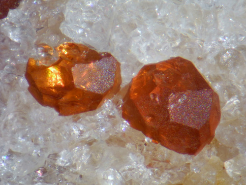
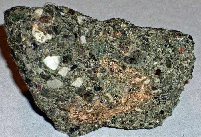


Smedley Park beryl locality, Springfield Township, Delaware County, Pennsylvania, USA