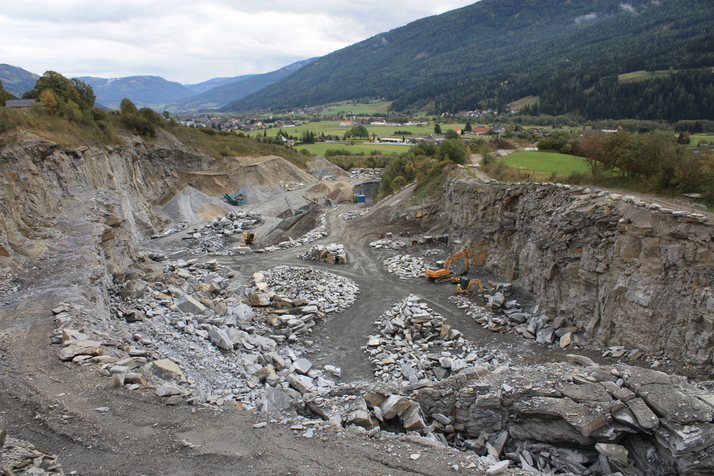
Tamsweg District, Salzburg, Austriai
| Regional Level Types | |
|---|---|
| Tamsweg District | District |
| Salzburg | State |
| Austria | Country |
This page is currently not sponsored. Click here to sponsor this page.


Type:
Largest Settlements:
| Place | Population |
|---|---|
| Tamsweg | 3,509 (2018) |
| Sankt Michael im Lungau | 2,059 (2018) |
| Mariapfarr | 1,612 (2018) |
| Mauterndorf | 1,261 (2018) |
| Unternberg | 1,035 (2018) |
| Mörtelsdorf | 970 (2018) |
Mindat Locality ID:
51376
Long-form identifier:
mindat:1:2:51376:5
GUID (UUID V4):
2895022c-557a-4ad1-bc72-bfa2b8fe5c42
Other/historical names associated with this locality:
Lungau
Other Languages:
Bavarian:
Lungau, Soizburg, Östareich (Estareich)
French:
District de Tamsweg, Salzbourg, Autriche
German:
Bezirk Tamsweg, Salzburg, Österreich
Italian:
distretto di Tamsweg, Salisburgo, Austria
Russian:
Тамсвег, Зальцбург, Австрия
Simplified Chinese:
塔姆斯韦格县, 萨尔茨堡, 奥地利
Spanish:
Distrito de Tamsweg, Salzburgo, Austria
Aragonese:
Districto de Tamsweg, Salzburgo, Austria
Cebuano:
Politischer Bezirk Tamsweg, Salzburg, Awstriya
Croatian:
Tamsweg , Salzburg, Austrija
Czech:
Okres Tamsweg, Salzburg, Rakousko
Danish:
Lungau, Salzburg, Østrig
Dutch:
Tamsweg, Salzburg, Oostenrijk
Esperanto:
Distrikto Tamsweg, Salzburg, Aŭstrio
Farsi/Persian:
ناحیه تامسوگ, زالتسبورگ, اتریش
Friulian:
Distret di Tamsweg, Salisburghês, Austrie
Georgian:
ტამსვეგის ოლქი, ზალცბურგი, ავსტრია
Hungarian:
Tamswegi járás, Salzburg, Ausztria
Japanese:
タムスヴェーク郡, ザルツブルク, オーストリア
Norwegian (Nynorsk):
Distriktet Tamsweg, Salzburg, Austerrike
Polish:
Powiat Tamsweg, Salzburg, Austria
Romanian:
Districtul Tamsweg, Salzburg, Austria
Serbo-Croatian:
Tamsweg, Salzburg, Austrija
Slovak:
Tamsweg, Salzburg, Rakúsko
Swedish:
Tamsweg , Salzburg, Österrike
Ukrainian:
Тамсвег, Зальцбург, Австрія
Uzbek (Latin Script):
Tamsweg, Zalsburg, Avstriya
Vietnamese:
Tamsweg, Salzburg, Áo
Waray:
Tamsweg, Salzburg, Austrya
Note: The area of the Tamsweg District coincides with that of the "Lungau" region.
Select Mineral List Type
Standard Detailed Gallery Strunz Chemical ElementsCommodity List
This is a list of exploitable or exploited mineral commodities recorded from this region.Mineral List
Mineral list contains entries from the region specified including sub-localities241 valid minerals. 1 (TL) - type locality of valid minerals.
Rock Types Recorded
Note: data is currently VERY limited. Please bear with us while we work towards adding this information!
Rock list contains entries from the region specified including sub-localities
Select Rock List Type
Alphabetical List Tree DiagramDetailed Mineral List:
Gallery:

List of minerals arranged by Strunz 10th Edition classification
| Group 1 - Elements | |||
|---|---|---|---|
| ⓘ | Copper | 1.AA.05 | Cu |
| ⓘ | Silver var. Küstelite | 1.AA.05 | Ag |
| ⓘ | Gold var. Electrum | 1.AA.05 | (Au,Ag) |
| ⓘ | 1.AA.05 | Au | |
| ⓘ | Silver | 1.AA.05 | Ag |
| ⓘ | Bismuth | 1.CA.05 | Bi |
| ⓘ | Graphite | 1.CB.05a | C |
| ⓘ | Sulphur | 1.CC.05 | S8 |
| ⓘ | Tellurium | 1.CC.10 | Te |
| Group 2 - Sulphides and Sulfosalts | |||
| ⓘ | Allargentum | 2.AA.30 | (Ag1-xSbx) |
| ⓘ | Chalcocite | 2.BA.05 | Cu2S |
| ⓘ | Digenite | 2.BA.10 | Cu9S5 |
| ⓘ | Bornite | 2.BA.15 | Cu5FeS4 |
| ⓘ | Acanthite | 2.BA.35 | Ag2S |
| ⓘ | Hessite | 2.BA.60 | Ag2Te |
| ⓘ | Canfieldite | 2.BA.70 | Ag8SnS6 |
| ⓘ | var. Tellurium-bearing Canfieldite | 2.BA.70 | Ag8(Sn,Ge)(S,Te)6 |
| ⓘ | Pentlandite | 2.BB.15 | (NixFey)Σ9S8 |
| ⓘ | Imiterite ? | 2.BD.05 | Ag2HgS2 |
| ⓘ | Covellite | 2.CA.05a | CuS |
| ⓘ | Nukundamite | 2.CA.10 | Cu3.33Fe0.66S4 |
| ⓘ | Sphalerite | 2.CB.05a | ZnS |
| ⓘ | Metacinnabar | 2.CB.05a | HgS |
| ⓘ | Chalcopyrite | 2.CB.10a | CuFeS2 |
| ⓘ | Stannite | 2.CB.15a | Cu2FeSnS4 |
| ⓘ | Greenockite | 2.CB.45 | CdS |
| ⓘ | Cubanite | 2.CB.55a | CuFe2S3 |
| ⓘ | Isocubanite | 2.CB.55b | CuFe2S3 |
| ⓘ | Argentopyrite | 2.CB.65 | AgFe2S3 |
| ⓘ | Nickeline | 2.CC.05 | NiAs |
| ⓘ | Breithauptite | 2.CC.05 | NiSb |
| ⓘ | Pyrrhotite | 2.CC.10 | Fe1-xS |
| ⓘ | Millerite | 2.CC.20 | NiS |
| ⓘ | Mackinawite | 2.CC.25 | FeS |
| ⓘ | Galena var. Silver-bearing Galena | 2.CD.10 | PbS with Ag |
| ⓘ | Altaite | 2.CD.10 | PbTe |
| ⓘ | Galena | 2.CD.10 | PbS |
| ⓘ | Cinnabar | 2.CD.15a | HgS |
| ⓘ | Bismuthinite | 2.DB.05 | Bi2S3 |
| ⓘ | Stibnite | 2.DB.05 | Sb2S3 |
| ⓘ | Joséite-B | 2.DC.05 | Bi4Te2S |
| ⓘ | Tetradymite | 2.DC.05 | Bi2Te2S |
| ⓘ | Sylvanite | 2.EA.05 | AgAuTe4 |
| ⓘ | Melonite | 2.EA.20 | NiTe2 |
| ⓘ | Molybdenite | 2.EA.30 | MoS2 |
| ⓘ | Pyrite var. Bravoite | 2.EB.05a | (Fe,Ni)S2 |
| ⓘ | 2.EB.05a | FeS2 | |
| ⓘ | Vaesite ? | 2.EB.05a | NiS2 |
| ⓘ | Marcasite | 2.EB.10a | FeS2 |
| ⓘ | Löllingite | 2.EB.15a | FeAs2 |
| ⓘ | Arsenopyrite | 2.EB.20 | FeAsS |
| ⓘ | Gersdorffite | 2.EB.25 | NiAsS |
| ⓘ | Ullmannite ? | 2.EB.25 | NiSbS |
| ⓘ | Skutterudite | 2.EC.05 | CoAs3 |
| ⓘ | Valleriite | 2.FD.30 | (Fe2+,Cu)4(Mg,Al)3S4(OH,O)6 |
| ⓘ | Pyrargyrite | 2.GA.05 | Ag3SbS3 |
| ⓘ | Pyrostilpnite | 2.GA.10 | Ag3SbS3 |
| ⓘ | Bournonite | 2.GA.50 | PbCuSbS3 |
| ⓘ | Tennantite-(Cu) | 2.GB. | Cu6(Cu4Cu2)As4S12S |
| ⓘ | Tetrahedrite-(Zn) | 2.GB.05 | Cu6(Cu4Zn2)Sb4S12S |
| ⓘ | 'Freibergite Subgroup' | 2.GB.05 | (Ag6,[Ag6]4+)(Cu4 C2+2)Sb4S12S0-1 |
| ⓘ | 'Tetrahedrite Subgroup' | 2.GB.05 | Cu6(Cu4C2+2)Sb4S12S |
| ⓘ | 'var. Silver-bearing Tetrahedrite' | 2.GB.05 | (Cu,Ag)6[Cu4(Fe,Zn)2]Sb4S13 |
| ⓘ | 'Tennantite Subgroup' | 2.GB.05 | Cu6(Cu4C2+2)As4S12S |
| ⓘ | Stephanite | 2.GB.10 | Ag5SbS4 |
| ⓘ | Polybasite | 2.GB.15 | [Ag6Sb2S7][Ag9CuS4] |
| ⓘ | Aramayoite | 2.HA.25 | Ag3Sb2(Bi,Sb)S6 |
| ⓘ | Krupkaite | 2.HB.05a | PbCuBi3S6 |
| ⓘ | Aikinite | 2.HB.05a | PbCuBiS3 |
| ⓘ | Meneghinite | 2.HB.05b | Pb13CuSb7S24 |
| ⓘ | Nagyágite | 2.HB.20a | [Pb3(Pb,Sb)3S6](Au,Te)3 |
| ⓘ | Boulangerite | 2.HC.15 | Pb5Sb4S11 |
| ⓘ | Pavonite | 2.JA.05a | AgBi3S5 |
| ⓘ | Matildite | 2.JA.20 | AgBiS2 |
| ⓘ | Cosalite | 2.JB.10 | Pb2Bi2S5 |
| ⓘ | Junoite | 2.JB.25a | Cu2Pb3Bi8(S,Se)16 |
| ⓘ | Geocronite | 2.JB.30a | Pb14Sb6S23 |
| ⓘ | Jordanite ? | 2.JB.30a | Pb14As6S23 |
| ⓘ | Xilingolite | 2.JB.40a | Pb3Bi2S6 |
| ⓘ | Gustavite | 2.JB.40a | AgPbBi3S6 |
| ⓘ | Galenobismutite | 2.JC.25e | PbBi2S4 |
| ⓘ | Enargite | 2.KA.05 | Cu3AsS4 |
| ⓘ | Benleonardite | 2.LA.50 | [Ag6(Sb,As)2S6Te][Ag9Cu(S,Te)2Te2] |
| ⓘ | Tsnigriite | 2.LA.55 | Ag9SbTe3S3 |
| Group 3 - Halides | |||
| ⓘ | Halite | 3.AA.20 | NaCl |
| ⓘ | Fluorite | 3.AB.25 | CaF2 |
| Group 4 - Oxides and Hydroxides | |||
| ⓘ | Goethite | 4.00. | α-Fe3+O(OH) |
| ⓘ | Cuprite | 4.AA.10 | Cu2O |
| ⓘ | var. Tile ore | 4.AA.10 | Cu2O |
| ⓘ | Tenorite | 4.AB.10 | CuO |
| ⓘ | Litharge | 4.AC.20 | PbO |
| ⓘ | Jacobsite | 4.BB.05 | Mn2+Fe3+2O4 |
| ⓘ | Chromite | 4.BB.05 | Fe2+Cr3+2O4 |
| ⓘ | Magnetite | 4.BB.05 | Fe2+Fe3+2O4 |
| ⓘ | var. Titanium-bearing Magnetite | 4.BB.05 | Fe2+(Fe3+,Ti)2O4 |
| ⓘ | Hausmannite | 4.BB.10 | Mn2+Mn3+2O4 |
| ⓘ | Hematite | 4.CB.05 | Fe2O3 |
| ⓘ | var. Specularite | 4.CB.05 | Fe2O3 |
| ⓘ | Ilmenite | 4.CB.05 | Fe2+TiO3 |
| ⓘ | Pyrophanite | 4.CB.05 | Mn2+TiO3 |
| ⓘ | Cleusonite | 4.CC.40 | (Pb,Sr)(U4+,U6+)(Fe2+,Zn)2(Ti,Fe2+,Fe3+)18(O,OH)38 |
| ⓘ | Senaite | 4.CC.40 | Pb(Mn,Y,U)(Fe,Zn)2(Ti,Fe,Cr,V)18(O,OH)38 |
| ⓘ | Quartz var. Sceptre Quartz | 4.DA.05 | SiO2 |
| ⓘ | var. Rock Crystal | 4.DA.05 | SiO2 |
| ⓘ | var. Milky Quartz | 4.DA.05 | SiO2 |
| ⓘ | var. Rutilated Quartz | 4.DA.05 | SiO2 |
| ⓘ | 4.DA.05 | SiO2 | |
| ⓘ | var. Smoky Quartz | 4.DA.05 | SiO2 |
| ⓘ | var. Chalcedony | 4.DA.05 | SiO2 |
| ⓘ | Opal | 4.DA.10 | SiO2 · nH2O |
| ⓘ | Pyrolusite | 4.DB.05 | Mn4+O2 |
| ⓘ | Rutile | 4.DB.05 | TiO2 |
| ⓘ | 'Wolframite Group' | 4.DB.30 va | |
| ⓘ | Anatase | 4.DD.05 | TiO2 |
| ⓘ | Brookite | 4.DD.10 | TiO2 |
| ⓘ | Oxyplumboroméite | 4.DH. | Pb2Sb2O6O |
| ⓘ | 'Roméite Group' | 4.DH. | A2(Sb5+)2O6Z |
| ⓘ | Brannerite | 4.DH.05 | UTi2O6 |
| ⓘ | Hydroxycalcioroméite | 4.DH.20 | (Ca,Sb3+)2(Sb5+,Ti)2O6(OH) |
| ⓘ | 'Cuproroméite' ? | 4.DH.20 | Cu2Sb2(O,OH)7 |
| ⓘ | Fluorcalcioroméite | 4.DH.20 | (Ca,Na,◻)2Sb5+2(O,OH)6F |
| ⓘ | 'Bindheimite' | 4.DH.20 | Pb2Sb2O6O |
| ⓘ | Coronadite | 4.DK.05a | Pb(Mn4+6Mn3+2)O16 |
| ⓘ | Cryptomelane ? | 4.DK.05a | K(Mn4+7Mn3+)O16 |
| ⓘ | Uraninite var. Pitchblende | 4.DL.05 | UO2 |
| ⓘ | Cerianite-(Ce) | 4.DL.05 | (Ce4+,Th)O2 |
| ⓘ | Uraninite | 4.DL.05 | UO2 |
| ⓘ | Lepidocrocite ? | 4.FE.15 | γ-Fe3+O(OH) |
| ⓘ | Asbolane | 4.FL.30 | (Ni,Co)2-xMn4+(O,OH)4 · nH2O |
| Group 5 - Nitrates and Carbonates | |||
| ⓘ | Smithsonite | 5.AB.05 | ZnCO3 |
| ⓘ | Rhodochrosite | 5.AB.05 | MnCO3 |
| ⓘ | Magnesite var. Breunnerite | 5.AB.05 | (Mg,Fe)CO3 |
| ⓘ | 5.AB.05 | MgCO3 | |
| ⓘ | Siderite var. Sideroplesite | 5.AB.05 | (Fe,Mg)CO3 |
| ⓘ | Calcite | 5.AB.05 | CaCO3 |
| ⓘ | Magnesite var. Mesitine Spar | 5.AB.05 | (Mg,Fe)CO3 |
| ⓘ | Siderite | 5.AB.05 | FeCO3 |
| ⓘ | Dolomite | 5.AB.10 | CaMg(CO3)2 |
| ⓘ | Ankerite | 5.AB.10 | Ca(Fe2+,Mg)(CO3)2 |
| ⓘ | Kutnohorite | 5.AB.10 | CaMn2+(CO3)2 |
| ⓘ | Aragonite | 5.AB.15 | CaCO3 |
| ⓘ | Cerussite | 5.AB.15 | PbCO3 |
| ⓘ | Aragonite var. Flos Ferri | 5.AB.15 | CaCO3 |
| ⓘ | Strontianite | 5.AB.15 | SrCO3 |
| ⓘ | Azurite | 5.BA.05 | Cu3(CO3)2(OH)2 |
| ⓘ | Rosasite ? | 5.BA.10 | (Cu,Zn)2(CO3)(OH)2 |
| ⓘ | Malachite | 5.BA.10 | Cu2(CO3)(OH)2 |
| ⓘ | Hydrozincite | 5.BA.15 | Zn5(CO3)2(OH)6 |
| ⓘ | Aurichalcite | 5.BA.15 | (Zn,Cu)5(CO3)2(OH)6 |
| ⓘ | Synchysite-(Ce) | 5.BD.20c | CaCe(CO3)2F |
| ⓘ | Hydrocerussite | 5.BE.10 | Pb3(CO3)2(OH)2 |
| ⓘ | Bismutite ? | 5.BE.25 | (BiO)2CO3 |
| Group 7 - Sulphates, Chromates, Molybdates and Tungstates | |||
| ⓘ | Anhydrite | 7.AD.30 | CaSO4 |
| ⓘ | Baryte | 7.AD.35 | BaSO4 |
| ⓘ | Anglesite | 7.AD.35 | PbSO4 |
| ⓘ | Celestine | 7.AD.35 | SrSO4 |
| ⓘ | Brochantite | 7.BB.25 | Cu4(SO4)(OH)6 |
| ⓘ | Jarosite | 7.BC.10 | KFe3+3(SO4)2(OH)6 |
| ⓘ | Beaverite-(Cu) | 7.BC.10 | Pb(Fe3+2Cu)(SO4)2(OH)6 |
| ⓘ | Osarizawaite | 7.BC.10 | Pb(Al2Cu2+)(SO4)2(OH)6 |
| ⓘ | Linarite | 7.BC.65 | PbCu(SO4)(OH)2 |
| ⓘ | Chalcanthite | 7.CB.20 | CuSO4 · 5H2O |
| ⓘ | Gypsum | 7.CD.40 | CaSO4 · 2H2O |
| ⓘ | Copiapite | 7.DB.35 | Fe2+Fe3+4(SO4)6(OH)2 · 20H2O |
| ⓘ | Posnjakite | 7.DD.10 | Cu4(SO4)(OH)6 · H2O |
| ⓘ | Langite | 7.DD.10 | Cu4(SO4)(OH)6 · 2H2O |
| ⓘ | Devilline | 7.DD.30 | CaCu4(SO4)2(OH)6 · 3H2O |
| ⓘ | Cyanotrichite | 7.DE.10 | Cu4Al2(SO4)(OH)12 · 2H2O |
| ⓘ | Elyite | 7.DF.65 | Pb4Cu(SO4)O2(OH)4 · H2O |
| ⓘ | Wulfenite | 7.GA.05 | Pb(MoO4) |
| ⓘ | Stolzite | 7.GA.05 | Pb(WO4) |
| ⓘ | Scheelite | 7.GA.05 | Ca(WO4) |
| Group 8 - Phosphates, Arsenates and Vanadates | |||
| ⓘ | Arseniopleite | 8.AC.10 | NaCaMnMn2(AsO4)3 |
| ⓘ | Manganberzeliite | 8.AC.25 | (NaCa2)Mn2+2(AsO4)3 |
| ⓘ | Xenotime-(Y) | 8.AD.35 | Y(PO4) |
| ⓘ | Chernovite-(Y) | 8.AD.35 | Y(AsO4) |
| ⓘ | Monazite-(Ce) | 8.AD.50 | Ce(PO4) |
| ⓘ | Gasparite-(Ce) | 8.AD.50 | Ce(AsO4) |
| ⓘ | Gasparite-(La) | 8.AD.50 | La(AsO4) |
| ⓘ | Tilasite | 8.BB. | CaMg(AsO4)F |
| ⓘ | Sarkinite | 8.BB.15 | Mn2+2(AsO4)(OH) |
| ⓘ | Olivenite | 8.BB.30 | Cu2(AsO4)(OH) |
| ⓘ | Theisite | 8.BE.75 | Cu5Zn5(AsO4,SbO4)2(OH)14 |
| ⓘ | Arsentsumebite | 8.BG.05 | Pb2Cu(AsO4)(SO4)(OH) |
| ⓘ | Conichalcite | 8.BH.35 | CaCu(AsO4)(OH) |
| ⓘ | Duftite | 8.BH.35 | PbCu(AsO4)(OH) |
| ⓘ | Pyrobelonite | 8.BH.40 | PbMn2+(VO4)(OH) |
| ⓘ | Mottramite | 8.BH.40 | PbCu(VO4)(OH) |
| ⓘ | Corkite | 8.BL.05 | PbFe3(PO4)(SO4)(OH)6 |
| ⓘ | Goyazite | 8.BL.10 | SrAl3(PO4)(PO3OH)(OH)6 |
| ⓘ | Mimetite | 8.BN.05 | Pb5(AsO4)3Cl |
| ⓘ | Vanadinite | 8.BN.05 | Pb5(VO4)3Cl |
| ⓘ | Fluorapatite | 8.BN.05 | Ca5(PO4)3F |
| ⓘ | 'Unnamed (OH-analogue of Mimetite)' | 8.BN.05 | Pb5(AsO4)3(OH) |
| ⓘ | Fluorapatite var. Carbonate-rich Fluorapatite | 8.BN.05 | Ca5(PO4,CO3)3(F,O) |
| ⓘ | Pyromorphite | 8.BN.05 | Pb5(PO4)3Cl |
| ⓘ | Hedyphane | 8.BN.05 | Ca2Pb3(AsO4)3Cl |
| ⓘ | Scorodite | 8.CD.10 | Fe3+AsO4 · 2H2O |
| ⓘ | Newberyite | 8.CE.10 | Mg(PO3OH) · 3H2O |
| ⓘ | Phosphorrösslerite (TL) | 8.CE.20 | Mg(PO3OH) · 7H2O |
| ⓘ | Annabergite | 8.CE.40 | Ni3(AsO4)2 · 8H2O |
| ⓘ | Hörnesite | 8.CE.40 | Mg3(AsO4)2 · 8H2O |
| ⓘ | Kaňkite | 8.CE.60 | FeAsO4 · 3.5H2O |
| ⓘ | Krettnichite ? | 8.CG.15 | PbMn3+2(VO4)2(OH)2 |
| ⓘ | Pitticite | 8.DB.05 | (Fe, AsO4, H2O) (?) |
| ⓘ | Bukovskýite | 8.DB.40 | Fe3+2(AsO4)(SO4)(OH) · 9H2O |
| ⓘ | Cacoxenite | 8.DC.40 | Fe3+24AlO6(PO4)17(OH)12 · 75H2O |
| ⓘ | Tyrolite | 8.DM.10 | Ca2Cu9(AsO4)4(CO3)(OH)8 · 11H2O |
| ⓘ | Metazeunerite | 8.EB.10 | Cu(UO2)2(AsO4)2 · 8H2O |
| Group 9 - Silicates | |||
| ⓘ | Tephroite | 9.AC.05 | Mn2+2SiO4 |
| ⓘ | Spessartine | 9.AD.25 | Mn2+3Al2(SiO4)3 |
| ⓘ | Almandine | 9.AD.25 | Fe2+3Al2(SiO4)3 |
| ⓘ | Zircon | 9.AD.30 | Zr(SiO4) |
| ⓘ | Andalusite | 9.AF.10 | Al2(SiO4)O |
| ⓘ | Kyanite | 9.AF.15 | Al2(SiO4)O |
| ⓘ | Staurolite | 9.AF.30 | Fe2+2Al9Si4O23(OH) |
| ⓘ | Braunite | 9.AG.05 | Mn2+Mn3+6(SiO4)O8 |
| ⓘ | Titanite | 9.AG.15 | CaTi(SiO4)O |
| ⓘ | Hemimorphite | 9.BD.10 | Zn4Si2O7(OH)2 · H2O |
| ⓘ | Hejtmanite | 9.BE.55 | Ba2Mn2+4Ti2(Si2O7)2O2(OH)2F2 |
| ⓘ | Piemontite | 9.BG.05a | (CaCa)(AlAlMn3+)O[Si2O7][SiO4](OH) |
| ⓘ | Clinozoisite | 9.BG.05a | (CaCa)(AlAlAl)O[Si2O7][SiO4](OH) |
| ⓘ | Epidote | 9.BG.05a | (CaCa)(AlAlFe3+)O[Si2O7][SiO4](OH) |
| ⓘ | Allanite-(Ce) | 9.BG.05b | (CaCe)(AlAlFe2+)O[Si2O7][SiO4](OH) |
| ⓘ | Zoisite | 9.BG.10 | (CaCa)(AlAlAl)O[Si2O7][SiO4](OH) |
| ⓘ | Arsenmedaite | 9.BJ. | Mn2+6 As5+Si5O18(OH) |
| ⓘ | Tiragalloite | 9.BJ.25 | Mn2+4As5+Si3O12(OH) |
| ⓘ | Ardennite-(V) | 9.BJ.40 | Mn2+4Al4(AlMg)(VO4)(SiO4)2(Si3O10)(OH)6 |
| ⓘ | Ardennite-(As) | 9.BJ.40 | Mn2+4Al4(AlMg)(AsO4)(SiO4)2(Si3O10)(OH)6 |
| ⓘ | Schorl | 9.CK.05 | NaFe2+3Al6(Si6O18)(BO3)3(OH)3(OH) |
| ⓘ | Dravite | 9.CK.05 | NaMg3Al6(Si6O18)(BO3)3(OH)3(OH) |
| ⓘ | Milarite | 9.CM.05 | K(◻H2O)Ca2(Be2Al)[Si12O30] |
| ⓘ | Diopside | 9.DA.15 | CaMgSi2O6 |
| ⓘ | Aegirine | 9.DA.25 | NaFe3+Si2O6 |
| ⓘ | Clino-suenoite | 9.DE. | ◻{Mn2+2}{Mg5}(Si8O22)(OH)2 |
| ⓘ | Grunerite | 9.DE.05 | ◻{Fe2+2}{Fe2+5}(Si8O22)(OH)2 |
| ⓘ | Tremolite | 9.DE.10 | ◻Ca2Mg5(Si8O22)(OH)2 |
| ⓘ | Actinolite | 9.DE.10 | ◻Ca2(Mg4.5-2.5Fe0.5-2.5)Si8O22(OH)2 |
| ⓘ | Magnesio-hornblende | 9.DE.10 | ◻Ca2(Mg4Al)(Si7Al)O22(OH)2 |
| ⓘ | Richterite | 9.DE.20 | Na(NaCa)Mg5(Si8O22)(OH)2 |
| ⓘ | Ferri-winchite | 9.DE.20 | ◻(NaCa)(Mg4Fe3+)Si8O22(OH)2 |
| ⓘ | Magnesio-riebeckite ? | 9.DE.25 | ◻{Na2}{Mg3Fe3+2}(Si8O22)(OH)2 |
| ⓘ | Magnesio-arfvedsonite | 9.DE.25 | {Na}{Na2}{Mg4Fe3+}(Si8O22)(OH)2 |
| ⓘ | Bavenite | 9.DF.25 | Ca4Be2Al2Si9O26(OH)2 |
| ⓘ | Bavsiite ? | 9.DH. | Ba2V2O2[Si4O12] |
| ⓘ | Suzukiite ? | 9.DH.15 | BaVSi2O7 |
| ⓘ | Vittinkiite | 9.DK. | MnMn3Mn[Si5O15] |
| ⓘ | Rhodonite | 9.DK.05 | CaMn3Mn[Si5O15] |
| ⓘ | Pyroxmangite ? | 9.DO.05 | Mn2+SiO3 |
| ⓘ | Prehnite | 9.DP.20 | Ca2Al2Si3O10(OH)2 |
| ⓘ | Talc | 9.EC.05 | Mg3Si4O10(OH)2 |
| ⓘ | Muscovite var. Fuchsite | 9.EC.15 | K(Al,Cr)3Si3O10(OH)2 |
| ⓘ | var. Sericite | 9.EC.15 | KAl2(AlSi3O10)(OH)2 |
| ⓘ | var. Alurgite | 9.EC.15 | K(Al,Mn3+)2(AlSi3O10)(OH)2 |
| ⓘ | var. Phengite | 9.EC.15 | KAl1.5(Mg,Fe)0.5(Al0.5Si3.5O10)(OH)2 |
| ⓘ | 9.EC.15 | KAl2(AlSi3O10)(OH)2 | |
| ⓘ | Phlogopite | 9.EC.20 | KMg3(AlSi3O10)(OH)2 |
| ⓘ | Montmorillonite | 9.EC.40 | (Na,Ca)0.33(Al,Mg)2(Si4O10)(OH)2 · nH2O |
| ⓘ | Clinochlore var. Leuchtenbergite | 9.EC.55 | Mg5Al(AlSi3O10)(OH)8 |
| ⓘ | Chamosite | 9.EC.55 | (Fe2+)5Al(Si,Al)4O10(OH,O)8 |
| ⓘ | Clinochlore var. Nickel-bearing Clinochlore | 9.EC.55 | (Mg,Ni)5Al(AlSi3O10)(OH)8 |
| ⓘ | 9.EC.55 | Mg5Al(AlSi3O10)(OH)8 | |
| ⓘ | Nacrite | 9.ED.05 | Al2(Si2O5)(OH)4 |
| ⓘ | Kaolinite | 9.ED.05 | Al2(Si2O5)(OH)4 |
| ⓘ | Dickite | 9.ED.05 | Al2(Si2O5)(OH)4 |
| ⓘ | Antigorite | 9.ED.15 | Mg3(Si2O5)(OH)4 |
| ⓘ | Cronstedtite | 9.ED.15 | Fe2+2Fe3+((Si,Fe3+)2O5)(OH)4 |
| ⓘ | Chrysocolla | 9.ED.20 | Cu2-xAlx(H2-xSi2O5)(OH)4 · nH2O, x < 1 |
| ⓘ | Palygorskite | 9.EE.20 | ◻Al2Mg2◻2Si8O20(OH)2(H2O)4 · 4H2O |
| ⓘ | Sepiolite | 9.EE.25 | Mg4(Si6O15)(OH)2 · 6H2O |
| ⓘ | Coombsite | 9.EG.35 | KMn2+13(Si,Al)18O42(OH)14 |
| ⓘ | Stilpnomelane | 9.EG.40 | (K,Ca,Na)(Fe,Mg,Al)8(Si,Al)12(O,OH)36 · nH2O |
| ⓘ | Celsian | 9.FA.30 | Ba(Al2Si2O8) |
| ⓘ | Albite | 9.FA.35 | Na(AlSi3O8) |
| ⓘ | Laumontite | 9.GB.10 | CaAl2Si4O12 · 4H2O |
| ⓘ | Mordenite | 9.GD.35 | (Na2,Ca,K2)4(Al8Si40)O96 · 28H2O |
| Unclassified | |||
| ⓘ | 'K Feldspar var. Adularia' | - | KAlSi3O8 |
| ⓘ | 'Garnet Supergroup' | - | X3 Z2(TO4)3 |
| ⓘ | 'Calcite Group' | - | AXO3 |
| ⓘ | 'Apatite' | - | Ca5(PO4)3(Cl/F/OH) |
| ⓘ | 'Unnamed (Fe3+-analogue of Piemontite-(Sr))' | - | (CaSr)(Fe3+AlMn3+)O[Si2O7][SiO4](OH) |
| ⓘ | 'Coronadite Group' | - | |
| ⓘ | 'Feldspar Group' | - | |
| ⓘ | 'Hinsdalite-Plumbogummite Series' | - | |
| ⓘ | 'Unnamed (Nd-dominant Gasparite)' | - | NdAsO4 |
| ⓘ | 'Partzite' ? | - | Cu-Sb-O-H |
| ⓘ | 'Stilpnomelane Group' | - | |
| ⓘ | 'Tennantite-Tetrahedrite Series' | - | |
| ⓘ | 'Chlorite Group' | - | |
| ⓘ | 'Garnet Group' | - | X3Z2(SiO4)3 |
| ⓘ | 'Aeschynite' | - | |
| ⓘ | 'Limonite' | - | |
| ⓘ | 'Stilbite Subgroup' | - | M6-7[Al8-9Si27-28O72] · nH2O |
| ⓘ | 'Tourmaline' | - | AD3G6 (T6O18)(BO3)3X3Z |
| ⓘ | 'Asbestos' | - | |
| ⓘ | 'Protopartzite' ? | - | Cu(Sb,As,Fe,Zn)1.3(O,OH)6.8 |
| ⓘ | 'Amphibole Supergroup' | - | AB2C5((Si,Al,Ti)8O22)(OH,F,Cl,O)2 |
| ⓘ | 'Wad' | - | |
| ⓘ | 'Biotite' | - | K(Fe2+/Mg)2(Al/Fe3+/Mg/Ti)([Si/Al/Fe]2Si2O10)(OH/F)2 |
| ⓘ | 'Monazite' | - | REE(PO4) |
| ⓘ | 'Mica Group' | - | |
| ⓘ | 'Synchysite' | - | Ca(Ce/Nd/Y/REE)(CO3)2F |
| ⓘ | 'Manganese Oxides' | - | |
| ⓘ | 'Ferro-actinolite-Tremolite Series' | - | |
| ⓘ | 'Scapolite' | - | |
| ⓘ | 'Hornblende Root Name Group' | - | ◻Ca2(Z2+4Z3+)(AlSi7O22)(OH,F,Cl)2 |
| ⓘ | 'K Feldspar' | - | |
| ⓘ | 'Amphibole Supergroup var. Byssolite' | - | AX2Z5((Si,Al,Ti)8O22)(OH,F,Cl,O)2 |
| ⓘ | 'Chabazite' | - | |
| ⓘ | 'Serpentine Subgroup' | - | D3[Si2O5](OH)4 |
| ⓘ | 'Heulandite Subgroup' | - | (Na/Ca/K)5-6[Al8-9 Si27-28 O72] · nH2O |
| ⓘ | 'Calcium Amphibole Subgroup var. Hornblende-asbestos' | - | AnCa2(Z2+5-mZ3+m)(Si8-(n+m)Al(n+m))(OH,F,Cl)2 |
| ⓘ | 'Cummingtonite-Grunerite Series' | - | |
List of minerals for each chemical element
| H | Hydrogen | |
|---|---|---|
| H | ⓘ Actinolite | ◻Ca2(Mg4.5-2.5Fe0.5-2.5)Si8O22(OH)2 |
| H | ⓘ Allanite-(Ce) | (CaCe)(AlAlFe2+)O[Si2O7][SiO4](OH) |
| H | ⓘ Muscovite var. Alurgite | K(Al,Mn3+)2(AlSi3O10)(OH)2 |
| H | ⓘ Amphibole Supergroup | AB2C5((Si,Al,Ti)8O22)(OH,F,Cl,O)2 |
| H | ⓘ Annabergite | Ni3(AsO4)2 · 8H2O |
| H | ⓘ Antigorite | Mg3(Si2O5)(OH)4 |
| H | ⓘ Ardennite-(As) | Mn42+Al4(AlMg)(AsO4)(SiO4)2(Si3O10)(OH)6 |
| H | ⓘ Arsentsumebite | Pb2Cu(AsO4)(SO4)(OH) |
| H | ⓘ Asbolane | (Ni,Co)2-xMn4+(O,OH)4 · nH2O |
| H | ⓘ Aurichalcite | (Zn,Cu)5(CO3)2(OH)6 |
| H | ⓘ Azurite | Cu3(CO3)2(OH)2 |
| H | ⓘ Bavenite | Ca4Be2Al2Si9O26(OH)2 |
| H | ⓘ Beaverite-(Cu) | Pb(Fe23+Cu)(SO4)2(OH)6 |
| H | ⓘ Biotite | K(Fe2+/Mg)2(Al/Fe3+/Mg/Ti)([Si/Al/Fe]2Si2O10)(OH/F)2 |
| H | ⓘ Brochantite | Cu4(SO4)(OH)6 |
| H | ⓘ Bukovskýite | Fe23+(AsO4)(SO4)(OH) · 9H2O |
| H | ⓘ Cacoxenite | Fe243+AlO6(PO4)17(OH)12 · 75H2O |
| H | ⓘ Chalcanthite | CuSO4 · 5H2O |
| H | ⓘ Chamosite | (Fe2+)5Al(Si,Al)4O10(OH,O)8 |
| H | ⓘ Chrysocolla | Cu2-xAlx(H2-xSi2O5)(OH)4 · nH2O, x < 1 |
| H | ⓘ Clinochlore | Mg5Al(AlSi3O10)(OH)8 |
| H | ⓘ Clinozoisite | (CaCa)(AlAlAl)O[Si2O7][SiO4](OH) |
| H | ⓘ Conichalcite | CaCu(AsO4)(OH) |
| H | ⓘ Coombsite | KMn132+(Si,Al)18O42(OH)14 |
| H | ⓘ Copiapite | Fe2+Fe43+(SO4)6(OH)2 · 20H2O |
| H | ⓘ Corkite | PbFe3(PO4)(SO4)(OH)6 |
| H | ⓘ Cronstedtite | Fe22+Fe3+((Si,Fe3+)2O5)(OH)4 |
| H | ⓘ Cyanotrichite | Cu4Al2(SO4)(OH)12 · 2H2O |
| H | ⓘ Devilline | CaCu4(SO4)2(OH)6 · 3H2O |
| H | ⓘ Dickite | Al2(Si2O5)(OH)4 |
| H | ⓘ Dravite | NaMg3Al6(Si6O18)(BO3)3(OH)3(OH) |
| H | ⓘ Duftite | PbCu(AsO4)(OH) |
| H | ⓘ Elyite | Pb4Cu(SO4)O2(OH)4 · H2O |
| H | ⓘ Epidote | (CaCa)(AlAlFe3+)O[Si2O7][SiO4](OH) |
| H | ⓘ Muscovite var. Fuchsite | K(Al,Cr)3Si3O10(OH)2 |
| H | ⓘ Goethite | α-Fe3+O(OH) |
| H | ⓘ Grunerite | ◻{Fe22+}{Fe52+}(Si8O22)(OH)2 |
| H | ⓘ Gypsum | CaSO4 · 2H2O |
| H | ⓘ Goyazite | SrAl3(PO4)(PO3OH)(OH)6 |
| H | ⓘ Hejtmanite | Ba2Mn42+Ti2(Si2O7)2O2(OH)2F2 |
| H | ⓘ Hemimorphite | Zn4Si2O7(OH)2 · H2O |
| H | ⓘ Heulandite Subgroup | (Na/Ca/K)5-6[Al8-9 Si27-28 O72] · nH2O |
| H | ⓘ Hörnesite | Mg3(AsO4)2 · 8H2O |
| H | ⓘ Hydrocerussite | Pb3(CO3)2(OH)2 |
| H | ⓘ Hydrozincite | Zn5(CO3)2(OH)6 |
| H | ⓘ Jarosite | KFe33+(SO4)2(OH)6 |
| H | ⓘ Kaňkite | FeAsO4 · 3.5H2O |
| H | ⓘ Kaolinite | Al2(Si2O5)(OH)4 |
| H | ⓘ Langite | Cu4(SO4)(OH)6 · 2H2O |
| H | ⓘ Laumontite | CaAl2Si4O12 · 4H2O |
| H | ⓘ Lepidocrocite | γ-Fe3+O(OH) |
| H | ⓘ Hydroxycalcioroméite | (Ca,Sb3+)2(Sb5+,Ti)2O6(OH) |
| H | ⓘ Linarite | PbCu(SO4)(OH)2 |
| H | ⓘ Magnesio-riebeckite | ◻{Na2}{Mg3Fe23+}(Si8O22)(OH)2 |
| H | ⓘ Magnesio-hornblende | ◻Ca2(Mg4Al)(Si7Al)O22(OH)2 |
| H | ⓘ Magnesio-arfvedsonite | {Na}{Na2}{Mg4Fe3+}(Si8O22)(OH)2 |
| H | ⓘ Malachite | Cu2(CO3)(OH)2 |
| H | ⓘ Metazeunerite | Cu(UO2)2(AsO4)2 · 8H2O |
| H | ⓘ Milarite | K(◻H2O)Ca2(Be2Al)[Si12O30] |
| H | ⓘ Mordenite | (Na2,Ca,K2)4(Al8Si40)O96 · 28H2O |
| H | ⓘ Mottramite | PbCu(VO4)(OH) |
| H | ⓘ Muscovite | KAl2(AlSi3O10)(OH)2 |
| H | ⓘ Montmorillonite | (Na,Ca)0.33(Al,Mg)2(Si4O10)(OH)2 · nH2O |
| H | ⓘ Nacrite | Al2(Si2O5)(OH)4 |
| H | ⓘ Newberyite | Mg(PO3OH) · 3H2O |
| H | ⓘ Olivenite | Cu2(AsO4)(OH) |
| H | ⓘ Opal | SiO2 · nH2O |
| H | ⓘ Osarizawaite | Pb(Al2Cu2+)(SO4)2(OH)6 |
| H | ⓘ Palygorskite | ◻Al2Mg2◻2Si8O20(OH)2(H2O)4 · 4H2O |
| H | ⓘ Cuproroméite | Cu2Sb2(O,OH)7 |
| H | ⓘ Phosphorrösslerite | Mg(PO3OH) · 7H2O |
| H | ⓘ Muscovite var. Phengite | KAl1.5(Mg,Fe)0.5(Al0.5Si3.5O10)(OH)2 |
| H | ⓘ Phlogopite | KMg3(AlSi3O10)(OH)2 |
| H | ⓘ Piemontite | (CaCa)(AlAlMn3+)O[Si2O7][SiO4](OH) |
| H | ⓘ Pitticite | (Fe, AsO4, H2O) (?) |
| H | ⓘ Posnjakite | Cu4(SO4)(OH)6 · H2O |
| H | ⓘ Prehnite | Ca2Al2Si3O10(OH)2 |
| H | ⓘ Protopartzite | Cu(Sb,As,Fe,Zn)1.3(O,OH)6.8 |
| H | ⓘ Pyrobelonite | PbMn2+(VO4)(OH) |
| H | ⓘ Richterite | Na(NaCa)Mg5(Si8O22)(OH)2 |
| H | ⓘ Rosasite | (Cu,Zn)2(CO3)(OH)2 |
| H | ⓘ Sarkinite | Mn22+(AsO4)(OH) |
| H | ⓘ Schorl | NaFe32+Al6(Si6O18)(BO3)3(OH)3(OH) |
| H | ⓘ Scorodite | Fe3+AsO4 · 2H2O |
| H | ⓘ Senaite | Pb(Mn,Y,U)(Fe,Zn)2(Ti,Fe,Cr,V)18(O,OH)38 |
| H | ⓘ Sepiolite | Mg4(Si6O15)(OH)2 · 6H2O |
| H | ⓘ Staurolite | Fe22+Al9Si4O23(OH) |
| H | ⓘ Stilbite Subgroup | M6-7[Al8-9Si27-28O72] · nH2O |
| H | ⓘ Stilpnomelane | (K,Ca,Na)(Fe,Mg,Al)8(Si,Al)12(O,OH)36 · nH2O |
| H | ⓘ Talc | Mg3Si4O10(OH)2 |
| H | ⓘ Theisite | Cu5Zn5(AsO4,SbO4)2(OH)14 |
| H | ⓘ Tiragalloite | Mn42+As5+Si3O12(OH) |
| H | ⓘ Tremolite | ◻Ca2Mg5(Si8O22)(OH)2 |
| H | ⓘ Tyrolite | Ca2Cu9(AsO4)4(CO3)(OH)8 · 11H2O |
| H | ⓘ Valleriite | (Fe2+,Cu)4(Mg,Al)3S4(OH,O)6 |
| H | ⓘ Zoisite | (CaCa)(AlAlAl)O[Si2O7][SiO4](OH) |
| H | ⓘ Krettnichite | PbMn23+(VO4)2(OH)2 |
| H | ⓘ Hornblende Root Name Group | ◻Ca2(Z42+Z3+)(AlSi7O22)(OH,F,Cl)2 |
| H | ⓘ Muscovite var. Sericite | KAl2(AlSi3O10)(OH)2 |
| H | ⓘ Amphibole Supergroup var. Byssolite | AX2Z5((Si,Al,Ti)8O22)(OH,F,Cl,O)2 |
| H | ⓘ Clinochlore var. Leuchtenbergite | Mg5Al(AlSi3O10)(OH)8 |
| H | ⓘ Serpentine Subgroup | D3[Si2O5](OH)4 |
| H | ⓘ Cleusonite | (Pb,Sr)(U4+,U6+)(Fe2+,Zn)2(Ti,Fe2+,Fe3+)18(O,OH)38 |
| H | ⓘ Clinochlore var. Nickel-bearing Clinochlore | (Mg,Ni)5Al(AlSi3O10)(OH)8 |
| H | ⓘ Ferri-winchite | ◻(NaCa)(Mg4Fe3+)Si8O22(OH)2 |
| H | ⓘ Ardennite-(V) | Mn42+Al4(AlMg)(VO4)(SiO4)2(Si3O10)(OH)6 |
| H | ⓘ Apatite | Ca5(PO4)3(Cl/F/OH) |
| H | ⓘ Fluorcalcioroméite | (Ca,Na,◻)2Sb25+(O,OH)6F |
| H | ⓘ Partzite | Cu-Sb-O-H |
| H | ⓘ Unnamed (OH-analogue of Mimetite) | Pb5(AsO4)3(OH) |
| H | ⓘ Arsenmedaite | Mn62+ As5+Si5O18(OH) |
| H | ⓘ Clino-suenoite | ◻{Mn22+}{Mg5}(Si8O22)(OH)2 |
| H | ⓘ Unnamed (Fe3+-analogue of Piemontite-(Sr)) | (CaSr)(Fe3+AlMn3+)O[Si2O7][SiO4](OH) |
| Be | Beryllium | |
| Be | ⓘ Bavenite | Ca4Be2Al2Si9O26(OH)2 |
| Be | ⓘ Milarite | K(◻H2O)Ca2(Be2Al)[Si12O30] |
| B | Boron | |
| B | ⓘ Dravite | NaMg3Al6(Si6O18)(BO3)3(OH)3(OH) |
| B | ⓘ Schorl | NaFe32+Al6(Si6O18)(BO3)3(OH)3(OH) |
| B | ⓘ Tourmaline | AD3G6 (T6O18)(BO3)3X3Z |
| C | Carbon | |
| C | ⓘ Ankerite | Ca(Fe2+,Mg)(CO3)2 |
| C | ⓘ Aragonite | CaCO3 |
| C | ⓘ Aurichalcite | (Zn,Cu)5(CO3)2(OH)6 |
| C | ⓘ Azurite | Cu3(CO3)2(OH)2 |
| C | ⓘ Bismutite | (BiO)2CO3 |
| C | ⓘ Calcite | CaCO3 |
| C | ⓘ Fluorapatite var. Carbonate-rich Fluorapatite | Ca5(PO4,CO3)3(F,O) |
| C | ⓘ Cerussite | PbCO3 |
| C | ⓘ Dolomite | CaMg(CO3)2 |
| C | ⓘ Graphite | C |
| C | ⓘ Hydrocerussite | Pb3(CO3)2(OH)2 |
| C | ⓘ Hydrozincite | Zn5(CO3)2(OH)6 |
| C | ⓘ Kutnohorite | CaMn2+(CO3)2 |
| C | ⓘ Magnesite | MgCO3 |
| C | ⓘ Malachite | Cu2(CO3)(OH)2 |
| C | ⓘ Rhodochrosite | MnCO3 |
| C | ⓘ Rosasite | (Cu,Zn)2(CO3)(OH)2 |
| C | ⓘ Siderite | FeCO3 |
| C | ⓘ Siderite var. Sideroplesite | (Fe,Mg)CO3 |
| C | ⓘ Smithsonite | ZnCO3 |
| C | ⓘ Strontianite | SrCO3 |
| C | ⓘ Synchysite-(Ce) | CaCe(CO3)2F |
| C | ⓘ Tyrolite | Ca2Cu9(AsO4)4(CO3)(OH)8 · 11H2O |
| C | ⓘ Synchysite | Ca(Ce/Nd/Y/REE)(CO3)2F |
| C | ⓘ Aragonite var. Flos Ferri | CaCO3 |
| C | ⓘ Magnesite var. Breunnerite | (Mg,Fe)CO3 |
| C | ⓘ Magnesite var. Mesitine Spar | (Mg,Fe)CO3 |
| O | Oxygen | |
| O | ⓘ Actinolite | ◻Ca2(Mg4.5-2.5Fe0.5-2.5)Si8O22(OH)2 |
| O | ⓘ K Feldspar var. Adularia | KAlSi3O8 |
| O | ⓘ Aegirine | NaFe3+Si2O6 |
| O | ⓘ Albite | Na(AlSi3O8) |
| O | ⓘ Allanite-(Ce) | (CaCe)(AlAlFe2+)O[Si2O7][SiO4](OH) |
| O | ⓘ Muscovite var. Alurgite | K(Al,Mn3+)2(AlSi3O10)(OH)2 |
| O | ⓘ Amphibole Supergroup | AB2C5((Si,Al,Ti)8O22)(OH,F,Cl,O)2 |
| O | ⓘ Anatase | TiO2 |
| O | ⓘ Andalusite | Al2(SiO4)O |
| O | ⓘ Anglesite | PbSO4 |
| O | ⓘ Anhydrite | CaSO4 |
| O | ⓘ Ankerite | Ca(Fe2+,Mg)(CO3)2 |
| O | ⓘ Annabergite | Ni3(AsO4)2 · 8H2O |
| O | ⓘ Antigorite | Mg3(Si2O5)(OH)4 |
| O | ⓘ Aragonite | CaCO3 |
| O | ⓘ Ardennite-(As) | Mn42+Al4(AlMg)(AsO4)(SiO4)2(Si3O10)(OH)6 |
| O | ⓘ Arseniopleite | NaCaMnMn2(AsO4)3 |
| O | ⓘ Arsentsumebite | Pb2Cu(AsO4)(SO4)(OH) |
| O | ⓘ Asbolane | (Ni,Co)2-xMn4+(O,OH)4 · nH2O |
| O | ⓘ Aurichalcite | (Zn,Cu)5(CO3)2(OH)6 |
| O | ⓘ Azurite | Cu3(CO3)2(OH)2 |
| O | ⓘ Almandine | Fe32+Al2(SiO4)3 |
| O | ⓘ Baryte | BaSO4 |
| O | ⓘ Bavenite | Ca4Be2Al2Si9O26(OH)2 |
| O | ⓘ Beaverite-(Cu) | Pb(Fe23+Cu)(SO4)2(OH)6 |
| O | ⓘ Bindheimite | Pb2Sb2O6O |
| O | ⓘ Biotite | K(Fe2+/Mg)2(Al/Fe3+/Mg/Ti)([Si/Al/Fe]2Si2O10)(OH/F)2 |
| O | ⓘ Bismutite | (BiO)2CO3 |
| O | ⓘ Brannerite | UTi2O6 |
| O | ⓘ Braunite | Mn2+Mn63+(SiO4)O8 |
| O | ⓘ Brochantite | Cu4(SO4)(OH)6 |
| O | ⓘ Brookite | TiO2 |
| O | ⓘ Bukovskýite | Fe23+(AsO4)(SO4)(OH) · 9H2O |
| O | ⓘ Cacoxenite | Fe243+AlO6(PO4)17(OH)12 · 75H2O |
| O | ⓘ Calcite | CaCO3 |
| O | ⓘ Fluorapatite var. Carbonate-rich Fluorapatite | Ca5(PO4,CO3)3(F,O) |
| O | ⓘ Celestine | SrSO4 |
| O | ⓘ Celsian | Ba(Al2Si2O8) |
| O | ⓘ Cerianite-(Ce) | (Ce4+,Th)O2 |
| O | ⓘ Cerussite | PbCO3 |
| O | ⓘ Chalcanthite | CuSO4 · 5H2O |
| O | ⓘ Quartz var. Chalcedony | SiO2 |
| O | ⓘ Chamosite | (Fe2+)5Al(Si,Al)4O10(OH,O)8 |
| O | ⓘ Chernovite-(Y) | Y(AsO4) |
| O | ⓘ Chromite | Fe2+Cr23+O4 |
| O | ⓘ Chrysocolla | Cu2-xAlx(H2-xSi2O5)(OH)4 · nH2O, x < 1 |
| O | ⓘ Clinochlore | Mg5Al(AlSi3O10)(OH)8 |
| O | ⓘ Clinozoisite | (CaCa)(AlAlAl)O[Si2O7][SiO4](OH) |
| O | ⓘ Conichalcite | CaCu(AsO4)(OH) |
| O | ⓘ Coombsite | KMn132+(Si,Al)18O42(OH)14 |
| O | ⓘ Copiapite | Fe2+Fe43+(SO4)6(OH)2 · 20H2O |
| O | ⓘ Corkite | PbFe3(PO4)(SO4)(OH)6 |
| O | ⓘ Coronadite | Pb(Mn64+Mn23+)O16 |
| O | ⓘ Cronstedtite | Fe22+Fe3+((Si,Fe3+)2O5)(OH)4 |
| O | ⓘ Cryptomelane | K(Mn74+Mn3+)O16 |
| O | ⓘ Cuprite | Cu2O |
| O | ⓘ Cyanotrichite | Cu4Al2(SO4)(OH)12 · 2H2O |
| O | ⓘ Devilline | CaCu4(SO4)2(OH)6 · 3H2O |
| O | ⓘ Dickite | Al2(Si2O5)(OH)4 |
| O | ⓘ Diopside | CaMgSi2O6 |
| O | ⓘ Dolomite | CaMg(CO3)2 |
| O | ⓘ Dravite | NaMg3Al6(Si6O18)(BO3)3(OH)3(OH) |
| O | ⓘ Duftite | PbCu(AsO4)(OH) |
| O | ⓘ Elyite | Pb4Cu(SO4)O2(OH)4 · H2O |
| O | ⓘ Epidote | (CaCa)(AlAlFe3+)O[Si2O7][SiO4](OH) |
| O | ⓘ Fluorapatite | Ca5(PO4)3F |
| O | ⓘ Muscovite var. Fuchsite | K(Al,Cr)3Si3O10(OH)2 |
| O | ⓘ Garnet Supergroup | X3 Z2(TO4)3 |
| O | ⓘ Gasparite-(Ce) | Ce(AsO4) |
| O | ⓘ Goethite | α-Fe3+O(OH) |
| O | ⓘ Grunerite | ◻{Fe22+}{Fe52+}(Si8O22)(OH)2 |
| O | ⓘ Gypsum | CaSO4 · 2H2O |
| O | ⓘ Goyazite | SrAl3(PO4)(PO3OH)(OH)6 |
| O | ⓘ Hausmannite | Mn2+Mn23+O4 |
| O | ⓘ Hedyphane | Ca2Pb3(AsO4)3Cl |
| O | ⓘ Hejtmanite | Ba2Mn42+Ti2(Si2O7)2O2(OH)2F2 |
| O | ⓘ Hematite | Fe2O3 |
| O | ⓘ Hemimorphite | Zn4Si2O7(OH)2 · H2O |
| O | ⓘ Heulandite Subgroup | (Na/Ca/K)5-6[Al8-9 Si27-28 O72] · nH2O |
| O | ⓘ Hörnesite | Mg3(AsO4)2 · 8H2O |
| O | ⓘ Hydrocerussite | Pb3(CO3)2(OH)2 |
| O | ⓘ Hydrozincite | Zn5(CO3)2(OH)6 |
| O | ⓘ Ilmenite | Fe2+TiO3 |
| O | ⓘ Jacobsite | Mn2+Fe23+O4 |
| O | ⓘ Jarosite | KFe33+(SO4)2(OH)6 |
| O | ⓘ Kaňkite | FeAsO4 · 3.5H2O |
| O | ⓘ Kaolinite | Al2(Si2O5)(OH)4 |
| O | ⓘ Kutnohorite | CaMn2+(CO3)2 |
| O | ⓘ Kyanite | Al2(SiO4)O |
| O | ⓘ Langite | Cu4(SO4)(OH)6 · 2H2O |
| O | ⓘ Laumontite | CaAl2Si4O12 · 4H2O |
| O | ⓘ Lepidocrocite | γ-Fe3+O(OH) |
| O | ⓘ Hydroxycalcioroméite | (Ca,Sb3+)2(Sb5+,Ti)2O6(OH) |
| O | ⓘ Linarite | PbCu(SO4)(OH)2 |
| O | ⓘ Litharge | PbO |
| O | ⓘ Manganberzeliite | (NaCa2)Mn22+(AsO4)3 |
| O | ⓘ Magnesite | MgCO3 |
| O | ⓘ Magnesio-riebeckite | ◻{Na2}{Mg3Fe23+}(Si8O22)(OH)2 |
| O | ⓘ Magnesio-hornblende | ◻Ca2(Mg4Al)(Si7Al)O22(OH)2 |
| O | ⓘ Magnesio-arfvedsonite | {Na}{Na2}{Mg4Fe3+}(Si8O22)(OH)2 |
| O | ⓘ Magnetite | Fe2+Fe23+O4 |
| O | ⓘ Malachite | Cu2(CO3)(OH)2 |
| O | ⓘ Metazeunerite | Cu(UO2)2(AsO4)2 · 8H2O |
| O | ⓘ Milarite | K(◻H2O)Ca2(Be2Al)[Si12O30] |
| O | ⓘ Mimetite | Pb5(AsO4)3Cl |
| O | ⓘ Monazite | REE(PO4) |
| O | ⓘ Monazite-(Ce) | Ce(PO4) |
| O | ⓘ Mordenite | (Na2,Ca,K2)4(Al8Si40)O96 · 28H2O |
| O | ⓘ Mottramite | PbCu(VO4)(OH) |
| O | ⓘ Muscovite | KAl2(AlSi3O10)(OH)2 |
| O | ⓘ Montmorillonite | (Na,Ca)0.33(Al,Mg)2(Si4O10)(OH)2 · nH2O |
| O | ⓘ Nacrite | Al2(Si2O5)(OH)4 |
| O | ⓘ Newberyite | Mg(PO3OH) · 3H2O |
| O | ⓘ Olivenite | Cu2(AsO4)(OH) |
| O | ⓘ Opal | SiO2 · nH2O |
| O | ⓘ Osarizawaite | Pb(Al2Cu2+)(SO4)2(OH)6 |
| O | ⓘ Palygorskite | ◻Al2Mg2◻2Si8O20(OH)2(H2O)4 · 4H2O |
| O | ⓘ Cuproroméite | Cu2Sb2(O,OH)7 |
| O | ⓘ Phosphorrösslerite | Mg(PO3OH) · 7H2O |
| O | ⓘ Muscovite var. Phengite | KAl1.5(Mg,Fe)0.5(Al0.5Si3.5O10)(OH)2 |
| O | ⓘ Phlogopite | KMg3(AlSi3O10)(OH)2 |
| O | ⓘ Piemontite | (CaCa)(AlAlMn3+)O[Si2O7][SiO4](OH) |
| O | ⓘ Uraninite var. Pitchblende | UO2 |
| O | ⓘ Pitticite | (Fe, AsO4, H2O) (?) |
| O | ⓘ Posnjakite | Cu4(SO4)(OH)6 · H2O |
| O | ⓘ Prehnite | Ca2Al2Si3O10(OH)2 |
| O | ⓘ Protopartzite | Cu(Sb,As,Fe,Zn)1.3(O,OH)6.8 |
| O | ⓘ Pyrobelonite | PbMn2+(VO4)(OH) |
| O | ⓘ Pyrolusite | Mn4+O2 |
| O | ⓘ Pyromorphite | Pb5(PO4)3Cl |
| O | ⓘ Pyrophanite | Mn2+TiO3 |
| O | ⓘ Pyroxmangite | Mn2+SiO3 |
| O | ⓘ Quartz | SiO2 |
| O | ⓘ Rhodochrosite | MnCO3 |
| O | ⓘ Rhodonite | CaMn3Mn[Si5O15] |
| O | ⓘ Richterite | Na(NaCa)Mg5(Si8O22)(OH)2 |
| O | ⓘ Roméite Group | A2(Sb5+)2O6Z |
| O | ⓘ Rosasite | (Cu,Zn)2(CO3)(OH)2 |
| O | ⓘ Quartz var. Rutilated Quartz | SiO2 |
| O | ⓘ Rutile | TiO2 |
| O | ⓘ Sarkinite | Mn22+(AsO4)(OH) |
| O | ⓘ Scheelite | Ca(WO4) |
| O | ⓘ Schorl | NaFe32+Al6(Si6O18)(BO3)3(OH)3(OH) |
| O | ⓘ Scorodite | Fe3+AsO4 · 2H2O |
| O | ⓘ Senaite | Pb(Mn,Y,U)(Fe,Zn)2(Ti,Fe,Cr,V)18(O,OH)38 |
| O | ⓘ Sepiolite | Mg4(Si6O15)(OH)2 · 6H2O |
| O | ⓘ Siderite | FeCO3 |
| O | ⓘ Siderite var. Sideroplesite | (Fe,Mg)CO3 |
| O | ⓘ Smithsonite | ZnCO3 |
| O | ⓘ Quartz var. Smoky Quartz | SiO2 |
| O | ⓘ Spessartine | Mn32+Al2(SiO4)3 |
| O | ⓘ Staurolite | Fe22+Al9Si4O23(OH) |
| O | ⓘ Stilbite Subgroup | M6-7[Al8-9Si27-28O72] · nH2O |
| O | ⓘ Stilpnomelane | (K,Ca,Na)(Fe,Mg,Al)8(Si,Al)12(O,OH)36 · nH2O |
| O | ⓘ Stolzite | Pb(WO4) |
| O | ⓘ Strontianite | SrCO3 |
| O | ⓘ Suzukiite | BaVSi2O7 |
| O | ⓘ Synchysite-(Ce) | CaCe(CO3)2F |
| O | ⓘ Talc | Mg3Si4O10(OH)2 |
| O | ⓘ Tenorite | CuO |
| O | ⓘ Tephroite | Mn22+SiO4 |
| O | ⓘ Theisite | Cu5Zn5(AsO4,SbO4)2(OH)14 |
| O | ⓘ Tilasite | CaMg(AsO4)F |
| O | ⓘ Cuprite var. Tile ore | Cu2O |
| O | ⓘ Tiragalloite | Mn42+As5+Si3O12(OH) |
| O | ⓘ Titanite | CaTi(SiO4)O |
| O | ⓘ Magnetite var. Titanium-bearing Magnetite | Fe2+(Fe3+,Ti)2O4 |
| O | ⓘ Tourmaline | AD3G6 (T6O18)(BO3)3X3Z |
| O | ⓘ Tremolite | ◻Ca2Mg5(Si8O22)(OH)2 |
| O | ⓘ Tyrolite | Ca2Cu9(AsO4)4(CO3)(OH)8 · 11H2O |
| O | ⓘ Uraninite | UO2 |
| O | ⓘ Valleriite | (Fe2+,Cu)4(Mg,Al)3S4(OH,O)6 |
| O | ⓘ Vanadinite | Pb5(VO4)3Cl |
| O | ⓘ Wulfenite | Pb(MoO4) |
| O | ⓘ Xenotime-(Y) | Y(PO4) |
| O | ⓘ Zircon | Zr(SiO4) |
| O | ⓘ Zoisite | (CaCa)(AlAlAl)O[Si2O7][SiO4](OH) |
| O | ⓘ Hematite var. Specularite | Fe2O3 |
| O | ⓘ Quartz var. Rock Crystal | SiO2 |
| O | ⓘ Quartz var. Milky Quartz | SiO2 |
| O | ⓘ Krettnichite | PbMn23+(VO4)2(OH)2 |
| O | ⓘ Synchysite | Ca(Ce/Nd/Y/REE)(CO3)2F |
| O | ⓘ Quartz var. Sceptre Quartz | SiO2 |
| O | ⓘ Aragonite var. Flos Ferri | CaCO3 |
| O | ⓘ Magnesite var. Breunnerite | (Mg,Fe)CO3 |
| O | ⓘ Hornblende Root Name Group | ◻Ca2(Z42+Z3+)(AlSi7O22)(OH,F,Cl)2 |
| O | ⓘ Muscovite var. Sericite | KAl2(AlSi3O10)(OH)2 |
| O | ⓘ Garnet Group | X3Z2(SiO4)3 |
| O | ⓘ Amphibole Supergroup var. Byssolite | AX2Z5((Si,Al,Ti)8O22)(OH,F,Cl,O)2 |
| O | ⓘ Clinochlore var. Leuchtenbergite | Mg5Al(AlSi3O10)(OH)8 |
| O | ⓘ Serpentine Subgroup | D3[Si2O5](OH)4 |
| O | ⓘ Magnesite var. Mesitine Spar | (Mg,Fe)CO3 |
| O | ⓘ Cleusonite | (Pb,Sr)(U4+,U6+)(Fe2+,Zn)2(Ti,Fe2+,Fe3+)18(O,OH)38 |
| O | ⓘ Clinochlore var. Nickel-bearing Clinochlore | (Mg,Ni)5Al(AlSi3O10)(OH)8 |
| O | ⓘ Ferri-winchite | ◻(NaCa)(Mg4Fe3+)Si8O22(OH)2 |
| O | ⓘ Ardennite-(V) | Mn42+Al4(AlMg)(VO4)(SiO4)2(Si3O10)(OH)6 |
| O | ⓘ Calcite Group | AXO3 |
| O | ⓘ Apatite | Ca5(PO4)3(Cl/F/OH) |
| O | ⓘ Fluorcalcioroméite | (Ca,Na,◻)2Sb25+(O,OH)6F |
| O | ⓘ Partzite | Cu-Sb-O-H |
| O | ⓘ Oxyplumboroméite | Pb2Sb2O6O |
| O | ⓘ Unnamed (OH-analogue of Mimetite) | Pb5(AsO4)3(OH) |
| O | ⓘ Bavsiite | Ba2V2O2[Si4O12] |
| O | ⓘ Arsenmedaite | Mn62+ As5+Si5O18(OH) |
| O | ⓘ Clino-suenoite | ◻{Mn22+}{Mg5}(Si8O22)(OH)2 |
| O | ⓘ Gasparite-(La) | La(AsO4) |
| O | ⓘ Vittinkiite | MnMn3Mn[Si5O15] |
| O | ⓘ Unnamed (Nd-dominant Gasparite) | NdAsO4 |
| O | ⓘ Unnamed (Fe3+-analogue of Piemontite-(Sr)) | (CaSr)(Fe3+AlMn3+)O[Si2O7][SiO4](OH) |
| F | Fluorine | |
| F | ⓘ Amphibole Supergroup | AB2C5((Si,Al,Ti)8O22)(OH,F,Cl,O)2 |
| F | ⓘ Biotite | K(Fe2+/Mg)2(Al/Fe3+/Mg/Ti)([Si/Al/Fe]2Si2O10)(OH/F)2 |
| F | ⓘ Fluorapatite var. Carbonate-rich Fluorapatite | Ca5(PO4,CO3)3(F,O) |
| F | ⓘ Fluorapatite | Ca5(PO4)3F |
| F | ⓘ Fluorite | CaF2 |
| F | ⓘ Hejtmanite | Ba2Mn42+Ti2(Si2O7)2O2(OH)2F2 |
| F | ⓘ Synchysite-(Ce) | CaCe(CO3)2F |
| F | ⓘ Tilasite | CaMg(AsO4)F |
| F | ⓘ Synchysite | Ca(Ce/Nd/Y/REE)(CO3)2F |
| F | ⓘ Hornblende Root Name Group | ◻Ca2(Z42+Z3+)(AlSi7O22)(OH,F,Cl)2 |
| F | ⓘ Amphibole Supergroup var. Byssolite | AX2Z5((Si,Al,Ti)8O22)(OH,F,Cl,O)2 |
| F | ⓘ Apatite | Ca5(PO4)3(Cl/F/OH) |
| F | ⓘ Fluorcalcioroméite | (Ca,Na,◻)2Sb25+(O,OH)6F |
| Na | Sodium | |
| Na | ⓘ Aegirine | NaFe3+Si2O6 |
| Na | ⓘ Albite | Na(AlSi3O8) |
| Na | ⓘ Arseniopleite | NaCaMnMn2(AsO4)3 |
| Na | ⓘ Dravite | NaMg3Al6(Si6O18)(BO3)3(OH)3(OH) |
| Na | ⓘ Halite | NaCl |
| Na | ⓘ Heulandite Subgroup | (Na/Ca/K)5-6[Al8-9 Si27-28 O72] · nH2O |
| Na | ⓘ Manganberzeliite | (NaCa2)Mn22+(AsO4)3 |
| Na | ⓘ Magnesio-riebeckite | ◻{Na2}{Mg3Fe23+}(Si8O22)(OH)2 |
| Na | ⓘ Magnesio-arfvedsonite | {Na}{Na2}{Mg4Fe3+}(Si8O22)(OH)2 |
| Na | ⓘ Mordenite | (Na2,Ca,K2)4(Al8Si40)O96 · 28H2O |
| Na | ⓘ Montmorillonite | (Na,Ca)0.33(Al,Mg)2(Si4O10)(OH)2 · nH2O |
| Na | ⓘ Richterite | Na(NaCa)Mg5(Si8O22)(OH)2 |
| Na | ⓘ Schorl | NaFe32+Al6(Si6O18)(BO3)3(OH)3(OH) |
| Na | ⓘ Stilpnomelane | (K,Ca,Na)(Fe,Mg,Al)8(Si,Al)12(O,OH)36 · nH2O |
| Na | ⓘ Ferri-winchite | ◻(NaCa)(Mg4Fe3+)Si8O22(OH)2 |
| Na | ⓘ Fluorcalcioroméite | (Ca,Na,◻)2Sb25+(O,OH)6F |
| Mg | Magnesium | |
| Mg | ⓘ Actinolite | ◻Ca2(Mg4.5-2.5Fe0.5-2.5)Si8O22(OH)2 |
| Mg | ⓘ Ankerite | Ca(Fe2+,Mg)(CO3)2 |
| Mg | ⓘ Antigorite | Mg3(Si2O5)(OH)4 |
| Mg | ⓘ Ardennite-(As) | Mn42+Al4(AlMg)(AsO4)(SiO4)2(Si3O10)(OH)6 |
| Mg | ⓘ Biotite | K(Fe2+/Mg)2(Al/Fe3+/Mg/Ti)([Si/Al/Fe]2Si2O10)(OH/F)2 |
| Mg | ⓘ Clinochlore | Mg5Al(AlSi3O10)(OH)8 |
| Mg | ⓘ Diopside | CaMgSi2O6 |
| Mg | ⓘ Dolomite | CaMg(CO3)2 |
| Mg | ⓘ Dravite | NaMg3Al6(Si6O18)(BO3)3(OH)3(OH) |
| Mg | ⓘ Hörnesite | Mg3(AsO4)2 · 8H2O |
| Mg | ⓘ Magnesite | MgCO3 |
| Mg | ⓘ Magnesio-riebeckite | ◻{Na2}{Mg3Fe23+}(Si8O22)(OH)2 |
| Mg | ⓘ Magnesio-hornblende | ◻Ca2(Mg4Al)(Si7Al)O22(OH)2 |
| Mg | ⓘ Magnesio-arfvedsonite | {Na}{Na2}{Mg4Fe3+}(Si8O22)(OH)2 |
| Mg | ⓘ Montmorillonite | (Na,Ca)0.33(Al,Mg)2(Si4O10)(OH)2 · nH2O |
| Mg | ⓘ Newberyite | Mg(PO3OH) · 3H2O |
| Mg | ⓘ Palygorskite | ◻Al2Mg2◻2Si8O20(OH)2(H2O)4 · 4H2O |
| Mg | ⓘ Phosphorrösslerite | Mg(PO3OH) · 7H2O |
| Mg | ⓘ Muscovite var. Phengite | KAl1.5(Mg,Fe)0.5(Al0.5Si3.5O10)(OH)2 |
| Mg | ⓘ Phlogopite | KMg3(AlSi3O10)(OH)2 |
| Mg | ⓘ Richterite | Na(NaCa)Mg5(Si8O22)(OH)2 |
| Mg | ⓘ Sepiolite | Mg4(Si6O15)(OH)2 · 6H2O |
| Mg | ⓘ Siderite var. Sideroplesite | (Fe,Mg)CO3 |
| Mg | ⓘ Stilpnomelane | (K,Ca,Na)(Fe,Mg,Al)8(Si,Al)12(O,OH)36 · nH2O |
| Mg | ⓘ Talc | Mg3Si4O10(OH)2 |
| Mg | ⓘ Tilasite | CaMg(AsO4)F |
| Mg | ⓘ Tremolite | ◻Ca2Mg5(Si8O22)(OH)2 |
| Mg | ⓘ Valleriite | (Fe2+,Cu)4(Mg,Al)3S4(OH,O)6 |
| Mg | ⓘ Magnesite var. Breunnerite | (Mg,Fe)CO3 |
| Mg | ⓘ Clinochlore var. Leuchtenbergite | Mg5Al(AlSi3O10)(OH)8 |
| Mg | ⓘ Magnesite var. Mesitine Spar | (Mg,Fe)CO3 |
| Mg | ⓘ Clinochlore var. Nickel-bearing Clinochlore | (Mg,Ni)5Al(AlSi3O10)(OH)8 |
| Mg | ⓘ Ferri-winchite | ◻(NaCa)(Mg4Fe3+)Si8O22(OH)2 |
| Mg | ⓘ Ardennite-(V) | Mn42+Al4(AlMg)(VO4)(SiO4)2(Si3O10)(OH)6 |
| Mg | ⓘ Clino-suenoite | ◻{Mn22+}{Mg5}(Si8O22)(OH)2 |
| Al | Aluminium | |
| Al | ⓘ K Feldspar var. Adularia | KAlSi3O8 |
| Al | ⓘ Albite | Na(AlSi3O8) |
| Al | ⓘ Allanite-(Ce) | (CaCe)(AlAlFe2+)O[Si2O7][SiO4](OH) |
| Al | ⓘ Muscovite var. Alurgite | K(Al,Mn3+)2(AlSi3O10)(OH)2 |
| Al | ⓘ Amphibole Supergroup | AB2C5((Si,Al,Ti)8O22)(OH,F,Cl,O)2 |
| Al | ⓘ Andalusite | Al2(SiO4)O |
| Al | ⓘ Ardennite-(As) | Mn42+Al4(AlMg)(AsO4)(SiO4)2(Si3O10)(OH)6 |
| Al | ⓘ Almandine | Fe32+Al2(SiO4)3 |
| Al | ⓘ Bavenite | Ca4Be2Al2Si9O26(OH)2 |
| Al | ⓘ Biotite | K(Fe2+/Mg)2(Al/Fe3+/Mg/Ti)([Si/Al/Fe]2Si2O10)(OH/F)2 |
| Al | ⓘ Cacoxenite | Fe243+AlO6(PO4)17(OH)12 · 75H2O |
| Al | ⓘ Celsian | Ba(Al2Si2O8) |
| Al | ⓘ Chamosite | (Fe2+)5Al(Si,Al)4O10(OH,O)8 |
| Al | ⓘ Chrysocolla | Cu2-xAlx(H2-xSi2O5)(OH)4 · nH2O, x < 1 |
| Al | ⓘ Clinochlore | Mg5Al(AlSi3O10)(OH)8 |
| Al | ⓘ Clinozoisite | (CaCa)(AlAlAl)O[Si2O7][SiO4](OH) |
| Al | ⓘ Coombsite | KMn132+(Si,Al)18O42(OH)14 |
| Al | ⓘ Cyanotrichite | Cu4Al2(SO4)(OH)12 · 2H2O |
| Al | ⓘ Dickite | Al2(Si2O5)(OH)4 |
| Al | ⓘ Dravite | NaMg3Al6(Si6O18)(BO3)3(OH)3(OH) |
| Al | ⓘ Epidote | (CaCa)(AlAlFe3+)O[Si2O7][SiO4](OH) |
| Al | ⓘ Muscovite var. Fuchsite | K(Al,Cr)3Si3O10(OH)2 |
| Al | ⓘ Goyazite | SrAl3(PO4)(PO3OH)(OH)6 |
| Al | ⓘ Heulandite Subgroup | (Na/Ca/K)5-6[Al8-9 Si27-28 O72] · nH2O |
| Al | ⓘ Kaolinite | Al2(Si2O5)(OH)4 |
| Al | ⓘ Kyanite | Al2(SiO4)O |
| Al | ⓘ Laumontite | CaAl2Si4O12 · 4H2O |
| Al | ⓘ Magnesio-hornblende | ◻Ca2(Mg4Al)(Si7Al)O22(OH)2 |
| Al | ⓘ Milarite | K(◻H2O)Ca2(Be2Al)[Si12O30] |
| Al | ⓘ Mordenite | (Na2,Ca,K2)4(Al8Si40)O96 · 28H2O |
| Al | ⓘ Muscovite | KAl2(AlSi3O10)(OH)2 |
| Al | ⓘ Montmorillonite | (Na,Ca)0.33(Al,Mg)2(Si4O10)(OH)2 · nH2O |
| Al | ⓘ Nacrite | Al2(Si2O5)(OH)4 |
| Al | ⓘ Osarizawaite | Pb(Al2Cu2+)(SO4)2(OH)6 |
| Al | ⓘ Palygorskite | ◻Al2Mg2◻2Si8O20(OH)2(H2O)4 · 4H2O |
| Al | ⓘ Muscovite var. Phengite | KAl1.5(Mg,Fe)0.5(Al0.5Si3.5O10)(OH)2 |
| Al | ⓘ Phlogopite | KMg3(AlSi3O10)(OH)2 |
| Al | ⓘ Piemontite | (CaCa)(AlAlMn3+)O[Si2O7][SiO4](OH) |
| Al | ⓘ Prehnite | Ca2Al2Si3O10(OH)2 |
| Al | ⓘ Schorl | NaFe32+Al6(Si6O18)(BO3)3(OH)3(OH) |
| Al | ⓘ Spessartine | Mn32+Al2(SiO4)3 |
| Al | ⓘ Staurolite | Fe22+Al9Si4O23(OH) |
| Al | ⓘ Stilbite Subgroup | M6-7[Al8-9Si27-28O72] · nH2O |
| Al | ⓘ Stilpnomelane | (K,Ca,Na)(Fe,Mg,Al)8(Si,Al)12(O,OH)36 · nH2O |
| Al | ⓘ Valleriite | (Fe2+,Cu)4(Mg,Al)3S4(OH,O)6 |
| Al | ⓘ Zoisite | (CaCa)(AlAlAl)O[Si2O7][SiO4](OH) |
| Al | ⓘ Hornblende Root Name Group | ◻Ca2(Z42+Z3+)(AlSi7O22)(OH,F,Cl)2 |
| Al | ⓘ Muscovite var. Sericite | KAl2(AlSi3O10)(OH)2 |
| Al | ⓘ Amphibole Supergroup var. Byssolite | AX2Z5((Si,Al,Ti)8O22)(OH,F,Cl,O)2 |
| Al | ⓘ Clinochlore var. Leuchtenbergite | Mg5Al(AlSi3O10)(OH)8 |
| Al | ⓘ Clinochlore var. Nickel-bearing Clinochlore | (Mg,Ni)5Al(AlSi3O10)(OH)8 |
| Al | ⓘ Ardennite-(V) | Mn42+Al4(AlMg)(VO4)(SiO4)2(Si3O10)(OH)6 |
| Al | ⓘ Unnamed (Fe3+-analogue of Piemontite-(Sr)) | (CaSr)(Fe3+AlMn3+)O[Si2O7][SiO4](OH) |
| Si | Silicon | |
| Si | ⓘ Actinolite | ◻Ca2(Mg4.5-2.5Fe0.5-2.5)Si8O22(OH)2 |
| Si | ⓘ K Feldspar var. Adularia | KAlSi3O8 |
| Si | ⓘ Aegirine | NaFe3+Si2O6 |
| Si | ⓘ Albite | Na(AlSi3O8) |
| Si | ⓘ Allanite-(Ce) | (CaCe)(AlAlFe2+)O[Si2O7][SiO4](OH) |
| Si | ⓘ Muscovite var. Alurgite | K(Al,Mn3+)2(AlSi3O10)(OH)2 |
| Si | ⓘ Amphibole Supergroup | AB2C5((Si,Al,Ti)8O22)(OH,F,Cl,O)2 |
| Si | ⓘ Andalusite | Al2(SiO4)O |
| Si | ⓘ Antigorite | Mg3(Si2O5)(OH)4 |
| Si | ⓘ Ardennite-(As) | Mn42+Al4(AlMg)(AsO4)(SiO4)2(Si3O10)(OH)6 |
| Si | ⓘ Almandine | Fe32+Al2(SiO4)3 |
| Si | ⓘ Bavenite | Ca4Be2Al2Si9O26(OH)2 |
| Si | ⓘ Biotite | K(Fe2+/Mg)2(Al/Fe3+/Mg/Ti)([Si/Al/Fe]2Si2O10)(OH/F)2 |
| Si | ⓘ Braunite | Mn2+Mn63+(SiO4)O8 |
| Si | ⓘ Celsian | Ba(Al2Si2O8) |
| Si | ⓘ Quartz var. Chalcedony | SiO2 |
| Si | ⓘ Chamosite | (Fe2+)5Al(Si,Al)4O10(OH,O)8 |
| Si | ⓘ Chrysocolla | Cu2-xAlx(H2-xSi2O5)(OH)4 · nH2O, x < 1 |
| Si | ⓘ Clinochlore | Mg5Al(AlSi3O10)(OH)8 |
| Si | ⓘ Clinozoisite | (CaCa)(AlAlAl)O[Si2O7][SiO4](OH) |
| Si | ⓘ Coombsite | KMn132+(Si,Al)18O42(OH)14 |
| Si | ⓘ Cronstedtite | Fe22+Fe3+((Si,Fe3+)2O5)(OH)4 |
| Si | ⓘ Dickite | Al2(Si2O5)(OH)4 |
| Si | ⓘ Diopside | CaMgSi2O6 |
| Si | ⓘ Dravite | NaMg3Al6(Si6O18)(BO3)3(OH)3(OH) |
| Si | ⓘ Epidote | (CaCa)(AlAlFe3+)O[Si2O7][SiO4](OH) |
| Si | ⓘ Muscovite var. Fuchsite | K(Al,Cr)3Si3O10(OH)2 |
| Si | ⓘ Grunerite | ◻{Fe22+}{Fe52+}(Si8O22)(OH)2 |
| Si | ⓘ Hejtmanite | Ba2Mn42+Ti2(Si2O7)2O2(OH)2F2 |
| Si | ⓘ Hemimorphite | Zn4Si2O7(OH)2 · H2O |
| Si | ⓘ Heulandite Subgroup | (Na/Ca/K)5-6[Al8-9 Si27-28 O72] · nH2O |
| Si | ⓘ Kaolinite | Al2(Si2O5)(OH)4 |
| Si | ⓘ Kyanite | Al2(SiO4)O |
| Si | ⓘ Laumontite | CaAl2Si4O12 · 4H2O |
| Si | ⓘ Magnesio-riebeckite | ◻{Na2}{Mg3Fe23+}(Si8O22)(OH)2 |
| Si | ⓘ Magnesio-hornblende | ◻Ca2(Mg4Al)(Si7Al)O22(OH)2 |
| Si | ⓘ Magnesio-arfvedsonite | {Na}{Na2}{Mg4Fe3+}(Si8O22)(OH)2 |
| Si | ⓘ Milarite | K(◻H2O)Ca2(Be2Al)[Si12O30] |
| Si | ⓘ Mordenite | (Na2,Ca,K2)4(Al8Si40)O96 · 28H2O |
| Si | ⓘ Muscovite | KAl2(AlSi3O10)(OH)2 |
| Si | ⓘ Montmorillonite | (Na,Ca)0.33(Al,Mg)2(Si4O10)(OH)2 · nH2O |
| Si | ⓘ Nacrite | Al2(Si2O5)(OH)4 |
| Si | ⓘ Opal | SiO2 · nH2O |
| Si | ⓘ Palygorskite | ◻Al2Mg2◻2Si8O20(OH)2(H2O)4 · 4H2O |
| Si | ⓘ Muscovite var. Phengite | KAl1.5(Mg,Fe)0.5(Al0.5Si3.5O10)(OH)2 |
| Si | ⓘ Phlogopite | KMg3(AlSi3O10)(OH)2 |
| Si | ⓘ Piemontite | (CaCa)(AlAlMn3+)O[Si2O7][SiO4](OH) |
| Si | ⓘ Prehnite | Ca2Al2Si3O10(OH)2 |
| Si | ⓘ Pyroxmangite | Mn2+SiO3 |
| Si | ⓘ Quartz | SiO2 |
| Si | ⓘ Rhodonite | CaMn3Mn[Si5O15] |
| Si | ⓘ Richterite | Na(NaCa)Mg5(Si8O22)(OH)2 |
| Si | ⓘ Quartz var. Rutilated Quartz | SiO2 |
| Si | ⓘ Schorl | NaFe32+Al6(Si6O18)(BO3)3(OH)3(OH) |
| Si | ⓘ Sepiolite | Mg4(Si6O15)(OH)2 · 6H2O |
| Si | ⓘ Quartz var. Smoky Quartz | SiO2 |
| Si | ⓘ Spessartine | Mn32+Al2(SiO4)3 |
| Si | ⓘ Staurolite | Fe22+Al9Si4O23(OH) |
| Si | ⓘ Stilbite Subgroup | M6-7[Al8-9Si27-28O72] · nH2O |
| Si | ⓘ Stilpnomelane | (K,Ca,Na)(Fe,Mg,Al)8(Si,Al)12(O,OH)36 · nH2O |
| Si | ⓘ Suzukiite | BaVSi2O7 |
| Si | ⓘ Talc | Mg3Si4O10(OH)2 |
| Si | ⓘ Tephroite | Mn22+SiO4 |
| Si | ⓘ Tiragalloite | Mn42+As5+Si3O12(OH) |
| Si | ⓘ Titanite | CaTi(SiO4)O |
| Si | ⓘ Tremolite | ◻Ca2Mg5(Si8O22)(OH)2 |
| Si | ⓘ Zircon | Zr(SiO4) |
| Si | ⓘ Zoisite | (CaCa)(AlAlAl)O[Si2O7][SiO4](OH) |
| Si | ⓘ Quartz var. Rock Crystal | SiO2 |
| Si | ⓘ Quartz var. Milky Quartz | SiO2 |
| Si | ⓘ Quartz var. Sceptre Quartz | SiO2 |
| Si | ⓘ Hornblende Root Name Group | ◻Ca2(Z42+Z3+)(AlSi7O22)(OH,F,Cl)2 |
| Si | ⓘ Muscovite var. Sericite | KAl2(AlSi3O10)(OH)2 |
| Si | ⓘ Garnet Group | X3Z2(SiO4)3 |
| Si | ⓘ Amphibole Supergroup var. Byssolite | AX2Z5((Si,Al,Ti)8O22)(OH,F,Cl,O)2 |
| Si | ⓘ Clinochlore var. Leuchtenbergite | Mg5Al(AlSi3O10)(OH)8 |
| Si | ⓘ Serpentine Subgroup | D3[Si2O5](OH)4 |
| Si | ⓘ Clinochlore var. Nickel-bearing Clinochlore | (Mg,Ni)5Al(AlSi3O10)(OH)8 |
| Si | ⓘ Ferri-winchite | ◻(NaCa)(Mg4Fe3+)Si8O22(OH)2 |
| Si | ⓘ Ardennite-(V) | Mn42+Al4(AlMg)(VO4)(SiO4)2(Si3O10)(OH)6 |
| Si | ⓘ Bavsiite | Ba2V2O2[Si4O12] |
| Si | ⓘ Arsenmedaite | Mn62+ As5+Si5O18(OH) |
| Si | ⓘ Clino-suenoite | ◻{Mn22+}{Mg5}(Si8O22)(OH)2 |
| Si | ⓘ Vittinkiite | MnMn3Mn[Si5O15] |
| Si | ⓘ Unnamed (Fe3+-analogue of Piemontite-(Sr)) | (CaSr)(Fe3+AlMn3+)O[Si2O7][SiO4](OH) |
| P | Phosphorus | |
| P | ⓘ Cacoxenite | Fe243+AlO6(PO4)17(OH)12 · 75H2O |
| P | ⓘ Fluorapatite var. Carbonate-rich Fluorapatite | Ca5(PO4,CO3)3(F,O) |
| P | ⓘ Corkite | PbFe3(PO4)(SO4)(OH)6 |
| P | ⓘ Fluorapatite | Ca5(PO4)3F |
| P | ⓘ Goyazite | SrAl3(PO4)(PO3OH)(OH)6 |
| P | ⓘ Monazite | REE(PO4) |
| P | ⓘ Monazite-(Ce) | Ce(PO4) |
| P | ⓘ Newberyite | Mg(PO3OH) · 3H2O |
| P | ⓘ Phosphorrösslerite | Mg(PO3OH) · 7H2O |
| P | ⓘ Pyromorphite | Pb5(PO4)3Cl |
| P | ⓘ Xenotime-(Y) | Y(PO4) |
| P | ⓘ Apatite | Ca5(PO4)3(Cl/F/OH) |
| S | Sulfur | |
| S | ⓘ Acanthite | Ag2S |
| S | ⓘ Aikinite | PbCuBiS3 |
| S | ⓘ Anglesite | PbSO4 |
| S | ⓘ Anhydrite | CaSO4 |
| S | ⓘ Argentopyrite | AgFe2S3 |
| S | ⓘ Arsenopyrite | FeAsS |
| S | ⓘ Aramayoite | Ag3Sb2(Bi,Sb)S6 |
| S | ⓘ Arsentsumebite | Pb2Cu(AsO4)(SO4)(OH) |
| S | ⓘ Baryte | BaSO4 |
| S | ⓘ Beaverite-(Cu) | Pb(Fe23+Cu)(SO4)2(OH)6 |
| S | ⓘ Bismuthinite | Bi2S3 |
| S | ⓘ Bornite | Cu5FeS4 |
| S | ⓘ Boulangerite | Pb5Sb4S11 |
| S | ⓘ Bournonite | PbCuSbS3 |
| S | ⓘ Pyrite var. Bravoite | (Fe,Ni)S2 |
| S | ⓘ Brochantite | Cu4(SO4)(OH)6 |
| S | ⓘ Bukovskýite | Fe23+(AsO4)(SO4)(OH) · 9H2O |
| S | ⓘ Benleonardite | [Ag6(Sb,As)2S6Te][Ag9Cu(S,Te)2Te2] |
| S | ⓘ Canfieldite | Ag8SnS6 |
| S | ⓘ Celestine | SrSO4 |
| S | ⓘ Chalcopyrite | CuFeS2 |
| S | ⓘ Chalcanthite | CuSO4 · 5H2O |
| S | ⓘ Chalcocite | Cu2S |
| S | ⓘ Cinnabar | HgS |
| S | ⓘ Copiapite | Fe2+Fe43+(SO4)6(OH)2 · 20H2O |
| S | ⓘ Corkite | PbFe3(PO4)(SO4)(OH)6 |
| S | ⓘ Cosalite | Pb2Bi2S5 |
| S | ⓘ Covellite | CuS |
| S | ⓘ Cubanite | CuFe2S3 |
| S | ⓘ Cyanotrichite | Cu4Al2(SO4)(OH)12 · 2H2O |
| S | ⓘ Devilline | CaCu4(SO4)2(OH)6 · 3H2O |
| S | ⓘ Digenite | Cu9S5 |
| S | ⓘ Elyite | Pb4Cu(SO4)O2(OH)4 · H2O |
| S | ⓘ Enargite | Cu3AsS4 |
| S | ⓘ Freibergite Subgroup | (Ag6,[Ag6]4+)(Cu4 C22+)Sb4S12S0-1 |
| S | ⓘ Galena | PbS |
| S | ⓘ Galenobismutite | PbBi2S4 |
| S | ⓘ Geocronite | Pb14Sb6S23 |
| S | ⓘ Gersdorffite | NiAsS |
| S | ⓘ Greenockite | CdS |
| S | ⓘ Gustavite | AgPbBi3S6 |
| S | ⓘ Gypsum | CaSO4 · 2H2O |
| S | ⓘ Imiterite | Ag2HgS2 |
| S | ⓘ Isocubanite | CuFe2S3 |
| S | ⓘ Jarosite | KFe33+(SO4)2(OH)6 |
| S | ⓘ Jordanite | Pb14As6S23 |
| S | ⓘ Joséite-B | Bi4Te2S |
| S | ⓘ Junoite | Cu2Pb3Bi8(S,Se)16 |
| S | ⓘ Krupkaite | PbCuBi3S6 |
| S | ⓘ Langite | Cu4(SO4)(OH)6 · 2H2O |
| S | ⓘ Linarite | PbCu(SO4)(OH)2 |
| S | ⓘ Mackinawite | FeS |
| S | ⓘ Marcasite | FeS2 |
| S | ⓘ Matildite | AgBiS2 |
| S | ⓘ Meneghinite | Pb13CuSb7S24 |
| S | ⓘ Metacinnabar | HgS |
| S | ⓘ Millerite | NiS |
| S | ⓘ Molybdenite | MoS2 |
| S | ⓘ Nagyágite | [Pb3(Pb,Sb)3S6](Au,Te)3 |
| S | ⓘ Nukundamite | Cu3.33Fe0.66S4 |
| S | ⓘ Osarizawaite | Pb(Al2Cu2+)(SO4)2(OH)6 |
| S | ⓘ Pavonite | AgBi3S5 |
| S | ⓘ Pentlandite | (NixFey)Σ9S8 |
| S | ⓘ Polybasite | [Ag6Sb2S7][Ag9CuS4] |
| S | ⓘ Posnjakite | Cu4(SO4)(OH)6 · H2O |
| S | ⓘ Pyrargyrite | Ag3SbS3 |
| S | ⓘ Pyrite | FeS2 |
| S | ⓘ Pyrostilpnite | Ag3SbS3 |
| S | ⓘ Pyrrhotite | Fe1-xS |
| S | ⓘ Sphalerite | ZnS |
| S | ⓘ Stannite | Cu2FeSnS4 |
| S | ⓘ Stephanite | Ag5SbS4 |
| S | ⓘ Stibnite | Sb2S3 |
| S | ⓘ Sulphur | S8 |
| S | ⓘ Tennantite Subgroup | Cu6(Cu4C22+)As4S12S |
| S | ⓘ Tetradymite | Bi2Te2S |
| S | ⓘ Tetrahedrite Subgroup | Cu6(Cu4C22+)Sb4S12S |
| S | ⓘ Tsnigriite | Ag9SbTe3S3 |
| S | ⓘ Ullmannite | NiSbS |
| S | ⓘ Vaesite | NiS2 |
| S | ⓘ Valleriite | (Fe2+,Cu)4(Mg,Al)3S4(OH,O)6 |
| S | ⓘ Xilingolite | Pb3Bi2S6 |
| S | ⓘ Tetrahedrite Subgroup var. Silver-bearing Tetrahedrite | (Cu,Ag)6[Cu4(Fe,Zn)2]Sb4S13 |
| S | ⓘ Galena var. Silver-bearing Galena | PbS with Ag |
| S | ⓘ Canfieldite var. Tellurium-bearing Canfieldite | Ag8(Sn,Ge)(S,Te)6 |
| S | ⓘ Tetrahedrite-(Zn) | Cu6(Cu4Zn2)Sb4S12S |
| S | ⓘ Tennantite-(Cu) | Cu6(Cu4Cu2)As4S12S |
| Cl | Chlorine | |
| Cl | ⓘ Amphibole Supergroup | AB2C5((Si,Al,Ti)8O22)(OH,F,Cl,O)2 |
| Cl | ⓘ Halite | NaCl |
| Cl | ⓘ Hedyphane | Ca2Pb3(AsO4)3Cl |
| Cl | ⓘ Mimetite | Pb5(AsO4)3Cl |
| Cl | ⓘ Pyromorphite | Pb5(PO4)3Cl |
| Cl | ⓘ Vanadinite | Pb5(VO4)3Cl |
| Cl | ⓘ Hornblende Root Name Group | ◻Ca2(Z42+Z3+)(AlSi7O22)(OH,F,Cl)2 |
| Cl | ⓘ Amphibole Supergroup var. Byssolite | AX2Z5((Si,Al,Ti)8O22)(OH,F,Cl,O)2 |
| Cl | ⓘ Apatite | Ca5(PO4)3(Cl/F/OH) |
| K | Potassium | |
| K | ⓘ K Feldspar var. Adularia | KAlSi3O8 |
| K | ⓘ Muscovite var. Alurgite | K(Al,Mn3+)2(AlSi3O10)(OH)2 |
| K | ⓘ Biotite | K(Fe2+/Mg)2(Al/Fe3+/Mg/Ti)([Si/Al/Fe]2Si2O10)(OH/F)2 |
| K | ⓘ Coombsite | KMn132+(Si,Al)18O42(OH)14 |
| K | ⓘ Cryptomelane | K(Mn74+Mn3+)O16 |
| K | ⓘ Muscovite var. Fuchsite | K(Al,Cr)3Si3O10(OH)2 |
| K | ⓘ Heulandite Subgroup | (Na/Ca/K)5-6[Al8-9 Si27-28 O72] · nH2O |
| K | ⓘ Jarosite | KFe33+(SO4)2(OH)6 |
| K | ⓘ Milarite | K(◻H2O)Ca2(Be2Al)[Si12O30] |
| K | ⓘ Mordenite | (Na2,Ca,K2)4(Al8Si40)O96 · 28H2O |
| K | ⓘ Muscovite | KAl2(AlSi3O10)(OH)2 |
| K | ⓘ Muscovite var. Phengite | KAl1.5(Mg,Fe)0.5(Al0.5Si3.5O10)(OH)2 |
| K | ⓘ Phlogopite | KMg3(AlSi3O10)(OH)2 |
| K | ⓘ Stilpnomelane | (K,Ca,Na)(Fe,Mg,Al)8(Si,Al)12(O,OH)36 · nH2O |
| K | ⓘ Muscovite var. Sericite | KAl2(AlSi3O10)(OH)2 |
| Ca | Calcium | |
| Ca | ⓘ Actinolite | ◻Ca2(Mg4.5-2.5Fe0.5-2.5)Si8O22(OH)2 |
| Ca | ⓘ Allanite-(Ce) | (CaCe)(AlAlFe2+)O[Si2O7][SiO4](OH) |
| Ca | ⓘ Anhydrite | CaSO4 |
| Ca | ⓘ Ankerite | Ca(Fe2+,Mg)(CO3)2 |
| Ca | ⓘ Aragonite | CaCO3 |
| Ca | ⓘ Arseniopleite | NaCaMnMn2(AsO4)3 |
| Ca | ⓘ Bavenite | Ca4Be2Al2Si9O26(OH)2 |
| Ca | ⓘ Calcite | CaCO3 |
| Ca | ⓘ Fluorapatite var. Carbonate-rich Fluorapatite | Ca5(PO4,CO3)3(F,O) |
| Ca | ⓘ Clinozoisite | (CaCa)(AlAlAl)O[Si2O7][SiO4](OH) |
| Ca | ⓘ Conichalcite | CaCu(AsO4)(OH) |
| Ca | ⓘ Devilline | CaCu4(SO4)2(OH)6 · 3H2O |
| Ca | ⓘ Diopside | CaMgSi2O6 |
| Ca | ⓘ Dolomite | CaMg(CO3)2 |
| Ca | ⓘ Epidote | (CaCa)(AlAlFe3+)O[Si2O7][SiO4](OH) |
| Ca | ⓘ Fluorapatite | Ca5(PO4)3F |
| Ca | ⓘ Fluorite | CaF2 |
| Ca | ⓘ Gypsum | CaSO4 · 2H2O |
| Ca | ⓘ Hedyphane | Ca2Pb3(AsO4)3Cl |
| Ca | ⓘ Heulandite Subgroup | (Na/Ca/K)5-6[Al8-9 Si27-28 O72] · nH2O |
| Ca | ⓘ Kutnohorite | CaMn2+(CO3)2 |
| Ca | ⓘ Laumontite | CaAl2Si4O12 · 4H2O |
| Ca | ⓘ Hydroxycalcioroméite | (Ca,Sb3+)2(Sb5+,Ti)2O6(OH) |
| Ca | ⓘ Manganberzeliite | (NaCa2)Mn22+(AsO4)3 |
| Ca | ⓘ Magnesio-hornblende | ◻Ca2(Mg4Al)(Si7Al)O22(OH)2 |
| Ca | ⓘ Milarite | K(◻H2O)Ca2(Be2Al)[Si12O30] |
| Ca | ⓘ Mordenite | (Na2,Ca,K2)4(Al8Si40)O96 · 28H2O |
| Ca | ⓘ Montmorillonite | (Na,Ca)0.33(Al,Mg)2(Si4O10)(OH)2 · nH2O |
| Ca | ⓘ Piemontite | (CaCa)(AlAlMn3+)O[Si2O7][SiO4](OH) |
| Ca | ⓘ Prehnite | Ca2Al2Si3O10(OH)2 |
| Ca | ⓘ Rhodonite | CaMn3Mn[Si5O15] |
| Ca | ⓘ Richterite | Na(NaCa)Mg5(Si8O22)(OH)2 |
| Ca | ⓘ Scheelite | Ca(WO4) |
| Ca | ⓘ Stilpnomelane | (K,Ca,Na)(Fe,Mg,Al)8(Si,Al)12(O,OH)36 · nH2O |
| Ca | ⓘ Synchysite-(Ce) | CaCe(CO3)2F |
| Ca | ⓘ Tilasite | CaMg(AsO4)F |
| Ca | ⓘ Titanite | CaTi(SiO4)O |
| Ca | ⓘ Tremolite | ◻Ca2Mg5(Si8O22)(OH)2 |
| Ca | ⓘ Tyrolite | Ca2Cu9(AsO4)4(CO3)(OH)8 · 11H2O |
| Ca | ⓘ Zoisite | (CaCa)(AlAlAl)O[Si2O7][SiO4](OH) |
| Ca | ⓘ Synchysite | Ca(Ce/Nd/Y/REE)(CO3)2F |
| Ca | ⓘ Aragonite var. Flos Ferri | CaCO3 |
| Ca | ⓘ Hornblende Root Name Group | ◻Ca2(Z42+Z3+)(AlSi7O22)(OH,F,Cl)2 |
| Ca | ⓘ Ferri-winchite | ◻(NaCa)(Mg4Fe3+)Si8O22(OH)2 |
| Ca | ⓘ Apatite | Ca5(PO4)3(Cl/F/OH) |
| Ca | ⓘ Fluorcalcioroméite | (Ca,Na,◻)2Sb25+(O,OH)6F |
| Ca | ⓘ Unnamed (Fe3+-analogue of Piemontite-(Sr)) | (CaSr)(Fe3+AlMn3+)O[Si2O7][SiO4](OH) |
| Ti | Titanium | |
| Ti | ⓘ Amphibole Supergroup | AB2C5((Si,Al,Ti)8O22)(OH,F,Cl,O)2 |
| Ti | ⓘ Anatase | TiO2 |
| Ti | ⓘ Biotite | K(Fe2+/Mg)2(Al/Fe3+/Mg/Ti)([Si/Al/Fe]2Si2O10)(OH/F)2 |
| Ti | ⓘ Brannerite | UTi2O6 |
| Ti | ⓘ Brookite | TiO2 |
| Ti | ⓘ Hejtmanite | Ba2Mn42+Ti2(Si2O7)2O2(OH)2F2 |
| Ti | ⓘ Ilmenite | Fe2+TiO3 |
| Ti | ⓘ Hydroxycalcioroméite | (Ca,Sb3+)2(Sb5+,Ti)2O6(OH) |
| Ti | ⓘ Pyrophanite | Mn2+TiO3 |
| Ti | ⓘ Rutile | TiO2 |
| Ti | ⓘ Senaite | Pb(Mn,Y,U)(Fe,Zn)2(Ti,Fe,Cr,V)18(O,OH)38 |
| Ti | ⓘ Titanite | CaTi(SiO4)O |
| Ti | ⓘ Magnetite var. Titanium-bearing Magnetite | Fe2+(Fe3+,Ti)2O4 |
| Ti | ⓘ Amphibole Supergroup var. Byssolite | AX2Z5((Si,Al,Ti)8O22)(OH,F,Cl,O)2 |
| Ti | ⓘ Cleusonite | (Pb,Sr)(U4+,U6+)(Fe2+,Zn)2(Ti,Fe2+,Fe3+)18(O,OH)38 |
| V | Vanadium | |
| V | ⓘ Mottramite | PbCu(VO4)(OH) |
| V | ⓘ Pyrobelonite | PbMn2+(VO4)(OH) |
| V | ⓘ Senaite | Pb(Mn,Y,U)(Fe,Zn)2(Ti,Fe,Cr,V)18(O,OH)38 |
| V | ⓘ Suzukiite | BaVSi2O7 |
| V | ⓘ Vanadinite | Pb5(VO4)3Cl |
| V | ⓘ Krettnichite | PbMn23+(VO4)2(OH)2 |
| V | ⓘ Ardennite-(V) | Mn42+Al4(AlMg)(VO4)(SiO4)2(Si3O10)(OH)6 |
| V | ⓘ Bavsiite | Ba2V2O2[Si4O12] |
| Cr | Chromium | |
| Cr | ⓘ Chromite | Fe2+Cr23+O4 |
| Cr | ⓘ Muscovite var. Fuchsite | K(Al,Cr)3Si3O10(OH)2 |
| Cr | ⓘ Senaite | Pb(Mn,Y,U)(Fe,Zn)2(Ti,Fe,Cr,V)18(O,OH)38 |
| Mn | Manganese | |
| Mn | ⓘ Muscovite var. Alurgite | K(Al,Mn3+)2(AlSi3O10)(OH)2 |
| Mn | ⓘ Ardennite-(As) | Mn42+Al4(AlMg)(AsO4)(SiO4)2(Si3O10)(OH)6 |
| Mn | ⓘ Arseniopleite | NaCaMnMn2(AsO4)3 |
| Mn | ⓘ Asbolane | (Ni,Co)2-xMn4+(O,OH)4 · nH2O |
| Mn | ⓘ Braunite | Mn2+Mn63+(SiO4)O8 |
| Mn | ⓘ Coombsite | KMn132+(Si,Al)18O42(OH)14 |
| Mn | ⓘ Coronadite | Pb(Mn64+Mn23+)O16 |
| Mn | ⓘ Cryptomelane | K(Mn74+Mn3+)O16 |
| Mn | ⓘ Hausmannite | Mn2+Mn23+O4 |
| Mn | ⓘ Hejtmanite | Ba2Mn42+Ti2(Si2O7)2O2(OH)2F2 |
| Mn | ⓘ Jacobsite | Mn2+Fe23+O4 |
| Mn | ⓘ Kutnohorite | CaMn2+(CO3)2 |
| Mn | ⓘ Manganberzeliite | (NaCa2)Mn22+(AsO4)3 |
| Mn | ⓘ Piemontite | (CaCa)(AlAlMn3+)O[Si2O7][SiO4](OH) |
| Mn | ⓘ Pyrobelonite | PbMn2+(VO4)(OH) |
| Mn | ⓘ Pyrolusite | Mn4+O2 |
| Mn | ⓘ Pyrophanite | Mn2+TiO3 |
| Mn | ⓘ Pyroxmangite | Mn2+SiO3 |
| Mn | ⓘ Rhodochrosite | MnCO3 |
| Mn | ⓘ Rhodonite | CaMn3Mn[Si5O15] |
| Mn | ⓘ Sarkinite | Mn22+(AsO4)(OH) |
| Mn | ⓘ Senaite | Pb(Mn,Y,U)(Fe,Zn)2(Ti,Fe,Cr,V)18(O,OH)38 |
| Mn | ⓘ Spessartine | Mn32+Al2(SiO4)3 |
| Mn | ⓘ Tephroite | Mn22+SiO4 |
| Mn | ⓘ Tiragalloite | Mn42+As5+Si3O12(OH) |
| Mn | ⓘ Krettnichite | PbMn23+(VO4)2(OH)2 |
| Mn | ⓘ Ardennite-(V) | Mn42+Al4(AlMg)(VO4)(SiO4)2(Si3O10)(OH)6 |
| Mn | ⓘ Arsenmedaite | Mn62+ As5+Si5O18(OH) |
| Mn | ⓘ Clino-suenoite | ◻{Mn22+}{Mg5}(Si8O22)(OH)2 |
| Mn | ⓘ Vittinkiite | MnMn3Mn[Si5O15] |
| Mn | ⓘ Unnamed (Fe3+-analogue of Piemontite-(Sr)) | (CaSr)(Fe3+AlMn3+)O[Si2O7][SiO4](OH) |
| Fe | Iron | |
| Fe | ⓘ Actinolite | ◻Ca2(Mg4.5-2.5Fe0.5-2.5)Si8O22(OH)2 |
| Fe | ⓘ Aegirine | NaFe3+Si2O6 |
| Fe | ⓘ Allanite-(Ce) | (CaCe)(AlAlFe2+)O[Si2O7][SiO4](OH) |
| Fe | ⓘ Ankerite | Ca(Fe2+,Mg)(CO3)2 |
| Fe | ⓘ Argentopyrite | AgFe2S3 |
| Fe | ⓘ Arsenopyrite | FeAsS |
| Fe | ⓘ Almandine | Fe32+Al2(SiO4)3 |
| Fe | ⓘ Beaverite-(Cu) | Pb(Fe23+Cu)(SO4)2(OH)6 |
| Fe | ⓘ Biotite | K(Fe2+/Mg)2(Al/Fe3+/Mg/Ti)([Si/Al/Fe]2Si2O10)(OH/F)2 |
| Fe | ⓘ Bornite | Cu5FeS4 |
| Fe | ⓘ Pyrite var. Bravoite | (Fe,Ni)S2 |
| Fe | ⓘ Bukovskýite | Fe23+(AsO4)(SO4)(OH) · 9H2O |
| Fe | ⓘ Cacoxenite | Fe243+AlO6(PO4)17(OH)12 · 75H2O |
| Fe | ⓘ Chalcopyrite | CuFeS2 |
| Fe | ⓘ Chamosite | (Fe2+)5Al(Si,Al)4O10(OH,O)8 |
| Fe | ⓘ Chromite | Fe2+Cr23+O4 |
| Fe | ⓘ Copiapite | Fe2+Fe43+(SO4)6(OH)2 · 20H2O |
| Fe | ⓘ Corkite | PbFe3(PO4)(SO4)(OH)6 |
| Fe | ⓘ Cronstedtite | Fe22+Fe3+((Si,Fe3+)2O5)(OH)4 |
| Fe | ⓘ Cubanite | CuFe2S3 |
| Fe | ⓘ Epidote | (CaCa)(AlAlFe3+)O[Si2O7][SiO4](OH) |
| Fe | ⓘ Goethite | α-Fe3+O(OH) |
| Fe | ⓘ Grunerite | ◻{Fe22+}{Fe52+}(Si8O22)(OH)2 |
| Fe | ⓘ Hematite | Fe2O3 |
| Fe | ⓘ Ilmenite | Fe2+TiO3 |
| Fe | ⓘ Isocubanite | CuFe2S3 |
| Fe | ⓘ Jacobsite | Mn2+Fe23+O4 |
| Fe | ⓘ Jarosite | KFe33+(SO4)2(OH)6 |
| Fe | ⓘ Kaňkite | FeAsO4 · 3.5H2O |
| Fe | ⓘ Lepidocrocite | γ-Fe3+O(OH) |
| Fe | ⓘ Löllingite | FeAs2 |
| Fe | ⓘ Mackinawite | FeS |
| Fe | ⓘ Magnesio-riebeckite | ◻{Na2}{Mg3Fe23+}(Si8O22)(OH)2 |
| Fe | ⓘ Magnesio-arfvedsonite | {Na}{Na2}{Mg4Fe3+}(Si8O22)(OH)2 |
| Fe | ⓘ Magnetite | Fe2+Fe23+O4 |
| Fe | ⓘ Marcasite | FeS2 |
| Fe | ⓘ Nukundamite | Cu3.33Fe0.66S4 |
| Fe | ⓘ Pentlandite | (NixFey)Σ9S8 |
| Fe | ⓘ Muscovite var. Phengite | KAl1.5(Mg,Fe)0.5(Al0.5Si3.5O10)(OH)2 |
| Fe | ⓘ Pitticite | (Fe, AsO4, H2O) (?) |
| Fe | ⓘ Protopartzite | Cu(Sb,As,Fe,Zn)1.3(O,OH)6.8 |
| Fe | ⓘ Pyrite | FeS2 |
| Fe | ⓘ Pyrrhotite | Fe1-xS |
| Fe | ⓘ Schorl | NaFe32+Al6(Si6O18)(BO3)3(OH)3(OH) |
| Fe | ⓘ Scorodite | Fe3+AsO4 · 2H2O |
| Fe | ⓘ Senaite | Pb(Mn,Y,U)(Fe,Zn)2(Ti,Fe,Cr,V)18(O,OH)38 |
| Fe | ⓘ Siderite | FeCO3 |
| Fe | ⓘ Siderite var. Sideroplesite | (Fe,Mg)CO3 |
| Fe | ⓘ Stannite | Cu2FeSnS4 |
| Fe | ⓘ Staurolite | Fe22+Al9Si4O23(OH) |
| Fe | ⓘ Stilpnomelane | (K,Ca,Na)(Fe,Mg,Al)8(Si,Al)12(O,OH)36 · nH2O |
| Fe | ⓘ Magnetite var. Titanium-bearing Magnetite | Fe2+(Fe3+,Ti)2O4 |
| Fe | ⓘ Valleriite | (Fe2+,Cu)4(Mg,Al)3S4(OH,O)6 |
| Fe | ⓘ Hematite var. Specularite | Fe2O3 |
| Fe | ⓘ Magnesite var. Breunnerite | (Mg,Fe)CO3 |
| Fe | ⓘ Tetrahedrite Subgroup var. Silver-bearing Tetrahedrite | (Cu,Ag)6[Cu4(Fe,Zn)2]Sb4S13 |
| Fe | ⓘ Magnesite var. Mesitine Spar | (Mg,Fe)CO3 |
| Fe | ⓘ Cleusonite | (Pb,Sr)(U4+,U6+)(Fe2+,Zn)2(Ti,Fe2+,Fe3+)18(O,OH)38 |
| Fe | ⓘ Ferri-winchite | ◻(NaCa)(Mg4Fe3+)Si8O22(OH)2 |
| Fe | ⓘ Unnamed (Fe3+-analogue of Piemontite-(Sr)) | (CaSr)(Fe3+AlMn3+)O[Si2O7][SiO4](OH) |
| Co | Cobalt | |
| Co | ⓘ Asbolane | (Ni,Co)2-xMn4+(O,OH)4 · nH2O |
| Co | ⓘ Skutterudite | CoAs3 |
| Ni | Nickel | |
| Ni | ⓘ Annabergite | Ni3(AsO4)2 · 8H2O |
| Ni | ⓘ Asbolane | (Ni,Co)2-xMn4+(O,OH)4 · nH2O |
| Ni | ⓘ Pyrite var. Bravoite | (Fe,Ni)S2 |
| Ni | ⓘ Breithauptite | NiSb |
| Ni | ⓘ Gersdorffite | NiAsS |
| Ni | ⓘ Melonite | NiTe2 |
| Ni | ⓘ Millerite | NiS |
| Ni | ⓘ Nickeline | NiAs |
| Ni | ⓘ Pentlandite | (NixFey)Σ9S8 |
| Ni | ⓘ Ullmannite | NiSbS |
| Ni | ⓘ Vaesite | NiS2 |
| Ni | ⓘ Clinochlore var. Nickel-bearing Clinochlore | (Mg,Ni)5Al(AlSi3O10)(OH)8 |
| Cu | Copper | |
| Cu | ⓘ Aikinite | PbCuBiS3 |
| Cu | ⓘ Arsentsumebite | Pb2Cu(AsO4)(SO4)(OH) |
| Cu | ⓘ Aurichalcite | (Zn,Cu)5(CO3)2(OH)6 |
| Cu | ⓘ Azurite | Cu3(CO3)2(OH)2 |
| Cu | ⓘ Beaverite-(Cu) | Pb(Fe23+Cu)(SO4)2(OH)6 |
| Cu | ⓘ Bornite | Cu5FeS4 |
| Cu | ⓘ Bournonite | PbCuSbS3 |
| Cu | ⓘ Brochantite | Cu4(SO4)(OH)6 |
| Cu | ⓘ Benleonardite | [Ag6(Sb,As)2S6Te][Ag9Cu(S,Te)2Te2] |
| Cu | ⓘ Chalcopyrite | CuFeS2 |
| Cu | ⓘ Chalcanthite | CuSO4 · 5H2O |
| Cu | ⓘ Chalcocite | Cu2S |
| Cu | ⓘ Chrysocolla | Cu2-xAlx(H2-xSi2O5)(OH)4 · nH2O, x < 1 |
| Cu | ⓘ Conichalcite | CaCu(AsO4)(OH) |
| Cu | ⓘ Covellite | CuS |
| Cu | ⓘ Cubanite | CuFe2S3 |
| Cu | ⓘ Cuprite | Cu2O |
| Cu | ⓘ Cyanotrichite | Cu4Al2(SO4)(OH)12 · 2H2O |
| Cu | ⓘ Copper | Cu |
| Cu | ⓘ Devilline | CaCu4(SO4)2(OH)6 · 3H2O |
| Cu | ⓘ Digenite | Cu9S5 |
| Cu | ⓘ Duftite | PbCu(AsO4)(OH) |
| Cu | ⓘ Elyite | Pb4Cu(SO4)O2(OH)4 · H2O |
| Cu | ⓘ Enargite | Cu3AsS4 |
| Cu | ⓘ Freibergite Subgroup | (Ag6,[Ag6]4+)(Cu4 C22+)Sb4S12S0-1 |
| Cu | ⓘ Isocubanite | CuFe2S3 |
| Cu | ⓘ Junoite | Cu2Pb3Bi8(S,Se)16 |
| Cu | ⓘ Krupkaite | PbCuBi3S6 |
| Cu | ⓘ Langite | Cu4(SO4)(OH)6 · 2H2O |
| Cu | ⓘ Linarite | PbCu(SO4)(OH)2 |
| Cu | ⓘ Malachite | Cu2(CO3)(OH)2 |
| Cu | ⓘ Meneghinite | Pb13CuSb7S24 |
| Cu | ⓘ Metazeunerite | Cu(UO2)2(AsO4)2 · 8H2O |
| Cu | ⓘ Mottramite | PbCu(VO4)(OH) |
| Cu | ⓘ Nukundamite | Cu3.33Fe0.66S4 |
| Cu | ⓘ Olivenite | Cu2(AsO4)(OH) |
| Cu | ⓘ Osarizawaite | Pb(Al2Cu2+)(SO4)2(OH)6 |
| Cu | ⓘ Cuproroméite | Cu2Sb2(O,OH)7 |
| Cu | ⓘ Polybasite | [Ag6Sb2S7][Ag9CuS4] |
| Cu | ⓘ Posnjakite | Cu4(SO4)(OH)6 · H2O |
| Cu | ⓘ Protopartzite | Cu(Sb,As,Fe,Zn)1.3(O,OH)6.8 |
| Cu | ⓘ Rosasite | (Cu,Zn)2(CO3)(OH)2 |
| Cu | ⓘ Stannite | Cu2FeSnS4 |
| Cu | ⓘ Tennantite Subgroup | Cu6(Cu4C22+)As4S12S |
| Cu | ⓘ Tenorite | CuO |
| Cu | ⓘ Tetrahedrite Subgroup | Cu6(Cu4C22+)Sb4S12S |
| Cu | ⓘ Theisite | Cu5Zn5(AsO4,SbO4)2(OH)14 |
| Cu | ⓘ Cuprite var. Tile ore | Cu2O |
| Cu | ⓘ Tyrolite | Ca2Cu9(AsO4)4(CO3)(OH)8 · 11H2O |
| Cu | ⓘ Valleriite | (Fe2+,Cu)4(Mg,Al)3S4(OH,O)6 |
| Cu | ⓘ Tetrahedrite Subgroup var. Silver-bearing Tetrahedrite | (Cu,Ag)6[Cu4(Fe,Zn)2]Sb4S13 |
| Cu | ⓘ Partzite | Cu-Sb-O-H |
| Cu | ⓘ Tetrahedrite-(Zn) | Cu6(Cu4Zn2)Sb4S12S |
| Cu | ⓘ Tennantite-(Cu) | Cu6(Cu4Cu2)As4S12S |
| Zn | Zinc | |
| Zn | ⓘ Aurichalcite | (Zn,Cu)5(CO3)2(OH)6 |
| Zn | ⓘ Hemimorphite | Zn4Si2O7(OH)2 · H2O |
| Zn | ⓘ Hydrozincite | Zn5(CO3)2(OH)6 |
| Zn | ⓘ Protopartzite | Cu(Sb,As,Fe,Zn)1.3(O,OH)6.8 |
| Zn | ⓘ Rosasite | (Cu,Zn)2(CO3)(OH)2 |
| Zn | ⓘ Senaite | Pb(Mn,Y,U)(Fe,Zn)2(Ti,Fe,Cr,V)18(O,OH)38 |
| Zn | ⓘ Smithsonite | ZnCO3 |
| Zn | ⓘ Sphalerite | ZnS |
| Zn | ⓘ Theisite | Cu5Zn5(AsO4,SbO4)2(OH)14 |
| Zn | ⓘ Tetrahedrite Subgroup var. Silver-bearing Tetrahedrite | (Cu,Ag)6[Cu4(Fe,Zn)2]Sb4S13 |
| Zn | ⓘ Cleusonite | (Pb,Sr)(U4+,U6+)(Fe2+,Zn)2(Ti,Fe2+,Fe3+)18(O,OH)38 |
| Zn | ⓘ Tetrahedrite-(Zn) | Cu6(Cu4Zn2)Sb4S12S |
| Ge | Germanium | |
| Ge | ⓘ Canfieldite var. Tellurium-bearing Canfieldite | Ag8(Sn,Ge)(S,Te)6 |
| As | Arsenic | |
| As | ⓘ Annabergite | Ni3(AsO4)2 · 8H2O |
| As | ⓘ Arsenopyrite | FeAsS |
| As | ⓘ Ardennite-(As) | Mn42+Al4(AlMg)(AsO4)(SiO4)2(Si3O10)(OH)6 |
| As | ⓘ Arseniopleite | NaCaMnMn2(AsO4)3 |
| As | ⓘ Arsentsumebite | Pb2Cu(AsO4)(SO4)(OH) |
| As | ⓘ Bukovskýite | Fe23+(AsO4)(SO4)(OH) · 9H2O |
| As | ⓘ Benleonardite | [Ag6(Sb,As)2S6Te][Ag9Cu(S,Te)2Te2] |
| As | ⓘ Chernovite-(Y) | Y(AsO4) |
| As | ⓘ Conichalcite | CaCu(AsO4)(OH) |
| As | ⓘ Duftite | PbCu(AsO4)(OH) |
| As | ⓘ Enargite | Cu3AsS4 |
| As | ⓘ Gasparite-(Ce) | Ce(AsO4) |
| As | ⓘ Gersdorffite | NiAsS |
| As | ⓘ Hedyphane | Ca2Pb3(AsO4)3Cl |
| As | ⓘ Hörnesite | Mg3(AsO4)2 · 8H2O |
| As | ⓘ Jordanite | Pb14As6S23 |
| As | ⓘ Kaňkite | FeAsO4 · 3.5H2O |
| As | ⓘ Löllingite | FeAs2 |
| As | ⓘ Manganberzeliite | (NaCa2)Mn22+(AsO4)3 |
| As | ⓘ Metazeunerite | Cu(UO2)2(AsO4)2 · 8H2O |
| As | ⓘ Mimetite | Pb5(AsO4)3Cl |
| As | ⓘ Nickeline | NiAs |
| As | ⓘ Olivenite | Cu2(AsO4)(OH) |
| As | ⓘ Pitticite | (Fe, AsO4, H2O) (?) |
| As | ⓘ Protopartzite | Cu(Sb,As,Fe,Zn)1.3(O,OH)6.8 |
| As | ⓘ Sarkinite | Mn22+(AsO4)(OH) |
| As | ⓘ Scorodite | Fe3+AsO4 · 2H2O |
| As | ⓘ Skutterudite | CoAs3 |
| As | ⓘ Tennantite Subgroup | Cu6(Cu4C22+)As4S12S |
| As | ⓘ Theisite | Cu5Zn5(AsO4,SbO4)2(OH)14 |
| As | ⓘ Tilasite | CaMg(AsO4)F |
| As | ⓘ Tiragalloite | Mn42+As5+Si3O12(OH) |
| As | ⓘ Tyrolite | Ca2Cu9(AsO4)4(CO3)(OH)8 · 11H2O |
| As | ⓘ Unnamed (OH-analogue of Mimetite) | Pb5(AsO4)3(OH) |
| As | ⓘ Arsenmedaite | Mn62+ As5+Si5O18(OH) |
| As | ⓘ Gasparite-(La) | La(AsO4) |
| As | ⓘ Unnamed (Nd-dominant Gasparite) | NdAsO4 |
| As | ⓘ Tennantite-(Cu) | Cu6(Cu4Cu2)As4S12S |
| Se | Selenium | |
| Se | ⓘ Junoite | Cu2Pb3Bi8(S,Se)16 |
| Sr | Strontium | |
| Sr | ⓘ Celestine | SrSO4 |
| Sr | ⓘ Goyazite | SrAl3(PO4)(PO3OH)(OH)6 |
| Sr | ⓘ Strontianite | SrCO3 |
| Sr | ⓘ Cleusonite | (Pb,Sr)(U4+,U6+)(Fe2+,Zn)2(Ti,Fe2+,Fe3+)18(O,OH)38 |
| Sr | ⓘ Unnamed (Fe3+-analogue of Piemontite-(Sr)) | (CaSr)(Fe3+AlMn3+)O[Si2O7][SiO4](OH) |
| Y | Yttrium | |
| Y | ⓘ Chernovite-(Y) | Y(AsO4) |
| Y | ⓘ Senaite | Pb(Mn,Y,U)(Fe,Zn)2(Ti,Fe,Cr,V)18(O,OH)38 |
| Y | ⓘ Xenotime-(Y) | Y(PO4) |
| Y | ⓘ Synchysite | Ca(Ce/Nd/Y/REE)(CO3)2F |
| Zr | Zirconium | |
| Zr | ⓘ Zircon | Zr(SiO4) |
| Mo | Molybdenum | |
| Mo | ⓘ Molybdenite | MoS2 |
| Mo | ⓘ Wulfenite | Pb(MoO4) |
| Ag | Silver | |
| Ag | ⓘ Acanthite | Ag2S |
| Ag | ⓘ Allargentum | (Ag1-xSbx) |
| Ag | ⓘ Argentopyrite | AgFe2S3 |
| Ag | ⓘ Aramayoite | Ag3Sb2(Bi,Sb)S6 |
| Ag | ⓘ Benleonardite | [Ag6(Sb,As)2S6Te][Ag9Cu(S,Te)2Te2] |
| Ag | ⓘ Canfieldite | Ag8SnS6 |
| Ag | ⓘ Gold var. Electrum | (Au,Ag) |
| Ag | ⓘ Freibergite Subgroup | (Ag6,[Ag6]4+)(Cu4 C22+)Sb4S12S0-1 |
| Ag | ⓘ Gustavite | AgPbBi3S6 |
| Ag | ⓘ Hessite | Ag2Te |
| Ag | ⓘ Imiterite | Ag2HgS2 |
| Ag | ⓘ Matildite | AgBiS2 |
| Ag | ⓘ Pavonite | AgBi3S5 |
| Ag | ⓘ Polybasite | [Ag6Sb2S7][Ag9CuS4] |
| Ag | ⓘ Pyrargyrite | Ag3SbS3 |
| Ag | ⓘ Pyrostilpnite | Ag3SbS3 |
| Ag | ⓘ Silver | Ag |
| Ag | ⓘ Stephanite | Ag5SbS4 |
| Ag | ⓘ Sylvanite | AgAuTe4 |
| Ag | ⓘ Tsnigriite | Ag9SbTe3S3 |
| Ag | ⓘ Tetrahedrite Subgroup var. Silver-bearing Tetrahedrite | (Cu,Ag)6[Cu4(Fe,Zn)2]Sb4S13 |
| Ag | ⓘ Galena var. Silver-bearing Galena | PbS with Ag |
| Ag | ⓘ Canfieldite var. Tellurium-bearing Canfieldite | Ag8(Sn,Ge)(S,Te)6 |
| Ag | ⓘ Silver var. Küstelite | Ag |
| Cd | Cadmium | |
| Cd | ⓘ Greenockite | CdS |
| Sn | Tin | |
| Sn | ⓘ Canfieldite | Ag8SnS6 |
| Sn | ⓘ Stannite | Cu2FeSnS4 |
| Sn | ⓘ Canfieldite var. Tellurium-bearing Canfieldite | Ag8(Sn,Ge)(S,Te)6 |
| Sb | Antimony | |
| Sb | ⓘ Allargentum | (Ag1-xSbx) |
| Sb | ⓘ Aramayoite | Ag3Sb2(Bi,Sb)S6 |
| Sb | ⓘ Bindheimite | Pb2Sb2O6O |
| Sb | ⓘ Boulangerite | Pb5Sb4S11 |
| Sb | ⓘ Bournonite | PbCuSbS3 |
| Sb | ⓘ Breithauptite | NiSb |
| Sb | ⓘ Benleonardite | [Ag6(Sb,As)2S6Te][Ag9Cu(S,Te)2Te2] |
| Sb | ⓘ Freibergite Subgroup | (Ag6,[Ag6]4+)(Cu4 C22+)Sb4S12S0-1 |
| Sb | ⓘ Geocronite | Pb14Sb6S23 |
| Sb | ⓘ Hydroxycalcioroméite | (Ca,Sb3+)2(Sb5+,Ti)2O6(OH) |
| Sb | ⓘ Meneghinite | Pb13CuSb7S24 |
| Sb | ⓘ Nagyágite | [Pb3(Pb,Sb)3S6](Au,Te)3 |
| Sb | ⓘ Cuproroméite | Cu2Sb2(O,OH)7 |
| Sb | ⓘ Polybasite | [Ag6Sb2S7][Ag9CuS4] |
| Sb | ⓘ Protopartzite | Cu(Sb,As,Fe,Zn)1.3(O,OH)6.8 |
| Sb | ⓘ Pyrargyrite | Ag3SbS3 |
| Sb | ⓘ Pyrostilpnite | Ag3SbS3 |
| Sb | ⓘ Roméite Group | A2(Sb5+)2O6Z |
| Sb | ⓘ Stephanite | Ag5SbS4 |
| Sb | ⓘ Stibnite | Sb2S3 |
| Sb | ⓘ Tetrahedrite Subgroup | Cu6(Cu4C22+)Sb4S12S |
| Sb | ⓘ Theisite | Cu5Zn5(AsO4,SbO4)2(OH)14 |
| Sb | ⓘ Tsnigriite | Ag9SbTe3S3 |
| Sb | ⓘ Ullmannite | NiSbS |
| Sb | ⓘ Tetrahedrite Subgroup var. Silver-bearing Tetrahedrite | (Cu,Ag)6[Cu4(Fe,Zn)2]Sb4S13 |
| Sb | ⓘ Fluorcalcioroméite | (Ca,Na,◻)2Sb25+(O,OH)6F |
| Sb | ⓘ Partzite | Cu-Sb-O-H |
| Sb | ⓘ Oxyplumboroméite | Pb2Sb2O6O |
| Sb | ⓘ Tetrahedrite-(Zn) | Cu6(Cu4Zn2)Sb4S12S |
| Te | Tellurium | |
| Te | ⓘ Altaite | PbTe |
| Te | ⓘ Benleonardite | [Ag6(Sb,As)2S6Te][Ag9Cu(S,Te)2Te2] |
| Te | ⓘ Hessite | Ag2Te |
| Te | ⓘ Joséite-B | Bi4Te2S |
| Te | ⓘ Melonite | NiTe2 |
| Te | ⓘ Nagyágite | [Pb3(Pb,Sb)3S6](Au,Te)3 |
| Te | ⓘ Sylvanite | AgAuTe4 |
| Te | ⓘ Tellurium | Te |
| Te | ⓘ Tetradymite | Bi2Te2S |
| Te | ⓘ Tsnigriite | Ag9SbTe3S3 |
| Te | ⓘ Canfieldite var. Tellurium-bearing Canfieldite | Ag8(Sn,Ge)(S,Te)6 |
| Ba | Barium | |
| Ba | ⓘ Baryte | BaSO4 |
| Ba | ⓘ Celsian | Ba(Al2Si2O8) |
| Ba | ⓘ Hejtmanite | Ba2Mn42+Ti2(Si2O7)2O2(OH)2F2 |
| Ba | ⓘ Suzukiite | BaVSi2O7 |
| Ba | ⓘ Bavsiite | Ba2V2O2[Si4O12] |
| La | Lanthanum | |
| La | ⓘ Gasparite-(La) | La(AsO4) |
| Ce | Cerium | |
| Ce | ⓘ Allanite-(Ce) | (CaCe)(AlAlFe2+)O[Si2O7][SiO4](OH) |
| Ce | ⓘ Cerianite-(Ce) | (Ce4+,Th)O2 |
| Ce | ⓘ Gasparite-(Ce) | Ce(AsO4) |
| Ce | ⓘ Monazite-(Ce) | Ce(PO4) |
| Ce | ⓘ Synchysite-(Ce) | CaCe(CO3)2F |
| Ce | ⓘ Synchysite | Ca(Ce/Nd/Y/REE)(CO3)2F |
| Nd | Neodymium | |
| Nd | ⓘ Synchysite | Ca(Ce/Nd/Y/REE)(CO3)2F |
| Nd | ⓘ Unnamed (Nd-dominant Gasparite) | NdAsO4 |
| W | Tungsten | |
| W | ⓘ Scheelite | Ca(WO4) |
| W | ⓘ Stolzite | Pb(WO4) |
| Au | Gold | |
| Au | ⓘ Gold var. Electrum | (Au,Ag) |
| Au | ⓘ Gold | Au |
| Au | ⓘ Nagyágite | [Pb3(Pb,Sb)3S6](Au,Te)3 |
| Au | ⓘ Sylvanite | AgAuTe4 |
| Hg | Mercury | |
| Hg | ⓘ Cinnabar | HgS |
| Hg | ⓘ Imiterite | Ag2HgS2 |
| Hg | ⓘ Metacinnabar | HgS |
| Pb | Lead | |
| Pb | ⓘ Aikinite | PbCuBiS3 |
| Pb | ⓘ Altaite | PbTe |
| Pb | ⓘ Anglesite | PbSO4 |
| Pb | ⓘ Arsentsumebite | Pb2Cu(AsO4)(SO4)(OH) |
| Pb | ⓘ Beaverite-(Cu) | Pb(Fe23+Cu)(SO4)2(OH)6 |
| Pb | ⓘ Bindheimite | Pb2Sb2O6O |
| Pb | ⓘ Boulangerite | Pb5Sb4S11 |
| Pb | ⓘ Bournonite | PbCuSbS3 |
| Pb | ⓘ Cerussite | PbCO3 |
| Pb | ⓘ Corkite | PbFe3(PO4)(SO4)(OH)6 |
| Pb | ⓘ Coronadite | Pb(Mn64+Mn23+)O16 |
| Pb | ⓘ Cosalite | Pb2Bi2S5 |
| Pb | ⓘ Duftite | PbCu(AsO4)(OH) |
| Pb | ⓘ Elyite | Pb4Cu(SO4)O2(OH)4 · H2O |
| Pb | ⓘ Galena | PbS |
| Pb | ⓘ Galenobismutite | PbBi2S4 |
| Pb | ⓘ Geocronite | Pb14Sb6S23 |
| Pb | ⓘ Gustavite | AgPbBi3S6 |
| Pb | ⓘ Hedyphane | Ca2Pb3(AsO4)3Cl |
| Pb | ⓘ Hydrocerussite | Pb3(CO3)2(OH)2 |
| Pb | ⓘ Jordanite | Pb14As6S23 |
| Pb | ⓘ Junoite | Cu2Pb3Bi8(S,Se)16 |
| Pb | ⓘ Krupkaite | PbCuBi3S6 |
| Pb | ⓘ Linarite | PbCu(SO4)(OH)2 |
| Pb | ⓘ Litharge | PbO |
| Pb | ⓘ Meneghinite | Pb13CuSb7S24 |
| Pb | ⓘ Mimetite | Pb5(AsO4)3Cl |
| Pb | ⓘ Mottramite | PbCu(VO4)(OH) |
| Pb | ⓘ Nagyágite | [Pb3(Pb,Sb)3S6](Au,Te)3 |
| Pb | ⓘ Osarizawaite | Pb(Al2Cu2+)(SO4)2(OH)6 |
| Pb | ⓘ Pyrobelonite | PbMn2+(VO4)(OH) |
| Pb | ⓘ Pyromorphite | Pb5(PO4)3Cl |
| Pb | ⓘ Senaite | Pb(Mn,Y,U)(Fe,Zn)2(Ti,Fe,Cr,V)18(O,OH)38 |
| Pb | ⓘ Stolzite | Pb(WO4) |
| Pb | ⓘ Vanadinite | Pb5(VO4)3Cl |
| Pb | ⓘ Wulfenite | Pb(MoO4) |
| Pb | ⓘ Xilingolite | Pb3Bi2S6 |
| Pb | ⓘ Krettnichite | PbMn23+(VO4)2(OH)2 |
| Pb | ⓘ Galena var. Silver-bearing Galena | PbS with Ag |
| Pb | ⓘ Cleusonite | (Pb,Sr)(U4+,U6+)(Fe2+,Zn)2(Ti,Fe2+,Fe3+)18(O,OH)38 |
| Pb | ⓘ Oxyplumboroméite | Pb2Sb2O6O |
| Pb | ⓘ Unnamed (OH-analogue of Mimetite) | Pb5(AsO4)3(OH) |
| Bi | Bismuth | |
| Bi | ⓘ Aikinite | PbCuBiS3 |
| Bi | ⓘ Aramayoite | Ag3Sb2(Bi,Sb)S6 |
| Bi | ⓘ Bismuth | Bi |
| Bi | ⓘ Bismuthinite | Bi2S3 |
| Bi | ⓘ Bismutite | (BiO)2CO3 |
| Bi | ⓘ Cosalite | Pb2Bi2S5 |
| Bi | ⓘ Galenobismutite | PbBi2S4 |
| Bi | ⓘ Gustavite | AgPbBi3S6 |
| Bi | ⓘ Joséite-B | Bi4Te2S |
| Bi | ⓘ Junoite | Cu2Pb3Bi8(S,Se)16 |
| Bi | ⓘ Krupkaite | PbCuBi3S6 |
| Bi | ⓘ Matildite | AgBiS2 |
| Bi | ⓘ Pavonite | AgBi3S5 |
| Bi | ⓘ Tetradymite | Bi2Te2S |
| Bi | ⓘ Xilingolite | Pb3Bi2S6 |
| Th | Thorium | |
| Th | ⓘ Cerianite-(Ce) | (Ce4+,Th)O2 |
| U | Uranium | |
| U | ⓘ Brannerite | UTi2O6 |
| U | ⓘ Metazeunerite | Cu(UO2)2(AsO4)2 · 8H2O |
| U | ⓘ Uraninite var. Pitchblende | UO2 |
| U | ⓘ Senaite | Pb(Mn,Y,U)(Fe,Zn)2(Ti,Fe,Cr,V)18(O,OH)38 |
| U | ⓘ Uraninite | UO2 |
| U | ⓘ Cleusonite | (Pb,Sr)(U4+,U6+)(Fe2+,Zn)2(Ti,Fe2+,Fe3+)18(O,OH)38 |
Fossils
This region is too big or complex to display the fossil list, try looking at smaller subregions.Other Databases
| Wikipedia: | https://en.wikipedia.org/wiki/Tamsweg_District |
|---|---|
| Wikidata ID: | Q268090 |
| GeoNames ID: | 2763928 |
Localities in this Region
- Salzburg
- Tamsweg District
- ⭔Gnadenbrücke-Gnadenfall area
- ⭔Göriach
- ⭔Graunock - Hundstein area
- ⭔Lessach
- ⭔Mariapfarr
- ⭔Mauterndorf
- ⭔Muhr
- A10 Highway tunnel (Tauern tunnel)
- Jägerspitze (Jagerspitzel)
- Muhr
- Mur source
- Plankovitsspitze
- Reinkar
- Rotgülden
- Rotschopf Alp
- Schellgaden
- Sticklerhütte
- Wasserfallscharte
- Weißeck area (incl. Rauchkopf; Riedingscharte)
- Tamsweg District
- Salzburg
- Tamsweg District
- Muhr
- Weißeck area (incl. Rauchkopf; Riedingscharte)
- ⭔Ramingstein
- ⭔Sankt Andrä im Lungau
- ⭔Sankt Margarethen im Lungau
- ⭔Sankt Michael im Lungau
- ⭔Tamsweg
- ⭔Thomatal
- ⭔Tweng
- ⭔Unternberg
- ⭔Weißpriach
- ⭔Zederhaus
- Muhr
- Tamsweg District
Other Regions, Features and Areas that Intersect
Austria
- Ankogel GroupMountain Range
- Carinthia
- Nock MountainsMountain Range
- Gurktal AlpsMountain Range
- Hohe Tauern National ParkNational Park
- Lower Tauern (Niedere Tauern)Mountain Range
- Salzburg
- Radstadt TauernMountain Range
- Tamsweg District
- Lessach valleyValley
- Salzburg
- Tamsweg District
- Lignitz valleyValley
- Taurach valleyValley
- Weißpriach valleyValley
- Zederhaus valleyValley
- Tamsweg District
Eurasian PlateTectonic Plate
Europe
- The AlpsMountain Range
- Hohe Tauern (High Tauern)Mountain Range
This page contains all mineral locality references listed on mindat.org. This does not claim to be a complete list. If you know of more minerals from this site, please register so you can add to our database. This locality information is for reference purposes only. You should never attempt to
visit any sites listed in mindat.org without first ensuring that you have the permission of the land and/or mineral rights holders
for access and that you are aware of all safety precautions necessary.
References
Quick NavTopCommoditiesMineral ListRock TypesFossilsOther DatabasesLocalities in RegionOther RegionsReferences


Summit Cleft, Weißeck area, Muhr, Tamsweg District, Salzburg, Austria